This page shows the release notes of older versions up until the point that the new version was released. For a full list of release notes of an old version, consult the documentation of that version.
For example if you want to see what is fixed in each 2019.1.x patch release, consult the release notes in the documentation of the 2019.1 release.
2025.0
2025.0.12
ImprovementLuciadFusion
LCD-13860
TLcdWKTReferenceParser now supports topocentric and projected references that use the
BASEGEODCRS keyword.
ImprovementLuciadFusion
LCD-14064
You can now change the roundness of a TLcdRoundedPolygon or TLcdRoundedPolyline using their new setRoundness() methods.
Note that you should follow the usual procedure for changing elements in a model as described in the section Changing data in a LuciadLightspeed model of the Threading and locking in LuciadLightspeed article:
try (TLcdLockUtil.Lock lock = TLcdLockUtil.writeLock(model)) {
roundedElement.setRoundness(0.6);
model.elementChanged(roundedElement, FIRE_LATER);
} finally {
model.fireCollectedModelChanges();
}
ImprovementDefense Standards
LCD-14025
TLcdNITFModelDecoder can now also decode NITF files with file extension ".nitf".
Bug fixLuciadFusion
LF-2830
Bug fixLuciadFusion
LCD-14066
Bug fixLuciadFusion
LCD-14056
TLspFillStyle would sometimes be visualized incorrectly
in a 3D view.
Bug fixWeather & Environment Standards
LCD-14062
TLcdNetCDFModelDecoder now correctly handles GRIB2 files with complex packing when
groups have a group width of 0. Previously, the data points in such groups were always interpreted as containing
missing values. With this fix, the decoder checks the group reference value to determine whether the data points
should be treated as valid values or as missing. As a result, some previously missing values may now appear as
actual data.
Bug fixDefense Symbology
LCD-14023
Bug fixDefense Symbology
LCD-11407
- Tetrahedrons, Dragons Teeth, and Other Similar Obstacles - Fixed and Prefabricated
- Tetrahedrons, Dragons Teeth, and Other Similar Obstacles - Movable
- Tetrahedrons, Dragons Teeth, and Other Similar Obstacles - Movable and Prefabricated
- Vertical Obstructions - Tower, Low
- Vertical Obstructions - Tower, High
- Vertical Obstructions - Overhead Wire
Upgrade considerationLuciadFusion
LCD-14071
| Group ID | Artifact ID | Old Version | New Version |
|---|---|---|---|
| org.postgresql | postgresql | 42.5.4 | 42.7.3 |
| org.checkerframework | checker-qual | 3.5.0 | 3.42.0 |
Upgrade considerationLuciadFusion
LF-2772, LF-2832
| Group ID | Artifact ID | Old Version | New Version |
|---|---|---|---|
| org.apache.lucene | lucene-analyzers-common | 6.4.0 | 6.6.6 |
| org.apache.lucene | lucene-core | 6.4.0 | 6.6.6 |
| org.apache.lucene | lucene-queries | 6.4.0 | 6.6.6 |
| org.apache.lucene | lucene-queryparser | 6.4.0 | 6.6.6 |
| org.apache.lucene | lucene-sandbox | 6.4.0 | 6.6.6 |
| org.apache.lucene | lucene-spatial | 6.4.0 | 6.6.6 |
| org.apache.lucene | lucene-suggest | 6.4.0 | 6.6.6 |
Upgrade considerationLuciadFusion
LCD-14001
Upgrade considerationLuciadFusion
LCD-13983
Upgrade considerationAdvanced Raster Services
LCD-13931
libecw library was upgraded to version 6.1.lcd-10, resolving the following CVEs:
- CVE-2018-25032
- CVE-2016-9843
- CVE-2016-9842
Upgrade considerationDatabase Connectors
LCD-14071
2025.0.11
Bug fixLuciadFusion
LCD-14060
TLsp3DIconStyle: when a custom ILcd3DMesh was used with per vertex colors,
the color was not always correctly applied to the mesh.
2025.0.10
ImprovementAviation Standards
LCD-13827
TLcdAIXM51ModelDecoder now supports decoding AIXM 5.1(.1) features
contained in a WFS 2.0.0 feature collection. This eases decoding AIXM 5.1(.1) data served by a WFS 2.0.0 service
(for example, set up with LuciadFusion).
ImprovementAviation Standards
LCD-14047
TLcdAIXM51MessageUtil has been
made more robust against time slices that contain an availability property with an empty time interval.
This triggered a NullPointerException, which prevented the use of
TLcdAIXM51MessageUtil to calculate snapshots (for example, in support of a time slider
on the map).
Bug fixLuciadFusion
LCD-14038
GetCoverage which prevented requesting the coverage data in a custom
registered format.
Bug fixLuciadFusion
LF-2806
Bug fixLuciadFusion
LCD-14043
TLcdFeaturedMultiShapeList#getBounds() now returns undefined bounds instead of null bounds when the shape list is empty.
Bug fixLuciadFusion
LCD-14041
ILcdModel#query method was called with a TLcdOGCBBoxOperator.
Bug fixLuciadFusion
LCD-14040
CIRCULARSTRING are now correctly handled by the TLcdGeoPackageModelDecoder.
Bug fixLuciadFusion
LCD-14051
Bug fixLuciadFusion
LCD-14054
GetTile and GetFeatureInfo requests.
This could lead the coordinates used in GetFeatureInfo requests to be incorrect.
Bug fixLuciadFusion
LCD-14050
GetFeature request contained an incorrect GML 2 schema
location in case GML 2 was requested as output format.
Bug fixAviation Standards
LCD-14039
Upgrade considerationLuciadFusion
LF-2820, LF-2821
| Group ID | Artifact ID | Old Version | New Version |
|---|---|---|---|
| org.eclipse.jetty | jetty-alpn-client | 12.0.21 | 12.0.25 |
| org.eclipse.jetty | jetty-alpn-conscrypt-server | 12.0.21 | 12.0.25 |
| org.eclipse.jetty | jetty-alpn-server | 12.0.21 | 12.0.25 |
| org.eclipse.jetty | jetty-client | 12.0.21 | 12.0.25 |
| org.eclipse.jetty | jetty-ee | 12.0.21 | 12.0.25 |
| org.eclipse.jetty | jetty-http | 12.0.21 | 12.0.25 |
| org.eclipse.jetty | jetty-io | 12.0.21 | 12.0.25 |
| org.eclipse.jetty | jetty-jndi | 12.0.21 | 12.0.25 |
| org.eclipse.jetty | jetty-plus | 12.0.21 | 12.0.25 |
| org.eclipse.jetty | jetty-security | 12.0.21 | 12.0.25 |
| org.eclipse.jetty | jetty-server | 12.0.21 | 12.0.25 |
| org.eclipse.jetty | jetty-session | 12.0.21 | 12.0.25 |
| org.eclipse.jetty | jetty-util | 12.0.21 | 12.0.25 |
| org.eclipse.jetty | jetty-xml | 12.0.21 | 12.0.25 |
| org.eclipse.jetty.ee10 | jetty-ee10-annotations | 12.0.21 | 12.0.25 |
| org.eclipse.jetty.ee10 | jetty-ee10-plus | 12.0.21 | 12.0.25 |
| org.eclipse.jetty.ee10 | jetty-ee10-servlet | 12.0.21 | 12.0.25 |
| org.eclipse.jetty.ee10 | jetty-ee10-webapp | 12.0.21 | 12.0.25 |
| org.eclipse.jetty.ee10.websocket | jetty-ee10-websocket-jakarta-client | 12.0.21 | 12.0.25 |
| org.eclipse.jetty.ee10.websocket | jetty-ee10-websocket-jakarta-common | 12.0.21 | 12.0.25 |
| org.eclipse.jetty.ee10.websocket | jetty-ee10-websocket-jakarta-server | 12.0.21 | 12.0.25 |
| org.eclipse.jetty.ee10.websocket | jetty-ee10-websocket-jetty-server | 12.0.21 | 12.0.25 |
| org.eclipse.jetty.ee10.websocket | jetty-ee10-websocket-servlet | 12.0.21 | 12.0.25 |
| org.eclipse.jetty.http2 | jetty-http2-common | 12.0.21 | 12.0.25 |
| org.eclipse.jetty.http2 | jetty-http2-hpack | 12.0.21 | 12.0.25 |
| org.eclipse.jetty.http2 | jetty-http2-server | 12.0.21 | 12.0.25 |
| org.eclipse.jetty.websocket | jetty-websocket-core-client | 12.0.21 | 12.0.25 |
| org.eclipse.jetty.websocket | jetty-websocket-core-common | 12.0.21 | 12.0.25 |
| org.eclipse.jetty.websocket | jetty-websocket-core-server | 12.0.21 | 12.0.25 |
| org.eclipse.jetty.websocket | jetty-websocket-jetty-api | 12.0.21 | 12.0.25 |
| org.eclipse.jetty.websocket | jetty-websocket-jetty-common | 12.0.21 | 12.0.25 |
| org.ow2.asm | asm | 9.7.1 | 9.8 |
| org.ow2.asm | asm-commons | 9.7.1 | 9.8 |
| org.ow2.asm | asm-tree | 9.7.1 | 9.8 |
Upgrade considerationInfrastructure Standards
LCD-13925
Fixed a bug in the TLcdDGNModelDecoder class: decoding no longer fails when all tag sets of
a DGN dataset are requested, and the dataset contains an unknown type of tag set.
To implement this fix, the libdgn-native library version was updated to 24.8+4.
See also
TLcdDGNModelDecoder#resetTagSetSelection()
.
2025.0.09
ImprovementLuciadFusion
LF-2808
ImprovementDefense Symbology
LCD-13978
TLcdAPP6AObjectCustomizer and TLcdMS2525bObjectCustomizer) now show the display name of modifiers instead of a code.
This is mostly noticeable in the Country combo box, where the country name is now shown instead of a 3-letter country code.
Bug fixLuciadFusion
LCD-14032
TLcdObliqueStereographic. The WKT parser, and the following affected EPSG codes now
make use of this new projection:
- EPSG:2036: NAD83(CSRS98) / New Brunswick Stereo
- EPSG:2171: Pulkovo 1942(58) / Poland zone I
- EPSG:2172: Pulkovo 1942(58) / Poland zone II
- EPSG:2173: Pulkovo 1942(58) / Poland zone III
- EPSG:2174: Pulkovo 1942(58) / Poland zone IV
- EPSG:2292: NAD83(CSRS98) / Prince Edward Isl. Stereographic (NAD83)
- EPSG:2953: NAD83(CSRS) / New Brunswick Stereographic
- EPSG:2954: NAD83(CSRS) / Prince Edward Isl. Stereographic (NAD83)
- EPSG:3120: Pulkovo 1942(58) / Poland zone I
- EPSG:3328: Pulkovo 1942(58) / GUGiK-80
- EPSG:3844: Pulkovo 1942(58) / Stereo70
- EPSG:5588: NAD27 / New Brunswick Stereographic (NAD27)
- EPSG:22239: NAD83(CSRS)v2 / PEI Stereographic
- EPSG:22240: NAD83(CSRS)v2 / NB Stereographic
- EPSG:22780: Deir ez Zor / Levant Stereographic
- EPSG:28991: Amersfoort / RD Old
- EPSG:31600: Dealul Piscului 1930 / Stereo 33
- EPSG:31700: Dealul Piscului 1970/ Stereo 70
Bug fixLuciadFusion
LF-2806
Bug fixLuciadFusion
LF-2809
2025.0.08
Bug fixLuciadFusion
LCD-14008
Bug fixAviation Standards
LCD-14021
TLcdARINCProcedureHandler no longer throws an exception when missing magnetic heading
information.
Upgrade considerationDatabase Connectors
Upgrade considerationInfrastructure Standards
LCD-13953
TLcdRevitModelDecoder and the TLcdNWDModelDecoder.
This upgrade lowers the glibc requirement for Revit and Navisworks data on Linux systems to 2.28, in line with the
minimum requirements for LuciadLightspeed and LuciadFusion.
2025.0.07
New featureLuciadFusion
You can now configure the WMTS tile matrix sets used by your WMTS services, using the LuciadFusion Studio REST API. We have introduced new REST API endpoints that enable you to configure the tile matrix sets programmatically.
The default tile matrix sets that will be used for new WMTS Services are now pre-populated in the database. They include:
- GoogleMapsCompatible
- GlobalCRS84Pixel
- GlobalCRS84Scale
- WorldCRS84Quad
- WGS84
- EPSG3395TiledMercator
- NSGArcticNorthUPSTile - earlier versions used "NSG Arctic (North) UPS Tile"
- NSGArcticSouthUPSTile - earlier versions used "NSG Arctic (South) UPS Tile"
GlobalCRS84Pixel and GlobalCRS84Scale are newly added tile matrix sets in this release.
The specification for these tile matrix sets is consistent with OGC API - Tiles - Part 1: Core and OGC Two Dimensional Tile Matrix Set and Tile Set Metadata. You can programmatically add, update, and remove WMTS tile matrix sets that can be used by your WMTS services using the LuciadFusion Studio REST API. See How to configure the WMTS tile matrix sets for more information.
ImprovementLuciadFusion
Bug fixLuciadFusion
Bug fixLuciadFusion
LCD-14010
TLspMBTilesVectorLayerBuilder: fixed a discrepancy in level-of-detail selection between 2D
and 3D views.
Bug fixLuciadFusion
LCD-14011
Bug fixLuciadFusion
LCD-14015
NullPointerException that would occur when styling a point painted in view space
with a TLspParameterizedIconStyle.
Upgrade considerationLuciadFusion
| Group ID | Artifact ID | Old Version | New Version |
|---|---|---|---|
| io.micrometer | micrometer-commons | 1.14.7 | 1.14.11 |
| io.micrometer | micrometer-core | 1.14.7 | 1.14.11 |
| io.micrometer | micrometer-jakarta9 | 1.14.7 | 1.14.11 |
| io.micrometer | micrometer-observation | 1.14.7 | 1.14.11 |
| org.apache.tomcat.embed | tomcat-embed-el | 10.1.41 | 10.1.46 |
| org.hibernate.validator | hibernate-validator | 8.0.2.Final | 8.0.3.Final |
| org.springframework | spring-aop | 6.2.7 | 6.2.11 |
| org.springframework | spring-beans | 6.2.7 | 6.2.11 |
| org.springframework | spring-context | 6.2.7 | 6.2.11 |
| org.springframework | spring-context-support | 6.2.7 | 6.2.11 |
| org.springframework | spring-core | 6.2.7 | 6.2.11 |
| org.springframework | spring-expression | 6.2.7 | 6.2.11 |
| org.springframework | spring-jdbc | 6.2.7 | 6.2.11 |
| org.springframework | spring-messaging | 6.2.7 | 6.2.11 |
| org.springframework | spring-tx | 6.2.7 | 6.2.11 |
| org.springframework | spring-web | 6.2.7 | 6.2.11 |
| org.springframework | spring-webmvc | 6.2.7 | 6.2.11 |
| org.springframework | spring-websocket | 6.2.7 | 6.2.11 |
| org.springframework.boot | spring-boot | 3.4.6 | 3.4.10 |
| org.springframework.boot | spring-boot-actuator | 3.4.6 | 3.4.10 |
| org.springframework.boot | spring-boot-actuator-autoconfigure | 3.4.6 | 3.4.10 |
| org.springframework.boot | spring-boot-autoconfigure | 3.4.6 | 3.4.10 |
| org.springframework.boot | spring-boot-configuration-processor | 3.4.6 | 3.4.10 |
| org.springframework.boot | spring-boot-starter | 3.4.6 | 3.4.10 |
| org.springframework.boot | spring-boot-starter-actuator | 3.4.6 | 3.4.10 |
| org.springframework.boot | spring-boot-starter-freemarker | 3.4.6 | 3.4.10 |
| org.springframework.boot | spring-boot-starter-jdbc | 3.4.6 | 3.4.10 |
| org.springframework.boot | spring-boot-starter-json | 3.4.6 | 3.4.10 |
| org.springframework.boot | spring-boot-starter-logging | 3.4.6 | 3.4.10 |
| org.springframework.boot | spring-boot-starter-security | 3.4.6 | 3.4.10 |
| org.springframework.boot | spring-boot-starter-validation | 3.4.6 | 3.4.10 |
| org.springframework.boot | spring-boot-starter-web | 3.4.6 | 3.4.10 |
| org.springframework.boot | spring-boot-starter-websocket | 3.4.6 | 3.4.10 |
| org.springframework.ldap | spring-ldap-core | 3.2.12 | 3.2.14 |
| org.springframework.security | spring-security-config | 6.4.6 | 6.4.11 |
| org.springframework.security | spring-security-core | 6.4.6 | 6.4.11 |
| org.springframework.security | spring-security-crypto | 6.4.6 | 6.4.11 |
| org.springframework.security | spring-security-ldap | 6.4.6 | 6.4.11 |
| org.springframework.security | spring-security-oauth2-core | 6.4.6 | 6.4.11 |
| org.springframework.security | spring-security-oauth2-resource-server | 6.4.6 | 6.4.11 |
| org.springframework.security | spring-security-web | 6.4.6 | 6.4.11 |
Upgrade considerationLuciadFusion
| Group ID | Artifact ID | Old Version | New Version |
|---|---|---|---|
| io.micrometer | micrometer-commons | 1.14.7 | 1.14.11 |
| io.micrometer | micrometer-observation | 1.14.7 | 1.14.11 |
| org.apache.tomcat.embed | tomcat-embed-el | 10.1.41 | 10.1.46 |
| org.springframework | spring-aop | 6.2.7 | 6.2.11 |
| org.springframework | spring-beans | 6.2.7 | 6.2.11 |
| org.springframework | spring-context | 6.2.7 | 6.2.11 |
| org.springframework | spring-core | 6.2.7 | 6.2.11 |
| org.springframework | spring-expression | 6.2.7 | 6.2.11 |
| org.springframework | spring-web | 6.2.7 | 6.2.11 |
| org.springframework | spring-webmvc | 6.2.7 | 6.2.11 |
| org.springframework.boot | spring-boot | 3.4.6 | 3.4.10 |
| org.springframework.boot | spring-boot-autoconfigure | 3.4.6 | 3.4.10 |
| org.springframework.boot | spring-boot-starter | 3.4.6 | 3.4.10 |
| org.springframework.boot | spring-boot-starter-json | 3.4.6 | 3.4.10 |
| org.springframework.boot | spring-boot-starter-logging | 3.4.6 | 3.4.10 |
| org.springframework.boot | spring-boot-starter-web | 3.4.6 | 3.4.10 |
Upgrade considerationLuciadFusion
LCD-14001
| Group ID | Artifact ID | Old Version | New Version |
|---|---|---|---|
| org.apache.commons | commons-lang3 | 3.14.0 | 3.18.0 |
| org.apache | commons-codec | 1.15 | 1.19.0 |
| org.apache.commons | commons-compress | 1.26.0 | 1.28.0 |
| org.apache | commons-io | 1.15.1 | 1.20.0 |
2025.0.06
ImprovementLuciadFusion
The LuciadFusion Studio REST API has been extended with the POST /api/data/filter endpoint.
It has the same functionality as the GET /api/data/filter endpoint, and can be useful when
the length of an RSQL filter exceeds the maximum length of a GET request.
ImprovementAviation Standards
LCD-13993
TLcdARINCRunwayHandler, has been updated
to support version 22 of the format. Aligned with this improvement, 2 new object properties are added:
- ILcdARINCRunwayDirectionFeature.RUNWAY_ACCURACY_COMPLIANCE
- ILcdARINCRunwayDirectionFeature.LANDING_THRESHOLD_ELEVATION_ACCURACY_COMPLIANCE
ImprovementInfrastructure Standards
LCD-13995
TLcdIFCModelDecoder support for reading metadata properties has been improved. The decoder
now also extracts the information from any IfcPropertySet linked to an object via the
IfcRelDefinesByType relationship.
Bug fixLuciadFusion
LF-2798
Bug fixLuciadFusion
LCD-14000
LCD-13898 introduced an incorrect
XML element swe:description, which is not defined by the OGC WCS 2.0.1 specification.
Bug fixInfrastructure Standards
LCD-13824
TLcdBinzModelDecoder that caused an
InterruptedIOException when loading Binz datasets that have an unusual internal
archive structure.
2025.0.05
ImprovementLuciadFusion
The LuciadFusion Studio REST API endpoint GET /api/data/filter now allows spatial filtering
on Data
resources by using the new contains, within and
intersects
operators.
You can learn how to add geometry information to the custom properties of Data resources in the
custom properties article.
Next, you can find how to use the GET /api/data/filter endpoint with these new custom
geometry properties in the data querying
article.
ImprovementLuciadFusion
LCD-13981
ImprovementLuciadFusion
LCD-13972
ImprovementWeather & Environment Standards
LCD-13989
TLcdNetCDFModelDecoder: it is now possible to disable calculating the min and max
values of the ALcdBandSemantics when the model is decoded. These values are an
estimate, so they may not always be correct. In some cases where correct values are expected, like image processing,
you can disable these calculations to avoid any issues.
ImprovementAviation Standards
LCD-13987
#urn.uuid. as prefix for the
identifier value.
Bug fixLuciadFusion
LF-2789
CONTAINS and WITHIN spatial operators on Oracle databases with other databases;
These operators now correctly consider identical shapes when using the CSW protocol.
Bug fixLuciadFusion
LCD-13979
TLcdEllipsoidRhumblineUtil#intersectionGeodesicRhumblineSFCT didn't produce correct results
when both the rhumb line and the geodesic line are overlapping meridians.
Bug fixLuciadFusion
LCD-13985
ILspImageProjectionLayer#projectPoint always returning
NaN
coordinates, when defined in a projection that does not cover the entire globe.
Bug fixLuciadFusion
LCD-13980
ILcdModelDecoder implementations.
Bug fixAdvanced GIS Engine
LCD-13975
TLcdEllipsoidalConstructiveGeometry which could result in incorrect
intersections between geodesic and rhumb lines.
Bug fixWeather & Environment Standards
LCD-13988
Bug fixDefense Symbology
2025.0.04
ImprovementLuciadFusion
Added support for defining custom properties that contain a 2D geometry.
To use this feature, you can use the following methods in the class TLfnCustomPropertyDefinitions:
addGeometry2DProperty(String),addGeometry2DProperty(String, String, boolean).
Custom geometry2D properties can be set and obtained for a specific Data using the LuciadFusion Studio REST API.
The PATCH /api/data/{id} endpoint allows users to set the custom geometry2D properties for
a Data.
The GET /api/data/{id} endpoint allows users to obtain the custom geometry2D properties for
a Data.
The PUT /api/data/{id}/custom-properties/{customPropertyName} endpoint allows users to
update the value of a custom geometry2D property for a Data.
The GET /api/data/{id}/custom-properties/{customPropertyName} endpoint allows users to
obtain the value of a custom geometry2D property for a Data.
ImprovementLuciadFusion
LF-2781
Bug fixLuciadFusion
LF-2790
Bug fixLuciadFusion
LF-2782
Bug fixLuciadFusion
LCD-13963
TLcdGXYLabelPainter had a bug in their retrieveLabels function,
which caused issues when changing the label contents. For example, the label was cut off or too large after
changing the label contents. This has now been fixed.
Bug fixLuciadFusion
LCD-13971
ILspImageProjectionLayer, when defined in a projection that does not
cover the entire globe. In this case, the layer would paint over the entire region that falls outside the
projection's bounds.
Bug fixWeather & Environment Standards
LCD-9184, LCD-13952
TLcdNetCDFModelDecoder now supports variables with additional, superfluous dimensions
beyond the expected ones, which increases compatibility with more diverse NetCDF datasets.
Bug fixAviation Standards
LCD-13960
2025.0.03
ImprovementLuciadFusion
LF-2337
ImprovementLuciadFusion
LCD-13903
lcdutil native library has been moved from lib/thirdparty to lib.
ImprovementLuciadFusion
LCD-13938
ImprovementLuciadFusion
LCD-13950
FILTER parameter, which can be used in GetMap and GetFeatureInfo requests,
is now also supported for raster data. Previously, using this parameter with raster data would return a service
exception report. This allows users to plug in a raster model that applies a filter supplied by a WMS client
to dynamically filter the raster data.
ImprovementLuciadFusion
LCD-13937
ImprovementLuciadFusion
LCD-13936
TLcdGXYImagePainter's handling of images with a geodetic coordinate reference
and bounds that are more than 180 degrees high.
ImprovementLuciadFusion
LCD-13896, LCD-6641
ILcdWCSModelEncoderFactory. This interface is used by the LuciadFusion WCS
to create a ILcdModelEncoder that can encode the result of a GetCoverage
request to a format requested by the WCS client.
ImprovementLuciadFusion
LCD-13897
image/jp2 (JPEG 2000), image/jpeg
and image/png as output formats next to GeoTIFF.
ImprovementLuciadFusion
LCD-13857
TLcdLonLatGeoBuffers with many points.
ImprovementLuciadFusion
LCD-13891
image/tiff as format parameter to request a coverage in the
GeoTIFF format. Before, only the values GeoTIFF and
image/tiff;subtype="geotiff" were accepted.
ImprovementLuciadFusion
LCD-13942
TLcdGeoTIFFModelDecoder now additionally assumes that a GeoTIFF file contains elevation
data when the following conditions are met.
- The file has two bands of the type short, float, or double.
- The 2nd band is marked as alpha.
- The photometric interpretation is
min-is-black.
ImprovementDefense Symbology
LCD-13640
ImprovementInfrastructure Standards
LCD-13923
TLcdBinzModelDecoder now also supports inverted cone and cylinder surfaces defined
by 2D contours, which can be used to visualize the inside of a double-walled pipe.
Bug fixLuciadFusion
LCD-13945
TLcdOGC3DTilesModelDecoder.
Bug fixLuciadFusion
LF-2771
Bug fixLuciadFusion
LCD-13928
TLcdShapeUtil.isSelfIntersectingEllipsoidal which could cause an exception
to be thrown for certain shapes. For example shapes spanning across poles.
Bug fixLuciadFusion
LCD-13862
TLcdModelMetadata#getResourceMetadata's
ISO metadata can now be encoded to XML.
This will make the information appear in, for example, metadata downloaded from LuciadFusion Studio.
Bug fixLuciadFusion
LCD-13898
DescribeCoverage response which caused an incorrect
description of band information in the rangeType section.
Bug fixLuciadFusion
LF-2668
Bug fixLuciadFusion
LCD-13940
TLspParameterizedIconStyle: when the elevation mode was set to ABOVE_TERRAIN
icons would become invisible when the selection state of an object changes.
Bug fixLuciadFusion
LCD-13947
Bug fixLuciadFusion
LCD-13949
TLspImageProjectionLayerBuilder could not be used for a model
with an ILcdGridReference.
Bug fixDefense Symbology
LCD-13795
Bug fixInfrastructure Standards
LCD-13941
TLcdIFCModelDecoder did not properly handle non-uniform scaling.
This could lead to objects being deformed or positioned incorrectly in the geometry model.
2025.0.02
ImprovementInfrastructure Standards
LCD-13922
The 3D Tiles Processing Engine will now produce smaller glTF meshes in the OGC 3D Tiles output datasets.
Depending on the input data, the output datasets can be 10% to up to 60% smaller.
This change applies to both the OGC 3D Tiles versions 1.0 (with .b3dm payloads) and 1.1 (with .glb payloads).
Note that this change does not affect the mesh quality, the improvement consists of avoiding
unnecessary data duplication.
2025.0.01
ImprovementLuciadFusion
LCD-13893
Bug fixLuciadFusion
LF-2767
lfn.filePath.
Bug fixLuciadFusion
LCD-13894
Bug fixLuciadFusion
LF-2760
Bug fixLuciadFusion
LCD-11628
TLspShapeLayerBuilder: fixed an issue that would cause a warning to be logged when styling an
object with both a TLspIconStyle and a TLspParameterizedIconStyle.
Bug fixLuciadFusion
LF-2761
Bug fixInfrastructure Standards
LCD-13909
The coordinates in the GeoJSON output of the bim.converter.[bat|sh] commandline sample are
now 2D coordinates again instead of 3D coordinates with a zero altitude. This is more in line with the format-specific
converter samples for IFC, Binz and Revit from the previous releases, which were replaced by this commandline sample.
Note that in combination with the MinZ and MaxZ properties from the
GeoJSON output, you can obtain the 3D bounds of the objects.
Bug fixInfrastructure Standards
LCD-13865
lcd_binz_connector.pom file no longer excludes the native myVRDatakitConverter libraries.
2025.0
New featureLuciadFusion
TLcdOGC3DTilesModelDecoder.
New featureLuciadFusion
- Added a version configuration option to generate either 1.0 or 1.1 OGC 3D Tiles for datasets with a 'Mesh' data category, such as BIM, OBJ or GLB datasets.
- OGC 3D Tiles 1.0 and 1.1 mesh datasets can now be reprocessed to change the version or compression type.
New featureLuciadFusion
PUT
/api/services/{serviceId}
endpoint.
See the updated article How to configure
access to services in LuciadFusion
for more information.
New featureLuciadFusion
You can now configure the WFS feature types used by your WFS services, using both the LuciadFusion
Studio web application and its REST API. In the web application, you can find a new tab
Publish Info
for each WFS service, enabling you to configure the WFS feature
types for a selected service. Additionally, we have introduced new REST API endpoints that enable you to
configure the feature types programmatically:
GET /api/services/{serviceId}/products/{productId}: Retrieve the current feature type information, included in thepublishInfoproperty, for a specific WFS Service and Product.PUT /api/services/{serviceId}/products/{productId}: Update the feature types by modifying the feature type list in thepublishInfoproperty for a specified WFS Service and Product.
New featureLuciadFusion
New featureLuciadFusion
The TLcdOGC3DTilesModelEncoder now allows specifying the OGC 3D Tiles version when encoding
3D Tiles. The version can be set using the setTileSetVersion method, which accepts an
ELcdOGC3DTilesVersion
argument.
-
The default version is
VERSION_1_0, which is the earlier version of the OGC 3D Tiles specification. -
Not all features of
VERSION_1_1are used. An overview of differences between data exported with the two versions can be found in theELcdOGC3DTilesVersionjavadoc.
New featureLuciadFusion
Added support for Azure Maps, a geospatial mapping service provided by Microsoft. It offers data such as worldwide road maps and high-resolution imagery. You can decode an Azure Maps model for a desired map and visualize the resulting data in GXY and Lightspeed views.
For more details, see the Azure Maps entry in the Data Formats documentation section.
Please note that Azure Maps is introduced by Microsoft as the successor of Bing Maps. Only enterprise account customers can continue using Bing Maps for Enterprise services until June 30th, 2028. Free (Basic) account customers can no longer use Bing Maps and need to switch to Azure Maps.
New featureLuciadFusion
TLspMagnifierController now has an additional constructor that allows the user to pass a TLspMagnifierController.OverlayShape.
This sets the shape of the overlay used for the controller to either a circle or square.
New featureInfrastructure Standards
You can now display DGN data on a Lightspeed view with proper styling.
See TLspDGNStyler and TLspDGNLayerFactory for details.
The existing limitations of decoded objects and styling in GXY still apply.
New featureInfrastructure Standards
You can now display DWG and DXF data on a Lightspeed view with proper styling.
See TLspDWGStyler and TLspDWGLayerFactory for details.
The existing limitations of decoded objects and styling in GXY still apply.
ImprovementLuciadFusion
LF-2656
fusion.studio.configuration.defaultData.previewBackgroundColor property in the fusion.common.yml config file for more information.
ImprovementLuciadFusion
LCD-13696
Transaction requests. A format for which the data model had a
TLcdShapeListAnnotation always required a MultiGeometry GML element
in the past. This was for example the case for database formats. For such formats, the WFS server now accepts
both single geometry types (e.g. Point, LineString or
Polygon) and multi geometry types. This improves the interoperability with other WFS-T
clients, such as Hexagon's GeoMedia application.
ImprovementLuciadFusion
LCD-10696
TLcdGeoPackageModelEncoder and TLcdGeoPackageModelEncoder now offer support for encoding and decoding elements with a TLcdLonLatGeoBuffer as shape.
ImprovementLuciadFusion
LF-2675
We now pick up the WKT geo-reference, part of the "user coordinate system", inside the LGSx file.
If there is no geo-reference in the file, but you know it and want to apply it, use a .prj file next to your .lgsx file.
Do note that the user coordinate system can only be applied to the panoramic photos, not the HSPC point cloud. This is because we expose the HSPC that is inside the LGSx file as-is directly.
If you don't want to apply the user coordinate system to the panoramas, you can set system property -Dcom.luciad.format.lgsx.useCoordSys=false.
If you have a dataset with user coordinate system and need to apply it to both the panoramas and the point cloud, we advise to apply it on the client.
ImprovementLuciadFusion
LCD-13721
wfs.transaction.includeAutoGeneratedPrimaryKey
to true in the fusion.common.yml config file.
ImprovementLuciadFusion
LCD-13721
TLcdPrimaryKeyAnnotation now has
- A
isAutoGenerated()method to determine if the primary key is autogenerated or not. When it is not known if the key is autogenerated or not,falseis returned. - A
TLcdPrimaryKeyAnnotation(TLcdDataProperty, boolean)constructor to specify whether the key is autogenerated or not.
ImprovementLuciadFusion
wms.layerPerProduct
property in the fusion.common.yml config file for more information.
ImprovementLuciadFusion
LCD-13685
TLcdGeoJsonModelEncoder can now encode properties of types
java.time.Instant and java.time.Duration.
By default, these properties are encoded as a Unix timestamp in seconds, and a duration in seconds respectively. To
override the default behaviour, for example to encode ISO timestamps instead, you can configure a custom
TLcdFeatureMetaDataProvider on the TLcdGeoJsonModelEncoder.
ImprovementLuciadFusion
ImprovementLuciadFusion
TLcdTransportFactory, you can now control the number of retry attempts
for HTTP 429 and HTTP 503 errors using the newly added methods
setRetryCount(int) and getRetryCount().
ImprovementLuciadFusion
LCD-13666
TLcdGeoTIFFModelEncoder now supports writing ALcdBasicImage
and ALcdMultilevelImage instances having values of type double.
ImprovementLuciadFusion
LF-2134
ImprovementLuciadFusion
LF-2363
ALfnJob has been extended with a LastCompletionTime property.
The property contains the last time the job completed successfully. The responses from the REST API endpoints /api/crawl-jobs and /api/preprocess-jobs include this new property.
This property is only available for jobs that have completed after the upgrade, since the property will be missing from existing
jobs.
ImprovementLuciadFusion
LF-2665
fusion.studio.configuration.preprocessing.threadPool.minimumSize
and fusion.studio.configuration.preprocessing.threadPool.maximumSize.
ImprovementDatabase Connectors
LCD-13873
TLcdPostGISModelDecoder and TLcdPostGISModelEncoder now have support for the following geometry types:
| MULTICURVE |
| MULTISURFACE |
| CURVEPOLYGON |
| COMPOUNDCURVE |
| CIRCULARSTRING |
ImprovementDatabase Connectors
LCD-13693
TLcdOracleSpatialModelDecoder and TLcdOracleSpatialModelEncoder are now able to handle columns of type TIMESTAMP WITH TIME ZONE.
These columns are modeled as a TLcdDataType with instance class java.time.ZonedDateTime.
ImprovementDefense Standards
TLcdNITFModelDecoder#discoverDataSources now provides two data sources.
- The first data source can be used to decode the NITF data into a georeferenced model, similar to the data source returned in the past. The resulting model can be used to visualize the data in georeferenced GXY or Lightspeed view.
- The second data source can be used to decode the NITF data into a non-georeferenced model. This model is an
ILcdModelTreeNodewith a sub-model for each NITF data segment. The resulting model can be used to visualize the data in a GXY view with a CRS:1 reference or to publish the data in a LuciadFusion WMS service that has CRS:1 reference support. This is described in the LuciadFusion article "How to set up a non-georeferenced WMS".
ImprovementDefense Standards
libjpeg-turbo library is now used to decode JPEG images in NITF files. The use of this library fixes the handling of images that use a
YCbCr color space. Those were incorrectly displayed with red and green colors in the past.
ImprovementDefense Symbology
LF-2711
- Symbol.FrameWidth: specifies the frame width of icon symbols, expressed in pixels.
- Symbol.FrameColor: specifies the frame color of icon symbols.
- Symbol.AlternateFillColor: specifies color used to fill the part of the symbol frame, that is not covered by the fill percentage.
- Symbol.ForcedColor: overrides the standard affiliation color of a symbol
ImprovementInfrastructure Standards
ImprovementInfrastructure Standards
The TLcd3DTilesProcessorBuilder now allows specifying the OGC 3D Tiles version when
creating the 3D Tiles processor. The version can be set using the tileSetVersion method,
which accepts an ELcdOGC3DTilesVersion argument.
-
The default version is
VERSION_1_0, which is the earlier version of the OGC 3D Tiles specification. -
Not all features of
VERSION_1_1are used. An overview of differences between data exported with the two versions can be found in theELcdOGC3DTilesVersionjavadoc.
ImprovementInfrastructure Standards
LF-2665
ForkJoinPool on the
TLcd3DTilesProcessorBuilder to use to perform asynchronous tasks during the preprocessing of
3D Tiles. If no ForkJoinPool is specified, the common ForkJoinPool
will be used by default (see ForkJoinPool.commonPool()). To configure the
ForkJoinPool on the TLcd3DTilesProcessorBuilder, you can use the
method TLcd3DTilesProcessorBuilder.forkJoinPool.
Bug fixLuciadFusion
LCD-13867
TLcdOGC3DTilesModelEncoder could fail when encoding an empty payload.
Bug fixLuciadFusion
LF-2692
GET /api/data and GET /api/data/filter endpoints
where when filtering on filepaths in some cases incorrect results where returned.
Bug fixLuciadFusion
ILcdModelTreeNode. This is for example
the case when decoding an USRP dataset through its header file.
Bug fixLuciadFusion
LCD-13850
ILcdText) geometries. Because they cannot be expressed in GeoJSON, these geometries
are now approximated by their bounding box.
Bug fixLuciadFusion
LCD-13874
start_felix.bat script.
Bug fixAdvanced Raster Services
LCD-13875
TLcdGeospatialPDFModelDecoder#decode
left files open even after
ILcdModel#dispose
was called. As a result, decoded files could not be renamed or removed until the JVM process exited.
Bug fixDatabase Connectors
LCD-12654
Bug fixDatabase Connectors
LCD-13751
ILcdBounds of the ILcdModel decoded by the TLcdPostGISModelDecoder were always two-dimensional.
This is corrected so that the dimensions of data are correctly used.
Bug fixDefense Standards
LCD-10122
Upgrade considerationLuciadFusion
LCD-13554
java.util.logging by default.
If you haven't explicitly configured a logging framework for LuciadLightspeed yet,
and you still need to use java.util.logging, follow the instructions in the
TLcdLoggerFactory class javadoc to configure the desired logging framework.
Upgrade considerationLuciadFusion
libjpeg-turbo library has been upgraded to
version 3.0.0.lcd-5, introducing support for a Linux ARM 64-bit version of
the library.
Upgrade considerationLuciadFusion
EXT_meshopt_compression glTF extension.
Upgrade considerationLuciadFusion
The Draco library has been upgraded to version 1.5.7.lcd-6.
With this upgrade, a Linux ARM 64-bit version of this library is added, while the win32 version is removed. We also improved memory usage when decoding a Draco compressed dataset.
This library is used by the
TLcdOGC3DTilesModelEncoder
and allows you to use Draco compression on 3D mesh and point cloud data.
Upgrade considerationLuciadFusion
TLcdMBTilesModelDecoder: the Google Protobuf library used by the decoder has been updated
to version 3.25.5.
Upgrade considerationLuciadFusion
- Windows, starting from Windows 10 and Windows Server 2016
- macOS, starting from macOS 13
Upgrade considerationLuciadFusion
lib/thirdparty directory now contains the latest SQL Server JDBC driver version
12.10.0.jre11 replacing version 7.2.1.jre8.
You might be required to add ;encrypt=true;trustServerCertificate=true; to the url property,
see the
SQL Server Connecting with encryption page
for more information.
Upgrade considerationLuciadFusion
Upgrade considerationLuciadFusion
Upgrade considerationLuciadFusion
ALcdWMSLayer and its default implementation TLcdWMSLayer.
- ALcdWMSLayer#getBoundingBox(String) allows to retrieve a bounding box for a given coordinate reference system.
- TLcdWMSLayer#addBoundingBox(String, ILcdBounds) allows to register a bounding box for a given coordinate reference system.
ALcdWMSLayer need to implement the new getBoundingBox(String) but can decide to return either a bounding box for the given coordinate reference system, or return an empty optional.
Upgrade considerationLuciadFusion
The class TLcdBingMapsTransportFactory which was deprecated
since 2013 has been removed. The features of the deprecated class like caching etc.
are now available through the TLcdTransportFactory class.
If you are using the TLcdBingMapsTransportFactory class, you
can replace it with the following code:
TLcdTransportFactory transportFactory = new TLcdTransportFactory();
transportFactory.setCaching(true);
transportFactory.setMaxCacheEntries(1000);
transportFactory.setRetryCount(3);
Upgrade considerationLuciadFusion
LCD-13666, LCD-13731
| Group ID | Artifact ID | Old Version | New Version |
|---|---|---|---|
| javax.media | jai | 1.1.4+8-lcd | 1.1.4+9-lcd |
| com.sun.media | jai_imageio | 1.2+23-lcd | 1.2+25-lcd |
Upgrade considerationLuciadFusion
| Group ID | Artifact ID | Old Version | New Version |
|---|---|---|---|
| ch.qos.logback | logback-classic | 1.4.14 | 1.5.18 |
| ch.qos.logback | logback-core | 1.4.14 | 1.5.18 |
| com.fasterxml.jackson.dataformat | jackson-dataformat-yaml | 2.15.4 | 2.18.4 |
| com.fasterxml.jackson.module | jackson-module-parameter-names | 2.15.4 | 2.18.4 |
| com.microsoft.sqlserver | mssql-jdbc | 7.2.1.jre8 | 12.10.0.jre11 |
| com.zaxxer | HikariCP | 5.0.1 | 5.1.0 |
| commons-beanutils | commons-beanutils | 1.9.3 | 1.11.0 |
| io.micrometer | micrometer-commons | 1.12.11 | 1.14.7 |
| io.micrometer | micrometer-core | 1.12.11 | 1.14.7 |
| io.micrometer | micrometer-jakarta9 | 1.12.11 | 1.14.7 |
| io.micrometer | micrometer-observation | 1.12.11 | 1.14.7 |
| io.swagger.core.v3 | swagger-annotations-jakarta | 2.2.19 | 2.2.27 |
| io.swagger.core.v3 | swagger-core-jakarta | 2.2.19 | 2.2.27 |
| io.swagger.core.v3 | swagger-models-jakarta | 2.2.19 | 2.2.27 |
| org.apache.logging.log4j | log4j-api | 2.21.1 | 2.24.3 |
| org.apache.logging.log4j | log4j-to-slf4j | 2.21.1 | 2.24.3 |
| org.apache.tomcat.embed | tomcat-embed-el | 10.1.31 | 10.1.41 |
| org.freemarker | freemarker | 2.3.33 | 2.3.34 |
| org.hdrhistogram | HdrHistogram | 2.1.12 | 2.2.2 |
| org.hibernate.validator | hibernate-validator | 8.0.1.Final | 8.0.2.Final |
| org.slf4j | jcl-over-slf4j | 2.0.16 | 2.0.17 |
| org.slf4j | jul-to-slf4j | 2.0.16 | 2.0.17 |
| org.slf4j | log4j-over-slf4j | 2.0.16 | 2.0.17 |
| org.slf4j | slf4j-api | 2.0.16 | 2.0.17 |
| org.springdoc | springdoc-openapi-starter-common | 2.3.0 | 2.8.3 |
| org.springdoc | springdoc-openapi-starter-webmvc-api | 2.3.0 | 2.8.3 |
| org.springdoc | springdoc-openapi-starter-webmvc-ui | 2.3.0 | 2.8.3 |
| org.springframework | spring-aop | 6.1.14 | 6.2.7 |
| org.springframework | spring-beans | 6.1.14 | 6.2.7 |
| org.springframework | spring-context | 6.1.14 | 6.2.7 |
| org.springframework | spring-context-support | 6.1.14 | 6.2.7 |
| org.springframework | spring-core | 6.1.14 | 6.2.7 |
| org.springframework | spring-expression | 6.1.14 | 6.2.7 |
| org.springframework | spring-jdbc | 6.1.14 | 6.2.7 |
| org.springframework | spring-messaging | 6.1.14 | 6.2.7 |
| org.springframework | spring-tx | 6.1.14 | 6.2.7 |
| org.springframework | spring-web | 6.1.14 | 6.2.7 |
| org.springframework | spring-webmvc | 6.1.14 | 6.2.7 |
| org.springframework | spring-websocket | 6.1.14 | 6.2.7 |
| org.springframework.boot | spring-boot | 3.2.11 | 3.4.6 |
| org.springframework.boot | spring-boot-actuator | 3.2.11 | 3.4.6 |
| org.springframework.boot | spring-boot-actuator-autoconfigure | 3.2.11 | 3.4.6 |
| org.springframework.boot | spring-boot-autoconfigure | 3.2.11 | 3.4.6 |
| org.springframework.boot | spring-boot-configuration-processor | 3.2.11 | 3.4.6 |
| org.springframework.boot | spring-boot-starter | 3.2.11 | 3.4.6 |
| org.springframework.boot | spring-boot-starter-actuator | 3.2.11 | 3.4.6 |
| org.springframework.boot | spring-boot-starter-freemarker | 3.2.11 | 3.4.6 |
| org.springframework.boot | spring-boot-starter-jdbc | 3.2.11 | 3.4.6 |
| org.springframework.boot | spring-boot-starter-json | 3.2.11 | 3.4.6 |
| org.springframework.boot | spring-boot-starter-logging | 3.2.11 | 3.4.6 |
| org.springframework.boot | spring-boot-starter-security | 3.2.11 | 3.4.6 |
| org.springframework.boot | spring-boot-starter-validation | 3.2.11 | 3.4.6 |
| org.springframework.boot | spring-boot-starter-web | 3.2.11 | 3.4.6 |
| org.springframework.boot | spring-boot-starter-websocket | 3.2.11 | 3.4.6 |
| org.springframework.ldap | spring-ldap-core | 3.2.7 | 3.2.12 |
| org.springframework.security | spring-security-config | 6.2.7 | 6.4.6 |
| org.springframework.security | spring-security-core | 6.2.7 | 6.4.6 |
| org.springframework.security | spring-security-crypto | 6.2.7 | 6.4.6 |
| org.springframework.security | spring-security-ldap | 6.2.7 | 6.4.6 |
| org.springframework.security | spring-security-oauth2-core | 6.2.7 | 6.4.6 |
| org.springframework.security | spring-security-oauth2-resource-server | 6.2.7 | 6.4.6 |
| org.springframework.security | spring-security-web | 6.2.7 | 6.4.6 |
| org.webjars | swagger-ui | 5.10.3 | 5.18.2 |
| org.yaml | snakeyaml | 2.2 | 2.3 |
The following dependencies have been added:
| Group ID | Artifact ID | Version |
|---|---|---|
| org.jspecify | jspecify | 1.0.0 |
| org.webjars | webjars-locator-lite | 1.0.1 |
The following dependencies have been removed:
| Group ID | Artifact ID | Version |
|---|---|---|
| com.fasterxml.jackson.datatype | jackson-datatype-jdk8 | 2.15.4 |
| com.fasterxml.jackson.datatype | jackson-datatype-jsr310 | 2.15.4 |
The following sample dependencies have been updated:
| Group ID | Artifact ID | Old Version | New Version |
|---|---|---|---|
| org.eclipse.jetty | jetty-alpn-client | 12.0.9 | 12.0.21 |
| org.eclipse.jetty | jetty-alpn-conscrypt-server | 12.0.9 | 12.0.21 |
| org.eclipse.jetty | jetty-alpn-server | 12.0.9 | 12.0.21 |
| org.eclipse.jetty | jetty-client | 12.0.9 | 12.0.21 |
| org.eclipse.jetty | jetty-ee | 12.0.9 | 12.0.21 |
| org.eclipse.jetty | jetty-http | 12.0.9 | 12.0.21 |
| org.eclipse.jetty | jetty-io | 12.0.9 | 12.0.21 |
| org.eclipse.jetty | jetty-jndi | 12.0.9 | 12.0.21 |
| org.eclipse.jetty | jetty-plus | 12.0.9 | 12.0.21 |
| org.eclipse.jetty | jetty-security | 12.0.9 | 12.0.21 |
| org.eclipse.jetty | jetty-server | 12.0.9 | 12.0.21 |
| org.eclipse.jetty | jetty-session | 12.0.9 | 12.0.21 |
| org.eclipse.jetty | jetty-util | 12.0.9 | 12.0.21 |
| org.eclipse.jetty | jetty-xml | 12.0.9 | 12.0.21 |
| org.eclipse.jetty.ee10 | jetty-ee10-annotations | 12.0.9 | 12.0.21 |
| org.eclipse.jetty.ee10 | jetty-ee10-plus | 12.0.9 | 12.0.21 |
| org.eclipse.jetty.ee10 | jetty-ee10-servlet | 12.0.9 | 12.0.21 |
| org.eclipse.jetty.ee10 | jetty-ee10-webapp | 12.0.9 | 12.0.21 |
| org.eclipse.jetty.ee10.websocket | jetty-ee10-websocket-jakarta-client | 12.0.9 | 12.0.21 |
| org.eclipse.jetty.ee10.websocket | jetty-ee10-websocket-jakarta-common | 12.0.9 | 12.0.21 |
| org.eclipse.jetty.ee10.websocket | jetty-ee10-websocket-jakarta-server | 12.0.9 | 12.0.21 |
| org.eclipse.jetty.ee10.websocket | jetty-ee10-websocket-jetty-server | 12.0.9 | 12.0.21 |
| org.eclipse.jetty.ee10.websocket | jetty-ee10-websocket-servlet | 12.0.9 | 12.0.21 |
| org.eclipse.jetty.http2 | jetty-http2-common | 12.0.9 | 12.0.21 |
| org.eclipse.jetty.http2 | jetty-http2-hpack | 12.0.9 | 12.0.21 |
| org.eclipse.jetty.http2 | jetty-http2-server | 12.0.9 | 12.0.21 |
| org.eclipse.jetty.websocket | jetty-websocket-core-client | 12.0.9 | 12.0.21 |
| org.eclipse.jetty.websocket | jetty-websocket-core-common | 12.0.9 | 12.0.21 |
| org.eclipse.jetty.websocket | jetty-websocket-core-server | 12.0.9 | 12.0.21 |
| org.eclipse.jetty.websocket | jetty-websocket-jetty-api | 12.0.9 | 12.0.21 |
| org.eclipse.jetty.websocket | jetty-websocket-jetty-common | 12.0.9 | 12.0.21 |
| org.ow2.asm | asm | 9.7 | 9.7.1 |
| org.ow2.asm | asm-commons | 9.7 | 9.7.1 |
| org.ow2.asm | asm-tree | 9.7 | 9.7.1 |
The following sample dependencies have been removed:
| Group ID | Artifact ID | Version |
|---|---|---|
| org.slf4j | slf4j-api | 2.0.12 |
Upgrade considerationLuciadFusion
| Group ID | Artifact ID | Old Version | New Version |
|---|---|---|---|
| com.fasterxml.jackson.core | jackson-annotations | 2.15.4 | 2.18.4 |
| com.fasterxml.jackson.core | jackson-core | 2.15.4 | 2.18.4 |
| com.fasterxml.jackson.core | jackson-databind | 2.15.4 | 2.18.4 |
| com.google.protobuf | protobuf-java | 3.25.3 | 3.25.5 |
| com.microsoft.sqlserver | mssql-jdbc | 7.2.1.jre8 | 12.10.0.jre11 |
| org.slf4j | slf4j-api | 2.0.16 | 2.0.17 |
The following dependencies have been added:
| Group ID | Artifact ID | Version |
|---|---|---|
| com.fasterxml.jackson.datatype | jackson-datatype-jdk8 | 2.18.4 |
| com.fasterxml.jackson.datatype | jackson-datatype-jsr310 | 2.18.4 |
| org.apache.httpcomponents.client5 | httpclient5 | 5.4.3 |
| org.apache.httpcomponents.client5 | httpclient5-cache | 5.4.3 |
| org.apache.httpcomponents.core5 | httpcore5 | 5.3.4 |
| org.apache.httpcomponents.core5 | httpcore5-h2 | 5.3.4 |
| org.lwjgl | lwjgl-meshoptimizer | 3.3.3 |
The following dependencies have been removed:
| Group ID | Artifact ID | Version |
|---|---|---|
| org.apache.httpcomponents | httpclient-cache | 4.5.13 |
| org.apache.httpcomponents | httpmime | 4.5.13 |
The following sample dependencies have been updated:
| Group ID | Artifact ID | Old Version | New Version |
|---|---|---|---|
| ch.qos.logback | logback-classic | 1.4.14 | 1.5.18 |
| ch.qos.logback | logback-core | 1.4.14 | 1.5.18 |
| com.fasterxml.jackson.datatype | jackson-datatype-jdk8 | 2.15.4 | 2.18.4 |
| com.fasterxml.jackson.datatype | jackson-datatype-jsr310 | 2.15.4 | 2.18.4 |
| com.fasterxml.jackson.module | jackson-module-parameter-names | 2.15.4 | 2.18.4 |
| com.zaxxer | HikariCP | 5.0.1 | 5.1.0 |
| io.micrometer | micrometer-commons | 1.12.11 | 1.14.7 |
| io.micrometer | micrometer-observation | 1.12.11 | 1.14.7 |
| org.apache.logging.log4j | log4j-api | 2.21.1 | 2.24.3 |
| org.apache.logging.log4j | log4j-to-slf4j | 2.21.1 | 2.24.3 |
| org.apache.tomcat.embed | tomcat-embed-el | 10.1.31 | 10.1.41 |
| org.eclipse.jetty | jetty-alpn-client | 12.0.9 | 12.0.21 |
| org.eclipse.jetty | jetty-client | 12.0.9 | 12.0.21 |
| org.eclipse.jetty | jetty-ee | 12.0.9 | 12.0.21 |
| org.eclipse.jetty | jetty-http | 12.0.9 | 12.0.21 |
| org.eclipse.jetty | jetty-io | 12.0.9 | 12.0.21 |
| org.eclipse.jetty | jetty-jndi | 12.0.9 | 12.0.21 |
| org.eclipse.jetty | jetty-plus | 12.0.9 | 12.0.21 |
| org.eclipse.jetty | jetty-security | 12.0.9 | 12.0.21 |
| org.eclipse.jetty | jetty-server | 12.0.9 | 12.0.21 |
| org.eclipse.jetty | jetty-session | 12.0.9 | 12.0.21 |
| org.eclipse.jetty | jetty-util | 12.0.9 | 12.0.21 |
| org.eclipse.jetty | jetty-xml | 12.0.9 | 12.0.21 |
| org.eclipse.jetty.ee10 | jetty-ee10-annotations | 12.0.9 | 12.0.21 |
| org.eclipse.jetty.ee10 | jetty-ee10-plus | 12.0.9 | 12.0.21 |
| org.eclipse.jetty.ee10 | jetty-ee10-servlet | 12.0.9 | 12.0.21 |
| org.eclipse.jetty.ee10 | jetty-ee10-webapp | 12.0.9 | 12.0.21 |
| org.eclipse.jetty.ee10.websocket | jetty-ee10-websocket-jakarta-client | 12.0.9 | 12.0.21 |
| org.eclipse.jetty.ee10.websocket | jetty-ee10-websocket-jakarta-common | 12.0.9 | 12.0.21 |
| org.eclipse.jetty.ee10.websocket | jetty-ee10-websocket-jakarta-server | 12.0.9 | 12.0.21 |
| org.eclipse.jetty.ee10.websocket | jetty-ee10-websocket-jetty-server | 12.0.9 | 12.0.21 |
| org.eclipse.jetty.ee10.websocket | jetty-ee10-websocket-servlet | 12.0.9 | 12.0.21 |
| org.eclipse.jetty.websocket | jetty-websocket-core-client | 12.0.9 | 12.0.21 |
| org.eclipse.jetty.websocket | jetty-websocket-core-common | 12.0.9 | 12.0.21 |
| org.eclipse.jetty.websocket | jetty-websocket-core-server | 12.0.9 | 12.0.21 |
| org.eclipse.jetty.websocket | jetty-websocket-jetty-api | 12.0.9 | 12.0.21 |
| org.eclipse.jetty.websocket | jetty-websocket-jetty-common | 12.0.9 | 12.0.21 |
| org.ow2.asm | asm | 9.7 | 9.7.1 |
| org.ow2.asm | asm-commons | 9.7 | 9.7.1 |
| org.ow2.asm | asm-tree | 9.7 | 9.7.1 |
| org.slf4j | jul-to-slf4j | 2.0.16 | 2.0.17 |
| org.springframework | spring-aop | 6.1.14 | 6.2.7 |
| org.springframework | spring-beans | 6.1.14 | 6.2.7 |
| org.springframework | spring-context | 6.1.14 | 6.2.7 |
| org.springframework | spring-core | 6.1.14 | 6.2.7 |
| org.springframework | spring-expression | 6.1.14 | 6.2.7 |
| org.springframework | spring-web | 6.1.14 | 6.2.7 |
| org.springframework | spring-webmvc | 6.1.14 | 6.2.7 |
| org.springframework.boot | spring-boot | 3.2.11 | 3.4.6 |
| org.springframework.boot | spring-boot-autoconfigure | 3.2.11 | 3.4.6 |
| org.springframework.boot | spring-boot-starter | 3.2.11 | 3.4.6 |
| org.springframework.boot | spring-boot-starter-json | 3.2.11 | 3.4.6 |
| org.springframework.boot | spring-boot-starter-logging | 3.2.11 | 3.4.6 |
| org.springframework.boot | spring-boot-starter-web | 3.2.11 | 3.4.6 |
| org.yaml | snakeyaml | 2.2 | 2.3 |
The following sample dependencies have been added:
| Group ID | Artifact ID | Version |
|---|---|---|
| commons-logging | commons-logging | 1.2 |
| org.apache.httpcomponents | httpclient | 4.5.13 |
| org.apache.httpcomponents | httpcore | 4.4.13 |
The following sample dependencies have been removed:
| Group ID | Artifact ID | Version |
|---|---|---|
| com.fasterxml.jackson.core | jackson-annotations | 2.15.4 |
| org.slf4j | slf4j-api | 2.0.12 |
Upgrade considerationLuciadFusion
LCD-13019
wellKnownName of a mark graphic.
This means that TLcdSLDMark#getWellKnownName() now returns a TLcdSLDParameterValue instead of a String.
You can still retrieve any text content from that TLcdSLDParameterValue.
Upgrade considerationLuciadFusion
lib directory
to the lib/thirdparty directory, so that they can be easily distinguished from the product libraries.
If you have custom startup scripts, you'll need to add both directories to the classpath.
Upgrade considerationAdvanced Raster Services
LCD-13700
The TLcdMrSIDModelDecoder#canDecodeSource method no longer accepts
.sdw files. The main entry point for a MrSID data set is the
.sid file, as indicated by the class documentation of
TLcdMrSIDModelDecoder. The .sdw file is only a supporting file.
This fix avoids that a MrSID file that gets added to LuciadFusion results in two similar data items.
Users that used the .sdw file as the entry point of a data set can simply
switch to the .sid file.
Upgrade considerationDatabase Connectors
;encrypt=true;trustServerCertificate=true; to the url property, see the SQL Server Connecting with encryption page for more information.
Upgrade considerationDatabase Connectors
TLcdPostGISModelDecoder and TLcdPostGISModelEncoder.
This version is no longer supported by the PostgreSQL Global Development Group, see the PostgreSQL Versioning Policy page.
It's advisable to upgrade to a newer version of PostgreSQL if you are still using version 12.
Upgrade considerationDatabase Connectors
TLcdMSSQLModelDecoder and TLcdMSSQLModelEncoder.
This version is no longer supported by Microsoft, see the SQL Server 2014 lifecycle page.
It's advisable to upgrade to a newer version of SQL Server if you are still using version 2014.
Upgrade considerationDefense Standards
TLcdNITFUncompressedImageDecoderhas been removed.TLcdNITFModelDecoder#decodeImageBoundshas been removed.TLcdNITFModelDecoder#decodeModelReferencehas been removed.TLcdNITFTextSegmentnow has a copy constructor.TLcdNITFModelDescriptor#addTextSegmenthas been added.
TLcdNITFModelDecoder.
Upgrade considerationInfrastructure Standards
The names of the DWG native jar files have been revised to indicate the library version update from 24.8 to 26.2. Version 26.2 aligns with the latest release of the OpenDesignAlliance's Drawings SDK, version 2026.2.
The available DWG native jar files, at the time of writing, are:
libdwg-26.2.lcd-1-native.linux64.jarlibdwg-26.2.lcd-1-native.linux64_arm.jarlibdwg-26.2.lcd-1-native.macos_64.jarlibdwg-26.2.lcd-1-native.macos_64_arm.jarlibdwg-26.2.lcd-1-native.win64.jar
Upgrade considerationInfrastructure Standards
The names of the DGN native jar files have been revised to indicate the library version update from 24.8 to 26.2. Version 26.2 aligns with the latest release of the OpenDesignAlliance's Drawings SDK, version 2026.2.
The available DGN native jar files, at the time of writing, are:
libdgn-26.2.lcd-1-native.linux64.jarlibdgn-26.2.lcd-1-native.linux64_arm.jarlibdgn-26.2.lcd-1-native.macos_64.jarlibdgn-26.2.lcd-1-native.macos_64_arm.jarlibdgn-26.2.lcd-1-native.win64.jar
Upgrade considerationInfrastructure Standards
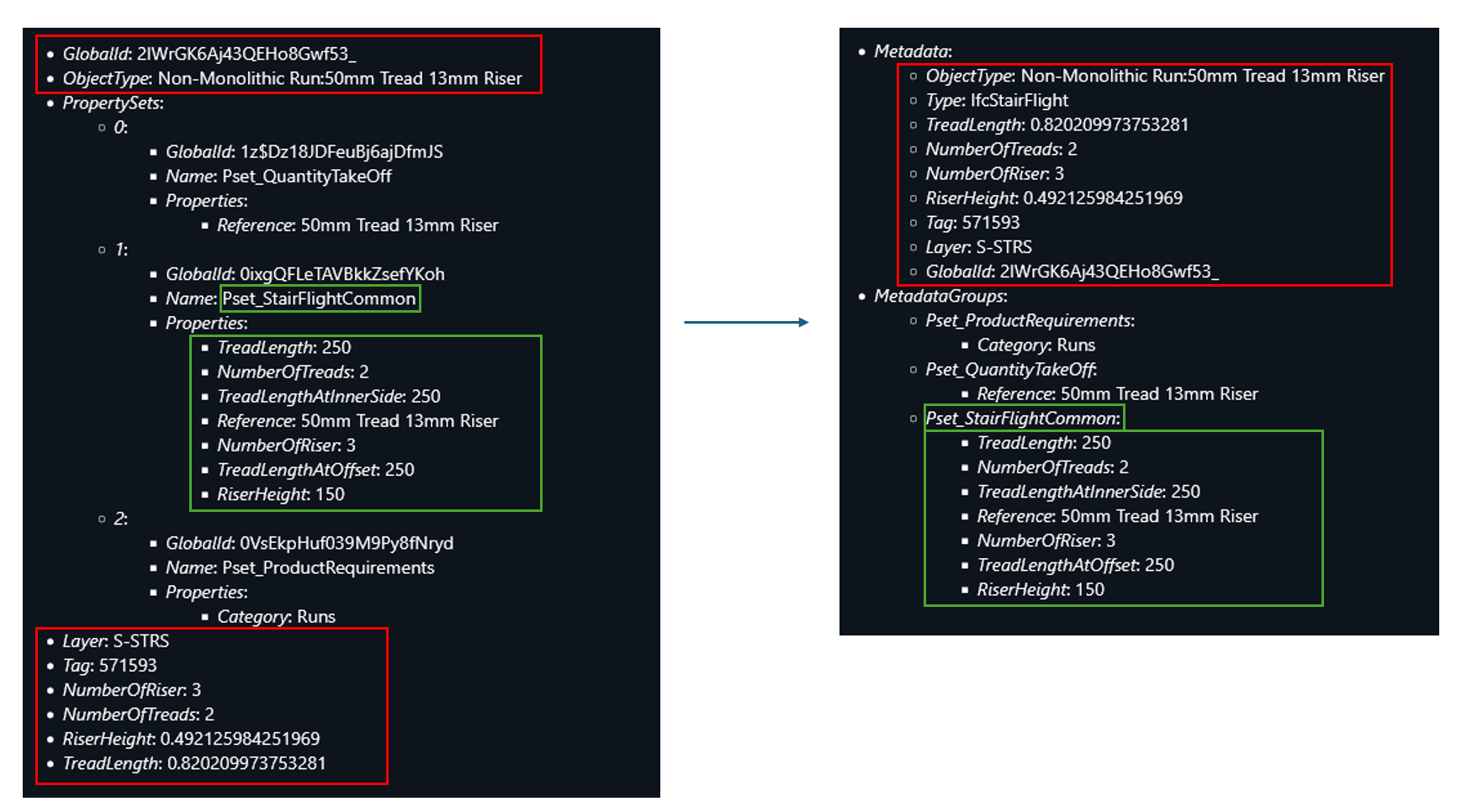
The TLcdIFCModelDecoder returns a feature data model with an ILcdDataObject. The TLcdDataModel of that ILcdDataObject has been changed to align it with the feature data models of other BIM formats. The data model now has:
-
A new property with the name
Metadata. This property is aMapand contains the non-categorized metadata of the object as found in the IFC dataset. In previous versions, theILcdDataObjectitself contained this metadata. -
A new property with the name
MetadataGroups. This property is aMapand contains the metadata within the differentIfcPropertySetslinked to the object in the IFC dataset. In previous versions, an array ofIfcPropertySetelements contained this information.
The following image shows an illustration of the new TLcdDataModel (on the right) compared
to the old TLcdDataModel (on the left).
Upgrade considerationInfrastructure Standards
The geometry model returned by the TLcdBinzModelDecoder no longer contains the metadata
of the objects. Only the FeatureID is retained in the geometry model. This change has an impact on the OGC 3D Tiles generation
process: it now stores only the FeatureID inside the batch table. Depending on the amount of metadata inside
the Binz dataset, this can lead to a significant reduction in the size of the OGC 3D Tiles output.
The metadata of the objects is still available in the feature data model. The FeatureID in the geometry model can be used to match the objects in the geometry model with the objects in the features model. If you have code that reads out the metadata directly from the OGC 3D Tiles data, you must change this code to read this metadata from the feature data model. The Visualize BIM data article explains this in more detail.
Upgrade considerationInfrastructure Standards
LCD-13711
TLcd3DTilesProcessorBuilder: the cache directory is now placed under the system-wide
temporary files directory. This allows the 3D Tiles Processing Engine to be used when the installation directory
is not writable.
Upgrade considerationInfrastructure Standards
The TLcdBinzModelDecoder returns a feature data model with elements implementing the ILcdDataObject interface.
The TLcdDataModel of these elements has been changed to align it with the feature data models of other BIM formats.
These changes were made:
-
Added a property with the name
Metadata. This new property is aMapand contains the non-categorized metadata of the object as found in the Binz dataset. In previous versions, theILcdDataObjectitself contained this metadata. -
Removed the
RenderIdproperty. This property was used to store the original FeatureID of the feature in the Binz dataset. Instead, aFeatureIDOffsetproperty is stored in the root feature of the model. You can use this property to calculate the original FeatureID by subtracting this offset from theFeatureIDproperty of the object. -
The features in the model no longer implement the
ILcdExtrudedShapeinterface. Instead, this information can be derived from theBounds,MinZandMaxZproperties.
You must change code that reads out this Binz metadata to use this new structure. This snippet shows
a code example of how to read the moniker Binz property in a previous version of the model:
// will no longer work in 2025.0
TLcdBinzModelDecoder decoder = new TLcdBinzModelDecoder();
ILcdModel featuresModel = decoder.decodeSource(new TLcdBIMDataSource("path/to/dataset.binz", FEATURES));
ILcdDataObject feature = (ILcdDataObject) featuresModel.elements().next();
String moniker = (String) feature.getValue("moniker");
To work with the new model, change the code to retrieve the Metadata property first.
This property is a Map containing the Binz metadata, like the moniker.
This snippet shows how to read this moniker property in the new version of the model:
TLcdBinzModelDecoder decoder = new TLcdBinzModelDecoder();
ILcdModel featuresModel = decoder.decodeSource(new TLcdBIMDataSource("path/to/dataset.binz", FEATURES));
ILcdDataObject feature = (ILcdDataObject) featuresModel.elements().next();
Map<String, Object> metadata = (Map<String, Object>) feature.getValue("Metadata");
String moniker = (String) metadata.get("moniker");
The RenderId property is no longer available on the features in the model. Instead, you can
now calculate it by subtracting the FeatureIDOffset from the FeatureID.
This snippet shows a code example of how to accomplish that:
TLcdBinzModelDecoder decoder = new TLcdBinzModelDecoder();
ILcdModel featuresModel = decoder.decodeSource(new TLcdBIMDataSource("path/to/dataset.binz", FEATURES));
// Get some feature
ILcdDataObject feature = (ILcdDataObject) featuresModel.elements().next();
// Get the root feature
Integer rootFeatureId = ((List<Integer>) feature.getValue("AncestorPath")).get(0);
ILcdDataObject rootFeature = (ILcdDataObject) featuresModel.query(...);
// Calculate the RenderID
Integer featureId = (Integer) feature.getValue("FeatureID");
Integer featureIdOffset = (Integer) rootFeature.getValue("FeatureIDOffset");
Integer renderId = featureID - featureIdOffset;
Casting a Binz feature to an ILcdExtrudedShape now results in a ClassCastException
because the feature no longer implements this interface. This snippet shows a code example of how to convert a
Binz feature into an ILcdExtrudedShape in the new version of the model:
TLcdBinzModelDecoder decoder = new TLcdBinzModelDecoder();
ILcdModel featuresModel = decoder.decodeSource(new TLcdBIMDataSource("path/to/dataset.binz", FEATURES));
ILcdDataObject feature = (ILcdDataObject) featuresModel.elements().next();
ILcdExtrudedShape shape = new TLcdExtrudedShape(ALcdShape.fromDomainObject(feature),
(Double) feature.getValue("MinZ"),
(Double) feature.getValue("MaxZ"));Upgrade considerationInfrastructure Standards
TLcdRevitModelDecoder and the
TLcdNWDModelDecoder on this platform.
2024.1
2024.1.14
Bug fixInfrastructure Standards
LCD-13831
Bug fixInfrastructure Standards
LCD-13588
Bug fixInfrastructure Standards
LCD-13723
2024.1.13
ImprovementDefense Standards
LCD-13839
TLcdNITFModelDecoder is now more robust,
so more NITF files can be decoded successfully.
Bug fixLuciadFusion
LCD-13852
TLcdOGCFilterEncoder now also encodes the z dimension of the bounds specified in a
TLcdOGCBBoxOperator, if the associated geographic reference has 3 dimensions.
Additionally, TLcdOGCFilterEncoder has been made more flexible by also allowing
to encode a TLcdOGCBBoxOperator without a property name.
Both capabilities were already supported by TLcdOGCFilterDecoder.
Bug fixLuciadFusion
LCD-13847
Transaction request with property values that include
newline characters. These were ignored in the past.
Bug fixLuciadFusion
LCD-13846
TLcdOGC3DTilesModelEncoder could throw an UnsupportedOperationException
when encoding a non-compressed OGC 3D Tiles model.
Bug fixInfrastructure Standards
LCD-13859
TLcdBinzModelDecoder that caused an invalid feature model when you would
process a *.binz.index file that refers to an empty binz dataset.
Bug fixInfrastructure Standards
LCD-13837
TLcd3DTilesProcessorBuilder: fixed a possible performance degradation when processing an OBJ
file referencing many textures.
2024.1.12
ImprovementLuciadFusion
LF-2713
Bug fixLuciadFusion
LF-2741
/api/data/{id}/access-rules endpoint now verifies that the provided geometry is a simple polygon.
The endpoint reports an error when unsupported geometries, like multipolygons or geometry collections, are supplied.
Bug fixLuciadFusion
LCD-13835
Transaction request with an Update
operation containing multiple property updates.
Bug fixLuciadFusion
LCD-13832
TLcdGeoTIFFModelEncoder could pick an incorrect vertical datum code.
It ignored the unit of measure.
Bug fixLuciadFusion
LCD-13781
TLspShapeLayerBuilder: The height of a line was not always correct in a 3D view when
the vertical exaggeration factor on the view was not 1.
Bug fixLuciadFusion
LCD-13819
TLcdGXYViewBufferedImage within JavaFX applications.
Bug fixLuciadFusion
LF-2697
SQLiteDriver was registered multiple times with the DriverManager.
Bug fixLuciadFusion
LCD-13833
TLcdMercator and
TLcdPseudoMercator was not always taken into account correctly.
Bug fixLuciadFusion
LF-2743
Bug fixLuciadFusion
LCD-13834
TLcdOGC3DTilesModelDecoder: Fixed issue when decoding GLB files with non-indexed vertices.
Bug fixAdvanced Raster Services
LCD-13828
TLcdECWModelDecoder where the lock held on an ECW data
source file is not released even after calling ILcdModel#dispose() on the model
produced by the TLcdECWModelDecoder.
Bug fixWeather & Environment Standards
LCD-13829
XXX being used if no information is available in the BUFR file).
Bug fixDefense Standards
LCD-13825
NullPointerException that could occur if the MGCP XML file referred to a non-existing SHP file.
Bug fixInfrastructure Standards
LF-2736, LF-2556
TLcd3DTilesProcessorBuilder: fixed a rare crash that could occur in the xatlas native
library.
2024.1.11
New featureLuciadFusion
LF-2728
ImprovementTerrain Analysis Engine
LCD-13809
Bug fixLuciadFusion
LCD-6573
Transaction request to a WFS-T server that required authentication
triggered authentication failures, if that request contained one or more features.
This was for example the case for an Insert operation to insert new features for a given
WFS feature type.
Bug fixLuciadFusion
LCD-13702
Bug fixLuciadFusion
LF-2716, LF-2710, LF-2717
Bug fixLuciadFusion
LCD-13801
Bug fixLuciadFusion
LCD-13539
TLcdGeoTIFFModelEncoder related to encoding model references
to GeoTIFF tags.
Cases where source GeoTIFF data used a ModelTransformationTag containing a rotation could
not be encoded back to GeoTIFF using embedded tags.
Added support for grid references using a TLcdGeodetic projection, with/without rotation.
Bug fixLuciadFusion
LF-2730
Bug fixLuciadFusion
LCD-13796
TLcdLonLatGeoBuffer for certain shapes and buffer widths was
incorrectly visualized.
Bug fixLuciadFusion
LCD-13816
com.luciad.format.database.TLcdFeaturedSingleShapeList as domain
object could not be committed if the table's geometry column represented a single shape type (POINT,
LINESTRING, ...).
Bug fixAviation Standards
LCD-9775
Bug fixDefense Symbology
LCD-13811
Bug fixInfrastructure Standards
LCD-13820
TLcdRevitModelDecoder
and TLcdNWDModelDecoder when decoding the model metadata of the dataset.
Bug fixInfrastructure Standards
LCD-13782
Upgrade considerationInfrastructure Standards
LCD-13718, LCD-13737, LCD-13783, LCD-13784
TLcdRevitModelDecoder and the TLcdNWDModelDecoder.
This upgrade brings the following new features and enhancements:
- Fixes a decoding crash for some Navisworks files
- Fixes an issue where hidden geometry was rendered
- Fixes an issue where some colors were lost for some Revit files
- Fixes several issues to the generated metadata
2024.1.09
ImprovementLuciadFusion
LF-2719
ImprovementInfrastructure Standards
LCD-13790
Bug fixLuciadFusion
LF-2720
Bug fixAdvanced GIS Engine
LCD-13791, LCD-13818
TLcdShapeUtil.isSelfIntersectingEllipsoidal which could cause an exception
to be thrown for certain shapes.
Upgrade considerationLuciadFusion
LF-2628
Added Studio database indexes to improve the performance of filtering data using custom properties.
These indexes are created automatically when starting the new version of LuciadFusion. No manual action is required.2024.1.08
ImprovementLuciadFusion
LCD-13772
TLcdWMSGeoJsonGetFeatureInfoEncoder now accepts a parameter that indicates whether a property's name TLcdDataProperty#getName()
or its display name TLcdDataProperty#getDisplayName() should be used as key for the feature info properties.
By default, a property's name is used, but you can plug in your own TLcdWMSGeoJsonGetFeatureInfoEncoder to change this.
Bug fixLuciadFusion
LF-2715
Bug fixLuciadFusion
LCD-13764
TLspShapeLayerBuilder: when vector data is defined in a grid reference with a large unit of
measure, the data loading of the layer could take a long time.
Bug fixLuciadFusion
LCD-13769
TLcdGeoPackageModelDecoder
did not match with the instance class of the data type.
Bug fixLuciadFusion
LCD-13389, LCD-13390
IllegalArgumentException
or ArrayIndexOutOfBoundsException when used in combination with SLD styling to render data on a Lightspeed view.
Bug fixInfrastructure Standards
LCD-13771, LCD-13773, LCD-13776
TLcdIFCModelDecoder support for reading materials has been improved. The decoder can now
read the material from the presentation layer of an object (IfcPresentationLayerWithStyle).
We also added support for reading the material from IfcFillAreaStyle, IfcColourRgb and
IfcDraughtingPreDefinedColour. In addition, when an unknown material construction
is encountered in the IFC file, the decoder no longer assigns a 'black' material to the object, but instead logs a
warning and reuses the material from the context, or the default 'white' material if no material was present in the context.
Bug fixInfrastructure Standards
LCD-13770
TLcdIFCModelDecoder now supports IfcProxy elements. Items that
are encoded this way in the IFC file are now properly decoded and are returned in both the geometry and features models.
2024.1.07
Bug fixAviation Standards
LCD-13752
Upgrade considerationAviation Standards
LCD-13756
JTS library, v1.19.0, has been added in support of the AIXM format implementation.
The previous JTS version, 1.14.0, is also still included for backwards compatibility.
Both JTS libraries use a different namespace, so they can be used together without interference.
2024.1.06
ImprovementLuciadFusion
LCD-13733
ILcdWFSFilteredModelFactory by adding an
@LcdServiceannotation
to the implementation. This interface is used by the WFS service to filter requested data based on filter
properties included in a GetFeature or GetFeatureWithLock request.
Examples include an OGC Filter, a feature sorting condition, a feature limit, and/or
a feature properties filter. Only the factory with the highest priority is used. By default, a factory
with support for the filter properties defined in TLcdWFSGetFeatureConstraints is used.
Bug fixLuciadFusion
LF-2703, LF-2712
Bug fixLuciadFusion
LCD-13753
TLcdCompositeGXYLayerFactory: the default GXY vector layer factory now takes
model read locks when accessing model bounds.
Bug fixAdvanced Raster Services
LCD-13746
Bug fixDefense Symbology
LCD-13760
Bug fixDefense Symbology
LCD-13760
2024.1.05
Bug fixLuciadFusion
LF-2702
Bug fixLuciadFusion
LF-2701
Bug fixAdvanced Raster Services
LF-2700
Bug fixDefense Symbology
LCD-13744
2024.1.04
ImprovementLuciadFusion
LCD-13704
ImprovementDefense Symbology
LCD-13689
setSymbolFrameColor(Color) in the class TLcdMilitarySymbolStyle.
This can be used to make the frame color of the symbol white in order to make the frame visible when displaying symbols on
a dark background.
When the symbol fill is disabled and the affiliation color is enabled, the symbol's affiliation color will be used as frame
color, regardless of the configured symbol frame color.
Additionally, the frame color will always be black and white dotted, for symbols of assumed affiliations (Assumed Friend,
Assumed Neutral, etc.) for APP-6B/C/D and MIL-STD-2525C/D.

Bug fixLuciadFusion
LCD-13719
TLcdXYText when using text with a carriage return, for instance ABC\r\nDEF.
The text object would have zero width, and only "DEF" was displayed in a GXY view.
Both are now resolved.
Bug fixLuciadFusion
LCD-13720
LockFeature or GetFeatureWithLock request.
Such locks were only released by using them in a Transaction request
with a lock release action.
Bug fixLuciadFusion
LCD-13712
TLcdGeoTIFFWCSCoverageDecoder
to throw an ArrayIndexOutOfBoundsException in selected cases during decoding.
Bug fixLuciadFusion
LCD-13714
TLspComplexStrokedLineStyle: fixed an issue where lines styled with a
TLspComplexStrokedLineStyle,with the orientation set to
ComplexStrokeOrientation#CAMERA_FACING, would sometimes become very narrow or disappear.
Bug fixLuciadFusion
LCD-13709
Bug fixLuciadFusion
LCD-13709
Bug fixLuciadFusion
LF-2691
Bug fixLuciadFusion
LF-2696
Bug fixLuciadFusion
LCD-13692
ILcdSurface instances containing
circles or circular arcs.
Bug fixLuciadFusion
LCD-13717
TLcdWFSLockFeatureRequest didn't correctly initialize the default value for
the expiry time in case the WFS server did not support WFS 2.0.0. In this case, a default value
of 300 minutes was used instead of the expected 5 minutes.
Bug fixLuciadFusion
LCD-13717
TLcdWFSGetFeatureWithLockRequest didn't correctly initialize the default values for
the expiry time and lock action properties. Not setting an expiry time resulted in an expiry time of 0 seconds,
while the default value is expected to be 300 seconds. Not setting a lock action resulted in a
NullPointerException when the request was used.
Bug fixLuciadFusion
LCD-13716
TLcdWFSLockFeatureRequest and
TLcdWFSGetFeatureWithLockRequest resulted in an incorrect expiry time value in case the WFS
server did not support WFS 2.0.0. For WFS versions 1.0.0 and 1.1.0, a conversion needs to be done to minutes.
See the javadoc of the method for the updated conversion logic.
Bug fixDefense Symbology
LCD-13689
TLcdMilitarySymbolStyle.setSymbolFillEnabled and TLcdMilitarySymbolStyle.setAffiliationColorEnabled).
The symbol frame will now be colored in the symbol frame color when both symbol fill and affiliation color are disabled.
(See TLcdMilitarySymbolStyle.setSymbolFrameColor).
Bug fixInfrastructure Standards
LCD-13707
2024.1.03
ImprovementLuciadFusion
LF-1873
ImprovementLuciadFusion
LCD-13665
TLcdGeoJsonModelEncoder can now encode properties that contain objects of type
ILcdShape. This was previously only possible if that property was marked as
the domain object's geometry through a TLcdHasGeometryAnnotation.
ImprovementInfrastructure Standards
LCD-13703
The bim.converter.[bat|sh] commandline sample now has an additional flag to specify whether
you want the output folder to contain the OGC 3D Tiles output: --tileset. By default, the
flag is set totrue. To skip the OGC 3D Tiles output, set the flag to
false by adding --tileset=false or
--no-tilesetto the commandline.
Note that disabling the OGC 3D Tiles output is only useful if you enable the -g|--geojson
flag to generate geojson output. If that flag is not set to true, and the
--tileset flag is set tofalse, then no output will be generated and
an error message will be printed.
Bug fixLuciadFusion
LF-2690
Bug fixLuciadFusion
LCD-13701
GetFeature request for a non-georeferenced feature type
if the request contained a bounding box spatial filter.
Bug fixLuciadFusion
LF-2687
Bug fixInfrastructure Standards
LCD-13694
TLcdIFCModelDecoder did not properly handle
IfcBooleanResult subtractions in some cases, which could result in empty .b3dm
files generated by the TLcdOGC3DTilesModelEncoder.
2024.1.02
ImprovementInfrastructure Standards
LCD-13450
TLcdRevitModelDecoder now uses the Shared Coordinates of a Revit
file. This allows to correctly geolocate Revit datasets using standard model references.
ImprovementInfrastructure Standards
LCD-13690
Improved the support for DWG line weights according to the DWG specification.
We now display the line weight of the ILcdDWGShape model elements,
taking into account the actual dimensions of your screen.
Additionally, if TLcdDWGPolyline2D and TLcdDWGCompositeCurve have
a non-zero line width value, that value will be converted to a world-sized line width.
These changes also improve visualisation of a DWG dataset via a WMS service in LuciadFusion.
Bug fixLuciadFusion
LF-2682
Bug fixLuciadFusion
LF-2681
Bug fixLuciadFusion
LCD-13691
Upgrade considerationInfrastructure Standards
LCD-13663
TLcdRevitModelDecoder and the TLcdNWDModelDecoder.
This upgrade brings the following new features and enhancements:
- Fixes a decoding crash for some Revit files
- Contains several improvements to the generated metadata for Revit and Navisworks files
2024.1.01
ImprovementLuciadFusion
LF-2676
ApplicationListener
asynchronously, if it indicates it supports asynchronous execution via its ApplicationListener.supportsAsyncExecution method.
ImprovementLuciadFusion
LCD-13491
TLcdGeoTIFFModelDecoder now logs the reference priority mode used when decoding the
raster reference for a file when the logging level is set to debug.
ImprovementLuciadFusion
LF-2673
ImprovementLuciadFusion
LCD-13669
TLcdOGCFilterDecoder now also accepts fes:Literal as XML element to
represent the time value in a binary temporal filter condition (for example, TEquals). Before,
only a gml:TimeInstant containing a gml:timePosition was accepted.
The time value in a fes:Literal element needs to be formatted according to ISO 8601
(e.g. 2025-01-28T02:45:00.000Z), similar to the time value used in a gml:timePosition.
ImprovementLuciadFusion
LCD-13670
String representation, you can now use a new
encodeToString method in TLcdOGCFilterEncoder
that accepts an OGC Filter and the desired OGC Filter encoding version (1.1.0 or 2.0.0).
ImprovementLuciadFusion
LCD-9349
TLspCreateController#setHandleLabelStyler, which allows to
customize the appearance of the handle's label during the creation of a geometry.
ImprovementLuciadFusion
LCD-13687
TLcdE57ModelDecoder now contains a safeguard for panoramic image datasets with invalid
values the pixelWidth and pixelHeight values of spherical images.
Datasets containing such invalid values can now be processed into Luciad Panorama datasets.
ImprovementLuciadFusion
LCD-12674, LCD-12676, LCD-12677
TLcdTFWRasterModelDecoder, TLcdTABRasterModelDecoder,
and TLcdRasterModelDecoder.
ImprovementLuciadFusion
LCD-12988
TLcdE57ModelDecoder, to facilitate out-of-the box support for datasets that are
created with more recent versions of the Leica software.
ImprovementLuciadFusion
LCD-13034
ImprovementInfrastructure Standards
LCD-13662
Bug fixLuciadFusion
LF-2670
FILTER parameter would fail
when LuciadFusion Platform access control was enabled.
Bug fixLuciadFusion
LF-2670
FILTER parameter for GetMap requests.
GetMap requests could fail when the data contained in the requested LAYER would be decoded in a ILcdModelTreeNode.
Bug fixLuciadFusion
LF-2671
Bug fixLuciadFusion
LF-2667
Bug fixLuciadFusion
LF-2663
Content-Type header could be set when serving a file.
This issue only occurred when running LuciadFusion Platform on a Tomcat server.
Bug fixLuciadFusion
LCD-13682
TLcdE57ModelDecoder: added the acquisitionDateTime property to
the decoded panoramic image elements of E57 datasets.
Bug fixLuciadFusion
LCD-7932, LCD-7930
TLcdGeoPackageModelEncoder now correctly supports TLcdPrimaryKeyAnnotation.
The support primary key types are:
TLcdCoreDataTypes.LONG_TYPE |
TLcdCoreDataTypes.SHORT_TYPE |
TLcdCoreDataTypes.INTEGER_TYPE |
TLcdCoreDataTypes.STRING_TYPE |
Bug fixLuciadFusion
LCD-13278
TLcdKML22Polygon: when the altitude mode of a KML22 Polygon is set to CLAMP_TO_GROUND,
it will now use rhumbline interpolation instead of geodetic interpolation, as specified in official
the KML 2.2 specification. This behavior works both in GXY and Lightspeed views.
Bug fixLuciadFusion
LCD-13645
Bug fixLuciadFusion
LCD-13642
TLsp3DTileLayerBuilder: Tiles in the foreground could sometimes disappear
unexpectedly when vertical exaggeration was applied to the view.
Bug fixLuciadFusion
LF-2664
Bug fixLuciadFusion
LCD-13643
Bug fixLuciadFusion
LCD-13589
TLcdE57ModelDecoder where separate panoramic image locations from an
E57 dataset were accidentally merged into a single panorama.
Bug fixLuciadFusion
LCD-13683
TLcdOGCBinaryTemporalOperator condition was not correctly evaluated in case
the tested data property (containing a date) occurred multiple times in the data.
Bug fixLuciadFusion
LCD-13676
TLcdOGCBinaryComparisonOperator condition was not correctly evaluated in case
the tested data property occurred multiple times in the data.
Bug fixAviation Standards
LCD-4589, LCD-13599
TaxiwayElement features in a Lightspeed view could trigger an
IllegalArgumentException in some cases.
Bug fixDefense Standards
LCD-13667
Bug fixDefense Standards
LCD-13668
Bug fixDefense Symbology
LCD-13648
TLcdNVG20SymbolizedContent and TLcdNVG15MapObject elements were not properly invalidated when their
symbol code or modifiers were updated. This caused some style changes to not be applied immediately in GXY views.
Bug fixDefense Symbology
LCD-13610
TLcdNVG20ModelEncoder.
Bug fixInfrastructure Standards
LCD-13541
TLcd3DTilesProcessorBuilder: fixed an issue that could cause points to get moved far away
from the mesh, which resulted in unexpected extruded triangles and overly large bounding boxes.
Bug fixInfrastructure Standards
LCD-13631
TLcd3DTilesProcessorBuilder: fixed an issue where material colors were applied multiple
times, causing textures to become darker than intended. This happened if a texture was referenced multiple times
in different materials.
Bug fixInfrastructure Standards
LCD-13369
TLcd3DTilesProcessorBuilder: fixed a possible performance degradation when processing an OBJ
file with textures.
Bug fixInfrastructure Standards
LCD-13674
TLcdBinzModelDecoder could generate wrong material PBR color values
for the output 3DTiles dataset for some input data.
Bug fixInfrastructure Standards
LCD-13635
TLcdIFCModelDecoder did not properly handle
IfcBooleanResult subtractions in some cases, which could lead to missing objects in the
geometry model.
Bug fixMaritime Standards
LCD-12214
Upgrade considerationAdvanced Raster Services
LCD-13673
TLcdGeospatialPDFModelDecoder#discoverDataSources now throws an IOException when there are
no map frames in the PDF, which is the case for regular (i.e. non-geospatial) PDFs. This allows an
TLcdCompositeModelDecoder to continue searching for model decoders that can correctly decode
a non-geospatial PDFs.
Upgrade considerationAdvanced Raster Services
LCD-13675
TLcdGDALModelDecoder#decode will by default throw an IOException when no model reference
could be found. This change allows a TLcdCompositeModelDecoder
to continue searching for a model decoder for a file for which the TLcdGDALModelDecoder could
not find a model reference. It is possible to revert to the old behavior by using the new API:
TLcdGDALModelDecoder#get/setDefaultModelReferenceallow setting a default model reference, which will be used when no model reference could be decoded.TLcdGDALModelDecoder#get/setModelReferenceDecoderallow setting a model reference decoder that can decode any custom model references. This is more flexible than setting a default model reference.
2024.1
New featureLuciadFusion
LuciadFusion Studio now supports LGSx data, a reality capture file format defined by Leica Geosystems.
LGSx files archive a complete reality project in a single, highly compressed package, and may contain point clouds, imagery, assets, and metadata. LuciadFusion currently supports the following data types inside LGSx files:- Point cloud data, stored as packed HSPC data, which can be published in an HSPC service.
- Panorama data, which can be published in a Panoramics service.
The article Handling LGSx data explains in more detail how you can use LGSx data in LuciadFusion Studio.
New featureLuciadFusion
- LockFeature
- GetFeatureWithLock
- Transaction
TLcdDatabaseModel, which includes vector data decoded from Microsoft SQL Server, DB2 Spatial, Informix (Geodetic and Spatial), Oracle (Locator
and Spatial), PostgreSQL PostGIS, SQLite SpatiaLite, and GeoPackage.
You can also extend this functionality by plugging in your own ILcdWFSServerModelEncoderFactory.
More information can be found on this page.
New featureLuciadFusion
ILcdModelContainer)
in WFS services. A WFS service will map a composite model to multiple WFS feature types. These feature types
will be listed in the capabilities document and can be used in all other WFS operations that require
a WFS feature type.
New featureLuciadFusion
TLcdGeoTIFFModelDecoder) now supports loading TIFF data
with overview levels from an external file.
For a file named
<filename>.tif the overview file is expected to be named <filename>.tif.ovr.
For a file named
<filename>.tiff the overview file is expected to be named <filename>.tiff.ovr.
New featureInfrastructure Standards
Added support for the Autodesk Navisworks data format. Autodesk Navisworks is a BIM software tool for architects, engineers, and construction professionals to combine and review 3D models created by other software packages, such as Autodesk Revit, AutoCAD, and others.
For more details, see the Autodesk Navisworks entry in the Data Formats documentation section.
New featureInfrastructure Standards
TLcdIFCModelDecoder now supports decoding IFC files in the IFC 4.3 file format.
ImprovementLuciadFusion
LF-2648
ImprovementLuciadFusion
LF-2655
ImprovementLuciadFusion
LF-2641
ImprovementLuciadFusion
LCD-8013
TLcdShapeUtil to check if polygons are self-intersecting, using
either ellipsoidal or cartesian calculations.
ImprovementLuciadFusion
ImprovementLuciadFusion
ImprovementLuciadFusion
- HSPC
- Panoramics
- OGC3DTiles
ImprovementLuciadFusion
build/maven/deploy.xml now accepts a
-Drepository.id=X parameter, that can link to a server component in
your maven settings.xml file. When this parameter is provided, the script assumes that
authentication is configured in that settings file and won't prompt you to input user credentials.
ImprovementLuciadFusion
LCD-13546
GetLegendGraphic support for layers styled
with an SLD:
- External SVG and bitmap icons defined in a
PointSymbolizerare now included in a legend. - The optional
WIDTHandHEIGHTparameters are now taken into account to generate legend icons. - An optional
LEGEND_OPTIONSparameter is now supported to control the visual appearance of a legend, such as the font and background color. See the sample classsamples.wms.server.SLDLegendOptionsfor the possibilities. Note that this option is currently only supported for WMSGetLegendGraphicrequests.
- samples.wms.server.SLDWMSGetLegendGraphicEncoder
samples.wmts.server.SLDWMTSGetLegendGraphicEncoder
ImprovementLuciadFusion
The LuciadFusion Studio REST API and Java API now offer the capability to create, update, delete and fetch a single custom property at a time.
To perform these operations in Java, the methods getCustomProperty(String) and
cloneAsEditableData()
have been added to the class TLfnData.
Additionally, the class TLfnEditableData has been added which contains the following
methods to modify the custom properties: putCustomProperty(String, Object),
deleteCustomProperty(String).
To enable LuciadFusion clients applications to perform these operations, the following LuciadFusion REST API endpoints have been added:
| HTTP method | Path pattern |
| GET | /api/data/{dataId}/custom-properties/{customPropertyName} |
| PUT | /api/data/{dataId}/custom-properties/{customPropertyName} |
| DELETE | /api/data/{dataId}/custom-properties/{customPropertyName} |
ImprovementLuciadFusion
Non-draped pixel-sized 3D lines with complex strokes are now oriented towards the viewer by default.
This behavior can be adapted by using
TLspComplexStrokedLineStyle.Builder#orientation(TLspComplexStrokedLineStyle.ComplexStrokeOrientation)
and passing
TLspComplexStrokedLineStyle.ComplexStrokeOrientation#PARALLEL_TO_EARTH_SURFACE
.
Draped strokes and world-sized strokes are always oriented parallel to the Earth's surface.
ImprovementLuciadFusion
elevationMode SLD vendor option
accepting the values of ILspWorldElevationStyle.ElevationMode.
ImprovementLuciadFusion
ILcdComplexPolygon now has a List accessor for its subpolygons.
ImprovementLuciadFusion
LCD-10555, LCD-12804
TLcdLASModelDecoder can now additionally decode LASzip (LAZ) 1.4 files.
ImprovementLuciadFusion
TLspComplexStrokedLineStyle.Builder#elevationMode(ILspWorldElevationStyle.ElevationMode)
now correctly handles ILspWorldElevationStyle.ElevationMode#ABOVE_TERRAIN.
In the past ILspWorldElevationStyle.ElevationMode#ABOVE_ELLIPSOID was used instead.
ImprovementLuciadFusion
TLcdGeoTIFFModelDecoder has improved support for GeoTIFF tags related to the
vertical coordinate system of a reference.
It now falls back on the EGM2008 vertical datum when the vertical datum is not supported.
ImprovementLuciadFusion
TLcdWKTReferenceParser.
ImprovementLuciadFusion
TLcdEPSGReferenceParser.
- EPSG:3901 to EPSG:3903
- EPSG:4097 to EPSG:4100
- EPSG:5318
- EPSG:5554 to EPSG:5556
- EPSG:5598
- EPSG:5698 to EPSG:5699
- EPSG:5707 to EPSG:5708
- EPSG:5832 to EPSG:5835
- EPSG:5942
- EPSG:5945 to EPSG:5976
- EPSG:6144 to EPSG:6176
- EPSG:6190
- EPSG:6696 to EPSG:6697
- EPSG:6700
- EPSG:6917
- EPSG:6927
- EPSG:7400 to EPSG:7405
- EPSG:7409 to EPSG:7414
- EPSG:7416 to EPSG:7423
- EPSG:7954 to EPSG:7956
- EPSG:8349 to EPSG:8350
- EPSG:8360
- EPSG:8370
- EPSG:8912
- EPSG:9422 to EPSG:9430
- EPSG:9449 to EPSG:9450
- EPSG:9452
- EPSG:9462
- EPSG:9500 to EPSG:9501
- EPSG:9505 to EPSG:9517
- EPSG:9519 to EPSG:9542
- EPSG:9656 to EPSG:9657
- EPSG:9705
- EPSG:9723 to EPSG:9725
- EPSG:9785
- EPSG:9897
- EPSG:9907
- EPSG:9920
- EPSG:9922
- EPSG:9924
- EPSG:9928 to EPSG:9935
- EPSG:9948 to EPSG:9953
- EPSG:10162 to EPSG:10174
- EPSG:10245 to EPSG:10246
- EPSG:10318
- EPSG:20001
ImprovementLuciadFusion
libjpeg-turbo library to encode images as JPEG.
Depending on the used data and underlying hardware, this reduces the CPU usage during the processing
of a coverage that uses JPEG as tile format.
ImprovementLuciadFusion
TLcdGeoPackageModelEncoder now uses the libjpeg-turbo library
to encode images as JPEG. Depending on the used data and underlying hardware, this reduces the CPU usage
during the encoding process.
ImprovementLuciadFusion
libjpeg-turbo library to encode maps as JPEG.
This improves the performance of GetMap requests that use the JPEG format with up to 50%.
ImprovementLuciadFusion
LCD-7068
TLcdImageMeasureProviderFactory has been added to work
on ALcdImage directly without the need to construct a model around it.
ImprovementLuciadFusion
LCD-10575
TLcdGeoPackageModelEncoder now correctly describes which geometry types are supported and which ones are not.
ImprovementLuciadFusion
LCD-11511
ImprovementAdvanced Raster Services
LCD-13600
TLcdLuciadPanoramaModelEncoder to modify the resolution of the output
cubemap images: see
setResolutionFactor(double).
ImprovementAdvanced Raster Services
LCD-12877
TLcdLuciadPanoramaModelEncoder that were previously
only accessible through the constructors. The constructors with arguments have been deprecated and will be
removed in a future release. Use the
no-arg
constructor and the setters methods to override the default values.
ImprovementDatabase Connectors
LCD-8431
TLcdMSSQLModelDecoder and TLcdMSSQLModelEncoder now have support for the CURVEPOLYGON geometry types.
ImprovementInfrastructure Standards
LCD-12693
FeatureId shift when combining multiple Binz datasets using a
*.binz.index file in the TLcdBinzModelDecoder.
The resulting dataset will now no longer have huge gaps in the FeatureId range.
The link to the original FeatureId is now also stored in the feature metadata
as RenderId.
ImprovementInfrastructure Standards
LCD-12404
RenderId property,
which is the original FeatureId in the original binz file. Both are especially useful when converting multiple
Binz files into a single model using a *.binz.index file in the TLcdBinzModelDecoder.
ImprovementInfrastructure Standards
LCD-13534
Changed the log level for problems when decoding IFC, Binz, Revit and Navisworks datasets:
if the input dataset contains objects that are incorrect (for example, a circle with a negative radius)
or impossible to discretize (for example, a cylinder with zero height),
this will no longer appear in the log as ERROR or WARNING messages.
This change affects all BIM data types: IFC,
Binz,
Revit and
Navisworks.
The log level has been changed to DEBUG, so to re-enable the output you can change your log
configuration accordingly. Refer to the Logging
tutorial for more information.
ImprovementMaritime Standards
The S-52 symbology has been updated to S-52 Presentation Library version 4.0.4 (October 2024).
The changes compared to the previous version are small.
TLcdS52Symbology.getPresentationLibraryVersion now returns "4.0" as version.
Bug fixLuciadFusion
LF-2647
Bug fixLuciadFusion
TLcdDatabaseModelEncoder where it did not properly lock the given models before exporting or saving them.
Bug fixLuciadFusion
Bug fixLuciadFusion
FEATUREID
parameter was specified.
Bug fixLuciadFusion
NullPointerException.
Bug fixLuciadFusion
typeName
parameter of a WFS Transaction request.
Bug fixLuciadFusion
TLcdLASModelDecoder now takes into account the extra bytes when calculating the format size, making it possible to decode files which triggered
an error in earlier versions.
Bug fixDatabase Connectors
LCD-11321
TLcdMSSQLModelDecoder now correctly takes into account the base of the CURVEPOLYGON geometry type as defined by the WKB string.
Bug fixDatabase Connectors
LCD-12894
TLcdOracleSpatialModelDecoder: The dimensions configured in the ora file now have priority over the value in the metadata retrieved from the database,
to determine the dimension of the TLcdOracleSpatialModelDescriptor.
If the property is not specified, the value in the metadata retrieved from the database is used.
If no value can be retrieved in the metadata from the database, we fall back to the default value of 2.
Bug fixInfrastructure Standards
LCD-13584
TLcdRevitModelDecoder failed to decode Revit files if the working directory was read-only.
Bug fixMaritime Standards
LCD-13558
Upgrade considerationLuciadFusion
FusionServer(.sh/.bat) script to run the LuciadFusion server now uses an increased
default heap size of 8GB to improve its overall performance when working with large datasets.
You can override the default settings by altering the
config/vmoptions/com.luciad.fusion.platform.vmoptions file.
Upgrade considerationLuciadFusion
| Group ID | Artifact ID | Old Version | New Version |
|---|---|---|---|
| org.springframework.boot | spring-boot | 3.2.1 | 3.2.11 |
| org.springframework.boot | spring-boot-starter | 3.2.1 | 3.2.11 |
| org.springframework.boot | spring-boot-autoconfigure | 3.2.1 | 3.2.11 |
| org.springframework.boot | spring-boot-starter-json | 3.2.1 | 3.2.11 |
| org.springframework.boot | spring-boot-starter-logging | 3.2.1 | 3.2.11 |
| org.springframework.boot | spring-boot-starter-web | 3.2.1 | 3.2.11 |
| org.springframework | spring-aop | 6.1.2 | 6.1.14 |
| org.springframework | spring-beans | 6.1.2 | 6.1.14 |
| org.springframework | spring-context | 6.1.2 | 6.1.14 |
| org.springframework | spring-core | 6.1.2 | 6.1.14 |
| org.springframework | spring-expression | 6.1.2 | 6.1.14 |
| org.springframework | spring-web | 6.1.2 | 6.1.14 |
| org.springframework | spring-webmvc | 6.1.2 | 6.1.14 |
| org.ow2.asm | asm | 9.6 | 9.7 |
| org.ow2.asm | asm-commons | 9.6 | 9.7 |
| org.ow2.asm | asm-tree | 9.6 | 9.7 |
| com.fasterxml.jackson.datatype | jackson-datatype-jdk8 | 2.15.3 | 2.15.4 |
| com.fasterxml.jackson.datatype | jackson-datatype-jsr310 | 2.15.3 | 2.15.4 |
| com.fasterxml.jackson.module | jackson-module-parameter-names | 2.15.3 | 2.15.4 |
| com.fasterxml.jackson.core | jackson-annotations | 2.15.3 | 2.15.4 |
| com.fasterxml.jackson.core | jackson-core | 2.15.3 | 2.15.4 |
| com.fasterxml.jackson.core | jackson-databind | 2.15.3 | 2.15.4 |
| org.eclipse.jetty | jetty-client | 12.0.7 | 12.0.9 |
| org.eclipse.jetty | jetty-http | 12.0.7 | 12.0.9 |
| org.eclipse.jetty | jetty-io | 12.0.7 | 12.0.9 |
| org.eclipse.jetty | jetty-plus | 12.0.7 | 12.0.9 |
| org.eclipse.jetty | jetty-security | 12.0.7 | 12.0.9 |
| org.eclipse.jetty | jetty-server | 12.0.7 | 12.0.9 |
| org.eclipse.jetty | jetty-util | 12.0.7 | 12.0.9 |
| org.eclipse.jetty | jetty-xml | 12.0.7 | 12.0.9 |
| org.eclipse.jetty.ee10 | jetty-ee10-annotations | 12.0.7 | 12.0.9 |
| org.eclipse.jetty.ee10 | jetty-ee10-plus | 12.0.7 | 12.0.9 |
| org.eclipse.jetty.ee10 | jetty-ee10-servlet | 12.0.7 | 12.0.9 |
| org.eclipse.jetty.ee10 | jetty-ee10-webapp | 12.0.7 | 12.0.9 |
| org.eclipse.jetty.websocket | jetty-websocket-jetty-common | 12.0.7 | 12.0.9 |
| org.eclipse.jetty.websocket | jetty-websocket-jetty-api | 12.0.7 | 12.0.9 |
| org.eclipse.jetty.websocket | jetty-websocket-core-common | 12.0.7 | 12.0.9 |
| org.eclipse.jetty.websocket | jetty-websocket-core-server | 12.0.7 | 12.0.9 |
| org.eclipse.jetty.websocket | jetty-websocket-core-client | 12.0.7 | 12.0.9 |
| org.eclipse.jetty.ee10 | jetty-ee10-websocket-jakarta-client | 12.0.7 | 12.0.9 |
| org.eclipse.jetty.ee10 | jetty-ee10-websocket-jakarta-common | 12.0.7 | 12.0.9 |
| org.eclipse.jetty.ee10 | jetty-ee10-websocket-jakarta-server | 12.0.7 | 12.0.9 |
| org.eclipse.jetty.ee10 | jetty-ee10-websocket-jetty-server | 12.0.7 | 12.0.9 |
| org.eclipse.jetty.ee10 | jetty-ee10-websocket-servlet | 12.0.7 | 12.0.9 |
| org.eclipse.jetty | jetty-alpn-client | 12.0.7 | 12.0.9 |
| org.eclipse.jetty | jetty-jndi | 12.0.7 | 12.0.9 |
| org.eclipse.jetty | jetty-session | 12.0.7 | 12.0.9 |
| org.slf4j | jul-to-slf4j | 2.0.9 | 2.0.16 |
| io.micrometer | micrometer-commons | 1.12.1 | 1.12.11 |
| io.micrometer | micrometer-observation | 1.12.1 | 1.12.11 |
The following dependencies have been added:
| Group ID | Artifact ID | Version |
|---|---|---|
| org.apache.tomcat.embed | tomcat-embed-el | 10.1.31 |
| jakarta.enterprise | jakarta.enterprise.cdi-api | 4.0.1 |
| jakarta.enterprise | jakarta.enterprise.lang-model | 4.0.1 |
| jakarta.inject | jakarta.inject-api | 2.0.1 |
| jakarta.interceptor | jakarta.interceptor-api | 2.1.0 |
| org.slf4j | slf4j-api | 2.0.12 |
| org.eclipse.jetty | jetty-ee | 12.0.9 |
Upgrade considerationLuciadFusion
| Group ID | Artifact ID | Old Version | New Version |
|---|---|---|---|
| org.apache.commons | commons-configuration2 | 2.9.0 | 2.11.00 |
| org.freemarker | freemarker | 2.3.32 | 2.3.33 |
| com.fasterxml.jackson.datatype | jackson-datatype-jdk8 | 2.15.3 | 2.15.4 |
| com.fasterxml.jackson.datatype | jackson-datatype-jsr310 | 2.15.3 | 2.15.4 |
| com.fasterxml.jackson.module | jackson-module-parameter-names | 2.15.3 | 2.15.4 |
| com.fasterxml.jackson.dataformat | jackson-dataformat-yaml | 2.15.3 | 2.15.4 |
| org.slf4j | jul-to-slf4j | 2.0.9 | 2.0.16 |
| org.slf4j | jcl-over-slf4j | 2.0.9 | 2.0.16 |
| org.slf4j | log4j-over-slf4j | 2.0.9 | 2.0.16 |
| org.springframework | spring-aop | 6.1.2 | 6.1.14 |
| org.springframework | spring-beans | 6.1.2 | 6.1.14 |
| org.springframework | spring-context | 6.1.2 | 6.1.14 |
| org.springframework | spring-context-support | 6.1.2 | 6.1.14 |
| org.springframework | spring-core | 6.1.2 | 6.1.14 |
| org.springframework | spring-expression | 6.1.2 | 6.1.14 |
| org.springframework | spring-jdbc | 6.1.2 | 6.1.14 |
| org.springframework | spring-messaging | 6.1.2 | 6.1.14 |
| org.springframework | spring-tx | 6.1.2 | 6.1.14 |
| org.springframework | spring-web | 6.1.2 | 6.1.14 |
| org.springframework | spring-webmvc | 6.1.2 | 6.1.14 |
| org.springframework | spring-websocket | 6.1.2 | 6.1.14 |
| org.springframework.ldap | spring-ldap-core | 3.2.1 | 3.2.7 |
| org.springframework.security | spring-security-config | 6.2.1 | 6.2.7 |
| org.springframework.security | spring-security-core | 6.2.1 | 6.2.7 |
| org.springframework.security | spring-security-crypto | 6.2.1 | 6.2.7 |
| org.springframework.security | spring-security-ldap | 6.2.1 | 6.2.7 |
| org.springframework.security | spring-security-oauth2-core | 6.2.1 | 6.2.7 |
| org.springframework.security | spring-security-oauth2-resource-server | 6.2.1 | 6.2.7 |
| org.springframework.security | spring-security-web | 6.2.1 | 6.2.7 |
| org.springframework.boot | spring-boot | 3.2.1 | 3.2.11 |
| org.springframework.boot | spring-boot-actuator-autoconfigure | 3.2.1 | 3.2.11 |
| org.springframework.boot | spring-boot-actuator | 3.2.1 | 3.2.11 |
| org.springframework.boot | spring-boot-autoconfigure | 3.2.1 | 3.2.11 |
| org.springframework.boot | spring-boot-configuration-processor | 3.2.1 | 3.2.11 |
| org.springframework.boot | spring-boot-starter | 3.2.1 | 3.2.11 |
| org.springframework.boot | spring-boot-starter-actuator | 3.2.1 | 3.2.11 |
| org.springframework.boot | spring-boot-starter-freemarker | 3.2.1 | 3.2.11 |
| org.springframework.boot | spring-boot-starter-jdbc | 3.2.1 | 3.2.11 |
| org.springframework.boot | spring-boot-starter-json | 3.2.1 | 3.2.11 |
| org.springframework.boot | spring-boot-starter-logging | 3.2.1 | 3.2.11 |
| org.springframework.boot | spring-boot-starter-security | 3.2.1 | 3.2.11 |
| org.springframework.boot | spring-boot-starter-validation | 3.2.1 | 3.2.11 |
| org.springframework.boot | spring-boot-starter-web | 3.2.1 | 3.2.11 |
| org.springframework.boot | spring-boot-starter-websocket | 3.2.1 | 3.2.11 |
| io.micrometer | micrometer-common | 1.12.1 | 1.12.11 |
| io.micrometer | micrometer-jakarta9 | 1.12.1 | 1.12.11 |
| io.micrometer | micrometer-observation | 1.12.1 | 1.12.11 |
| io.micrometer | micrometer-core | 1.12.1 | 1.12.11 |
| org.apache.tomcat.embed | tomcat-embed-el | 10.1.17 | 10.1.31 |
| jakarta.xml.bind | jakarta.xml.bind-api | 4.0.0 | 4.0.2 |
| org.ow2.asm | asm | 9.6 | 9.7 |
| org.ow2.asm | asm-commons | 9.6 | 9.7 |
| org.ow2.asm | asm-tree | 9.6 | 9.7 |
| org.eclipse.jetty | jetty-client | 12.0.7 | 12.0.9 |
| org.eclipse.jetty | jetty-http | 12.0.7 | 12.0.9 |
| org.eclipse.jetty | jetty-io | 12.0.7 | 12.0.9 |
| org.eclipse.jetty | jetty-plus | 12.0.7 | 12.0.9 |
| org.eclipse.jetty | jetty-security | 12.0.7 | 12.0.9 |
| org.eclipse.jetty | jetty-server | 12.0.7 | 12.0.9 |
| org.eclipse.jetty | jetty-util | 12.0.7 | 12.0.9 |
| org.eclipse.jetty | jetty-xml | 12.0.7 | 12.0.9 |
| org.eclipse.jetty.ee10 | jetty-ee10-annotations | 12.0.7 | 12.0.9 |
| org.eclipse.jetty.ee10 | jetty-ee10-plus | 12.0.7 | 12.0.9 |
| org.eclipse.jetty.ee10 | jetty-ee10-servlet | 12.0.7 | 12.0.9 |
| org.eclipse.jetty.ee10 | jetty-ee10-webapp | 12.0.7 | 12.0.9 |
| org.eclipse.jetty.websocket | jetty-websocket-jetty-common | 12.0.7 | 12.0.9 |
| org.eclipse.jetty.websocket | jetty-websocket-jetty-api | 12.0.7 | 12.0.9 |
| org.eclipse.jetty.websocket | jetty-websocket-core-common | 12.0.7 | 12.0.9 |
| org.eclipse.jetty.websocket | jetty-websocket-core-server | 12.0.7 | 12.0.9 |
| org.eclipse.jetty.websocket | jetty-websocket-core-client | 12.0.7 | 12.0.9 |
| org.eclipse.jetty.ee10 | jetty-ee10-websocket-jakarta-client | 12.0.7 | 12.0.9 |
| org.eclipse.jetty.ee10 | jetty-ee10-websocket-jakarta-common | 12.0.7 | 12.0.9 |
| org.eclipse.jetty.ee10 | jetty-ee10-websocket-jakarta-server | 12.0.7 | 12.0.9 |
| org.eclipse.jetty.ee10 | jetty-ee10-websocket-jetty-server | 12.0.7 | 12.0.9 |
| org.eclipse.jetty.ee10 | jetty-ee10-websocket-servlet | 12.0.7 | 12.0.9 |
| org.eclipse.jetty | jetty-alpn-client | 12.0.7 | 12.0.9 |
| org.eclipse.jetty | jetty-jndi | 12.0.7 | 12.0.9 |
| org.eclipse.jetty | jetty-session | 12.0.7 | 12.0.9 |
| org.eclipse.jetty.http2 | jetty-http2-common | 12.0.7 | 12.0.9 |
| org.eclipse.jetty.http2 | jetty-http2-hpack | 12.0.7 | 12.0.9 |
| org.eclipse.jetty.http2 | jetty-http2-server | 12.0.7 | 12.0.9 |
| org.eclipse.jetty | jetty-alpn-conscrypt-server | 12.0.7 | 12.0.9 |
| org.eclipse.jetty | jetty-alpn-server | 12.0.7 | 12.0.9 |
| org.slf4j | jul-to-slf4j | 2.0.9 | 2.0.16 |
| io.micrometer | micrometer-commons | 1.2.1 | 1.2.11 |
| io.micrometer | micrometer-observation | 1.2.1 | 1.2.11 |
The following sample dependencies related to Jetty have been added:
| Group ID | Artifact ID | Version |
|---|---|---|
| jakarta.enterprise | jakarta.enterprise.cdi-api | 4.0.1 |
| jakarta.enterprise | jakarta.enterprise.lang-model | 4.0.1 |
| jakarta.inject | jakarta.inject-api | 2.0.1 |
| jakarta.interceptor | jakarta.interceptor-api | 2.0.1 |
| org.eclipse.jetty | jetty-ee | 12.0.9 |
Upgrade considerationLuciadFusion
The following dependencies have been added to support reading JXR images contained in LGSx reality capture data:
| Group ID | Artifact ID | Version |
|---|---|---|
| com.luciad.native | libjxr | 1.1+2 |
Upgrade considerationLuciadFusion
com.luciad.reference.format.allowApproximateVerticalReference
with the value false.
Upgrade considerationLuciadFusion
libjpeg-turbo.
This library is used by a number of components to improve performance for writing images as JPEG.
For each usage, a separate release note is added that describes the improvement.
Upgrade considerationLuciadFusion
LCD-13346, LCD-13416, LCD-13484, LCD-10555, LCD-12804
| Group ID | Artifact ID | Old Version | New Version |
|---|---|---|---|
| software.amazon.awssdk | annotations | 2.17.168 | 2.25.57 |
| software.amazon.awssdk | apache-client | 2.17.168 | 2.25.57 |
| software.amazon.awssdk | arns | 2.17.168 | 2.25.57 |
| software.amazon.awssdk | auth | 2.17.168 | 2.25.57 |
| software.amazon.awssdk | aws-core | 2.17.168 | 2.25.57 |
| software.amazon.awssdk | aws-query-protocol | 2.17.168 | 2.25.57 |
| software.amazon.awssdk | aws-xml-protocol | 2.17.168 | 2.25.57 |
| software.amazon.awssdk | json-utils | 2.17.168 | 2.25.57 |
| software.amazon.awssdk | metrics-spi | 2.17.168 | 2.25.57 |
| software.amazon.awssdk | profiles | 2.17.168 | 2.25.57 |
| software.amazon.awssdk | protocol-core | 2.17.168 | 2.25.57 |
| software.amazon.awssdk | regions | 2.17.168 | 2.25.57 |
| software.amazon.awssdk | s3 | 2.17.168 | 2.25.57 |
| software.amazon.awssdk | sdk-core | 2.17.168 | 2.25.57 |
| software.amazon.awssdk | third-party-jackson-core | 2.17.168 | 2.25.57 |
| software.amazon.awssdk | utils | 2.17.168 | 2.25.57 |
| org.reactivestreams | reactive-streams | 1.0.3 | 1.0.4 |
| com.github.mreutegg | laszip4j | 0.9 | 0.19 |
| com.fasterxml.jackson.core | jackson-annotations | 2.15.3 | 2.15.4 |
| com.fasterxml.jackson.core | jackson-core | 2.15.3 | 2.15.4 |
| com.fasterxml.jackson.core | jackson-databind | 2.15.3 | 2.15.4 |
| org.slf4j | slf4j-api | 2.0.9 | 2.0.16 |
The following dependencies have been added:
| Group ID | Artifact ID | Version |
|---|---|---|
| software.amazon.awssdk | checksums | 2.25.57 |
| software.amazon.awssdk | checksums-spi | 2.25.57 |
| software.amazon.awssdk | crt-core | 2.25.57 |
| software.amazon.awssdk | endpoints-spi | 2.25.57 |
| software.amazon.awssdk | http-auth | 2.25.57 |
| software.amazon.awssdk | http-auth-aws | 2.25.57 |
| software.amazon.awssdk | http-client-spi | 2.25.57 |
| software.amazon.awssdk | identity-spi | 2.25.57 |
| commons-codec | commons-codec | 1.15 |
The following dependencies have been removed:
| Group ID | Artifact ID | Version |
|---|---|---|
| org.apache | commons-codec | 1.11 |
Upgrade considerationAdvanced Raster Services
LCD-13600
TLcdLuciadPanoramaModelEncoder.
The new resolution will now be a factor sqrt(2) bigger than the previously, resulting in better
image quality but larger output data sets.
To revert to the earlier behaviour, you can use the new
setResolutionFactor method with 1 / sqrt(2) as argument.
This setting is also available in the fusion.panoramics.preprocessing section
of the LuciadFusion config/fusion.common.yml file.
This setting is also available as commandline option for the panoramaConverter.bat
sample (-r|--resolutionFactor).
Upgrade considerationInfrastructure Standards
Upgrade considerationInfrastructure Standards
TLcdRevitModelDecoder and the TLcdNWDModelDecoder.
Without this upgrade, there is no support for the Navisworks format.
Upgrade considerationInfrastructure Standards
The commandline samples to create 3DTiles datasets for different BIM data types have been consolidated into one
single sample: bim.converter.[bat|sh]. The previous samples all used the same syntax, which
is now available on the new sample.
The sample provides a uniform way to convert these data formats: Binz,
IFC, Revit and Navisworks.
The following commandline samples are no longer available:
decoder.binz.[bat|sh]decoder.ifc.[bat|sh]decoder.revit.[bat|sh]
2024.0
2024.0.11
ImprovementDefense Symbology
LCD-13562
ImprovementInfrastructure Standards
LCD-13585
Bug fixLuciadFusion
LF-2644
Bug fixLuciadFusion
LCD-13619
FormatDate no longer logs a warning message when it is called with a null value.
As before, it returns null. When used inside a TextSymbolizer to format labels,
this now ensures that the label remains empty without any warnings in case of an empty property.
Bug fixDefense Symbology
LCD-13571
TLcdNVG20ArcBand and TLcdNVG15ArcBand where the
symbol stroke was painted in opposite orientation (counter-clockwise instead of clockwise) in Lightspeed views.
This caused the stroke pattern to be painted inside out for some symbols, such as "Free Fire area".
2024.0.10
Bug fixLuciadFusion
LCD-13597
Bug fixLuciadFusion
LCD-13594
Bug fixLuciadFusion
LF-2654
ErrorController configured by LuciadFusion Platform did not
apply the Spring error configuration properties, such as server.error.include-stacktrace.
Bug fixLuciadFusion
LCD-13592
GetFeature requests
with a property name filter in case the source data did not have an explicit identifier (such as SHP files).
Bug fixInfrastructure Standards
LF-2651
TLcdRevitModelDecoder did not properly mark the Revit
files referenced by a '.rvt.index' dataset as support files.
Bug fixInfrastructure Standards
LCD-13596
ILcdModel returned by the TLcdRevitModelDecoder
no longer contains the '.rvt' extension for '.rvt.index' datasets.
2024.0.09
Bug fixLuciadFusion
LCD-10234
TLcdGeoPackageModelEncoder now allows to add extensions to existing files.
Bug fixLuciadFusion
LCD-13575
TLcdGeoTIFFModelDecoder when using GeoTIFF tags.
A user defined reference with Mercator projection ignored the parameter ProjNatOriginLatGeoKey.
Bug fixAviation Standards
LCD-13578
schemaLocation attribute that referred to accessible
XML Schemas for AIXM 5.1.1-related namespaces could result in a model with an incorrect
TLcdDataModel. This could lead to a NullPointerException in the
AIXM 5 visualization logic, which relies on the data model to find an appropriate style for an AIXM 5 feature type.
Bug fixAviation Standards
LCD-13568
Bug fixDefense Symbology
LCD-13567
TLcdNVG15ArcBand and TLcdNVG20ArcBand objects.
Upgrade considerationInfrastructure Standards
LCD-13551
2024.0.08
ImprovementLuciadFusion
LCD-13516
HTTP 500 Internal Error responses when any exception occurs during painting.
You can enable this behavior by setting the system property com.luciad.fusion.wms.server.errorResponseOnPaintException to true.
ImprovementAviation Standards
LCD-13565
- http://www.aixm.aero/schema/5.1/extensions/EUR/iNM/EAD-Audit
- http://www.aixm.aero/schema/5.1/extensions/EUR/iNM/EAD-ADN
- http://www.aixm.aero/schema/5.1/extensions/EUR/iNM/EAD-ADR
- http://www.aixm.aero/schema/5.1/extensions/EUR/iNM/NaturalDescriptor
ImprovementDefense Symbology
LCD-13485
TLcdEditableMS2525bObject and TLcdEditableAPP6AObject
to clearly mention the different supported SIDC code formats.
ImprovementInfrastructure Standards
LCD-13551
REGION entities. They will be decoded as
TLcdDWGSurface objects.
ImprovementInfrastructure Standards
LCD-13545
lcd_revit.jar have been moved into a new
lcd_binz_connector.jar.
Bug fixLuciadFusion
LCD-13559, LCD-13560
TLcdWKTReferenceFormatter and TLcdWKTReferenceParser for
Cartesian references that don't use meter as distance unit.
Additionally, the parser will now use the conversion parameter that is provided in the WKT string to transform the unit to meter, even if the unit was not previously known or registered.
Bug fixDefense Symbology
LCD-13537
Bug fixDefense Symbology
LCD-13550
TLcdAPP6AObjectCustomizer and the TLcdMS2525bObjectCustomizer,
that could result in a NullPointerException being thrown when quickly changing combobox values multiple times one after another.
Bug fixInfrastructure Standards
LCD-13529
TLcd3DTilesProcessorBuilder: fixed a possible performance degradation when processing a
referenced dataset.
Bug fixInfrastructure Standards
LCD-13549
TLcdIFCModelDecoder did not properly handle the material transparency
defined on IfcSurfaceStyleShading and IfcIndexedColourMap elements.
Upgrade considerationAdvanced Raster Services
LF-2478, LF-2612
Upgrade considerationInfrastructure Standards
LCD-13552, LF-2631
TLcdRevitModelDecoder. This upgrade brings the following new features and enhancements:
- Fixes a decoding crash for some Revit files
- Contains several improvements to the generated Revit metadata
2024.0.07
ImprovementLuciadFusion
LF-2560
ImprovementLuciadFusion
LF-2560
ImprovementLuciadFusion
LF-2610
TLfnDataCreatedEventTLfnDataDeletedEventTLfnDataUpdatedEventTLfnDataRootCreatedEventTLfnDataRootDeletedEventTLfnDataRootUpdatedEventTLfnJobCreatedEventTLfnJobDeletedEventTLfnJobSchedulingFailedEventTLfnJobUpdatedEventTLfnJobStoppedEventTLfnJobQueuedEventTLfnProductCreatedEventTLfnProductDeletedEventTLfnProductUpdatedEventTLfnServiceCreatedEventTLfnServiceDeletedEventTLfnServiceStatusChangedEventTLfnServiceUpdatedEventTLfnStyleCreatedEventTLfnStyleDeletedEventTLfnStyleUpdatedEvent
ImprovementLuciadFusion
LF-2611
TLfnEventSourceRequest of events published by LuciadFusion now includes the remote address of the client that made the request.
The address can be obtained by calling the getRemoteAddress method on the TLfnEventSourceRequest object.
Note that this address can be the address of a proxy server if a proxy is put in front of LuciadFusion.
Bug fixLuciadFusion
LCD-13445
TLcdBingMapsModelDecoder: resolved an issue where unexpected parameters in the Bing Maps template URL could trigger a parse exception.
Bug fixLuciadFusion
LF-2633
Bug fixLuciadFusion
LCD-13533
Bug fixInfrastructure Standards
LCD-13501
TLcdIFCModelDecoder showed wrong material information in specific
use cases.
2024.0.06
Bug fixLuciadFusion
LCD-13525
2024.0.05
ImprovementInfrastructure Standards
LCD-13506
TLcdRevitModelDecoder with respect to textured materials.
Bug fixLuciadFusion
LCD-13519
GetLegendGraphic support for layers styled with an SLD did not take
into account the color of a polygon symbolizer if it was defined inside a mark.
Bug fixLuciadFusion
LCD-13508
GetCapabilities request:
- The parameter was not supported for WCS 1.1 POST requests.
- The parameter was not validated for WCS 1.0 GET and POST requests.
Bug fixLuciadFusion
LCD-13496
TLcdGeoPackageModelDecoder, TLcdLVDBModelDecoder and TLcdSpatiaLiteModelDecoder now are able to correctly resolve the srs_id of data when the name of the table or column containing the spatial data contains non ASCII characters.
Bug fixLuciadFusion
LCD-13510
GetFeature hits request.
Bug fixDefense Standards
LCD-13500
TLcdNITFModelDecoder can now process image blocks with different width and height,
meaning they no longer need to be square.
2024.0.04
ImprovementLuciadFusion
LCD-13270
ImprovementLuciadFusion
LF-2622
lfn.creationTime or lfn.updateTime properties has been improved.
ImprovementAdvanced Raster Services
LCD-13456
TLcdGDALModelDecoder can now handle data in which the image is
rotated relative to the axes of the model reference. In this case a fitted (also called "derived") projected
ILcdGridReference will be returned as a model reference.
ImprovementAdvanced Raster Services
LCD-13455
TLcdGDALModelDecoder will now decode a ILcdModelTreeNode
if the data contains subdatasets.
ImprovementInfrastructure Standards
LCD-13486
Bug fixLuciadFusion
LF-2626
Bug fixLuciadFusion
LCD-13477
PointSymbolizer can now be disabled.
This capability can be activated on a TLcdSLDPointSymbolizer by configuring an SLD vendor option
with name allowEditing and value false.
Bug fixLuciadFusion
LCD-13476, LCD-13470
LCD-13438 have been reverted. An alternative solution is provided through LCD-13477.
Bug fixLuciadFusion
LCD-13424
ILcdModel instances created by the TLcdGeoPackageModelDecoder on fields that start with a number.
Bug fixLuciadFusion
LCD-12862
TLcdSemanticsOp contain nodata values but the original semantics did not, they will now be taken into account in further processing.
This means pixel values matching the nodata value do not participate in any further operations. These pixels will not be
displayed when visualized on screen.
Bug fixLuciadFusion
LCD-13475
- Dimensions with an axis without a unit.
- Dimensions with strings as possible values.
Bug fixReal-time Engine
LCD-13487
TLspContinuousLabelingAlgorithm didn't handle edited labels correctly anymore. Such labels
were, for example, not correctly moved when colliding with one of the view's edges, or with another label. This was
a regression that was introduced in the first LuciadLightspeed 2022.1 release.
Bug fixDefense Symbology
LCD-11416
Upgrade considerationLuciadFusion
LCD-13414
Fixed a potential deadlock when modifying the ILcdCollection that is returned by
ILspInteractivePaintableLayer#getObjectsWithPaintState, while holding a write lock on that
collection. To fix this, ILcdCollection (and by extension ILcdList)
now have additional methods that allow specifying an ILcdFireEventMode when performing
modifications. By using the ILcdFireEventMode.FIRE_LATER event mode, collection change
events are fired after the write lock has been released.
We recommend scanning your codebase for any custom usages of
ILspInteractivePaintableLayer#getObjectsWithPaintState and making sure that
any modifications to this collection happen within a write lock, while the change events are only fired after
that write lock has been released. An example code snippet on how to do this can be found in the
ILspInteractivePaintableLayer#getObjectsWithPaintState method javadoc.
2024.0.03
New featureInfrastructure Standards
LCD-13337
Please refer to the Filtering BIM data article for more information.
ImprovementLuciadFusion
LCD-13396
com.luciad.format.dafif.TLcdDAFIFModelDecoder#canDecodeSource and
com.luciad.format.coverage.TLcdCoverageModelDecoder#canDecodeSource have been optimized.
This also improves crawling performance of data inside LuciadFusion, which is now up to 24% faster.
ImprovementLuciadFusion
LF-2592
hspcInfo.json file.
ImprovementLuciadFusion
LCD-12583
ImprovementLuciadFusion
LCD-10417
TLcdGeoPackageModelDecoder and TLcdGeoPackageModelEncoder now have support for the following geometry types:
| MULTICURVE |
| MULTISURFACE |
| CURVEPOLYGON |
| COMPOUNDCURVE |
ImprovementLuciadFusion
LF-2598
ImprovementLuciadFusion
LF-2505
ImprovementLuciadFusion
LCD-13464
ImprovementLuciadFusion
LCD-13447
GetFeature POST requests has now been
aligned between all WFS versions: similar as for WFS 1.x requests, spatial filters in WFS 2.0 POST requests are now
decoded and transformed to the geographic reference of the requested WFS feature type. For GET requests, this was already
the case.
ImprovementDefense Symbology
LCD-3155
TLspIconStyle.
ImprovementInfrastructure Standards
LCD-13408
TLcd3DTilesProcessorBuilder: Now uses all registered ILcdModelReferenceDecoder
instances when searching for external model reference files.
Bug fixLuciadFusion
LCD-13433
Bug fixLuciadFusion
LF-2617
TLfnJobQueuedEvent from being published
when a crawl job was queued as a result of a new data root being created.
Bug fixLuciadFusion
LCD-13466
ILcdMultiDimensional model dimensions that have a
TLcdISO19103DistanceMeasure as measure.
Bug fixLuciadFusion
LCD-13347
com.luciad.sqlite.cacheMode system property allows the user to provide the cache mode used by sqlite driver.
Possible values are private and shared, with private being the default value.
Bug fixLuciadFusion
LF-2590
tomcat-embed-el library.
Bug fixLuciadFusion
LCD-13474
TLcdEPSGReferenceParser parsed the TOWGS84 rotation incorrectly for some EPSG codes.
Coordinate references using the following datums are affected:
- IG05/12 Intermediate Datum (EPSG:1144)
- World Geodetic System 1984 (G730) (EPSG:1152)
- World Geodetic System 1984 (Transit) (EPSG:1166)
- CR-SIRGAS (EPSG:1225)
- Sistem Referensi Geospasial Indonesia 2013 (EPSG:1293)
- International Terrestrial Reference Frame 1992 (EPSG:6651)
Bug fixLuciadFusion
LCD-13351
TLcdSphereUtil#closestPointOnGeodesic and TLcdSphereUtil#closestDistanceToGeodesic
didn't always produce correct results.
Bug fixLuciadFusion
LCD-11876
TLcdGeoTIFFModelDecoder and TLcdMIFModelDecoder
for data that makes use of the "Amersfoort / RD New" reference (EPSG:28992).
Bug fixLuciadFusion
LCD-10789
TLcdLambert1972BelgiumGridReference now aligns more closely to the definition of
EPSG:31300 in the EPSG database. This improves the precision of this reference by a few millimeters.
Bug fixLuciadFusion
LCD-10790
TLcdWKTReferenceParser and
TLcdEPSGReferenceParser now don't return an instance of
TLcdLambert1972BelgiumGridReference anymore because it deviates from the definition of
EPSG:31370.
Bug fixLuciadFusion
LF-2186, LF-2607
Bug fixLuciadFusion
LF-2616
TLfnStyleDeletedEvent being published. This was previously not the case.
Bug fixLuciadFusion
LCD-13448
TLcdGeorefUtil: fixed a rounding error that could occur when parsing a GEOREF coordinate.
Bug fixLuciadFusion
LCD-13438
PointSymbolizer can only be enabled when the geometry is an ILcdPoint.
This avoids unwanted behavior when editing is enabled in combination with an SLD style containing multiple symbolizers.
Bug fixLuciadFusion
LCD-13434
Bug fixLuciadFusion
LCD-13427
TLcdCartesian#orientation2D no longer throws an exception when passing an empty point list.
This also improves the robustness of the TLcdGeoJsonModelEncoder.
Bug fixLuciadFusion
LCD-13407
xsd:anyType elements with a built-in XML data type
that is specified using xsi:type.
Bug fixLuciadFusion
LF-2595
Bug fixLuciadFusion
LF-2567
GET api/data/filter endpoint that resulted in too many parameter errors reported by the database.
Bug fixLuciadFusion
LF-2200
Bug fixLuciadFusion
LCD-10813
TLcdGeoPackageModelDecoder now correctly handles the CIRCULARSTRING geometry type as a collection of zero or more continuous circular arc segments and
the TLcdGeoPackageModelEncoder is able to encode a ILcdCompositeCurve containing multiple ILcdCircularArcBy3Points instances to CIRCULARSTRING.
Bug fixLuciadFusion
LCD-13460
Bug fixLuciadFusion
LF-2620
fusion.hspc.cache.maxAge property to 30 days, which corresponds to
the value mentioned in the documentation.
Bug fixLuciadFusion
LCD-13449
ArrayIndexOutOfBoundsException when accessing DTED data through the
ILcdRaster API.
This could occur when using the TLcdDTEDDirectoryModelDecoder with lazy
DTED tile loading and when the DTED file deviates from the DTED specification.
Bug fixLuciadFusion
LCD-13423
Bug fixLuciadFusion
LCD-6862
TLcdTABRasterModelDecoder could throw a RuntimeException instead of an
IOException when decoding a TAB for raster data not supported by JAI.
Now it throws an IOException with a more clear message.
Bug fixLuciadFusion
LCD-12749
TLcdBandColorSemanticsBuilder ignored the specified no data value when building from a color model.
Bug fixLuciadFusion
LCD-13377
Bug fixLuciadFusion
LF-2620
Updated the value of the cache.maxAge properties to 30 days, which corresponds to
the value mentioned in the documentation.
The following caching properties have been updated:
fusion.ogctilesservice.cache.maxAgefusion.panoramics.cache.maxAgefusion.studio.webapp.cache.maxAge
Bug fixLuciadFusion
LCD-13429, LCD-13432
UnsupportedOperationException.
Bug fixLuciadFusion
LCD-13431
GoogleCRS84Quad tile matrix set that used a reference with a lat/lon axis order.
This prevented the layer from being visualized on the map.
Bug fixLuciadFusion
LCD-13379
TLcdOGC3DTilesModelDecoder: fixed an issue when opening Luciad Point Cloud datasets
by passing a file URL.
Bug fixLuciadFusion
LCD-13413
lcd_epsg_resources.jar) could not be loaded in an OSGi environment.
Bug fixDatabase Connectors
LCD-13280
TLcdOracleSpatialModelDecoder no longer uses the SDO_COLUMN_NAME column of the
USER_SDO_INDEX_METADATA view to determine the dimension of the spatial index, because this column is not always present.
Bug fixAviation Standards
LCD-13435
NullPointerException when it was visualized in a Lightspeed view.
Bug fixDefense Symbology
LCD-13411
- The outline of the area is now drawn with a solid stroke instead of a dashed stroke
- The hostile indicator ("ENY") is now rendered in the outline stroke, when the symbol's affiliation is set to 'Hostile'
Bug fixDefense Symbology
LCD-13394
arrow element,
where the "crossover" point would be located at the tail of the arrow instead of at the tip of the arrow.
Bug fixDefense Symbology
LCD-13412
Bug fixInfrastructure Standards
LF-2520
TLcd3DTilesProcessorBuilder: fixed an issue where TIFF textures could end up missing in the
output.
Bug fixInfrastructure Standards
LCD-13457
TLcd3DTilesProcessorBuilder: fixed a possible crash issue when handling textures with indexed
colors.
Bug fixInfrastructure Standards
LCD-13352
Bug fixInfrastructure Standards
LCD-13472
TLcdIFCModelDecoder did not revert the direction of a trimmed
IfcLine or IfcPolyline when necessary.
Bug fixInfrastructure Standards
LCD-13471
TLcdIFCModelDecoder now ignores elements with an IfcGridPlacement.
A warning is logged when such elements are encountered.
Bug fixInfrastructure Standards
LCD-13298
TLcdCompositeModelDecoder, when used in combination with a TLcdIFCModelDecoder,
wasn't able to decode the IFC features datasource returned by the discoverDataSources
method.
Bug fixMaritime Standards
LCD-13463
ClassCastException could happen when cloning a cell model bounds.
Upgrade considerationWeather & Environment Standards
LCD-13437
Upgrade considerationInfrastructure Standards
LCD-13400
TLcdRevitModelDecoder. This upgrade brings the following new features and enhancements:
- Adds support for Revit 2025
- Fixes a decoding crash for some Revit files
- Contains several improvements to the generated Revit metadata
2024.0
New featureLuciadFusion
LuciadFusion Studio now supports the Autodesk Revit format.
Adding or crawling a Revit file will result in two data entries: one for the geometry data and one for the features data. The geometry data can be published in an OGC 3D Tiles service. It will be pre-processed into OGC 3D Tiles before the service is started. The features data can be published in a WFS service.
The article Serving BIM data from LuciadFusion Studio explains in more detail how you can use Revit data.
New featureLuciadFusion
New featureLuciadFusion
New featureLuciadFusion
New featureLuciadFusion
The Spring Boot dependencies of LuciadFusion have been upgraded from version 2.7 to version 3.2. This newer version brings numerous new features and fixes. It's advisable to read through the release notes of every version to know what is new, what has changed and what has been deprecated.
- Spring Boot 3.0 Migration Guide
- Spring Boot 3.1 Release Notes
- Spring Boot 3.2 Release Notes
- Spring Framework 6 Release Notes
- Preparing for Spring Security 6
- Spring Security 6 migration guide
Check out our LuciadFusion troubleshooting guide for a list of major changes caused by the Spring Boot upgrade.
New featureLuciadFusion
TLcdMBTilesModelDecoder
now also supports MBTiles services, next to files. To decode an MBTiles service you need to provide the TileJSON endpoint
as source.
An MBTiles service can for example be set up with LuciadFusion as of version 2024.0.
New featureLuciadFusion
New featureLuciadFusion
colorReplace and colorReplaceTolerance in a
TLcdSLDRasterSymbolizer. The new article
How to replace a color
illustrates this capability with an example.
New featureLuciadFusion
TLcdPixelReplaceOp
is a new image operator which replaces a given color or value in an
image with another. It can be used, for instance, to remove blank borders around an image by replacing them with
a transparent color.
New featureAdvanced Raster Services
LuciadFusion and LuciadLightspeed users can now visualize ECW images with any number of bands and any bit depth.
New featureReal-time Engine
TLspRadarVideoLayerBuilder
now has the ability to work with radar feeds
whose angular or radial resolution are variable over time. This requires the user to manually
specify the resolution of the visualization, which is then effectively decoupled from that of
the data. The new method displayResolution() on the layer builder is
used to enable this behavior. If called, the radar video layer will be fully robust against
all variations in the resolution of the incoming data.
New featureInfrastructure Standards
Added support for the Autodesk Revit data format. Autodesk Revit is a BIM software tool for architects, engineers, and construction professionals to model shapes, structures, and systems in 3D.
For more details, see the Autodesk Revit entry in the Data Formats documentation section
ImprovementLuciadFusion
LCD-13326
FILTER parameter that operates like the WFS GetFeature FILTER parameter for both GetMap and GetFeatureInfo requests.
ImprovementLuciadFusion
GetLegendGraphic support
to create a meaningful legend for vector-oriented SLD styles (containing polygon, line and/or point symbolizers).
You can also find the implementation in sample code to ease customizations: see
samples.wms.server.SLDVectorWMSGetLegendGraphicEncoder and
samples.wmts.server.SLDVectorWMTSGetLegendGraphicEncoder.
ImprovementLuciadFusion
LF-2576
fusion.common.yml file.
ImprovementLuciadFusion
The following new system properties let users configure reference decoder priority for the following model decoders:
TLcdGeoTIFFModelDecoder:com.luciad.format.raster.TLcdGeoTIFFModelDecoder.referenceDecoderPriorityTLcdLASModelDecoder:com.luciad.format.las.TLcdLASModelDecoder.referenceDecoderPriorityTLcdE57ModelDecoder:com.luciad.format.e57.TLcdE57ModelDecoder.referenceDecoderPriority
The priority decides whether the model reference decoding is first attempted from the reference information embedded in the data file and then fall back to external reference source files such as WKT (.prj), REF (.ref) and EPSG (*.epsg) in case of an error or vice versa when the other reference decoder priority is selected.
For more information on how to configure the reference decoder priority for supported
ILcdModelDecoder
implementations, refer to the following article:
Setting model reference decoder priority
ImprovementLuciadFusion
LCD-13341
TLcdGeoPackageModelDecoder to
provide the correct display names in TLcdDataModelDisplayNameProvider#getDisplayName(TLcdDataProperty).
ImprovementLuciadFusion
ImprovementLuciadFusion
ImprovementLuciadFusion
LCD-13289
TLcdGXYTiledWMSProxyPainter and TLspTiledWMSProxyPainter.
Customizing tile grid references can be useful to align with a server-defined tile grid reference used for caching of requests.
ImprovementLuciadFusion
ImprovementLuciadFusion
LCD-8681, LCD-13260
TLcdDataProperty#getSourceName, which contains the property name as it was
defined in the source data. This may differ from the actual name of the property within the
TLcdDataType, because that name can contain only alphanumeric characters and underscores,
and may therefore have been sanitized.
When building a data type, the source name of a property can be configured with a setter on the
TLcdDataPropertyBuilder. Additionally, TLcdDataType#getProperty
now also checks this source name when searching a property that matches a given name.
The default TLcdDataModelDisplayNameProvider has also been adapted to use this source
name by default, when retrieving a display name for a property.
Finally, The TLcdGeoJsonModelEncoder now uses these source names by default as well,
when encoding data objects to GeoJSON features.
ImprovementLuciadFusion
LF-1958
To ease using HTTP/2 with LuciadFusion, the following improvements have been introduced:
- A new article How to use HTTP/2 with LuciadFusion has been introduced.
- HTTP/2 is now enabled by default in the LuciadFusion Platform configuration.
- In order to enable HTTP/2 with the sample Jetty server shipped with LuciadFusion, we have included the following sample dependencies:
| Group ID | Artifact ID ID | Version |
|---|---|---|
| org.eclipse.jetty.http2 | jetty-http2-common | 12.0.7 |
| org.eclipse.jetty.http2 | jetty-http2-hpack | 12.0.7 |
| org.eclipse.jetty.http2 | jetty-http2-server | 12.0.7 |
| org.eclipse.jetty | jetty-alpn-conscrypt-server | 12.0.7 |
| org.eclipse.jetty | jetty-alpn-server | 12.0.7 |
| org.conscrypt | conscrypt-openjdk-uber | 2.5.2 |
ImprovementLuciadFusion
GET /api/data/filter now allows filtering Data
resources by data categories and keywords.
These properties are also listed by the GET /api/data/queryable-properties endpoint.
More information on how you can use the GET /api/data/filter endpoint can be found in
the data querying article.
ImprovementLuciadFusion
LF-2495
A LuciadFusion Studio REST API developer can now define custom properties with a limited set of allowed
values for the Long data type
in addition to the already supported String type.
As a result of this:
addLongProperty(String, Set)
and
addLongProperty(String, String, Set, boolean)
methods have been added to the class TLfnCustomPropertyDefinitions.
In addition to the above inclusions to the API, the following
addEnumProperty(String, String, Set, boolean)
and addEnumProperty(String, Set) methods
of the class TLfnCustomPropertyDefinitions have been deprecated in favor of new
methods addStringProperty(String, String, Set, boolean) and
addStringProperty(String, Set).
It is recommended to use the newly introduced methods instead of the deprecated ones.
The deprecated methods will subsequently be removed in one of the future product releases.
As a result of this enhancement the LuciadFusion Studio REST API endpoints
GET /api/data/custom-properties
and
GET /api/data/queryable-propertiesno longer return
'Enum' as a 'type' in a REST API response. They now return the data type as determined
by the type of value a custom property can take i.e. Long, Double, Boolean, Date,
String. This change is consistent with the behavior of the
custom properties which already returned the 'type' as their data type of the values.
ImprovementLuciadFusion
LF-1949
ImprovementLuciadFusion
LF-1245, LF-1239, LF-2071
ImprovementLuciadFusion
LCD-9753
TLcdGeoPackageFeatureDatabaseModelEncoder: encoding data objects with multiple geometry properties
now results in a clear error message, instead of a message indicating a unique constraint violation.
ImprovementLuciadFusion
LCD-9574
ImprovementLuciadFusion
LF-2580
ImprovementAviation Standards
LCD-13371
ImprovementDefense Symbology
LCD-13199
A new style class, TLcdMilitarySymbolStyle, has been added to the Military Symbology API.
This class can be used to define the symbol style of both APP-6 and MIL-STD-2525 symbols.
The usage is equivalent to the usage of the existing, standard specific style classes (TLcdDefaultAPP6AStyle and TLcdDefaultMS2525bStyle).
You can configure a symbol dependent style, by either having your domain objects implement ILcdStyledMilitarySymbol or by defining a default style on your
painter providers or layers.
The following methods have been added to configure a TLcdMilitarySymbolStyle on painter providers and layers:
TLcdAPP6AGXYPainterProvider.setDefaultMilitarySymbolStyleTLcdAPP6AGXYLabelPainterProvider.setDefaultMilitarySymbolStyleTLspAPP6ALayerBuilder.defaultStyleTLspAPP6ASymbolStyle.Builder.militarySymbolStyleTLcdMS2525bGXYLabelProvider.setDefaultMilitarySymbolStyleTLcdMS2525bGXYLabelPainterProvider.setDefaultMilitarySymbolStyleTLspMS2525bLayerBuilder.defaultStyleTLspMS2525bSymbolStyle.Builder.militarySymbolStyleTLspMilitarySymbologyLayerBuilder.defaultStyle
ImprovementInfrastructure Standards
discoverDataSources method of TLcdIFCModelDecoder now returns
a list of TLcdBIMDataSource objects.
Bug fixLuciadFusion
LCD-13245
TLcdIOUtil#resolve returned an incorrect result for source names starting with "jpip://".
The method now returns null.
Bug fixLuciadFusion
LCD-13252
TLcdSLDFeatureTypeStylePainter now implements ILcdGXYEditorProvider,
which returns itself as ILcdGXYEditor to edit objects in a GXY view. This better aligns with
the already implemented painter-related interfaces ILcdGXYPainter and
ILcdGXYPainterProvider.
Bug fixLuciadFusion
LCD-13231
TLcdEarthRepositoryModelDecoder: improved the robustness when interrupting a thread
that was reading a tile repository. This improves compatibility with Java 21.
Bug fixLuciadFusion
LF-2354
startedTime property on a service was never updated if the service was restarted.
Bug fixLuciadFusion
LF-2513
Bug fixLuciadFusion
LF-2589
Bug fixLuciadFusion
LF-2578
Bug fixLuciadFusion
LF-2573
Bug fixLuciadFusion
LF-2570
Bug fixLuciadFusion
LCD-13386
settings.xml
file was not used when deploying the license to the Maven repository.
Bug fixLuciadFusion
LF-2582
GET api/data/filter endpoint for wildcard character
^
based equality comparison of String based custom properties.
Now the query using wildcard ^ based equality comparison will only work when the wildcard
character is placed at the beginning of string to be compared against a custom property.
^
will now be interpreted as a regular character if used anywhere other than the beginning
of a string.
Bug fixLuciadFusion
LF-2575
Bug fixLuciadFusion
LF-2568
Principal of the authenticated
user was not an instance of UserDetails.
Bug fixLuciadFusion
LF-2579
SELECT ON SYS.DBA_RECYCLEBIN privilege.
A warning is shown if this privilege is not granted to the user used by LuciadFusion to connect to the database.
Bug fixLuciadFusion
LCD-12748
TLcdGeoTIFFModelDecoder for the case of data with photometric
interpretation RGB with additional sample values. The standard cases RGB(A) worked fine.
For the case with additional sample values the ALcdImage band semantics did not include
information on the red, green, and blue channels. It would be interpreted as a greyscale image by the image painter.
Now the correct band semantics are reported which makes the image painter pick it up and render the file correctly.
Bug fixData Connectivity Manager
LF-2490
Bug fixDatabase Connectors
LCD-4462
TLcdOracleSpatialModelDecoder now uses the CS_SRS table to determine the ILcdModelReference of the
decoded ILcdModel when the ILcdModelReference can not be determined using a list of pre-defined references.
Upgrade considerationLuciadFusion
We now enable support for vertical datums by default for a number of model decoders. If your services require preprocessing (such as LTS and OGC 3D Tiles) and you encounter issues with vertical datum application, you may need to preprocess the involved data again to ensure correct application of the vertical datum support. Preprocessing again is only necessary if you have other data with vertical datums and observe inconsistencies. Inconsistencies occur when combining the following data:
- Data which is served by an LTS or OGC 3D Tiles service, which has not applied the vertical datum. This usually occurs because the service was created with an older LuciadFusion version (2023.1 or older), which did not enable vertical datum support by default.
- Data which is loaded directly into a client application, is served by a service which does not do preprocessing or is served by a new LTS or OGC 3D Tiles service, which has been created in LuciadFusion 2024.0.
More information about enabling support for vertical datums by default is given in the release note for issue LCD-12921.
Upgrade considerationLuciadFusion
TLcdIOUtil, TLcdInputStreamFactory,
and several model decoders.
Because of this, the following invalid data source paths may no longer be recognized:
- The colon ":" is no longer accepted in Windows file names.
- Spaces are no longer accepted in file URI's. They need to be escaped as described in the URI specification.
Upgrade considerationLuciadFusion
Upgrade considerationLuciadFusion
Upgrade considerationLuciadFusion
LCD-12921
The default behavior of a number of model decoders has been changed. We now enable support for vertical datums by default for a number of model decoders. The vertical datum support will cause the appropriate geoid height to be applied to data files of the affected formats, if the data advertises a vertical datum. In previous versions, we ignored the vertical datum advertised by data by default.
Using the geoid will result in the use of more accurate elevation values, at the cost of performance when processing the data.
The following data formats are affected by this change:
- DEM:
TLcdDEMModelDecoder - DMED/DTED:
TLcdDMEDModelDecoder,TLcdDTEDModelDecoder,TLcdDTEDDirectoryModelDecoder - ETOPO:
TLcdETOPOModelDecoder - GeoTIFF:
TLcdGeoTIFFModelDecoder - LAS/LAZ:
TLcdLASModelDecoder - SwissDHM:
TLcdSwissDHMMatrixModelDecoder
Because the default behavior has changed for these formats, your data may be painted at a different height, which can cause misalignment with your other layers. For example, you may apply the geoid to points in a LAS file, which causes your LAS points to be painted at a different elevation. If you combine this LAS data with an inaccurate terrain layer, there may be overlap between your LAS points and the terrain layer. You should check that your data is still properly aligned with your other layers after upgrading.
The recommended way to fix such alignment issues is to make sure you use an accurate terrain layer and use the same geoid on all your layers with elevation data. You should also verify that all your elevation data advertises the correct vertical datum. Read our article on Detecting and fixing vertical datum issues for more details.
If you have different behavior then before, and you are sure that the old behavior is preferred, you can revert to the old behavior in the following ways:
- Disable geoid support for a specific model decoder, by calling the method
#setSupportGeoidDatums(boolean) - Disable geoid support for all aforementioned model decoders, by setting the system property
com.luciad.geodesy.geoidSupport.LEGACYtotrue.
Upgrade considerationLuciadFusion
Since the upgrade to Spring Security version 6, Spring Security blocks all requests for which no authorization rule is defined.
In order to register authorization rules for services in LuciadFusion, a few changes have been made in the LuciadFusion
configuration and the ILfnServiceTypeConfiguration interface, which makes it possible to plug in custom service types in LuciadFusion
The documentation changes consist of 2 new properties: fusion.security.serviceAuthenticationRequired and fusion.security.authenticatedEndpoints
fusion.security.serviceAuthenticationRequiredallows you to globally configure if services published in LuciadFusion require authentication or if anonymous access is permitted.fusion.security.authenticatedEndpointsallows you to override the configuration set byfusion.security.serviceAuthenticationRequiredfor certain url patterns. This can, for example, be used if you want to allow anonymous access for all services except services of a certain type (wms, wfs, lts, etc)
Additionally we have deprecated the property fusion.accessControl.authenticatedEndpoints.
This property used to only have an effect when access control is enabled, it is now replaced by fusion.security.authenticatedEndpoints, which is also active when access control is disabled.
If you are using fusion.accessControl.authenticatedEndpoints, this configuration will still be applied, but this property will be removed in a future LuciadFusion release, so we recommend
that you
replace its usage by fusion.accessControl.authenticatedEndpoints.
We have added the method getEndpointPatterns() to he interface ILfnServiceTypeConfiguration.
This method is used to inform the LuciadFusion Security system of which url patterns are handled by the service type implementation.
Please read the following articles for more information:
Upgrade considerationLuciadFusion
| Group ID | Artifact ID | Old Version | New Version |
|---|---|---|---|
| org.springframework.boot | spring-boot | 2.7.14 | 3.2.1 |
| org.springframework.boot | spring-boot-starter | 2.7.14 | 3.2.1 |
| org.springframework.boot | spring-boot-autoconfigure | 2.7.14 | 3.2.1 |
| org.springframework.boot | spring-boot-starter-jetty | 2.7.8 | 3.2.1 |
| org.springframework.boot | spring-boot-starter-json | 2.7.14 | 3.2.1 |
| org.springframework.boot | spring-boot-starter-logging | 2.7.14 | 3.2.1 |
| org.springframework.boot | spring-boot-starter-web | 2.7.14 | 3.2.1 |
| org.springframework | spring-aop | 5.3.29 | 6.1.2 |
| org.springframework | spring-beans | 5.3.29 | 6.1.2 |
| org.springframework | spring-context | 5.3.29 | 6.1.2 |
| org.springframework | spring-core | 5.3.29 | 6.1.2 |
| org.springframework | spring-expression | 5.3.29 | 6.1.2 |
| org.springframework | spring-jdbc | 5.3.29 | 6.1.2 |
| org.springframework | spring-tx | 5.3.29 | 6.1.2 |
| org.springframework | spring-web | 5.3.29 | 6.1.2 |
| org.springframework | spring-webmvc | 5.3.29 | 6.1.2 |
| com.zaxxer | HikariCP | 4.0.3 | 5.0.1 |
| org.ow2.asm | asm-commons | 9.4 | 9.6 |
| org.ow2.asm | asm-tree | 9.4 | 9.6 |
| com.fasterxml.jackson.datatype | jackson-datatype-jdk8 | 2.14.2 | 2.15.3 |
| com.fasterxml.jackson.datatype | jackson-datatype-jsr310 | 2.14.2 | 2.15.3 |
| com.fasterxml.jackson.module | jackson-module-parameter-names | 2.14.2 | 2.15.3 |
| org.apache.tomcat.embed | tomcat-embed-el | 9.0.78 | 10.1.17 |
| org.eclipse.jetty | jetty-client | 9.4.50.v20221201 | 12.0.7 |
| org.eclipse.jetty | jetty-http | 9.4.50.v20221201 | 12.0.7 |
| org.eclipse.jetty | jetty-io | 9.4.50.v20221201 | 12.0.7 |
| org.eclipse.jetty | jetty-plus | 9.4.50.v20221201 | 12.0.7 |
| org.eclipse.jetty | jetty-security | 9.4.50.v20221201 | 12.0.7 |
| org.eclipse.jetty | jetty-server | 9.4.50.v20221201 | 12.0.7 |
| org.eclipse.jetty | jetty-util | 9.4.50.v20221201 | 12.0.7 |
| org.eclipse.jetty | jetty-xml | 9.4.50.v20221201 | 12.0.7 |
| org.slf4j | jul-to-slf4j | 1.7.36 | 2.0.9 |
| org.slf4j | slf4j-api | 1.7.36 | 2.0.9 |
| org.apache.logging.log4j | log4j-api | 2.17.2 | 2.21.1 |
| org.apache.logging.log4j | log4j-to-slf4j | 2.17.2 | 2.21.1 |
| ch.qos.logback | logback-classic | 1.2.12 | 1.4.14 |
| ch.qos.logback | logback-core | 1.2.12 | 1.4.14 |
| org.yaml | snakeyaml | 2.0 | 2.2 |
| jakarta.annotation | jakarta.annotation-api | 1.3.5 | 2.1.1 |
| jakarta.websocket | jakarta.websocket-api | 1.1.2 | 2.1.1 |
The following dependencies have been added:
| Group ID | Artifact ID | Version |
|---|---|---|
| org.eclipse.jetty.ee10 | jetty-ee10-annotations | 12.0.7 |
| org.eclipse.jetty.ee10 | jetty-ee10-plus | 12.0.7 |
| org.eclipse.jetty.ee10 | jetty-ee10-servlet | 12.0.7 |
| org.eclipse.jetty.ee10 | jetty-ee10-servlets | 12.0.7 |
| org.eclipse.jetty.ee10 | jetty-ee10-webapp | 12.0.7 |
| org.eclipse.jetty.ee10 | jetty-ee10-websocket-jakarta-client | 12.0.7 |
| org.eclipse.jetty.ee10 | jetty-ee10-websocket-jakarta-common | 12.0.7 |
| org.eclipse.jetty.ee10 | jetty-ee10-websocket-jakarta-server | 12.0.7 |
| org.eclipse.jetty.ee10 | jetty-ee10-websocket-jetty-server | 12.0.7 |
| org.eclipse.jetty.ee10 | jetty-ee10-websocket-servlet | 12.0.7 |
| org.eclipse.jetty | jetty-alpn-client | 12.0.7 |
| org.eclipse.jetty | jetty-jndi | 12.0.7 |
| org.eclipse.jetty | jetty-session | 12.0.7 |
| jakarta.websocket | jakarta.websocket-client-api | 2.1.1 |
The following dependencies have been removed:
| Group ID | Artifact ID | Version |
|---|---|---|
| org.eclipse.jetty | jetty-annotations | 9.4.50.v20221201 |
| org.eclipse.jetty | jetty-continuation | 9.4.50.v20221201 |
| org.eclipse.jetty | jetty-servlet | 9.4.50.v20221201 |
| org.eclipse.jetty | jetty-servlets | 9.4.50.v20221201 |
| org.eclipse.jetty | jetty-util-ajax | 9.4.50.v20221201 |
| org.eclipse.jetty | jetty-webapp | 9.4.50.v20221201 |
| org.eclipse.jetty.websocket | websocket-api | 9.4.50.v20221201 |
| org.eclipse.jetty.websocket | websocket-client | 9.4.50.v20221201 |
| org.eclipse.jetty.websocket | websocket-common | 9.4.50.v20221201 |
| org.eclipse.jetty.websocket | websocket-server | 9.4.50.v20221201 |
| org.eclipse.jetty.websocket | websocket-servlet | 9.4.50.v20221201 |
Upgrade considerationLuciadFusion
| Group ID | Artifact ID | Old Version | New Version |
|---|---|---|---|
| org.springframework.boot | spring-boot | 2.7.14 | 3.2.1 |
| org.springframework.boot | spring-boot-actuator-autoconfigure | 2.7.14 | 3.2.1 |
| org.springframework.boot | spring-boot-actuator | 2.7.14 | 3.2.1 |
| org.springframework.boot | spring-boot-autoconfigure | 2.7.14 | 3.2.1 |
| org.springframework.boot | spring-boot-configuration-processor | 2.7.14 | 3.2.1 |
| org.springframework.boot | spring-boot-starter | 2.7.14 | 3.2.1 |
| org.springframework.boot | spring-boot-starter-actuator | 2.7.14 | 3.2.1 |
| org.springframework.boot | spring-boot-starter-freemarker | 2.7.14 | 3.2.1 |
| org.springframework.boot | spring-boot-starter-jdbc | 2.7.14 | 3.2.1 |
| org.springframework.boot | spring-boot-starter-json | 2.7.14 | 3.2.1 |
| org.springframework.boot | spring-boot-starter-logging | 2.7.14 | 3.2.1 |
| org.springframework.boot | spring-boot-starter-security | 2.7.14 | 3.2.1 |
| org.springframework.boot | spring-boot-starter-validation | 2.7.14 | 3.2.1 |
| org.springframework.boot | spring-boot-starter-web | 2.1.14 | 3.2.1 |
| org.springframework.boot | spring-boot-starter-websocket | 2.7.14 | 3.2.1 |
| org.springframework.ldap | spring-ldap-core | 2.4.1 | 3.0.4 |
| org.springframework.security | spring-security-config | 5.8.6 | 6.2.1 |
| org.springframework.security | spring-security-core | 5.8.6 | 6.2.1 |
| org.springframework.security | spring-security-crypto | 5.8.6 | 6.2.1 |
| org.springframework.security | spring-security-ldap | 5.8.6 | 6.1.2 |
| org.springframework.security | spring-security-oauth2-core | 5.8.6 | 6.1.2 |
| org.springframework.security | spring-security-oauth2-resource-server | 5.8.6 | 6.1.2 |
| org.springframework.security | spring-security-web | 5.8.6 | 6.2.1 |
| org.springframework | spring-aop | 5.3.29 | 6.1.2 |
| org.springframework | spring-beans | 5.3.29 | 6.1.2 |
| org.springframework | spring-context | 5.3.29 | 6.1.2 |
| org.springframework | spring-context-support | 5.3.29 | 6.1.2 |
| org.springframework | spring-core | 5.3.29 | 6.1.2 |
| org.springframework | spring-expression | 5.3.29 | 6.1.2 |
| org.springframework | spring-jdbc | 5.3.29 | 6.1.2 |
| org.springframework | spring-messaging | 5.3.29 | 6.1.2 |
| org.springframework | spring-tx | 5.3.29 | 6.1.2 |
| org.springframework | spring-web | 5.3.29 | 6.1.2 |
| org.springframework | spring-webmvc | 5.3.29 | 6.1.2 |
| org.springframework | spring-websocket | 5.3.29 | 6.1.2 |
| org.webjars | swagger-ui | 4.15.5 | 5.10.3 |
| org.apache.tomcat.embed | tomcat-embed-el | 9.0.78 | 10.1.17 |
| org.yaml | snakeyaml | 2.0 | 2.2 |
| org.hibernate.validator | hibernate-validator | 6.2.5.Final | 8.0.1.Final |
| org.apache.logging.log4j | log4j-api | 2.17.2 | 2.21.1 |
| org.apache.logging.log4j | log4j-to-slf4j | 2.17.2 | 2.21.1 |
| org.jboss.logging | jboss-logging | 3.4.1.Final | 3.4.3.Final |
| org.slf4j | jcl-over-slf4j | 1.7.36 | 2.0.9 |
| org.slf4j | jul-to-slf4j | 1.7.36 | 2.0.9 |
| org.slf4j | log4j-over-slf4j | 1.7.36 | 2.0.9 |
| org.slf4j | slf4j-api | 1.7.36 | 2.0.9 |
| ch.qos.logback | logback-classic | 1.2.12 | 1.4.14 |
| ch.qos.logback | logback-core | 1.2.12 | 1.4.14 |
| com.zaxxer | HikariCP | 4.0.3 | 5.0.1 |
| io.github.classgraph | classgraph | 4.8.149 | 4.8.108 |
| io.micrometer | micrometer-core | 1.9.13 | 1.12.1 |
| joda-time | joda-time | 2.8.1 | 2.10.10 |
| com.sun.activation | jakarta.activation | 1.2.2 | 2.0.1 |
| jakarta.servlet | jakarta.servlet-api | 4.0.4 | 6.0.0 |
| jakarta.validation | jakarta.validation-api | 2.0.2 | 3.0.2 |
| jakarta.xml.bind | jakarta.xml.bind-api | 2.3.3 | 4.0.0 |
The following dependencies have been added:
| Group ID | Artifact ID | Version |
|---|---|---|
| io.micrometer | micrometer-common | 1.12.1 |
| io.micrometer | micrometer-jakarta9 | 1.12.1 |
| io.micrometer | micrometer-observation | 1.12.1 |
| io.swagger.core.v3 | swagger-annotations-jakarta | 2.2.19 |
| io.swagger.core.v3 | swagger-core-jakarta | 2.2.19 |
| io.swagger.core.v3 | swagger-models-jakarta | 2.2.19 |
| org.springdoc | springdoc-openapi-starter-common | 2.3.0 |
| org.springdoc | springdoc-openapi-starter-webmvc-api | 2.3.0 |
| org.springdoc | springdoc-openapi-starter-webmvc-ui | 2.3.0 |
| jakarta.transaction | jakarta.transaction-api | 6.0.0 |
The following dependencies have been removed:
| Group ID | Artifact ID | Version |
|---|---|---|
| commons-lang | commons-lang | 2.6 |
| javax.inject | javax.inject | 1 |
| io.swagger.core.v3 | swagger-annotations | 2.2.7 |
| io.swagger.core.v3 | swagger-core | 2.2.7 |
| io.swagger.core.v3 | swagger-models | 2.2.7 |
| org.springdoc | springdoc-openapi-common | 1.6.14 |
| org.springdoc | springdoc-openapi-security | 1.6.14 |
| org.springdoc | springdoc-openapi-ui | 1.6.14 |
| org.springdoc | springdoc-openapi-webmvc-core | 1.6.14 |
| org.webjars | webjars-locator-core | 0.52 |
LuciadFusion can be used with a Jetty embedded servlet container. The jetty sample dependencies are used in this situation. The following sample dependencies related to Jetty have changed:
| org.springframework.boot | spring-boot-starter-jetty | 2.7.8 | 3.2.1 |
| org.ow2.asm | asm-commons | 9.4 | 9.6 |
| org.ow2.asm | asm-tree | 9.4 | 9.6 |
| org.eclipse.jetty | jetty-client | 9.4.50.v20221201 | 12.0.7 |
| org.eclipse.jetty | jetty-http | 9.4.50.v20221201 | 12.0.7 |
| org.eclipse.jetty | jetty-io | 9.4.50.v20221201 | 12.0.7 |
| org.eclipse.jetty | jetty-plus | 9.4.50.v20221201 | 12.0.7 |
| org.eclipse.jetty | jetty-security | 9.4.50.v20221201 | 12.0.7 |
| org.eclipse.jetty | jetty-server | 9.4.50.v20221201 | 12.0.7 |
| org.eclipse.jetty | jetty-util | 9.4.50.v20221201 | 12.0.7 |
| org.eclipse.jetty | jetty-xml | 9.4.50.v20221201 | 12.0.7 |
| jakarta.annotation | jakarta.annotation-api | 1.3.5 | 2.1.1 |
| jakarta.websocket | jakarta.websocket-api | 1.1.2 | 2.1.1 |
The following sample dependencies related to Jetty have been added:
| Group ID | Artifact ID | Version |
|---|---|---|
| org.eclipse.jetty.ee10 | jetty-ee10-annotations | 12.0.7 |
| org.eclipse.jetty.ee10 | jetty-ee10-plus | 12.0.7 |
| org.eclipse.jetty.ee10 | jetty-ee10-servlet | 12.0.7 |
| org.eclipse.jetty.ee10 | jetty-ee10-servlets | 12.0.7 |
| org.eclipse.jetty.ee10 | jetty-ee10-webapp | 12.0.7 |
| org.eclipse.jetty.ee10 | jetty-ee10-websocket-jakarta-client | 12.0.7 |
| org.eclipse.jetty.ee10 | jetty-ee10-websocket-jakarta-common | 12.0.7 |
| org.eclipse.jetty.ee10 | jetty-ee10-websocket-jakarta-server | 12.0.7 |
| org.eclipse.jetty.ee10 | jetty-ee10-websocket-jetty-server | 12.0.7 |
| org.eclipse.jetty.ee10 | jetty-ee10-websocket-servlet | 12.0.7 |
| org.eclipse.jetty | jetty-alpn-client | 12.0.7 |
| org.eclipse.jetty | jetty-jndi | 12.0.7 |
| org.eclipse.jetty | jetty-session | 12.0.7 |
| jakarta.websocket | jakarta.websocket-client-api | 2.1.1 |
The following sample dependencies related to Jetty have been removed:
| Group ID | Artifact ID | Version |
|---|---|---|
| org.eclipse.jetty | jetty-annotations | 9.4.50.v20221201 |
| org.eclipse.jetty | jetty-continuation | 9.4.50.v20221201 |
| org.eclipse.jetty | jetty-servlet | 9.4.50.v20221201 |
| org.eclipse.jetty | jetty-servlets | 9.4.50.v20221201 |
| org.eclipse.jetty | jetty-util-ajax | 9.4.50.v20221201 |
| org.eclipse.jetty | jetty-webapp | 9.4.50.v20221201 |
| org.eclipse.jetty.websocket | websocket-api | 9.4.50.v20221201 |
| org.eclipse.jetty.websocket | websocket-client | 9.4.50.v20221201 |
| org.eclipse.jetty.websocket | websocket-common | 9.4.50.v20221201 |
| org.eclipse.jetty.websocket | websocket-server | 9.4.50.v20221201 |
| org.eclipse.jetty.websocket | websocket-servlet | 9.4.50.v20221201 |
Upgrade considerationLuciadFusion
LCD-13176
TLcdGXYImagePainter, TLcdRasterPainter, TLcdMultilevelRasterPainter,
TLcdEarthGXYRasterPainter, TLcdGXYTiledWMSProxyPainter and TLcdWMSProxyGXYPainter
now apply brightness and contrast to raster layers with the same algorithm as Lightspeed's TLspRasterStyle.
This used to be different but has now been aligned.
With the new behavior, the [0, 2] brightness value range covers the entire color brightness range (black to white).
The contrast setting offers a modifier on top for further tweaking.
Upgrade considerationLuciadFusion
POST /api/services/{id}/keywords now accepts a set instead of a list of keywords.
Any duplicate keywords that are added to the service are ignored.
Upgrade considerationLuciadFusion
The LuciadLightspeed and LuciadFusion APIs now use the Jakarta EE 10 API and Jakarta Servlet 6.0 API, where in previous releases
the Java EE 7 API and Java Servlet 3.1 API were used.
There are a few breaking changes in the new Jakarta Servlet 6.0 API, the main one being a rename of the javax.servlet package to jakarta.servlet.
Any LuciadLightspeed or LuciadFusion API that use classes from this package thus contain a corresponding breaking change.
The affected classes are mainly the classes implementing the OGC server standards (WM(T)S, WFS, etc).
Any compilation errors you encounter related to this change can typically be resolved by performing a find and replace operation.
Refer to the documentation on hardware and software requirements in the prerequisites section for more information.
Upgrade considerationLuciadFusion
isoMetadataXmlContent that is part of the Service resource of the
LuciadFusion Studio REST API
was marked for deprecation in release 2023.0 and has now been removed. Instead, use LuciadFusion's Studio
Catalog Service to get
the ISO-19115 metadata of a service.
Upgrade considerationLuciadFusion
Upgrade considerationLuciadFusion
LF-2408
| Group ID | Artifact ID | Old Version | New Version |
|---|---|---|---|
| org.apache.commons | commons-configuration2 | 2.9.0.lcd-11 | 2.9.0 |
| org.orbisgis | cts | 1.4.0 | 1.7.0 |
| org.geolatte | geolatte-geom | 0.13 | 1.9.1 |
| com.h2database | h2 | 1.4.195 | 2.1.214 |
| org.orbisgis | h2gis-api | 1.3.1 | 2.2.0 |
| org.orbisgis | h2gis-utilities | 1.3.1 | 2.2.0 |
| org.orbisgis | h2gis | 1.3.1 | 2.2.0 |
| org.liquibase | liquibase-core | 3.6.3 | 4.8.0 |
The following dependencies have been added:
| Group ID | Artifact ID | Version |
|---|---|---|
| org.eclipse.jdt | ecj | 3.26.0 |
| org.orbisgis | poly2tri | 0.4.0 |
The following dependencies have been removed:
| Group ID | Artifact ID | Version |
|---|---|---|
| org.codehaus.mojo | animal-sniffer-annotations | 1.14 |
| com.infradna.tool | bridge-method-annotation | 1.13 |
| org.javassist | javassist | 3.18.2-GA |
| org.reflections | reflections | 0.9.9 |
| org.orbisgis | poly2tri-core | 0.1.2 |
| com.vividsolutions | jts-io | 1.14.0 |
| com.googlecode.json-simple | json-simple | 1.1 |
| jakarta.activation | jakarta.activation-api | 1.2.2 |
Upgrade considerationLuciadFusion
LCD-9539
| Group ID | Artifact ID | Old Version | New Version |
|---|---|---|---|
| com.fasterxml.jackson.core | jackson-annotations | 2.14.2 | 2.15.3 |
| com.fasterxml.jackson.core | jackson-core | 2.14.2 | 2.15.3 |
| com.fasterxml.jackson.core | jackson-databind | 2.14.2 | 2.15.3 |
| com.google.protobuf | protobuf-java | 3.19.4 | 3.25.3 |
| com.thetransactioncompany | cors-filter | 1.3.2 | 3.0 |
| com.thetransactioncompany | java-property-utils | 1.6 | 1.17 |
| jakarta.servlet | jakarta.servlet-api | 4.0.4 | 6.0.0 |
| joda-time | joda-time | 2.8.1 | 2.10.10 |
| org.apache.commons | commons-compress | 1.22 | 1.26 |
| org.apache | commons-io | 2.6 | 2.15.1 |
| org.apache.commons | commons-lang3 | 3.12.0 | 3.14.0 |
| org.apache.xmlgraphics | batik-xml | 1.16 | 1.17 |
| org.apache.xmlgraphics | batik-util | 1.16 | 1.17 |
| org.apache.xmlgraphics | batik-transcoder | 1.16 | 1.17 |
| org.apache.xmlgraphics | batik-swing | 1.16 | 1.17 |
| org.apache.xmlgraphics | batik-svggen | 1.16 | 1.17 |
| org.apache.xmlgraphics | batik-svg-dom | 1.16 | 1.17 |
| org.apache.xmlgraphics | batik-script | 1.16 | 1.17 |
| org.apache.xmlgraphics | batik-shared-resources | 1.16 | 1.17 |
| org.apache.xmlgraphics | batik-parser | 1.16 | 1.17 |
| org.apache.xmlgraphics | batik-i18n | 1.16 | 1.17 |
| org.apache.xmlgraphics | batik-gvt | 1.16 | 1.17 |
| org.apache.xmlgraphics | batik-gui-util | 1.16 | 1.17 |
| org.apache.xmlgraphics | batik-ext | 1.16 | 1.17 |
| org.apache.xmlgraphics | batik-dom | 1.16 | 1.17 |
| org.apache.xmlgraphics | batik-css | 1.16 | 1.17 |
| org.apache.xmlgraphics | batik-constants | 1.16 | 1.17 |
| org.apache.xmlgraphics | batik-codec | 1.16 | 1.17 |
| org.apache.xmlgraphics | batik-bridge | 1.16 | 1.17 |
| org.apache.xmlgraphics | batik-awt-util | 1.16 | 1.17 |
| org.apache.xmlgraphics | batik-anim | 1.16 | 1.17 |
| org.apache.xmlgraphics | xmlgraphics-commons | 2.7 | 2.9 |
| org.slf4j | slf4j-api | 1.7.36 | 2.0.9 |
The following dependencies have been added:
| Group ID | Artifact ID | Version |
|---|---|---|
| org.locationtech | jts-core | 1.19.0 |
The following dependencies have been removed:
| Group ID | Artifact ID | Version |
|---|---|---|
| com.vividsolutions | jts-core | 1.14.0 |
Upgrade considerationLuciadFusion
LF-2408
H2 library has been updated to version 2.1.214.
The H2GIS library has been updated to version 2.2.0.
Upgrade considerationLuciadFusion
LCD-9539
QueryDSL library has been updated to version 5.0.0. Please note that these libraries have been modified from the original QueryDSL
libraries to include additional fixes.
Upgrade considerationLuciadFusion
LCD-9539
JTS library has been updated to version 1.19.0. Please note that this library is not backward compatible.
All classes have moved from com.vividsolutions.* to org.locationtech.*.
Upgrade considerationLuciadFusion
LCD-12881
Upgrade considerationLuciadFusion
Upgrade considerationLuciadFusion
Upgrade considerationLuciadFusion
Upgrade considerationLuciadFusion
LCD-10042
TLcdLRDBModelEncoder#SUPPORTED_COVERAGE_TYPES is removed from the API.
Upgrade considerationAdvanced Raster Services
LF-2542
com.erdas.gen3.ecwjp2:ecw-native has been upgraded to version 6.1.0.1084.
Upgrade considerationAdvanced Raster Services
The class TLcdECWConfiguration is now removed from the API to keep the API clean and
simple. If you were using this class, it is now required to use TLcdECWModelDecoder#getMaxCacheSize
and
TLcdECWModelDecoder#setMaxCacheSizeinstead of similar methods exposed by
TLcdECWConfiguration.
The class TLcdECWImageDecoder is now removed from the API due to its limited capability
in supporting decoding of multi band and multi bit depth ECW data files. If you were using this class, it is now
required to use the enhanced TLcdECWModelDecoder, which fully supports decoding
multi band and multi bit depth ECW data files. This updated decoder provides a more robust and versatile solution
for handling ECW data.
The previous
libecw-6.1.*.jar
libraries are now replaced by
ecw-6.1.0-native*.jar
containing the native libraries provided as part of ERDAS ECW JP2 SDK 6.1.0. This change also adds the
ecw-6.1.0.jar
library which contains the JNI bindings to access the
functionalities exposed by the packaged native libraries.
Upgrade considerationAdvanced Raster Services
TLcdGDALModelDecoder#setUnlockAllFormats(boolean) and the system property com.luciad.format.gdal.unlockAllFormats have been replaced
with the method TLcdGDALModelDecoder#setAllowUnverifiedFormats(boolean) and the system property com.luciad.format.gdal.allowUnverifiedFormats.
The old method would only unlock a specific set of whitelisted formats, whereas the new method will unlock any and all formats
for which a GDAL driver is found.
Upgrade considerationAdvanced Raster Services
TLcdGDALModelDecoder can no longer decode Arc/Info Export E00 GRID files.
The GDAL library no longer offers supports for this format.
The jpeg, png16 and proj libraries are no longer loaded separately, they are now packaged with the gdal library.
Upgrade considerationDatabase Connectors
LCD-6130, LCD-8872
TLcdDataModel of the TLcdDatabaseModelDescriptor now maps columns of type CLOB and TIMESTAMP
to the correct types, TLcdDatabaseDataTypes#ClobType and TLcdDatabaseDataTypes#TimestampType.
Data stored in a column of type TIMESTAMP is now converted into an object of type java.sql.Timestamp instead of a oracle.sql.TIMESTAMP when loading data from an Oracle database.
Upgrade considerationDatabase Connectors
LCD-10712
TLcdMSSQLModelDecoder and TLcdMSSQLModelEncoder.
It's advisable to upgrade to a newer version of SQL Server if you are still using version 2008 or 2012.
Upgrade considerationDatabase Connectors
LCD-13196
TLcdOracleSpatialModelDecoder, TLcdOracleSpatialModelEncoder and TLcdOracleGeoRasterModelDecoder.
These versions are no longer supported by Oracle, see the Oracle Lifetime Support Policy document.
It's advisable to upgrade to a newer version of Oracle database if you are still using any of these versions.
Upgrade considerationDatabase Connectors
LCD-13197
TLcdPostGISModelDecoder and TLcdPostGISModelEncoder.
These versions are no longer supported by the PostgreSQL Global Development Group, see the PostgreSQL Versioning Policy page.
It's advisable to upgrade to a newer version of PostgreSQL if you are still using any of these versions.
Upgrade considerationDefense Symbology
LCD-13140
The geometry type of a number of APP-6A/B Minefield symbols has been changed. These symbols were modeled as polygons, which required the symbol to have at least 3 anchor points to define the symbol's shape. To better align these symbols with the NVG geometry bindings specification, the geometry has now been changed to a point, which requires only a single anchor point to define the symbol's shape. The following symbols are affected by this change:
- 2.X.2.2.1.6.1 "Planned Minefield"
- 2.X.2.2.1.6.2 "Completed Minefield"
- 2.X.2.2.1.6.5 "Antitank (AT) Minefield"
- 2.X.2.2.1.6.6 "Scatterable Mines"
- 2.X.2.2.1.6.7 "Antipersonnel (AP) Minefield Reinforced With Scatterable With Self-Destruct Date-Time-Group"
- 2.X.2.2.1.6.8 "Scatterable Minefield (Antitank Mines) With Self-Destruct Date-Time-Group"
- 2.X.2.2.1.7 "Executed Volcano Minefield"
Upgrade considerationDefense Symbology
LCD-13138
Upgrade considerationDefense Symbology
LCD-13175, LCD-13300
The interfaces ILcdAPP6AStyle and ILcdMS2525bStyle,
and their implementations TLcdDefaultAPP6AStyle and TLcdDefaultMS2525bStyle have been deprecated.
If you need to create a symbol style, you should use the newly introduced class TLcdMilitarySymbolStyle.
Upgrade considerationInfrastructure Standards
IFCPath property of the elements in the features model returned by the TLcdIFCModelDecoder
has been deprecated. We recommended using the new AncestorPath property instead which has
same value. The IFCPath property is still included to maintain backwards compatibility with clients that
depend on it, but it will be removed in a future release.
Upgrade considerationInfrastructure Standards
TLcdRevitModelDecoder.
Upgrade considerationInfrastructure Standards
The discoverDataSources method of the TLcdBinzModelDecoder now returns
a list containing two TLcdBIMDataSource objects: one for the geometry model, and one for the
features model. Previously, it returned a list containing only a TLcdDataSource for the geometry
model.
The following snippet can be used to get the geometry model for both the new and the previous version of this
discoverDataSources method.
TLcdBinzModelDecoder decoder = new TLcdBinzModelDecoder();
List<? extends ILcdDataSource> dataSources = decoder.discoverDataSources("path/to/dataset.binz");
ILcdModel geometryModel = decoder.decodeSource(dataSources.get(0));
Upgrade considerationInfrastructure Standards
TLcdRevitModelDecoder.
Upgrade considerationInfrastructure Standards
The following deprecated DGN classes have been removed from the LuciadLightspeed API:
- TLcdDGNMicroStationServlet
- TLcdDGNMicroStationModelDecoder
- TLcdDGNMicroStationDisplayInfo
- TLcdDGNMicroStationLevelSymbology
Any usage of these classes should be replaced by the TLcdDGNModelDecoder.
2023.1
2023.1.16
Bug fixLuciadFusion
LCD-13356
TLcdSpatiaLiteModelDecoder#decode(Properties) no longer triggers an error with message no such function: spatialite_version.
2023.1.15
ImprovementLuciadFusion
LCD-13315
extrudedShapeMinimum, accepting a literal or property name that specifies the minimum value in meters.extrudedShapeMaximum, accepting a literal or property name that specifies the maximum value in meters.extrudedShapeReference, accepting the values ofILspWorldElevationStyle.ElevationMode
ImprovementDefense Symbology
LCD-13354
Bug fixLuciadFusion
LCD-13361
WGS84 tile matrix
set was used.
Bug fixLuciadFusion
LCD-13362
urn:ogc:def:crs:EPSG:6.18.3:3857).
Bug fixLuciadFusion
LCD-12343
TLcdGXYCompositeCurvePainter: fixed a regression caused by LCD-11480 where the editing
handles were no longer shown.
Bug fixLuciadFusion
LCD-13368
startAngle calculation has been corrected to use the angle of the second point towards the first point of a (poly)line, instead of the
other way around.
Bug fixDefense Symbology
LCD-13353
Bug fixInfrastructure Standards
LCD-13332, LCD-13339
TLcdIFCModelDecoder did not properly handle
IfcBooleanResult subtractions, which led to dangling triangles.
2023.1.14
ImprovementLuciadFusion
com.google.protobuf:protobuf-java has been upgraded from version 3.19.4 to 3.25.3.
ImprovementInfrastructure Standards
LCD-13344
TLcdBinzModelDecoder encounters objects with an unknown type, the decoding will no
longer fail. The unknown objects will be logged and skipped, the conversion will continue without them.
Bug fixLuciadFusion
LCD-13343
TLspXYGridLayerBuilder or TLcdXYGridLayer),
a large difference between the minimum spacing and the maximum spacing could result in lines not being shown.
Bug fixLuciadFusion
LCD-13308
#setSupportGeoidDatums is set to true).
Bug fixLuciadFusion
LCD-13334
followLine=true).
Bug fixLuciadFusion
LCD-13340
TLcdBingMapsCopyrightIcon no longer paints outside its bounds.
This could cause text to be truncated.
Bug fixLuciadFusion
LCD-13269
ALspAWTView, caused by an #invokeAndWait
with a lambda, called from a static block.
Bug fixLuciadFusion
TLcdLonLatPointFormat#parseObject now throws a ParseException when parsing only whitespace.
Bug fixDatabase Connectors
LCD-13336
2023.1.13
Bug fixLuciadFusion
LCD-13323
GetCoverage requests that
neither specify a bounding box nor a resolution.
Bug fixLuciadFusion
LCD-13327
TLcdWFSProxyModel could trigger a NullPointerException when retrieving data from
a WFS server that did not advertise arithmetic function capabilities.
2023.1.11
ImprovementLuciadFusion
LCD-13310
ImprovementLuciadFusion
LCD-13288
TLcdGXYTiledWMSProxyPainterTLcdWCSProxyTLspWMSLayerBuilderwithTLspWMSLayerBuilder#paintStrategy(ELcdWMSPaintStrategy aPaintStrategy)set toELcdWMSPaintStrategy#TILED
Bug fixLuciadFusion
LCD-13312
GetFeature XML request always
resulted in a service exception response based on WFS 1.1.0, regardless of the WFS version used by the request.
Bug fixLuciadFusion
LCD-13314
GetCapabilities
request: there was no validation against the value defined in the WCS server's capabilities.
Bug fixLuciadFusion
LCD-13313
ServiceExceptionReport response generated by the WCS server in case of issues
did not fully adhere to the WCS 1.0.0 standard: the version was not set to 1.0.0 and the schema location
for the default namespace was not correct.
Bug fixLuciadFusion
LCD-13306
TLspOffscreenView::display with true as argument, the method didn't always
wait for labels to be fully painted.
Bug fixLuciadFusion
LCD-13299
TLspInPathLabelingAlgorithm weren't always visible when using a
bounds geometry.
2023.1.09
New featureAviation Standards
LCD-13285
TLcdDAFIFTATSRouteDecoder#setSplitByBatch allows you to split
a DAFIFT ATS route with multiple batches into multiple ATS routes.
The new method TLcdDAFIFModelDecoder#createModelDecodersForDataType allows you to
return a specific model decoder for a specific data type. So if you're using
TLcdDAFIFModelDecoder and you want split batches into separate ATS routes,
you can override #createModelDecodersForDataType and return
a custom TLcdDAFIFTATSRouteDecoder which is configured to split batches into separate routes.
ImprovementLuciadFusion
LCD-13240
org.springframework.boot:spring-boot-starter-jetty has been upgraded from version
2.7.14 to version 2.7.18. This upgrade makes our samples depend on Jetty version 9.4.53.
Bug fixLuciadFusion
LF-2563
Bug fixLuciadFusion
LCD-13260, LCD-12796
Bug fixInfrastructure Standards
LCD-13290, LCD-13291
TLcdIFCModelDecoder did not properly handle
IfcBooleanResult subtractions where the objects being subtracted did overlap with
each other.
2023.1.08
ImprovementInfrastructure Standards
LCD-13271
The picocli-4.1.4.jar library is only used in sample code and has been moved from
lib to samples/lib/thirdparty.
The following samples use this library:
samples.decoder.binz.BinzConvertersamples.decoder.ifc.IFCConvertersamples.meshup.Meshupsamples.panorama.converter.PanoramaConverter
Bug fixLuciadFusion
LCD-13274
ILcdSLDOnlineResourceResolver configured on a TLspSLDStyler
to dynamically resolve icon paths was never used.
Bug fixLuciadFusion
LCD-13273
GoogleCRS84Quad tile matrix set. This lead to exceptions during visualization.
Bug fixInfrastructure Standards
LCD-13272
TLcdIFCModelDecoder did not properly handle
IfcBooleanResult subtractions.
Bug fixInfrastructure Standards
LCD-13276
TLcdIFCModelDecoder did not always properly handle
IfcBooleanClippingResult elements with an IfcPolygonalBoundedHalfSpace
as second operator.
2023.1.07
ImprovementAdvanced Raster Services
LCD-13254
TLcdPegasusModelDecoder now has out of the box support for Pegasus datasets that are
created with the latest Leica processing software, without the need for renaming the .csv and
.txt files.
Bug fixLuciadFusion
LCD-13268
Bug fixLuciadFusion
LCD-13338
EDITING_CHANGE would be emitted multiple times for the same edit
operation, for example when deleting a point of a polyline.
Bug fixLuciadFusion
LCD-13243
ILcdGeoBuffer,
it could occur that only the ILcdGeoBuffer got dragged, instead of all the selected shapes.
Bug fixAdvanced GIS Engine
LCD-13263
TLcdEllipsoidalConstructiveGeometry would sometimes consider Rhumb
shapes to be geodetic shapes.
2023.1.06
New featureLuciadFusion
LCD-13121
ILcdModelContainer) in WFS services. A WFS service will now map a composite
DAFIF or ARINC model to multiple WFS feature types. These feature types will be listed in the capabilities document
and can be used in all other WFS operations that require a WFS feature type.
ImprovementLuciadFusion
LCD-13247
ImprovementLuciadFusion
LCD-13132
ImprovementInfrastructure Standards
LCD-13248
TLcdBinzModelDecoder now supports nodes of type
INSTANCE.
ImprovementInfrastructure Standards
LCD-13219
Bug fixLuciadFusion
LCD-13253
Bug fixLuciadFusion
LCD-13238
TLcdGMLApplicationModelEncoder now correctly encodes unit of measures for GML2 and GML3.1.
For GML2 it transforms a ILcdISO19103UnitOfMeasure into a String.
For GML3.1 it transforms a ILcdISO19103UnitOfMeasure into a URI
containing the unit of measure.
TLcdGMLApplicationModelDecoder also transforms these types correctly in the other direction.
Bug fixLuciadFusion
LF-2543
Bug fixLuciadFusion
LCD-13257
UnitSymbol
and / or UOM property.
Bug fixDefense Symbology
LCD-13251
- Armoured Carrier With Scatterable Mines (1.X.3.2.2.3.4.5)
- Drilling Vehicle (1.X.3.2.2.3.6)
Bug fixInfrastructure Standards
LCD-13221
TLcdBinzModelDecoder now uses the transmit field in the
Binz data to determine the transparency of a color.
Bug fixInfrastructure Standards
LCD-13230
TLcdIFCModelDecoder assigned the wrong colour to an object when a diffuse colour
was specified as a IfcColourRgb.
2023.1.05
Bug fixLuciadFusion
LCD-10121
TLcdWKTReferenceFormatter now uses more standard names for the parameters to define the
center of the following projections:
- TLcdAlbersEqualAreaConic
- TLcdAzimuthalEquidistant
- TLcdLambertAzimuthalEqualArea
Bug fixLuciadFusion
LCD-10121
TLcdWKTReferenceParser is now more flexible in accepting parameter names for the projection
center.
Bug fixLuciadFusion
LF-2518
Bug fixLuciadFusion
LF-2508
Bug fixLuciadFusion
LF-2523
Bug fixLuciadFusion
LF-2187
2023.1.04
ImprovementLuciadFusion
LCD-13186
ILcdGeoJsonShapeEncoder and accompanying getter and setter on the
TLcdGeoJsonModelEncoder. This shape encoder can be used to extend or override encoding of
shapes to GeoJSON geometries.
Bug fixLuciadFusion
LCD-13227
TLcdSLDFeatureTypeStyleEncoder.
Bug fixLuciadFusion
LCD-13222
TLcdSVGIcon did not properly support the world-sized units pt and
pc, which are respectively equal to 1/72 inch and 1/6 inch.
Bug fixLuciadFusion
LCD-13215
ILcdModel#query calls.
Bug fixLuciadFusion
LCD-13224
TLspRulerController was not reset when
the controller is cancelled.
Bug fixLuciadFusion
LCD-13225
TLcdSLDFeatureTypeStyleEncoder:
- The alpha component of a color was not preserved during encoding when the SLD style was decoded from an OGC SE 1.1 style file.
- The color map was not encoded to the correct color map function: Categorize and Interpolate were incorrectly exchanged.
Bug fixLuciadFusion
LCD-13226
TLcdSLDFeatureTypeStyleEncoder.
Bug fixLuciadFusion
LF-2385
Bug fixAdvanced Raster Services
LCD-13213
TLcdGeospatialPDFModelDecoder now calculates the bounds of the model elements more
accurately by using double precision (64 bit instead of 32 bit) to calculate the width and height of the bounds.
Bug fixAviation Standards
LCD-13223
2023.1.03
Bug fixLuciadFusion
LCD-5848
Bug fixLuciadFusion
LCD-13201
TLcdGeoJsonModelDecoder has a custom implementation
of #parseCustomGeometry, and encounters a GeometryCollection feature
that contains 2 or more consecutive custom shapes.
Additionally, the order of such GeometryCollection geometries is now always kept the same as
in the input JSON, even when it contains custom geometries.
Bug fixLuciadFusion
LCD-13150
Bug fixInfrastructure Standards
LCD-12544, LCD-12971, LCD-13174
TLcdIFCModelDecoder did not properly handle
IfcBooleanResult subtractions.
Bug fixInfrastructure Standards
LCD-13187
2023.1.02
ImprovementLuciadFusion
LCD-13172
TLspWMSLayerBuilder#mapScaleProvider and TLspWMSLayerBuilder#sldStyle have been added to the API.
These methods allow the developer to control the scale that is used for the painter and to configure client-side scale ranges
that determine when the data is visualized.
ImprovementAviation Standards
LCD-13185
Bug fixLuciadFusion
LCD-13073
TLcdWMSGXYViewFactory#createGXYView(boolean, int, int, ILcdBounds, ILcdXYWorldReference, Color,
aRequestContext)
was no longer called during the creation of a TLcdGXYViewBufferedImage.
Extensions of TLcdWMSGXYViewFactory overriding this method to change the
configuration of TLcdGXYViewBufferedImage where no longer applied because of this.
2023.1.01
ImprovementLuciadFusion
LCD-13127
ImprovementLuciadFusion
LCD-13124
TLcdGeoTIFFModelDecoder improving the decoding time.
Bug fixLuciadFusion
LCD-13097
Bug fixLuciadFusion
LCD-13144
NODATA value. This could result in using inappropriate values
when generating coverages having a more detailed level of detail.
Bug fixLuciadFusion
LCD-13182
Bug fixAviation Standards
LCD-13183
Bug fixDefense Symbology
LCD-13156
Bug fixDefense Symbology
LCD-13136
2023.1
New featureLuciadFusion
A new configuration option DECODE FAILURE RESOLUTION for crawl jobs in LuciadFusion Studio has
been added to provide more flexibility when corrupted or inaccessible data/styles are detected while crawling a data root.
When the configuration option Keep associated Data and Styles is enabled, the crawl job will
retain inaccessible or corrupt data/styles on a re-crawl.
This also means that the associated Products will keep this data/styles on a subsequent re-crawl.
When the valid data/styles is accessible again at a later time, the user will be able to visualize/access it normally as
before when requested via an associated OGC service.
When the configuration option Delete associated Data and Styles is enabled, the crawl job will
delete the inaccessible or corrupt data/styles from all the associated Products.
This behavior/configuration is enabled by default.
New featureLuciadFusion
TLcdMBTilesModelDecoder
now supports vector tiles as well as image tiles. Vector tile data can be visualized
in a Lightspeed view by using TLspMBTilesVectorLayerBuilder.
New featureLuciadFusion
New featureLuciadFusion
LF-2439
LuciadFusion now allows users to pre-process and publish custom elevation formats in a Luciad Tile Service (LTS). Check Registering a model decoder for a custom elevation format as a service to find out how.
New featureLuciadFusion
The role-based access control for data resources in LuciadFusion has been extended to allow the user to provide both scale and spatial ranges for the data rules. You can use the updated LuciadFusion REST API to configure the extended data access rules.
Read the access control in LuciadFusion reference guide for more information.
New featureInfrastructure Standards
ImprovementLuciadFusion
ImprovementLuciadFusion
LCD-11110
An ellipsoidal version of TLcdLambertAzimuthalEqualArea has been added:
TLcdEllipsoidalLambertAzimuthalEqualArea. This projection use ellipsoidal calculations
instead of only spherical calculations.
This also improves the precision of the WKT and EPSG references that use this an ellipsoidal version
of this projection. TLcdWKTReferenceParser now makes a distinction
between the spherical and the ellipsoidal versions of this projection. The precision of these
EPSG codes has now been improved:
- 3035
- 3571 to 3576
- 5633, 5635, 5636, 5638
- 6931, 6932
- 9039
- 9947
ImprovementLuciadFusion
LCD-13074
ImprovementLuciadFusion
LCD-13067
The TLcdGeoJsonModelDecoder can now decode features with a null
geometry. The resulting domain objects are ILcdDataObjects containing the json properties,
and also implement ILcdShapeList, but contain no shapes (they are empty shape lists).
Likewise, the TLcdGeoJsonModelEncoder now supports encoding domain objects that don't
have a geometry, provided that they implement ILcdDataObject. The resulting json contains
the data object's properties and a null geometry.
ImprovementLuciadFusion
enum string properties are no longer case-sensitive in the LuciadFusion REST API.
ImprovementLuciadFusion
LCD-13022, LCD-13016, LCD-8758
ImprovementLuciadFusion
LCD-13035
ILcdGXYPainter#isTouched:
TLcdGXYImageIconPainter |
ALcdEarthGXYPainter |
TLcdEarthGXYVertexArrayPainter |
TLcdGXYClippingPainterWrapper |
The precision of
ILcdGXYPainter#isTouched for ALcdRasterPainter and TLcdMultivaluedRasterPainter has been improved.
ImprovementLuciadFusion
TLcdOBJModelDecoder now supports setting a default reference, which will be used in
case the model reference decoder doesn't provide one.
ImprovementLuciadFusion
ImprovementLuciadFusion
LCD-13047
TLspScaleBasedStylerBuilder.styler(TLcdDimensionInterval<TLcdMapScale>, ALspStyler)
has been changed to accept an ILspStyler instead of an ALspStyler. This makes it possible
to use the TLspScaleBasedStylerBuilder with every ILspStyler implementation in LuciadLightspeed.
ImprovementLuciadFusion
LF-2474
TLfnCustomProperty.Builder to set the value of the custom property to a
generic Object value.
ImprovementLuciadFusion
ImprovementLuciadFusion
LCD-12999
TLcdGXYClippingPainterWrapper now supports two modes: an inclusive (default) and exclusive
mode, which respectively indicate whether only content inside or outside the clipping shapes gets painted.
ImprovementLuciadFusion
LCD-12995
ILcdGXYViewEncoder is now used to determine the order of the supported image formats advertised in the capabilities of the WMS Server.
ImprovementLuciadFusion
LF-2503
uuid attribute of
their ISO metadata record's dataIdentification and serviceIdentification section respectively.
This change will only affect existing Data resources after they have been re-crawled using a
Crawl Job whose forceRecrawlFiles property has been set to true.
This change will only affect existing Service resources after they have been updated.
ImprovementLuciadFusion
LF-1517
ImprovementInfrastructure Standards
TLcdDWGModelDecoder now supports Autocad 2018 DWG data files.
Bug fixLuciadFusion
LCD-13123
TLcdEllipsoidUtil#intersects2DLS could incorrectly return true if a point of the first segment is collinear with the points of the second segment, but outside the boundaries of the second
segment.This also influences higher level functionality, such as polygon/polygon intersection checks.
Bug fixLuciadFusion
LCD-13116
TLcdGXYShapePainter: when visualizing shapes that both implement an ILcdShape
subtype and ILcdPointList, the painter now gives priority to the former.
Refer to the painter's javadoc for more information on the supported objects.
Bug fixLuciadFusion
Bug fixLuciadFusion
LCD-13079
TLcdOGCFilterEvaluator could not handle a spatial condition with an empty geometry property
for domain objects that implemented both ILcdShape and ILcdDataObject
and that contained multiple geometry properties.
Bug fixLuciadFusion
LF-2090
LuciadFusion now allows you to use data decoded through the HGTModelDecoder and the TLcdBCIRasterModelDecoder in an LTS service.
Bug fixLuciadFusion
LF-2423
Issues with storing information with unicode characters in LuciadFusion Studio when an SQL Server database is used have been
fixed.
Crawling files with file names containing unicode characters, or entering metadata information that contained unicode characters
would result in the
unicode characters being replaced by ?? after storing the information in the database.
This has been fixed by changing the type of the columns that store this information from VARCHAR to NVARCHAR.
| SQL Server database version | Max file path length |
|---|---|
| 2012, 2014 | 450 |
| 2016 or later | 850 |
Bug fixLuciadFusion
LF-2436
Bug fixLuciadFusion
LF-2503
operatesOn links in a Service resource's ISO metadata records
would result in an empty response. For the fix to have effect on existing Service resources,
you must update the Service resource using the LuciadFusion Studio REST API or the LuciadFusion Studio UI.
Bug fixLuciadFusion
ILcdModel produced by the TLcdJPEG2000ModelDecoder
has been optimized to allow for faster access from multiple threads.
Bug fixLuciadFusion
LF-2502
Bug fixLuciadFusion
LCD-13054
TLcdOGC3DTilesModelDecoder: Fixed issue when decoding GLB files with a byteStride parameter.
Bug fixLuciadFusion
LCD-13160
luciad.dpi VM parameter.
Bug fixLuciadFusion
LCD-13139
TLcdExpressionFactory: when using the eq expression without an epsilon
or an epsilon equal to 0, the expression would evaluate to false for equal numbers.
Bug fixLuciadFusion
LF-2501
operatesOn links pointing tp the datasets contained in a Service resource
were removed from the Service's ISO Metadata when updating the Service metadata by uploading a new ISO metadata file.
Bug fixDatabase Connectors
LCD-12941
TLcdPostGISModelDecoder.
Upgrade considerationLuciadFusion
Upgrade considerationLuciadFusion
The dependency to io.reactivex:rxnetty:0.4.9 has been removed because it is no longer used by LuciadFusion.
The following dependencies are no longer included in the LuciadFusion release:
| Group ID | Artifact ID | Version |
|---|---|---|
| io.reactivex | rxnetty | 0.4.9 |
| io.reactivex | rxjava | 1.0.10 |
| io.netty | netty-codec-http | 4.0.27 |
| io.netty | netty-transport-native-epoll | 4.0.27 |
| io.netty | netty-codec | 4.0.27 |
| io.netty | netty-handler | 4.0.27 |
| io.netty | netty-common | 4.0.27 |
| io.netty | netty-buffer | 4.0.27 |
| io.netty | netty-transport | 4.0.27 |
Upgrade considerationLuciadFusion
LF-2401
| Group ID | Artifact ID | Old Version | New Version |
|---|---|---|---|
| org.apache.tomcat.embed | tomcat-embed-el | 9.0.71 | 9.0.78 |
| org.springframework | spring-websocket | 5.3.25 | 5.3.29 |
| org.springframework | spring-webmvc | 5.3.25 | 5.3.29 |
| org.springframework | spring-web | 5.3.25 | 5.3.29 |
| org.springframework | spring-tx | 5.3.25 | 5.3.29 |
| org.springframework | spring-messaging | 5.3.25 | 5.3.29 |
| org.springframework | spring-jdbc | 5.3.25 | 5.3.29 |
| org.springframework | spring-expression | 5.3.25 | 5.3.29 |
| org.springframework | spring-core | 5.3.25 | 5.3.29 |
| org.springframework | spring-context-support | 5.3.25 | 5.3.29 |
| org.springframework | spring-context | 5.3.25 | 5.3.29 |
| org.springframework | spring-beans | 5.3.25 | 5.3.29 |
| org.springframework | spring-aop | 5.3.25 | 5.3.29 |
| org.springframework.boot | spring-boot-starter-websocket | 2.7.8 | 2.7.14 |
| org.springframework.boot | spring-boot-starter-web | 2.7.8 | 2.7.14 |
| org.springframework.boot | spring-boot-starter-validation | 2.7.8 | 2.7.14 |
| org.springframework.boot | spring-boot-starter-security | 2.7.8 | 2.7.14 |
| org.springframework.boot | spring-boot-starter-logging | 2.7.8 | 2.7.14 |
| org.springframework.boot | spring-boot-starter-json | 2.7.8 | 2.7.14 |
| org.springframework.boot | spring-boot-starter-jdbc | 2.7.8 | 2.7.14 |
| org.springframework.boot | spring-boot-autoconfigure | 2.7.8 | 2.7.14 |
| org.springframework.boot | spring-boot-actuator | 2.7.8 | 2.7.14 |
| org.springframework.boot | spring-boot-starter-freemarker | 2.7.8 | 2.7.14 |
| org.springframework.boot | spring-boot-starter-actuator | 2.7.8 | 2.7.14 |
| org.springframework.boot | spring-boot-starter | 2.7.8 | 2.7.14 |
| org.springframework.boot | spring-boot-configuration-processor | 2.7.8 | 2.7.14 |
| org.springframework.boot | spring-boot-actuator-autoconfigure | 2.7.8 | 2.7.14 |
| org.springframework.boot | spring-boot | 2.7.8 | 2.7.14 |
| org.yaml | snakeyaml | 1.33 | 2.0 |
| org.apache.commons | commons-configuration2 | 2.8.0 | 2.9.0 |
| ch.qos.logback | logback-core | 1.2.11 | 1.2.12 |
| ch.qos.logback | logback-classic | 1.2.11 | 1.2.12 |
| io.micrometer | micrometer-core | 1.9.7 | 1.9.13 |
| org.springframework.security | spring-security-web | 5.8.1 | 5.8.6 |
| org.springframework.security | spring-security-config | 5.8.1 | 5.8.6 |
| org.springframework.security | spring-security-oauth2-resource-server | 5.8.1 | 5.8.6 |
| org.springframework.security | spring-security-ldap | 5.8.1 | 5.8.6 |
| org.springframework.security | spring-security-core | 5.8.1 | 5.8.6 |
| org.springframework.security | spring-security-crypto | 5.8.1 | 5.8.6 |
| org.springframework.security | 5.8.1 | 5.8.6 |
| Group ID | Artifact ID | Version |
|---|---|---|
| com.opencsv | opencsv | 5.7.1 |
| org.apache.commons | commons-collections4 | 4.4 |
Upgrade considerationLuciadFusion
| Group ID | Artifact ID | Old Version | New Version |
|---|---|---|---|
| com.fasterxml.woodstox | woodstox-core | 5.0.3 | 6.5.1 |
| org.codehaus.woodstox | stax2-api | 3.1.4 | 4.2.1 |
Security updates have been applied to the following sample dependencies of the OGC server sample:
| Group ID | Artifact ID | Old Version | New Version |
|---|---|---|---|
| org.springframework.boot | spring-boot | 2.7.8 | 2.7.14 |
| org.springframework.boot | spring-boot-starter | 2.7.8 | 2.7.14 |
| org.springframework.boot | spring-boot-autoconfigure | 2.7.8 | 2.7.14 |
| org.springframework.boot | spring-boot-starter-json | 2.7.8 | 2.7.14 |
| org.springframework.boot | spring-boot-starter-jetty | 2.7.8 | 2.7.14 |
| org.springframework.boot | spring-boot-starter-logging | 2.7.8 | 2.7.14 |
| org.springframework.boot | spring-boot-starter-web | 2.7.8 | 2.7.14 |
| org.springframework | spring-aop | 5.3.25 | 5.3.29 |
| org.springframework | spring-tx | 5.3.25 | 5.3.29 |
| org.springframework | spring-jdbc | 5.3.25 | 5.3.29 |
| org.springframework | spring-beans | 5.3.25 | 5.3.29 |
| org.springframework | spring-context | 5.3.25 | 5.3.29 |
| org.springframework | spring-core | 5.3.25 | 5.3.29 |
| org.springframework | spring-expression | 5.3.25 | 5.3.29 |
| org.springframework | spring-web | 5.3.25 | 5.3.29 |
| org.springframework | spring-webmvc | 5.3.25 | 5.3.29 |
| org.eclipse.jetty.websocket | javax-websocket-client-impl | 9.4.50.v20221201 | 9.4.51.v20230217 |
| org.eclipse.jetty.websocket | javax-websocket-server-impl | 9.4.50.v20221201 | 9.4.51.v20230217 |
| org.eclipse.jetty | jetty-annotations | 9.4.50.v20221201 | 9.4.51.v20230217 |
| org.eclipse.jetty | jetty-client | 9.4.50.v20221201 | 9.4.51.v20230217 |
| org.eclipse.jetty | jetty-continuation | 9.4.50.v20221201 | 9.4.51.v20230217 |
| org.eclipse.jetty | jetty-http | 9.4.50.v20221201 | 9.4.51.v20230217 |
| org.eclipse.jetty | jetty-io | 9.4.50.v20221201 | 9.4.51.v20230217 |
| org.eclipse.jetty | jetty-plus | 9.4.50.v20221201 | 9.4.51.v20230217 |
| org.eclipse.jetty | jetty-security | 9.4.50.v20221201 | 9.4.51.v20230217 |
| org.eclipse.jetty | jetty-server | 9.4.50.v20221201 | 9.4.51.v20230217 |
| org.eclipse.jetty | jetty-servlet | 9.4.50.v20221201 | 9.4.51.v20230217 |
| org.eclipse.jetty | jetty-servlets | 9.4.50.v20221201 | 9.4.51.v20230217 |
| org.eclipse.jetty | jetty-util | 9.4.50.v20221201 | 9.4.51.v20230217 |
| org.eclipse.jetty | jetty-util-ajax | 9.4.50.v20221201 | 9.4.51.v20230217 |
| org.eclipse.jetty | jetty-webapp | 9.4.50.v20221201 | 9.4.51.v20230217 |
| org.eclipse.jetty | jetty-xml | 9.4.50.v20221201 | 9.4.51.v20230217 |
| org.eclipse.jetty.websocket | websocket-api | 9.4.50.v20221201 | 9.4.51.v20230217 |
| org.eclipse.jetty.websocket | websocket-client | 9.4.50.v20221201 | 9.4.51.v20230217 |
| org.eclipse.jetty.websocket | websocket-common | 9.4.50.v20221201 | 9.4.51.v20230217 |
| org.eclipse.jetty.websocket | websocket-server | 9.4.50.v20221201 | 9.4.51.v20230217 |
| org.eclipse.jetty.websocket | websocket-servlet | 9.4.50.v20221201 | 9.4.51.v20230217 |
| org.apache.tomcat.embed | tomcat-embed-el | 9.0.71 | 9.0.78 |
| org.yaml | snakeyaml | 1.33 | 2.0 |
| ch.qos.logback | logback-core | 1.2.11 | 1.2.12 |
| ch.qos.logback | logback-classic | 1.2.11 | 1.2.12 |
Upgrade considerationLuciadFusion
TLcdMBTilesModelDecoder
has been moved from the SQLite
component to a dedicated MBTiles component. It is now contained in the package
com.luciad.format.mbtiles
Upgrading users will get a compiler error because of this, which can be
resolved by adapting the affected import statements.
Furthermore, build configurations may need to be updated to include the new
lcd_mbtiles.jar
file.
Upgrade considerationLuciadFusion
TLcdMBTilesModelDecoder
now requires the Google Protocol Buffer
library (protobuf-java-3.19.4.jar) to support files which
contain vector tiles.
Upgrade considerationLuciadFusion
TLspScaleBasedStyler.getStylersByScaleRange has been changed
from ALspStyler to ILspStyler.
Upgrade considerationLuciadFusion
| Group ID | Artifact ID | Version |
|---|---|---|
| de.inetsoftware | jlessc | 1.10 |
Upgrade considerationLuciadFusion
| Group ID | Artifact ID | Version |
|---|---|---|
| io.bit3 | jsass | 5.7.0 |
Upgrade considerationInfrastructure Standards
LCD-12414
TLcd3DTilesProcessorBuilder#meshCompression()
with argument
NONE
or pass
--meshCompression NONE
as a parameter to the command line Meshup sample.
Upgrade considerationInfrastructure Standards
The names of the DWG native jar files, which the lcd_dwg.jar jar depends on, have been
changed.
The libraries used to follow the pattern lcd_dwg-native.{platform}.jar, but they have now
been renamed to follow the pattern libdwg-${version}-native.${platform}.jar.
The available DWG native jar files, at the time of writing, are:
libdwg-24.8.lcd-1-native.linux.jarlibdwg-24.8.lcd-1-native.linux64.jarlibdwg-24.8.lcd-1-native.macos_64.jarlibdwg-24.8.lcd-1-native.win32.jarlibdwg-24.8.lcd-1-native.win64.jar
The names of these libraries have also been changed in the Maven POM files.
The Maven groupId:artifactId:version of these libraries used to follow the
pattern com.luciad:lcd_dwg-native.{platform}:{version}.
This has now been changed to com.luciad:libdwg-native.{platform}:{version}, we also added
the module com.luciad:libdwg:24.8.lcd-1, which depends on all DWG native modules.
The available DWG Maven modules, at the time of writing, are:
com.luciad:libdwg:24.8.lcd-1com.luciad:libdwg-native.linux:24.8.lcd-1com.luciad:libdwg-native.linux64:24.8.lcd-1com.luciad:libdwg-native.mac_os64:24.8.lcd-1com.luciad:libdwg-native.win32:24.8.lcd-1com.luciad:libdwg-native.win64:24.8.lcd-1
Upgrade considerationInfrastructure Standards
The names of the DGN native jar files, which the lcd_dgn.jar jar depends on, have been
changed.
The libraries used to follow the pattern lcd_dgn-native.{platform}.jar, but they have now
been renamed to follow the pattern libdgn-${version}-native.${platform}.jar.
The available DGN native jar files, at the time of writing, are:
libdgn-24.8.lcd-1-native.linux.jarlibdgn-24.8.lcd-1-native.linux64.jarlibdgn-24.8.lcd-1-native.macos_64.jarlibdgn-24.8.lcd-1-native.win32.jarlibdgn-24.8.lcd-1-native.win64.jar
The names of these libraries have also been changed in the Maven POM files.
The Maven groupId:artifactId:version of these libraries used to follow the
pattern com.luciad:lcd_dgn-native.{platform}:{version}.
This has now been changed to com.luciad:libdgn-native.{platform}:{version}, we also added
the module com.luciad:libdgn:24.8.lcd-1, which depends on all DGN native modules.
The available DGN Maven modules, at the time of writing, are:
com.luciad:libdgn:24.8.lcd-1com.luciad:libdgn-native.linux:24.8.lcd-1com.luciad:libdgn-native.linux64:24.8.lcd-1com.luciad:libdgn-native.mac_os64:24.8.lcd-1com.luciad:libdgn-native.win32:24.8.lcd-1com.luciad:libdgn-native.win64:24.8.lcd-1
Upgrade considerationInfrastructure Standards
2023.0
2023.0.12
ImprovementLuciadFusion
LCD-13042
TLcdOGC3DTilesModelDecoder: Fixed issue when loading 3D Tiles payload files with an
invalid roughness or metallic value. These values should be inside the range of 0 to 1. Values that lie
outside of this range will be set to 1, which is the glTF 2.0 default.
ImprovementLuciadFusion
LCD-13122
shape://slashorslash: a forward diagonal lineshape://backslashorbackslash: a backward diagonal lineshape://plusorplus: a plus markshape://timesortimes: a times mark
ImprovementInfrastructure Standards
LCD-13042
TLcd3DTilesProcessorBuilder: Fixed issue when processing GLB files with an invalid roughness or
metallic value. These values should be inside the range of 0 to 1. Values that lie outside of this range will be
set to 1, which is the glTF 2.0 default.
Bug fixLuciadFusion
TLfnDataQueryEvent is now published when performing an RSQL query using the GET /data/filter endpoint of the REST API.
Bug fixLuciadFusion
LCD-13114
TLcdWFSProxyModel did not work well with a WFS server that required authentication: if the
correct credentials were specified through a TLcdOWSHttpTransport, fetching of resources such
as XML Schemas could still lead to authentication failures.
Bug fixLuciadFusion
LCD-13120
Resolved an issue where the TLcdOGCFilter containing a TLcdOGCBinarySpatialOperator
would try to convert the condition's ILcdShape to the ILcdModelReference of the domain object when it was not necessary to do so.
For instance, when the shape used by the spatial operator and the shape used by the domain object, had a different ILcdGeoReference containing the same ILcdGeodeticDatum.
This could cause an IllegalArgumentException to be thrown when evaluating the TLcdOGCFilter, stating the spatial condition and domain object had incompatible references.
Bug fixLuciadFusion
Bug fixLuciadFusion
LCD-13126
horline and vertline resulted in a visual
gap between the symbols when they were used for a fill pattern.
Bug fixLuciadFusion
LCD-13113
has-a-shape domain object in a GXY view if the geometry property
name was missing in the SLD. Similar as for other SLD symbolizers, the shape will now be automatically discovered based on
a
TLcdHasGeometryAnnotation available on the domain object's data model.
Bug fixAviation Standards
LCD-13088
Bug fixDefense Standards
LCD-12308
TLcdNITFModelDecoder#canDecodeSource is now more strict when checking CADRG frame files.
This decreases the chance of the NITF model decoder falsely indicating that it can decode a file with a CADRG
frame file extension.
Bug fixInfrastructure Standards
LCD-13054
TLcd3DTilesProcessorBuilder: Fixed issue when processing GLB files with a byteStride parameter.
Bug fixRadar Connectors
LCD-13125
ALcdASTERIXScalingFactorProvider is configured on the ASTERIX decoder.
In all other cases, a default value (7) is used, similar as before.
2023.0.11
ImprovementLuciadFusion
LF-2492
ImprovementLuciadFusion
LCD-13099
TLcdEPSGReferenceParser now also documents which EPSG codes are not supported.
ImprovementLuciadFusion
LF-2494
ErrorController implementation to LuciadFusion.
The default error controller provided by LuciadFusion will not be activated in that case.
Previously, adding your own error controller would result in an ambiguous mapping error about the /error endpoint.
ImprovementLuciadFusion
LCD-12947
ImprovementLuciadFusion
LCD-12969
TLcdSymbol.PLUS_DIAMOND was added.
ImprovementInfrastructure Standards
LCD-12687
ImprovementInfrastructure Standards
LCD-12915
Bug fixLuciadFusion
LCD-13103
Bug fixLuciadFusion
LCD-13093
TLcdShapeList that themselves contains an ILcdShape that implements both ILcdPolyline
and ILcdPolygon are now correctly exported to LVDB and Geopackage databases.
Bug fixLuciadFusion
LCD-13085
Bug fixLuciadFusion
LCD-13108
MissingParameterValue instead of InvalidParameterValue.
Bug fixLuciadFusion
LCD-13107
Bug fixLuciadFusion
LCD-13104
TLcdWFSProxyModel#getGeometryPropertyName could trigger
a NullPointerException when it was called from multiple threads concurrently.
Bug fixLuciadFusion
LCD-13049
ALcdWMSProxy#toDataSource
now takes ATLcdSLDNamedLayer#isQueryable into account.
This fixes the problem that the "enable feature info" checkbox in the Connect-To panel in Lucy was broken for SLD
styled layers.
Bug fixLuciadFusion
LF-2488
Bug fixLuciadFusion
LCD-13107, LCD-13218
Bug fixAviation Standards
LCD-13087
Bug fixDefense Symbology
LCD-13089
cornerSmoothness values were configured on the
military symbology styles of the TLcdNVGGXYLabelPainterProvider and the TLcdNVGGXYPainterProvider.
Bug fixDefense Symbology
LCD-13100
Bug fixDefense Symbology
LCD-13080
Bug fixDefense Symbology
LCD-13021
2023.0.10
ImprovementDefense Symbology
LCD-13065
TLcdDefaultAPP6AStyle.setHaloEnabled
or TLcdDefaultMS2525bStyle.setHaloEnabled).
Bug fixLuciadFusion
LF-2481
Bug fixLuciadFusion
LCD-13078
TLcdE57ModelDecoder: when creating panoramic images from input pinhole
images, multiple locations could end up in one Luciad Panorama if they differ only in their Z coordinate.
Bug fixInfrastructure Standards
LCD-13082
IFCFeatures decoded by the TLcdIFCModelDecoder no longer contains
children that don't exist in the model.
2023.0.09
Bug fixLuciadFusion
LCD-13063
NullPointerException in TLspSLDStyler that could happen when adding an SLD-styled raster layer to the view.
Bug fixLuciadFusion
LCD-13061
TLsp3DIconStyle: an exception was thrown when styling an oriented point with a
TLsp3DIconStyle on a 2D cartesian view.
Bug fixLuciadFusion
LCD-13050
ILcdGXYView implementations
when using HiDPI rendering.
Bug fixLuciadFusion
LCD-13066
START_POINT_FUNCTION_NAME,
END_POINT_FUNCTION_NAME, START_ANGLE_FUNCTION_NAME,
END_ANGLE_FUNCTION_NAME, INTERIOR_POINT_FUNCTION_NAME and
VERTICES_FUNCTION_NAME in TLcdOGCVendorSpecificFunctions
could not handle GML geometry properties.
Bug fixDefense Symbology
LCD-13031
2023.0.08
Bug fixLuciadFusion
LCD-12930
java.io.File#separatorChar.
Bug fixLuciadFusion
LCD-13036
Bug fixLuciadFusion
LCD-13032
TILcdDatabaseEncoder2 now uses PreparedStatement#getParameterMetaData to determine the SQL type of a parameter when setting null values.
This corrects the situation where a null value for a nullable boolean column resulted in an error when saving.
Bug fixLuciadFusion
LCD-13046
TLspEditController to edit an object, and
simultaneously modifying that object programmatically.
Bug fixLuciadFusion
LCD-12888
TLcdMBTilesModelDecoder
now interprets the minzoom value stored in the metadata table.
As a result tiles are now shown which previously where not.
Bug fixLuciadFusion
LCD-12664
TLcdLVDBModelDecoder and the TLcdGeoPackageModelDecoder now return null instead of 0 when the NULL value is stored in the database.
Bug fixLuciadFusion
LCD-12861
TLcdMBTilesModelDecoder
and TLcdGeoPackageModelDecoder no longer create empty directories when trying to open non-existing sources.
Bug fixLuciadFusion
LCD-13029
ILspInteractivePaintableLayer#getObjectsWithPaintState are now protected by read or write
locks, managed by TLcdLockUtil. Before this locking mechanism was introduced, a rare
ConcurrentModificationException could occur for example when changing a layer filter, while
simultaneously (de)selecting objects on that layer.
We recommended checking your codebase for any custom usages of #getObjectsWithPaintState and
apply the proper locking. An example snippet of how to take a read or write lock is included in the method javadoc.
This recommendation is mostly relevant for dynamic layers, in which for example the layer filter may frequently
change, and in which the elements can be selected or edited.
2023.0.07
ImprovementLuciadFusion
LCD-13004
ImprovementLuciadFusion
LCD-12948
ImprovementLuciadFusion
LCD-13014
horline or
shape://horline for a horizontal line and vertline and
shape://vertline for a vertical line.
ImprovementLuciadFusion
LCD-13030
ImprovementAviation Standards
LCD-12950
com.luciad.ais.model.finalapproachpath has been added to AIS containing domain
objects to model a final approach path.
ImprovementAviation Standards
LCD-12950
TLcdDAFIFTPrecisionApproachPathDecoder has been added to support
the decoding of Precision Approach Path objects. The data type of the decoded objects is
TLcdDAFIFTDataTypes#PrecisionApproachPath, which extends from the new
FinalApproachPath type in AIS.
ImprovementRadar Connectors
LCD-13002
TLcdASTERIXCategory34. As a result,
TLcdASTERIXLiveModelDecoder and TLcdASTERIXModelDecoder
can now decode ASTERIX Category 34 datasets. The data type of the decoded objects is
TLcdASTERIXDataTypes#Category34RadarServiceMessageType.
Bug fixLuciadFusion
LF-2471
OGC services sample failed to start if the lcd_fusionplatform.jar was
on the classpath. This has now been fixed.
Bug fixLuciadFusion
LCD-13008
TLcdWKTReferenceParser didn't parse WKT strings using the 'Albers_Equal_Area' projection
name correctly and TLcdWKTReferenceFormatter used an invalid name with a 't'.
This issue was introduced in patch version 2022.1.13.
Bug fixLuciadFusion
LF-2469
Bug fixLuciadFusion
LCD-12980
Bug fixLuciadFusion
LCD-12983
TLspPopupMenuSelectionCandidateHandler did not handle correctly
selection candidates correctly when they were already selected.
Bug fixLuciadFusion
LCD-13000
TLcdDatabaseModelDecoder now correctly handles the optional maxCacheSize parameter,
disabling the caching when the value is less or equal to 0.
Bug fixLuciadFusion
LCD-13006
foot for the uom property of
a point symbolizer, in contrast with Lightspeed. To ease using this uom, a new method
foot has been added to the builder of TLcdSLDPointSymbolizer.
Bug fixLuciadFusion
LCD-13020
ILcdPropertyRetrieverProvider#createDefaultPropertyRetrieverProvider
could result in model read access without an appropriate lock.
Bug fixAviation Standards
LCD-12850
Bug fixAviation Standards
LCD-12852
Bug fixInfrastructure Standards
LCD-13012
TLcdIFCModelDecoder no longer throws a ClassCastException when an
IfcSpatialStructureElement has invalid bounds.
Bug fixInfrastructure Standards
LCD-13013
TLcdIFCModelDecoder now supports IfcArcIndex with a radius that
is different from 1.0.
Bug fixInfrastructure Standards
LCD-12934
TLcdIFCModelDecoder now decodes ISO8859 characters that have been encoded with the
\S\ and \P\ control directives.
Bug fixInfrastructure Standards
LCD-12935
TLcdIFCModelDecoder no longer throws an IndexOutOfBoundsException
when openings are defined on an IfcElement, but none of them could get converted for
some reason.
2023.0.06
ImprovementLuciadFusion
LF-2397
Upgrade considerationAdvanced Raster Services
LF-2453, LF-2464
2023.0.05
ImprovementLuciadFusion
LF-2460
fusion.security.ldap.groupSearch.searchSubtree property to true in
config/application-fusion.production.yml. By default, LuciadFusion does
not perform a subtree search for performance reasons.
ImprovementLuciadFusion
LF-2437
fusion.lts.preProcessing.engineThreadCount property. The default value of this property
is the number of processors divided by two.
ImprovementLuciadFusion
LF-2214
TLcdDataModelBuilder and TLfnCustomPropertyDefinitions
now allow type names and property names that include periods and dashes.
Bug fixLuciadFusion
LCD-12996
com.luciad.io.TLcdStatusInputStreamFactory now excludes wrapping created input streams
for GeoTIFF files as reading this format requires random file access.
Bug fixLuciadFusion
LF-2457
2023.0.04
ImprovementLuciadFusion
LCD-12337
TLcdWKTReferenceParser now supports compound references with an ellipsoidal vertical datum: VERT_DATUM tag with value 2002 (ellipsoid).
ImprovementLuciadFusion
LCD-11990
TLcdWKTReferenceParser now recognizes "North American 1983 CSRS", "North American Datum 1983 CSRS" and variants as aliases for the
"NAD83 Canadian Spatial Reference System" geodetic datum name.
ImprovementLuciadFusion
LF-2278
ImprovementLuciadFusion
LF-2279
GET /api endpoint of the REST API.
The productInfo.version property contains the version of LuciadFusion.
ImprovementLuciadFusion
LF-2284
ImprovementLuciadFusion
LF-2416
404 Not Found response, instead of a 503 Service Unavailable response.
ImprovementDefense Symbology
LCD-12973
TLcdDefaultMS2525bSymbologyStyle.setSizeSymbol(int) and TLcdDefaultAPP6ASymbologyStyle.setSizeSymbol(int)ImprovementInfrastructure Standards
LCD-12938
Bug fixLuciadFusion
LF-2458
Bug fixLuciadFusion
LCD-9650
TLspLabelPainter that could happen when removing a layer that contains labels with pins, or disposing the view.
Bug fixLuciadFusion
LCD-12726
TLcdWKTReferenceParser now more consistently assigns the correct datum transformation parameters to "Amersfoort / RD New" references.
Bug fixLuciadFusion
LCD-12471
TLcdEPSGReferenceParser had incorrect projection parameters. This affected references where the EPSG database
defines parameters in a different unit than meters or degrees:
- EPSG:3359
- EPSG:22391 and EPSG:22392
- EPSG:22780
- EPSG:26191 to EPSG:26195
- EPSG:26814 and EPSG:26815
- EPSG:26819 to EPSG:26822
- EPSG:26825 and EPSG:26826
- EPSG:26830 to EPSG:26833
- EPSG:26836 and EPSG:26837
- EPSG:26841 to EPSG:26844
- EPSG:30491 and EPSG:30492
- EPSG:30791 and EPSG:30792
Bug fixLuciadFusion
LCD-12979
TLcd2DBoundsIndexedModel model bounds calculation.
In certain edge cases, the Z/depth of the model bounds could be too small,
causing model.getBounds().contains3D(modelObject.getBounds()) to fail.
Bug fixLuciadFusion
LF-2422
Bug fixLuciadFusion
LF-2396
getDataSource method of the TLfnData
in a TLfnDataUpdatedEvent to return null when re-crawling changed data.
Bug fixLuciadFusion
LF-2416
Bug fixLuciadFusion
LCD-12967
Bug fixLuciadFusion
LCD-6724
lmap-geotiff* files in the temporary folder.
Bug fixLuciadFusion
LF-2432
createdBy property of a PreprocessJob to be empty when using the REST API.
Bug fixDefense Symbology
LCD-11917, LCD-12636
Bug fixInfrastructure Standards
LCD-12987
Upgrade considerationLuciadFusion
LF-2429, LF-2430
| Group ID | Artifact ID | Old Version | New Version |
|---|---|---|---|
| com.fasterxml.jackson.dataformat | jackson-dataformat-xml | 2.9.7 | 2.14.0 |
| com.fasterxml.jackson.dataformat | jackson-dataformat-cbor | 2.9.7 | 2.14.0 |
| com.fasterxml.jackson.datatype | jackson-datatype-jdk8 | 2.9.7 | 2.14.0 |
| com.fasterxml.jackson.datatype | jackson-datatype-jsr310 | 2.9.7 | 2.14.0 |
| com.fasterxml.jackson.module | jackson-module-afterburner | 2.9.7 | 2.14.0 |
| com.fasterxml.jackson.module | jackson-module-jaxb-annotations | 2.9.7 | 2.14.0 |
2023.0.03
ImprovementLuciadFusion
LCD-12640
TLspEditController can now handle external changes to the edited object that result in
a change in the amount of edit handles generated for those objects. For example when adding or removing points of
a polyline.
Bug fixLuciadFusion
LCD-12952
Bug fixLuciadFusion
LCD-12793, LCD-9529, LCD-7035
uom property of a symbolizer.
This property can be used to draw icons with a world size. When omitted, a pixel size is applied by default.
Upgrade considerationAdvanced Raster Services
LCD-12970
TLcdECWModelDecoder: the libecw-6.1.*.jar libraries were upgraded to a
newer build of the ECW SDK to fix a certificate issue on Mac. This prevented the decoder from loading
libecw61.dylib, and could trigger a malware warning on the client.
2023.0.02
ImprovementLuciadFusion
LCD-12933
ImprovementAviation Standards
LCD-12842
TLcdDAFIFTMinimumSectorAltitudeDecoder now supports the decoding
of the MSA Type property, which gives information about the type of the terminal procedure of the record.
The property can be accessed via TLcdDAFIFTSectorDataProperties#MSA_TYPE.
Bug fixLuciadFusion
LCD-12905
Bug fixLuciadFusion
LCD-12963
TLcdDurationFormat: rounding could lead to invalid durations such as "1m 60s". This has been fixed.
Bug fixLuciadFusion
LCD-12955
Bug fixLuciadFusion
LCD-12944
2023.0.01
ImprovementLuciadFusion
LF-2398
404 Not Found response, instead of a 503 Service Unavailable response.
ImprovementLuciadFusion
LF-2394
crawlJob.enqueueJob property with value false
in the REST API POST /api/data-roots endpoint.
ImprovementLuciadFusion
LCD-12863
TLcdEPSGReferenceParser now additionally supports the following datums, and coordinate references that make use of it:
- Korean Datum 1985
- Macao 1920
ImprovementLuciadFusion
LCD-12863
TLcdGeodeticDatum now supports the Molodensky-Badekas 10-parameter transformation. On top of the previous 7 parameters,
it is now possible to set 3 additional parameters that define a pivot point. See
TLcdGeodeticDatum#setPivotXTLcdGeodeticDatum#setPivotYTLcdGeodeticDatum#setPivotZ
ImprovementLuciadFusion
LCD-12917
TLcdGeoTIFFModelDecoder now can read single band float data for which a mask image is used
to indicate the 'no data' values. The elevation data for which the mask indicates there is no value is mapped onto
the value TLcdDTEDTileDecoder.UNKNOWN_ELEVATION. This mapped no data value is exposed in the
ALcdImage semantics and as the default value for ILcdRaster.
Bug fixLuciadFusion
LF-2415
build/maven/deploy.xml which cause some artifacts from the ecw-native dependency to be deployed with incorrect classifiers.
This caused the Maven sample project to fail.
Bug fixLuciadFusion
LF-2414
--add-opens parameter from StartFusionPlatformServer.sh and StartFusionPlatformServer.sh
which caused the script to fail when running on JDK 8.
Bug fixLuciadFusion
LF-2405
Bug fixLuciadFusion
LF-2398
Bug fixLuciadFusion
LCD-9092
TLcdGeoTIFFModelEncoder could produce incorrectly located GeoTIFF files.
This could happen for references using a custom datum with a prime meridian different from 0.
Now an exception is thrown to indicate the encoding does not support it.
Bug fixLuciadFusion
LCD-12920
TLcdGeoTIFFModelEncoder could produce incorrectly located GeoTIFF files.
This could happen for grid references having a rotation value different from zero and for which there
is no EPSG code available.
2023.0
New featureLuciadFusion
LuciadFusion now supports role-based access control for data resources. You can use the new LuciadFusion REST API to configure data access rules.
Read the access control in LuciadFusion developer guide for more information.
New featureLuciadFusion
The Spring Boot dependencies of LuciadFusion have been upgraded from version 2.1 to version 2.7. This newer version brings numerous new features and fixes. It's advisable to read through the release notes of every version to know what is new, what has changed and what has been deprecated.
- Spring Boot 2.2 Release Notes
- Spring Boot 2.3 Release Notes
- Spring Boot 2.4 Release Notes
- Spring Boot 2.5 Release Notes
- Spring Boot 2.6 Release Notes
- Spring Boot 2.7 Release Notes
Check out our LuciadFusion troubleshooting guide for a list of major changes caused by the Spring Boot upgrade.
New featureLuciadFusion
It is now possible to configure multiple named styles for WMS and WMTS Services.
To accomplish this, new endpoints /api/products/{id}/style-sets and
/api/products/{id}/data
are now part of the REST API.
The endpoint /api/products/{id}/styled-data is now deprecated.
You can find more explanation on how to create named styles for WMS and WMTS services within the LuciadFusion REST API Developer Guide webpage.
New featureMaritime Standards
LuciadLightspeed and LuciadFusion now fully support AML V3 object class and attributes modeling, as well as visualization according to the Portrayal Specification 3.0.0, including the proper scale ranges based on the cell levels.
AML V2 data is also still supported.
This change is automatic for AML V2 and V3 data.
ImprovementLuciadFusion
LCD-12439
make_osgi_bundles script now comes with an upgraded BND library and Felix framework, improving compatibility
with Java 11 and higher.
ImprovementLuciadFusion
LF-2371
ImprovementLuciadFusion
LCD-12864
TLcdOGCVendorSpecificFunctions that can replace a pattern in a String property.
This function can be used when querying a model (see ILcdModel#query), when creating an OGC Filter or when
creating an SLD style.
ImprovementLuciadFusion
LCD-11611
lcd_*.jar files.
This improves compatibility with JDK 9 and higher.
ImprovementLuciadFusion
lcd_3dtiles.jar file has been renamed to lcd_tiled3d.jar,
so Java can generate an automatic module for it.
The name change also applies to the corresponding maven pom file.
ImprovementLuciadFusion
LCD-11985
TLcdVVAltitudeRangeSliderJPanel, TLcdVVStartEndIndexJSlider,
and TLcdVVStartEndIndexJSlider) no longer reset when the vertical view's ILcdVVModel
fires a change event.
Usually those controllers only need to be reset when the view displays an entirely different profile.
You can achieve this by maintaining a 1-to-1 mapping between the domain object and the vertical view model, as shown
in the sample class FlightSelectionListener.
In addition, TLcdVVTerrainModel has a new constructor making it easier to create a fully initialized
terrain profile to achieve that 1-to-1 mapping. The other constructors have been deprecated.
If you don't have a 1-to-1 mapping, you can unset and set the vertical view's model
(i.e. vview.setVVModel(null); vview.setVVModel(model);) whenever you want to reset the controllers.
ImprovementLuciadFusion
lfn.type=ic=${aStringPropName},
when querying data resources.
This change applies to the REST API GET api/data/filter endpoint.
ImprovementLuciadFusion
ImprovementLuciadFusion
LF-2379
config/application-fusion.common.yml file on how to disable this.
Disabling compression is useful if the servlet container that LuciadFusion is running in already handles compression.
For example, LuciadFusion running in a Tomcat container with compression turned on.
ImprovementLuciadFusion
LF-2390
ImprovementAdvanced Raster Services
LF-2296
ImprovementDefense Symbology
LCD-12827
lcd_ms2525b.jar has been renamed to
lcd_military_symbology.jar, to better reflect its contents.
The name change also applies to the corresponding maven pom file.
In addition, some resources have been split off into a separate
lcd_military_symbology_resources.jar file.
ImprovementMaritime Standards
ELcdS57ProductType now has a convenience method fromModel to retrieve
the S-57 product type from an ILcdModel.
ImprovementMaritime Standards
TLcdS57ModelDescriptor#getLevel.
Bug fixLuciadFusion
LF-2393
Bug fixLuciadFusion
LF-2384
fusion.studio.configuration.jobs.threadPool) were not defined.
Bug fixLuciadFusion
LCD-12923
TLcdCSWDecoder would enforce the same reference system unto all decoded content, which could
trigger a TLcdOutOfBoundsException. This is no longer the case.
Bug fixLuciadFusion
LCD-12910
TLcdSVGIcon painted a world-sized icon too large when the icon was smaller than the SVG document size.
Bug fixLuciadFusion
LCD-12909
uom
property of a symbolizer. Reading or setting the property through ALcdSLDSymbolizer#getUom and
ALcdSLDSymbolizer#setUom is now aligned with the XML representation.
Bug fixLuciadFusion
LCD-12800
Bug fixLuciadFusion
LCD-12896
Bug fixDatabase Connectors
LCD-12912
TLcdOracleSpatialModelDecoder now uses the dimension of the spatial index to construct the where statement for a BBOX.
This solves the problem that an Oracle exception was thrown when querying 3d data when a 2d spatial index is defined.
Upgrade considerationLuciadFusion
fusion.ecwp.enabled=true
in the config/application-fusion.common.yml file. If you are using Linux, make
sure to disable the customization of the Studio front-end in this case by setting the property
fusion.studio.webapp.theme.enabled=false.
Upgrade considerationLuciadFusion
ILspView is now 4.2. GPUs or drivers which do not
support this version will no longer be able to use the hardware-accelerated Lightspeed view. For more information
please contact support.luciad.gsp@hexagon.com.
Upgrade considerationLuciadFusion
Upgrade considerationLuciadFusion
LCD-11985
TLcdAltitudeRangeSliderAdapter has been deprecated.
Its functionality is now handled automatically by TLcdVVAltitudeRangeSliderJPanel.
You can safely remove it from your code.
Upgrade considerationLuciadFusion
vmoptions files used by start.jar and the launcher scripts have
been simplified and moved to config/vmoptions to avoid split packages.
If you want to override the startup parameters of a sample or product, look for a vmoptions file in that directory
starting with the relevant package, such as com.luciad.lucy.vmoptions for com.luciad.lucy.TLcyMain.
Upgrade considerationLuciadFusion
| Group ID | Artifact ID | Old Version | New Version |
|---|---|---|---|
| ch.qos.logback | logback-classic | 1.2.3 | 1.2.11 |
Upgrade considerationLuciadFusion
LCD-12446, LCD-12445
com.luciad.ogc.filter.model package is no longer split between multiple jars.
To achieve this, the following API has been moved:
| Class or interface | Old package | New package |
|---|---|---|
|
ILcdGenericExpression ILcdOGCCondition ILcdOGCExpression ILcdOGCSortBy |
com.luciad.ogc.filter.model | com.luciad.ogc.filter |
| ILcdOGCFeatureIDRetriever | com.luciad.ogc.filter | com.luciad.ogc.filter.evaluator |
| TLcdOGCFilterCapabilitiesConstants | com.luciad.ogc.filter | N/A |
TLcdOGCFilterCapabilitiesConstants class.
If you require some of its constants, you can define these yourself.
Upgrade considerationLuciadFusion
LCD-12445
com.luciad.geometry package is no longer split between multiple jars.
To achieve this, the following API has been moved:
| Class or interface | Old package | New package |
|---|---|---|
|
ILcd2DAdvancedBinaryTopology ILcd2DBinaryTopology ALcd2DBasicBinaryTopology ALcd2DBasicBinaryTopologyMultiShape ELcdGeometryDimension ELcdGeometryRegion ILcd2DLineIntersectionTopology ILcdIntersectionMatrix ILcdIntersectionMatrixPattern |
com.luciad.geometry | com.luciad.geometry.topology |
|
TLcdCartesianAdvancedBinaryTopology TLcdCartesianBasicBinaryTopology |
com.luciad.geometry.cartesian | com.luciad.geometry.topology.cartesian |
| ILcd2DEllipsoidalBinaryTopology TLcdEllipsoidalAdvancedBinaryTopology TLcdEllipsoidalBasicBinaryTopology |
com.luciad.geometry.ellipsoidal | com.luciad.geometry.topology.ellipsoidal |
|
TLcdSphericalAdvancedBinaryTopology TLcdSphericalBasicBinaryTopology |
com.luciad.geometry.spherical | com.luciad.geometry.topology.spherical |
| ILcdConstructiveGeometry | com.luciad.geometry | com.luciad.geometry.constructive |
| TLcdCartesianConstructiveGeometry | com.luciad.geometry.cartesian | com.luciad.geometry.constructive.cartesian |
| TLcdSphericalConstructiveGeometry | com.luciad.geometry.spherical | com.luciad.geometry.constructive.spherical |
| TLcdEllipsoidalConstructiveGeometry | com.luciad.geometry.ellipsoidal | com.luciad.geometry.constructive.ellipsoidal |
| TLcdEllipsoidalShapePointEnumerationFactory | com.luciad.geometry.ellipsoidal | N/A |
| ILcd2DBasicBinaryTopology | com.luciad.geometry | N/A |
ILcd2DBasicBinaryTopology, you can replace it with
the identical ILcd2DBinaryTopology interface.
If you still have a need for TLcdEllipsoidalShapePointEnumerationFactory, please reach out
to support.luciad.gsp@hexagon.com.
Upgrade considerationLuciadFusion
| Group ID | Artifact ID | Old Version | New Version |
|---|---|---|---|
| org.apache.commons | commons-text | 1.6 | 1.10.0 |
| org.apache.commons | commons-configuration2 | 2.2.4 | 2.8.0 |
| commons-beanutils | commons-beanutils | 1.9.3 | 1.9.4 |
The following dependencies have been added:
| Group ID | Artifact ID | Version |
|---|---|---|
| org.sharegov | mjson | 1.4.1 |
Upgrade considerationLuciadFusion
com.luciad.format.gml, containing legacy support for GML 2, has been removed.
Its functionality has been deprecated for more than a decade, with
com.luciad.format.gml2.xml.TLcdGML2ModelDecoder and
com.luciad.format.gml2.xml.TLcdGML2ModelEncoder in the
com.luciad.format.gml2.xml package as direct replacements.
Upgrade considerationLuciadFusion
TLcdJDOM2OGCFilter which was deprecated since 2017 has been removed.
If you are using this class, you can replace it with the following code:
ByteArrayOutputStream outputStream = new ByteArrayOutputStream();
new XMLOutputter().output(element, outputStream);
TLcdOGCFilterDecoder filterDecoder = new TLcdOGCFilterDecoder();
filterDecoder.setInputStreamFactory(string -> new ByteArrayInputStream(outputStream.toByteArray()));
return (TLcdOGCFilter) filterDecoder.decode("");
Upgrade considerationLuciadFusion
| Group ID | Artifact ID | Old Version | New Version |
|---|---|---|---|
| com.fasterxml.jackson.core | jackson-databind | 2.14.0 | 2.14.2 |
| com.fasterxml.jackson.core | jackson-core | 2.14.0 | 2.14.2 |
| com.fasterxml.jackson.core | jackson-annotations | 2.14.0 | 2.14.2 |
| org.apache.xmlgraphics | batik-xml | 1.11 | 1.16 |
| org.apache.xmlgraphics | batik-util | 1.11 | 1.16 |
| org.apache.xmlgraphics | batik-transcode | 1.11 | 1.16 |
| org.apache.xmlgraphics | batik-swing | 1.11 | 1.16 |
| org.apache.xmlgraphics | batik-svggen | 1.11 | 1.16 |
| org.apache.xmlgraphics | batik-svg-dom | 1.11 | 1.16 |
| org.apache.xmlgraphics | batik-script | 1.11 | 1.16 |
| org.apache.xmlgraphics | batik-parser | 1.11 | 1.16 |
| org.apache.xmlgraphics | batik-i18n | 1.11 | 1.16 |
| org.apache.xmlgraphics | batik-gvt | 1.11 | 1.16 |
| org.apache.xmlgraphics | batik-gui-util | 1.11 | 1.16 |
| org.apache.xmlgraphics | batik-ext | 1.11 | 1.16 |
| org.apache.xmlgraphics | batik-dom | 1.11 | 1.16 |
| org.apache.xmlgraphics | batik-css | 1.11 | 1.16 |
| org.apache.xmlgraphics | batik-constants | 1.11 | 1.16 |
| org.apache.xmlgraphics | batik-codec | 1.11 | 1.16 |
| org.apache.xmlgraphics | batik-bridge | 1.11 | 1.16 |
| org.apache.xmlgraphics | batik-awt-util | 1.11 | 1.16 |
| org.apache.xmlgraphics | batik-anim | 1.11 | 1.16 |
| org.apache.xmlgraphics | xmlgraphics-commons | 2.3 | 2.7 |
| org.slf4j | slf4j-api | 1.7.25 | 1.7.36 |
| org.postgresql | postgresql | 42.3.6 | 42.5.4 |
| com.github.mreutegg | laszip4j | 0.7 | 0.9 |
| org.jdom | jdom2 | 2.0.5 | 2.0.6.1 |
| org.apache.commons | commons-text | 1.6 | 1.10 |
| org.apache.commons | commons-lang3 | 3.8.1 | 3.12 |
| org.apache.commons | commons-compress | 1.5 | 1.22 |
The following dependencies have been removed:
| Group ID | Artifact ID | Version |
|---|---|---|
| xalan | xalan | 2.7.2 |
| xalan | serializer | 2.7.2 |
| org.jdom | jdom | 1.1.3 |
| javax.servlet | javax.servlet-api | 3.1.0 |
The following dependencies have been added:
| Group ID | Artifact ID | Version |
|---|---|---|
| jakarta.servlet | jakarta.servlet-api | 4.0.4 |
| org.apache.xmlgraphics | batik-shared-resources | 1.16 |
Upgrade considerationLuciadFusion
| Group ID | Artifact ID | Old Version | New Version |
|---|---|---|---|
| org.springframework.boot | spring-boot | 2.1.2.RELEASE | 2.7.8 |
| org.springframework.boot | spring-boot-starter | 2.1.2.RELEASE | 2.7.8 |
| org.springframework.boot | spring-boot-autoconfigure | 2.1.2.RELEASE | 2.7.8 |
| org.springframework.boot | spring-boot-starter-json | 2.1.2.RELEASE | 2.7.8 |
| org.springframework.boot | spring-boot-starter-logging | 2.1.2.RELEASE | 2.7.8 |
| org.springframework.boot | spring-boot-starter-web | 2.1.2.RELEASE | 2.7.8 |
| org.springframework | spring-aop | 5.1.4.RELEASE | 5.3.25 |
| org.springframework | spring-beans | 5.1.4.RELEASE | 5.3.25 |
| org.springframework | spring-context | 5.1.4.RELEASE | 5.3.25 |
| org.springframework | spring-core | 5.1.4.RELEASE | 5.3.25 |
| org.springframework | spring-expression | 5.1.4.RELEASE | 5.3.25 |
| org.springframework | spring-jdbc | 5.1.4.RELEASE | 5.3.25 |
| org.springframework | spring-tx | 5.1.4.RELEASE | 5.3.25 |
| org.springframework | spring-web | 5.1.4.RELEASE | 5.3.25 |
| org.springframework | spring-webmvc | 5.1.4.RELEASE | 5.3.25 |
| com.zaxxer | HikariCP | 3.2.0 | 4.0.3 |
| org.ow2.asm | asm | 5.0.4 | 9.4 |
| com.fasterxml.jackson.datatype | jackson-datatype-jdk8 | 2.9.8 | 2.14.2 |
| com.fasterxml.jackson.datatype | jackson-datatype-jsr310 | 2.9.8 | 2.14.2 |
| com.fasterxml.jackson.module | jackson-module-parameter-names | 2.9.8 | 2.14.2 |
| org.eclipse.jetty.websocket | javax-websocket-client-impl | 9.4.3.v20170317 | 9.4.50.v20221201 |
| org.eclipse.jetty.websocket | javax-websocket-server-impl | 9.4.3.v20170317 | 9.4.50.v20221201 |
| org.eclipse.jetty | jetty-annotations | 9.4.3.v20170317 | 9.4.50.v20221201 |
| org.eclipse.jetty | jetty-client | 9.4.3.v20170317 | 9.4.50.v20221201 |
| org.eclipse.jetty | jetty-continuation | 9.4.3.v20170317 | 9.4.50.v20221201 |
| org.eclipse.jetty | jetty-http | 9.4.3.v20170317 | 9.4.50.v20221201 |
| org.eclipse.jetty | jetty-io | 9.4.3.v20170317 | 9.4.50.v20221201 |
| org.eclipse.jetty | jetty-plus | 9.4.3.v20170317 | 9.4.50.v20221201 |
| org.eclipse.jetty | jetty-security | 9.4.3.v20170317 | 9.4.50.v20221201 |
| org.eclipse.jetty | jetty-server | 9.4.3.v20170317 | 9.4.50.v20221201 |
| org.eclipse.jetty | jetty-servlet | 9.4.3.v20170317 | 9.4.50.v20221201 |
| org.eclipse.jetty | jetty-servlets | 9.4.3.v20170317 | 9.4.50.v20221201 |
| org.eclipse.jetty | jetty-util | 9.4.3.v20170317 | 9.4.50.v20221201 |
| org.eclipse.jetty | jetty-util-ajax | 9.4.3.v20170317 | 9.4.50.v20221201 |
| org.eclipse.jetty | jetty-webapp | 9.4.3.v20170317 | 9.4.50.v20221201 |
| org.eclipse.jetty | jetty-xml | 9.4.3.v20170317 | 9.4.50.v20221201 |
| org.slf4j | jul-to-slf4j | 1.7.25 | 1.7.36 |
| org.slf4j | slf4j-api | 1.7.25 | 1.7.36 |
| org.apache.logging.log4j | log4j-api | 2.11.1 | 2.17.2 |
| org.apache.logging.log4j | log4j-to-slf4j | 2.11.1 | 2.17.2 |
| ch.qos.logback | logback-classic | 1.2.3 | 1.2.11 |
| ch.qos.logback | logback-core | 1.2.3 | 1.2.11 |
| org.yaml | snakeyaml | 1.23 | 1.33 |
| org.eclipse.jetty.websocket | websocket-api | 9.4.3.v20170317 | 9.4.50.v20221201 |
| org.eclipse.jetty.websocket | websocket-client | 9.4.3.v20170317 | 9.4.50.v20221201 |
| org.eclipse.jetty.websocket | websocket-common | 9.4.3.v20170317 | 9.4.50.v20221201 |
| org.eclipse.jetty.websocket | websocket-server | 9.4.3.v20170317 | 9.4.50.v20221201 |
| org.eclipse.jetty.websocket | websocket-servlet | 9.4.3.v20170317 | 9.4.50.v20221201 |
The following dependencies have been added:
| Group ID | Artifact ID | Version |
|---|---|---|
| org.springframework.boot | spring-boot-starter-jetty | 2.7.8 |
| jakarta.annotation | jakarta.annotation-api | 1.3.5 |
| jakarta.websocket | jakarta.websocket-api | 1.1.2 |
| org.apache.tomcat.embed | tomcat-embed-el | 9.0.71 |
| org.ow2.asm | asm-commons | 9.4 |
| org.ow2.asm | asm-tree | 9.4 |
The following dependencies have been removed:
| Group ID | Artifact ID | Version |
|---|---|---|
| org.eclipse.jetty | jetty-unixsocket | 9.4.3.v20170317 |
| org.eclipse.jetty | jetty-schemas | 9.4.3.v20170317 |
| org.eclipse.jetty | jetty-rewrite | 9.4.3.v20170317 |
| org.eclipse.jetty | jetty-quickstart | 9.4.3.v20170317 |
| org.eclipse.jetty | jetty-proxy | 9.4.3.v20170317 |
| org.eclipse.jetty | jetty-proxy | 9.4.3.v20170317 |
| org.eclipse.jetty | jetty-nosql | 9.4.3.v20170317 |
| org.eclipse.jetty | jetty-memcached-sessions | 9.4.3.v20170317 |
| org.eclipse.jetty | jetty-jndi | 9.4.3.v20170317 |
| org.eclipse.jetty | jetty-jmx | 9.4.3.v20170317 |
| org.eclipse.jetty | jetty-jaspi | 9.4.3.v20170317 |
| org.eclipse.jetty | jetty-jaas | 9.4.3.v20170317 |
| org.eclipse.jetty | jetty-infinispan | 9.4.3.v20170317 |
| org.eclipse.jetty | jetty-gcloud-session-manager | 9.4.3.v20170317 |
| org.eclipse.jetty | jetty-deploy | 9.4.3.v20170317 |
| org.eclipse.jetty | jetty-alpn-server | 9.4.3.v20170317 |
| org.eclipse.jetty | jetty-continuation | 9.4.3.v20170317 |
| org.eclipse.jetty | jetty-continuation | 9.4.3.v20170317 |
| org.eclipse.jetty.cdi | cdi-core | 9.4.3.v20170317 |
| org.eclipse.jetty.cdi | cdi-servlet | 9.4.3.v20170317 |
| org.eclipse.jetty.cdi | cdi-websocket | 9.4.3.v20170317 |
| com.fasterxml.jackson.core | jackson-core | 2.9.8 |
| com.fasterxml.jackson.core | jackson-databind | 2.9.8 |
| javax.annotation | javax.annotation-api | 1.3.2 |
| javax.websocket | javax.websocket-api | 1.0 |
Upgrade considerationLuciadFusion
| Group ID | Artifact ID | Old Version | New Version |
|---|---|---|---|
| org.springframework.boot | spring-boot-actuator-autoconfigure | 2.1.2.RELEASE | 2.7.8 |
| org.springframework.boot | spring-boot-actuator | 2.1.2.RELEASE | 2.7.8 |
| org.springframework.boot | spring-boot-autoconfigure | 2.1.2.RELEASE | 2.7.8 |
| org.springframework.boot | spring-boot-configuration-processor | 2.1.0.RELEASE | 2.7.8 |
| org.springframework.boot | spring-boot-starter-actuator | 2.1.2.RELEASE | 2.7.8 |
| org.springframework.boot | spring-boot-starter-freemarker | 2.1.2.RELEASE | 2.7.8 |
| org.springframework.boot | spring-boot-starter-jdbc | 2.1.2.RELEASE | 2.7.8 |
| org.springframework.boot | spring-boot-starter-json | 2.1.2.RELEASE | 2.7.8 |
| org.springframework.boot | spring-boot-starter-logging | 2.1.2.RELEASE | 2.7.8 |
| org.springframework.boot | spring-boot-starter-web | 2.1.2.RELEASE | 2.7.8 |
| org.springframework.boot | spring-boot-starter-websocket | 2.1.0.RELEASE | 2.7.8 |
| org.springframework.boot | spring-boot-starter-validation | / | 2.7.8 |
| org.springframework.boot | spring-boot-starter | 2.1.2.RELEASE | 2.7.8 |
| org.springframework.boot | spring-boot | 2.1.2.RELEASE | 2.7.8 |
| org.springframework.ldap | spring-ldap-core | 2.3.4.RELEASE | 2.4.1 |
| org.springframework.security | spring-security-config | 5.1.1.RELEASE | 5.8.1 |
| org.springframework.security | spring-security-core | 5.1.1.RELEASE | 5.8.1 |
| org.springframework.security | spring-security-ldap | 5.1.1.RELEASE | 5.8.1 |
| org.springframework.security | spring-security-web | 5.1.1.RELEASE | 5.8.1 |
| org.springframework | spring-aop | 5.1.4.RELEASE | 5.3.25 |
| org.springframework | spring-context-support | 5.1.4.RELEASE | 5.3.25 |
| org.springframework | spring-context | 5.1.4.RELEASE | 5.3.25 |
| org.springframework | spring-expression | 5.1.4.RELEASE | 5.3.25 |
| org.springframework | spring-jdbc | 5.1.4.RELEASE | 5.3.25 |
| org.springframework | spring-messaging | 5.1.2.RELEASE | 5.3.25 |
| org.springframework | spring-web | 5.1.4.RELEASE | 5.3.25 |
| org.springframework | spring-webmvc | 5.1.4.RELEASE | 5.3.25 |
| org.springframework | spring-websocket | 5.1.2.RELEASE | 5.3.25 |
| org.springframework | spring-beans | 5.1.4.RELEASE | 5.3.25 |
| org.springframework | spring-core | 5.1.4.RELEASE | 5.3.25 |
| org.springframework | spring-tx | 5.1.4.RELEASE | 5.3.25 |
| org.springdoc | springdoc-openapi-common | 1.6.9 | 1.6.14 |
| org.springdoc | springdoc-openapi-security | 1.6.9 | 1.6.14 |
| org.springdoc | springdoc-openapi-ui | 1.6.9 | 1.6.14 |
| org.springdoc | springdoc-openapi-webmvc-core | 1.6.9 | 1.6.14 |
| io.swagger.core.v3 | swagger-annotations | 2.2.0 | 2.2.7 |
| io.swagger.core.v3 | swagger-core | 2.2.0 | 2.2.7 |
| io.swagger.core.v3 | swagger-models | 2.2.0 | 2.2.7 |
| org.webjars | swagger-ui | 4.11.1 | 4.15.5 |
| org.webjars | webjars-locator-core | 0.50 | 0.52 |
| org.apache.tomcat.embed | tomcat-embed-el | / | 9.0.71 |
| org.yaml | snakeyaml | 1.23 | 1.33 |
| com.zaxxer | HikariCP | 3.2.0 | 4.0.3 |
| org.hdrhistogram | HdrHistogram | 2.1.9 | 2.1.12 |
| io.github.classgraph | classgraph | 4.8.147 | 4.8.149 |
| com.fasterxml | classmate | 1.4.0 | 1.5.1 |
| org.freemarker | freemarker | 2.3.28 | 2.3.32 |
| org.hibernate.validator | hibernate-validator | 6.0.14.Final | 6.2.5.Final |
| org.jboss.logging | jboss-logging | 3.3.2.Final | 3.4.1.Final |
| org.slf4j | jul-to-slf4j | 1.7.25 | 1.7.36 |
| org.slf4j | jcl-over-slf4j | 1.7.25 | 1.7.36 |
| org.slf4j | log4j-over-slf4j | 1.7.25 | 1.7.36 |
| org.apache.logging.log4j | log4j-api | 2.11.1 | 2.17.2 |
| org.apache.logging.log4j | log4j-to-slf4j | 2.11.1 | 2.17.2 |
| ch.qos.logback | logback-classic | 1.2.3 | 1.2.11 |
| ch.qos.logback | logback-core | 1.2.3 | 1.2.11 |
| com.fasterxml.jackson.datatype | jackson-datatype-jdk8 | 2.9.8 | 2.14.2 |
| com.fasterxml.jackson.datatype | jackson-datatype-jsr310 | 2.9.8 | 2.14.2 |
| com.fasterxml.jackson.module | jackson-module-parameter-names | 2.9.8 | 2.14.2 |
| com.fasterxml.jackson.dataformat | jackson-dataformat-yaml | 2.9.8 | 2.14.2 |
| io.micrometer | micrometer-core | 1.1.2 | 1.9.7 |
The following dependencies have been added:
| Group ID | Artifact ID | Version |
|---|---|---|
| org.springframework.security | spring-security-crypto | 5.8.1 |
| org.springframework.boot | spring-boot-starter-security | 2.7.8 |
| jakarta.validation | jakarta.validation-api | 2.0.2 |
The following dependencies have been removed:
| Group ID | Artifact ID | Version |
|---|---|---|
| com.google.code.gson | gson | 2.8.5 |
| com.fasterxml.jackson.dataformat | jackson-dataformat-cbor | 2.9.8 |
| com.fasterxml.jackson.dataformat | jackson-dataformat-xml | 2.9.8 |
| com.fasterxml.jackson.module | jackson-module-afterburner | 2.9.8 |
| com.fasterxml.jackson.module | jackson-module-jaxb-annotations | 2.9.8 |
| javax.annotation | javax.annotation-api | 1.3.2 |
| org.glassfish.web | javax.el | 2.2.4 |
| javax.el | javax.el-api | 3.0.0 |
| org.springframework.plugin | spring-plugin-core | 1.2.0.RELEASE |
| org.springframework.plugin | spring-plugin-metadata | 1.2.0.RELEASE |
| javax.validation | validation-api | 2.0.1 |
LuciadFusion can be used with a jetty embedded servlet container. The jetty sample dependencies are used in this situation. The following sample dependencies related to jetty have changed:
| org.ow2.asm | asm | 5.0.4 | 9.4 |
| org.eclipse.jetty.websocket | javax-websocket-client-impl | 9.4.3.v20170317 | 9.4.50.v20221201 |
| org.eclipse.jetty.websocket | javax-websocket-server-impl | 9.4.3.v20170317 | 9.4.50.v20221201 |
| org.eclipse.jetty | jetty-annotations | 9.4.3.v20170317 | 9.4.50.v20221201 |
| org.eclipse.jetty | jetty-client | 9.4.3.v20170317 | 9.4.50.v20221201 |
| org.eclipse.jetty | jetty-continuation | 9.4.3.v20170317 | 9.4.50.v20221201 |
| org.eclipse.jetty | jetty-http | 9.4.3.v20170317 | 9.4.50.v20221201 |
| org.eclipse.jetty | jetty-io | 9.4.3.v20170317 | 9.4.50.v20221201 |
| org.eclipse.jetty | jetty-plus | 9.4.3.v20170317 | 9.4.50.v20221201 |
| org.eclipse.jetty | jetty-security | 9.4.3.v20170317 | 9.4.50.v20221201 |
| org.eclipse.jetty | jetty-server | 9.4.3.v20170317 | 9.4.50.v20221201 |
| org.eclipse.jetty | jetty-servlet | 9.4.3.v20170317 | 9.4.50.v20221201 |
| org.eclipse.jetty | jetty-servlets | 9.4.3.v20170317 | 9.4.50.v20221201 |
| org.eclipse.jetty | jetty-util | 9.4.3.v20170317 | 9.4.50.v20221201 |
| org.eclipse.jetty | jetty-util-ajax | 9.4.3.v20170317 | 9.4.50.v20221201 |
| org.eclipse.jetty | jetty-webapp | 9.4.3.v20170317 | 9.4.50.v20221201 |
| org.eclipse.jetty | jetty-xml | 9.4.3.v20170317 | 9.4.50.v20221201 |
| org.slf4j | slf4j-api | 1.7.25 | 1.7.36 |
| org.eclipse.jetty.websocket | websocket-api | 9.4.3.v20170317 | 9.4.50.v20221201 |
| org.eclipse.jetty.websocket | websocket-client | 9.4.3.v20170317 | 9.4.50.v20221201 |
| org.eclipse.jetty.websocket | websocket-common | 9.4.3.v20170317 | 9.4.50.v20221201 |
| org.eclipse.jetty.websocket | websocket-server | 9.4.3.v20170317 | 9.4.50.v20221201 |
| org.eclipse.jetty.websocket | websocket-servlet | 9.4.3.v20170317 | 9.4.50.v20221201 |
The following sample dependencies related to jetty have been added:
| Group ID | Artifact ID | Version |
|---|---|---|
| org.springframework.boot | spring-boot-starter-jetty | 2.7.8 |
| jakarta.annotation | jakarta.annotation-api | 1.3.5 |
| jakarta.websocket | jakarta.websocket-api | 1.1.2 |
| org.ow2.asm | asm-commons | 9.4 |
| org.ow2.asm | asm-tree | 9.4 |
The following sample dependencies related to jetty have been removed:
| Group ID | Artifact ID | Version |
|---|---|---|
| org.eclipse.jetty | jetty-unixsocket | 9.4.3.v20170317 |
| org.eclipse.jetty | jetty-schemas | 9.4.3.v20170317 |
| org.eclipse.jetty | jetty-rewrite | 9.4.3.v20170317 |
| org.eclipse.jetty | jetty-quickstart | 9.4.3.v20170317 |
| org.eclipse.jetty | jetty-proxy | 9.4.3.v20170317 |
| org.eclipse.jetty | jetty-proxy | 9.4.3.v20170317 |
| org.eclipse.jetty | jetty-nosql | 9.4.3.v20170317 |
| org.eclipse.jetty | jetty-memcached-sessions | 9.4.3.v20170317 |
| org.eclipse.jetty | jetty-jndi | 9.4.3.v20170317 |
| org.eclipse.jetty | jetty-jmx | 9.4.3.v20170317 |
| org.eclipse.jetty | jetty-jaspi | 9.4.3.v20170317 |
| org.eclipse.jetty | jetty-jaas | 9.4.3.v20170317 |
| org.eclipse.jetty | jetty-infinispan | 9.4.3.v20170317 |
| org.eclipse.jetty | jetty-gcloud-session-manager | 9.4.3.v20170317 |
| org.eclipse.jetty | jetty-deploy | 9.4.3.v20170317 |
| org.eclipse.jetty | jetty-alpn-server | 9.4.3.v20170317 |
| org.eclipse.jetty | jetty-continuation | 9.4.3.v20170317 |
| org.eclipse.jetty | jetty-continuation | 9.4.3.v20170317 |
| org.eclipse.jetty.cdi | cdi-core | 9.4.3.v20170317 |
| org.eclipse.jetty.cdi | cdi-servlet | 9.4.3.v20170317 |
| org.eclipse.jetty.cdi | cdi-websocket | 9.4.3.v20170317 |
| javax.websocket | javax.websocket-api | 1.0 |
Upgrade considerationLuciadFusion
LCD-12684
#getInputStreamFactory and
#setInputStreamFactory:
- TLcdGeoTIFFModelDecoder#getImageInputStreamFactory
- TLcdGeoTIFFModelDecoder#setImageInputStreamFactory
- TLcdTABRasterModelDecoder#getImageInputStreamFactory
- TLcdTABRasterModelDecoder#setImageInputStreamFactory
- TLcdTFWRasterModelDecoder#getImageInputStreamFactory
- TLcdTFWRasterModelDecoder#setImageInputStreamFactory
- TLcdRasterModelDecoder#getTileInputStreamFactory
- TLcdRasterModelDecoder#setTileInputStreamFactory
- TLcdDIMAPModelDecoder#getImageInputStreamFactory
- TLcdDIMAPModelDecoder#setImageInputStreamFactory
#getInputStreamFactory or
#setInputStreamFactory.
Upgrade considerationAdvanced Raster Services
LCD-12779
TLcdECWModelDecoder
has been upgraded to use ERDAS ECW JP2 SDK 6.1. The names of the JAR
files containing the native libraries reflect this change: libecw-6.0.*.jar is now
libecw-6.1.*.jar. No other changes are necessary.
Upgrade considerationTerrain Analysis Engine
TLcdVVTerrainProfileModel and TLcdUpdateTerrainModelAction
have been deprecated in favor of the more capable TLcdVVTerrainModel.
The corresponding vertical view sample has been removed.
Upgrade considerationInfrastructure Standards
Upgrade considerationMaritime Standards
LuciadLightspeed and LuciadFusion now apply the proper scale ranges for the levels in the AML cell files that are in a CATALOG.031.
Before, AML data had no scale range. Usually, these scale ranges are beneficial to your application, both to reduce loading
time and to reduce visual clutter.
For details, see TLcdS52DisplaySettings#getScaleDenominators.
If you relied on always displaying all AML information in a catalog without scale range, you will now have to configure that.
You can do this by setting [100000000, 100000000, 100000000, 100000000, 100000000, 100000000, 100000000, 100000000, 100000000, 100000000]
as scale denominators on TLcdS52DisplaySettings.
2022.1
2022.1.09
ImprovementAviation Standards
LCD-12899
ImprovementAviation Standards
LCD-12901
ImprovementDefense Symbology
LCD-12885
Bug fixLuciadFusion
LCD-12849
TLcdE57ModelDecoder no longer throws an exception when the optional
images2D and data3D nodes are missing in the
e57root XML element of the data.
Bug fixLuciadFusion
LCD-12810
Bug fixDefense Symbology
LCD-12891
Resolved some issues with the TLcdAPP6AObjectCustomizer and TLcdMS2525bObjectCustomizer where the possible values in the combo boxes were not updated properly after
setting a new object on them using the .setObject(Object) method.
Additionally resolved an issue where the customized object's symbol code was not always updated properly when selecting an new value in the customizer's combo boxes.
Bug fixDefense Symbology
The default hierarchy icon line color for Sea Mine symbols is now always Color.BLACK instead
of the symbology style's color (TLcdDefaultAPP6AStyle.getColor or
TLcdDefaultMS2525bStyle.getColor).
This improves consistency with the other symbols where the symbology style's color is only used to color offset lines, direction of movement arrows and other icon decorations.
2022.1.08
Bug fixDefense Symbology
LCD-12819
Bug fixDefense Symbology
LCD-12866
Resolved an issue where the first two values of the 'Additional Information' modifier were used instead of the 'Altitude/Depth' modifier in the following APP-6A symbol. Additionally, the first value of the 'Additional Information' is now used in the width label instead of the third value for the same symbol in both APP-6A and APP-6B.
| Standard(s) | Hierarchy Code | Name |
|---|---|---|
| APP-6A & APP-6B | 2.X.2.1.2.2.3 | Standard-Use Army Aircraft Flight Route (SAAFR) |
Bug fixDefense Symbology
LCD-12865
Resolved an issue where the value of the 'Additional Information' modifier was used instead of the 'Width' modifier in the labels of following symbols:
| Standard(s) | Set Code | Symbol Code | Name |
|---|---|---|---|
| APP-6D & MIL-STD-2525d | 25 | 170100 | Air Corridor |
| APP-6D | 25 | 170101 | Air Corridor With Multiple Segments |
| APP-6D & MIL-STD-2525d | 25 | 170200 | Low-Level Transit Route |
| APP-6D & MIL-STD-2525d | 25 | 170300 | Minimum-Risk Route |
| APP-6D & MIL-STD-2525d | 25 | 170400 | Safe Lane |
| APP-6D & MIL-STD-2525d | 25 | 170500 | Standard Use Army Aircraft Flight Route (SAAFR) |
| APP-6D & MIL-STD-2525d | 25 | 170600 | Transit Corridors |
| APP-6D & MIL-STD-2525d | 25 | 170700 | Unmanned Aircraft (UA) Route |
Bug fixDefense Symbology
LCD-12855
ILcdMS2525bCoded.getTextModifierValue with the modifier key ILcdMS2525bCoded.sStaticDynamic.
Bug fixDefense Symbology
LCD-12855
2022.1.07
ImprovementAdvanced Raster Services
LCD-12801
TLcdLuciadPanoramaModelEncoder constructor. Higher values of this parameter will cause the
full-quality output panoramic images to have fewer tiles with bigger file sizes.
Bug fixLuciadFusion
LCD-12848
TLcdGeoJsonModelEncoder.
This loop could occur when a cyclic reference exists between model element properties that also implement ILcdDataObject.
Bug fixAviation Standards
LCD-12845
2022.1.06
Bug fixLuciadFusion
LF-2365
Bug fixLuciadFusion
LF-2359
TLfnService in a ALfnServiceEvent was not always up to date.
Additionally, a TLfnServiceUpdatedEvent now gets published when a Product gets added to a Service as this causes a change in the Service metadata.
Bug fixLuciadFusion
LCD-12821
TLcdEllipsoidRhumblineUtil.intersectionGeodesicRhumblineSFCT would sometimes return an intersection
point that lies outside of that rhumbline.
Bug fixLuciadFusion
LCD-12798
TLcdGMLTransformer: fixed a problem where GML files produced with LuciadLightspeed 2021.1
or earlier could no longer be decoded, because of a change in global element names.
Bug fixLuciadFusion
LCD-12835
TLcdImageIcon: fixed a regression that caused the paintIcon method
taking custom dimensions to ignore these parameters.
Bug fixWeather & Environment Standards
LCD-12822
ConcurrentModificationException could be thrown when disposing of a TLcdNetCDFFilteredModel.
Bug fixAviation Standards
LCD-12841
NullPointerException.
Bug fixDefense Symbology
LCD-12823
Bug fixDefense Symbology
LCD-12619
TLcdAPP6AGXYPainterProvider/TLcdMS2525bGXYPainterProvider:
improved robustness when the same model is asynchronously painted in multiple views.
Bug fixDefense Symbology
LCD-12811
ILcdAPP6ACoded.sDateTimeGroup/ILcdMS2525bCoded.sDateTimeGroup modifiers.
The display name used to be "Data/Time Group". This has been changed to "Date/Time Group".
Upgrade considerationLuciadFusion
LF-2358, LF-2362
Upgrade considerationLuciadFusion
LF-2368
| Group ID | Artifact ID | Old Version | New Version |
|---|---|---|---|
| com.fasterxml.jackson.dataformat | jackson-dataformat-xml | 2.9.8 | 2.14.0 |
| com.fasterxml.jackson.dataformat | jackson-dataformat-cbor | 2.9.8 | 2.14.0 |
| com.fasterxml.jackson.datatype | jackson-datatype-jdk8 | 2.9.8 | 2.14.0 |
| com.fasterxml.jackson.datatype | jackson-datatype-jsr310 | 2.9.8 | 2.14.0 |
| com.fasterxml.jackson.module | jackson-module-afterburner | 2.9.8 | 2.14.0 |
| com.fasterxml.jackson.module | jackson-module-jaxb-annotations | 2.9.8 | 2.14.0 |
Upgrade considerationLuciadFusion
LF-2368
| Group ID | Artifact ID | Old Version | New Version |
|---|---|---|---|
| com.fasterxml.jackson.core | jackson-core | 2.9.8 | 2.14.0 |
| com.fasterxml.jackson.core | jackson-databind | 2.9.8 | 2.14.0 |
| com.fasterxml.jackson.datatype | jackson-datatype-jdk8 | 2.9.8 | 2.14.0 |
| com.fasterxml.jackson.datatype | jackson-datatype-jsr310 | 2.9.8 | 2.14.0 |
| com.fasterxml.jackson.module | jackson-module-parameter-names | 2.9.8 | 2.14.0 |
2022.1.05
ImprovementLuciadFusion
LCD-12794
ILcdSLDOnlineResourceResolver can be implemented and configured on a TLcdSLDContext.
The interface allows to resolve TLcdSLDOnlineResource instances, which are used to represent
the location of external graphics in an SLD file.
ImprovementLuciadFusion
LF-2346
fullelementSetName to get related resources in the returned records of a CSW query.
ImprovementAviation Standards
LCD-12653

ImprovementDefense Symbology
LCD-12797
TLspMilitarySymbologyLayerBuilder lets you visualize APP-6 and MIL-STD-2525
symbols within the same layer.
ImprovementDefense Symbology
LCD-12753
Improved the rendering of the Sea Mine symbols when their fill is disabled for various standards. When their symbol fill is disabled, the hierarchy representation is no longer filled, revealing additional details such as the 'N' icon inside the "Ground (Bottom) Non-Mine Mine-Like Contact" MIL-STD-2525c symbol. This makes the Sea Mine symbols more recognisable. This change affects the Sea Mine symbols in the following standards: APP-6D, MIL-STD-2525c, MIL-STD-2525d.
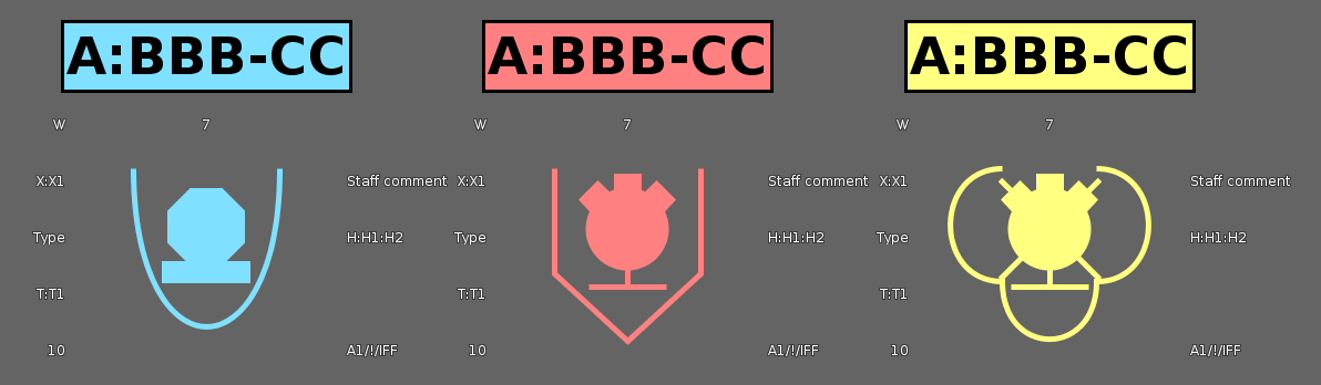
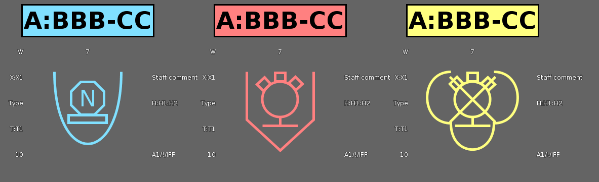
ImprovementDefense Symbology
LCD-11202
TLcdDefaultAPP6AStyle, where it used to be painted in the affiliation color.
ImprovementInfrastructure Standards
LCD-12528
Bug fixLuciadFusion
LF-2276
Bug fixLuciadFusion
LCD-11874
TLspXYGridLayerBuilder: Fixed a crash when building a grid with TLcdCartesianReference as reference.
Bug fixLuciadFusion
LCD-12805
Bug fixLuciadFusion
LCD-12806
Bug fixLuciadFusion
LCD-12799
TLcdGML32ArcByCenterPoint no longer returns incorrect bounds when using grid references.
Bug fixAviation Standards
LCD-12807
TLcdAIXMProcedureHandler will skip procedure legs with type OTHER
instead of throwing an exception.
Bug fixDefense Symbology
LCD-12784
Bug fixDefense Symbology
LCD-12781
ILinSymbologyStyle.setLabelPosition(int aPosition)Bug fixDefense Symbology
LCD-12780
Bug fixDefense Symbology
LCD-12616
Upgrade considerationLuciadFusion
LF-2276
2022.1.04
ImprovementLuciadFusion
TLcdOGCBinaryLogicOperator now has a constructor with a varargs parameter for conditions.
ImprovementLuciadFusion
LCD-12228
ImprovementAviation Standards
LCD-12795
Bug fixLuciadFusion
LCD-12796
TLcdGeoJsonModelEncoder now correctly encodes data objects with list properties which in turn
also contain data objects. Before this fix, the type names of those list elements would not be included in the
resulting JSON.
Bug fixLuciadFusion
LF-2347
TLcdE57ModelDecoder now supports E57 data containing more points than
Integer.MAX_VALUE, regardless of the number of points to be read set with the
TLcdE57ModelDecoder#setMaxNumberOfPoints method.
Bug fixLuciadFusion
LF-2347
TLcdLASModelDecoder now supports LIDAR data containing more points than
Integer.MAX_VALUE, regardless of the number of points to be read set with the
TLcdLASModelDecoder#setMaxNumberOfPoints method.
Bug fixLuciadFusion
LF-2347
TLfnPointCloudPreprocessor now supports point cloud data containing more points
than Integer.MAX_VALUE.
Bug fixLuciadFusion
LCD-12770
TLspParameterizedIconStyle: fixed a memory leak that could occur when using an
ILcdParameter in one of the expressions on the style.
Bug fixLuciadFusion
LCD-12786
TLcdSLDFeatureTypeStylePainter#getCreationClickCount was not correct
in case of a model with multiple geometry types and a layer with SLD styling rules that filter on the geometry type.
This could lead to incorrect object creation behavior, which relies on this method to know how many points are needed.
Bug fixLuciadFusion
LCD-12785
TLcdOGCVendorSpecificFunctions.GEOMETRY_TYPE_FUNCTION_NAME,
used to identify the type of a geometry value, could not handle GML polygons.
2022.1.03
ImprovementLuciadFusion
LF-2077
filePath property to the URL when using the POST /api/data or POST /api/styles REST API endpoint.
The data or style should be accessible to LuciadFusion without requiring authentication.
Only data formats for which LuciadFusion has a model decoder that implement the ILcdInputStreamFactoryCapable interface are supported.
ImprovementInfrastructure Standards
LCD-12690
ImprovementInfrastructure Standards
LCD-12605
TLcd3DTilesProcessorBuilder: Now produces textures at multiples of four for data sources
coming from reality capture data. This improves the ability for clients to compress the textures on the GPU.
ImprovementInfrastructure Standards
LCD-12385
TLcdIFCModelDecoder now supports IfcFacetedBrepWithVoids.
ImprovementInfrastructure Standards
LCD-12776
Bug fixLuciadFusion
LCD-12772
TLcdGeodetic to a geodetic reference, bounds that extend over the date line
were transformed into bounds that don't include the date line.
Bug fixLuciadFusion
LCD-12773
TLcdOGCVendorSpecificFunctions.GEOMETRY_TYPE_FUNCTION_NAME,
used to identify the type of a geometry value, could not handle GML geometry properties.
Bug fixDefense Symbology
LCD-12754
Bug fixInfrastructure Standards
LCD-12750
2022.1.02
ImprovementLuciadFusion
LF-2328
== and case-insensitive text match
using =ic= RSQL comparison operators on enum properties.
This change applies to the REST API GET api/data/filter endpoint.
Bug fixLuciadFusion
LCD-12431
TLcdEPSGReferenceParser would throw a RuntimeException
instead of a ParseException when decoding a reference that makes use of the resources in that jar.
Bug fixLuciadFusion
LCD-12745
SQL logic error (near "-": syntax error) when opening certain GeoPackage files.
2022.1.01
ImprovementLuciadFusion
LF-2329
GET /api/data/custom-properties endpoint allows users to request all the queryable and
non-queryable custom properties.
ImprovementLuciadFusion
LF-2323, LF-2324
LuciadFusion now publishes events when searching for TLfnProduct or
TLfnService resources: see TLfnProductQueryEvent and
TLfnServiceQueryEvent respectively.
For a complete overview of available events, refer to the Listening for LuciadFusion events article.
ImprovementLuciadFusion
LCD-8587
TLcdEllipsoidUtil#geodesicDistance3DTLcdEllipsoidRhumblineUtil#rhumblineDistance3DTLcdSphereUtil#greatCircleDistance3DTLcdSphereRhumblineUtil#rhumblineDistance3D
ImprovementLuciadFusion
LF-1610
ImprovementLuciadFusion
LCD-12719
ImprovementLuciadFusion
LCD-12672
ImprovementDatabase Connectors
LCD-12730
ILcdShape
objects that provide access to the M coordinate:
POINT:TLcdLonLatMPoint,TLcdXYMPoint,TLcdLonLatHeightMPointorTLcdXYZMPointLINESTRING:TLcdLonLatMPolyline,TLcdXYMPolyline,TLcdLonLatHeightMPolylineorTLcdXYZMPolylinePOLYGON:TLcdLonLatMPolygon,TLcdXYMPolygon,TLcdLonLatHeightMPolygonorTLcdXYZMPolygonMULTIPOINT:ILcdShapeListcontainingTLcdLonLatMPolypoint,TLcdXYMPolypoint,TLcdLonLatHeightMPolypointorTLcdXYZMPolypointobjectsMULTILINESTRING:ILcdShapeListcontainingTLcdLonLatMPolyline,TLcdXYMPolyline,TLcdLonLatHeightMPolylineorTLcdXYZMPolylineobjectsMULTIPOLYGON:ILcdShapeListcontainingTLcdLonLatMPolygon,TLcdXYMPolygon,TLcdLonLatHeightMPolygonorTLcdXYZMPolylineobjects
Bug fixLuciadFusion
LF-2322
Bug fixLuciadFusion
LCD-12741
TLspContinuousLabelingAlgorithm.
Bug fixLuciadFusion
LCD-12721
TLcdE57ModelDecoder no longer throws an IOException for files
that contain more than Integer.MAX_VALUE points, provided that
setMaxNumberOfPoints() is first called to set a lower point count.
Bug fixLuciadFusion
LCD-12724
LCD-12679 was not complete.
The WMS capabilities now advertise the SLD operations in the correct XML namespace.
Bug fixInfrastructure Standards
LCD-12688
TLcdIFCModelDecoder
now supports unit conversions with IfcReal or IfcInteger factors
instead of throwing a NullPointerException.
Bug fixMaritime Standards
LCD-12740
Bug fixMaritime Standards
LCD-12532
2022.1
New featureLuciadFusion
TLfnAccessEventPublisher has been added which allows a developer to publish
a TLfnProductAccessEvent or a TLfnServiceAccessEvent in a custom
LuciadFusion service.
New featureLuciadFusion
LuciadFusion now publishes events using the Spring framework's event mechanism. These events are triggered when certain manual or automated actions occur, such as: creating a content root, deleting a style, a crawl job completed, etc.
Read the Listening for LuciadFusion events article to learn more about the available events and how to listen to them.
New featureLuciadFusion
LuciadFusion is now able to read certain data formats from Amazon S3 cloud storage. To enable this feature, one
must run LuciadFusion with the fusion.aws Spring profile activated. A list of all supported
data formats can be found here. Please
refer to the developer platform for more
details.
Apart from out-of-the-box support for AWS S3, LuciadFusion now provides the building blocks required for adding
support for a different (cloud) storage technology. Developers aiming to do so, need to implement an
ILfnResourceConnector
to enable LuciadFusion to communicate with the storage, and an
ILcdInputStreamFactory
to allow model decoders to read its resources.
This is also described in more detail in the article linked above.
New featureLuciadFusion
CustomAuthenticationFusionPlatformApplication to
run and explore the sample application.
See the
Configuring a custom user authentication logic
article for more information.
New featureLuciadFusion
LuciadLightspeed now ships with a component named lcd_aws. This component contains an
ILcdInputStreamFactory that is capable of reading files from Amazon S3 cloud storage. Most
model decoders that implement ILcdInputStreamFactoryCapable automatically pick up this
factory by means of the services registry, and are now able to decode sources directly from S3. Please refer to
Supported data types to find out which
formats are supported exactly.
The implementation of this factory, named S3InputStreamFactory, is also available in sample
code. It can be used as an example for developers aiming to add support for a different (cloud) storage
technology, or simply in case a modified version of the factory is desired. For example to set the
S3Client that is used, or changing the default AWS Credentials Provider.
New featureLuciadFusion
Users can now associate additional information with a Data in LuciadFusion Studio by setting custom properties on that Data. Custom properties are name-value pairs, with the name uniquely identifying the property and the value containing the information for that property. The value of a custom property can be of type string, boolean, number or date.
The custom properties can be used to store additional metadata information about a Data, or they can be used to
store
information needed when extending LuciadFusion with custom functionality.
An example of the former would be to add custom properties
publisherName
(string) and publicationYear (number) to
store the name of the publisher of the Data
and the year it was published.
An example of the latter would be to add a spotlight (boolean)
property to a Data, and using it to highlight certain Data that should stand out from the rest.
Custom properties can be set and obtained for a specific Data using the LuciadFusion Studio REST API.
The PATCH /api/data/{id} endpoint allows users to set the custom properties for a Data.
The GET /api/data/{id} endpoint allows users to obtain the custom properties for a Data.
New featureLuciadFusion
LuciadFusion is able to pick up custom properties from a metadata file when crawling or adding Data. This allows users to automatically associate additional metadata information with Data when it gets added to LuciadFusion. For example, if the metadata specifies the name of the publisher of the Data and a year when the Data was published, then this information could be extracted from the metadata and added as custom properties to the Data in LuciadFusion when it is imported.
An implementation of ILfnCustomPropertyDecoder is needed to let LuciadFusion extract custom properties
from a TLcdISO19115Metadata decoded by an ILcdMetadataDecoder.
To learn more, see this article.
New featureLuciadFusion
LuciadFusion can be configured to allow querying Data based on queryable properties.
This allows users to search for Data based on the additional metadata information that is associated with the Data.
For example, when using custom properties publisherName (string)
and publishYear (number) to store the name of the publisher of the Data
and the year it was published, a user can search for all Data published by a specific publisher during a specific year.
An implementation of ILfnCustomPropertyDecoder needs to be provided so that
LuciadFusion is aware of the type of the custom properties, as this has an impact on the supported query
operations.
See the
Define the custom properties
article for more information.
Querying Data based on queryable properties is done using the LuciadFusion Studio REST API.
The GET api/data/queryable-properties endpoint lists all the properties that can be used to
query Data.
To query Data, use the GET api/data/filter endpoint.
For more information on how to query Data and which operations are supported, see this article.
New featureLuciadFusion
ImprovementLuciadFusion
LCD-12354
ILcdWFSClientModelEncoderFactory by adding an
@LcdServiceannotation
to the implementation. This interface is used by WFS services to encode features. Only the factory with the highest
priority is used. By default, a factory with support for GML 2 / 3.1 / 3.2 and GeoJSON is used.
ImprovementLuciadFusion
LF-2294
ImprovementLuciadFusion
The LuciadFusion Studio async jobs thread pool is now configurable. the thread pool size can be configured with the following properties:
fusion.studio.configuration.jobs.threadPool.minimumSizefusion.studio.configuration.jobs.threadPool.maximumSize
These properties are configured in the fusion.common.yml configuration file.
Have a look there for more information about these properties.
ImprovementLuciadFusion
ImprovementLuciadFusion
LCD-12602
A new interface ILcdWMTSGXYLayerFactory has been introduced to create request-based
layer factories for a WMTS layer. By adding an
@LcdServiceannotation
to an implementation,
it is automatically picked by at runtime by the LuciadFusion Platform application.
ImprovementLuciadFusion
LCD-12572
TLcdEllipsoidRhumblineUtil#intersectionGeodesicRhumblineSFCT has improved
one to two orders of magnitude for the case where the rhumbline is a meridian or a parallel.
ImprovementLuciadFusion
LF-2138
DataSource bean has been marked with @Primary annotation
to indicate that this DataSource bean will be given preference when multiple
DataSource
beans are defined. This essentially ensures that
LuciadFusion will work as intended in the presence of multiple user defined
DataSource
beans.
ImprovementLuciadFusion
findAndDecodeMetadata method to ILcdMetadataDecoder. This
method returns the decoded metadata, together with the location of the metadata files.
ImprovementLuciadFusion
ILcdMetadataDecoder implementations (like TLcdISO19139MetadataDecoder)
can now be discovered by the service loading mechanism.
A new TLcdCompositeMetadataDecoder implementation has been added that will use the appropriate
ILcdMetadataDecoder service to decode the given metadata source.
Bug fixLuciadFusion
LCD-12479
ILspMapScaleProvider, causing objects to receive wrong styling until a repaint was forced.
Bug fixLuciadFusion
LCD-12340
ILspMapScaleProvider can be used on a layer in a 3D view now. Before, optimizations
would cause the map scale provider to not be properly taken into account.
Bug fixLuciadFusion
LCD-12430, LCD-12522
TLcdJPEG2000ModelDecoder: fixed an issue that prevented opacity bands in images from being
applied correctly in an ILcdGXYView.
Bug fixLuciadFusion
LCD-12699
TLcdEllipsoidUtil#geodesicArea could return incorrect results for triangles with coinciding points.
Bug fixInfrastructure Standards
LCD-12641
TLcd3DTilesProcessorBuilder: Fixed an issue that would cause thin lines to appear at tile
edges when DRACO compression was enabled.
Upgrade considerationLuciadFusion
LCD-12725
Upgrade considerationLuciadFusion
For its new S3 functionalities, LuciadFusion makes the use of some new libraries:
- AWS SDK Annotations (version 2.17.168)
- AWS SDK Apache-client (version 2.17.168)
- AWS SDK Arns (version 2.17.168)
- AWS SDK Auth (version 2.17.168)
- AWS SDK Aws-core (version 2.17.168)
- AWS SDK Aws-query-protocol (version 2.17.168)
- AWS SDK Aws-xml-protocol (version 2.17.168)
- AWS SDK Http-client-spi (version 2.17.168)
- AWS SDK Json-utils (version 2.17.168)
- AWS SDK Metrics-spi (version 2.17.168)
- AWS SDK Profiles (version 2.17.168)
- AWS SDK Protocol-core (version 2.17.168)
- AWS SDK Regions (version 2.17.168)
- AWS SDK S3 (version 2.17.168)
- AWS SDK Sdk-core (version 2.17.168)
- AWS SDK Third-party-jackson-core (version 2.17.168)
- AWS SDK Utils (version 2.17.168)
- Reactivestreams (version 1.0.3)
- Eventstream (version 1.0.1)
- Commons-codec (version 1.11)
- Httpcomponents Httpclient (version 4.5.13)
- Httpcomponents Httpcore (version 4.4.13)
- org.reactivestreams reactive-streams New 1.0.3 MIT)
- Slf4j (version 1.7.36)
Upgrade considerationLuciadFusion
LuciadFusion now uses an RSQL library to support querying Data against LuciadFusion's built-in standard and user defined custom properties.As a result, upgrading an older version of LuciadFusion to V2022.1 or later is desired. The following JAR has been added.
- rsql-common-<version>.jar
Upgrade considerationLuciadFusion
- TLcdGeoTIFFModelDecoder#getImageInputStreamFactory
- TLcdGeoTIFFModelDecoder#setImageInputStreamFactory
- TLcdTABRasterModelDecoder#getImageInputStreamFactory
- TLcdTABRasterModelDecoder#setImageInputStreamFactory
- TLcdTFWRasterModelDecoder#getImageInputStreamFactory
- TLcdTFWRasterModelDecoder#setImageInputStreamFactory
- TLcdRasterModelDecoder#getTileInputStreamFactory
- TLcdRasterModelDecoder#setTileInputStreamFactory
- TLcdDIMAPModelDecoder#getImageInputStreamFactory
- TLcdDIMAPModelDecoder#setImageInputStreamFactory
#getInputStreamFactory, while the
setters no longer have any effect. Please change any calls to these methods to
#getInputStreamFactory or #setInputStreamFactory instead. In the next
major release, these methods will be removed entirely.
Upgrade considerationLuciadFusion
TLspLabelingAlgorithm, TLspOnPathLabelingAlgorithm,
TLspInPathLabelingAlgorithm and TLspCurvedPathLabelingAlgorithm has been raised
to 1 iso 0.5. This means that by default, no labels will be dropped because of the quality setting. When you have a layer
that
has a lot of labeled objects, in some cases this might result in more work being done in the background, and in slower label
updates.
If this is the case, you can go back to the old behavior by calling the setQuality method of those algorithms with a value
of 0.5.
Upgrade considerationLuciadFusion
LCD-8329
TLcdSpatialReferenceParser class is now deprecated. It is encouraged to use the
TLcdEPSGReferenceParser class instead.
Upgrade considerationAdvanced Raster Services
LCD-12358
TLcdECWModelDecoder
has been upgraded to use ERDAS ECW JP2 SDK 6.0. The names of the JAR
files containing the native libraries reflect this change: libecw-5.4.*.jar is now
libecw-6.0.*.jar. No other changes are necessary.
Upgrade considerationInfrastructure Standards
LCD-12659
TLcdDWGModelDecoder
and TLcdDWGModelListDecoder now by default decode extended entity types.
As a result, the objects in DWG models now by default include extended entity types if present in the data.
This can be reverted by calling the method clearExtendedEntityTypeSelection() on the decoder.
2022.0
2022.0.16
ImprovementLuciadFusion
LCD-12643
TLcdEPSGReferenceParser now supports references based on the IG05/12 Intermediate datum:
- EPSG:6988
- EPSG:6989
- EPSG:6990
- EPSG:6991
ImprovementLuciadFusion
TLcdSLDGraphic has a new method anchorPoint to set the
anchor point of the graphic.
ImprovementAviation Standards
LCD-12656
com.luciad.ais.model.procedure.ILcdProcedureLeg:
getOriginalAltitudeUppergetOriginalAltitudeLower
ImprovementAviation Standards
LCD-12661
ImprovementInfrastructure Standards
LCD-12682
TLcdIFCModelDecoder
now supports the IFC4 IfcPolygonalFaceSet element.
Bug fixLuciadFusion
LCD-12694
TLspLabelPainter: fixed a memory leak that could happen when removing objects from a model
and firing a style
event in the styler (ALspStyler#fireStyleChangeEvent) at the same time.
Bug fixLuciadFusion
LCD-12681
ILcdGXYView#setPaintInBackground
functionality was active. This has been resolved.
Bug fixLuciadFusion
LF-2306
Bug fixLuciadFusion
LCD-12691
Bug fixLuciadFusion
LCD-12679
Bug fixAviation Standards
LCD-12639
TLspARINCLayerBuilder defines a list of ARINC-specific SLD files
in location TLspARINCLayerBuilder#SYMBOLOGY_ENCODING_FILES_LOCATION. The default style
for runways Runway.sld did not define the fill style correctly and has been fixed.
Bug fixAviation Standards
LCD-12662
Bug fixDefense Standards
LCD-12685
TLcdNITFModelDecoder#decode now throws an IOException instead of an
OutOfMemoryError when parsing a corrupt NITF tagged record extension.
Bug fixDefense Symbology
LCD-12683
TLcdGARSFormat now also parses GARS coordinate strings with a cell column consisting of fewer than 3 digits.
2022.0.15
ImprovementLuciadFusion
LCD-12655
ImprovementLuciadFusion
LCD-12670
TLcdOGCVendorSpecificFunctions.DATE_FORMAT_FUNCTION_NAME and
TLcdOGCVendorSpecificFunctions.DATE_PARSE_FUNCTION_NAME.
ImprovementLuciadFusion
LCD-12669
FormatDate now also supports properties of type
String, java.util.Date and java.util.GregorianCalendar.
ImprovementInfrastructure Standards
LCD-12382
TLcdIFCModelDecoder
now supports the IFC4 IfcIndexedPolyCurve element.
ImprovementInfrastructure Standards
LCD-12633
Bug fixLuciadFusion
LCD-12665
Bug fixAdvanced Raster Services
LCD-12454
TLcdPegasusModelDecoder.
Bug fixDatabase Connectors
LCD-12652
2022.0.14
Bug fixLuciadFusion
LCD-12647
Bug fixLuciadFusion
LF-2303
Bug fixInfrastructure Standards
LF-2285
TLcd3DTilesProcessorBuilder: Fixed an issue that could cause very high levels of subdivision
with certain referenced GLB datasets.
2022.0.13
ImprovementLuciadFusion
LCD-11239
TLcdCoverageModelDecoder#canDecodeSource methods has been improved
to only accept LuciadFusion coverage XML sources.
Bug fixLuciadFusion
LCD-12618
Bug fixLuciadFusion
LCD-12598
TLspOnPathLabelingAlgorithm (and other labeling algorithms) to 100%, it could still
happen that the algorithm didn't try to place all labels.
Bug fixLuciadFusion
LCD-12598
TLspOnPathLabelingAlgorithm could become very slow for objects with many labels.
Bug fixLuciadFusion
LCD-12542
TLcdPrimaryKeyAnnotation. This fix makes sure that the response contains a
valid unique identifier for each feature, regardless of any WFS property name filter.
Bug fixLuciadFusion
LCD-12609
invalid sample dimension value.
This was specifically problematic when requesting multiple layers having the same dimension but with different
non-overlapping ranges.
Bug fixLuciadFusion
LCD-12608
0, the server would incorrectly return an error response with
invalid sample dimension value.
Bug fixLuciadFusion
LCD-12558
Bug fixLuciadFusion
LCD-12624
TLspPaintRepresentation
were sometimes not updated correctly when the domain object changes.
Bug fixAdvanced Raster Services
LCD-12591
TLcdGeospatialPDFModelDecoder#decode will now correctly parse UTF-16 Little Endian
encoded metadata.
Bug fixAviation Standards
LCD-12611
TLcdARINCMinimumSectorAltitudeHandler did not correctly support ARINC
424 version 15, which uses a different Minimum Sector Altitude data structure than more recent versions.
Bug fixDefense Symbology
LCD-12598
Bug fixDefense Symbology
LCD-12615
NullPointerException that could occur when painting symbols with a large number of points when strict segmentation is disabled
(see TLcdDefaultAPP6AStyle.setStrictSegmentationEnabled(boolean) and TLcdDefaultMS2525bStyle.setStrictSegmentationEnabled(boolean))
and the corner smoothness is set to 0.0 (see TLcdDefaultAPP6AStyle.setCornerSmoothness(double) and TLcdDefaultMS2525bStyle.setCornerSmoothness(double)).
Upgrade considerationLuciadFusion
LF-2299
2022.0.12
ImprovementDefense Symbology
LCD-12586
It is now possible to enable/disable strict segmentation of tactical graphics. Disabling strict segmentation will limit the amount of times information is repeated on a symbol. Strictly speaking, the military standards defines that some symbols need to repeat all information for each segment of 2 consecutive anchor points. This is not very useful in realistic situations.
For example, if you create a "Main Supply Route" that matches an actual route in the real world. It could be constructed out of many thousands of anchor points, forming very small segments. Having to repeat the information thousands of times is not desired as labels will overlap with each other and can cause performance issues when zooming out far enough where you are able to see the whole symbol.
This strict segmentation can be enabled/disabled with the following methods:
TLcdDefaultAPP6AStyle.setStrictSegmentationEnabled(boolean)TLcdDefaultMS2525bStyle.setStrictSegmentationEnabled(boolean)
Bug fixLuciadFusion
LCD-12604
Bug fixLuciadFusion
LCD-12601
TLspPopupMenuSelectionCandidateHandler and clicking on a menu item, the corresponding object will no
longer be deselected and reselected multiple times. If it was already selected it will just keep its selection
state.
Bug fixLuciadFusion
LCD-12606
TLcdOWSHttpTransport no longer throws an exception when
the server returns a valid but empty response.
Bug fixLuciadFusion
LCD-12597
TLcdOWSHttpTransport did not support services that redirect
from HTTPS to HTTP or vice versa in combination with HTTP(S) Basic Authentication.
Bug fixDatabase Connectors
LCD-12596
TLcdPostGISModelEncoder that caused the following warning to appear in the database log when exporting:
WARNING: OGC WKB expected, EWKB provided - use GeometryFromEWKB() for this.
Bug fixDefense Symbology
LCD-12603
zOrder of ALspStyles submitted to a
TLspAPP6ASymbolStyler
or
TLspMS2525bSymbolStyler
got ignored for tactical graphics symbols.
Bug fixDefense Symbology
LCD-12593
ILspLabelingAlgorithm was created each time a label was placed.
We now reuse the ILspLabelingAlgorithm where feasible.
Bug fixDefense Symbology
LCD-12502
Bug fixDefense Symbology
LCD-12501
NullPointerException in GXY views.
2022.0.11
ImprovementLuciadFusion
LF-1541
TLcdModelMetadata decoded from the data itself.
ImprovementInfrastructure Standards
LCD-12564
Bug fixLuciadFusion
LCD-12566
TLspOnPathLabelingAlgorithm didn't always clean up its terrain listeners correctly, due to a memory leak. When using a lot
of different algorithm instances, this could have a noticeable effect on performance, even after removing the layer using
these algorithms.
Bug fixLuciadFusion
LCD-12575
relaxngDatatype library was downloaded twice and therefore found
twice in the classpath in Maven-based projects built using the product POM files.
Bug fixLuciadFusion
LCD-12588
samples.common.dimensionalfilter.model.FilterProvider and TLcyDimensionalFilterAddOn now correctly interpolate non-double Number types.
Previously, interpolation could lead to a ClassCastException.
Bug fixLuciadFusion
LCD-12580
TLcdGXYShapePainter now correctly edits polygons that implement ILcd3DEditablePolygon.
Bug fixLuciadFusion
LCD-12573
TLcdDTEDDirectoryModelDecoder would attempt to use incorrect filenames in specific cases.
This happened for DTED directory data sets where the bounding box extent would cross the 180 meridian.
As example for a data extent with a location of (172.0, -44.0)
and a width of 21.0 and height 116.0.
Bug fixAviation Standards
LF-2290, LCD-12201, LCD-10311
TLcdDAFIFModelDecoder now returns data series when decoding model metadata.
Bug fixMaritime Standards
LCD-12560
Fixed an erroneous warning about missing cell update files in case of cell re-issues.
This was just a warning, the actual updates were applied correctly.
Note that all available update files are attempted to be applied, regardless of missing intermediate updates.
2022.0.10
ImprovementAviation Standards
LCD-12524
TLcdARINCMinimumSectorAltitudeHandler has been added to support
the decoding of Minimum Sector Altitude objects. These objects define the lowest altitudes that may be used
safely in the presence of terrain and obstacles. Decoded objects are of the type
ILcdMinimumSectorAltitude, which can contain one or more ILcdSector
objects that define the minimum altitude for an area represented by an arc band. The data types of these objects
are respectively TLcdARINCDataTypes#MinimumSectorAltitude and
TLcdARINCDataTypes#Sector.
ImprovementDefense Symbology
LCD-12549
It is now possible to configure the icon type of the "Antitank Obstacles, Tetrahedrons, Dragon’s Teeth and Other Similar Obstacles" symbols in APP-6A and APP-6B. These symbols can have different icons depending on their type: "Fixed And Prefabricated", "Movable" or "Movable And Prefabricated". Unfortunately the APP-6A and APP-6B specifications do not indicate how this obstacle type should be encoded in the symbol.
The approach taken here is similar to other products: the obstacle type is encoded in the "Type Of Equipment" text modifier of the symbol. The value should either be one of the following values (casing is not important):
| Obstacle Type | Possible values |
|---|---|
| Fixed And Prefabricated | "Fixed And Prefabricated", "F", "01" |
| Movable | "Movable", "M", "02" |
| Movable And Prefabricated | "Movable And Prefabricate"1, "P", "03" |
| 1There is no "d" at the end "Movable And Prefabricate" because the max length of the "Type Of Equipment" text modifier is 24. | |
ImprovementInfrastructure Standards
LCD-12555
Bug fixLuciadFusion
LCD-12563
Bug fixLuciadFusion
LCD-12561
Bug fixReal-time Engine
LCD-12541
TLspRadarVideoLayerBuilder: the afterglow duration set on TLspRadarVideoStyle
wasn't applied correctly when the intensity was not set to 1, blips would disappear to fast.
Bug fixAviation Standards
LF-2289
TLcdDAFIFModelDecoder#canDecodeSource method allowed transaction files (files in T_TRANS
directory) even though these files are not supported yet. To prevent issues when decoding these files,
TLcdDAFIFModelDecoder#canDecodeSource
now returns false for transaction files.
2022.0.09
ImprovementDatabase Connectors
LCD-12538
ILcdShape
objects that provide access to the M coordinate:
POINTM:TLcdLonLatMPointorTLcdXYMPointPOINTZM:TLcdLonLatHeightMPointorTLcdXYZMPointLINESTRINGM:TLcdLonLatMPolylineorTLcdXYMPolylineLINESTRINGZM:TLcdLonLatHeightMPolylineorTLcdXYZMPolylinePOLYGONM:TLcdLonLatMPolygonorTLcdXYMPolygonPOLYGONZM:TLcdLonLatHeightMPolygonorTLcdXYZMPolygonMULTIPOINTM:ILcdShapeListcontainingTLcdLonLatMPointorTLcdXYMPointobjectsMULTIPOINTZM:ILcdShapeListcontainingTLcdLonLatHeightMPointorTLcdXYZMPointobjectsMULTILINESTRINGM:ILcdShapeListcontainingTLcdLonLatMPolylineorTLcdXYMPolylineobjectsMULTILINESTRINGZM:ILcdShapeListcontainingTLcdLonLatHeightMPolylineorTLcdXYZMPolylineobjectsMULTIPOLYGONM:ILcdShapeListcontainingTLcdLonLatMPolygonorTLcdXYMPolygonobjectsMULTIPOLYGONZM:ILcdShapeListcontainingTLcdLonLatHeightMPolygonorTLcdXYZMPolylineobjects
Bug fixLuciadFusion
LCD-12550
ConcurrentModificationException when trying to take a read lock on a
TLcdModelList, while a different thread is adding or removing models to this list, even when
that thread correctly took a write lock.
Bug fixLuciadFusion
LCD-12527
2022.0.08
ImprovementLuciadFusion
ILcdMetadataDecoder
implementations using the @LcdService annotation.
Bug fixLuciadFusion
LCD-12540
Bug fixLuciadFusion
LCD-12533
Bug fixLuciadFusion
LF-2282
discoverDataSources method of the corresponding
ILcdModelDecoder returns more than one ILcdDataSource,
a Data entry is created for every ILcdDataSource. However, if a ISO19103
metadata file existed next to the data file, only an entry for the first ILcdDataSource
was created. This has been fixed.
Bug fixLuciadFusion
LCD-12534
GLTF data related using translation-rotation-scale
parameters instead of a transformation matrix. Affected data would have objects with a bad scale, which
has now been corrected. This affects the 3D Tiles format, as that is based on
GLTF internally.
Bug fixLuciadFusion
LF-2272
Bug fixInfrastructure Standards
LCD-12530
TLcd3DTilesProcessorBuilder: Fixed a potential StackOverflowError when
processing modeled 3D data, with very long, thin triangles.
Bug fixInfrastructure Standards
LCD-12518
TLcd3DTilesProcessorBuilder: Fixed a NullPointerException in some edge
cases when converting a GLB file to 3D Tiles with a mix of repeating textures and base colors.
2022.0.07
ImprovementLuciadFusion
LCD-12521
TLcdEllipsoidUtil#computeBufferContour2D method was added with an additional parameter to control the amount of points that is used
for caps and joins. This can for example be used to simplify buffer contours and improve rendering performance when you show
a large amount of buffers on the view.
ImprovementInfrastructure Standards
LCD-12506, LCD-12525, LCD-12535
Bug fixLuciadFusion
LCD-12482
TLcdLASModelDecoder
no longer throws an IOException for files that
contain more than Integer.MAX_VALUE points, provided that
setMaxNumberOfPoints()
is first called to set a lower point count.
2022.0.06
ImprovementLuciadFusion
LCD-12488, LCD-12487
build/maven/pom).
ImprovementLuciadFusion
LCD-12511
IsLike condition with other property-based conditions.
ImprovementAviation Standards
LCD-12500
Bug fixLuciadFusion
LCD-12508
Due to a regression triggered by 2022.0 enhancement LF-2159, WMS GetMap requests with a
non-null STYLES parameter but without an SLD could no longer be processed, resulting in a service exception report.
Bug fixLuciadFusion
LCD-12504
TLcdOBJModelDecoder: fixed regression in decoding speed that was introduced in 2022.0.
Bug fixLuciadFusion
LCD-12451
build/maven/deploy.xml), where it would consider some thirdparty libraries that aren't available on the central Maven repository as public.
Bug fixLuciadFusion
LF-2275
Bug fixLuciadFusion
LCD-11627
Bug fixLuciadFusion
LCD-12498
Bug fixLuciadFusion
LF-2271
Bug fixReal-time Engine
LCD-12510
TLcdSimulator, the simulator now uses that view's
ILspView#invokeLater for updating the simulator model. Previously, it would always schedule
model changes on the AWT Thread, which was not compatible with TLspFXView.
2022.0.04
ImprovementLuciadFusion
LF-2270
A new property wms.additionalParametersForViewPoolCacheKey has been added to
fusion.common.yml to specify additional WMS request parameters that need to be
taken into account for the view pool cache. This applies when you plug in a custom WMS layer factory that changes
the visualization based on additional request parameters beyond the standardized WMS parameters.
ImprovementAviation Standards
LCD-12489
ImprovementDefense Symbology
LCD-12452
TLspAPP6ASymbolStyle/TLspMS2525bSymbolStyle in your label styler implementation.
ImprovementInfrastructure Standards
LCD-12486
TLcd3DTilesProcessorBuilder for reality capture meshes.
Bug fixLuciadFusion
LF-2269
Bug fixLuciadFusion
LF-2266
Bug fixAdvanced Raster Services
LCD-12481
TLcdGeospatialPDFModelDecoder#decode will now correctly parse UTF-16 encoded metadata.
Bug fixDefense Symbology
LCD-12464
Bug fixInfrastructure Standards
LCD-12469
2022.0.03
ImprovementLuciadFusion
LF-2254
ImprovementRadar Connectors
LCD-12240
TLcdASTERIXCategory48: now supports Asterix category 48 revision 1.21. It incorporates
cumulative changes since Asterix category 48 revision 1.15. As a result
TLcdASTERIXLiveModelDecoder
and
TLcdASTERIXModelDecoder
can now decode Asterix datasets in compliance with Asterix category 48 revision 1.21 and earlier revisions.
Bug fixLuciadFusion
LF-2262
ILcdWMSGXYLayerFactory
was no longer picked up by LuciadFusion's WM(T)S services to render products.
Bug fixLuciadFusion
LF-2261
2022.0.02
ImprovementLuciadFusion
LCD-12457
ImprovementLuciadFusion
LCD-12459
TLspKML22LayerBuilder where 3D models would be incorrectly rotated on their heading
property.
ImprovementLuciadFusion
LCD-12286
TLcdCoverageModelDecoder method discoverDataSources
now returns a list with a single data source when the source is a coverage XML file on the local file system.
Bug fixLuciadFusion
LCD-12237
ALcdTransformingModel: when applying a new TLcdDimensionFilter
the clusters wouldn't always update accordingly.
Bug fixInfrastructure Standards
LCD-12468
Bug fixInfrastructure Standards
LCD-12412
Bug fixInfrastructure Standards
LCD-12455
- A single invalid object (NaN bounds) will no longer make binz-conversion fail.
- Sweeps no longer have inverted normals when the sweep contour is closed.
- Sweeps no longer have a dark line at the closing point of the sweep contour.
- Planes no longer fail during tesselation when the cause was a faulty normal.
2022.0.01
ImprovementLuciadFusion
ImprovementLuciadFusion
LCD-12266
ILcdGeoBuffers.
To change it, you can change the discretization parameters in the
TLspShapeDiscretizationParameters
and extend the TLspShapeDiscretizer to fit your needs.
ImprovementLuciadFusion
LCD-12261
PerpendicularOffset property
on the LineSymbolizer and PolygonSymbolizer symbolizers.
To help implement this improvement, TLcdSLDSymbolizerPainterFactory now overloads
createStrokePainterProvider with a variant that takes a TLcdSLDContext.
The new method deprecates the previous variant.
ImprovementLuciadFusion
LCD-12429
TLcdModelMetadata.Builder.resourceMetadata method will now try to extract dimensional information from the given ILcdResourceMetadata.
It will specifically extract the temporal and vertical axis information, if it is available.
ImprovementLuciadFusion
LCD-12342
TLcdServiceLoader) for GML tree nodes in an
ILcdGXYView.
ImprovementLuciadFusion
LCD-12406
ImprovementInfrastructure Standards
LCD-12375
TLcdIFCModelDecoder is now reporting concrete progress to its registered
ILcdStatusListeners.
Bug fixLuciadFusion
TLcdModelReferenceEncoder and TLcdModelReferenceDecoder didn't take into account geoids with different
horizontal transformation parameters.
Bug fixLuciadFusion
TLcdEPSGReferenceParser, even though it was not correctly supported.
Trying to decode EPSG:7404 now throws a ParseException as expected.
Bug fixLuciadFusion
LCD-12228, LCD-7715
Bug fixLuciadFusion
Bug fixLuciadFusion
LCD-12369
Bug fixLuciadFusion
LCD-12347
BlackLimeLookAndFeel: fixed an issue when using Java 17, resulting in incorrect text colors in a JXTreeTable.
Bug fixLuciadFusion
LCD-12453
Bug fixLuciadFusion
LCD-12408
Bug fixLuciadFusion
LCD-12434
TLcdWKTReferenceParser with certain compound references could modify the references that are returned by TLcdGeoidGeodeticDatumFactory.
Bug fixLuciadFusion
LF-2253
Bug fixLuciadFusion
LCD-12234
TLspIconStyle: when the application was switched to another screen with different DPI, an
endless repaint loop could occur when icons were made invisible.
Bug fixLuciadFusion
LCD-12433
Note that a vertical datum is only applied when the GeoTIFF decoder is configured with
com.luciad.format.raster.TLcdGeoTIFFModelDecoder.setSupportGeoidDatums.
Bug fixLuciadFusion
LCD-12447
GDAL_NODATA tag when using
the legacy ILcdRaster API.
The no data tag was already used when working with the imaging API.
Bug fixInfrastructure Standards
LCD-12371
Bug fixInfrastructure Standards
LCD-12407
TLcd3DTilesProcessorBuilder: Now uses absolute file paths for caching textures. This fixes
an issue that in some rare cases, textures would be cached twice with a different key.
Bug fixInfrastructure Standards
LCD-12356
TLcd3DTilesProcessorBuilder: Fixed an issue that would bad UV coordinates to be generated in
trimmed tiles. The effects of this bug were blurriness in some higher level tiles, and a inflated output data size.
With this fix, output datasets for reality captures should be smaller and the simplified levels should be slightly
sharper.
Upgrade considerationLuciadFusion
The TLcdGeoJsonModelEncoder will now detect a primary key that has been declared on a supertype of a TLcdDataType.
The primary key property is used as id value of the GeoJson feature,
and is omitted from the properties list.
{
"type" : "Feature",
"id" : "0001",
"geometry" : { ... },
"properties" : {
"nonPrimaryKeyProperty" : "someValue",
...
}
}
Upgrade considerationInfrastructure Standards
Due to changes in how the GeoJson encoder handles primary keys of objects, the GeoJson output of the BinzConverter
will now have the FeatureID encoded as the id member of the features, instead of having it
as a property.
{
"type" : "Feature",
"id" : 0,
"geometry" : { ... },
"properties" : { ... }
}
When reading GeoJson files from Binz datasets, you can use this snippet to get the primary key property for both new and old GeoJson files:
ILcdModel model = new TLcdGeoJsonModelDecoder().decode("path\\to\\features.geojson");
TLcdDataType dt = ((ILcdDataObject) model.elements().nextElement()).getDataType(); // assuming the model has at least one element
TLcdPrimaryKeyAnnotation annotation = dt.getAnnotation(TLcdPrimaryKeyAnnotation.class);
TLcdDataProperty property = annotation != null ? annotation.getProperty() : dt.getProperty("FeatureID");
2022.0
New featureLuciadFusion
TLfnPointCloudPreprocessor now supports Draco compression. You can use
this new functionality through the API:
builder.pointCloudCompression(ELcdOGC3DTilesMeshCompressionType.DRACO).
It is also available in LuciadFusion Studio when you create an OGC3DTiles service from point cloud data,
and in the PointCloudPreprocessorTool.
The samples.fusion.pointcloud.PointCloudPreprocessorTool also supports Draco compression.
It can be activated through a "--compression=draco" program argument.
New featureInfrastructure Standards
Added support for the IFC data format. The IFC format is an open international standard for Building Information Model (BIM) data covering entities such as buildings or facilities.
For more details, see the IFC entry in the Data Formats documentation section
ImprovementLuciadFusion
When creating a WFS service for a product consisting of multiple data sources, the corresponding WFS feature types now each have as title a combination of the product title and the data source title. Before, only the product title was used, which made it difficult to differentiate between the WFS feature types in client applications.
ImprovementLuciadFusion
LCD-2839, LCD-8405
ILcdDataObject objects that have been decoded from XML no longer return the default attribute value
in the getValue method if the attribute value is missing.
Instead, the default value can be retrieved from the corresponding TLcdDataProperty.
This improves consistency when encoding these objects again.
ImprovementLuciadFusion
config/application-fusion.development.yml, are now empty.
ImprovementLuciadFusion
ImprovementLuciadFusion
LCD-12265
ILcdModelReferenceDecoder has a new method
findAndDecodeModelReference. Apart from decoding the model reference like its sibling method
decodeModelReference, this new method also provides the source file from which the
reference was decoded, when it exists and is known. An implementation of this method has been added to all
ILcdModelReferenceDecoder classes which are provided in the API, or as an
LcdService.
ImprovementLuciadFusion
LCD-11939
ImprovementLuciadFusion
LCD-6306
samples.wms.client.ecdis.lightspeed.MainPanel.
ImprovementLuciadFusion
ILcdInputStreamFactory.canCreateInputStream checks
whether a factory supports creating an input stream for a given source name.
This makes it possible to ignore factories that have no chance of succeeding when alternatives are available,
for instance in the new TLcdCompositeInputStreamFactory.
A default implementation is available in the interface that always returns true.
ImprovementLuciadFusion
ImprovementLuciadFusion
TLcd2DRegularTiledBoundsIndexedModel and their related API
have been deprecated, because they are only used to support deprecated formats.
ImprovementLuciadFusion
text/html or
text/xml as output format. When setting the output format to text/xml,
the generated XML is based on the WMTS GetFeatureInfo XSD, which can be found
here.
ImprovementLuciadFusion
LCD-10029
TLcdEllipsoidUtil.geodesicArea(ILcdShape, ILcdEllipsoid)TLcdSphereUtil.geodesicArea(ILcdShape, double)TLcdCartesian.area(ILcdShape)
ImprovementLuciadFusion
ImprovementLuciadFusion
LF-2159
It is now possible to implement request-based SLD rendering customizations for a LuciadFusion product with an SLD style.
To accomplish this, a new method has been added to the WMS API: ALcdSLDWMSGXYLayerFactory#createGXYLayer(ILcdModel aModel, ALcdWMSLayer aWMSLayer, TLcdSLDFeatureTypeStyle[] aStyle, TLcdWMSRequestContext
aRequestContext)
Based on the request stored in the TLcdWMSRequestContext changes can be applied to the TLcdSLDFeatureTypeStyle[] to allow for SLD rendering customizations.
It is now also possible to configure feature type styles on the server side.
This is done by plugging in a custom implementation of a ILcdWMSSLDFeatureTypeStyleProvider in the ALcdOGCWMSCommandDispatcherFactory by overriding the method ALcdOGCWMSCommandDispatcherFactory#createSLDFeatureTypeStyleProvider(ServletConfig aServletConfig).
ImprovementLuciadFusion
ImprovementLuciadFusion
com.luciad.wms.client.serverMapRotation. If you set it to true,
map rotations are propagated to the WMS server through the custom GetMap request
parameter angle. When used in combination with LuciadFusion or other WMS servers supporting
this parameter, it ensures that labels on rotated maps are always upright, and that oriented icons still have their
intended orientation.
ImprovementLuciadFusion
GetMap request
parameter angle, WMS clients can indicate the map rotation in degrees, measured clockwise
around the center of the map.
ImprovementLuciadFusion
ILcdWMTSGetLegendGraphicRequestEncoder or ILcdWMSGetLegendGraphicRequestEncoder using the mechanism of the
TLcdServiceLoader.
This way it is possible to generate custom legends for GetLegendGraphic requests coming from WMS or WMTS clients.
ImprovementLuciadFusion
LCD-7979, LF-2236
ImprovementLuciadFusion
ImprovementLuciadFusion
ALcdWMSServiceMetaDataImprovementLuciadFusion
ALcdWMSServiceMetaData.
ImprovementLuciadFusion
LCD-12187
TLcdGML2ModelEncoder and TLcdGML31ModelEncoder's generated feature collection element is now in the _FeatureCollection
substitution group. This improves embedding feature collections into other data models, such as WMTS feature info responses.
ImprovementLuciadFusion
LCD-11854
ILspMapScaleProvider. The map scale provider can be added
to a layer with TLspLayer#setMapScaleProvider, or it can be added to other layers by
overriding ILspLayer#getMapScaleProvider. See
the map scale provider how-to article for more
info.
ImprovementLuciadFusion
The WMTS server now supports HTTP GET operation using RESTful encodings.
ImprovementLuciadFusion
The WMTS server now supports the following additional Well Known Scale Sets: EPSG:3395, EPSG:4326, EPSG:5041 and EPSG:5042.
ImprovementLuciadFusion
ImprovementLuciadFusion
The WMTS and WMS services now support image/gif as output format.
ImprovementLuciadFusion
TLcdGXYPolylineLabelPainter making it possible to specify the color
and line width of the frame surrounding the labels.
ImprovementLuciadFusion
LCD-11314
TLcdCSVModelDecoder now creates models that implement
ILcdMultiDimensionalModel, when at least one of the columns is specified to contain values
of type TLcdCSVDataSource.ColumnType.DATE_TIME. The resulting model contains one time
dimension for each column of that type.
ImprovementLuciadFusion
LCD-12039
TLspViewNavigationUtil#animatedZoom, which performs an animated
zoom to a target map scale on a Lightspeed view.
ImprovementLuciadFusion
LCD-12088
ILspView implementations now fire property change events for the background and paintingOrder
properties.
ImprovementLuciadFusion
TLcdJPEG2000ModelDecoder: the decoder can now parse the model reference from embedded GMLJP2
in the file. The decoder supports versions 1.0, 2.0 and 2.1 of the GMLJP2 specification, and will only parse the
model reference,
other elements will be ignored but are accessible via the TLcdJPEG2000ModelDescriptor.
ImprovementLuciadFusion
LCD-10677
ILcdModel#dispose() on the output of
TLcdJPEG2000ModelDecoder
now closes the JPEG2000 file.
ImprovementLuciadFusion
LCD-8189
_rpc.txt which contains the RPC00B coefficients.
ImprovementLuciadFusion
LCD-8903
ImprovementLuciadFusion
ImprovementLuciadFusion
ImprovementLuciadFusion
LCD-4415
ImprovementLuciadFusion
LCD-4332
ImprovementLuciadFusion
LCD-4252
ImprovementLuciadFusion
LCD-4241
ImprovementLuciadFusion
ImprovementLuciadFusion
ImprovementLuciadFusion
ImprovementLuciadFusion
ImprovementLuciadFusion
LMAP-4075
ImprovementLuciadFusion
ImprovementLuciadFusion
ImprovementLuciadFusion
ImprovementLuciadFusion
ImprovementLuciadFusion
ImprovementLuciadFusion
ImprovementLuciadFusion
ImprovementLuciadFusion
ImprovementLuciadFusion
ImprovementLuciadFusion
ImprovementAviation Standards
ILcdCurve:
The following AIS API classes now implement ILcdRing:
The following AIS API interfaces now extend ILcdRing:
ILcdAirspaceCorridor now extends ILcdCurve.
ImprovementDefense Symbology
LCD-12336
The forced color style is now also applied to tactical graphic symbols instead of only to icon symbols. The forced color can be inspected/edited with the following methods:
ILcdMS2525bStyle.setForcedColorILcdMS2525bStyle.getForcedColorILcdAPP6AStyle.setForcedColorILcdAPP6AStyle.getForcedColor
ImprovementDefense Symbology
LCD-12140, LCD-10328
It is now possible to override the default line style of the outer frame of an icon.
To support this, the following methods are added to the interfaces ILcdMS2525bStyle and
ILcdAPP6AStyle:
ILcdMS2525bStyle.setForcedFrameLineStyleILcdMS2525bStyle.getForcedFrameLineStyleILcdAPP6AStyle.setForcedFrameLineStyleILcdAPP6AStyle.getForcedFrameLineStyle
These new methods are implemented by the existing API classes TLcdDefaultMS2525bStyle and TLcdDefaultAPP6AStyle.
ImprovementInfrastructure Standards
ImprovementInfrastructure Standards
For more information, refer to the how to article in the Binz documentation section.
ImprovementRadar Connectors
TLcdASTERIXTrajectory now implements ILcdCurve.
Bug fixLuciadFusion
LCD-12265
TLcdOBJModelDecoder now includes the MTL and referenced texture files in the supporting
sources of its models' TLcdModelMetadata.
Bug fixLuciadFusion
LCD-12265
TLcdIGRFModelDecoder and TLcdWMMModelDecoder now set the correct
source names on their model descriptor and TLcdModelMetadata.
Bug fixLuciadFusion
LCD-12265
TLcdMIFModelDecoder now includes the MID file in the supporting sources of its
models' TLcdModelMetadata.
Bug fixLuciadFusion
LCD-12265
TLcdBILModelDecoder now includes the BIL and HDR files in the supporting sources of its
models' TLcdModelMetadata.
Bug fixLuciadFusion
LCD-12265
TLcdModelMetadata. For example, the
model reference file can be a PRJ file that lives next to the data source, having the same file name or
"directory.prj".
TLcdArcInfoASCIIGridModelDecoderTLcdBILModelDecoderTLcdBinzModelDecoderTLcdCGMModelDecoderTLcdDGNModelDecoderTLcdDWGModelDecoderTLcdEarthRepositoryModelDecoderTLcdECWModelDecoderTLcdGDALModelDecoderTLcdGeoTIFFModelDecoderTLcdGMLModelDecoderTLcdLASModelDecoderTLcdMrSIDModelDecoderTLcdNITFModelDecoderTLcdOBJModelDecoderTLcdOSGBModelDecoderTLcdPegasusModelDecoderTLcdTFWRasterModelDecoder
Bug fixLuciadFusion
LCD-12258
TLcdSHPModelDecoder
now sets the correct data category and support files in the
TLcdModelMetadata
of its models.
Bug fixLuciadFusion
LCD-12254
TLcdSHPModelEncoder
now also uses its output stream factory for encoding the model reference.
Bug fixLuciadFusion
LCD-12250
ILcdInputStreamFactoryCapable#setInputStreamFactory for decoding the model reference when
necessary:
TLcdArcInfoASCIIGridModelDecoderTLcdBILModelDecoderTLcdBinzModelDecoderTLcdCGMModelDecoderTLcdCSVModelDecoderTLcdDGNModelDecoderTLcdDWGModelDecoderTLcdGeoTIFFModelDecoderTLcdLASModelDecoderTLcdNITFModelDecoderTLcdOBJModelDecoderTLcdOpenFlightModelDecoderTLcdOSGBModelDecoderTLcdPegasusModelDecoderTLcdSHPModelDecoderTLcdTFWRasterModelDecoder
Bug fixLuciadFusion
LCD-12191
TLcdGML31ModelEncoder's generated feature collection type now extends AbstractFeatureCollectionType.
The behavior for TLcdGML32ModelEncoder (which deprecated built-in feature collection types) remains unchanged.
Bug fixLuciadFusion
TLcdCSVModelDecoder now also parses the time component of a date by default, using a
SimpleDateFormat with pattern "yyyy-MM-dd HH:mm:ssXXX" for columns of
type TLcdCSVDataSource.ColumnType.DATE_TIME. This DateFormat can be
modified with TLcdCSVModelDecoder#setDateFormat.
Bug fixLuciadFusion
mvn package, because the command was too long.
Bug fixLuciadFusion
build/maven/setup-sample-project.xml.
Bug fixLuciadFusion
LCD-11185
TLcdJPEG2000ModelDecoder: fixed a potential
NullPointerException
when reading the TIFF IFD from a JPEG 2000 file.
Bug fixLuciadFusion
LCD-11036
TLcdJPEG2000ModelDecoder: in some cases, attempting to decode a non-georeferenced
JPEG2000 file would result in a NullPointerException rather than the expected
IOException.
Bug fixLuciadFusion
LCD-8840
TLcdJPIPModelDecoder will now start a new session if the JPIP server returns a HTTP 503
response (invalid channel ID).
Bug fixLuciadFusion
LCD-8841
TLcdJPIPModelDecoder's cache management. This resulted in gray tiles
being rendered.
Bug fixLuciadFusion
LCD-8824
TLcdJPEG2000ModelDecoder now respects the sampling mode (point vs. area-sampled)
defined in a geoJP2 header.
Bug fixLuciadFusion
LCD-8496
Bug fixLuciadFusion
Bug fixLuciadFusion
LCD-7914
Bug fixLuciadFusion
LCD-7893
Bug fixLuciadFusion
Bug fixLuciadFusion
LCD-6500
Bug fixLuciadFusion
LCD-6495
Bug fixLuciadFusion
LCD-6354
Bug fixLuciadFusion
LCD-6010
Bug fixLuciadFusion
LCD-5773
Bug fixLuciadFusion
LCD-4400
Bug fixLuciadFusion
LCD-4257
Bug fixLuciadFusion
LCD-3550
Bug fixLuciadFusion
LCD-3537
Bug fixLuciadFusion
LCD-3502
Bug fixLuciadFusion
LCD-3481
Bug fixLuciadFusion
LCD-2627
Bug fixLuciadFusion
LMAP-5974
Bug fixLuciadFusion
LMAP-5479, LCD-94
Bug fixLuciadFusion
JPEG2000_POOL_SIZE to jpeg2000.pool.size, in line with the usual
naming conventions. The old system property name is still used as a fallback, for backwards
compatibility.
Bug fixLuciadFusion
Bug fixLuciadFusion
LMAP-3932
Bug fixLuciadFusion
LMAP-3850
Bug fixLuciadFusion
Bug fixLuciadFusion
Bug fixAdvanced Raster Services
LCD-12265
TLcdPegasusModelDecoder now includes the 'Internal Orientation.csv' and referenced image
files in the supporting sources of its models' TLcdModelMetadata.
Bug fixAdvanced Raster Services
LCD-12265
TLcdGeoSPOTModelDecoder now adds the supporting sources and data series to the
TLcdModelMetadata of its decoded models.
- When decoding a REP file, the model metadata contains the BIL, HDR and RSC files as supporting sources.
- When decoding a DSC file, the model metadata contains every referenced REP subset as data series, each containing their respective BIL, HDR and RSC as supporting sources.
Bug fixDefense Standards
LCD-12265
TLcdBCIRasterModelDecoder now adds the supporting sources to the
TLcdModelMetadata of its decoded models. These supporting sources are all the individual
QDR files, as well as the vqtable file, if it exists.
Bug fixMaritime Standards
LCD-9921
Upgrade considerationLuciadFusion
samples/lib/thirdparty directory.
Upgrade considerationLuciadFusion
lcd_jpeg2000_decoder and lcd_jpeg2000_encoder have
been merged into one module lcd_jpeg2000,
which contains the JPEG2000 model decoder and encoder.
Upgrade considerationLuciadFusion
swaggerV2Url property of the response returned by the /api endpoint has been renamed to apiSpecification.
Upgrade considerationLuciadFusion
The LuciadFusion Studio REST API specification now follows the OpenAPI 3 specification. Previously this followed the Swagger 2 specification. If you are using a tool to automatically generate an API based on the LuciadFusion Studio REST API specification then you now need to make sure it supports the OpenAPI 3 specification. The interactive console and REST API documentation have been updated to use the OpenAPI 3 version of the specification and can be used as before.
To support the upgrade from Swagger 2 to OpenAPI 3, the following dependencies were added to LuciadFusion:
| Group ID | Artifact ID | Version |
|---|---|---|
| org.springdoc | springdoc-openapi-ui | 1.6.9 |
| org.springdoc | springdoc-openapi-common | 1.6.9 |
| org.springdoc | springdoc-openapi-webmvc-core | 1.6.9 |
| org.springdoc | springdoc-openapi-security | 1.6.9 |
| io.swagger.core.v3 | swagger-annotations | 2.2.0 |
| io.swagger.core.v3 | swagger-core | 2.2.0 |
| io.swagger.core.v3 | swagger-models | 2.2.0 |
| io.github.classgraph | classgraph | 4.8.147 |
| org.webjars | swagger-ui | 4.11.1 |
| org.webjars | webjars-locator-core | 0.50 |
| com.fasterxml.jackson.dataformat | jackson-dataformat-yaml | 2.9.8 |
Dependencies related to Springfox and the older version of Swagger have been removed.
Upgrade considerationLuciadFusion
The com.luciad.format.raster package is no longer split between multiple jars. This means that the following classes have been moved to their own sub
package:
| Class | New Package |
|---|---|
TLcdJPEG2000AssociationBox |
com.luciad.format.jpeg2000 |
TLcdJPEG2000Box |
com.luciad.format.jpeg2000 |
TLcdJPEG2000ImageDecoder |
com.luciad.format.jpeg2000 |
TLcdJPEG2000ModelDecoder |
com.luciad.format.jpeg2000 |
TLcdJPEG2000ModelDescriptor |
com.luciad.format.jpeg2000 |
TLcdJPIPModelDecoder |
com.luciad.format.jpeg2000 |
TLcdJPIPModelDescriptor |
com.luciad.format.jpeg2000 |
TLcdJPEG2000ModelEncoder |
com.luciad.format.jpeg2000 |
TLcdBCIRasterModelDecoder |
com.luciad.format.bci |
TLcdBCIRasterModelDescriptor |
com.luciad.format.bci |
TLcdBCITileDecoder |
com.luciad.format.bci |
TLcdDIMAPModelDecoder |
com.luciad.format.dimap |
TLcdDIMAPModelDescriptor |
com.luciad.format.dimap |
TLcdECWConfiguration |
com.luciad.format.ecw |
TLcdECWImageDecoder |
com.luciad.format.ecw |
TLcdECWModelDecoder |
com.luciad.format.ecw |
TLcdECWModelDescriptor |
com.luciad.format.ecw |
TLcdGeoSPOTSubsetDescriptor |
com.luciad.format.geospot |
TLcdGeoSPOTSceneDescriptor |
com.luciad.format.geospot |
TLcdGeoSPOTRasterDescriptor |
com.luciad.format.geospot |
TLcdGeoSPOTRaster |
com.luciad.format.geospot |
TLcdGeoSPOTModelDescriptor |
com.luciad.format.geospot |
TLcdGeoSPOTModelDecoder |
com.luciad.format.geospot |
TLcdMrSIDImageDecoder |
com.luciad.format.mrsid |
TLcdMrSIDModelDecoder |
com.luciad.format.mrsid |
TLcdMrSIDModelDescriptor |
com.luciad.format.mrsid |
TLcdCADRGBoundaryRectangleDescriptor |
com.luciad.format.cadrg |
TLcdCADRGDirectoryModelDecoder |
com.luciad.format.cadrg |
TLcdCADRGFrameDescriptor |
com.luciad.format.cadrg |
TLcdCADRGImageDecoder |
com.luciad.format.cadrg |
TLcdCADRGModelDecoder |
com.luciad.format.cadrg |
TLcdCADRGModelDescriptor |
com.luciad.format.cadrg |
TLcdCADRGMultilevelRasterModelDescriptor |
com.luciad.format.cadrg |
TLcdCADRGRaster |
com.luciad.format.cadrg |
TLcdCADRGTile |
com.luciad.format.cadrg |
TLcdECRGMediaMetadata |
com.luciad.format.ecrg |
TLcdECRGModelDecoder |
com.luciad.format.ecrg |
TLcdECRGModelDescriptor |
com.luciad.format.ecrg |
TLcdECRGMultilevelRasterModelDescriptor |
com.luciad.format.ecrg |
TLcdECRGTile |
com.luciad.format.ecrg |
ELcdNITFBandRepresentation |
com.luciad.format.nitf |
TLcdNITFGXYLayerFactory |
com.luciad.format.nitf |
TLcdNITFModelDecoder |
com.luciad.format.nitf |
TLcdNITFModelDescriptor |
com.luciad.format.nitf |
TLcdNITFTextSegment |
com.luciad.format.nitf |
TLcdNITFUncompressedImageDecoder |
com.luciad.format.nitf |
TLspNITFLayerFactory |
com.luciad.format.nitf |
TLcdSwissDHMMatrixModelDecoder |
com.luciad.format.swissdhm |
TLcdSwissDHMMatrixModelDescriptor |
com.luciad.format.swissdhm |
TLcdUSRPAccuracyDescriptor |
com.luciad.format.usrp |
TLcdUSRPDatasetModelDescriptor |
com.luciad.format.usrp |
TLcdUSRPLegend |
com.luciad.format.usrp |
TLcdUSRPModelDecoder |
com.luciad.format.usrp |
TLcdUSRPModelDescriptor |
com.luciad.format.usrp |
TLcdUSRPTile |
com.luciad.format.usrp |
TLcdUSRPZoneDescriptor |
com.luciad.format.usrp |
If you encounter any compile errors due to these changes, simply update the relevant import statement.
Upgrade considerationLuciadFusion
Upgrade considerationLuciadFusion
Upgrade considerationLuciadFusion
Upgrade considerationLuciadFusion
ILcdWMSGetLegendGraphicRequestEncoder#encode(ALcdWMSLayer,ALcdSLDLayer,TLcdSLDStyledLayerDescriptor,String,String,float,int,int,OutputStream,TLcdWMSRequestContext)
has been changed into #encode(TLcdWMSGetLegendGraphicRequestContext,TLcdWMSRequestContext,OutputStream).
TLcdWMSGetLegendGraphicRequestContext gives access to the original method arguments and a number of additional arguments.
The change impacts WMS implementations that use an implementation of ILcdWMSGetLegendGraphicRequestEncoder.
Upgrade considerationLuciadFusion
Upgrade considerationLuciadFusion
Upgrade considerationLuciadFusion
LCD-12054
Upgrade considerationLuciadFusion
Upgrade considerationLuciadFusion
LCD-12142
Upgrade considerationLuciadFusion
ILcdPolyline constructor parameter of TLcdSHPPolylineZ now also needs to be an instance of ILcdCurve.
Upgrade considerationLuciadFusion
createFilteredModel(ILcdModel aSourceModel, TLcdWFSGetFeatureConstraints aConstraints) method of ILcdWFSFilteredModelFactory now imposes new conditions on the elements in the model.
Any ILcdPolyline or ILcdPolygon model elements now also need to implement ILcdCurve or ILcdRing, respectively.
Upgrade considerationLuciadFusion
TLspLonLatGridLayerBuilder's layers now generate lines that use the same
ILcdGeodeticDatum as the world reference of the view, even when the world reference of
the view changes. It always used the WGS 84 datum before this change. It is still possible to use a fixed
geodetic datum by using the TLspLonLatGridLayerBuilder#createModel method that takes an
ILcdGeodeticDatum as argument.
Upgrade considerationDatabase Connectors
Upgrade considerationAviation Standards
TLcdAISPolygon#set3DEditablePolygon now requires an ILcdRing as parameter.
TLcdAISPolyline#set3DEditablePolyline now requires an ILcdCurve as parameter.
The following AIS API methods of ALcdAISGeometryFactory now need to return an instance of ILcdCurve:
ALcdAISGeometryFactory#createPolyline()ALcdAISGeometryFactory#createPolyline(ILcd3DEditablePointList aPointList)
ALcdAISGeometryFactory now need to return an instance of ILcdRing:
ALcdAISGeometryFactory#createPolygon()ALcdAISGeometryFactory#createPolygon(ILcd3DEditablePointList aPointList)
Upgrade considerationDefense Symbology
LCD-11404, LCD-12138
TLcdEditableMS2525bUnit: This class has been deprecated in favor of the more generalTLcdEditableMS2525bObject. Existing code depending on this class can be updated by using theTLcdEditableMS2525bObject.TLcdMS2525bShapeGXYNewController: This controller has been made deprecated in favor ofTLcdGXYNewController2. Existing code depending on this class can be updated by usingTLcdGXYNewController2that is initialized with an implementation ofALcdMS2525bGXYNewControllerModel. This is illustrated in the symbology samples.TLcdAPP6AShapeGXYNewController: This controller has been made deprecated in favor ofTLcdGXYNewController2. Existing code depending on this class can be updated by usingTLcdGXYNewController2that is initialized with an implementation ofALcdAPP6AGXYNewControllerModel. This is illustrated in the symbology samples.
Upgrade considerationDefense Symbology
LCD-4341, LCD-8814
The paint representations used for the direction of movement arrows have been removed from the API.
TLspMS2525bLayerBuilder.ARROW_PAINT_REPRESENTATIONTLspAPP6ALayerBuilder.ARROW_PAINT_REPRESENTATION
The direction of movement arrows are now painted in the TLspPaintRepresentation.BODY paint representation.
If you had a custom TLspPaintingOrder handling the ARROW_PAINT_REPRESENTATION, you can replace it with a default
TLspPaintingOrder.
2021.1
2021.1.15
ImprovementLuciadFusion
LCD-12129
The Maven sample project setup script 'build/maven/setup-sample-project.xml' now uses NodeJS instead of the Nashorn JavaScript engine. This means you now have to install NodeJS before running the setup script.
In addition, the ProGuard version used by the script was upgraded from ProGuard 6 to ProGuard 7.
These changes make it possible to run the setup script with JDK 17.
ImprovementLuciadFusion
LCD-12335
ImprovementAviation Standards
LCD-12283
Bug fixLuciadFusion
LCD-12322
TLcdGXYLocationListLabelingAlgorithm: When a selected label is larger or smaller than when it is not selected, the algorithm would place the selected
label at an incorrect location after selecting it.
Bug fixLuciadFusion
LCD-12325
TLcdResizeableIcon's paint method could hang when used with certain display scale factors.
This has been fixed.
Bug fixReal-time Engine
LCD-12331
TLcdGXYContinuousLabelingAlgorithm didn't always take selection into account. For labels with a selected size that differs from
their non-selected size, this could lead to incorrect decluttering results.
Bug fixDefense Symbology
LCD-12321
Fixed an issue which caused the selection color to not be applied when selecting certain meteorological symbols that have multiple colors. The affected meteorological symbols are:
- Stationary Front
- Upper Stationary Front
- Stationary Frontogenesis
- Stationary Frontolysis
- Inter-Tropical Discontinuity
The selection color of a symbol can be inspected/edited with the following methods:
ILcdMS2525bStyle.setSelectionColorILcdMS2525bStyle.getSelectionColorILcdAPP6AStyle.setSelectionColorILcdAPP6AStyle.getSelectionColor
Bug fixDefense Symbology
LCD-12333
TLcdMS2525bObjectCustomizer to throw a StringIndexOutOfBoundsException
when setting a MIL-STD-2525d symbol on it to be customized.
2021.1.14
ImprovementInfrastructure Standards
LCD-12305
com.luciad.bim.tiling.pruneOutliers to true.
Bug fixLuciadFusion
LCD-12323
TLcdRasterModelHeightProviderFactory#canCreateHeightProvider now takes the appropriate model
lock when inspecting the given model's elements.
This also avoids potential warnings from being logged about incorrect model locking.
Bug fixLuciadFusion
LCD-12307
ILcdGXYView implementation could cause a NullPointerException when
performance logging (see TLcdMBeanPerformanceLogHandler) is configured.
Bug fixLuciadFusion
LCD-12306
TLcdEllipsoidRhumblineUtil#intersectionGeodesicRhumblineSFCT didn't work correctly for rhumb lines that cross the date line.
Bug fixLuciadFusion
LCD-12312
TLcdRangeSlider no longer performs illegal reflective access operations.
Bug fixLuciadFusion
LF-2241
Bug fixLuciadFusion
LCD-12316
TLcdGeoTIFFModelEncoder could be confusing about why the
model was not accepted. The error message now contains more detailed information on the reason of rejecting a model.
Bug fixAdvanced Raster Services
LF-2231
Bug fixAdvanced Raster Services
LCD-12302
TLcdGeospatialPDFModelDecoder#discoverDataSources
will now return multiple data sources
when decoding a Geospatial PDF with multiple map frames.
Bug fixMaritime Standards
LCD-11980
2021.1.13
ImprovementInfrastructure Standards
LF-2237
.mtl file exists next to a .obj file with
the same name. This is added fallback behavior in case there is no direct mtllib reference
inside the
.obj
file to the .mtl file.
Bug fixLuciadFusion
LCD-12289
TLcdGML31LinearRing/TLcdGML32LinearRing's bounds are now properly updated when adding or removing points.
Bug fixLuciadFusion
LCD-12287
TLcdKML22GXYPainterProvider: when rendering polygons with inner rings, superfluous lines could appear. This has been fixed.
Bug fixLuciadFusion
LCD-12303
Bug fixTerrain Analysis Engine
LCD-12292
Bug fixWeather & Environment Standards
LCD-12284
2021.1.12
ImprovementLuciadFusion
LCD-12275
TLspFixedOnPathLabelLocationProvider
has a new property: allowUpsideDown. This property allows you keep the text upside down
instead of flipping it 180 degrees.
ImprovementLuciadFusion
LCD-12276
TLcdWKTReferenceParser now supports WKT strings that contain a "Local" projection parameter,
which corresponds to an orthographic projection.
ImprovementAviation Standards
LCD-12281
ImprovementAviation Standards
LCD-12259
TLcdAIXM51ModelDecoder now allows to configure whether the interpolation
of linear GML elements needs to be geodesic in case of a geodetic reference, through the newly introduced methods
setLinearElementsUseGeodesicInterpolationForGeodeticSrs and
isLinearElementsUseGeodesicInterpolationForGeodeticSrs. This impacts the AIXM-compatible
GML elements LineStringSegment and LinearRing.
Although these GML elements conceptually represent geometries with a linear interpolation, they are often
used to represent geometries with lon/lat coordinates and a geodesic interpolation.
The default setting is to use geodesic interpolation.
2021.1.11
Bug fixLuciadFusion
LF-2235
Bug fixAdvanced Raster Services
LCD-12271
TLcdECWModelDecoder: fixed incorrect positioning of images that use feet as their unit of
measure.
Bug fixDefense Symbology
LCD-12213
- arcband
- circle
- ellipse
- rectangle
Upgrade considerationLuciadFusion
LF-2234
2021.1.10
ImprovementTerrain Analysis Engine
LCD-11680
Bug fixAdvanced Raster Services
LCD-12257
TLcdECWModelDecoder: fixed issue where accessing an ECW image would fail silently if the ECW
file became unavailable after decoding the model but before first accessing the data.
Bug fixDefense Symbology
LCD-12255
2021.1.09
ImprovementLuciadFusion
LCD-12244
TLcdTransformingModelFactory now takes into account if the view allows asynchronous
operations to determine if data transformations are executed on a dedicated thread.
ImprovementInfrastructure Standards
LCD-12246
2021.1.08
ImprovementLuciadFusion
LCD-12232
TLcdProj4ReferenceParser and TLcdProj4ReferenceFormatter now also
support the krovak projection.
ImprovementRadar Connectors
LCD-12242
com.luciad.format.asterix.cat48.usePolarCoordinates to true.
Bug fixLuciadFusion
LF-2227
Bug fixLuciadFusion
LCD-12230
ILcdLogger: some methods didn't log the correct class or method when using
java.util.logging (see TLcdJULLoggerFactory).
Bug fixLuciadFusion
LCD-12233
TLspAWTView could trigger a high usage of the Event Dispatch Thread (EDT). This has been fixed.
Bug fixLuciadFusion
LCD-12243
TLspPointToPointSnapper where ILcdPoint shapes
would not be considered as valid snap targets for other overlapping ILcdPoint shapes.
Bug fixLuciadFusion
LF-2228
WebMvcRegistrations bean
with a modified RequestMappingHandlerAdapter as detailed on
https://spring.io/blog/2022/03/31/spring-framework-rce-early-announcement#suggested-workarounds.
If you add your own @ControllerAdvice that sets the disallowed fields on the
WebDataBinder
make sure to include
"class.*", "Class.*", "*.class.*", "*.Class.*"
in the disallowed fields list.
2021.1.07
ImprovementLuciadFusion
LCD-12215
TLcdGXYPointListPainter: a new method retrievePointList makes it easier
to change how to derive the ILcdPointList from the domain object.
ImprovementLuciadFusion
LCD-12225
TLcdPolarStereographic projection.
The latitude extent is how far the projection extends outwards from the poles, expressed in degrees latitude.
For example, you can use this to show data located in the southern hemisphere,
on a map with a north polar stereographic projection.
ImprovementAviation Standards
LCD-12196
com.luciad.ais.model.sector has been added to AIS containing domain objects to
model sector-based minimum safety altitudes.
ImprovementAviation Standards
LCD-12196
TLcdDAFIFTMinimumSectorAltitudeDecoder has been added to support
the decoding of Minimum Sector Altitude objects. The data type of the decoded objects is
TLcdDAFIFTDataTypes#MinimumSectorAltitude, which extends from the new
MinimumSectorAltitude type in AIS.
ImprovementInfrastructure Standards
LCD-12222
TLcdDGNModelDecoder: Text with true-type fonts are now displayed in italics or bold where needed.
ImprovementInfrastructure Standards
LCD-12221
TLcdDGNModelDecoder: Adjusted the width, height and justification of text elements with true-type fonts to match the Bentley Microstation display.
Bug fixLuciadFusion
LCD-12226
TLcdOGC3DTilesModelEncoder: fixed an issue where Draco encoding failed for tiles with an
empty mesh.
Bug fixLuciadFusion
LF-2224
Bug fixLuciadFusion
LCD-12202
TLspShapeLayerBuilder: the outline of a polygon with points on the poles would be clipped
on the equator in the Lambert Conformal projection.
Bug fixAviation Standards
LCD-12220
Bug fixDefense Standards
LCD-12212
TLspVPFLayerBuilder: the ILspLayer.LayerType set on the builder was
not
correctly set on the layers build.
2021.1.06
ImprovementInfrastructure Standards
LCD-12208
Bug fixLuciadFusion
TLcdGXYAsynchronousPaintQueue: after a period of inactivity, the isEmpty
method could incorrectly return false.
Bug fixDefense Standards
LCD-12204
TLcdUSRPModelDecoder now returns data series and supporting files when decoding model
metadata.
2021.1.05
ImprovementLuciadFusion
LF-2215
ImprovementAdvanced Raster Services
LCD-12186
ImprovementAviation Standards
LCD-12197
Bug fixLuciadFusion
LCD-12185
TLcdOGC3DTilesModelDecoder: fixed a NullPointerException that could
occur when decoding a 3D Tiles dataset containing GLTF
without primitives.
Bug fixLuciadFusion
LF-2219
Resolved an issue with the default values of the cache configuration of LuciadFusion Platform services.
The cache.enabled and cache.maxAge properties were uninitialized if the properties were missing from the configuration profile.
Meaning that caching was disabled by default, while the yml configuration files mentioned caching is enabled by default.
The default values have been changed so caching is enabled by default and the maxAge property is set to 30 days by default.
The following caching properties have been affected:
fusion.ogctilesservice.cache.enabledfusion.ogctilesservice.cache.maxAgefusion.panoramics.cache.enabledfusion.panoramics.cache.maxAgefusion.hspc.cache.enabledfusion.hspc.cache.maxAgefusion.studio.webapp.cache.enabledfusion.studio.webapp.cache.maxAge
Bug fixLuciadFusion
LCD-12199
TLspComplexStrokedLineStyle: a TLcdLonLatCompositeRing or
TLcdXYCompositeRing containing TLcdCompositeCurve was visualized incorrectly
when styled with a complex stroke.
Bug fixAviation Standards
LCD-12192
Bug fixInfrastructure Standards
LCD-12168
TLcd3DTilesProcessorBuilder: fixed a potential deadlock that could occur when processing GLB
files.
This fix also generally improves the performance of processing GLB files.
Bug fixS-63
LCD-12190
2021.1.04
ImprovementLuciadFusion
LCD-11989
ImprovementLuciadFusion
LCD-12172
ImprovementLuciadFusion
LF-2210
ImprovementAviation Standards
LCD-12170
ImprovementInfrastructure Standards
LCD-12182
TLcd3DTilesProcessorBuilder: repeating textures will now be scaled to the nearest power of two resolution. This improves compatibility with
some clients that don't support repeating textures for non power-of-two resolutions.
Bug fixLuciadFusion
LF-2216
Bug fixLuciadFusion
LCD-10415
TLcdImageModelHeightProviderFactory and other implementations of
ILcdModelHeightProviderFactory could change the value of the optional
ALcdRasterModelHeightProviderFactory#KEY_PIXEL_DENSITY property that is provided when
creating a height provider. This side effect no longer happens.
Bug fixLuciadFusion
LCD-12169
- EPSG:2065
- EPSG:5513
- EPSG:8352
Bug fixLuciadFusion
LCD-12179
Bug fixLuciadFusion
LCD-12173
Bug fixAviation Standards
LCD-12067
2021.1.03
New featureLuciadFusion
LCD-12148
TLcdOSGBModelDecoder, including support for
- Binary brackets
- DrawElementsUInt
- Vec2Array
- Vec3Array
ImprovementLuciadFusion
LCD-12146
TLspEyeDomeLightingSettings) cannot be used in a 2D
view is now logged as a debug message.
ImprovementLuciadFusion
LCD-10529
AnchorPoint property for
icons.
ImprovementDefense Symbology
LCD-12136
Bug fixLuciadFusion
LCD-11533
NullPointerException when retrieving the TLcdModelMetadata from
an ILcdMultiDimensionalModel with unbounded dimensions.
Bug fixLuciadFusion
LCD-12102
TLspRasterLayer now properly handles images which have a geodetic coordinate reference and
bounds that are more than 360 degrees wide. The part of the image that extends outside the 360 degree horizontal
range is not painted.
Bug fixLuciadFusion
LF-2201
totalPages of
0
when fetching the first page of a request that returns no results.
The totalPages will now be 1 in case of no results to match the
page property.
Bug fixLuciadFusion
LF-2125
defaultRasterData
or defaultVectorData had not been set.
Bug fixLuciadFusion
LCD-12137
ALcdMeasureProvider created by TLcdImageModelMeasureProviderFactory
which could result in ClassCastExceptions when used from multiple threads.
Bug fixAdvanced Raster Services
LF-2195
Bug fixTerrain Analysis Engine
LCD-12047
TLcdLOSCoverageFactory.createLOSCoverageRaster.
This could happen in certain scenarios when the provided LOS coverage has a max radius that is not a multiple of the radius
step.
Bug fixDefense Symbology
LCD-12071
Bug fixInfrastructure Standards
LCD-12011
TLcdBinzModelDecoder where metadata could be skipped in BINZ version 5.
BINZ data created by Hexagon Smart Interop Publisher up to version 15.2 are supported.
Bug fixS-63
LCD-12150
2021.1.02
ImprovementLuciadFusion
LF-2194
Windows Authentication when using a MSSQL database account is now supported. There is also a detailed explanation on how to enable support for Windows Authentication when using a MSSQL database account.
ImprovementLuciadFusion
ImprovementLuciadFusion
LCD-12133
TLcdOGCVendorSpecificFunctions#VERTICES,
which returns the points of a geometry. An example use case is the usage of the function in an SLD Geometry element
to style the individual points of a polyline with an icon.
ImprovementLuciadFusion
LCD-12130
TLcdOGCVendorSpecificFunctions#INTERIOR_POINT,
which returns a point that is interior the the geometry in case of a polygon, or sitting on its boundary otherwise.
An example use case is the usage of the function in an SLD Geometry element, to style a point that is interior
to the geometry with an icon or text symbolizer.
ImprovementAviation Standards
LCD-12123
ImprovementAviation Standards
LCD-12126
Bug fixLuciadFusion
LCD-12090
TLspParameterizedRasterIconStyle.
Bug fixLuciadFusion
Bug fixLuciadFusion
LCD-12108
TLcdLonLatCircle
and TLcdLonLatCircularArcByCenterPoint are now more accurate. Before, the bounds were too small
in some cases.
Bug fixLuciadFusion
LCD-12121
ILspView using its getImage() method could
show incorrect colors if the view itself had a transparent background. This happened because the image returned did
not correctly report itself as having premultiplied alpha. This problem also affected
TLcdGXYLspAsynchronousLayerWrapper.
Bug fixLuciadFusion
LF-2196
Bug fixLuciadFusion
LCD-12134
Bug fixLuciadFusion
LF-2188
dc:type property.
Bug fixLuciadFusion
LCD-12132
Bug fixLuciadFusion
LF-2151
Bug fixLuciadFusion
LF-2182
Bug fixLuciadFusion
LCD-12102
TLcdGXYImagePainter
now properly handles images which have a geodetic coordinate reference
and bounds that are more than 360 degrees wide. The part of the image that extends outside the 360 degree horizontal
range, is not painted.
Bug fixAdvanced Raster Services
LF-2199
2021.1.01
Bug fixLuciadFusion
LCD-12100
TLcdGXYCurvedPathLabelPainter: labels that use a halo weren't always correctly painted on
a screen with display scaling larger than 100%. This problem only occurred with a Java version 9 or later.
Bug fixLuciadFusion
LCD-12089
ALspEditHandles would not interact correctly with touch events in applications with
a display scaling value other than 100%.
Bug fixLuciadFusion
LCD-12076
TLspTouchNavigateController
would not work correctly with a display scaling value other than
100%.
Bug fixLuciadFusion
LCD-12101
TLcdGeoTIFFModelDecoder for TIFF files where the coordinate reference is
a geodetic reference and the data extent is more than 360 degrees wide.
The data extent was clamped to 360 degrees.
Note this issue is related to LCD-12102 for the visualization of such data.
Bug fixLuciadFusion
LCD-12080
ALcdSLDWMSGXYLayerFactory instances are registered.
Now the WMS server no longer advertises this when no such layer factories are registered.
Bug fixDefense Symbology
LCD-12104
TLcdNVGGXYPainterProvider: Fixed editing issue with arrow symbols where the editing preview would not be painted correctly.
Bug fixDefense Symbology
LCD-12084
Fixed an issue with TLcdEditableMS2525bObject and TLcdEditableAPP6AObject
where it was possible to paint the movement direction arrow of an icon symbol that should not have a movement direction arrow.
Additionally the movement direction and speed modifiers configuration has been changed for a number of symbols hierarchies to make them more consistent with the other hierarchies.
The ILcdMS2525bCoded.sMovementDirection/ILcdAPP6ACoded.sMovementDirection modifier was added to the following symbol hierarchies:
-
MIL-STD-2525D
- 01 - Air
- 02 - Air Missile
- 05 - Space
- 06 - Space Missile
- 30 - Sea Surface
- 35 - Sea Subsurface
-
APP-6C
- 01 - Air
- 02 - Air Missile
- 05 - Space
- 06 - Space Missile
- 30 - Sea Surface
- 35 - Sea Subsurface
The ILcdMS2525bCoded.sSpeedLabel/ILcdAPP6ACoded.sSpeedLabel modifier was added to the following symbol hierarchies:
-
MIL-STD-2525D
- 35 - Sea Subsurface
-
APP-6C
- 01 - Air
- 02 - Air Missile
- 05 - Space
- 06 - Space Missile
- 30 - Sea Surface
- 35 - Sea Subsurface
The ILcdMS2525bCoded.sMovementDirection/ILcdAPP6ACoded.sMovementDirection modifier was removed from the following symbol hierarchies:
-
MIL-STD-2525D
- 20 - Land Installations
-
APP-6C
- 20 - Land Installations
-
APP-6D
- 25 - Control Measure
The ILcdMS2525bCoded.sSpeedLabel/ILcdAPP6ACoded.sSpeedLabel modifier was removed from the following symbol hierarchies:
-
MIL-STD-2525D
- 20 - Land Installations
-
APP-6C
- 20 - Land Installations
-
APP-6D
- 25 - Control Measure
Upgrade considerationLuciadFusion
LF-2193
Polygon to Geometry.
2021.1
New featureLuciadFusion
New featureLuciadFusion
TLcdOGC3DTilesModelEncoder now supports Draco mesh compression for mesh models, such as
Binz and
OSGB mesh data, or even existing OGC 3D Tiles datasets. You can use
this new functionality through the API: setMeshCompression(ELcdOGC3DTilesMeshCompressionType).
It is also available
in LuciadFusion Studio when you create an OGC3DTiles service from the mesh data, and in the MeshUp en BinzConverter
CLI samples.
New featureLuciadFusion
The TLcdRoundedPolyline and TLcdRoundedPolygon shapes have been added.
These shapes allow you to create a rounded curve based on a set of control points. You can use these shapes to create rounded
versions
of ILcdPolyline and ILcdPolygon shapes.
They can be visualized, created, and edited in ILcdGXYView and ILspView implementations.
The utility class TLcdShapeUtil was added to the API. This class contains utility method to created rounded lines.
TLcdShapeUtil.round(ILcdModelReference, ILcdPolyline, double): Use this method to created aTLcdRoundedPolyline.TLcdShapeUtil.round(ILcdModelReference, ILcdPolygon, double): Use this method to created aTLcdRoundedPolygon.
Example usage of these shapes can be found in the complex strokes Lightspeed sample. This sample has been adjusted so rounded
lines are used in the Cartography layer.
The lines are rounded using a custom ALspStyleTargetProvider which provides rounded lines for every ILcdPolyline or ILcdPolygon in the model.
This ALspStyleTargetProvider is located in samples.lightspeed.style.strokedline.LayerFactory.RoundedLineStyleTargetProvider.
New featureAdvanced Raster Services
ILcdModelDecoder class has been introduced for helping you decode custom datasets
containing panoramic images: the CycloramaXMLModelDecoder class contains logic to decode the
Cyclorama data format.
New featureDefense Symbology
TLspGARSGridLayerBuilder allows visualizing Global Area Reference System (GARS)
grid data. This is demonstrated in the new military grid sample in
the samples.lightspeed.grid.military package.
New featureInfrastructure Standards
When you convert Binz data to OGC 3D Tiles in LuciadLightspeed (decoder.binz.bat sample) or LuciadFusion
(using an OGC3DTILES service), the conversion process (using TLcdBinzModelDecoder
followed by TLcdOGC3DTilesModelEncoder) now also calculates physically based rendering
(PBR) material properties from the material information which is always present in the Binz data.
The PBR properties are automatically added to the resulting OGC 3D Tiles data set during the conversion. No action is required on your part. If you have previously converted Binz data, however, you must process it again to have the PBR material properties calculated.
Client applications, such as LuciadRIA, can use these properties to generate more realistic images of an OGC 3D Tiles data set. It can result in highlights and reflections on the rendered objects.

Using the PBR material properties in LuciadRIA is not activated by default: you have to use the
pbrSettings of the meshStyle on the TileSet3DLayer.
Refer to the Styling mesh data article in the LuciadRIA documentation for more information on how to use this feature.
New featureInfrastructure Standards
ELcdOGC3DTilesCompressionType.DRACO.
It results in significantly smaller OCG 3D Tiles datasets that allow for faster streaming.
Use the new command line option "-m DRACO" to activate the Draco mesh compression algorithm.
New featureInfrastructure Standards
ELcdOGC3DTilesCompressionType.DRACO.
It results in significantly smaller OCG 3D Tiles datasets that allow for faster streaming.
Use the new command line option "-m DRACO" to activate the Draco mesh compression algorithm.
ImprovementLuciadFusion
ImprovementLuciadFusion
ImprovementLuciadFusion
TLspRasterLayer is configured with the incrementalPainting flag
set to false and contains multiple rasters, the layer is not updated until all tiles of all rasters are ready.
Previously, the layer was updated whenever all tiles of any raster were ready.
ImprovementLuciadFusion
TLspKML22LayerBuilder/TLcdKML22GXYLayerFactory: improved the default layer label.
ImprovementLuciadFusion
ImprovementLuciadFusion
ALspLayer
now has a map scale range property, which controls at what map scales
the layer is rendered. This already existed on TLspLayer and was pulled up. This should
be particularly useful for TLspRasterLayer. When creating a
TLspRasterLayer
the map scale range can be configured with
TLspRasterLayerBuilder.
ImprovementLuciadFusion
LCD-11639
TLcdExpressionFactory: A eq and neq expression
with an epsilon parameter have been added. These are useful to compare float values, for which it is recommended
to do an epsilon compare. The map expression now also uses an epsilon compare to prevent
issues in the visualization in some cases.
ImprovementLuciadFusion
LCD-11104
ImprovementLuciadFusion
LCD-11431
TLcdGeoJsonModelDecoder#parseGeometry, which parses a single
GeoJSON geometry object to an ILcdShape.
ImprovementAdvanced Raster Services
LCD-12021
TLcdPegasusModelDecoder now supports datasets with asymmetrical image parameters.
ImprovementAdvanced Raster Services
ImprovementDefense Symbology
TLcdMGRSFormat can now be configured using an EBNF pattern format.
ImprovementDefense Symbology
ImprovementInfrastructure Standards
TLcd3DTilesProcessorBuilder.textureSize has been increased to 512, and
the default value for TLcd3DTilesProcessorBuilder.verticesPerTile has been increased to 5000.
These values were chosen as they produce smaller datasets, with less tiny tiles. On average, this increases 3D Tiles
processing performance as well as download speed when using the dataset over the internet.
ImprovementInfrastructure Standards
TLcd3DTilesProcessorBuilder
now also accepts input data in GLB format (the binary variant of
GLTF). Furthermore, if the input data contains PBR materials, these are now also encoded in the OGC 3D Tiles output.
ImprovementInfrastructure Standards
TLcd3DTilesProcessorBuilder: data which contained a lot of textures but relatively little
geometry (or vice versa) could lead to underutilization of the memory allocated to the 3D Tiles Processor. Internal
changes have been made that allow the 3D Tiles Processor to better adapt its memory usage to the input data. This
leads to reduced disk access and thus improved performance.
ImprovementMaritime Standards
A new S-52 radar category styling property has been added to set whether objects should be displayed that are meant
to appear over or under a radar picture: see setRadarCategory(ELcdS52RadarCategory) and
getRadarCategory() in TLcdS52DisplaySettings.
- an ECDIS layer for which the S-52 radar category setting is set to
ELcdS52RadarCategory#UNDER, - the radar layer,
- an ECDIS layer for which the S-52 radar category setting is set to
ELcdS52RadarCategory#OVER.
Bug fixLuciadFusion
LCD-12066
ALspViewXYZWorldTransformation#getMapScale returning incorrect results for
TLcdMapScale.ScaleLocation.MAP_CENTER
when either the world reference is 3D geocentric, or
the view's DPI scale is not equal to 1.
Bug fixLuciadFusion
LF-2139
Bug fixLuciadFusion
LCD-11770
TLcdSHPModelDecoder is now able to parse 'Infinity' and '-Infinity' as number properties.
Bug fixDefense Standards
LCD-12030
TLcdNITFModelDecoder#setIgnoreGraphics to true now correctly ensures that CGM
graphics are not included in the resulting model.
Bug fixDefense Standards
LCD-12029
TLcdNITFModelDecoder#setSeparateGraphics
is set to true and the element's parent is not an image element, or it has no parent at all.
Upgrade considerationLuciadFusion
Upgrade considerationLuciadFusion
SQLite library has been updated to version 3.36.0.
Upgrade considerationLuciadFusion
TLspRasterLayer is configured with the incrementalPainting flag
set to false and contains multiple rasters, the layer is not updated until all tiles of all rasters are ready.
Previously, the layer was updated whenever all tiles of any raster were ready.
Upgrade considerationLuciadFusion
Upgrade considerationLuciadFusion
| Old Class | New Class |
|---|---|
| com.luciad.text.TLcdMGRSFormat | com.luciad.text.mgrs.TLcdMGRSFormat |
| com.luciad.text.TLcdGARSPointFormat | com.luciad.text.gars.TLcdGARSFormat |
| com.luciad.view.map.TLcdMGRS* | com.luciad.view.map.mgrs.TLcdMGRS* |
| com.luciad.view.lightspeed.painter.grid.TLspMGRS* | com.luciad.view.lightspeed.painter.grid.mgrs.TLspMGRS* |
Upgrade considerationLuciadFusion
ALspLayer map scale range property can clash with custom subclasses of
ALspLayer. Additionally, to make this property work as expected for custom layers, it
might be needed to listen to
TLspLayerStateEvent.Type#MAP_SCALE_RANGE_CHANGED
events or to override
ALspLayer#setMapScaleRange
to ensure the layer is shown and hidden as needed.
Upgrade considerationDatabase Connectors
2021.0
2021.0.11
ImprovementLuciadFusion
ILcdShape.
ImprovementLuciadFusion
LCD-12017
TLcdSHPModelEncoder
now creates buffered output streams by default, which greatly improves
encoding speed.
Bug fixLuciadFusion
LCD-12081
ILcdPointList geometries that do not implement ILcdCurve.
Bug fixLuciadFusion
LCD-12078
TLcdGeoTIFFModelDecoder for TIFF files with an index color model where
setting an index as transparent value, using setForcedTransparentColorIndex, was not
applied correctly.
Bug fixLuciadFusion
LF-2178
TLcdCSWRecordTransformationFactory would incorrectly apply ISO metadata CRS information
to ISO metadata WGS 84 bounding boxes. This resulted in CSW and ATOM records with inconsistent bounding boxes.
Bug fixLuciadFusion
LF-2179
ALcdCSWCommandDispatcherFactory would return an exception when asking to include
{http://www.opengis.net/ows}BoundingBox in the response of a GetRecords request.
Bug fixLuciadFusion
LCD-12062
TLspComplexStrokedLineStyle: On some GPUs you could get shader compile errors on the console
when zooming in very close on a line styled with a TLspComplexStrokedLineStyle.
Bug fixLuciadFusion
LCD-12073
TLcdClusteringTransformer
could throw an ArrayIndexOutOfBoundsException, leading to
incorrect clustering results. This has now been fixed.
Bug fixLuciadFusion
LF-2173
TLcdOGCWMSCommandDispatcher threw a runtime exception when performing a GetMap request
with duplicate layers.
Bug fixTerrain Analysis Engine
LF-2170
2021.0.10
ImprovementLuciadFusion
LCD-12046
TLcdOGCFilterEvaluator now accepts a TLcdOGCBinarySpatialOperator with
a shape that's not a point nor bounds object, provided that the source and target reference are equal.
ImprovementAviation Standards
LCD-12033
Bug fixLuciadFusion
TLcdGXYGeoBufferPainter where it was no longer possible to add or remove points by CTRL+clicking the buffer axis.
Bug fixLuciadFusion
LCD-12031
TLspEditController where domain objects that were selected before the
controller was activated stayed in the edited state, even after deselection.
Bug fixLuciadFusion
LCD-12035
TLcdGML31DirectPositionList and TLcdGML32DirectPositionList did not handle
coordinates correctly for non-geodetic references with inverse axis order (i.e. Y-axis, X-axis).
Bug fixLuciadFusion
LCD-12034
TLcdMultilevelGridLayer: you no longer need to override ILcdMultilevelGrid#createGridCoordinate to support grids with more than 5 levels.
Bug fixAdvanced Raster Services
LCD-12032
TLcdECWModelDecoder: fixed a potential JVM crash when attempting to decode a corrupted ECW
file.
Bug fixAviation Standards
LCD-12050
ILcdDAFIFNavaidFeature#ICAO_CODE was not correctly decoded from
DAFIFT navaid data: it received the same value as the ILcdDAFIFNavaidFeature#ICAO_REGION
property.
Bug fixDefense Symbology
TLcdNVGGXYPainterProvider: Fixed editing issue with arrow symbols where the arrow direction would be reversed during editing.
Bug fixDefense Symbology
LCD-12122
TLcdNVGGXYLayerFactory: Fixed an editing issue in NVG GXY views where area symbols were painted without edit handles and lost some required styling
(Affiliation color, corner roundness, etc).
Bug fixS-63
LCD-12043
Fixed an issue when using an S-63 hardware ID directly using the system property com.luciad.format.s63.encryptedHardwareID or using the
call setEncryptedHardwareID.
Decoding of the corresponding S-63 cell permits would fail if that ID had a letter in its hexadecimal form, for example 0xA2345.
This did not affect hardware IDs based on Luciad-provided User Permits embedded in the Luciad license.
2021.0.09
ImprovementLuciadFusion
LCD-12005
TLcdGeoTIFFModelDecoder now supports GeoTIFF files with a photometric interpretation
Palette Color that have two bands of type BYTE rather than having
a single band. The second band is interpreted as an alpha value.
Bug fixLuciadFusion
LF-2162
LuciadFusion now detects usage of the 'X-Forwarded-Proto' HTTP header to detect if requests were sent to a LuciadFusion instance
running behind a HTTPS reverse proxy.
The endpointUrl of Service resources will now start with a secure protocol (e.g. HTTPS) when the 'X-Forwarded-Proto' header indicates HTTPS
was used.
The URI passes to the getEndpointBaseURI method of ILfnServiceTypeConfiguration instances,
will similarly use an HTTPS protocol when the 'X-Forwarded-Proto' header indicates HTTPS was used.
Bug fixLuciadFusion
LCD-12028
Bug fixAviation Standards
LCD-12019
Bug fixAviation Standards
LCD-12018
2021.0.08
Bug fixLuciadFusion
LCD-12009
TLcdGXYGeoBufferPainter:
- Fixed a bug where the buffer width would be edited instead of the shape when trying to translate the first or last axis point of the buffer.
- The TLcdGXYGeoBufferPainter#getMinimumEditDelta value will now be taken into account before applying edit operations which translate or reshape the buffer outline/axis. This helps prevent accidentally editing the buffer when selecting it.
Bug fixAviation Standards
LCD-12014
Bug fixAviation Standards
LCD-12012
Bug fixDefense Symbology
LCD-12007
TLspCGRSGridLayerBuilder: fixed an issue where CGRS grid lines were appearing outside of the CGRS grid area.
Bug fixDefense Symbology
LCD-12008
TLspCGRSGridLayerBuilder: fixed CGRS labels which were appearing and disappearing at wrong locations when panning in and out of
the CGRS grid area.
2021.0.07
Bug fixLuciadFusion
LCD-12000
UnsupportedOperationException that occurred when querying a
TLspLayer
that contains view-spaced icons with a
TLspIconStyle
that uses orientation.
Bug fixLuciadFusion
LCD-11994
TLspRadarVideoLayerBuilder: a NegativeArraySizeException could sometimes occur
during visualization of a radar.
Bug fixReal-time Engine
LCD-11994
TLspRadarVideoLayerBuilder: a NegativeArraySizeException could sometimes occur
during visualization of a radar.
2021.0.06
ImprovementLuciadFusion
You can now connect to OpenStreetMap tile services providing imagery data. The article How to load data from an OpenStreetMap tile server describes how to do this. A potential use case is to republish the service as an OGC WM(T)S service.
ImprovementLuciadFusion
samples.earth.decoder.osm.OpenStreetMapModelDecoder
as well as layer factories for GXY (samples.earth.decoder.osm.OpenStreetMapLayerFactory)
and Lightspeed maps (samples.lightspeed.decoder.osm.OpenStreetMapLayerFactory) have been added.
The articles
Visualize OpenStreetMap raster tiles data on a GXY map
and
Visualize OpenStreetMap raster tiles data on a Lightspeed map
provide more information about their usage.
ImprovementLuciadFusion
LCD-11911
Bug fixLuciadFusion
LCD-11996
TLcdShapeUtil and of military symbols with rounded lines in the Military Symbology module.
2021.0.05
New featureDefense Symbology
TLspCGRSGridLayerBuilder allows visualizing Common Grid Reference System (CGRS) grid data.
This is demonstrated in the new military grid sample in the samples.lightspeed.grid.military package.
Bug fixLuciadFusion
LF-2152
Bug fixLuciadFusion
LCD-11993
TLspXYGridLayerBuilder didn't work correctly when creating a layer with only horizontal or
only vertical lines. On certain zoom levels, lines would not be displayed or would be cut off at the wrong location.
Bug fixLuciadFusion
LCD-11978
TLcdE57ModelDecoder will no longer enforce the presence of
the isAtomicClockReferenced element. Although this element is mandatory, some data may not
have it.
Bug fixLuciadFusion
LCD-11988
TLspSelectController could forward null events to its chained controller in some cases.
Bug fixLuciadFusion
LF-2154
Bug fixDefense Symbology
LCD-11987
Bug fixDefense Symbology
LCD-11933
Upgrade considerationLuciadFusion
samples.gxy.grid.military package.
2021.0.04
ImprovementLuciadFusion
TLspScaleBasedStylerBuilder are now instances of the newly
introduced class TLspScaleBasedStyler. This class allows to inspect the configured stylers
and their scale ranges for easy reuse.
ImprovementLuciadFusion
LCD-11947
conflictResolution to enable/disable label
decluttering (see release note of LCD-11850) is now also supported in the WMS server.
This allows a WMS client to include an SLD in a request that enables(default) or
disables label decluttering.
ImprovementLuciadFusion
LF-2110
ImprovementLuciadFusion
LCD-11958
Bug fixLuciadFusion
LCD-11973
TLspGeorefGridLayerBuilder/TLspMGRSGridLayerBuilder/TLspXYGridLayerBuilder:
fixed some labeling issues when working with HiDPI screens.
Bug fixLuciadFusion
LCD-11957
TLspMagnifierController now correctly magnifies
TLspGXYLayerAdapter layers in 2D views.
Previously, magnified objects would not end up on the correct place in the magnified overlay.
Bug fixLuciadFusion
LCD-11974
TLspIconStyle: the minimum pixel size was not applied correctly during printing.
Bug fixLuciadFusion
TLspGeorefGridOverlayLabelBuilder/
TLspMGRSGridOverlayLabelBuilder/TLspXYGridOverlayLabelBuilder: the
COORDINATE_AT_MOUSE_CURSOR
mode did not work correctly on HiDPI screens.
Bug fixLuciadFusion
LCD-11969
TLcdSHPModelDecoder and TLcdSHPModelDecoder2 would
not apply the correct charset when decoding property names from the DBF file.
Bug fixLuciadFusion
LF-2149
Bug fixLuciadFusion
LCD-11979
TLspComplexStrokedLineStyle: fixed errors that could lead to redundant compilation of shader
programs when using multiple style instances that are actually equal.
Bug fixInfrastructure Standards
LCD-11900, LCD-11962
Resolved a caching issue which caused the .binz input files to remain open after decoding them with the TLcdBinzModelDecoder.
This resulted in a number of issues when manipulating the files.
For example:
- The .binz file could no longer be removed form disk.
- When replacing an existing .binz file with a new version, this could result in
IOExceptionsbeing thrown when decoding the new version of the .binz file.
2021.0.03
ImprovementAviation Standards
LCD-11953
TLcdDAFIFModelDecoder now implement
ILcdFeatureIndexedModel, to ease indexing them for one or more properties.
An example use case for airport models is the use of an index for the ICAO code property
ILcdDAFIFAerodromeFeature.ICAO_CODE, to quickly find airports for a given ICAO code
using ILcdFeatureIndexedModel#retrieveByUniqueIndex.
Bug fixLuciadFusion
LCD-11949
TLcdEPSGReferenceParser would throw an exception when the lcd_geoid_resources.jar file was
missing from the class path. It now only throws when it effectively needs this resource file to parse a reference.
Bug fixLuciadFusion
LF-2108
Bug fixLuciadFusion
LF-2137
2021.0.02
ImprovementLuciadFusion
LCD-11937
followLine=true) has been improved in GXY views
and in a WM(T)S server environment:
- the placement is now dynamic within a WM(T)S server environment, making sure that each generated map or tile shows the label of the visible curved paths (such as streets or rivers); this avoids that labels disappear when zooming in.
- the vendor option
repeat=valueInPixelsis now supported to repeat labels along a curved path, taking into account the specified pixel value to be used between subsequent labels; repeating labels can be useful to improve the label readability for long curved paths.
ImprovementLuciadFusion
LCD-11938
TLcdGXYCurvedPathLabelingAlgorithm, using the newly introduced methods
setMinimumGap and getMinimumGap.
ImprovementInfrastructure Standards
LCD-11225
ImprovementRadar Connectors
LCD-11858
- Category 30: By default, the Calculated Track Altitude field is used. This can be changed to the
Calculated Track Flight Level field by setting the System property
com.luciad.format.asterix.cat30.useCalculatedTrackFlightLevelto true. - Category 62: By default, the Calculated Track Geometric Altitude field is used. This can be changed to the
Calculated Track Barometric Altitude field by setting the System property
com.luciad.format.asterix.cat62.useCalculatedTrackBarometricAltitudeto true.
Bug fixLuciadFusion
LF-2130
Bug fixLuciadFusion
LCD-11932
TLspEditContext that showed up when using
the TLspEditController while shapes were selected.
Bug fixLuciadFusion
LF-2093
Bug fixLuciadFusion
LCD-10089
TLcdSHPModelDecoder2#applyOnInteract2DBounds now correctly considers MultiPoint geometries
to be points as well. This makes sure that MultiPoint objects containing only one point will still be visualized,
even though a minimum size condition might not be met.
2021.0.01
ImprovementLuciadFusion
LCD-11914
TLcdTransformedHeightProvider now avoids evaluating the same geoid twice if the
transformation is between geodetic references with only a geoid difference.
ImprovementInfrastructure Standards
LCD-11199
ImprovementInfrastructure Standards
LCD-11731
TLcdBinzModelDecoder now supports BINZ version 5.
This includes the BINZ data created by Hexagon Smart Interop Publisher version 15.
Bug fixLuciadFusion
LCD-11920
Bug fixLuciadFusion
LCD-11919
Bug fixLuciadFusion
LCD-11899
Bug fixLuciadFusion
LF-2115
Bug fixLuciadFusion
LCD-11875
TLcdXYGridLayer now works correctly when a non-uniform scaling is used.
Bug fixLuciadFusion
LCD-11875
TLspXYGridLayerBuilder now work correctly when a non-uniform scaling is
used in a 2D view.
Bug fixLuciadFusion
LCD-11912
TLcdCSVModeldeccoder could crash when parsing lon-lat point strings,
depending on the default locale.
Bug fixLuciadFusion
LF-2120
Bug fixLuciadFusion
LCD-11902
TLcdDataModel with generic enumerated types,
such as String or Object.
Bug fixDefense Symbology
LCD-11928
Bug fixDefense Symbology
LCD-11904
Bug fixMaritime Standards
You can now re-throw cell warnings in your error handler (ILcdS57InvalidCellExceptionHandler#handleCellWarnings),
which will make sure the cell is not loaded.
If you disable TLcdS57UnifiedModelDecoder#ignoreInvalidCells, decoding the entire catalog will fail if you re-throw warnings or errors.
By default, the warnings are logged and not re-thrown, so the cell is still loaded.
Bug fixMaritime Standards
LCD-11894
The S-57 and S-63 decoders now issue a warning when we detect that certain updates are missing. This can happen for example when you have cell GB5X01SW.000 and update file GB5X01SW.002, but not the intermediate update file GB5X01SW.001.
You can inspect the warning either through TLcdS57ModelDescriptor#getWarnings
or by registering an error handler on your decoder and implementing ILcdS57InvalidCellExceptionHandler#handleCellWarnings.
If you want to fail the decoding of the particular cell, you can propagate the warning by re-throwing it
in ILcdS57InvalidCellExceptionHandler#handleCellWarnings.
2021.0
New featureLuciadFusion
New featureLuciadFusion
TLcdWMTSClient has a new method getFeatureInfo to perform the GetFeatureInfo
request.
This method expects a TLcdWMTSGetFeatureInfoContext parameter, which is a new class
that specifies WMTS GetFeatureInfo settings. Additionally, a WMTS model's domain object now implements
the new interface ILcdWMTSClientProvider to easily access a TLcdWMTSClient.
New featureLuciadFusion
New featureLuciadFusion
You can now add custom service types to LuciadFusion. Adding a custom service type allows you to serve geospatial data managed in LuciadFusion Studio using a custom protocol. As a result, you gain access to a vast range of options for getting your data to clients. Custom service types can be used in addition to the built-in service types such as WMS, WFS, OGC 3D Tiles, etc.
Take a look at the com.luciad.fusion.platform.services.configuration package on how to get
started with adding a custom service type.
The classes in the com.luciad.fusion.platform.repository package contain the repositories
necessary to access services, products, data from your custom service endpoint.
There is also a
detailed tutorial
on how to add a custom service type to LuciadFusion.
New featureLuciadFusion
Maven POM files are now provided for LuciadFusion releases. There are Maven POM files available for each product tier (Essential, Advanced, Pro), which depend on all non-optional components of their respective tiers. In addition there are maven POM files for each optional component for each tier.
The product tier POM dependencies are:
| Group ID | Artifact ID |
|---|---|
| com.luciad | luciadfusion_essential |
| com.luciad | luciadfusion_advanced |
| com.luciad | luciadfusion_pro |
The optional component POM dependencies are:
| Group ID | Artifact ID |
|---|---|
| com.luciad | luciadfusion_database_connectors |
| com.luciad | luciadfusion_google_earth_enterprise |
| com.luciad | luciadfusion_graph_and_routing_engine |
| com.luciad | luciadfusion_terrain_analysis_engine |
| com.luciad | luciadfusion_weather_environment_standards |
| com.luciad | luciadfusion_aviation_standards |
| com.luciad | luciadfusion_infrastructure_standards |
| com.luciad | luciadfusion_maritime_standards |
| com.luciad | luciadfusion_defense_standards |
| com.luciad | luciadfusion_radar_connectors |
| com.luciad | luciadfusion_s63 |
| com.luciad | luciadfusion_defense_symbology |
New featureLuciadFusion
TLspFXView at high resolution. The newly
introduced print() method can be used to generate a print-quality image. The sample class
samples.lightspeed.javafx.common.printing.PrintPreview
demonstrates how to use this method
together with the JavaFX printing API. It also implements a preview of the print result and supports multi-page
printing. The print preview can be accessed via a new toolbar button which is available in all JavaFX samples.
New featureLuciadFusion
New featureLuciadFusion
TLspFXCompassNavigationControl: rotate and pan the map.TLspFXPanNavigationControl: pan the map.TLspFXZoomNavigationControl: change the zoom level of the map.TLspFXAltitudeExaggerationControl: change the altitude exaggeration factor of a 3D view.
New featureAdvanced Raster Services
New featureAdvanced Raster Services
TLcdMrSIDModelDecoder now supports multispectral images with up to 255 bands and more than 8-bits per band.
LiDAR point clouds and password protected files are currently not supported.
ImprovementLuciadFusion
TLcdRD1918DutchGridReference model reference class has been deprecated,
because it uses outdated hardcoded parameters.
Where possible, using EPSG or WKT parsing is encouraged, for example:new TLcdEPSGReferenceParser().parseModelReference("EPSG:28992").
ImprovementLuciadFusion
LCD-11312
TLcdExpressionFactory: a log expression has been added which returns
the natural logarithm of its parameter.
ImprovementLuciadFusion
LCD-5200
ImprovementLuciadFusion
service.endpointUrl.
This property contains a url that clients can use to connect to the service.
ImprovementLuciadFusion
LCD-5095, LCD-2134, LCD-6783
TLcdMapScale class now allows working with a physical, unitless map scale ratios
such as "1:100.000". You can directly set and retrieve them on any ILcdGXYView.
For Lightspeed views, you can retrieve the scale from ALspViewXYZWorldTransformation and set it using
TLspViewNavigationUtil.
TLcdMapScale#createScaleRange is also supported in several places to specify unitless map scale
ranges.
For more information, refer to the
Working with map scales article.
ImprovementLuciadFusion
- Layers can be moved in the tree with drag and drop or buttons.
- A progress indicator now indicates when a layer is busy.
- Buttons have been added to toggle selectable, editable and labeled.
FXLayerControl can be reused in your own application.
ImprovementLuciadFusion
LF-1378
forceRecrawlFiles to true
using the REST API
or changing the 'Force Recrawl Files' option of a crawl job to 'Enable' in the web interface.
Enable this feature when noticing that some files have changed, but are not being processed again.
Note that reprocessing all files will impact time to completion.
ImprovementLuciadFusion
LCD-11631
ALcdModel. This check is only enabled when assertions are enabled (vm parameter:
-ea) and logs violations as Warnings when it finds any.
ImprovementLuciadFusion
LCD-9280
samples.wms.client.common.WMSGetFeatureInfoMouseListener
using TLcdWMSGetFeatureInfoParameters.Builder.maxFeatureCount.
ImprovementLuciadFusion
LCD-9196
TLspWMSLayerFactory has been added to the API.
It uses the LcdService annotation, so it can be picked up by TLcdServiceLoader.
The existing TLcdWMSProxyGXYLayerFactory now also uses the LcdService annotation.
ImprovementLuciadFusion
LCD-6652
TLcdWMSGetMapRequest.setTransparant to
TLcdWMSGetMapRequest.setTransparent.
The incorrectly spelled method name remains to exist for now for backward compatibility.
ImprovementLuciadFusion
LF-1511
ImprovementLuciadFusion
LF-1481
ImprovementTerrain Analysis Engine
ImprovementAviation Standards
ImprovementDefense Symbology
LCD-11871
TLcdMS2525bGXYEditorProvider/TLcdAPP6AGXYEditorProvider:
improved consistency when editing buffer-like shapes.
You can now change the width of all these shapes without having to press the CTRL key.
Bug fixLuciadFusion
LCD-11827
Bug fixLuciadFusion
LCD-11740, LCD-11742, LCD-11109, LCD-11163, LCD-11175, LCD-11158, LCD-5238, LCD-11156, LCD-11162, LCD-11761, LCD-11752, LCD-11188
-Dluciad.dpi.
Bug fixLuciadFusion
LF-1556
Bug fixAdvanced Raster Services
TLcdMrSIDModelDecoder did not read the least detailed level of a MrSID image. This has been fixed.
Bug fixAdvanced Raster Services
LCD-11683
TLcdMrSIDModelDecoder
now properly supports filenames that contain non-ASCII characters.
Upgrade considerationLuciadFusion
LCD-11871
TLcdGXYGeoBufferPainter: you can now change the width of buffers without having to press the CTRL key.
Upgrade considerationLuciadFusion
LCD-11790, LCD-11852
- This fixes the interpretation of GeoTIFF images with exactly 4 bands. The 4th band was always interpreted as alpha channel.
Upgrade considerationLuciadFusion
service.endpointPath of the service resource in the LuciadFusion Studio REST api has been deprecated.
We recommended to use the new property service.endpointUrl instead.
Upgrade considerationLuciadFusion
LCD-11749
Microsoft ended its support for Windows 7 and Windows Server 2008. In line with that decision, we now support LuciadLightspeed development and deployment on Windows platforms starting from versions Windows 8.1 and Windows Server 2012.
Upgrade considerationLuciadFusion
LF-1813
Microsoft ended its support for Windows 7 and Windows Server 2008. In line with that decision, we now support LuciadFusion development and deployment on Windows platforms starting from versions Windows 8.1 and Windows Server 2012.
Upgrade considerationLuciadFusion
Upgrade considerationLuciadFusion
Upgrade considerationLuciadFusion
The Maven POM files provided with a LuciadLightspeed release have been renamed to follow the Maven artifactId naming conventions.
If you depend on any Lightspeed component in your project's POM file, they will need to be renamed as follows.
| Group ID | Old Artifact ID | New Artifact ID |
|---|---|---|
| com.luciad | LuciadLightspeed | luciadlightspeed |
| com.luciad | Advanced_GIS_Engine | luciadlightspeed_advanced_gis_engine |
| com.luciad | Advanced_Raster_Connectors | luciadlightspeed_advanced_raster_connectors |
| com.luciad | Aviation_Standards | luciadlightspeed_aviation_standards |
| com.luciad | Database_Connectors | luciadlightspeed_database_connectors |
| com.luciad | Defense_Standards | luciadlightspeed_defense_standards |
| com.luciad | Defense_Symbology | luciadlightspeed_defense_symbology |
| com.luciad | Google_Earth_Enterprise | luciadlightspeed_google_earth_enterprise |
| com.luciad | Graph_and_Routing_Engine | luciadlightspeed_graph_and_routing_engine |
| com.luciad | Infrastructure_Standards | luciadlightspeed_infrastructure_standards |
| com.luciad | Maritime_Standards | luciadlightspeed_maritime_standards |
| com.luciad | Radar_Connectors | luciadlightspeed_radar_connectors |
| com.luciad | Real_time_Engine | luciadlightspeed_real_time_engine |
| com.luciad | S_63 | luciadlightspeed_s63 |
| com.luciad | Terrain_Analysis_Engine | luciadlightspeed_terrain_analysis_engine |
| com.luciad | Tiling_Engine | luciadlightspeed_tiling_engine |
| com.luciad | Weather_Environment_Standards | luciadlightspeed_weather_environment_standards |
In addition, POM files are now available for each product tier (Essential, Advanced and Pro). These POM files depend on all non-optional modules available for their respective product tiers.
The new product tier POM files are:
| Group ID | Artifact ID |
|---|---|
| com.luciad | luciadlightspeed_essential |
| com.luciad | luciadlightspeed_advanced |
| com.luciad | luciadlightspeed_pro |
Upgrade considerationLuciadFusion
| Group ID | Artifact ID | Old Version | New Version |
|---|---|---|---|
| org.springframework.cloud | spring-cloud-netflix-archaius | 2.1.0.M1 | 2.1.0.RELEASE |
| org.springframework.cloud | spring-cloud-starter-netflix-hystrix | 2.1.0.M1 | 2.1.0.RELEASE |
| org.springframework.cloud | spring-cloud-netflix-eureka-server | 2.1.0.M1 | 2.1.0.RELEASE |
| org.springframework.cloud | spring-cloud-netflix-zuul | 2.1.0.M1 | 2.1.0.RELEASE |
| org.springframework.cloud | spring-cloud-starter | 2.1.0.M1 | 2.1.0.RELEASE |
| org.springframework.cloud | spring-cloud-starter-netflix-zuul | 2.1.0.M1 | 2.1.0.RELEASE |
| org.springframework.cloud | spring-cloud-netflix-hystrix | N/A | 2.1.0.RELEASE |
| org.springframework.cloud | spring-cloud-context | 2.1.0.M1 | 2.1.0.RELEASE |
| org.springframework.cloud | spring-cloud-netflix-ribbon | 2.1.0.M1 | 2.1.0.RELEASE |
| org.springframework.cloud | spring-cloud-commons | 2.1.0.M1 | 2.1.0.RELEASE |
| org.springframework.cloud | spring-cloud-starter-netflix-ribbon | 2.1.0.M1 | 2.1.0.RELEASE |
| org.springframework.cloud | spring-cloud-netflix-eureka-client | 2.1.0.M1 | 2.1.0.RELEASE |
| org.springframework.boot | spring-boot-starter-actuator | 2.1.0.RELEASE | 2.1.2.RELEASE |
| org.springframework.boot | spring-boot-actuator-autoconfigure | 2.1.0.RELEASE | 2.1.2.RELEASE |
| org.springframework.boot | spring-boot-starter | 2.1.0.RELEASE | 2.1.2.RELEASE |
| org.springframework.boot | spring-boot-autoconfigure | 2.1.0.RELEASE | 2.1.2.RELEASE |
| org.springframework.boot | spring-boot-starter-web | 2.1.0.RELEASE | 2.1.2.RELEASE |
| org.springframework.boot | spring-boot-starter-aop | 2.1.0.RELEASE | 2.1.2.RELEASE |
| org.springframework.boot | spring-boot-starter-freemarker | 2.1.0.RELEASE | 2.1.2.RELEASE |
| org.springframework.boot | spring-boot-starter-json | 2.1.0.RELEASE | 2.1.2.RELEASE |
| org.springframework | spring-boot-starter-jdbc | N/A | 2.1.2.RELEASE |
| org.springframework.boot | spring-boot | 2.1.0.RELEASE | 2.1.2.RELEASE |
| org.springframework.boot | spring-boot-actuator | 2.1.0.RELEASE | 2.1.2.RELEASE |
| org.springframework.boot | spring-boot-starter-logging | 2.1.0.RELEASE | 2.1.2.RELEASE |
| org.springframework | spring-context-support | 5.1.2.RELEASE | 5.1.4.RELEASE |
| org.springframework | spring-webmvc | 5.1.2.RELEASE | 5.1.4.RELEASE |
| org.springframework | spring-aop | 5.1.2.RELEASE | 5.1.4.RELEASE |
| org.springframework | spring-beans | 5.1.2.RELEASE | 5.1.4.RELEASE |
| org.springframework | spring-context | 5.1.2.RELEASE | 5.1.4.RELEASE |
| org.springframework | spring-core | 5.1.2.RELEASE | 5.1.4.RELEASE |
| org.springframework | spring-expression | 5.1.2.RELEASE | 5.1.4.RELEASE |
| org.springframework | spring-web | 5.1.2.RELEASE | 5.1.4.RELEASE |
| org.springframework | spring-tx | 5.1.2.RELEASE | 5.1.4.RELEASE |
| org.springframework | spring-jdbc | 5.1.2.RELEASE | 5.1.4.RELEASE |
| org.hibernate.validator | hibernate-validator | 6.0.13.Final | 6.0.14.Final |
| com.netflix.eureka | eureka-client | 1.9.3 | 1.9.8 |
| com.netflix.eureka | eureka-core | 1.9.3 | 1.9.8 |
| com.netflix.hystrix | chystrix-core | 1.5.12 | 1.5.18 |
| com.netflix.hystrix | hystrix-javanica | 1.5.12 | 1.5.18 |
| com.netflix.hystrix | hystrix-metrics-event-stream | 1.5.12 | 1.5.18 |
| com.netflix.hystrix | hystrix-serialization | 1.5.12 | 1.5.18 |
| com.netflix.ribbon | ribbon-transport | 2.2.5 | 2.3.0 |
| com.netflix.ribbon | ribbon | 2.2.5 | 2.3.0 |
| com.netflix.ribbon | ribbon-core | 2.2.5 | 2.3.0 |
| com.netflix.ribbon | ribbon-httpclient | 2.2.5 | 2.3.0 |
| com.netflix.ribbon | ribbon-loadbalancer | 2.2.5 | 2.3.0 |
| com.fasterxml.jackson.dataformat | jackson-dataformat-xml | 2.9.7 | 2.9.8 |
| com.fasterxml.jackson.dataformat | jackson-dataformat-cbor | 2.9.7 | 2.9.8 |
| com.fasterxml.jackson.datatype | jackson-dataformat-jsr310 | 2.9.7 | 2.9.8 |
| com.fasterxml.jackson.datatype | jackson-dataformat-jdk8 | 2.9.7 | 2.9.8 |
| com.fasterxml.jackson.module | jackson-module-jaxb-annotations | 2.9.7 | 2.9.8 |
| com.fasterxml.jackson.module | jackson-module-afterburner | 2.9.7 | 2.9.8 |
| com.fasterxml.jackson.module | jackson-module-parameter-names | 2.9.7 | 2.9.8 |
| io.micrometer | micrometer-core | 2.9.7 | 2.9.8 |
| org.aspectj | aspectjweaver | 1.9.1 | 1.9.2 |
Upgrade considerationLuciadFusion
Due to changes in the dependencies of LuciadFusion we have upgraded our com.fasterxml dependencies in LuciadLightspeed to ensure we depend on the same version across all products.
Here is an overview of the dependency changes:
| Group ID | Artifact ID | Old Version | New Version |
|---|---|---|---|
| com.fasterxml.jackson.core | jackson-core | 2.9.7 | 2.9.8 |
| com.fasterxml.jackson.core | jackson-databind | 2.9.7 | 2.9.8 |
| com.fasterxml.jackson.core | jackson-annotations | 2.9.5 | 2.9.8 |
Upgrade considerationLuciadFusion
LF-2068
Upgrade considerationLuciadFusion
LCD-9196
TLcdOGCWMSProxyModelDecoder behavior for calling the method decode
with just an URL without a data=layerName argument has been aligned with the behavior of the
WFS and WCS decoders. In this case the decoder now returns a model with a ALcdWMSProxy
configured with the first WMS layer found in the capabilities.
Users that do not want this behavior can get a model with an empty ALcdWMSProxy by calling
TLcdOGCWMSProxyModelDecoder#setUseEmptyProxyForUrlOnly(true).
Upgrade considerationAdvanced Raster Services
TLcdMrSIDModelDecoder is no longer supported on 32-bit Linux systems as this is no longer
supported by the MrSID decoding SDK.
Upgrade considerationAdvanced Raster Services
Upgrade considerationDatabase Connectors
Upgrade considerationWeather & Environment Standards
LCD-11540
TLcdNetCDFModelDecoder#discoverDataSources method now returns multi-band sources for data sources that are related.
Previously, all sources were returned as single-band sources.
This change required changing the return type to a list of ILcdDataSource instances, since
the returned sources can now contain both TLcdNetCDFDataSource and TLcdNetCDFMultiBandDataSource instances.
To return all sources as single-band sources as the TLcdNetCDFModelDecoder#discoverDataSources method did previously,
set the multi-band creation of the TLcdNetCDFModelDecoder to MultiBandImageCreation.NEVER.
2020.1
2020.1.25
ImprovementLuciadFusion
LCD-11866
TLcdOGCVendorSpecificFunctions that can trim a String property.
This function can be used when querying a model (see ILcdModel#query), when creating an OGC Filter or when
creating an SLD style.
ImprovementLuciadFusion
LCD-9858
TLcdOGCVendorSpecificFunctions that can transform a property value to another value.
The intended use case is to define an SLD styling property as a function of the contents of a data property.
For example, an SLD polygon fill style can be defined that uses a Recode function to map property values to fill colors.
Bug fixLuciadFusion
LCD-11880
TLcdDTEDDirectoryModelDecoder and disposing the model
would result in not being able to delete the DTED folder right after. Some resources used within the decoder were
not promptly closed after usage.
Bug fixLuciadFusion
LCD-11874
TLspXYGridLayerBuilder using a
TLcdCartesianReference
didn't work correctly, nothing was painted.
Bug fixLuciadFusion
LCD-11770
TLcdSHPModelDecoder now prints a warning when it fails to parse a number property.
Bug fixLuciadFusion
LCD-11873
ALcdCompassNavigationControl: fixed a small inconsistency between the visual
highlighting of the compass elements and their actual priorities when receiving mouse events.
Bug fixLuciadFusion
LCD-11862
TLspPlotLayerBuilder: fixed a deadlock that could occur in a plot layer when model changes
were fired.
Bug fixLuciadFusion
LCD-11677
TLfnClientFactory.createLTSClient now sanitizes the provided LTS URL by removing
request parameters reserved by the LTS protocol. This avoids requests with duplicate LTS request parameters,
which can lead to request handling errors in a LuciadFusion server.
Bug fixLuciadFusion
LCD-11860
The caching in the WMS server now takes additional request parameters into account for generated images.
There is also the possibility to configure which additional request parameters must be taken into account when trying to reuse views from the view pool. This is only intended for the case where you have extended the WMS server with one or more non-standard parameters that affect the layer creation.
Bug fixDefense Symbology
LCD-11867
TLcdMS2525bGXYEditorProvider/TLcdAPP6AGXYEditorProvider:
Fixed a regression that prevented editing of buffer-like shapes.
2020.1.24
ImprovementLuciadFusion
LCD-11850
conflictResolution
and value false on a TLcdSLDTextSymbolizer.
ImprovementRadar Connectors
LCD-11809
TLcdASTERIXLiveDecoder#decodeBlockSFCT could throw an ArrayIndexOutOfBoundsException in case of an ASTERIX
record of which the encoded record length exceeds the actual record length. Such a record is now skipped and logged.
Bug fixLuciadFusion
LCD-11803
TLcdEarthTerrainElevationProvider on sparse raster data.
Bug fixLuciadFusion
LCD-11795
Bug fixLuciadFusion
LCD-11848
refresh on a TLcdDatabaseModel resulted
in a connection leak when using a connection pooling JDBC driver, such as the Proxool driver.
Bug fixLuciadFusion
LCD-11799
http://www.opengis.net/gml.
Bug fixLuciadFusion
LCD-11808
Bug fixInfrastructure Standards
LCD-11840
Fixed a bug where decoding certain Binz datasets would cause the application to crash with a ClassCastException.
2020.1.23
ImprovementLuciadFusion
LCD-11825
TLspSwipeController, TLspFlickerController and
TLspPortholeController can now be used in a JavaFX view.
ImprovementLuciadFusion
LCD-11843
AUTO(2):42001 or AUTO(2):42002)
they are used as preferred fall-back reference for the GetMap requests.
ImprovementInfrastructure Standards
LCD-11834
Bug fixLuciadFusion
LF-2080
Bug fixLuciadFusion
LF-2103
TLcdCSWRecordPropertyRetrieverProvider now supports the
{http://www.opengis.net/ows}BoundingBox property.
Bug fixLuciadFusion
LCD-11833
Bug fixLuciadFusion
LCD-11822
NullPointerException
when rendered in an ILcdGXYView. This has been fixed.
Bug fixLuciadFusion
LCD-11807
TLcdWKTReferenceParser
and TLcdEPSGReferenceParser didn't
always correctly take a non-zero prime meridian and a different angular unit into account. This could result in:
- an incorrect prime meridian shift
- a prime meridian shift that was applied twice
- incorrect projection parameters
Bug fixLuciadFusion
LCD-11832
TLcdDEMModelDecoder did not use a custom set ILcdInputStreamFactory
everywhere.
Bug fixInfrastructure Standards
LCD-11796
TLcd3DTilesProcessorBuilder that would cause missing data and holes in
some large datasets.
Bug fixInfrastructure Standards
LCD-11697
Bug fixInfrastructure Standards
LCD-11298
TLcd3DTilesProcessorBuilder no longer logs long data structures when logging with
logging level DEBUG. Previously this would cause the console output to flood, causing
performance issues with logging enabled. This was especially an issue when using logback classic with its default
settings.
2020.1.22
ImprovementLuciadFusion
LCD-11792
removeAlphaChannel
and value true on a TLcdSLDRasterSymbolizer.
ImprovementLuciadFusion
LCD-11798
Bug fixLuciadFusion
LCD-11791
Bug fixLuciadFusion
LCD-11785
Bug fixLuciadFusion
LCD-11786
Bug fixLuciadFusion
LCD-11720
setApplyGeoidDatums(true) on TLcdDMEDModelDecoder,
TLcdDTEDModelDecoder, or TLcdDTEDDirectoryModelDecoder
the geoid values where not applied when accessing the data using the imaging API.
It was only applied when using the raster API.
Bug fixLuciadFusion
LCD-11743
AUTO and AUTO2 reference formatters did not check for the
false easting and false northing values to be 0.0 for some of the codes.
Also the auto equirectangular code resulted in the projection using spherical formulas but this must be the ellipsoidal
formulas.
Bug fixAdvanced Raster Services
LCD-11806
TLcdGDALModelDecoder that made it fail to recognize certain
.IMG files as containing elevation data.
Bug fixWeather & Environment Standards
LCD-11805
TLcdNetCDFModelDecoder could be shifted along the
longitude axis.
Bug fixDefense Standards
LCD-11710
TLcdNITFModelDecoder: nested NITF segments (with ALVL>0) are now correctly positioned relative to their parents' position.
Bug fixDefense Standards
LCD-11155
ILcdGXYView when using display scaling.
Bug fixMaritime Standards
LCD-11813
2020.1.21
ImprovementLuciadFusion
LCD-11769
TLcdEPSGReferenceParser now uses more precise parameters to transform from S-JTSK to WGS 84.
This affects to following codes:
- EPSG:2065
- EPSG:4156
- EPSG:4818
- EPSG:5221
- EPSG:5513
- EPSG:5514
Bug fixLuciadFusion
LCD-11777
Bug fixLuciadFusion
LCD-11787
Bug fixLuciadFusion
TLspLayerTreeNodeCellRenderer
did not always correctly calculate its enabled state when using a 3D world reference.
Bug fixLuciadFusion
LCD-11768
TLcdLambertConformal projection, geometries
were sometimes painted incompletely.
Bug fixLuciadFusion
LCD-11789
TLcdLonLatLine and TLcdLonLatHeightLine didn't have correct bounds. They could either be too small or too large.
This has now been aligned with the bounds calculation of TLcdLonLatPolyline and TLcdLonLatHeightPolyline, so they have correct and tight-fitting bounds.
Bug fixInfrastructure Standards
LCD-11778
IndexOutOfBoundsException that would occur when processing an OBJ that contained
multiple object names.
2020.1.20
ImprovementLuciadFusion
LCD-11733
TLcdSLDLineSymbolizer by configuring the SLD vendor
options with name startGap and endGap. Both take a value in pixels
that defines the size of the gap.
ImprovementDefense Symbology
LF-2092
Bug fixLuciadFusion
LF-2089
Bug fixLuciadFusion
LCD-11757
Bug fixLuciadFusion
LCD-11754
TLsp3DIconStyle.ScalingMode.VIEW_SCALING
now respects the print feature scale and display scaling.
Bug fixLuciadFusion
LCD-11738
ALspController in the controller chain now consumes the JavaFX events after handling
them. This solves the issue where tab panes stole the focus of the contained TLspFXView.
Bug fixLuciadFusion
LF-2086
config/application-fusion.production-template.yml autoReloadingOnChange
property spacing to assure it is under fusion.studio.webapp.theme to prevent
property validation errors.
Bug fixLuciadFusion
LCD-11739
TLcdGXYIconPainter#paint now sets a default Graphics stroke before painting its icon.
This avoids unexpected rendering effects caused by stroke changes from other painters.
Bug fixLuciadFusion
LCD-11765
TLcdWFSProxyModel's builder did not accept a feature type name String
containing a prefix.
Bug fixLuciadFusion
LCD-11748
Bug fixLuciadFusion
LF-2089
Bug fixLuciadFusion
LCD-11767
TLspShapeLayerBuilder: fixed a memory leak that could occur when using a
TLspComplexStrokedLineStyle with a text decoration.
Bug fixAdvanced Raster Services
LCD-11762
TLcdGDALModelDecoder
left files open even after
ILcdModel#dispose
was called. As a result, decoded files could not be renamed or removed until the JVM process exited.
2020.1.19
Bug fixLuciadFusion
LCD-11745
Bug fixLuciadFusion
LCD-11746
2020.1.18
ImprovementLuciadFusion
LCD-11736
TLcdWKTReferenceParser now supports "Australian 1984" (and variants) as alias for AGD84.
Bug fixLuciadFusion
LCD-11737
TLcdOGCModelReferenceFormatter and TLcdCRSReferenceFormatter
would incorrectly format references similar to, but different from NAD83 as CRS:83.
Bug fixLuciadFusion
LCD-11734
TLcdEPSGReferenceFormatter: WKT strings using the NAD83 (National Spatial Reference System 2011)
datum and without TOWGS84 parameter were incorrectly formatted as an EPSG code using an other NAD83 version.
Bug fixLuciadFusion
LCD-11494
TLcdShpTiler now starts with record number 1, as
prescribed in the shapeFile technical specification. Previously, record numbers would start at 0.
Bug fixAviation Standards
Bug fixAviation Standards
LCD-11732
2020.1.17
Bug fixLuciadFusion
LCD-11729
TLspTiledWMSProxyPainter) made during initialization a single
GetMaprequest to the WMS server on the Event Dispatch Thread (EDT) used for the Lightspeed view.
This could make the UI of the application unresponsive.
This was only noticeable when using a slow WMS server.
2020.1.15
ImprovementLuciadFusion
LCD-10211
ImprovementLuciadFusion
LCD-11719, LCD-11842
ImprovementLuciadFusion
LCD-11706
TLcdLonLatBuffer and TLcdLonLatHeightBuffer
on GXY views (using TLcdGXYGeoBufferPainter) and 2D Lightspeed views.
Bug fixLuciadFusion
LCD-11725
TLcdMercator and TLcdPseudoMercator: Fixed an issue where points
on the date line were transformed incorrectly.
Bug fixLuciadFusion
LCD-11703
TLspLabelPainter
and TLspEditController: fix a few small memory leaks.
When removing a domain object from a model, that object could sometimes not be garbage collected.
Bug fixAdvanced Raster Services
TLcdMrSIDModelDecoder would eventually produce
an image with the wrong colors in a GXY view due to incorrect processing of the alpha channel.
Bug fixAdvanced Raster Services
Bug fixDefense Standards
LCD-11711
TLcdNITFModelDecoder: nested NITF segments (with ALVL>0) now correctly inherit their parents' reference if they don't define one
themselves.
Bug fixMaritime Standards
LCD-11666
Upgrade considerationDefense Standards
LCD-11716
TLcdNITFModelDecoder.decodeImageBounds now has the display and attachment level of the image segment
bounds to decode as additional arguments.
2020.1.13
Bug fixLuciadFusion
TLspExternalView.
Bug fixLuciadFusion
TLcdServiceLoader's priority mechanism, it is returned and used when there is no registered layer factory
with a higher priority (for instance, a format-specific layer factory) available.
Bug fixLuciadFusion
TLcdCurveConnectorUtil.connectCompositeRing threw an exception when an empty composite ring was supplied.
Bug fixAviation Standards
LCD-11715
2020.1.12
ImprovementLuciadFusion
LCD-11695, LUCY-4921
TLcdSHPModelEncoder now uses UTF-8 by default for writing DBF
files, which supports non-latin text characters as well. It also writes the used charset to a CPG file now.
ImprovementLuciadFusion
LCD-11541
TLspFXView#getImage. This method returns a snapshot of the view after making
sure that it is completely (re-)painted if it was invalidated before.
ImprovementAviation Standards
LCD-11676
TLcdAIXM51GXYLayerFactory, now also supports
creating layers for model containers that include multiple AIXM 5.1 models. The resulting layer is a layer tree node
that includes a layer for each AIXM 5.1 model in the container.
ImprovementInfrastructure Standards
LCD-11580
ImprovementInfrastructure Standards
LCD-11692
ImprovementInfrastructure Standards
LCD-11673
TLcdTilesProcessorBuilder#outputPath will now automatically append a file separator
if it was not and the end of the output directory string. Previously this would end up with corrupted output
datasets.
Bug fixLuciadFusion
LCD-11688
TLspSwingView or
TLspFXView.
Bug fixLuciadFusion
LCD-11702
samples.ogc.server.StartOGCServices always advertised
world bounds for models that were not of type ILcd2DBoundsIndexedModel - which is for
example the case for SQLite-based formats such as GeoPackage. The bounds calculation logic has now been improved
to be able to advertise accurate bounds in these cases.
Bug fixLuciadFusion
LCD-11698
TLspIconStyle: fixed a NullPointerException that could occur in very rare occasions.
Bug fixLuciadFusion
LCD-11684
TLcdGeoPackageModelEncoder that prevented the encoding of vector
data with a primary key property that is not of type long.
Bug fixWeather & Environment Standards
LCD-11709
Bug fixAviation Standards
LCD-11693
Bug fixAviation Standards
LCD-11672
Bug fixDefense Standards
LCD-11687
Bug fixDefense Symbology
LCD-11698
NullPointerException when painting icons in Lightspeed views.
Bug fixInfrastructure Standards
LCD-11595
Bug fixMaritime Standards
LCD-11690
TLcdS52DisplaySettingssafetyContour property to Safety contour.
It used to be incorrectly labeled Shallow contour.
Bug fixMaritime Standards
LCD-11707
2020.1.11
ImprovementDefense Symbology
LCD-11665
xmlns:dc="http://purl.org/dc/elements/1.1/", but we now also accept
xmlns:dc="http://purl.org/dc/elements/1.1".
Bug fixLuciadFusion
LCD-11681
Bug fixLuciadFusion
LF-2073
Bug fixLuciadFusion
LCD-11669
TLcdOGCFilterFactory.property failed
in case of subsequents calls for both GML 2 and GML 3.1 properties. This could cause errors when trying to load
and visualize both GML 2 and GML 3.1 data on a map.
Bug fixAviation Standards
LCD-11671
Bug fixDefense Symbology
LCD-11664
com.luciad.symbology.app6a.model.ILcdRestrictedLengthPointList
instead of a
com.luciad.symbology.milstd2525b.model.ILcdRestrictedLengthPointList
in
TLcdEditableMS2525bObject.
Bug fixDefense Symbology
LCD-11670
2020.1.10
ImprovementLuciadFusion
LF-2066
ImprovementLuciadFusion
LCD-11650
com.luciad.ogc.ows.model.TLcdOWSHttpTransport.maxGetQueryLength.
This is mainly relevant for the WMS and WFS clients, which can generate large requests. When the maximum length
is reached (default is 2048 characters), a HTTP POST query is used instead if supported by the server.
Adjusting the maximum length can be useful to improve interoperability with servers that do not support HTTP POST.
Bug fixLuciadFusion
LCD-11651
Bug fixLuciadFusion
LCD-11661
Bug fixLuciadFusion
LUCY-4915
Bug fixLuciadFusion
LF-2069
TLcdModelMetadata.Builder object no longer clears the data
categories if the resource metadata doesn't contain any.
Bug fixLuciadFusion
LF-2069
2020.1.09
Bug fixLuciadFusion
LCD-11645
TLspIconStyle: fixed a NullPointerException that could occur in very rare occasions.
Bug fixAviation Standards
LCD-11648
TLcdARINCModelDecoder did not decode the Restrictive Airspace
property TLcdARINCRestrictiveAirspaceDataProperties.CYCLE_DATE.
Bug fixDefense Symbology
LCD-11646
2020.1.08
Bug fixLuciadFusion
LCD-11604
UnsupportedOperationException in ILcdGL#glGetActiveUniform().
Bug fixLuciadFusion
LF-2054
Bug fixLuciadFusion
LCD-11629
Bug fixLuciadFusion
LCD-11630
TLspLayer#query: when performing queries on a layer from multiple threads a
NullPointerException could occur.
Bug fixAdvanced Raster Services
LCD-11635
TLcdLuciadPanoramaModelEncoder failed if a
ILcdOGCFeatureIDRetriever was provided.
Bug fixDefense Symbology
LCD-11621
2020.1.07
Bug fixLuciadFusion
LF-2048
Bug fixLuciadFusion
LF-2058
Bug fixLuciadFusion
LCD-11470
TLspComplexStrokedLineStyle: when anti-aliasing is enabled it could occur that some pixels
on a line were missing near corners.
Bug fixS-63
LCD-11617
Fixed an issue where S-63 catalogs were not recognized, and decoded as S-57 catalogs instead, resulting in low-level errors.
This happened when an S-63 catalog had entries for cells (.000 files) that were missing on disk.
2020.1.06
ImprovementInfrastructure Standards
LCD-11615
Added the ability to recognize numeric values in feature metadata in Binz datasets.
In the Binz data format, all feature metadata are stored as String values, even if they represent numerical
values. If the metadata reader discovers that for a given metadata key, the values for all features represent
a number, the metadata for that key will now be decoded as numbers.
By doing this, we make sure that these numerical values are encoded as binary values in OGC 3D Tiles,
and can be used in styling expressions in LuciadRIA.
2020.1.05
New featureLuciadFusion
LCD-11601
TLcdE57ModelDecoder can now decode panoramic imagery from E57 files.
ImprovementLuciadFusion
LCD-11607
ImprovementLuciadFusion
LCD-9953
TLcdWMSDataSource.Builder.layer has been renamed to TLcdWMSDataSource.Builder.addLayer
to be in line with the other addLayer methods.
The former method has been deprecated.
The documentation for the methods TLcdWMSDataSource.Builder.addLayer now mention
that added layers are placed on top of earlier added layers.
ImprovementLuciadFusion
LCD-11331
ImprovementAviation Standards
LCD-11610
TLcdAIXMModelDecoder can now also decode stand-alone
AIXM-Update files, without requiring to load an AIXM-Snapshot file upfront.
Bug fixLuciadFusion
LCD-11448
TLspFXView would sometimes disappear after resizing it.
Bug fixAviation Standards
LCD-11606
NullPointerException that could occur when decoding an AIXM-Update file with route segment updates
containing a missing start and/or end point.
Bug fixDefense Symbology
Bug fixDefense Symbology
TLcdAPP6AGXYLabelPainterProvider and TLcdMS2525bGXYLabelPainterProvider
not to take the configured default style into account for some symbols.
2020.1.03
ImprovementLuciadFusion
LCD-11598
TLcdGeoTIFFModelDecoder uses, in non-strict mode, better default values for user defined ellipsoids
for which the corresponding GeoTIFF tags are missing. The default values are based on the WGS-84 ellipsoid.
ImprovementDefense Symbology
LCD-11592
ImprovementDefense Symbology
LCD-11582
ImprovementDefense Symbology
LCD-11582
ImprovementDefense Symbology
LCD-11531
TLcdEditableMS2525bObject.set2DEditablePointList and
TLcdEditableAPP6AObject.set2DEditablePoint
no longer have to implement the
ILcdRestrictedLengthPointList
or
ILcdRestrictedLengthPointList
interfaces.
Bug fixLuciadFusion
LF-2041
Bug fixLuciadFusion
LCD-11599
TLcdSHPModelEncoder that caused corrupt ShapeFiles when encoding 3D complex
polygons.
Bug fixLuciadFusion
LCD-11593
NullPointerException.
Bug fixAdvanced Raster Services
LCD-11577
TLcdLuciadPanoramaModelEncoder.
Bug fixAdvanced Raster Services
LCD-11586
TLcdPegasusModelDecoder failed to decode url-based sources on linux.
Bug fixInfrastructure Standards
LCD-11597
Upgrade considerationLuciadFusion
LF-2044
2020.1.02
ImprovementLuciadFusion
LCD-11555
ImprovementLuciadFusion
LCD-11553
TLcdOGC3DTilesModelDecoder where data with no byteOffset would not be
loaded. That offset now defaults to 0.
Bug fixLuciadFusion
LCD-11563
Bug fixLuciadFusion
LF-2037
Bug fixLuciadFusion
LCD-11579
TLcdXYGridLayer: the grid origin setting didn't work correctly for grids with
non-meter spacings.
Bug fixLuciadFusion
LCD-11579
TLspXYGridLayerBuilder: the grid origin setting didn't work correctly for grids with
non-meter spacings.
Bug fixLuciadFusion
LCD-11566
ALcdMeasureProviders created by
TLspImageLayerMeasureProviderFactory
now properly take the ALcdBandSemantics#getNoDataValue into account. Values equal to the
no-data value are not included in the result of ALcdMeasureProvider#retrieveMeasuresAt.
Bug fixLuciadFusion
LCD-9826
TLspPlotLayerBuilder:
fixed an issue where a plot layer would fail to paint some of its
data after it received a model change event. Note, however, that the change event will still cause the layer to
invalidate and recompute all of its cached state. For data that changes frequently, we therefore strongly recommend
using TLspShapeLayerBuilder and TLspParameterizedIconStyle.
Bug fixLuciadFusion
LCD-11549
TLcdDataSource objects from being decoded by the
TLcdGeoPackageModelDecoder.
Bug fixLuciadFusion
LCD-11514
TLspIconStyle: when using multiple TLspIconStyles, only one icon was
taken into account for selection. Thus, an object could only be selected by one of the icons it was styled with.
Bug fixAviation Standards
LCD-11547
- Airspaces that crossed the 180th meridian,
- Airspaces that started with an arc segment.
Bug fixDefense Symbology
LCD-11557
Bug fixDefense Symbology
LCD-11562
Bug fixDefense Symbology
LCD-11510
ILcdMS2525bStyle.setOffset and
ILcdAPP6AStyle.setOffset.
Bug fixDefense Symbology
LCD-11544
2020.1.01
ImprovementAdvanced Raster Services
LCD-11523
IOException instead.
ImprovementInfrastructure Standards
LCD-11532
When decoding Binz data, and no georeference information can be found, the
TLcdBinzModelDecoder will use a cartesian reference as fallback.
If no reference information can be found next to the input data, the decode method will
now load the data in its original, non-georeferenced coordinate system, instead of failing.
Note: Data that is decoded in its original coordinate system, can not be visualized on a
geographical map. The dataset must be geo-located with an external tool, after conversion has been done.
ImprovementS-63
LCD-11543
Bug fixLuciadFusion
LF-2031
Bug fixLuciadFusion
LCD-11534
Bug fixLuciadFusion
LF-2034
Bug fixLuciadFusion
TLcdLonLatGeoBuffer#setJoinStyle changed the end cap style. This has been fixed.
Bug fixAviation Standards
LCD-11548
TLcdARINCModelDecoder: fixed a potential NullPointerException that could occur when decoding
Start / End data properties within Restrictive Airspace continuation records.
Upgrade considerationLuciadFusion
LF-1964
fusion.logback.xml has been updated to use a different logger
for requests.
Make sure you use the updated logback when upgrading LuciadFusion.
2020.1
New featureLuciadFusion
The LuciadFusion documentation now contains a dedicated section on creating a configuration with multiple servers in a failover and/or load balancing scenario.
Refer to the Multi-node section of the LuciadFusion Platform documentation for detailed instructions.
New featureLuciadFusion
TLcdGeoPackageModelEncoder and TLcdGeoPackageModelDecoder now support elevation data.
New featureLuciadFusion
Raster layers now support bicubic interpolation, which greatly improves the image quality at high zoom levels.
Bicubic filtering is enabled by setting the interpolation type of TLspRasterStyle to
ELcdInterpolationType.CUBIC.
New featureLuciadFusion
The LuciadFusion Studio web app now allows users to add Data or Styles directly without the need for the source files to be part of a Data Root. This can be done clicking the ADD DATA or ADD STYLE on the DATA or STYLES page and providing the file path to the source file of the Data or Style. The Data or Style can be updated by clicking the REFRESH button on the detail page of the Data or Style. Data added directly can also be removed by clicking the REMOVE button.
New featureLuciadFusion
LuciadFusion administrators have the option to disable the advanced indexing of data.
This may affect the performance of searches in the Studio UI but makes it possible to deploy Studio in multi-node
mode.
See configuration file fusion.common.yml.
New featureLuciadFusion
The LuciadFusion Studio REST API now allows users to add Data or Styles directly without the need for the source files to be part of a Data Root. This can be done by supplying the path of the source file for the Data or Style to Studio through the REST API. Operations to update and remove Data or styles that were added directly have also been added to the REST API.
More specifically, the following additions have been made to the REST API:
POST /api/data: allows Data to be added directly to Studio.POST /api/styles: allows Styles to be added directly to Studio.PUT /api/data/{id}/refresh: allows Data to be updated based on the changes made to the source file(s).PUT /api/styles/{id}/refresh: allows Styles to be updated based on the changes made to the source file.DELETE /api/data/{id}: allows Data to be removed from Studio.DELETE /api/styles/{id}: allows Styles to be removed from Studio.
You can try out these new operations in the API Console, available at /api/console of a running Fusion development server. You can read in more detail about all the operations in the Developer's guide, available at /api/documentation.
Users will notice that adding certain Data directly to LuciadFusion Studio will be much quicker than crawling if the Data consists of many individual files (e.g. OGC 3D Tiles). This is because adding Data directly to LuciadFusion does not require evaluating all individual files.
New featureLuciadFusion
TLcdGeoPackageModelEncoder and TLcdGeoPackageModelDecoder now support the GeoPackage 1.1, 1.2.1, and the 1.3.0 specifications.
New featureLuciadFusion
You can now decode and visualize MBTiles files with image tiles in Lightspeed and GXY views, and LuciadFusion WMS/WMTS services.
For more details, see:
- The MBTiles entry in the Data Formats documentation section
-
The
TLcdMBTilesModelDecoderreference documentation
New featureAdvanced Raster Services
Data formats that contain panoramic images can now be decoded and served with LuciadFusion for visualisation in LuciadRIA.
Out-of-the-box, the Luciad products support reading panorama data from from E57 files and Pegasus spherical image tracks.
For unsupported formats, the API provides means to create custom data models. See packages
com.luciad.panorama.model and com.luciad.panorama.transformation.
The API provides a way to export any valid panorama model to a standardized CubeMap model. See
TLcdLuciadPanoramaModelEncoder for more information.
The CubeMap model can be served with LuciadFusion as a Panoramics service.
For more details, see the Panoramic images reference guide in the documentation.
New featureAdvanced Raster Services
New featureDefense Symbology
ImprovementLuciadFusion
TLcdGXYCompositeCurvePainter now paints the entire composite shape in a single pass, retrieving
the TLcdGeneralPath or TLcdAWTPath from the subpainters.
This allows better visual results in combination with complex line styles.
ImprovementLuciadFusion
You can now also load image data from E57 files.
To do this you will need the LuciadFusion "Advanced Raster" option.
You cannot use TLcdE57ModelDecoder directly for this.
Please refer to the LuciadFusion "Panoramic image data" documentation for details.
ImprovementLuciadFusion
TLcdCartesianReference instances as WKT using
the TLcdWKTReferenceFormatter or TLcdWKTReferenceParser classes respectively.
ImprovementLuciadFusion
TLcdGARSPointFormat allows easy conversion of GARS strings to lon lat points and vice versa.
ImprovementLuciadFusion
ILcdEditableTimeBounds#setToUnion to easily include another time interval in
a time bounds object.
ImprovementLuciadFusion
LCD-8112
TLcdGeoJsonModelDecoder automatically constructs a
TLcdDataModel. It now detects nested properties objects and creates separate data types for
them as well.
ImprovementLuciadFusion
ImprovementLuciadFusion
TLcdGXYStampLabelPainter: deprecated the setGXYInteractiveLabelProvider
method to avoid confusion with the TLcdGXYInteractiveLabelsController.
ImprovementLuciadFusion
LCD-10513
ImprovementLuciadFusion
LCD-11207
ILcdGXYController now has a getLayered method to add temporary layers to the view.
When the controller is active, the layers are painted and the view's label placer takes those layers into account.
The TLcdAdvancedMapRulerController now makes use of this if it's not configured
to add a measurement layer to the view.
ImprovementAviation Standards
LCD-10738
ImprovementAviation Standards
LCD-10738
ImprovementDefense Symbology
LCD-2941, LCD-9819, LCD-10478, LCD-10658, LCD-10916, LCD-10922, LCD-11186, LCD-11445, LCD-11480
ImprovementDefense Symbology
TLcdEditableAPP6AObject and TLcdEditableMS2525bObject now expose their buffer width as a modifier when appropriate,
similar to the speed and movement direction modifiers.
ImprovementInfrastructure Standards
TLcd3DTilesProcessorBuilder: Added support for metadata when processing OBJ mesh files. This metadata can be used for selection.
By default every single OBJ processed by the 3D fusion engine will have a unique id. On top of that,
if the OBJ file contains grouping information, every single group will also get a unique id.
The unique id is stored as an integer in the batch table of the produced 3D Tiles dataset.
Next to this, the source file and group name are also stored in the batch table.
ImprovementInfrastructure Standards
Added the ability to customize what metadata ends up in a dataset processed by
TLcd3DTilesProcessorBuilder.
Have a look at the ILcd3DTilesProcessorMetadataMapper, which
can be implemented using the
TLcd3DTilesProcessorBuilder#metadataMapper
method.
The details on how to use this are described in the customize metadata guide.
ImprovementInfrastructure Standards
LCD-11385
TLcd3DTilesProcessorBuilder can now preserve mesh borders during mesh simplification.
This feature, when activated, improves the visual appearance of low quality LODs with a minor computation cost.
Refer to the preserveBorders method for more information.
ImprovementInfrastructure Standards
LCD-11368
TLcd3DTilesProcessorBuilder can now configure the number of vertices and the texture size for individual tiles.
We also decreased the default number of vertices and texture size for enhanced performance.
Refer to the verticesPerTile and textureSize methods for more information.
On top of that, we also added an option to automatically drop geometrically complex objects in their entirety on
simplified levels. You can find this option in the method TLcd3DTilesProcessorBuilder.dropSmallComplexParts().
ImprovementInfrastructure Standards
TLcd3DTilesProcessorBuilder: improved the Clustering simplification algorithm in terms of speed and visual result.
Bug fixDefense Symbology
LCD-11518
Bug fixDefense Symbology
LCD-11355
Leadership Indicator modifier for APP-6D Control Measure symbols. This SIDC
modifier would operate on the same SIDC position as the Echelon modifier, so having them
both enabled would cause unexpected behaviour.
Upgrade considerationLuciadFusion
2020-01-01T00:00:00.000 and LuciadFusion
Studio is running on a machine in the CET timezone,
then the creationTime returned by the REST API is now 2020-01-01T00:00:00.000+01:00.
A creationTime that was previously 2020-08-01T00:00:00.000 will now return
2020-08-01T00:00:00.000+02:00 on that same machine.
Upgrade considerationLuciadFusion
LCD-11352
Upgrade considerationLuciadFusion
Upgrade considerationLuciadFusion
The optional ArcSDE component (com.luciad.format.arcsde) has been removed from the product after being deprecated since the 2016.0 release.
This component provided support for visualize data from an ESRI ArcSDE. However ArcSDE has been discontinued by Esri as of ArcGIS 10.3 in 2015, and you cannot buy it anymore.
As we're not aware of any customers using ArcSDE anymore, we removed it from all our products including LuciadFusion and Lucy. Consult the release notes of those products for more details.
Upgrade considerationLuciadFusion
SQLite library has been updated to version 3.31.1.
Upgrade considerationLuciadFusion
libgpkg has been updated to version 1.0.1 to support newer versions of the GeoPackage specification.
Upgrade considerationAdvanced Raster Services
LCD-11435, LCD-11437
TLcdGDALModelDecoder can now decode Geospatial PDF files. This is not supported
on Linux 32-bit platforms, or Linux distributions that still use the old ABI (such as RHEL 7).
Upgrade considerationDefense Symbology
LCD-11404
- ALcdMS2525bIconProvider
- TLcdMS2525bIconProvider
- TLcdMS2525bSelectionIconProvider
- TLcdEditableMS2525bUnitCustomizer
- TLcdEditableMS2525bUnitBeanInfo
- ALcdMS2525bModifier
- TLcdMS2525bAffiliationModifier
- TLcdMS2525bCountryModifier
- TLcdMS2525bEchelonModifier
- TLcdMS2525bMobilityEquipmentModifier
- TLcdMS2525bOrderOfBattleModifier
- TLcdMS2525bStatusModifier
- TLcdTextModifiersPanel
- TLcdMS2525bGXYLayerFactory
- TLcdMS2525bUnitIconPainterEditor
- TLcdMS2525bUnitNewControllerModel
2020.0
2020.0.16
ImprovementLuciadFusion
LCD-11493
TLcdXYGridStyle.Builder#originImprovementLuciadFusion
LCD-11493
TLspXYGridStyle.Builder#originImprovementLuciadFusion
LCD-11507
TLcdKML22Placemark objects without
a name. This will improve performance for files with many placemarks.
ImprovementLuciadFusion
LCD-11492
TLcdOGCFilter contained some expensive log, error and
debug
messages that were always created, even when they were not logged.
This has a negative impact on the performance.
Those expensive calls are now only done when the resulting message is actually used.
ImprovementAviation Standards
LCD-9619
ImprovementAviation Standards
LCD-11481
ImprovementInfrastructure Standards
LCD-11351
TLcd3DTilesProcessorBuilder.forcePNGEncoding() to true.
ImprovementInfrastructure Standards
LCD-11499
StackOverflowError from occuring when a very large number
of points maps to the exact same location. We now cap the depth of our spatial acceleration structure, and log
a warning when to many levels have been created. This usually indicates a problem with the data.
Bug fixLuciadFusion
LF-2018
ClassNotFoundException exceptions that would occur when running the
application or processing a point cloud data after LuciadFusion was obfuscated using the deployment script.
Bug fixLuciadFusion
LCD-11516
Bug fixLuciadFusion
LCD-11496
TLspFXView are now catched and logged by the view.
Because of a bug in the JDK (JDK-8199673), the internal state of JavaFX could break when errors where thrown in
event handlers. This sometimes occured when using touch controllers.
Bug fixLuciadFusion
LCD-11524
TLcdGXYRoundedPointListPainter: fixed a sensitivity problem when trying to insert a new point on a segment.
Bug fixLuciadFusion
LCD-11502
Bug fixLuciadFusion
LCD-11500
TLspTouchNavigateController without enabling combined gestures, rotating the map
in 2D could feel choppy.
Bug fixAviation Standards
LCD-11491
Bug fixDefense Symbology
LCD-11475
Bug fixRadar Connectors
LCD-11490
TLcdASTERIXLiveDecoder#decodeBlockSFCT could throw an ArrayIndexOutOfBoundsException in case of an
ASTERIX data block that defines a zero length. A zero length is now interpreted as the end of the data stream.
2020.0.15
ImprovementLuciadFusion
LF-1905
ImprovementLuciadFusion
LCD-11488
Bug fixLuciadFusion
LUCY-4900
TLspSelectController would not handle a mouse release event correctly
after it consumed the event.
Bug fixLuciadFusion
LCD-11484
TLcdComplexPolygonContourFinder et al. now perform proper geodetic interpolation between
points if necessary. This fixes issues with contour finding on data that crosses the date line or lies close to
the poles.
Bug fixLuciadFusion
LCD-11489
TLcdGXYNewController2, TLcdAdvancedMapRulerController,
and ALcdGXYSmartController did not remove their actions from the view's ActionMap.
Bug fixLuciadFusion
LCD-11479
TLspLabelPainter: labels that are updated often would sometimes disappear temporarily.
Bug fixLuciadFusion
LCD-11482
TLspLonLatGridLayerBuilder#model caused the spacingRange settings to be ignored.
Bug fixWeather & Environment Standards
LCD-11485
TLcdGRIBModelDecoder sometimes couldn't decode GRIB files with longitude bounds of [0, 360]
Bug fixWeather & Environment Standards
LCD-11485
TLcdNetCDFModelDecoder sometimes couldn't decode GRIB files with longitude bounds of [0, 360]
2020.0.14
Bug fixLuciadFusion
LF-2011
Bug fixAviation Standards
LCD-11468
2020.0.13
ImprovementLuciadFusion
LCD-11454
ILcdDataModel instances with
java.time.Instant property values.
ImprovementLuciadFusion
LCD-11457
TLcdEllipsoidalConstructiveGeometry could not deal with
TLcdSHPPolygonZ.
ImprovementLuciadFusion
LCD-11438
TLspLonLatGridLayerBuilder#createModel.
ImprovementS-63
LCD-11453
Bug fixLuciadFusion
LCD-11452
ALspLayerStyle to a Lightspeed view,
it was not painted.
Bug fixLuciadFusion
LCD-11436
Bug fixAviation Standards
LCD-11463
Bug fixAviation Standards
LCD-11449
- The connection from the previous and next airspace volume segment with the geographical border was not visible.
- The determined connection point on the geographical border could lead to a geometry edge case, which prevented the use of the airspace in an airspace aggregation.
Bug fixDefense Symbology
LCD-11450
Bug fixDefense Symbology
LCD-11418
- 1.X.4.5.1 - S*S*ED----***** - Ditched Aircraft
- 1.X.4.5.2 - S*S*EP----***** - Person in Water
- 1.X.4.5.3 - S*S*EV----***** - Distressed Vessel
- 1.X.4.6.1 - S*S*ZM----***** - Sea Minelike
- 1.X.4.6.2 - S*S*ZN----***** - Navigational
- 1.X.4.6.3 - S*S*ZI----***** - Iceberg
Bug fixInfrastructure Standards
LCD-11447
Fixed a bug where invalid data inside a Binz file could make the decoder fail.
The decoder should handle all valid elements, and skip the invalid ones.
Upgrade considerationLuciadFusion
LCD-11443
When evaluating an OGC filter through the TLcdOGCFilterEvaluator, the
ILcdPropertyRetrieverProvider
will
now cache and re-use the created ILcdPropertyRetriever instances which results in improved
performance.
Since the introduction of LCD-11278 the ILcdPropertyRetrieverProvider is queried more
often.
By introducing caching, there is no performance penalty anymore.
This is achieved by decorating the property retriever provider which is passed in the constructor of the
TLcdOGCFilterContext.
The result is that the corresponding getter returns an instance which isn't the same as the one which is passed
into
the constructor.
Upgrade considerationLuciadFusion
LCD-11443
When visualizing a Lightspeed or GXY layer using SLD the ILcdPropertyRetrieverProvider will
now cache and re-use the created ILcdPropertyRetriever instances which results in improved
performance.
This is achieved by decorating the property retriever provider which is passed in the constructor of the
TLcdSLDContext.
The result is that the corresponding getter returns an instance which isn't the same as the one which is passed
into
the constructor.
2020.0.12
ImprovementLuciadFusion
LF-2006
Bug fixLuciadFusion
LCD-11425
IndexColorModel could sometimes be visualized
with incorrect colors.
Bug fixLuciadFusion
LF-2007
Bug fixLuciadFusion
LF-1997
Bug fixAdvanced Raster Services
LCD-11320
2020.0.11
Bug fixLuciadFusion
LCD-11421
Bug fixLuciadFusion
LCD-11422
TLcdWMSDataSource now checks that a layer name (id) is passed which is either a
null value or an empty value.
An exception is thrown to prevent creation of an invalid WMS data source.
2020.0.10
ImprovementLuciadFusion
LCD-11392
config/fusion.common.yml.
ImprovementLuciadFusion
LCD-11392
The WCS server now uses a non-persistent cache for tiled GetCoverage requests. This cache makes
sure that subsequent tile requests are handled much faster, improving the performance and scalability of
the WCS server when using tiled requests. See ALcdOGCWCSCommandDispatcherFactory for more
information and configuration options.
This implies that for data that changes dynamically, extra care needs to be taken to make sure caches are
invalidated. To this end, the API ILcdCoverageOffering#getUpdateSequence and
TLcdDefaultCoverageOffering#setUpdateSequence is introduced to indicate that a WCS
coverage has changed. By default, the implementations of these methods (mostly) assume static data/coverages.
For WCS servers that serve data that changes over time (for example data updates), these methods should be used correctly.
Note that the LuciadFusion Platform already takes care of this. An alternative is to disable the caches.
Bug fixLuciadFusion
LCD-11397
application/json the result of GetFeatureInfo was limited
to features from the first layer.
Now all features are returned within the GeoJSON response.
The geometries of the features are all converted to WGS-84.
Bug fixDefense Symbology
2020.0.09
ImprovementLuciadFusion
LCD-11395
TLcdE57ModelDecoder.decodeModelMetadata the bounds and resource metadata will
only be calculated when accessed. This means that the whole model doesn't need to be decoded anymore to get other
parts of the metadata like the model reference.
ImprovementLuciadFusion
LCD-11395
TLcdModelMetadata will now only be computed during first
usage of respectively getBounds and getResourceMetadata.
ImprovementLuciadFusion
LF-1991
categories property.
This is a list of categories describing the different kinds of data contained in the Data.
ImprovementLuciadFusion
LCD-11388
getModelReferenceFormatter() has been added to TLcdWFSClientModelEncoderFactory
to ease access to the model reference formatter property in extensions. Additionally, the factory method
ALcdOGCWFSCommandDispatcherFactory#createClientModelEncoderFactory now configures a default model reference formatter
on created instances using the model reference formatter returned by ALcdOGCWFSCommandDispatcherFactory#getModelReferenceFormatter().
ImprovementLuciadFusion
LCD-11413
TLcdCartesianReference
now implements the loadProperties and
writePropertiesSFCT
methods. This allows this reference to be written to file using
TLcdModelReferenceEncoder, and to be read back using
TLcdModelReferenceDecoder.
ImprovementLuciadFusion
TLcdDurationFormat now uses the same default Locale as the JDK
(Locale.getDefault(Locale.Category.FORMAT)).
Bug fixLuciadFusion
LCD-11187
Bug fixLuciadFusion
LCD-11382
TLspCreateController, MouseEvents with id
MOUSE_RELEASED
can not start creation anymore. This could cause issues with some editing
handles.
Note that MouseEvents with MOUSE_MOVED or
MOUSE_PRESSED
can still start creation.
Bug fixLuciadFusion
LCD-11402
TLspBalloonManager in a
TLspSwingView.
Bug fixLuciadFusion
LF-2001
Bug fixLuciadFusion
LCD-11393
Bug fixLuciadFusion
LCD-11386
OGC filters: the changes made for LCD-11278 introduced a performance regression for the evaluation of a filter
with nested
OR
or AND conditions. This performance regression is now avoided, unless you're using an or
condition nested inside an and condition (or vice-versa).
Bug fixLuciadFusion
LCD-11389
TLcdWFSClientModelEncoderFactory)
now uses the ILcdOGCFeatureIDRetriever of the requested feature type to uniquely identify objects.
Bug fixLuciadFusion
LF-1981
Bug fixLuciadFusion
LCD-11412
ALspSwingLabelStyler would paint Swing labels with incorrect letter-spacing when using a
display scaling value other than 100%.
Bug fixLuciadFusion
LCD-11405
TLspLabelLocations could throw a NPE when calling the updateLabelLocations
with a null label location for a non-existing label.
Bug fixLuciadFusion
LCD-11401
TLcdWKTReferenceFormatter didn't correctly format the axes for compound references
with both a horizontal and vertical datum.
Bug fixLuciadFusion
LCD-11401
TLcdWKTReferenceParser didn't correctly parse the axis information for compound references
with both a horizontal and vertical datum.
Bug fixDefense Symbology
LCD-11387
2020.0.08
ImprovementLuciadFusion
LCD-11376
TLspEditController more robust in cases where the edit controller was removed
from the view when still editing objects.
ImprovementLuciadFusion
LF-1979
Bug fixLuciadFusion
TLcdGML3xEnvelope is now undefined if it does not have an upper or lower corner.
Bug fixLuciadFusion
LCD-11373
TLcdDTEDModelDecoder#decodeModelMetadata
can now handle DTED files with non-standard source names.
Bug fixLuciadFusion
LCD-11372
TLspKeyActionController
will not request focus anymore when the mouse only hovers over a JavaFX
view.
Bug fixLuciadFusion
LF-1975
Bug fixLuciadFusion
LF-1960
Duplicate key error when requesting the layers or feature types of that service.
Bug fixLuciadFusion
LCD-11358
Bug fixLuciadFusion
LF-1963
Bug fixAviation Standards
LCD-11374
TLcdARINCModelDecoder: fixed a potential NullPointerException that could occur when decoding
Restrictive Airspace data with continuation records.
Bug fixDefense Symbology
LCD-11356
Bug fixInfrastructure Standards
LCD-11377
TLcd3DTilesProcessorBuilder: Fixed an issue where processing an OBJ would result in a "too many files open" exception.
2020.0.07
ImprovementLuciadFusion
LCD-11361
TLcdWFSModelDecoderDecorator now allows to configure whether the interpolation
of linear GML elements need to be geodesic in case of a geodetic reference, through the newly introduced
methods setLinearElementsUseGeodesicInterpolationForGeodeticSrs and
isLinearElementsUseGeodesicInterpolationForGeodeticSrs. This impacts the GML elements
LineString, LineStringSegment and LinearRing.
Although these GML elements conceptually represent geometries with a linear interpolation, they are often used to
represent geometries with lon/lat coordinates and a geodesic interpolation. The default value of this property
is true, for optimal interoperability with 3rd party WFS solutions.
Bug fixLuciadFusion
LCD-11303
TLcdDataType
could change at runtime (for instance, triggered by an additional request property, a user role, ...).
Bug fixLuciadFusion
LCD-11342
TLcdOGCFilter, this is now addressed by translating the received OGC Filter
into a TLcdOGCFilter with a TLcdOGCResourceIdsOperator condition.
The default filtering logic in the WFS server was not affected by this bug; it is only of relevance when a
custom TLcdWFSFilteredModelFactory is used to customize the filtering logic.
Bug fixLuciadFusion
LCD-11353
xsi:type attribute value without a namespace prefix could trigger an exception.
Bug fixLuciadFusion
LCD-11348
The TLcdOGCDistanceBuffer and TLcdOGCBinarySpatialOperator need to
transform
their shape to match the reference of the shape that is being evaluated.
This was not done in the past, causing wrong results of the spatial test.
Seeing as not all shapes can be converted from one reference to another, the documentation of both classes has been updated to clearly document that this transformation is needed when mixing references, and that it is recommended to avoid this case.
We support a limited number of shape transformations out of the box (currently only points and bounds). When the transformation fails, evaluating the filter will now throw a clear exception instead of providing the wrong results.
Bug fixLuciadFusion
LCD-11350
Bug fixLuciadFusion
LCD-10718
Bug fixAviation Standards
LCD-11357
2020.0.06
ImprovementLuciadFusion
LCD-11341
TLcdGeoJsonModelDecoder
now configures a display name provider on the
TLcdDataModel
of its decoded models. This ensures that TLcdDataProperty#getDisplayName always provides the
property name
as it is written in the source file, even when the name contains special characters.
Lucy picks up these display names automatically.
ImprovementLuciadFusion
LCD-11338
anyURI values.
ImprovementLuciadFusion
- a new constructor has been added in
TLcdSLDGeometry, accepting aTLcdOGCFunction, - a new
geometrymethod has been added in the builder of each symbolizer (e.g.,TLcdSLDPointSymbolizer), accepting aTLcdOGCFunction.
ImprovementLuciadFusion
LCD-11330
ImprovementLuciadFusion
LCD-11293
ImprovementLuciadFusion
LCD-11339
TLcdOGCModelReferenceParser
now also has support for
http://www.opengis.net/def/crs/OGC/1.3/CRS84
and
http://www.opengis.net/def/crs/OGC/0/CRS84h.
ImprovementLuciadFusion
LCD-11335
LAYERS=layername could leak
through the GetMap request and the LAYERS could appear twice within the request.
Having this parameter twice in the request may lead to undefined results or WMS services responding with an error message.
ImprovementDefense Symbology
LCD-11336
ImprovementDefense Symbology
LCD-11334
Bug fixLuciadFusion
LCD-11347
TLspLayerStyle
was broken when used in a TLspFXView with a 3D projection.
Bug fixLuciadFusion
LCD-11343
ClassCastException.
Now it correctly throws an IllegalArgumentException as documented.
Bug fixLuciadFusion
LCD-11337
Bug fixLuciadFusion
LCD-11318
Bug fixDefense Symbology
LCD-11333
2020.0.05
ImprovementInfrastructure Standards
LCD-11295
TLcd3DTilesProcessorBuilder: Improved robustness of the 3D tiling engine in the case where indices for vertices, uv coordinates or
normals are missing for parts of a dataset.
ImprovementInfrastructure Standards
LCD-11306
TLcd3DTilesProcessorBuilder: Improved support for OBJ files that contained duplicate triangles. Previously this would cause some z-fighting, but
this has been improved so only the last defined triangle in the OBJ ends up in the dataset. This improves
visual quality for an edge-case that typically occured in handcrafted 3D models.
ImprovementInfrastructure Standards
LCD-11315
TLcd3DTilesProcessorBuilder: Improved robustness of decoding of material files. We now replace backslashes in paths with OS-dependent file
separators. This allows some OBJ files which were encoded in Windows environments to be decoded on other operating
systems.
Bug fixLuciadFusion
LF-1954
abstractText property has also been added to the Data object in the REST API
Bug fixLuciadFusion
LF-1956
Bug fixLuciadFusion
TLcdCSVModelDecoder: fixed the incorrect parsing of days in DateTime fields.
Bug fixDefense Symbology
LCD-11325
| Set Code | Symbol Code | Name |
|---|---|---|
| 10 | 111001 | LAND UNIT - Command and Control - Signal – Radio |
| 10 | 111002 | LAND UNIT - Command and Control - Signal - Radio Relay |
| 10 | 111003 | LAND UNIT - Command and Control - Signal – Teletype |
| 10 | 111004 | LAND UNIT - Command and Control - Signal - Tactical Satellite |
| 10 | 111005 | LAND UNIT - Command and Control - Signal - Video Imagery (Combat Camera) |
Bug fixDefense Symbology
LCD-11323
Bug fixDefense Symbology
LCD-11319
Bug fixDefense Symbology
LCD-11327
Bug fixInfrastructure Standards
LCD-11316
TLcd3DTilesProcessorBuilder: When encoding material files, the illum value is now correctly interpreted as an integer instead of a floating
point value.
2020.0.04
ImprovementLuciadFusion
TLcdCSVModelDecoder now automatically skips any "\uFEFF" byte order mark.
ImprovementLuciadFusion
TLcdCSVModelDecoder can now parse non-standard date formats (see setDateFormat).
ImprovementLuciadFusion
LCD-11311
ILcdEditableTimeBounds#setToIncludeTime to easily include a single time in
a time bounds object.
ImprovementLuciadFusion
LF-1774
Bug fixLuciadFusion
LF-1952
Bug fixLuciadFusion
LCD-11292
Bug fixLuciadFusion
LCD-11305
TLcdGMLTransformer would close 3D polygons with a 2D point, regardless of the CRS. This has been fixed.
Bug fixDefense Symbology
LCD-11309
2020.0.02
ImprovementLuciadFusion
LF-1947
fusion.ogctilesservice.cache
property in the fusion.common.yml config file for more information.
ImprovementLuciadFusion
ImprovementLuciadFusion
LF-1930
ImprovementDefense Symbology
LCD-11256
Bug fixLuciadFusion
LF-1901
Bug fixLuciadFusion
LF-1950
NullPointerException.
This could happen when defining a tile matrix set in WGS:84 covering the entire world,
using 4 columns and 2 rows at the top-level and using 32x32 pixels per tile,
to fuse data where each pixel is about a few centimeters.
This case is handled correctly now.
Additionally threshold values internally have been adjusted to allow such global coverages up till 1cm resolution.
Bug fixLuciadFusion
LCD-11276
Bug fixLuciadFusion
LCD-11291
Bug fixDefense Symbology
LCD-11246
TLcdEditableMS2525bObject with 4
points in its point list or create a TLcdEditableMS2525bObject with a
ILcdRestrictedLengthPointList
or a
ILcdRestrictedLengthPointList
with a minimum point count of 4 points.
Upgrade considerationLuciadFusion
LCD-11278
ILcdEvaluatorFactory: the canBuildEvaluator method could not
perform a decent check
because it did not receive the same arguments as the buildEvaluator method.
This could result in the creation of evaluators which would throw exceptions when used.
This has been fixed by introducing a new default canBuildEvaluator method which has the
same arguments
as the buildEvaluator method.
The old method has been deprecated.
The result of this change is that calling TLcdOGCFilterEvaluator#buildFilter for a filter
containing
expressions that cannot be evaluated will now throw an IllegalArgumentException in all
cases,
and never return a filter with undefined behavior at runtime.
The ILcdEvaluatorFactory interface should not be implemented nor used by customers,
so this change should not affect your code base.
2020.0
New featureLuciadFusion
LuciadLightspeed now comes with a native JavaFX Lightspeed view called TLspFXView.
All controller and editing API has been adjusted to work with FX input events.
In addition, the following API has been added to kick-start your JavaFX development:
TLspViewBuilderto createTLspFXViewinstancesTLcdOverlayPaneto easily position nodes in the view's corners or along its edgesTLspFXScaleIndicatorto visually show the scale of your JavaFX viewTLcdFXIconis a JavaFX node that displays anILcdIconTLcdFXEventFilterBuilderto assist with controller chainingTLcdBingMapsLogoIcon#asJavaFXImageandTLspBingMapsCopyrightIcon#asJavaFXImagefor displaying Bing copyright informationTLspFXBalloonManagerfor displaying balloons on your maps.
Refer to the samples.lightspeed.javafx package for samples demonstrating the new FX
view.
Note that the LuciadLightspeed API provides numerous Swing UI components. However, only the UI elements explicitly listed above are currently available for JavaFX.
New featureWeather & Environment Standards
BUFR files containing World Area Forecasting System (WAFS) Significant Weather (SIGWX) data can now be decoded and visualized in Lightspeed and GXY views, and LuciadFusion WMS/WMTS/WFS services.
For more details, see:
- The BUFR entry in the Data Formats documentation section
TLcdBUFRModelDecoderto decode BUFR files containing SIGWX data.TLspBUFRLayerBuilderto visualize SIGWX models in a Lightspeed view.TLcdBUFRGXYLayerFactoryto visualize SIGWX models in a GXY view.TLcdBUFRStyleSettingsto customize the BUFR visualization.
New featureDefense Standards
XML files containing data for the MGCP 2.0.1 Portrayal standard can now be decoded and visualized in Lightspeed and GXY views, and LuciadFusion WMS/WMTS services.
For more details, see:
- The MGCP entry in the Data Formats documentation section
TLcdMGCPModelDecoderto decode XML files containing MGCP dataTLspMGCPLayerFactoryto visualize MGCP models in a Lightspeed viewTLcdMGCPGXYLayerFactoryto visualize MGCP models in a GXY view
New featureInfrastructure Standards
Support for the Hexagon PPM Binz data format. For more details, see
- The Binz entry in the Data Formats documentation section
TLcdBinzModelDecoderto decode Binz data filesTLcdOGC3DTilesModelEncoderto convert Binz data to OGC 3D Tiles
ImprovementLuciadFusion
TLcdWKTReferenceParser and
TLcdWKTReferenceFormatter. The WKT format loosely follows the topocentric example in the
OGC WKT CRS 1.0 specification.
ImprovementLuciadFusion
TLcdOGC3DTilesModelEncoder was added.
It can be used to encode tiled and multi-leveled mesh models into OGC 3D Tiles.
Currently it can only be used to encode models loaded from OSGB, BINZ or other Luciad-provided decoders.
ImprovementLuciadFusion
LcdService.
See the appropriate constructor for more information.
ImprovementLuciadFusion
TLcdModelList and TLcd2DBoundsIndexedModelList now override the query()
method and pass the query to the delegate model. This can greatly help performance if delegate models optimize the query
internally.
ImprovementLuciadFusion
ALcdScaleIndicator: you can now toggle between the scale bar icon and a textual
representation of the scale (e.g. 1 : 5000).
Refer to the class javadoc for more information on how to use this new feature.
ImprovementLuciadFusion
ILcdGXYView: added several methods that were already present in all view implementations.
ImprovementLuciadFusion
TLspMagnifierController: this new controller allows users to zoom in on a part of the view,
that is then displayed in a square overlay that follows the mouse position.
In the magnifier overlay, world sized objects are scaled while view sized objects have the same size as in the
original view.
The new controller is available in all samples with visual inspection tools
(e.g. samples.lightspeed.decoder)
ImprovementLuciadFusion
TLcdGXYShapePainter: considerably improved anti-aliased appearance of shapes that are discretized
into many small line segments.
ImprovementLuciadFusion
LCD-10079
TLcdGXYLayer#setGXYLabelingAlgorithmProvider and its sample code usages for more information.
ImprovementLuciadFusion
TLcdKrovak.
TLcdWKTReferenceParser and TLcdEPSGReferenceParser have been
modified to support this new projection. For the latter, the following EPSG codes that use the Krovak projection
are now supported:
- EPSG:2065
- EPSG:5221
- EPSG:5513
- EPSG:5514
- EPSG:8352
- EPSG:8353
ImprovementDefense Standards
LCD-11166
.mgcp.zip.
ImprovementDefense Symbology
ImprovementInfrastructure Standards
TLcd3DTilesProcessorBuilder to the API. This class lets you create a
processor that converts 3D meshes into the OGC 3D Tiles format. We also added a command line sample that allows you
to invoke the processor without writing code.
ImprovementMaritime Standards
The GXY-specific ECDIS sample has been removed. You can open S-57 data using the generic GXY Decoder sample.
If you need the S-52 display settings UI panel in GXY, you can easily plug that in and use the S52GXYLayerFactory to pick up the S-52 display settings instance.
For more information, see the tutorial article "How to customize the S-52 visualization".
ImprovementS-63
The S-63-specific sample have been removed. You can open S-63 data using the regular ECDIS Lightspeed sample, or the generic Lightspeed and GXY Decoder samples.
All these samples will automatically pick up the TLcdS63UnifiedModelDecoder to load S-63 data. Place your Cell Permit files (ENC.PMT or PERMIT.TXT) next to the source data, and make sure you are using
the Luciad license that has the corresponding User Permit.
Bug fixInfrastructure Standards
LCD-11264
TLcd3DTilesProcessorBuilder: fixed an issue that would cause small triangles to disappear when processing OBJ files with a geodetic reference.
Upgrade considerationLuciadFusion
TLcdTouchDevice#getInstance()
at application startup. Any touch enabled application that checks the touch device status automatically fulfills this requirement.
Additionally, the TLcdAWTEventDispatcher no longer dispatches touch events.
Upgrade considerationLuciadFusion
TLcdTouchEvent#getSource
and TLcdAWTEvent#getSource: the return type
has been changed from Component to Object.
This allows using the Lightspeed touch controllers in a Lightspeed JavaFX view.
If you were using those methods in your application, you may need to cast the result to a Component.
Upgrade considerationLuciadFusion
TLcdOBJModelDecoder has been
changed from VECTOR to MESH.
Upgrade considerationLuciadFusion
TLspExternalView
is now deprecated. Integration of LuciadLightspeed in C++
applications is no longer actively supported as of V2020.0. Please contact your account manager or
support.luciad.gsp@hexagon.com
to discuss possible alternatives.
Upgrade considerationLuciadFusion
TLspEditHandleResult#getProcessedEvent()
was changed from
EventObject
to AWTEvent. In practice,
this change should have no impact on existing applications, since
- API users are not expected to have overridden
getProcessedEvent(); - Other parts of the API and implementation did enforce the use of
AWTEvent.
Upgrade considerationLuciadFusion
- All views now have label placing enabled by default. If you don't want advanced label placement
or decluttering, you can disable it by calling
view.setGXYViewLabelPlacer(null). - All views now use anti-aliasing by default. To disable this, call
view.setAntiAliased(false). - All views no longer use smart panning by default. To revert this, call
view.setSmartPan(true). - All map implementations (e.g.
TLcdMapJPanel) now come with sensible minimum and maximum scale ranges. To revert this, callview.setMinScale(0)andview.setMaxScale(Double.MAX_VALUE).
2019.1
2019.1.11
ImprovementLuciadFusion
2019.1.10
ImprovementLuciadFusion
LF-1926
/api/services/types/validate-products is available which allows to check
which services can
be created for the given products.
ImprovementLuciadFusion
LF-1923
ImprovementLuciadFusion
LF-1922
config/fusion.common.yml for more details.
wms.crsReferenceswms.epsgReferenceswms.auto2Referenceswms.autoReferences
ImprovementLuciadFusion
LF-1924
ImprovementLuciadFusion
LF-1887
ImprovementLuciadFusion
LF-1939
ImprovementLuciadFusion
LCD-10644
TLcdBingMapsModelDecoder now uses the new on-demand variants for
imagery requests
when using ELcdBingMapsMapStyle.ROAD and ELcdBingMapsMapStyle.AERIAL_WITH_LABELS.
ImprovementLuciadFusion
LCD-10394
TLcdOBJModelDecoder now uses a TLcdCompositeModelReferenceDecoder with
all default available ILcdModelReferenceDecoder instances (i.e. all model reference decoders
annotated with the @LcdService annotation). This means that the default
TLcdOBJModelDecoder can now also decode OBJ files with, for example, a PRJ reference.
ImprovementMaritime Standards
LCD-11262
Bug fixLuciadFusion
LF-1941
Bug fixLuciadFusion
LF-1938
Bug fixLuciadFusion
LCD-11243
Bug fixLuciadFusion
LCD-123
TLcdGXYCircularArcPainter and TLcdGXYCircleBy3PointsPainter:
disallowed some snapping scenarios that would result into degenerate shapes.
Bug fixLuciadFusion
LCD-11248
TLcdGML*LinearRing now implements ILcdInvalidateable and automatically
invalidates itself when replacing its posGroup.
Bug fixLuciadFusion
TLcdGML*LinearRing with an empty TLcdGML*CoordinatesposGroup
would throw an exception when inserting a point. This has been fixed.
Bug fixLuciadFusion
LCD-6488
TLcdGeoTIFFModelEncoder now encodes the tiff tag GDAL_NODATA
when the source model contains a ALcdImage with semantics specifying a no data value.
Bug fixLuciadFusion
LCD-10947
TLsp2DPointListEditor/TLsp3DPointListEditor: fixed an issue that prevented customizing
the create handle to append points to both the start and end of a pointlist
using freehand ELspCreationMode.FREEHAND_AND_CLICK and ELspCreationMode.FREEHAND_SINGLE_SWIPE.
Bug fixLuciadFusion
LCD-11260
TLcdJAIRasterModelDecoder could not handle certain PNG files.
The decoding for such image files is now done via ImageIO.
Bug fixLuciadFusion
LCD-10926
TLcdSHPModelDecoder that could cause incorrect String properties in the decoded
features.
Bug fixDefense Symbology
LCD-11257
Bug fixDefense Symbology
LCD-11201
| Code Mask | Name |
|---|---|
| G*F*AKPC--****X | Purple Kill Box, Circular |
| G*F*AKPR--****X | Purple Kill Box, Rectangular |
| G*F*AKPI--****X | Purple Kill Box, Irregular |
| G*F*AKBC--****X | Blue Kill Box, Circular |
| GG*F*AKBR--****X | Blue Kill Box, Rectangular |
| G*F*AKBI--****X | Blue Kill Box, Irregular |
| G*F*ACNR--****X | No Fire Area (NFA), Rectangular |
| G*F*ACNC--****X | No Fire Area (NFA), Circular |
| G*M*NM----****X | Minimum safe Distance Zones |
Bug fixDefense Symbology
LCD-11152
Bug fixDefense Symbology
LCD-11266
2019.1.09
ImprovementLuciadFusion
LCD-7828
TLcdDatabaseModel now has a method #refresh that updates all cached elements with data in the database.
This method also picks up elements that were added to the database.
Previously, a workaround was needed that involved clearing the cache and querying the model in order for the cached elements
to be updated.
Note that this method only works for Oracle Spatial, PostgreSQL, MSSQL and Geopackage databases.
Bug fixLuciadFusion
LCD-11208
Bug fixLuciadFusion
LCD-11224
ALspComplexStroke: When creating a stroke with icons, it was possible that small gaps
were visible between adjacent icons on the stroke.
Bug fixLuciadFusion
LCD-9110
Bug fixLuciadFusion
LCD-11184
Bug fixDefense Standards
LCD-11192
TLcdVPFModelDecoder: If the decoder was configured to decode features using
ELEMENT_PER_FEATURE, some geometries could be missing.
Bug fixDefense Symbology
LCD-11183
| Set Code | Symbol Code | Name |
|---|---|---|
| 10 | 111001 | LAND UNIT - Command and Control - Signal – Radio |
| 10 | 111002 | LAND UNIT - Command and Control - Signal - Radio Relay |
| 10 | 111003 | LAND UNIT - Command and Control - Signal – Teletype |
| 10 | 111004 | LAND UNIT - Command and Control - Signal - Tactical Satellite |
| 10 | 111005 | LAND UNIT - Command and Control - Signal - Video Imagery (Combat Camera) |
| 10 | 160501 | LAND UNIT - Sustainment - Band - Army Music |
Bug fixDefense Symbology
LCD-10377
Upgrade considerationDefense Symbology
TLcdAPP6AEchelonNode.getCodeMask
and TLcdMS2525bEchelonNode.getCodeMask have been deprecated.
These methods are not compatible with the more recent symbology standards which no longer use code masks (MIL-STD
2525d, APP-6C, APP-6D,...).
These methods now always return the name of the echelon.
Use TLcdAPP6AEchelonNode.getName() or TLcdMS2525bEchelonNode.getName()
to identify an echelon.
Use TLcdAPP6AEchelonNode.applyOn(ILcdEditableAPP6ACoded) or
TLcdMS2525bEchelonNode.applyOn(ILcdEditableMS2525bCoded)
to apply the echelon to a symbol.
2019.1.08
ImprovementLuciadFusion
LF-1916
POST /api/services/id/keywords).
Previously you were required to request the service with the list of keywords, adjust the list and then update the service
with the new list.
ImprovementLuciadFusion
LF-1899
POST /api/services/id/products).
Previously you were required to request the list of products on a service, adjust the list and then set the updated list of
products.
ImprovementLuciadFusion
LCD-11142
Bug fixLuciadFusion
LCD-11190
Bug fixLuciadFusion
LF-1918
config/fusion.common.yml to enable or disable
the OGC 3D Tiles and File Server services. These need to be disabled when disabling Studio in the fusion.common.yml file.
Bug fixLuciadFusion
LCD-11121
TLspParameterizedIconStyle.
Bug fixLuciadFusion
LF-1917
Bug fixDefense Symbology
LCD-11139
2019.1.06
ImprovementDefense Symbology
LCD-11100
Support was added for the engagement bar graphical amplifier for the MIL-STD-2525c, MIL-STD-2525d and APP-6D standards.
A new text modifier was added which can be used to set the content of the engagement bar.
The name of this text modifier can be accessed trough the static properties
ILcdAPP6ACoded.sEngagementBar
and
ILcdMS2525bCoded.sEngagementBar.
Styling options for the engagement bar are configured using the new class
TLcdEngagementBarStyle, which can be set and retrieved from
ILcdAPP6AStyle
and ILcdMS2525bStyle.
ImprovementMaritime Standards
LCD-11124
Added an option to disable certain painting optimizations in TLcdS52GXYCatalogueLayer.
By default, these optimizations are enabled, and typically reduce the amount of elements to be painted by 30%. The cost of determining which elements to skip is offset by faster subsequent paints because of spatial locality.
In the context of a WMS server however, you have multiple threads/layers handling requests of multiple users, in different areas. In this case, each layer has to build up the visibility information separately and can re-use it a lot less in subsequent requests.
When using tiled WMS or WMTS, requests don't overlap and are typically cached on the client and/or server.
To use this option in WMS or WMTS, plug in your own ILcdGXYLayerFactory:
@LcdService(service = ILcdWMSGXYLayerFactory.class, priority = LcdService.HIGH_PRIORITY)
public class MyWMSLayerFactory implements ILcdWMSGXYLayerFactory {
@Override
public ILcdGXYLayer createGXYLayer(ILcdModel aModel, ALcdWMSLayer aWMSLayer, String aStyleID, TLcdWMSRequestContext aContext) {
TLcdS52GXYCatalogueLayer layer = (TLcdS52GXYCatalogueLayer)
TLcdS52ProductConfiguration.getInstance(ELcdS57ProductType.ENC).createGXYLayerFactory(displaySettings).createGXYLayer(aModel);
layer.setMultileveledObjectVisibilityCalculations(false);
return layer;
}
}
2019.1.05
ImprovementLuciadFusion
LF-1907
Bug fixLuciadFusion
LF-1835
Bug fixMaritime Standards
LCD-11106
2019.1.04
Bug fixLuciadFusion
LF-1904
Bug fixLuciadFusion
LF-1903
Bug fixLuciadFusion
LCD-11091
Bug fixLuciadFusion
LCD-11102
Bug fixDatabase Connectors
LCD-11098
Bug fixDatabase Connectors
LCD-11047
Bug fixDatabase Connectors
LCD-11046
Bug fixAviation Standards
LCD-11101
TLcdSegmentBasedRoute.set3DEditablePolyline was incorrect: when
the supplied polyline contained 2 or more existing points, some of these points were incorrectly included in the resulting
route geometry.
2019.1.03
ImprovementLuciadFusion
LF-1891
Bug fixLuciadFusion
LCD-11087
UnsupportedOperationException in
ILcdGL#glGetProgramInfoLog()Bug fixLuciadFusion
LCD-11093
Bug fixLuciadFusion
LF-1893
Bug fixLuciadFusion
LF-1890
Bug fixLuciadFusion
LF-1885
2019.1.01
ImprovementLuciadFusion
TLcdGXYCompositeController now also works with ILcdAWTEventListener
delegates.
ImprovementLuciadFusion
LCD-10958
SLD now supports the use of functions inside SLD Geometry and ParameterValue (such as rotation) elements. On top of the existing capability to use property names, this provides additional flexibility to determine the desired value.
Additionally, support has been added for 4 new functions inTLcdOGCVendorSpecificFunctions that operate on a geometry defined by a given property name:
startAngle(propertyName)andendAngle(propertyName): determine respectively the start and end angle of the referred geometry, measured in degrees clockwise from the direction at 12 o'clock.startPoint(propertyName)andendPoint(propertyName): determine respectively the start and end point of the referred geometry.
An example use case combining these new functions and the possibility to use them inside SLD Geometry and ParameterValue elements is the configuration of an arrow head at the end of a polyline. By using a point symbolizer with a geometry defined by the endPoint of the polyline and a rotation defined by the endAngle of the polyline, an oriented arrow icon can be drawn at the end of the polyline.
ImprovementLuciadFusion
LCD-11038
TLcdOBJModelDecoder will no longer throw exceptions when encountering 'map_d' lines with
empty reference in an MTL file.
ImprovementLuciadFusion
LCD-10183
ImprovementDefense Symbology
LCD-11027
- Air
- Air Missile
- Space
- Space Missile
- Land Unit
- Land Civilian Organization
- Land Equipment
- Land Installation
- Dismounted Individual
- Sea Surface
- Sea Subsurface
- Mine Warfare
- Activities
- Signals Intelligence - Space
- Signals Intelligence - Air
- Signals Intelligence - Land
- Signals Intelligence - Surface
- Signals Intelligence - Subsurface
- Cyberspace - Space
- Cyberspace - Air
- Cyberspace - Land
- Cyberspace - Surface
- Cyberspace - Subsurface
Bug fixLuciadFusion
LCD-11017
TLspSwipeController and TLspPortholeController did not work correctly on HiDPI screens.
Bug fixLuciadFusion
LCD-11037
Bug fixLuciadFusion
LCD-11016
TLcdGeoAnchoredBalloonDescriptor
in a Lightspeed view without any layer.
Bug fixLuciadFusion
LF-1876
Bug fixLuciadFusion
LF-1882
IllegalStateException.
Bug fixDefense Symbology
LCD-11024
2019.1
ImprovementLuciadFusion
ILcdLayered: added a default addLayeredListener method which triggers
the listener for all current and future layers.
ImprovementLuciadFusion
ILcdLayeredListener:
2 static factory methods have been added to the interface to easily listen for added and removed layers,
respectively.
ImprovementLuciadFusion
LCD-10862
ServiceRegistry interface is deleted from the sample code. All samples now use
TLcdServiceLoader
to query the service registry.
This makes the sample code less complex.
ImprovementLuciadFusion
LCD-7602
TLcdLonLatPointFormat
now has a strict mode using setOnlyAllowStrictValidCharacters.
In strict mode no invalid characters will be allowed. By default this will be set to false.
ImprovementLuciadFusion
LuciadLightspeed now supports the eye-dome lighting (EDL) technique to improve depth perception in point cloud data sets. For more details, see the how-to article on eye-dome lighting.
The functionality of changing the EDL parameters is also available in the Lucy UI.
ImprovementLuciadFusion
LCD-7424
TLcdSymbol now allows configuring the border width for the outline of the symbol.
ImprovementLuciadFusion
LCD-9399
TLcdCSVModelDecoder has been improved to handle coordinate data in a single column.
Valid coordinate data will be automatically detected. See TLcdCSVDataSource for more
info on how to specify column types.
ImprovementLuciadFusion
LCD-9358
TLcdColorMapCustomizer more user friendly by adding hover indications and tooltips.
These should make it clear for the user that the components can be edited.
ImprovementLuciadFusion
LCD-10811
optimize.raster.color.model no longer affects the TLcdGeoTIFFModelDecoder.
The behavior is now always the same whether you have a graphics environment or not.
ImprovementLuciadFusion
LCD-10498
ILcdStringTranslator as a service. It will be automatically picked up by
all our classes that use an ILcdStringTranslator. This makes it easy to translate all the UI components.
Just like other service interfaces we added a TLcdCompositeStringTranslator which makes it easy to work
with all registered instances.
ImprovementLuciadFusion
LCD-9540
TLcdOGCModelReferenceParser is extended to support WKT content with or
without the 'urn:ogc:def:crs:' prefix.
ImprovementLuciadFusion
LCD-8425
ILcdModel.FIRE_NOW as proper usage of model locks only allow for use cases
with ILcdModel.NO_EVENT or ILcdModel.FIRE_LATER.
ImprovementLuciadFusion
LCD-10430
ILcd2DEditablePointList now includes a default method append2DPoint
to append a point to the back of the list.
ImprovementLuciadFusion
LCD-9949
TLcdCSVModelDecoder has been improved to handle GeoJson geometry data.
Valid GeoJson data will be automatically detected. See TLcdCSVDataSource for more
info on how to specify column types.
ImprovementLuciadFusion
LCD-9714
ImprovementLuciadFusion
LCD-9560
TLcdOGCFilterContext#fromModel: this new utility method makes it easier to create
a filter context for filtering domain objects from a model.
ImprovementLuciadFusion
LCD-9241
TLcdOGCFilterFactory: added new bbox methods facilitating the creation
of a BBOX filter.
ImprovementLuciadFusion
LCD-10559
ILcdPointList2 interface added no extra methods compared to the
ILcdPointList
interface.
There was no more reason to use the ILcdPointList2 interface, so it has been deprecated.
ImprovementLuciadFusion
LCD-9148
ImprovementLuciadFusion
LCD-4977
TLcdAngleFormat is available to format angles specified in TLcdAngleUnit.
The format works similar as the TLcdSpeedFormat, TLcdAltitudeFormat and
TLcdDistanceFormat where an internal programming unit is used along with a display unit.
ImprovementLuciadFusion
LCD-9691
IOException when creating
an output stream using an ILcdOutputStreamFactory.
ImprovementLuciadFusion
LCD-5035
ILcdLogger interface now has default methods that accept an array of message parameters,
making it easier to log parameterized messages.
A custom ILcdLogger implementation must detect and handle these message parameters.
The log implementation must check whether or not it is receiving a single message parameter or an array of
message parameters and format the message accordingly.
ImprovementLuciadFusion
LCD-11018
TLcdGeoJsonModelEncoder now respects the input file's feature property order.
ImprovementLuciadFusion
LCD-10925
ImprovementTerrain Analysis Engine
TLcdAltitudeMatrixViewFactory: a new overloaded version of
createPathAltitudeMatrixView
has been added which retrieves the elevation values for the point of an ILcdCurve from the
curve itself,
instead of relying on an altitude provider.
ImprovementTerrain Analysis Engine
TLcdAltitudeDescriptor
and TLcdVisibilityDescriptor: added generics to
the map of special values.
Bug fixLuciadFusion
TLcdDomainObjectContext: The equals method did not use an identity check to compare domain
objects.
As a result, contexts with different ILcdShape instances as domain object could be indicated
as equal.
It now compares the different domain objects using an identity check.
Bug fixLuciadFusion
LF-1843
lcd_geoid_resources.jar by default. See
the commented out exclude attribute in the obfuscate target within
build/fusionplatform/deploy_fusionplatform_service.xml.
Bug fixLuciadFusion
LF-1342
- Removed the
enableFeatureTypeNameCompatabilityModeoption, now the default behavior should be similar to the behavior that happened when it existed and was set totrue. - Allow multiple data sources within a product that is included in a WFS service. Feature type names will be a combination of product and data name.
- Fixed an issue with quick service creating a product with a name that contains dashes which are not valid in the resulting WFS XML.
- Fixed an issue with GeoMedia not being able to read the LuciadFusion WFS because the namespace definitions don't match between GetCapabilities and DescribeFeatureType.
- Fixed an issue with ArcGIS not able to read 2.0.0 version of WFS because of not handling "(" separated feature types in DescribeFeatureType.
Bug fixLuciadFusion
LCD-10618, LCD-873, LCD-10797
TLcdLonLatEllipse#getBounds could return undersized bounds that would not
contain the entire ellipse. Now the bounds calculation is more accurate and consistent with
TLcdLonLatArc.
Bug fixLuciadFusion
LCD-10466
TLcdInputStreamFactory: can now create input streams for zipped data, independent of whether the data uses zlib/gzip compatible compression or not.
Bug fixLuciadFusion
Bug fixLuciadFusion
LCD-10991
Bug fixTerrain Analysis Engine
TLspLOSCoverageStyle.Builder to ElevationMode.ABOVE_ELLIPSOID.
Bug fixDefense Symbology
LCD-11006
- Single Fence
- Double Fence
- Double Apron Fence
- Low Wire Fence
- High Wire Fence
- Antitank Ditch - Under Construction
- Antitank Ditch - Complete
- Wire Obstacle - Unspecified
Upgrade considerationLuciadFusion
The eye-dome lighting technique will be enabled by default when visualizing point cloud
data sets. To disable, a custom TLspPointCloudStyle should be used for 3DTile point clouds,
or a custom
TLspPlotStyle
for LIDAR point clouds.
For more details, see the how-to article on eye-dome
lighting.
Upgrade considerationLuciadFusion
LCD-10695
TLcdSystemPropertiesUtil has been improved with a new method
isJavaVersion(JavaVersion). Java version check methods below the minimum Java requirement have been removed.
Upgrade considerationLuciadFusion
TLcdOGCFilterFactory: the public constructor has been removed.
This class only contains static factory methods and was never designed to be instantiated.
To make the intended usage of this class crystal clear, the public constructor has been removed.
Upgrade considerationLuciadFusion
LCD-7667
- Fix for possible
IndexOutOfBoundsExceptionwhen encoding a GeoTIFF with JPEG compression.
Upgrade considerationLuciadFusion
LCD-10754
com.luciad.view.lightspeed.action.TLspDeleteSelectionAction in favor of
com.luciad.view.TLcdDeleteSelectionAction.
This is an incompatible change
which can be resolved by using TLcdDeleteSelectionAction.
Upgrade considerationAviation Standards
LCD-10586
com.luciad.ais.model.TLcd2DBoundsIndexedModelList has been removed since
it duplicated com.luciad.model.TLcd2DBoundsIndexedModelList. Existing
usages of the removed class can simply be replaced with
com.luciad.model.TLcd2DBoundsIndexedModelList.
2019.0
2019.0.11
ImprovementLuciadFusion
LCD-11003
TLcdSymbol: improved anti-aliased/HiDPI rendering of several shape types.TLcdRotatingIcon also works better with anti-aliased/HiDPI symbols.
ImprovementLuciadFusion
LCD-10996
TLspLabelPainter has the behavior to not display labels when they are obscured by the terrain.
It is now possible to disable this behavior, i.e. allow labels to remain visible, even if their anchor is
located behind the terrain. See TLspLabelPainter#setUseTerrainForCulling.
ImprovementLuciadFusion
LCD-10981
TLcdGXYRoundedPointListPainter did not correctly paint polygons that crossed
the date line.
Bug fixLuciadFusion
LCD-11010
TLspExternalView#display().
Bug fixLuciadFusion
LCD-10984
TLcdGXYLabelPainter and TLcdGXYPolylineLabelPainter's clone method didn't do a correct deep clone of all fields.
This could lead to incorrectly painted labels when enabling asynchronous painting.
Bug fixLuciadFusion
LCD-11005
TLspTouchNavigateController#setCombineGestures(true).
See the javadoc of setShouldRotate, setShouldPan,
setShouldZoom and
TLspTouchNavigateController(aShouldRotate, aShouldZoom, aShouldPan)
for more details.
Bug fixDefense Symbology
LCD-10997
Bug fixDefense Symbology
LCD-10986
TLcdMS2525bGXYLabelPainterProvider
to be used by painters provided by the TLcdMS2525bGXYPainterProvider and vice
versa.
Same issue has also been resolved for TLcdAPP6AGXYLabelPainterProvider and
TLcdAPP6AGXYPainterProviderBug fixDefense Symbology
LCD-10964
- Follow And Assume
- Follow And Support
- Direction Of Attack - Main Attack
- Direction Of Attack - Supporting Attack
- Abatis
- Crossing Site/Water Crossing - Lane
- Crossing Site/Water Crossing - Ferry
- Crossing Site/Water Crossing - Raft Site
- Foxhole, Emplacement or Weapon Site
- Linear Target
- Linear Smoke Target
- Final Protective Fire
- Line Of Contact
Bug fixDefense Symbology
LCD-10983
- Seize
- Withdraw
- Withdraw Under Pressure
- Relief In Place
Bug fixDefense Symbology
LCD-10977
- Isolate
- Occupy
- Retain
- Secure
Upgrade considerationLuciadFusion
LCD-10526, LCD-10974
ILcdGXYChainableController, the view no longer dispatches the same event twice to
controllers implementing both MouseListener/MouseMotionListener/MouseWheelListener and ILcdAWTEventListener.
For example, the view used to dispatch a mouse drag event to both handleAWTEvent and mouseDragged.
This is no longer the case.
If you have a controller like this, you can dispatch events yourself as follows:
@Override
public void handleAWTEvent(AWTEvent aEvent) {
// delivers drag events to #mouseDragged, wheel events to #mouseWheelMoved, and so on
com.luciad.gui.TLcdAWTUtil.dispatchAWTEvent(aEvent, this);
}
2019.0.10
ImprovementDefense Symbology
LCD-10952
ImprovementDefense Symbology
Bug fixLuciadFusion
LF-1858
Bug fixLuciadFusion
LCD-10966
TLcdServiceLoader no longer throws an exception when the current thread's context class loader is null.
Bug fixLuciadFusion
LCD-10960
Bug fixLuciadFusion
LCD-10959
TLcdGeoTIFFModelEncoder#canExport to check that the image within the model
does have values of type double. If this is the case the method returns false as encoding
such images is not supported by the GeoTIFF encoder.
Bug fixAdvanced Raster Services
LF-1855
Bug fixDefense Symbology
LCD-10893
Bug fixDefense Symbology
LCD-10936
- Fortified Line
- Bearing Line
- Retirement
- Antitank Wall
- Obstacle Restricted Area
- Main Supply Route
- Alternate Supply Route
- Explosive State of Readiness 1 (Safe)
- Explosive State of Readiness 2 (Armed But Passable)
- Roadblock Complete
- Single Concertina
- Double Strand Concertina
- Triple Strand Concertina
Bug fixMaritime Standards
LCD-10948
setInteractMargin properly for text elements.
This is now resolved.
2019.0.09
ImprovementMaritime Standards
LCD-10919
Added support for InlandECDIS (IENC) cells that contain regular ENC data.
While this is not according to the specification, data providers often do this. For example, often IENC cells contain both "achare" objects (part of IENC) and "ACHARE" objects (part of regular ENC).
The IENC object classes and attributes now include those from ENC that were not already part of the IENC spec. Similarly, the IENC visualization rules now include the full S-52 rules as a fallback.
If you have IENC cells or catalogs/multicatalogs with only IENC cells, all this will be picked up automatically.
If you have catalogs or multicatalogs that contain cells of product type IENC as well as regular ENC, you have to manually force IENC. This is because the cells themselves contain this information, and are lazy-loaded.
// Decode the model
TLcdS57CatalogueModelDecoder decoder = TLcdS57ProductConfiguration.getInstance(ELcdS57ProductType.IENC).createCatalogueModelDecoder();
decoder.setLoadingPolicy(SOFT_REFERENCED);
ILcdModel model = decoder.decode("/path/to/CATALOG.031");
Bug fixLuciadFusion
LCD-10945
IndexColorModel could sometimes be visualized
with incorrect colors.
Bug fixLuciadFusion
LF-1856
ILcdLoggerFactory and its implementations are no longer obfuscated so that they can be picked up by the service loader.
You don't need to do anything when you obfuscate your application and include our luciadlightspeed.pro file in your Proguard configuration, as is recommended.
If you use your own Proguard configuration file which does not include luciadlightspeed.pro, you need to add the following lines:
-keep interface com.luciad.util.logging.ILcdLoggerFactory
-keep class * implements com.luciad.util.logging.ILcdLoggerFactory
Bug fixLuciadFusion
LCD-10918
Bug fixLuciadFusion
LCD-10944
ALcdImageMosaic to cope with small inaccuracies between
the image bounds and the mosaic's tile grid bounds.
Bug fixDefense Symbology
LCD-10929
Bug fixMaritime Standards
LCD-10937
Bug fixMaritime Standards
LCD-10943
Upgrade considerationLuciadFusion
LCD-10871
TLcdGXYImagePainter is now set to false for models with
multiple images when created with TLcdGXYImagePainter.create. Some layer factories use
this method internally.
The result is that outlines will no longer be filled for these cases. This avoids cluttering the view with red
hatched rectangles in areas where they overlap.
Upgrade considerationLuciadFusion
LF-1706
2019.0.08
Bug fixLuciadFusion
LCD-10915
TLspSwingView in certain circumstances.
Bug fixLuciadFusion
LCD-10914
TLcdOGC3DTilesModelDecoder would not propagate
correctly the transformation matrix from the tileset.json to the meshes.
Bug fixLuciadFusion
LCD-10905
ALcdImage with the TLcdGeoTIFFModelEncoder could fail
when the image only had ALcdBandMeasurementSemantics and no
ColorModel
could be associated with it.
This could happen for example when applying image operators on images.
Bug fixLuciadFusion
LCD-10870
TLcdDatabaseModel#clearCache now correctly invalidates the cache instead of only
discarding local changes.
Bug fixDefense Symbology
LCD-10902
2019.0.07
Bug fixLuciadFusion
LCD-10897
Bug fixLuciadFusion
LCD-10894
TLcdTFWRasterModelDecoder did not take the provided default model reference into account
as fall-back when it was provided through the class constructor.
Bug fixLuciadFusion
LCD-10879
Bug fixAviation Standards
LCD-10880
TLcdDAFIFTDataPreparatorMain could cause a
NullPointerException when encountering Refueling Track data (part of file ARF/ARF_PAR.TXT).
Bug fixDefense Symbology
LCD-10872
Bug fixDefense Symbology
LCD-10883
2019.0.06
ImprovementAviation Standards
LCD-10767
samples.decoder.aixm.gxy sample.
Bug fixLuciadFusion
LF-1832
Bug fixLuciadFusion
LF-1840
Bug fixLuciadFusion
LCD-10865
Bug fixLuciadFusion
LCD-10779
TLcdGXYOnPathLabelingAlgorithm
sometimes put labels at the wrong side of the line when using
AlignmentMode#LEFT
or AlignmentMode#RIGHT.
Bug fixMaritime Standards
LCD-10868
TLcdS52DisplaySettings.setScaleRanges at any time, and your TLcdS52GXYCatalogueLayer will
apply the change immediately.
2019.0.05
ImprovementLuciadFusion
LF-1335, LF-1738
ImprovementLuciadFusion
- Constructors that know the default image path have been added to the following classes:
TLcdGXYCompassNavigationControl,TLcdGXYZoomNavigationControl,TLspAltitudeExaggerationControl,TLspCompassNavigationControl,TLspPanNavigationControlandTLspZoomNavigationControl. TLcdGXYNavigationControlsFactorynow has a method (createNavigationControls) which allows you to combine a compass and zoom navigation control into a single component.
ImprovementLuciadFusion
LF-1520
ImprovementLuciadFusion
LCD-10603
TLspInteractiveLabelsController
was updating labels regardless of which view they belonged to.
The controller now only updates labels that belong to the view it is configured for.
ImprovementLuciadFusion
LCD-10572
TLspTouchNavigateController#set2DPanDistanceThreshold for more details.
Bug fixLuciadFusion
LCD-10863
TLcdXYEllipse
and TLcdLonLatEllipse: inversed the results of the
getTangent2D
method to match the direction (counter-clockwise) of the computePointSFCT method.
Bug fixLuciadFusion
LF-1821
Bug fixLuciadFusion
LCD-10814
optimize.raster.color.model which was
true
but cannot be used in a headless environment.
The implementation has been fixed and the above flag defaults value has been set to
false
such that the behavior is the same in an environment with or without graphics.
Bug fixLuciadFusion
LF-1521
Bug fixLuciadFusion
LCD-10795
TLspPinLineStyle#getPinVisibilityThreshold() is now evaluated correctly for pins that use
PinEndPosition.MIDDLE_OF_BOUNDS.
Bug fixAdvanced GIS Engine
LCD-10409
checkTopology and
lineIntersectionSFCT results would contradict.
Bug fixDefense Symbology
LCD-10822
Bug fixDefense Symbology
LCD-10453
Bug fixDefense Symbology
LCD-10788
Bug fixDefense Symbology
LCD-10820
NullPointerExceptions
to be thrown.
Bug fixMaritime Standards
LCD-10847
TLcdS52DisplaySettings.setScaleDenominators at any time, and your TLcdS52GXYCatalogueLayer will apply the change immediately.
Bug fixMaritime Standards
LCD-10659
2019.0.04
ImprovementLuciadFusion
LCD-10131
ImprovementLuciadFusion
LCD-10805
TLcdCassiniSoldner was added. This projection contains ellipsoidal cassini calculations.
TLcdCassini has not been modified. It still only supports spherical calculations.
TLcdWKTReferenceParser and TLcdEPSGReferenceParser have been
modified to support this new projection.
ImprovementLuciadFusion
LF-1730
ImprovementLuciadFusion
LF-1827
fusion.studio.configuration.datastore property is not set.
The prevents LuciadFusion from using an incorrect path for e.g. the uploads directory.
ImprovementLuciadFusion
LCD-10571
TLspTouchNavigateController#setPitchDistanceThreshold for more details.
Bug fixLuciadFusion
LF-1819
Bug fixLuciadFusion
LF-1677
Bug fixLuciadFusion
LCD-10753
Bug fixLuciadFusion
LF-1820
Bug fixLuciadFusion
LCD-10808
Bug fixLuciadFusion
LCD-10800
NullPointerException.
Bug fixLuciadFusion
LCD-10796
TLcdLonLatGridPainter: fixed a regression introduced in 2018.1 that caused vertical labels
not to snap to the edge of the view anymore.
Bug fixLuciadFusion
LF-1689, LF-1753
Bug fixLuciadFusion
LF-1797
Bug fixLuciadFusion
LF-1779
Bug fixLuciadFusion
LCD-10803
text/plain info format.
Bug fixLuciadFusion
LCD-10793
TLspTouchNavigateController#getMaximumNumberOfPoints incorrectly reported that it could handle up to 10 touch points.
TLspTouchNavigateController does not handle more than 2 touch points.
Bug fixLuciadFusion
LF-1724
Bug fixLuciadFusion
LF-1470
Bug fixDefense Symbology
LCD-10809
Bug fixDefense Symbology
LCD-10679
-
MIL-STD-2525 B/C/D
- 'Reinforced or Detached' got renamed to 'Reinforced or Reduced'
-
APP-6 C/D
- 'Special Headquarters' got renamed to 'Named Headquarters'
Upgrade considerationLuciadFusion
LCD-10798
2019.0.03
ImprovementLuciadFusion
LCD-10782
TLspTouchSelectEditController now allows configuring its select controller model.
ImprovementLuciadFusion
LCD-4001
ImprovementLuciadFusion
LCD-10239
ImprovementLuciadFusion
LCD-9862
ImprovementLuciadFusion
LCD-10740
ImprovementMaritime Standards
LCD-10708
TLcdS52FillStyle on HiDPI displays. You should take into account HiDPI
scaling if you are writing your own ILcdS52FillStyle implementations.
Bug fixLuciadFusion
LCD-10781
TLspSelectController from calling its protected methods.
Bug fixLuciadFusion
LCD-10746
Bug fixLuciadFusion
LCD-10748
TLcdMeasureFormatUtil
now formats flight levels correctly, using an "FL" prefix.
Bug fixLuciadFusion
LCD-10783, LCD-7660, LCD-7633
Bug fixLuciadFusion
LCD-10780
TLcdAltitudeFormat
no longer adds a space after the flight level prefix FL.
Bug fixLuciadFusion
LCD-10648
TLspTouchNavigateController
now extends ALspConfinedTouchController.
This fixes a bug where calling startInteraction
or terminateInteraction would call those same methods multiple times on the rest
of the controller chain.
This could cause problems in any of the appended controllers.
For example, when a TLspKeyActionController was appended to it, it would trigger
a NullPointerException.
Bug fixLuciadFusion
LCD-9815
Bug fixLuciadFusion
LCD-10756
Bug fixLuciadFusion
LCD-10657
Bug fixLuciadFusion
LCD-10744
TLcdWKTReferenceParser didn't interpret the latitude origin for Cassini projections
correctly. This also impacted TLcdEPSGReferenceParser for EPSG references EPSG:2314,
EPSG:3068, EPSG:3140, EPSG:3377-3385, EPSG:4390-4398, EPSG:24500, EPSG:28191, EPSG:28193 andEPSG:30200.
Bug fixDefense Symbology
LCD-10745
Bug fixDefense Symbology
LCD-10250
Bug fixDefense Symbology
LCD-10250
Bug fixDefense Symbology
LCD-10743
Upgrade considerationLuciadFusion
LCD-10792
TLspTouchNavigateController: the setPitchSensivityFactor method
which was accidentally added in version 2019.0.02 has been removed again.
2019.0.01
ImprovementLuciadFusion
LCD-10719
TLcdWCSProxy's tiled
multilevel raster structure, based on the coverage bounds. This helps to efficiently query WCS raster data and
avoids manual configuration of the raster structure settings (tile width, tile height, rows, columns ...).
ImprovementLuciadFusion
TLcdGXYSurfacePainter now supports creation of a surface,
provided that it has an exterior ring and no inner rings.
Bug fixLuciadFusion
LF-1790
Bug fixLuciadFusion
LF-1791
Bug fixLuciadFusion
LCD-10689
ALcdImageOperator.
Bug fixLuciadFusion
LCD-10701
Bug fixLuciadFusion
TLcdIconFactory.LINK_DECO_ICON: made the 16x16 icon consistent with the other icon sizes.
Bug fixLuciadFusion
LCD-10688
TLspIconStyle: icons did not adapt correctly when switching between a HiDPI and non-HiDPI
screen. As a result icons would appear to large on the non-HiDPI screen or to small when switching to a
HiDPI screen.
Bug fixLuciadFusion
LCD-10687
TLcdImageIcon: the icon would not be painted with the correct resolution
when switching between a HiDPI and a non-HiDPI display.
Bug fixLuciadFusion
LCD-10686
TLspSLDStyler configured an incorrect labeling algorithm for line and polygon symbolizers.
This would result in polygons with labels on the outline of the polygon instead of labels inside the polygon.
Bug fixLuciadFusion
LCD-10730
TLspSelectController was no longer able to select objects with the rectangle selection feature.
Bug fixDefense Symbology
LCD-10714
Bug fixDefense Symbology
LCD-10698
2019.0
ImprovementLuciadFusion
lightspeed.imageprojection sample has been modified to show
a sample video draped onto the terrain instead of a single image icon.
ImprovementLuciadFusion
Improved the rendering of both GXY and Lightspeed views on High DPI screens.
Accordingly, TLcdImageIcon now supports multiple versions of an icon for
different resolutions and uses the proper one according to the DPI scale of the screen.
Note:In most Linux distributions, Java does not pick up the operating system's configured
scale factor. You can use the -Dsun.java2d.uiScale VM parameter to manually set the scale factor.
Please refer to the articles Support high-resolution displays on a GXY map and Support high-resolution displays on a Lightspeed map for more information.
ImprovementLuciadFusion
LCD-10410
TLcdWFSDataSource.Builder now allows to set a QName as feature type
name, next to the existing capability to set a String. This better aligns with the
OGC WFS specification, which focuses on the use of qualified names for feature types.
ImprovementLuciadFusion
LCD-3558
ImprovementLuciadFusion
ILcdPointList now implements all methods of ILcdPointList2.
As such, there is no need to use the latter anymore.
ImprovementLuciadFusion
TLcdWFSModelDecoderDecorator can now be instantiated with a custom
ILcdOWSTransport. Example uses cases include the configuration of authentication
credentials or request / response interception.
ImprovementLuciadFusion
- The model decoder is now annotated with the
LcdServiceannotation. - Introduction of
TLcdBingMapsGXYLayerFactoryandTLspBingMapsLayerFactory. Both classes are also annotated asLcdService
- Introduced
TLcdBingMapsCopyrightIcon#asComponentmethod allowing to convert the copyright icon in a component which can be added to a Swing UI - Introduced the
TLcdBingMapsLogoIconclass (including a similarasComponentmethod), making it easy to add the Bing Maps icon to a Swing UI
ImprovementLuciadFusion
TLcdGXYAsynchronousPaintQueueManager to use asynchronous
layer wrappers in an ILcdGXYView.
ImprovementLuciadFusion
ImprovementLuciadFusion
ImprovementLuciadFusion
ImprovementLuciadFusion
LCD-10526
TLcdGXYNavigateController allows you to zoom using the mouse wheel and pan by
dragging the mouse.
TLcdGXYSelectController2,
TLcdGXYEditController2,
TLcdGXYNewController2,
TLcdGXYInteractiveLabelsController,
TLcdAdvancedMapRulerController,
and TLcdMagneticNorthGXYController
now implement ILcdGXYChainableController, so you can simply append a navigate controller to add zoom and pan behavior.
ImprovementLuciadFusion
TLcdGXYLayer now configures a more accurate pen by default.
If you need to switch back to the previous implementation, you can do so by calling
layer.setGXYPen(new TLcdGXYPen());.
ImprovementLuciadFusion
ImprovementLuciadFusion
IndexColorModel
and for RGB images without an alpha channel. The performance improvement will be automatically applied when
possible, this requires no configuration.
ImprovementLuciadFusion
LF-1339
ImprovementLuciadFusion
TLcdCSVModelDecoder now uses the TLcdHiddenDataPropertyAnnotation to
annotate its geometry property and its WKT property.
These properties will no longer be revealed to the end-user in Sample UI nor in Lucy UI.
ImprovementLuciadFusion
LF-1451
ignoreDeletedFiles to false using the REST API
or changing the 'Deleted Files' option of a crawl job to 'Detect' in the web interface.
ImprovementLuciadFusion
LF-1528, LF-1450, LF-1223
ImprovementLuciadFusion
LCD-10243
ImprovementLuciadFusion
LF-1627
fusion.ogctilesservice.preprocessorTempPath property in the fusion.common.yml config file for more information.
ImprovementLuciadFusion
LCD-9956
ILcdEllipsoid: introduced ILcdEllipsoid#geoc2height to calculate the
height above the ellipsoid for a geocentric point.
ImprovementGraph and Routing Engine
TLcdPartitionedShortestRoutePreprocessor: the return value of the preprocess method now uses
generics.
ImprovementAviation Standards
separateFeatureTypes has been added to TLcdAIXM51ModelDecoder
to support decoding AIXM 5.1 data as a model tree node, containing one model per separate feature type (airspace,
airport/heliport, ...). This was already possible as a manual post-decoding step through a utility method in
TLcdAIXM51MessageUtil, but it can now be done automatically by the decoder. Similarly,
TLcdAIXM51ModelEncoder now also accepts model tree nodes containing one model per feature type.
ImprovementDefense Symbology
LCD-10640
ImprovementDefense Symbology
ImprovementDefense Symbology
LCD-10432
ILcdEditableAPP6ACoded and ILcdEditableMS2525bCoded now
extend the interface ILcdCloneable interface instead of the Cloneable interface.
ImprovementDefense Symbology
LCD-10429
TLcdAPP6ADataTypes and TLcdMS2525bDataTypes have now been
marked as final to make it clear they should not be extended.
Their default constructor was already private, meaning it was already impossible to extend these classes. This
change should thus not have any impact on existing applications.
ImprovementDefense Symbology
Bug fixDefense Symbology
LCD-10642
ILcdMS2525bStyle#getLabelFont, ILcdMS2525bStyle#getSizeSymbol,
ILcdMS2525bStyle#isLabelFontScalingEnabled
for MIL-STD-2525 symbologies.
See ILcdAPP6AStyle#getLabelFont, ILcdAPP6AStyle#getSizeSymbol,
ILcdAPP6AStyle#isLabelFontScalingEnabled
for APP6 symbologies.
Upgrade considerationLuciadFusion
Upgrade considerationLuciadFusion
Upgrade considerationLuciadFusion
Lightspeed views now support high DPI rendering. This means that fonts, icons and other map elements will be automatically resized in proportion to the DPI scale factor configured in the operating system. Due to the way high DPI support is implemented in Swing, however, applications that use a Lightspeed view now essentially have an additional coordinate system to deal with, which we refer to as "toolkit coordinates". In most scenarios this is merely an implementation detail. Applications may need to be adjusted to work correctly with DPI scaling if they
- use the methods in
ALspViewXYZWorldTransformationto transform between UI coordinates and geographic coordinates; - contain custom implementations of
ILspController.
Please refer to the
javadoc of ALspViewXYZWorldTransformation for more information on
toolkit coordinates and DPI scaling.
Upgrade considerationLuciadFusion
TLcdWFSDataSource#getFeatureTypeName() now returns a QName instead
of a String, to better reflect the focus of the OGC WFS specification on the use
of qualified names for feature type names. Existing implementations can be updated by simply relying on the
toString method to convert the QName to a String.
Upgrade considerationLuciadFusion
TLcdIconFactory.DRAW_VARIABLE_BUFFER_ICON has been removed since
it was duplicating the TLcdIconFactory.DRAW_VARIABLE_WIDTH_BUFFER_ICON.
Upgrade considerationLuciadFusion
TLcdGXYSelectController2 now only draws a multi-select rectangle when holding down the shift key.
This makes it trivial to add pan behavior by appending TLcdGXYNavigateController.
To revert the previous behavior, call selectController.setMultiSelectModifierKey(0);.
Upgrade considerationLuciadFusion
ALspDensityStyle.Builder
and subclasses: the public constructors have been removed.
Creating your own density style (builder) instances was never supported.
Removing the constructors makes this clear.
If you called the public constructor of TLspDensity...Style.Builder, use the
TLspDensity...Style#newBuilder
method instead.
Upgrade considerationLuciadFusion
LCD-10486
ILcdGXYPen and ILcdAWTPath now support double coordinates
to improve precision in HiDPI views.
Hereafter methods accepting integer coordinates accept double coordinates.
In the unlikely event that you have a custom ILcdGXYPen or
ILcdAWTPath implementation, you may have to
modify it to use double coordinates as well, or alternatively convert the double coordinates to integers.
The following classses inherit ALcdGXYPen, and they were updated accordingly to be
able to use double coordinates.
Accordingly, the type of the protected field ALcdGXYPen#fLastAWTPoint has been changed
to TLcdXYPoint and the field has been renamed as fLastViewPoint.
Upgrade considerationLuciadFusion
LCD-9310, LCD-9763
- Support for decoding TIFF files using floating point predictor 3 (TIFF Technical Note 3) has been added.
- It improves on memory usage needed for reading the image metadata for large (Big)TIFF files when decoding the model.
Upgrade considerationLuciadFusion
Upgrade considerationLuciadFusion
LuciadLightspeed now uses LWJGL as its Java binding for the OpenGL and OpenCL APIs (instead of the JogAmp libraries used by previous versions). This means that the following JAR files are no longer part of the release:
- gluegen-rt-<version>.jar
- gluegen-rt-<version>-natives-<platform>.jar
- jocl-<version>.jar
- jocl-<version>-natives-<platform>.jar
- jogl-all-<version>.jar
- jogl-all-<version>-natives-<platform>.jar
The following JARs have been added to replace the above:
- lwjgl-<version>.jar
- lwjgl-<version>-natives-<platform>.jar
- lwjgl-jawt-<version>.jar
- lwjgl-opencl-<version>.jar
- lwjgl-opengl-<version>.jar
- lwjgl-opengl-<version>-natives-<platform>.jar
Users upgrading from LuciadLightspeed V2018.x or earlier to V2019.0 may need to adapt their IDE settings or build scripts to reflect these changes.
Additionally, the migration to LWJGL has also brought with it some changes to how Lightspeed views deal with NIO buffers. The most visible result of these changes is that some data which was previously stored in native memory, will now be stored on the heap. As a result, upgrading an application from an older version of LuciadLightspeed to V2019.0 or newer may result in the application using less native memory and more heap memory. This may require some adjustment of JVM parameters, especially for applications that were tuned to run within tight memory constraints.
Finally, some of the API surrounding ALcdGLBinding has been
changed incompatibly:
ILcdGLBufferet al. have been removed. All API methods that used this interface now accept onlyjava.nio.Bufferand/or primitive arrays. Applications that used these API methods will have to be updated accordingly. Note that the new classTLcdGLNIOBufferFactoryshould be used to allocate buffers that are intended to be passed to OpenGL calls.- The interface
ILcdGLhas been streamlined and now contains only the OpenGL core and compatibility profile API (i.e. no OpenGL extensions). It has, however, been updated to cover all OpenGL versions up to and including OpenGL 4.6. Applications that contain custom OpenGL code and use certain OpenGL extensions, can access these extensions by calling LWJGL directly. This is safe and easy to do since LWJGL exposes the OpenGL API entry points as static methods. ILcdGLhas also been stripped of method overloads that take a primitive array followed by an array offset parameter. Applications that use these methods should use an NIO buffer instead, positioned to the appropriate offset.-
The methods
makeCurrent(),canMakeCurrent()andrelease(), which were previously deprecated, have now been removed fromILcdGLDrawable. To execute code that requires an active OpenGL context, use the drawable'sinvokeLater()orinvokeAndWait()methods instead. -
The previously deprecated
displayChanged()method has been removed fromILcdGLEventListener. The method was never called by any implementation ofILcdGLDrawable.
Upgrade considerationLuciadFusion
LCD-10581
- ILcdDatabaseDecoder
- ILcdDatabaseDecoder2
- TLcdDatabaseModel
- TLcdDatabaseReadOnlyModel
Upgrade considerationLuciadFusion
LCD-10353
com.luciad.ogc.common.log.TLcdOGCLogFilter has been removed from the API.
This Servlet Filter implementation was introduced in the past for request logging purposes but was never
integrated / used in any of the OGC web service (WFS / WMS / WCS) implementations.
The removal of this class should not pose any impact.
Upgrade considerationAdvanced GIS Engine
ILcd2DBasicBinaryTopology: the constants defined in this interface have moved to the super
interface.
The ILcd2DBasicBinaryTopology no longer has any functionality left and has been deprecated as
a result.
It might get removed in a future release.
Upgrade considerationDatabase Connectors
Upgrade considerationDatabase Connectors
Upgrade considerationTerrain Analysis Engine
TLspLOSProperties has been made final.
This class was never designed to be extended and to make that clear the class has been made final.
Upgrade considerationWeather & Environment Standards
LCD-10324
Upgrade considerationDefense Symbology
LCD-10662
ILcdMS2525bStyle
and ILcdAPP6AStyle now extend ILcdCloneable.
TLcdDefaultMS2525bStyle
and TLcdDefaultAPP6AbStyle already implemented ILcdCloneable so
nothing should change if you were using those classes directly.
If you have your own implementation of ILcdMS2525bStyle or ILcdAPP6AStyle
you will need to add a clone() method.
2018.1
2018.1.16
Bug fixLuciadFusion
LCD-10139
ALcdImage might not
get painted if the model contained multiple images with different references.
Bug fixLuciadFusion
LF-1770
Bug fixLuciadFusion
LCD-10650
TLcdGXYLabelPainter and its extensions could paint labels of non-selected objects in the
selection color.
Bug fixLuciadFusion
LF-1755
Bug fixLuciadFusion
LF-1756
S52-SLD was missing from the capabilities of an WMS
service if it contained ECDIS data.
Bug fixLuciadFusion
LF-1754
Bug fixLuciadFusion
LCD-10645
TLcdGXYClippingPainterWrapper performed its clipping incorrectly when the clipping
geometries passed world boundaries.
This could happen for example when defining a clip shape in a Lambert Conformal Conic based coordinate reference
and displaying the data on the map in an Equidistant Cylindrical projection.
Bug fixLuciadFusion
LCD-10628
ALcdTransformingModel: Fixed a memory leak that could occur when modifying elements in the
original model.
Bug fixLuciadFusion
LCD-10554
TLspLabelPainter: labels using a TLspTextStyle with an underline
text attribute could, in some case, be painted as a label without underline.
Bug fixAviation Standards
TLcdAIXM51ModelDecoder#setAutoSortTimeSlices,
was erroneously mapped on the behavior of
TLcdAIXM51ModelDecoder#setAutoMergeFeatures.
Bug fixDefense Symbology
LCD-10656
TLcdDefaultAPP6AStyle#setLabelEnabled
and
TLcdDefaultMS2525bStyle#setLabelEnabled
so all static fields of ILcdAPP6ACoded and ILcdMS2525bCoded respectively,
can be passed to them without throwing exceptions.
When passing a label key of a modifier that is not a label, this will have no effect on the styling of the symbol.
Validation of label keys for
TLcdDefaultAPP6AStyle#isLabelEnabledTLcdDefaultMS2525bStyle#isLabelenabled
has also been replaced.
these methods will no longer throw IllegalArgumentException for unknown label keys, they will
return false for unknown labels instead.
Bug fixDefense Symbology
LCD-10508
| Hierarchy Code | Symbol Name |
|---|---|
| 2.X.4.3.3.4 | Censor Zone |
| 2.X.4.3.3.4.1 | Censor Zone, Irregular |
| 2.X.4.3.3.4.2 | Censor Zone; Rectangular |
| 2.X.4.3.3.6 | Critical Friendly Zone (CFZ) |
| 2.X.4.3.3.6.1 | Critical Friendly Zone (CFZ), Irregular |
| 2.X.4.3.3.6.2 | Critical Friendly Zone (CFZ), Rectangular |
Bug fixDefense Symbology
LCD-10610, LCD-13317
TLcdNVG20Point#getZ would always return
0.0, no matter what the value of the z property was set to.
TLcdNVG20Point#getZ
also always returned 0.0 when decoding an nvg file where the z attribute of the point element
was not 0.0.
2018.1.15
ImprovementLuciadFusion
LCD-10631
ImprovementLuciadFusion
LCD-10611
TLspPinLineStyle.Builder#pinVisibiltyThreshold.
Bug fixLuciadFusion
LCD-10505
EPSG:2180 reverses the X and Y axis which needs to be
reflected in the GetMap BBOX parameter.
Bug fixLuciadFusion
LCD-10584
TLspFixedOnPathLabelLocationProvider for curves with a large length (around 1000km or
longer) resulted in unstable labels.
Bug fixLuciadFusion
LCD-10629
Bug fixAviation Standards
LCD-10636
Bug fixAviation Standards
LCD-10601
canCreateLayers in the sample Lightspeed layer factory class AISLayerFactory
always assumed a non-null data model, which could lead to a NullPointerException.
Bug fixAviation Standards
2018.1.14
ImprovementLuciadFusion
LF-1757
Added a new method to the TLfnPointCloudPreprocessor class which returns the list of data sources.
ImprovementLuciadFusion
LCD-10612
Bug fixLuciadFusion
LCD-10595
TLspShapeLayerBuilder: when culling was disabled and a
TLcdModelQueryConfiguration
was configured, the objects on the map would not be updated when the view scale changed.
Bug fixLuciadFusion
LCD-9051
TLcdGeoTIFFModelDecoder could result in certain cases in throwing an IllegalArgumentException.
This was the case when
- the decoder was configured to create multiple levels automatically for files having only a single level of detail
- the data had 4 samples/pixel
Bug fixLuciadFusion
LCD-10604
Bug fixInfrastructure Standards
LCD-10616
Bug fixRadar Connectors
LCD-10619
2018.1.13
Bug fixLuciadFusion
LCD-10592
TLcdWFSModelDecoderDecorator#decodeModel methods to manually decode WFS response data did not set a model
reference in case of WFS 2.0 response data.
Bug fixLuciadFusion
LCD-10597
TLcd2DEditablePointList or
TLcd3DEditablePointList based on another point list that had no editable points.
They assumed that the delegate points were editable, causing ClassCastExceptions.
Bug fixLuciadFusion
LCD-10578
TLspLabelPainter: curved labels with a white color (or an other light color) and no halo
showed dark artifacts along the edges of the text.
Bug fixLuciadFusion
LCD-10585
ALcdWMSProxy was not called in case of a server
that went offline.
Bug fixDatabase Connectors
LCD-10598
Bug fixDefense Symbology
LCD-10593
Bug fixDefense Symbology
LCD-10591
Bug fixDefense Symbology
LCD-10251
Bug fixDefense Symbology
LCD-10253
Upgrade considerationLuciadFusion
LCD-10570
2018.1.12
Bug fixLuciadFusion
LF-1745
Bug fixLuciadFusion
LCD-10565
TLsp3DIconStyle: When the geometry to position the 3D icon was provided with an
ALspStyleTargetProvider, the 3D icon was not positioned at the correct height when the
elevation mode on the style was set to ABOVE_TERRAIN.
Bug fixTerrain Analysis Engine
LF-1729
2018.1.11
ImprovementLuciadFusion
LCD-10557
ImprovementLuciadFusion
LF-1743
ImprovementLuciadFusion
LCD-10537
ImprovementDefense Symbology
LCD-10355
ImprovementDefense Symbology
LCD-10473
Bug fixLuciadFusion
LCD-10480
TLcdDimensionFilter#createSnappingFilter snapped to the first or last interval of an axis,
even though the given filter value was outside the range of that axis. No it only performs snapping when the filter
value is within the axis range. For a model that defines multiple images on a time axis, this resulted in the behavior
that an image was always displayed, even though the time filter specifies a time that is outside the time range of the
ILcdMultiDimensionalModel.
Bug fixLuciadFusion
LCD-10297
Bug fixLuciadFusion
LCD-10579
TLcdWKTReferenceParser threw a NPE when trying to parse a COMPD_CS with an unsupported
vertical data. It now throws a ParseException.
Bug fixWeather & Environment Standards
LCD-10480
TLcdNetCDFFilteredModel now correctly handles the case where the
applyDimensionFilter method is called with a filter that doesn't match any of the images.
In that case, it now makes sure that no image is available in the model. The previous behavior was to do nothing
(i.e. don't change the image returned by the model) when such a filter was encountered.
Bug fixDefense Symbology
LCD-10576
Bug fixDefense Symbology
LCD-10448
2018.1.10
Bug fixLuciadFusion
LF-1735
Bug fixLuciadFusion
LF-1701
Bug fixLuciadFusion
LF-1710
Bug fixLuciadFusion
LF-1726
Bug fixLuciadFusion
LF-1727
2018.1.09
ImprovementLuciadFusion
LCD-10524, LCD-10412
setLinearElementsUseGeodesicInterpolationForGeodeticSrs and
isLinearElementsUseGeodesicInterpolationForGeodeticSrs. This impacts the GML elements
LineString, LineStringSegment and LinearRing.
Although these GML elements conceptually represent geometries with a linear interpolation, they are often used to
represent geometries with lon/lat coordinates and a geodesic interpolation.
Bug fixLuciadFusion
LCD-10546
TLcdVVJPanel: fixed an accuracy problem when horizontally zooming in on a vertical view.
Bug fixLuciadFusion
LCD-10545
TLcdVVTerrainModel: when computing the terrain for a buffer with purely vertical segments,
the calculation could get stuck in an infinite loop.
Bug fixAviation Standards
LCD-10544
Bug fixDefense Standards
LCD-10548
TLcdVPFModelDescriptor: a NullPointerException was thrown when calling
#getDataModel for models not containing VPF features (e.g. the library model).
Bug fixDefense Symbology
LCD-10014
Bug fixDefense Symbology
LCD-10542, LCD-10474
Bug fixDefense Symbology
LCD-10540
2018.1.08
ImprovementLuciadFusion
LCD-10532
TLcdSLDTextSymbolizer by configuring an SLD vendor option
with name followLine and value true.
ImprovementTerrain Analysis Engine
LCD-10525
TLcdLOSCoverageFactory.createLOSCoverageContours now creates contours that wrap around if
the angle arc spans 360 degrees. It does this even if the angle step is not a divisor of 360.
ImprovementDefense Symbology
LCD-10495
- 25110101: Boundary - Lateral
- 25110102: Boundary - Forward
- 25110103: Boundary - Rear
- 25110200: Light Line
- 25110300: Engineer Work Line
- 25120100: Area Of Operations
- 25120200: Named Area Of Interest
- 25120300: Target Area Of Interest
- 25120400: Airfield Zone
- 25120500: Base Camp
- 25120600: Guerrilla Base
- 25140100: Forward Line Of Troops
- 25140300: Phase Line
- 25140400: Forward Edge Of The Battle Area
- 25140900: Limit Of Advance
- 25141000: Line Of Departure
- 25141100: Line Of Departure / Line Of Contact
- 25141500: Holding Line (HL)
- 25150200: Assembly Area (AA)
- 25150501: Action Area - Joint Tactical Action Area (JTAA)
- 25150502: Action Area - Submarine Action Area (SAA)
- 25150503: Action Area - Submarine-Generated Action Area (SGAA)
- 25150700: Extraction Zone (EZ)
- 25150800: Landing Zone (LZ)
- 25151000: Fortified Area
- 25151200: Battle Position
- 25151203: Battle Position - Strong Point
- 25151205: Battle Position - Retain
- 25151300: Engagement Area (EA)
- 25151403: Axis Of Advance - Main Attack
- 25151404: Axis Of Advance - Supporting Attack
- 25151600: Attack Position
- 25151700: Objective Area
- 25151800: Encirclement
- 25170100: Air Corridor
- 25170101: Air Corridor - Air Corridor With Multiple Segments
- 25170200: Low-Level Transit Route
- 25170300: Temporary Minimum-Risk Route
- 25170400: Safe Lane
- 25170500: Standard Use Army Aircraft Flight Route (SAAFR)
- 25170600: Transit Corridors
- 25170700: Special Corridor
- 25170800: Base Defence Zone
- 25170900: High-Density Airspace Control Zone
- 25171000: Restricted Operations Zone (ROZ)
- 25171100: Air-to-Air Restricted Operations Zone (AARROZ)
- 25171200: Unmanned Aircraft Restricted Operations Zone (UA-ROZ)
- 25171300: Weapon Engagement Zone
- 25171400: Fighter Engagement Zone (FEZ)
- 25171500: Joint Engagement Zone (JEZ)
- 25171600: Missile Engagement Zone (MEZ)
- 25171700: Low (Altitude) Missile Engagement Zone (LOMEZ)
- 25171800: High (Altitude) Missile Engagement Zone (HIMEZ)
- 25171900: Short Range Air Defence Engagement Zone (SHORADEZ)
- 25172000: Weapons Free Zone
- 25190100: Identification, Friend-or-Foe (IFF) Off Line
- 25190200: Identification, Friend-or-Foe (IFF) On Line
- 25240101: Airspace Coordination Area (ACA) - Irregular
- 25240102: Airspace Coordination Area (ACA) - Rectangular
- 25240103: Airspace Coordination Area (ACA) - Circular
- 25240201: Free Fire Area (FFA) - Irregular
- 25240202: Free Fire Area (FFA) - Rectangular
- 25240203: Free Fire Area (FFA) - Circular
- 25240301: No Fire Area (NFA) - Irregular
- 25240302: No Fire Area (NFA) - Rectangular
- 25240303: No Fire Area (NFA) - Circular
- 25240401: Restricted Fire Area (RFA) - Irregular
- 25240402: Restricted Fire Area (RFA) - Rectangular
- 25240403: Restricted Fire Area (RFA) - Circular
- 25240601: Point Targets - Point or Single Target
- 25240602: Point Targets - Nuclear Target
- 25240603: Point Targets - Target-Recorded (Aegis Only)
- 25240701: Linear Targets - Linear Target
- 25240702: Linear Targets - Linear Smoke Target
- 25240703: Linear Targets - Final Protective Fire (FPF)
- 25240801: Area Targets - Area Target
- 25240802: Area Targets - Rectangular Target
- 25240803: Area Targets - Circular Target
- 25240804: Area Targets - Rectangular Target - Single Target (Aegis Only)
- 25240805: Area Targets - Series or Group Of Targets
- 25240806: Area Targets - Smoke
- 25240808: Area Targets - Bomb Area
- 25241001: Fire Support Area - Irregular
- 25241002: Fire Support Area - Rectangular
- 25241003: Fire Support Area - Circular
- 25241101: Artillery Target Intelligence Zone (ATI) - Irregular
- 25241102: Artillery Target Intelligence Zone (ATI) - Rectangular
- 25241103: Artillery Target Intelligence Zone (ATI) - Circular
- 25241201: Call for Fire Zone (CFFZ) - Irregular
- 25241202: Call for Fire Zone (CFFZ) - Rectangular
- 25241203: Call for Fire Zone (CFFZ) - Circular
- 25241401: Critical Friendly Zone (CFZ) - Irregular
- 25241402: Critical Friendly Zone (CFZ) - Rectangular
- 25241403: Critical Friendly Zone (CFZ) - Circular
- 25241601: Sensor Zone - Irregular
- 25241602: Sensor Zone - Rectangular
- 25241603: Sensor Zone - Circular
- 25241801: Target Value Area - Irregular
- 25241802: Target Value Area - Rectangular
- 25241803: Target Value Area - Circular
- 25242100: Weapon/Sensor Range Fan, Circular
- 25242200: Weapon/Sensor Range Fan, Sector
- 25260100: Fire Support Coordination Line (FSCL)
- 25270100: Obstacle Belt
- 25270200: Obstacle Zone
- 25270400: Obstacle Restricted Zone
- 25270504: Obstacle Effects - Turn
- 25270800: Mined Area
- 25270900: Decoy Mined Area
- 25270901: Decoy Mined Area - Fenced
- 25271000: Unexploded Explosive Ordnance (UXO) Area
- 25271100: Bridge or Gap
- 25271201: Roadblocks, Craters, and Blown Bridges - Planned
- 25271202: Roadblocks, Craters, and Blown Bridges - Explosives, State Of Readiness 1 (Safe)
- 25271203: Roadblocks, Craters, and Blown Bridges - Explosives, State Of Readiness 2 (Armed But Passable)
- 25271204: Roadblocks, Craters, and Blown Bridges - Roadblock Complete (Executed)
- 25271400: Bridge
- 25271700: Biological Contaminated Area
- 25271701: Biological Contaminated Area - Toxic Industrial Material
- 25271800: Chemical Contaminated Area
- 25271801: Chemical Contaminated Area - Toxic Industrial Material
- 25271900: Nuclear Contaminated Area
- 25272000: Radiological Contaminated Area
- 25272001: Radiological Contaminated Area - Toxic Industrial Material
- 25272100: Minimum Safe Distance Zone
- 25272200: Radiation Dose Rate Contour Line
- 25290100: Obstacle Line
- 25290900: Fortified Line
- 25300100: Intelligence Coordination Line
- 25310100: Detainee Holding Area
- 25310200: Enemy Prisoner Of War Holding Area
- 25310300: Forward Arming and Refuelling Point (FARP)
- 25310400: Refugee Holding Area
- 25310500: Regimental Support Area
- 25310600: Brigade Support Area (BSA)
- 25310700: Division Support Area
- 25330100: Moving Convoy
- 25330200: Halted Convoy
- 25330300: Main Supply Route (MSR)
- 25330301: Main Supply Route (MSR) - One Way Traffic
- 25330302: Main Supply Route (MSR) - Two Way Traffic
- 25330303: Main Supply Route (MSR) - Alternating Traffic
- 25330400: Alternate Supply Route (ASR)
- 25330401: Alternate Supply Route (ASR) - One Way Traffic
- 25330402: Alternate Supply Route (ASR) - Two Way Traffic
- 25330403: Alternate Supply Route (ASR) - Alternating Traffic
- 25340600: Counter Attack
- 25340800: Delay
- 25341100: Fix
- 25341300: Follow and Support
- 25341500: Isolate
- 25341700: Occupy
- 25342000: Retire/Retirement
- 25342100: Secure
- 25342201: Security - Cover
- 25342202: Security - Guard
- 25342203: Security - Screen
- 25342300: Seize
- 25342400: Withdraw
Bug fixLuciadFusion
LCD-10491
Bug fixLuciadFusion
LCD-15000
TLspRulerController when #displayAzimuth was set
to true,
a misleading snap target was created during the creation of a new measurement.
Bug fixLuciadFusion
LCD-10523
ALcdTransformingModel: would fire incorrect model events, triggered by changes on the
original model in some cases.
Bug fixDefense Symbology
Encirclement symbol in APP6-C and MIL-STD-2525 D.
Bug fixDefense Symbology
LCD-10456
Bug fixDefense Symbology
LCD-10531
TLcdMS2525bNode/TLcdAPP6ANode#getName: corrected the casing of several acronyms.
2018.1.07
ImprovementWeather & Environment Standards
LCD-10511
TLcdNetCDFModelDecoder: multi-band image detection now works more robustly.
Bug fixLuciadFusion
LCD-10521
TLspIconStyle, TLspParameterizedIconStyle: A scale configured on
these styles in combination with the default selection style could cause a partially hidden selection box when
the icon was selected.
Bug fixLuciadFusion
LCD-10518
Bug fixLuciadFusion
LCD-10512
TLspIconStyle, TLspParameterizedIconStyle: The scale configured on
these styles was not taken into account for selection, as a result icons could incorrectly be selected or not
be selectable.
Bug fixLuciadFusion
LCD-10510
TLspLonLatGridStyler: the setLabelLineOffset and
setLabelEdgeOffsets methods didn't always have any effect.
Bug fixLuciadFusion
LCD-10507
TLspShapeLayerBuilder: When there are frequent model updates, for certain camera angles
objects would sometimes appear to be flickering.
Bug fixLuciadFusion
LCD-10519
Bug fixDefense Symbology
LCD-10462
Bug fixDefense Symbology
LF-1723
Upgrade considerationDefense Symbology
LCD-10516
2018.1.06
ImprovementLuciadFusion
LCD-10459
ImprovementLuciadFusion
LCD-7988
TLspPointToPointSnapper now allows you to find out to which domain object the snapping object has snapped.
Use the TLspPointToPointSnapper.OBJECT_PROPERTY_KEY to get the target domain object
from the TLspEditOperation produced by TLspPointToPointSnapper.snap method.
See the developer guide for sample code.
Bug fixLuciadFusion
LF-1709
Bug fixLuciadFusion
LF-1714
Bug fixLuciadFusion
LF-1719
Bug fixLuciadFusion
LF-1708
Bug fixLuciadFusion
LF-1698
Bug fixLuciadFusion
LCD-10440
TLspIconStyle: When the elevation mode of the style was set to ABOVE_TERRAIN
and there was no terrain or imagery layer in the view, the icon would incorrectly have a small height offset
in a 3D view.
Bug fixLuciadFusion
LCD-10485
TLcdPrintPreview: added some missing translation strings.
The possible translation keys are listed in the setStringTranslator method javadoc.
Bug fixLuciadFusion
LCD-10482
TLcdModelQueryConfiguration of a layer would not always be taken into account when a
repaint was triggered by changes to model elements.
Bug fixLuciadFusion
LF-1711
Bug fixLuciadFusion
LF-1705
TextSymbolizerType were assigned the type None instead of Vector.
The None style type has also been changed to Unknown instead.
Related to this, the Web UI incorrectly showed the type Empty to filter styles on. This has now been changed to Unknown.
Bug fixLuciadFusion
LF-1697
Bug fixLuciadFusion
LCD-10488
TLcdLonLatArc#getLength2D. It always returned the full lengths, even when the two parameters were not 0.0 and 1.0.
Bug fixDefense Symbology
LCD-10354
Bug fixDefense Symbology
LCD-10497
Bug fixDefense Symbology
LCD-10496
Bug fixDefense Symbology
LCD-10479
Bug fixDefense Symbology
LCD-10471
2018.1.05
ImprovementLuciadFusion
LCD-10441
ImprovementLuciadFusion
LCD-10263
TLspTouchNavigateController keeps track of the inconsistent series of touch events
when navigating in a Lightspeed view with multiple fingers.
Before this enhancement, the contradictory state of the touchpoints reported with an error message
which may leave the view unresponsive.
Now, before the view becomes unresponsive, the controller waits until all the touched fingers lifted.
Afterward, the controller starts to interact with the view as usual.
ImprovementAdvanced GIS Engine
LCD-10461
ImprovementAdvanced GIS Engine
ImprovementDefense Symbology
LCD-10331
Bug fixLuciadFusion
LCD-10467
Bug fixLuciadFusion
LF-1713
Bug fixDefense Symbology
LCD-10454
- Labels no longer disappear when the rectangular target gets too small
- Space between two words in a label has been reduced
- Hostility indication labels (ENY) are no longer painted for the Rectangular Target symbol
- Label text is always painted upright and no longer follows the slope of the axis line of the rectangle
Bug fixDefense Symbology
LCD-10352
Bug fixDefense Symbology
LCD-10450
2018.1.04
ImprovementLuciadFusion
TLcdEllipsoidRhumblineUtil: The #polygonContains2D,
#intersectsGeodesicRhumbline
and
#intersectionGeodesicRhumblineSFCT
methods now do the necessary calculations on the ellipsoid passed as a parameter instead of on a sphere.
ImprovementLuciadFusion
LCD-10442
GetMap and GetFeatureInfo.
In case of WMS 1.3.0 the parameter CRS is required and for WMS 1.1.x the parameter SRS is required.
Bug fixLuciadFusion
LCD-10447
Bug fixLuciadFusion
LCD-10445
TLcdGeoJsonFeature#applyDataType would incorrectly resolve null values
to empty HashMap instances.
Bug fixLuciadFusion
LCD-10336
TLspTouchNavigateController with setCombineGestures(true)
On 2D maps, you can pan, rotate and zoom at the same time with two fingers.
On 3D maps, the map will pitch when using two fingers close to each-other, otherwise you can rotate and zoom at the same time.
Default behaviour unchanged, map can be rotated, zoomed, panned and pitched(only 3D) individually. Drift problem solved while
rotating the map.
Bug fixDefense Symbology
LCD-10427
ILcdMS2525bStyle#getCornerSmoothness
and
ILcdAPP6AStyle#getCornerSmoothness.
The following symbols are affected:
MIL-STD-2525 B:
- 2.X.3.1.1.1 - Belt
- 2.X.3.1.1.2 - Line
- 2.X.3.1.1.3 - Zone
- 2.X.3.1.1.4 - Obstacle Free Area
- 2.X.3.1.1.1 - Belt
- 2.X.3.1.1.2 - Line
- 2.X.3.1.1.3 - Zone
- 2.X.3.1.1.4 - Obstacle Free Area
- 25260100 - Fire Support Coordination Line (FSCL)
- 25260200 - Coordinated Fire Line (CFL)
- 25290100 - Obstacle Line
- 25270300 - Obstacle Free Zone
- 2.X.2.2.1.1.2 - Line
- 2.X.2.2.1.1.3 - Zone
- 2.X.2.2.1.9 - Obstacle Free Area
- 2.X.2.2.1.1.2 - Line
- 2.X.2.2.1.1.3 - Zone
- 2.X.2.2.1.9 - Obstacle Free Area
- 25260100 - Obstacle Belt
- 25260200 - Obstacle Zone
- 25270100 - Obstacle Line
- 25260300 - Obstacle Free Zone
Bug fixDefense Symbology
LCD-10428
Bug fixDefense Symbology
LCD-10435
2018.1.03
ImprovementLuciadFusion
LCD-10422
TLcdGXYEllipsePainter now starts painting its axis line editing handles after the first
point has been placed.
This used to only happen after the second point was placed. This brings the behaviour of the
TLcdGXYEllipsePainter
in line with Lightspeed.
ImprovementLuciadFusion
LCD-10201
- For GML 3.1 / 3.2 responses, linear GML elements are used by default. This makes sure that
ILcdPolylineandILcdPolygoninstances are respectively encoded toLineStringandLinearRingelements, regardless of their interpolation. Previously,GeodesicStringelements were used for a geodesic interpolation. - The sample WFS server now uses qualified feature type names by default. Additionally, these feature type names are reused as XML element names in the GML output data.
ImprovementLuciadFusion
LCD-10425
ImprovementDefense Symbology
LCD-10391
ILcdEditableMS2525bCoded#putTextModifier
and
ILcdAPP6Coded#putTextModifier) will also change the symbol's visual representation.
Creating such a symbol programmatically with two or more points in the
ILcdMS2525bShape/ILcdAPP6AShape's point list
will revert back to the legacy visualization and editing behaviour,
where the points define the start and end point of the buffer axis and
ILcdMS2525bShape/ILcdAPP6AShape#getWidth
defines the
buffer width.
The following symbols are affected by this change:
- MIL-STD-2525 B: 2.X.4.3.1.1 - Rectangular Target
- MIL-STD-2525 C: 2.X.4.3.1.1 - Rectangular Target
- MIL-STD-2525 D: 100025000024080200001 - Rectangular Target
- APP6-C: 10002500002306000000 - Rectangular Target
Bug fixLuciadFusion
LF-1692
Bug fixLuciadFusion
LCD-10421
Bug fixLuciadFusion
LF-1690
Bug fixLuciadFusion
LF-1683
Bug fixLuciadFusion
LF-1682
Bug fixLuciadFusion
LF-1685
Bug fixLuciadFusion
Bug fixLuciadFusion
LF-1686
Bug fixLuciadFusion
LCD-10378
Upgrade considerationLuciadFusion
2018.1.02
ImprovementLuciadFusion
LCD-10414
TLcdServiceLoader: improved compatibility with certain OSGi implementations.
ImprovementLuciadFusion
LCD-10156
TLspRasterLayerBuilder and TLspRasterLayer now allow you to configure
to include texture loading in this additional processing. By default, it is not included. Including it increases
the memory and cpu usage, but will often give faster updates for small pan and zoom operations.
ImprovementDefense Symbology
LCD-10399
Bug fixLuciadFusion
LCD-10379
Bug fixLuciadFusion
LCD-10405
Bug fixLuciadFusion
Bug fixLuciadFusion
LCD-10404
Bug fixLuciadFusion
TLcdOGCSLDWMSCommandDispatcher did not always include
the request context parameter when invoking the createGXYLayer method on the configured
layer factory of type ALcdSLDWMSGXYLayerFactory.
Bug fixLuciadFusion
LCD-10401
Bug fixLuciadFusion
LCD-10388
TLcdLonLatEllipse) on a Lightspeed view
using the regular TLspEllipseEditor.
When dragging a handle on one of the axes beyond XYZ, the ellipse was flipped: the major axis reversed and rotated by 180
degrees.
This has no visual result on the ellipse, but was unexpected.
Bug fixLuciadFusion
LCD-10406
Bug fixDefense Symbology
LCD-10408
2018.1.01
ImprovementLuciadFusion
LCD-10343
ImprovementLuciadFusion
LCD-10387
ImprovementLuciadFusion
LCD-10365
TLcdWMMMagneticNorthMap#setIgnoreModelLifeSpan
and
TLcdWMMMagneticNorthMap#setInputStreamFactory
can now be called even before the data files have been set.
Additionally, improved the error output for methods that cannot be called before the data files have been set.
ImprovementLuciadFusion
LCD-10337, LCD-10423
TLcdWKTReferenceParser now support WKT strings for the EPSG:3857 reference that were
formatted using the gdal library.
ImprovementLuciadFusion
LCD-10275
Bug fixLuciadFusion
LF-1652
Bug fixLuciadFusion
LCD-10374
TLcdOGC3DTilesModelDecoder
: Fixed a problem when handling gltf nodes identifiers that are Integers.
Bug fixLuciadFusion
LF-1661
/datastore/path/uploads
already exists" message when this occurred.
Bug fixLuciadFusion
LF-1647
Bug fixLuciadFusion
LF-1644
Bug fixLuciadFusion
TLcdISO8601DateFormat
did not correctly handle parsing errors according to the contract defined
in java.text.Format. In case of parsing errors:
parseObject(String)now throws aParseExceptioninstead of anIllegalArgumentException.parseObject(String, ParsePosition)now returns null instead of throwing anIllegalArgumentException.
Bug fixLuciadFusion
LCD-10305
Bug fixLuciadFusion
LCD-10299
java.sql.Timestamp.
Bug fixLuciadFusion
LCD-10312
ConcurrentModificationException when toggling tableview
visibility with multiple editable domain objects selected.
Bug fixLuciadFusion
LCD-10356
ILcdTransformingModel: when model changes were triggered on the original model, you did not
always get an event on the ILcdTransformingModel. This was the case when using
ILcdModel#allElemensChanged or ILcdModel#removeElement followed by an
ILcdModel#addElement for the same object.
Bug fixLuciadFusion
LCD-10304
Bug fixLuciadFusion
LCD-10358
TLcdWMMMagneticNorthMap#setDate would throw an exception for invalid dates,
even when isIgnoreModelLifeSpan is true.
Bug fixLuciadFusion
LCD-10321
TLspShapePainter that could be triggered when using a styler that
does not reuse ILcdIcon implementations.
Bug fixAviation Standards
LCD-9562
Bug fixDefense Symbology
LCD-10396
Bug fixDefense Symbology
LCD-10389
Bug fixDefense Symbology
LCD-10360
Bug fixDefense Symbology
LCD-10361
Bug fixDefense Symbology
LCD-10252
Bug fixDefense Symbology
LCD-10280
Bug fixDefense Symbology
LCD-10276
Bug fixDefense Symbology
LCD-10257
Bug fixS-63
LCD-10393
Fixed an issue with loading S-63 cell permits concurrently for multiple S-63 datasets, causing errors and missing cells.
In case where a single S-63 model decoder was used for multiple S-63 models, they share cell permit files. When displaying these models, these cell permit files were decoded concurrently, depending on timing. However, certain aspects of the IHO S-63 permit file decoding were not thread-safe, causing errors, that caused some permits to be skipped.
The end result was that some cell were not displayed. This is now resolved.
2018.1
ImprovementLuciadFusion
TLcdSystemPropertiesUtil: new utility methods have been added to check whether Java 10 or
Java 11 is used.
ImprovementLuciadFusion
LCD-10283
TLcdSLDContrastEnhancement, a
TLcdSLDNormalize instance can be set that defines the normalization step; the min and max
interval values are defined through the vendor options "minValue" and "maxValue". Aligned with the SLD specification,
a TLcdSLDContrastEnhancement defining a normalize operation can either be set globally on the
raster symbolizer (to let it apply to all raster channels) or separately per raster channel selection.
ImprovementLuciadFusion
LF-1636
ImprovementLuciadFusion
LF-1461, LF-1114
ImprovementLuciadFusion
LF-1620
ImprovementLuciadFusion
LCD-10206
TLspParameterizedLineStyle can now be configured with a dash pattern via its builder.
ImprovementLuciadFusion
LCD-10047
TLcdWFSDataSource, TLcdWMSDataSource,
TLcdWMTSDataSource and TLcdWCSDataSource have improved support
for parameterized URIs:
TLcdWFSDataSource.Builder.uri: now supports the use of the parameters 'data', 'typename' and 'typenames' to automatically set the desired feature type name.TLcdWMSDataSource.Builder.uri: now supports the use of the parameters 'data', and 'layers' to automatically set the desired layer(s); additionally, the parameters 'styles' and 'format' can be used to respectively set the layer style(s) and desired format.TLcdWMTSDataSource.Builder.uri: now supports the use of the parameter 'data' to automatically set the desired layer, similar to the existing supported parameter 'layer'.TLcdWCSDataSource.Builder.uri: now supports the use of the parameters 'data' and 'coverage' to automatically set the desired coverage name.
ImprovementLuciadFusion
--add-opens
flags.
More information about this flag is available in the technical notes.
ImprovementLuciadFusion
Added TLfnPointCloudPreprocessor to the Fusion API. This API lets you preprocess point
cloud file such as LAS, LAZ or E57 so they can efficiently be served in LuciadFusion Studio. LuciadFusion Studio
automatically preprocesses any point cloud file that is served as OGC 3D Tiles. The difference
is that this preprocessor lets you perform the preprocessing as part of a separate process. The output
can be served directly with LuciadFusion Studio without further processing requirements.
The TLfnPointCloudPreprocessor has a command-line sample that you can find in
samples.fusion.pointcloud.PointCloudPreprocessorTool.
ImprovementLuciadFusion
ImprovementLuciadFusion
TLcdE57ModelDecoder. This produces a model with a TLcdE57ModelDescriptor, which can
be used to access the metadata of the decoded model. Models can be visualized using a TLspLIDARLayerBuilder.
ImprovementLuciadFusion
LCD-9910
ILcdGXYView instances with many invisible layers.
ImprovementLuciadFusion
LCD-7843
TLcdOGCModelReferenceParser: the decoder can now parse model references in the form of URLs.
ImprovementLuciadFusion
LCD-10078
TLcdWCSCoverageModelDecoder to allow
configuring a custom ILcdOWSHttpTransport instance. This interface is used by the OGC client
implementations to perform request / response handling.
ImprovementLuciadFusion
LCD-10054
TLspRasterLayerBuilder and TLspRasterLayer now allow configuring
whether the layer should be repainted as soon as a tile is available. If the incremental painting property
is set to false, the layer is not updated until all tiles are ready.
ImprovementLuciadFusion
ImprovementLuciadFusion
ImprovementLuciadFusion
LF-1332
ImprovementLuciadFusion
LCD-9017
ALcdModel has a method setModelDisposer
to register a function to be called on ILcdModel#dispose().
This avoids the need to override the method ILcdModel#dispose() when using a model
implementation based on ALcdModel.
The GeoTIFF model decoder registers such a function to the model such that file descriptors are closed on disposal of the model. There is no need anymore to do this yourself for GeoTIFF.
ImprovementLuciadFusion
LCD-2075
TLcdLayerTree now by default hides its root node. If you don't want this,
call TLcdLayerTree#setRootVisible(true).
ImprovementLuciadFusion
LCD-9286
TLcdWKTModelReferenceDecoder and TLcdEPSGModelReferenceDecoder now
log a warning when a .prj or .epsg file is found, but with an invalid/unsupported WKT or EPSG string.
ImprovementLuciadFusion
TLcdGXYLabelPainter, TLcdGXYPolygonLabelPainter, and
TLcdGXYPolylineLabelPainter now support HTML labels.
In addition, minor layout issues were resolved in TLcdGXYLabelPainter.
ImprovementLuciadFusion
LCD-9223
TLcdTextIcon is a new multi-line text icon implementation.
TLcdBoxIcon draws an outlined and/or filled box around another icon.
ImprovementLuciadFusion
LCD-9922
TLcdDTEDColorModelFactory
The default color scheme for elevation data was enhanced to differentiate between levels of 3500m, 4000m, 4500m, 5000m, 5500m
and 6000m. Each of these levels now has a different color.
This will cause regions with high altitude, like e.g. the Himalayas, to show more details.
The createColorModel method uses these updated colors and levels by default.
The colors and levels returned by the static methods getDefaultColors and createColorModel will include the updated colors and levels.
ImprovementLuciadFusion
LCD-10286
ImprovementLuciadFusion
LCD-10281
TLcdWKTReferenceParser now also supports WKT strings that use Mercator_Auxiliary_Sphere as
projection parameter
ImprovementLuciadFusion
LCD-10285
TLcdWKTReferenceParser now also supports WKT strings that use Dutch_Stereographic as projection parameter
ImprovementAdvanced Raster Services
LCD-10270
TLcdGDALModelDecoder will now try and find external prj or ref files when the georeference
of the embedded WKT could not be parsed. This means that it is now possible to georeference a file by adding a WKT
string to an external filename.prj file next to the source file.
For more information, have a look at the TLcdWKTModelReferenceDecoder class javadoc.
ImprovementTerrain Analysis Engine
TLspLOSProperties.
This allows you to use your own custom sampling scheme. For example, using small steps close to the center of the
coverage and larger steps farther away could help increase the total range without impacting performance and accuracy much.
ImprovementTerrain Analysis Engine
LCD-10266
TLspLOSCalculator
now allows LOS calculations to be interrupted.
ImprovementAviation Standards
LCD-4633
decoder.aixm.gxy) now includes AIXM 4.5 example data which gets loaded at startup.
ImprovementAviation Standards
LCD-10174
ImprovementDefense Symbology
LCD-10226
ImprovementDefense Symbology
LCD-10137
Partial support for the military standard APP-6D has been added.
It is now possible to create and visualize TLcdEditableAPP6AObject instances using the
APP-6D 20-digit SIDC codes. TLcdAPP6ANode also exposes the new domain hierarchy.
The supported symbol sets are:
- 00: Unknown
- 01: Air
- 02: Air Missile
- 05: Space
- 10: Land Unit
- 11: Land Civilian Organization
- 15: Land Equipment
- 20: Land Installation
- 27: Dismounted Individual
- 30: Sea Surface
- 35: Sea Subsurface
- 36: Mine Warfare
- 37: Activities
ImprovementDefense Symbology
TLcdEditableMS2525bObject instances using the new
20-digit SIDC codes. TLcdMS2525bNode also exposes the new domain hierarchy.
ImprovementDefense Symbology
LF-1126
image/png.
Bug fixLuciadFusion
LCD-10091
ClassCastException when working with an XML list type of
xsd:integer or xsd:long values.
Bug fixLuciadFusion
LCD-9111
Bug fixLuciadFusion
LCD-9927
TLcdOpenFlightModelDecoder will now also
include the bounding box.
Bug fixLuciadFusion
LF-1519
Bug fixLuciadFusion
LF-1632
IMAGE with an area of interest (bounding box)
for geographic references. The area of interest was internally converted to a polygon to determine the clip to apply.
Bug fixLuciadFusion
LF-1634
Bug fixLuciadFusion
LF-1633
Bug fixLuciadFusion
LCD-10168
TLcdOGC3DTilesModelDecoder now correctly decodes normals.
This especially improves the rendering of meshes without textures when lighting is enabled.
Bug fixLuciadFusion
LCD-10290
IllegalStateException.
Bug fixLuciadFusion
LCD-10277
Bug fixLuciadFusion
LCD-10288
TLcdClusteringTransformer: When reused after another transformer was configured on the
TLcdTransformingModel, model changes that occurred when it was not in use,
were not visualized anymore (e.g. added elements were missing).
Bug fixTerrain Analysis Engine
LCD-9036
TLcdColorMap configured on a TLspLOSCoverageStyle can be gradient
or piecewise constant. When piecewise constant, the invisible and unknown color configured on the
TLspLOSCoverageStyle were not applied correctly.
To specify the invisible or unknown color, use invisibleColor or unknownColor
on TLspLOSCoverageStyle.Builder respectively when building the style.
Bug fixAviation Standards
LCD-10130
Bug fixDefense Symbology
LCD-9819
Improved the rendering of T-shaped and U-shaped military symbols in the APP-6 / MIL-STD 2525 standards.
The updated symbol set are:
- Block
- Breach
- Bypass
- Canalize
- Clear
- Contain
- Penetrate
- Bypass Easy
- Bypass Difficult
- Bypass Impossible
Bug fixDefense Symbology
LCD-10118
Bug fixDefense Symbology
LCD-10151
Bug fixDefense Symbology
LCD-10217
Affected symbols
APP6-C
| Name | Code(SIDC) |
|---|---|
| Control | 25321300 |
| Locate | 25323600 |
Affected symbols
APP6-A / APP6-B
| Name | Code(SIDC) | Hierarchy Code |
|---|---|---|
| Occupy | G*T*GO----*****" | 2.X.1.1.16 |
| Secure | G*T*GS----***** | 2.X.1.1.21 |
Affected symbols
MIL-STD-2525 B / MIL-STD-2525 C
| Name | Code(SIDC) | Hierarchy Code |
|---|---|---|
| Occupy | G*T*O-----****X | 2.X.1.16 |
| Secure | G*T*S-----****X" | 2.X.1.21 |
Bug fixDefense Symbology
LCD-10231
| Name | Code(SIDC) |
|---|---|
| Control | 25321300 |
| Locate | 25323600 |
Upgrade considerationLuciadFusion
Upgrade considerationLuciadFusion
Upgrade considerationLuciadFusion
Upgrade considerationLuciadFusion
Upgrade considerationLuciadFusion
- Spring Boot (version 2.1.0.RELEASE)
- Spring Core (version 5.1.2.RELEASE)
- Spring AOP (version 5.1.2.RELEASE)
- Spring Beans (version 5.1.2.RELEASE)
- Spring Expression (version 5.1.2.RELEASE)
- Spring Context (version 5.1.2.RELEASE)
- Spring JDBC (version 5.1.2.RELEASE)
- Spring Security LDAP (version 5.1.1.RELEASE)
- Spring Boot Starter (version 2.1.0.RELEASE)
- Spring Boot Starter Actuator (version 2.1.0.RELEASE)
- Spring Boot Starter Security (version 2.1.0.RELEASE)
- Spring Boot Starter Web (version 2.1.0.RELEASE)
- Spring Boot Starter Websocket (version 2.1.0.RELEASE)
- Spring Boot Configuration Processor (version 2.1.0.RELEASE)
- Spring Cloud Eureka (version 2.1.0.M1)
- HikariCP (version 3.2.0)
- Jackson (version 2.9.7)
- Gson 2.8.7
- JAXB Api (version 2.3.1)
- JAXB Implementation (version 2.3.0.1)
- Javax Annotation API (version 1.3.2)
- server.context-path property has been changed to server.servlet.context-path.
- server.session.timeout property has been changed to server.servlet.session.timeout.
- management.context-path has been renamed as management.server.servlet.context-path, therefore the properties which use it have been adjusted accordingly. endpointPattern of fusion.actuators.security.authenticatedEndpoints has been changed.
- Property 'management.security.enabled' is deprecated, there is no longer a separate security auto-configuration for the Actuators. For more information please refer Spring Boot 2.0 Migration Guide - Actuator Security
- Property 'security.basic.enabled' is deprecated, the security auto-configuration is no longer customizable.
- management.endpoints.web.exposure.include has been added to determine which actuator endpoints will be
exposed. For more information about the Actuator configuration, please refer to:
- the production template,
- Spring Boot 2.0 Migration Guide - Actuator Migration
Upgrade considerationLuciadFusion
- Spring-plugin (version 1.2.0.RELEASE)
- Swagger-Core (version 1.5.20)
- SpringFox (version 2.9.2)
- Guava (version 20.0)
Upgrade considerationLuciadFusion
Upgrade considerationLuciadFusion
ILcdGLBufferFactoryandILcdGLBuffershould be replaced by the equivalentjava.nio.Bufferconstructs.-
The
makeCurrent(),canMakeCurrent()andrelease()methods ofILcdGLDrawableare prone to improper use. Code that requires an active OpenGL context outside of a regular repaint cycle should instead be scheduled using theinvokeLater()orinvokeAndWait()method of the drawable. ILcdGLEventListener#displayChanged()is never called by any current implementations ofILcdGLDrawable. Theinit()method serves essentially the same purpose and should be used instead.
2018.0
2018.0.12
ImprovementLuciadFusion
LCD-10242
ImprovementLuciadFusion
LCD-10187
Bug fixLuciadFusion
LCD-10264
TLcdDTEDModelDecoder behavior which became more strict in 2018.0 on DTED file names.
This was related to improved meta data decoding functionality.
Bug fixLuciadFusion
LF-1113
Bug fixLuciadFusion
LF-1629
Bug fixLuciadFusion
LCD-10212, LCD-10213, LF-1626
- inverted-color images for jpeg output.
- non-transparent images for png output with requested transparency for the map background.
Bug fixLuciadFusion
LF-1623
Bug fixLuciadFusion
LCD-5486, LCD-9543
Bug fixLuciadFusion
LCD-10188
Bug fixLuciadFusion
LCD-10267
TLcdRasterImageBuilder now handles the case of an ILcdRaster
with a large tile size.
Bug fixLuciadFusion
LCD-10244
TLcdClusteringTransformer to stop updating clusters
if the user intentionally sets the system clock back while the application is running.
Bug fixLuciadFusion
LCD-10225
TLcdClusteringTransformer: when using multiple scale denominators to create a scale based
cluster transformer with TLcdClusteringTransformer#createScaleDependent,
an exception was incorrectly thrown when the denominators were ordered from low to high values. As a result it
was not possible to create a scale based cluster with more than one scale denominator.
Bug fixLuciadFusion
LCD-10203
TLspPlotLayerBuilder
: Fixed a NullPointerException that could occur when performing
a query on a plot layer (e.g. when using the select controller).
Bug fixLuciadFusion
LCD-10161
ILcdPoint.
Bug fixLuciadFusion
LCD-10179
Upgrade considerationLuciadFusion
TLcdClusteringTransformer#createScaleDependent has been deprecated. To create a scale based
cluster transformer TLcdClusteringTransformer#createMapScaleDependent should be used instead.
2018.0.11
ImprovementLuciadFusion
LCD-9732
ImprovementLuciadFusion
LCD-10181, LCD-10210
TLcdBingMapsModelDecoder now uses HTTPS for its imagery and tile requests.
Bug fixLuciadFusion
LF-1625
Bug fixLuciadFusion
LF-1624
Bug fixLuciadFusion
LF-1616
Bug fixLuciadFusion
LCD-9926
TLcdGXYCirclePainter that would break outline selection and isTouched behavior
when working with multiple circles. This also affected the editing of variable width buffers.
Bug fixLuciadFusion
LCD-10202
Bug fixWeather & Environment Standards
LCD-10228
TLcdNetCDFModelDecoder couldn't decode some of its variables when
specifying them using a TLcdNetCDFDataSource instance.
Bug fixWeather & Environment Standards
LCD-10220
TLcdNetCDFModelDecoder can now handle more files that are produced using the Panoply
application from NASA.
Bug fixDefense Symbology
LCD-10221
Bug fixRadar Connectors
LCD-10176
Upgrade considerationDefense Symbology
LCD-10190
2018.0.10
ImprovementLuciadFusion
LCD-10196
TLcdImageModelMeasureProviderFactory now creates providers that track model changes.
ImprovementLuciadFusion
LCD-10182
ImprovementLuciadFusion
ILspTerrainSupport
now has an additional
intersectTerrain
method which can be used to perform ray/terrain intersection tests even when the view is set to 2D.
ImprovementDefense Symbology
LCD-10157
Bug fixLuciadFusion
LCD-9716
TLspShapeLayerBuilder: An OutOfMemoryException
could occur in some cases when visualizing dynamic data in layers build with
TLspShapeLayerBuilder.
Bug fixLuciadFusion
LCD-10146
TLspContext of an ALspLayer to
(incorrectly) return a null pointer when calling #getModel.
Bug fixLuciadFusion
LCD-10155
NoSuchElementException
which in turn would result in HTTP status code 500 (internal server error).
Bug fixLuciadFusion
LCD-10186
Bug fixLuciadFusion
LCD-10180
ConcurrentModificationException was triggered in some rare cases.
Bug fixLuciadFusion
LCD-10175
Bug fixLuciadFusion
LCD-10154
Bug fixLuciadFusion
LCD-10124
Bug fixDefense Symbology
LCD-10177
Bug fixDefense Symbology
LCD-9899
Bug fixDefense Symbology
LCD-10169
Bug fixDefense Symbology
LCD-10165
Bug fixDefense Symbology
LCD-10158
2018.0.09
ImprovementLuciadFusion
LF-1599
ImprovementDefense Symbology
LCD-10135
ImprovementMaritime Standards
The ECDIS decoders and visualization now support InlandECDIS (IENC).
You can simply use TLcdS57UnifiedModelDecoder to decode an
IENC
CATALOG.031
cell file.
The product type will be or.000
ELcdS57ProductType.IENC.
The decoder supports IENC versions 2.0, 2.1, 2.2, 2.3 and 2.4. The visualization will use the display rules from IENC 2.4.
To visualize the data in a Lightspeed view, use TLspS52LayerBuilder.
To visualize the data in a GXY view, use TLcdS52GXYLayerFactory.
You can configure your ship's beam and
air draft
on the S-52 display settings (see TLcdS52DisplaySettings).
These settings affect the visualization of the safety of fixed bridges.
If necessary, you can also use TLcdS57ProductConfiguration and
TLcdS52ProductConfiguration
with product type IENC to have more fine-grained control
over the decoding and/or visualization, as described in Chapter 12 of the Maritime Standards Developer's Guide.
ImprovementS-63
TLcdS63UnifiedModelDecoder and variants) now supports InlandECDIS (IENC).
For details, see the release note in the Maritime Standards component.
Bug fixLuciadFusion
Bug fixLuciadFusion
LCD-10031
Bug fixLuciadFusion
LF-1600
Bug fixLuciadFusion
LCD-10141
TLcdGXYContinuousLabelingAlgorithm that could
cause performance problems when working with 100s/1000s of labels.
Bug fixLuciadFusion
LCD-10138
TLspExternalView. At some point, it would try and
create an AWTEvent with a null source component.
Bug fixLuciadFusion
LCD-10149
Bug fixLuciadFusion
LCD-10134
Bug fixLuciadFusion
LCD-10097
Bug fixReal-time Engine
LCD-10141
TLcdGXYContinuousLabelingAlgorithm that could
cause performance problems when working with 100s/1000s of labels.
Bug fixDefense Symbology
LCD-9886
Bug fixDefense Symbology
LCD-10120
Bug fixDefense Symbology
LCD-10133
Upgrade considerationDefense Symbology
LCD-10136
2018.0.07
ImprovementLuciadFusion
LCD-10114
Bug fixLuciadFusion
LCD-10113
TLspParameterizedLineStyle: An IllegalArgumentException would be
thrown for some Color values that were provided as an attribute in a
ILcdExpression
when selecting an object.
2018.0.04
ImprovementLuciadFusion
LF-1497
The TLfnRasterCoverageMetadata now allows to define an area of interest (bounding box),
which is used to clip the data within the raster coverage.
This does not affect the coverage tile set structure which is determined by the bounding box.
Note that the version number of the tile store format has been updated for this.
ImprovementLuciadFusion
LF-1476
ImprovementAviation Standards
LCD-8792
TLcdAIXM51RouteSegmentTimeSlice.START_PROPERTY and TLcdAIXM51RouteSegmentTimeSlice.END_PROPERTY properties are now used to deduce the geometry of Route Segments when there is no TLcdAIXM51RouteSegmentTimeSlice.CURVE_EXTENT_PROPERTY property.
ImprovementDefense Symbology
LCD-10090
ImprovementDefense Symbology
Bug fixLuciadFusion
LF-1568
Bug fixLuciadFusion
LCD-10071
TLcdOGCFilterEvaluator#buildFilter
would return
ILcdDynamicFilter
instances for unsupported TLcdOGCFilter instances.
Using the returned dynamic filter would result in runtime exceptions (like
NullPointerExpceptions).
Bug fixLuciadFusion
LCD-10082
Bug fixLuciadFusion
LCD-10060
TLspShapeLayerBuilder: Fixed a memory leak that could occur when modifying elements of the
layer's model. This could only occur when the layer was configured with a
TLcdModelQueryConfiguration and/or the minimum object size for painting was not equal to 0.
Bug fixLuciadFusion
LF-1568
Bug fixLuciadFusion
LF-1568
Bug fixLuciadFusion
LCD-10086
Bug fixAviation Standards
LCD-10005
TLcdDAFIFModelDecoder#decode
and TLcdDAFIFModelDecoder#canDecodeSource while decoding the data in a directory.
Bug fixAviation Standards
LCD-10064
Bug fixAviation Standards
LCD-10058
TOUCHDOWN_ZONE_ELEVATION, TOUCHDOWN_ZONE_ELEVATION_UNIT and TRUE_BEARING properties in TLcdARINCRunwayDataProperties are
now retrieved from Runway instead of RunwayDirection.
Bug fixDefense Symbology
LCD-9889
Bug fixDefense Symbology
LCD-10027
Bug fixDefense Symbology
Bug fixDefense Symbology
LCD-9492
TLcdEditableAPP6AObject and TLcdEditableMS2525bObject using
the ILcdDataObject interface returned outdated values.
Bug fixDefense Symbology
LCD-10088
Bug fixDefense Symbology
LCD-10085
TLcdNVGGXYPainterProvider that caused a missing view repaint when
using NVG data containing text in combination with asynchronous painting.
2018.0.03
ImprovementLuciadFusion
LCD-10077
TLcdSVGIcon now supports icons that have no width or size but do have a view box.
ImprovementLuciadFusion
LF-1555
ImprovementLuciadFusion
LF-1537
ImprovementLuciadFusion
LF-1564
ImprovementLuciadFusion
LCD-9999
ILcdModelContainer will now
by default include the data categories of the contained submodels as well.
ImprovementLuciadFusion
LCD-9967
ALcdModel has new methods to set or get the function that is used to collect metadata for
the model. See ALcdModel#getModelMetadataFunction and
ALcdModel#setModelMetadataFunctionImprovementLuciadFusion
LCD-10068
TLcdGeoJsonModelDecoder will set TLcdCoreDataTypes.DOUBLE_TYPE and
TLcdCoreDataTypes.LONG_TYPE respectively in the data type for double and long values, instead
of TLcdCoreDataTypes.NUMBER_TYPE for both.
ImprovementRadar Connectors
LCD-9760
TLcdASTERIXCategory62: Following trajectory properties are now available on the TLcdASTERIXTrajectory and their values can be changed by calling the setValue method
in the ILcdDataObject interface:
- Callsign
- IFPSFlightId and all its subproperties
- FlightCategory and all its subproperties
- TypeOfAircraft
- WakeTurbulenceCategory
- DepartureAirport
- DestinationAirport
Bug fixLuciadFusion
LCD-10072
Bug fixLuciadFusion
TLcdCGMModelDescriptor.
Bug fixLuciadFusion
LCD-9952
Bug fixLuciadFusion
LCD-9955
Bug fixAviation Standards
LCD-6993
Bug fixAviation Standards
LCD-7281
Bug fixAviation Standards
LCD-9673
Upgrade considerationLuciadFusion
LCD-10003
TLcdModelList#setClassTraceOn is now declared static, similar to other classes with that
method. If you override this method somewhere in your code, you should make that overriding method static as well.
Upgrade considerationLuciadFusion
LCD-10001
TLcdFeatureIndexedAnd2DBoundsIndexedModel#setTraceOn is no longer declared static. This was a
bug, since the method would enable tracing on for every instance of that class, which is not what the javadoc says
it does. If you call this method statically somewhere in your code, you should either:
- replace it with a call to
TLcdFeatureIndexedAnd2DBoundsIndexedModel#setClassTraceOn, which results in the same behaviour as before, or - call the method on a specific instance of the class.
2018.0.02
ImprovementLuciadFusion
LCD-10013
TLcdWKTReferenceFormatter now better detects if a geodetic datum uses a vertical reference.
ImprovementLuciadFusion
LF-1588
ImprovementLuciadFusion
LCD-10000
TLcdInputStreamFactory now supports relative paths in HTTP/HTTPS URL's.
ImprovementLuciadFusion
LF-1259
ImprovementLuciadFusion
LF-1534, LF-1535
ImprovementLuciadFusion
LCD-7968
TLcdGeoJsonModelDecoder
can now decode geojson files with properties that have special characters (non-alphanumerics/underscores) in their
name. Note that such properties will be renamed to something that does meet the requirements.
ImprovementLuciadFusion
LF-1139, LF-1492
TLfnFusionPlatformApplication class instead of creating a new main class.
This enhancement fixes the problem where servlet containers start up LuciadFusion Platform more than once
because multiple application entry points are discovered. You can now plug in additional Spring classes
by using the fusion.config.additionalScanPackages property. See
config/fusion.common.yml or the development guide for more information on
how to use this property.
ImprovementLuciadFusion
LCD-9931, LCD-9883, LCD-9281
TLcdSHPModelDecoder2 encounters corrupted SHX, SBN or SBX files.
ImprovementLuciadFusion
ImprovementLuciadFusion
LCD-3324
TLcdGeoJsonModelEncoder will now include the bounding box ('bbox' property) in the
resulting geojson file if the model to be encoded is ILcdBounded.
ImprovementLuciadFusion
LCD-6117
TLcdMIFModelReferenceParser.
ImprovementLuciadFusion
LCD-9283
TLcdSHPModelEncoder: The DBF file writer now logs warning messages when field names are
truncated because of the limiting dBASE IV format.
ImprovementLuciadFusion
LCD-9881
ImprovementWeather & Environment Standards
LCD-9054
TLcdNetCDFModelDecoder
The logic that automatically combines variables for the creation of a multi-band image (e.g. northward and eastward wind)
has been improved.
ImprovementWeather & Environment Standards
LCD-9762
TLcdNetCDFModelDecoder now accepts files with extension .hdf, .h5, .he5 or .hdf5.
ImprovementAviation Standards
LCD-6109
- ApronElement: If there is an associated Apron, the value of
TLcdAIXM51ApronTimeSlice.APRON_NAME_PROPERTYof Apron is used as name of the ApronElement. - RunwayElement: If there is an associated Runway, the value of
TLcdAIXM51RunwayTimeSlice.NAME_PROPERTYof Runway is used as name of the RunwayElement. - TaxiwayElement: If there is an associated Taxiway, the value of
TLcdAIXM51TaxiwayTimeSlice.NAME_PROPERTYof Taxiway is used as name of the TaxiwayElement.
ImprovementAviation Standards
LCD-9904
TLcdAIXM5AbstractAIXMMessage now implements the ILcdDataObjectIndexedModel interface which adds data object index support to AIXM 5 models.
ImprovementAviation Standards
LCD-6349
ImprovementAviation Standards
LCD-6349
ImprovementAviation Standards
LCD-6349
ImprovementAviation Standards
LCD-6349
ImprovementDefense Symbology
LCD-9888
Bug fixLuciadFusion
LCD-10013
TLcdWKTReferenceParser added incorrect authority and axis metadata to compound WKT
references.
Bug fixLuciadFusion
LCD-9984
Bug fixLuciadFusion
LCD-10024
Bug fixLuciadFusion
LCD-10004
Bug fixLuciadFusion
Bug fixLuciadFusion
LCD-9954
Bug fixLuciadFusion
LCD-9935
Bug fixLuciadFusion
LCD-10038
Bug fixLuciadFusion
LCD-9263
TLcdSHPModelDecoder2 when multiple threads concurrently try
to decode the same .shp file that is missing a valid corresponding .sbn or .sbx file.
Bug fixLuciadFusion
LF-1509
Bug fixLuciadFusion
LCD-9930
Bug fixLuciadFusion
LF-1525
Bug fixLuciadFusion
LCD-10028
Bug fixLuciadFusion
LCD-10040
Bug fixLuciadFusion
LCD-9934
TLcdSHPModelDecoder that would leak the .dbf file descriptor when a shape file's
header could not be read.
Bug fixLuciadFusion
LCD-8540
licenseserver.exe: when you specify a log file, the log file will now contain
the log messages for all specified license files, instead of only the messages for the first given license file.
Bug fixLuciadFusion
LCD-9402
Bug fixLuciadFusion
LCD-7888
Bug fixLuciadFusion
LCD-9770
Bug fixWeather & Environment Standards
LCD-10011
TLcdNetCDFModelDecoder
Resolved an issue where variables were incorrectly combined for the creation of multi-band images if they had very similar
names.
This fixes some problems introduced by the changes made in LCD-9700.
Bug fixWeather & Environment Standards
LCD-9700
com.luciad.netcdf.cachedir can now be used to set the NetCDF cache directory.
This directory is used e.g. for GRIB index files.
Setting this property prevents issues with creating cache files in case the default chosen cache directory is non-writable.
The system property can be set by providing it as a VM argument, e.g. -Dcom.luciad.netcdf.cachedir=<a-valid-path>.
The directory provided in the system property will be created if it is not available.
Bug fixAviation Standards
LCD-6820
Bug fixAviation Standards
LCD-6617
Bug fixDefense Symbology
LCD-10012
2018.0
ImprovementLuciadFusion
TLspViewNavigationUtil's fit behavior now uses the TLcdModelMetadata
bounds, if present. This makes the fit behavior more consistent, regardless of whether or not the model is
ILcdBounded.
ImprovementLuciadFusion
LF-1214
ImprovementLuciadFusion
LCD-9816
ImprovementLuciadFusion
LCD-6481
TLcdLASModelDecoder#setPerformBoundsAndRangeScan now allows skipping the (limited) data scan during decoding.
ImprovementLuciadFusion
LCD-9603
TLcdCSVModelDecoder now supports newline characters in quoted content.
ImprovementLuciadFusion
TLcdOGCVendorSpecificFunctions class for more information.
ImprovementLuciadFusion
ImprovementLuciadFusion
TLcdModelReferenceFactory and TLcdModelReferenceEncoder now
support the encoding of TLcdTopocentricReference instances.
ImprovementLuciadFusion
tilestore.lpc files).
ImprovementLuciadFusion
- The 3D Tiles Developer's Guide
- The javadoc of TLcdOGC3DTilesModelDecoder on how to decode OGC 3D Tiles
- The javadoc of TLcdOSGBModelDecoder on how to decode OSGB files
- The javadoc of TLsp3DTileLayerBuilder on how to visualize such data
ImprovementLuciadFusion
TLcdExpressionFactory
can now create expressions for trigonometric, vector and distance
operations. A view position attribute, which represents the view coordinates of the object that is
evaluated, was also added.
ImprovementLuciadFusion
TLspShapePainter (e.g. layers created with
TLspShapeLayerBuilder) were added to the com.luciadview.lightspeed.style
package:
- TLspParameterizedIconStyle
- TLspParameterizedLineStyle
- TLspParameterizedFillStyle
ILcdExpression, which can be created with the
TLcdExpressionFactory. This allows to style objects based on their property values
without the need to create a custom ALspStyler and submit multiple styles.
Since the evaluation of the expressions of the style is done on the GPU and only one style needs to be used
for property based styling, performance will improve compared with a custom ALspStyler.
The sample package samples.lightspeed.style.expressions contains a sample
demonstrating how
the parameterized styles can be used.
These styles can be used for dynamic and static data sets. However, for large static point data sets, it
is recommended to use
TLspPlotLayerBuilder.
ImprovementLuciadFusion
TLcdLASModelDescriptor) now disallow null values, because they cannot have absent values.
Only the "ExtraBytes" property is nullable, because whether or not extra bytes are present depends on the file content, not
the LAS point format.
ImprovementLuciadFusion
TLcdOGCWMSProxyModelDecoder: an extra constructor has been added which allows to specify the
ILcdOWSTransport. This can for example be used to connect to a server which requires
authentication.
ImprovementLuciadFusion
ImprovementLuciadFusion
ImprovementLuciadFusion
LF-1250
fusion.studio.configuration.hideDataSeriesChildren
configuration property.
ImprovementLuciadFusion
TLcdModelMetadata class encapsulates advanced metadata information (including
ISO 19115 metadata) about ILcdModel instances.
ILcdModelDecoder has a new method decodeModelMetadata to retrieve
model information without having to decode the entire model.
The information can also be accessed from any ILcdModel.
The Luciad model decoders have been enhanced to decode the metadata as efficiently as possible and provide more
generic metadata, such as the data category, related files and their mime types.
ImprovementLuciadFusion
LCD-9430
ILcdFeatured
and related interfaces have been deprecated in favor of
ILcdDataObject
and TLcdDataModel.
ImprovementLuciadFusion
LCD-8520
TLcdExpressionFactory.
ImprovementLuciadFusion
TLcdMapJPanel) now come with grid layers
that automatically refine when zooming in. If you want the previous behavior you can call
setGridLayer(new TLcdMapLonLatGridLayer());.
ImprovementLuciadFusion
LCD-4316
TLcdCompositeModelReferenceDecoder: a composite model reference decoder has been added.
To easily populate the composite instance with all available ILcdModelReferenceDecoder instances,
the model reference decoders have been made available as @LcdService.
The same has been done for the encoding of the model references by introducing
TLcdCompositeModelReferenceEncoder.
ImprovementLuciadFusion
LCD-9509
ImprovementLuciadFusion
LCD-8866
- WMS: through
TLcdOGCWMSProxyModelDecoder#decodeor (since issue fix LCD-10047) throughTLcdWMSDataSource#Builder#uri. - WFS: through
TLcdWFSModelDecoderDecorator#decodeor (since issue fix LCD-10047) throughTLcdWFSDataSource#Builder#uri. - WCS: through
TLcdWCSCoverageModelDecoder#decodeor (since issue fix LCD-10047) throughTLcdWCSDataSource#Builder#uri. - WMTS: through
TLcdWMTSModelDecoder#decodeor (since issue fix LCD-10047) throughTLcdWMTSDataSource#Builder#uri.
ImprovementLuciadFusion
LCD-9409
TLcdWFSDataSource has been introduced. A TLcdWFSDataSource models all
aspects of a WFS data source (URL, feature type,
format, ...). Instances can be created through the embedded builder and afterwards supplied to
TLcdWFSModelDecoderDecorator or TLcdWFSProxyModel#Builder to decode WFS data into a model.
ImprovementLuciadFusion
LCD-9410, LCD-8866
TLcdWCSCoverageModelDecoder and TLcdWCSDataSource have been introduced:
TLcdWCSCoverageModelDecoderis an implementation ofILcdModelDecoderto decode WCS coverage data into a model. Users can define the data to be decoded as aTLcdWCSDataSourceinstance (see next bullet) or as aStringrepresenting the URL and a key-value pair property 'data=...' that refers to the identifier of the desired coverage.TLcdWCSDataSourcemodels all aspects of a WCS data source (URL, coverage, format, ...). Instances can be created through the embedded builder and afterwards supplied to the new classTLcdWCSCoverageModelDecoder.
ImprovementLuciadFusion
ImprovementLuciadFusion
ImprovementLuciadFusion
com.luciad.util.collections: the collections for primitive types were extended with
methods to efficiently add an entire array of values without the overhead of boxing the primitive values. See the
javadoc for the new addAll methods for more detail.
ImprovementLuciadFusion
LCD-9096
TLcdCRSReferenceParser and TLcdCRSReferenceFormatter now also support
the "CRS:83" and "CRS:27" references, and now also have support for ILcdXYWorldReference.
TLcdOGCModelReferenceParser and TLcdOGCModelReferenceFormatter
now also handle references in the CRS name space.
ImprovementLuciadFusion
LCD-9611
TLcdOGCModelReferenceFormatter now also implements ILcdXYWorldReferenceFormatter.
ImprovementLuciadFusion
LCD-8401
TLcdClusteringTransformer. This improvement
greatly reduces the clustering time when zooming in on a large (100.000s of points) clustered data set.
For a data set with approximately 300.000 points, this can give a 20x performance improvement.
ImprovementLuciadFusion
ILcdSelection now has a new default method getSelectedObjects
that exposes the selected objects as a List.
In addition, the interface now has a type parameter so you can select more specific collections.
ImprovementLuciadFusion
ImprovementLuciadFusion
LCD-9413
TLcdOGCModelReferenceParser now also implements ILcdXYWorldReferenceParser.
ImprovementLuciadFusion
LCD-4144
TLspShapeLayerBuilder: you can now configure whether the created layer should be regarded
as a source for snapping points via TLspShapeLayerBuilder#snapTarget.
ImprovementReal-time Engine
TLspRadarVideoLayerBuildernow paints a sweep line, radar grid and range style by
default. Before, it only painted the radar video content.
The styler of the built layer implements ILspCustomizableStyler, so you can disable
and change the style for this new content using the methods of that interface. Consult the javadoc for detailed
information.
ImprovementReal-time Engine
TLcdRadar class allows you to visualize radar video data from
custom data feeds. See its addRadarSweep method to find out how to pass radar video
data into the radar object. The samples.realtime.lightspeed.radarvideo sample demonstrates
how to use these classes and how to visualize the data using TLspRadarVideoLayerBuilder.
ImprovementReal-time Engine
LCD-8729
TLspRadarVideoLayerBuilder now offers better support for radar video data in high resolution.
Previously, the data was sampled at a smaller resolution before it was shown on the screen. Now the full resolution
is preserved.
ImprovementRadar Connectors
LCD-6033
TLcdASTERIXLiveDecoder: you can now pass any ILcdModelContainer to the
decode*SFCT, not only a TLcdModelList. For instance, a TLcdModelTreeNode.
This is useful if your ASTERIX data contains a mix of category 240 and other categories. For a TLcdModelList,
all models need to have the same model reference. However, category 240 models typically has a different model reference than
the
other categories. TLcdModelTreeNode does not have this restriction.
ImprovementRadar Connectors
TLcdASTERIXLiveModelDecoder: this new class is an ILcdModelDecoder implementation
which allows to decode live ASTERIX data.
Bug fixLuciadFusion
TLcdSpatiaLiteModelDescriptor.TYPE_NAME to correspond with the actual type name in
the model descriptor instances.
Bug fixLuciadFusion
TLcdEditableModelListDescriptor's constructor taking a type name and display name switched the arguments around.
Bug fixLuciadFusion
Bug fixLuciadFusion
LCD-9434
Bug fixDatabase Connectors
TLcdOracleSpatialModelDescriptor.TYPE_NAME to correspond with the actual type name in
the model descriptor instances.
Bug fixDatabase Connectors
TLcdInformixSpatialModelDescriptor.TYPE_NAME to correspond with the actual type name in
the model descriptor instances.
Bug fixDatabase Connectors
TLcdDB2SpatialModelDescriptor.TYPE_NAME to correspond with the actual type name in
the model descriptor instances.
Bug fixDatabase Connectors
TLcdPostGISModelDescriptor.TYPE_NAME to correspond with the actual type name in
the model descriptor instances.
Bug fixDatabase Connectors
TLcdInformixGeodeticModelDescriptor.TYPE_NAME to correspond with the actual type name in
the model descriptor instances.
Bug fixReal-time Engine
LCD-9487
TLspRadarVideoLayerBuilder: a radar layer was only repainted in response to a model change event or a view change.
That could result in an unsmooth fade-out of the blips. Now the radar will
repaint itself automatically, resulting in a smooth fade-out of the blips.
Upgrade considerationLuciadFusion
Upgrade considerationLuciadFusion
ILcdModelReferenceDecoder and
ILcdModelReferenceEncoder
instances in a deployed application should no longer be obfuscated.
The Proguard configuration file in the release has been adjusted for this.
If you use your own Proguard configuration, make sure to update it as well.
Upgrade considerationLuciadFusion
TLcdGeoJsonModelDecoder now ensures that the uid property value of decoded Geojson features
is always of type String, as described by the associated data model. Implementations that expected an Integer type
in case of a numeric value in the input data should adapt accordingly.
Upgrade considerationLuciadFusion
ILcdOWSTransport a default canPerformRequest method has been added to the interface, allowing users of the transport to first check whether the request can be performed.
Upgrade considerationLuciadFusion
TLspPlotStyle
: The alpha value of the modulation color configured on the style is now
also taken into account, previously it was ignored. The transparency of the icon is now determined by multiplying
the alpha value of the modulation color and the opacity configured on the style. If in your code you use a
modulation color which is transparent on your style e.g.
TLspPlotStyle.newBuilder().modulationColor(new Color(255,0,0,128)).build(), then you will
need to change this to
TLspPlotStyle.newBuilder().modulationColor(new Color(255,0,0,255)).build()
if the icon needs to remain fully opaque.
Upgrade considerationLuciadFusion
TLcdInputStreamFactory
now by default requests compressed content over HTTP, using the "Accept-Encoding" header, for performance.
When serving compressed data is not available on the server, it automatically falls back on raw data, unless specified
differently.
This can be disabled using:
- The boolean system property com.luciad.io.TLcdInputStreamFactory.acceptHttpCompressedEncoding
- The method
TLcdInputStreamFactory#setAcceptCompressedEncoding -
The
setDefaultRequestProperty("Accept-Encoding", null)method on a specific factory instance
Upgrade considerationLuciadFusion
LCD-9343
ALspDensityStyle: the deprecated protected constructors from
ALspDensityStyle
and its subclasses have been removed.
Upgrade considerationLuciadFusion
Upgrade considerationLuciadFusion
fNextNumber and fScaleOrigin fields from the
GXY view map implementations (for example, TLcdMapJPanel).
If you used fNextNumber, you should manage the map count yourself in your map extension class.
If you used fScaleOrigin, you can replace it with 450 / (2 * Math.PI * TLcdConstant.EARTH_RADIUS).
Upgrade considerationLuciadFusion
TLcd3DPrimitiveType: this class represents an enumeration, but still had a public
constructor.
This constructor has been removed as nobody should create new instances of this class.
Upgrade considerationLuciadFusion
TLcdModelDescriptor's protected fields have been removed from the API.
You can replace any uses with calls to the respective setter and getter methods.
Upgrade considerationLuciadFusion
isBackgroundImageCapable methods from the GXY view map implementations
(for example, TLcdMapJPanel). You can safely replace any invocation with false.
Upgrade considerationLuciadFusion
LCD-9577
TLcdGXYLayer's default interact margin has been increased to 32 pixels.
It ensures that a model element is still painted if its visual representation
falls inside the view, but its model bounds do not. If you notice a performance impact,
you can change the value back by calling layer.setInteractMargin(5).
Upgrade considerationLuciadFusion
TLspViewBuilder#glResourceCacheSize.
Note that the cache size can also still be specified by setting the system property
com.luciad.view.lightspeed.opengl.cacheSize to a value in megabytes, e.g.
-Dcom.luciad.view.lightspeed.opengl.cacheSize=768.
Upgrade considerationAdvanced Raster Services
The native libraries used by the decoder have been updated to version 5.4 of the ERDAS ECW JPEG2000 Software Development Kit (SDK) for this purpose. The support for linux 32-bit binaries has been removed in this version.
Upgrade considerationDefense Standards
LCD-9361
TLcdVPFModelDescriptor#getVFPFeatureClass has been removed, this method duplicated
TLcdVPFModelDescriptor#getVPFFeatureClass which should be used instead.
Upgrade considerationDefense Symbology
LCD-9751
- ILcdMS2525bStyle#setArrowCurvedness
- ILcdMS2525bStyle#getArrowCurvedness
- ILcdAPP6AStyle#setArrowCurvedness
- ILcdAPP6AStyle#getArrowCurvedness
Upgrade considerationRadar Connectors
TLcdASTERIXDataSource: this class is now final. This class was never designed to be extended,
and to make that clear the class has been made final.
2017.1
2017.1.18
ImprovementLuciadFusion
LF-1476
ImprovementLuciadFusion
LF-1476
ImprovementLuciadFusion
LCD-9863
Bug fixLuciadFusion
LCD-9153
Bug fixLuciadFusion
LCD-9913
Bug fixDefense Symbology
LCD-9920
Bug fixDefense Symbology
LCD-9908
Bug fixDefense Symbology
LCD-9900
Bug fixDefense Symbology
LCD-9924
Bug fixDefense Symbology
LCD-6336
2017.1.17
ImprovementLuciadFusion
TLcdOGCFilter: added support to set a TLcdOGCResourceId condition for a single id value,
instead of requiring the need to use a TLcdOGCResourceIdOperator condition.
ImprovementLuciadFusion
LF-1274
ImprovementLuciadFusion
LCD-9219, LCD-9493
TLcdTransformingModelFactory : the bounds of the transformed model are now valid immediately
when creating it. This allows you to fit on the layer containing the transformed layer as soon as you created the
layer, for instance.
ImprovementAviation Standards
LCD-9895
- TLcdARINCAirport/HeliportCommunicationHandler: TLcdARINCAerodromeCommunicationDataProperties.COMMUNICATION_TRANSMIT_FREQUENCY, TLcdARINCAerodromeCommunicationDataProperties.COMMUNICATION_RECEIVE_FREQUENCY
- TLcdARINCEnrouteCommunicationHandler: TLcdARINCEnrouteCommunicationDataProperties.COMMUNICATION_TRANSMIT_FREQUENCY, TLcdARINCEnrouteCommunicationDataProperties.COMMUNICATION_RECEIVE_FREQUENCY
Bug fixLuciadFusion
LF-1480
--add-modules=ALL-SYSTEMBug fixLuciadFusion
LF-1513
Bug fixLuciadFusion
LCD-9869
TLspLineStyle using a dash
pattern, were visualized with geodetic lines instead of rhumb lines.
Bug fixLuciadFusion
LCD-9897
TLspPortholeController: an exception was thrown if the porthole
was resized to a width or height of 0 pixels, on a 3D map.
Bug fixAviation Standards
LCD-9785
Bug fixAviation Standards
LCD-9755
TLcdARINCModelDecoder: improved the accurateness of the canDecode method to detect non-ARINC text files.
Bug fixDefense Symbology
LCD-9838
Bug fixDefense Symbology
LCD-9891
Bug fixDefense Symbology
LCD-9890
2017.1.16
ImprovementLuciadFusion
LCD-9874
TLcdWMSGetFeatureInfoContext
when the query coordinate is outside the extent of the GetMap request.
ImprovementLuciadFusion
LCD-9871
ImprovementLuciadFusion
TLspRulerController no longer paints azimuth arrows in cartesian mode.
ImprovementDefense Symbology
LCD-9873
ImprovementDefense Symbology
LCD-9880
Bug fixLuciadFusion
LF-1505
Bug fixLuciadFusion
LCD-9872
TLcdEPSGReferenceFormatter#formatGeodeticDatum method now formats the WGS 84 datum
as EPSG:6326 instead of EPSG:6763.
Bug fixLuciadFusion
LCD-9867
ALcdWMSProxy#setCacheImage(true) could lead to incorrect cache entries
in case of style parameter changes (e.g., an SLD).
Bug fixLuciadFusion
LCD-9168
Bug fixDefense Symbology
LCD-9882
Bug fixDefense Symbology
LCD-9870
- OBSTACLE FREE AREA - TACGRP.MOBSU.OBST.GNL.OFA (2.X.3.1.1.4)
- OBSTACLE RESTRICTED AREA - TACGRP.MOBSU.OBST.GNL.ORA (2.X.3.1.1.5)
- ASSAULT CROSSING AREA - TACGRP.MOBSU.OBSTBP.CSGSTE.ASTCA (2.X.3.2.2.1)
- GAP - TACGRP.MOBSU.OBST.MNEFLD.GAP (2.X.3.1.1.1)
2017.1.15
ImprovementLuciadFusion
LCD-9147
ImprovementAviation Standards
LCD-9861
Bug fixLuciadFusion
LCD-9859
Bug fixLuciadFusion
LCD-9856
Upgrade considerationAviation Standards
LCD-9852
Restrictive Airspace decoding is improved for start and end dates related fields (5.152 and 5.153):
- TLcdARINCRestrictiveAirspaceDataProperties.START_END_DATE is divided into two separate properties; TLcdARINCRestrictiveAirspaceDataProperties.START_DATE, TLcdARINCRestrictiveAirspaceDataProperties.END_DATE.
- TLcdARINCRestrictiveAirspaceDataProperties.START_END_INDICATOR is removed. Afterwards TLcdDateIndicator class became unnecessary and it is also removed.
- "Change Date" capability is added which updates the record using the following record.
Runway decoding is improved for displacement threshold distance (5.69) and touchdown zone elevation (5.97) fields:
- TLcdARINCRunwayDirectionDataProperties.RUNWAY_THRESHOLD_DISPLACEMENT_DISTANCE is renamed as THRESHOLD_DISPLACEMENT_DISTANCE.
- TLcdARINCRunwayDirectionDataProperties.RUNWAY_THRESHOLD_DISPLACEMENT_DISTANCE_UNIT is renamed as THRESHOLD_DISPLACEMENT_DISTANCE_UNIT.
- TLcdARINCRunwayDataProperties.THRESHOLD_DISPLACEMENT_DISTANCE and TLcdARINCRunwayDataProperties.THRESHOLD_DISPLACEMENT_DISTANCE_UNIT are removed. Use newer properties in TLcdARINCRunwayDirectionDataProperties.
- TLcdARINCRunwayDirectionDataProperties.RUNWAY_TOUCHDOWN_ZONE_ELEVATION and TLcdARINCRunwayDirectionDataProperties.RUNWAY_TOUCHDOWN_ZONE_ELEVATION_UNIT are removed. Use properties in TLcdARINCRunwayDataProperties.
2017.1.14
ImprovementDefense Symbology
LCD-9820
ImprovementDefense Symbology
LCD-9834
ILcdMS2525bStyle and
ILcdAPP6AStyle
to set a preferred java.text.Format instance:
setDistanceFormat(Format) and getDistanceFormat()setAltitudeFormat(Format) and getAltitudeFormat()setAngleFormat(Format) and getAngleFormat()
Bug fixLuciadFusion
LF-1501
Bug fixLuciadFusion
LCD-9835
Bug fixLuciadFusion
LCD-9854
Bug fixDefense Symbology
LCD-9821
- The label is placed between the first two anchor points, as specified by the standard
- The label will be moved around so it does not overlap with other segments of the symbol
Bug fixDefense Symbology
LCD-9851
- EUOPAE----***** (EMERGENCY MEDICAL OPERATION AMBULANCE)
- EUOPAF----***** (MEDICAL EVACUATION HELICOPTER)
- EUOPBB----***** (EMERGENCY OPERATION EQUIPMENT)
- EUOPAB----***** (EMERGENCY MEDICAL OPERATION EQUIPMENT)
- EUOPCB----***** (FIRE FIGHTING OPERATION EQUIPMENT)
- EUOPCC----***** (FIRE HYDRANT)
- EUOPDB----***** (LAW ENFORCEMENT OPERATION EQUIPMENT)
- EFOPDDB---***** (ATF EQUIPMENT)
- EUOPDEB---***** (BORDER PATROL EQUIPMENT)
- EUOPDFB---***** (CUSTOMS SERVICE EQUIPMENT)
- EFOPDGB---***** (DEA EQUIPMENT)
- EFOPDHB---***** (DOJ EQUIPMENT)
- EFOPDIB---***** (FBI EQUIPMENT)
- EUOPDJB---***** (POLICE EQUIPMENT)
- EFOPDLB---***** (SECRET SERVICE EQUIPMENT)
- EFOPDMB---***** (TSA EQUIPMENT)
- EFOPDOB---***** (US MARSHALS SERVICE EQUIPMENT)
- EUOPEA----***** (BIOLOGICAL SENSOR)
- EUOPEB----***** (CHEMICAL SENSOR)
- EUOPEC----***** (INTRUSION SENSOR)
- EUOPED----***** (NUCLEAR SENSOR)
- EUOPEE----***** (RADIOLOGICAL SENSOR)
Bug fixDefense Symbology
LCD-9828
- TACGRP.MOBSU.OBST.GNL.BLT - BELT (2.X.3.1.1.1)
- TACGRP.MOBSU.OBST.GNL.LNE - LINE (2.X.3.1.1.2)
- TACGRP.MOBSU.OBST.GNL.Z - ZONE (2.X.3.1.1.3)
- TACGRP.MOBSU.OBST.ATO.TDTSM - ANTITANK OBSTACLES: TETRAHEDRONS, DRAGONS TEETH, AND OTHER SIMILAR OBSTACLES (2.X.3.1.3.3.1), (2.X.3.1.3.3.2), (2.X.3.1.3.3.3)
- TACGRP.MOBSU.OBST.OBSEFT.TUR - TURN (2.X.3.1.7.3)
- TACGRP.MOBSU.OBST.UXO - UNEXPLODED ORDNANCE AREA (UXO) (2.X.3.1.8)
- TACGRP.MOBSU.OBST.RCBB - ROADBLOCKS, CRATERS, AND BLOWN BRIDGES (2.X.3.1.9.1), (2.X.3.1.9.2), (2.X.3.1.9.3), (2.X.3.1.9.4)
- TACGRP.MOBSU.OBSTBP.CSGSTE.BRG - BRIDGE OR GAP (2.X.3.2.2.2)
Bug fixDefense Symbology
LCD-9827
2017.1.13
ImprovementLuciadFusion
LCD-9266
ImprovementLuciadFusion
LCD-9817
ImprovementLuciadFusion
LCD-9790
ImprovementDefense Symbology
LCD-9789
setSelectionRectangleHaloColor(Color aColor),
getSelectionRectangleHaloColor(),
getSelectionRectangleHaloWidth(int aWidth)
and
getSelectionRectangleHaloWidth()
to ILcdMS2525bStyle and ILcdAPP6AStyle.
These styling properties allow for the configuration of the halo width and color of the selection rectangle of icon
symbols.
Bug fixLuciadFusion
LCD-9811
Bug fixLuciadFusion
LCD-9791
Bug fixLuciadFusion
LCD-9818
TLcdOGCBinaryComparisonOperator with numeric values and with matchCase
set to false caused the numerical values to be interpreted as Strings in case of a database model,
potentially resulting in incorrect results.
Bug fixLuciadFusion
LCD-9823
TLcdPolarStereoGraphic, converting lon lat points to polar stereographic points
could result in NaN values when the true scale latitude is nearly at the pole.
Bug fixDefense Symbology
LCD-9829
2017.1.12
ImprovementLuciadFusion
LCD-9799
ImprovementLuciadFusion
LCD-8837
ImprovementAviation Standards
LCD-9803
ImprovementAviation Standards
LCD-9798
Restrictive Airspace Handler (TLcdARINCRestrictiveAirspaceHandler) now recognizes the National Security Area ('N') record in the Restrictive Airspace Type (REST TYPE) field. Instead of parsing as TLcdAirspaceType.UNKNOWN, the handler now uses TLcdAirspaceType.NATIONAL_SECURITY_AREA as value in this case.
Airport Handler (TLcdARINCAerodromeHandler) and Heliport Handler (TLcdARINCHeliportHandler) now also support Airport is joint Civil and Military ('J') record in the Public/Military Indicator (PUB/MIL) field. The handler now uses TLcdAerodromeOperationsType.JOINT as value in this case.
ImprovementDefense Standards
LCD-9802
ImprovementDefense Symbology
LCD-9809
setAlternateAffiliationColor(int aAffiliation, Color aColor) and
getAlternateAffiliationColor(int
aAffiliation)
to ILcdMS2525bStyle and ILcdAPP6AStyle.
These methods allow the configuration of an alternate color, to be used when painting the symbol.
This property only applies to symbols that visually express the boundary or line of contact between two entities,
including:
- MIL-STD 2525 b:
- 2.X.2.1.2.3 - Lines - Line Of Contact
- MIL-STD 2525 c:
- 2.X.2.1.2.3 - Lines - Line Of Contact
- APP 6a:
- 2.X.2.1.1.2.3 - Line - Line Of Contact
- APP 6b:
- 2.X.2.1.1.2.3 - Lines - Line Of Contact
- APP 6c:
- 25140200 - Manoeuvre Lines - Line Of Contact
ImprovementDefense Symbology
LCD-9800
- MIL-STD 2525 b:
- 2.X.3.3.5 - Strong Point
- MIL-STD 2525 c:
- 2.X.3.3.5 - Strong Point
- APP 6a:
- 2.X.2.1.4.1.3 - Strong Point (SP)
- 2.X.2.1.4.1.3.1 - Strong Point - Friendly
- 2.X.2.1.4.1.3.2 - Strong Point - Enemy Known and Confirmed
- APP 6b:
- 2.X.2.2.3.5 - Survivability - String Point
- APP 6c:
- 25151100 - Manoeuvre Areas - Strong Point
Bug fixLuciadFusion
LCD-9795
Bug fixLuciadFusion
TLcdXMLDataObjectEncoderLibrary.
Bug fixLuciadFusion
LF-1433
Bug fixLuciadFusion
LCD-9808
TLspRulerController.
When #setKeepMeasurements was set to true, the last created measurement would remain selected
during the creation of a new measurement.
Bug fixLuciadFusion
LCD-9761
Dimension element without a value for the
unitSymbol field. The unitSymbol field is optional.
When absent it could cause a NullPointerException.
Bug fixLuciadFusion
LCD-9801
TLspPlotLayerBuilder
: The plot layer did not always take locks on the model when accessing
it, which could lead to unexpected exceptions.
Bug fixDefense Symbology
LCD-9750
Bug fixDefense Symbology
LCD-9810
Bug fixDefense Symbology
LCD-9807
2017.1.11
ImprovementLuciadFusion
LCD-9737
TLspMGRSGridStyle#axes and
TLspGeorefGridStyle#axes.
ImprovementLuciadFusion
LCD-9771
Bug fixLuciadFusion
LCD-9792
BoundingBox element within the WMS capabilities now honours the axis order
in case it is expressed in EPSG:4326 iso the default CRS:84.
Bug fixLuciadFusion
LCD-9774
2017.1.10
ImprovementLuciadFusion
LF-1490
ImprovementLuciadFusion
LCD-9709
ImprovementLuciadFusion
LCD-9769
Bug fixLuciadFusion
LCD-9779
LAYERS for an image size within the cache threshold
resulted in an internal server error (NullPointerException).
The server now returns a proper WMS exception.
Bug fixLuciadFusion
LCD-9776
Bug fixLuciadFusion
LCD-9780
EPSG:4326
for WMS 1.3.0 requests is changed to true.
This makes the default value compliant with the WMS 1.3.0 specification.
Add the following to your LuciadFusion web.xml file fpr the WMS to disable inversion (making the WMS non-compliant):
<init-param>
<param-name>EPSG.4326.latlon</param-name>
<param-value>false</param-value>
</init-param>
Bug fixLuciadFusion
LCD-9780
EPSG:4326
for WMS 1.3.0 requests is changed to true.
This makes the default value compliant with the WMS 1.3.0 specification.
ALcdWMSProxy: the default value for the property invertXYForEPSG4326 is true.
Bug fixLuciadFusion
LCD-9780
EPSG:4326
for WMS 1.3.0 requests is changed to true.
This makes the default value compliant with the WMS 1.3.0 specification.
Add the following to your WMS web.xml file to disable inversion (making the WMS non-compliant):
<init-param>
<param-name>EPSG.4326.latlon</param-name>
<param-value>false</param-value>
</init-param>
Bug fixLuciadFusion
Bug fixLuciadFusion
LCD-9768
Bug fixAviation Standards
LCD-9717
Bug fixDefense Symbology
LCD-9745
Bug fixDefense Symbology
LCD-9749
Bug fixDefense Symbology
LCD-9773
- Changing the width of the Boundary Line didn’t have any effect
- Labels were not always not drawn for each segment of the line
- Labels were not replicated when zooming in
2017.1.09
ImprovementLuciadFusion
LCD-9686
ImprovementDefense Standards
LCD-9758
TLcdVPFGeoSymProvider did not recognize the product id 'VMap Lv 2 PL' or 'VMapL2 PL'.
Bug fixLuciadFusion
LCD-9740
Bug fixLuciadFusion
LCD-9748
TLcdGXYBufferPainter
and TLcdGXYGeoBufferPainter could get stuck
when performing a mouse drag during the creation of a buffer.
Bug fixLuciadFusion
LCD-9757
TLsp3DIconStyle: the opacity configured on the style was not applied when using an OpenFlight
model as the 3D icon.
Bug fixLuciadFusion
LCD-9746
Bug fixLuciadFusion
LCD-9743
Bug fixLuciadFusion
LCD-9711
Bug fixAviation Standards
LCD-9636
Bug fixDefense Symbology
LCD-9741
Bug fixDefense Symbology
LCD-9733
Affected symbols
APP6-a / APP6-b
| Name | Code(SIDC) | Hierarchy Code |
|---|---|---|
| Lateral Boundary | G*C*MGLBL-***** | 2.X.2.1.1.2.1.2 |
| Forward Boundary | G*C*MGLBF-***** | 2.X.2.1.1.2.1.3 |
| Rear Boundary | G*C*MGLBR-***** | 2.X.2.1.1.2.1.4 |
APP6-c
| Name | Code(SIDC) |
|---|---|
| Boundary - Lateral | 25110101 |
| Boundary - Forward | 25110102 |
| Boundary - Rear | 25110103 |
MIL-STD 2525 b/ MIL-STD 2525 cc
| Name | Code(SIDC) | Hierarchy Code |
|---|---|---|
| Boundaries | G*G*GLB---****X | 2.X.2.1.2.1 |
2017.1.08
ImprovementLuciadFusion
LCD-7002
ImprovementLuciadFusion
LCD-9728
ImprovementLuciadFusion
LCD-9686
Bug fixLuciadFusion
LCD-9719
Bug fixLuciadFusion
ILcdModelDecoder.discoverDataSources(String).
It now better describes the contract of the method.
Bug fixLuciadFusion
LCD-9684
Bug fixLuciadFusion
LCD-9715
2017.1.07
ImprovementLuciadFusion
LCD-9694
TLcdGXYScaleIndicator
and TLspScaleIndicator now have a method setBarSegmentCount that
allows configuring the amount of bar segments.
ImprovementLuciadFusion
LCD-9697
ImprovementLuciadFusion
LCD-9669
LCD-9517 behavior was added to the WMS painters to request images larger than the view port.
For the Lightspeed WMS painter the check whether a new image needs to be requested has been updated
such that it does this earlier.
This helps avoiding gaps on the map display when a new WMS request is needed.
ImprovementLuciadFusion
LCD-9688
Bug fixLuciadFusion
LF-1471
Bug fixLuciadFusion
LF-1467, LF-1473
Bug fixLuciadFusion
LCD-9708
IndexOutOfBoundsException
in case it was configured with a bounds area not overlapping with the actual data.
Now it throws an IOException following the contract of
ILcdModelDecoder.
Bug fixLuciadFusion
LCD-9647
TLspMGRSGridStyle, TLspGeorefGridStyle, TLspXYGridStyle
and TLspLonLatGridStyler now allow setting different edge offsets for each side of the view.
Bug fixLuciadFusion
LCD-9702
Bug fixLuciadFusion
LCD-9701
TLcdProj4ReferenceFormatter returned incorrect strings for geodetic references. It returned
proj4 strings with a "lonlat" or "latlon" projection instead of "longlat" or "latlong".
Bug fixLuciadFusion
LCD-9699
Bug fixLuciadFusion
LCD-9667
Bug fixLuciadFusion
LCD-9696
TLcdWKTReferenceFormatter didn't format references using the azimuthal equidistant
projection correctly.
2017.1.06
ImprovementLuciadFusion
LCD-9680
ALspCreateControllerModel into TLspRulerController.
This allows you to limit the point count of created measurements, or let the ruler controller create custom
ALspMeasurement objects.
ImprovementAviation Standards
LCD-9687
- TLcdARINCHeliportHandler, TLcdARINCAerodromeHandler: ILcdARINCAerodromeFeature.ELEVATION
- TLcdARINCHeliportHandler: TLcdARINCHeliportDataProperties.ELEVATION
- TLcdARINCAerodromeHandler: TLcdARINCAerodromeDataProperties.ELEVATION
Bug fixLuciadFusion
LCD-9670
2017.1.05
ImprovementLuciadFusion
LF-1465
ImprovementLuciadFusion
LCD-9685
ImprovementLuciadFusion
LCD-9683
Bug fixLuciadFusion
LCD-9676
Bug fixLuciadFusion
LCD-9616
EPSG:4326
for WMS 1.3.0 requests is changed to true.
This makes the default value compliant with the WMS 1.3.0 specification.
You can change the value in the configuration file fusion.common.yml to disable
this inversion (making the WMS non-compliant).
Change the value fusion.ogc.EPSG4326LatLon to false.
Bug fixLuciadFusion
LCD-9616, LCD-8512
EPSG:4326
for WMS 1.3.0 requests is changed to true.
This makes the default value compliant with the WMS 1.3.0 specification.
ALcdWMSProxy: the default value for the property invertXYForEPSG4326 is true.
TLcdWMSDataSource.newBuilder() constructs a builder where the default value
for the property invertXYForEPSG4326 is true.
Bug fixLuciadFusion
LCD-9616
EPSG:4326
for WMS 1.3.0 requests is changed to true.
This makes the default value compliant with the WMS 1.3.0 specification.
Add the following to your WMS web.xml file to disable inversion (making the WMS non-compliant):
<init-param>
<param-name>EPSG.4326.latlon</param-name>
<param-value>false</param-value>
</init-param>
Bug fixLuciadFusion
LCD-9681
TLcdWKTReferenceFormatter resulted in an
empty string.
Bug fixLuciadFusion
Bug fixLuciadFusion
LCD-9618
RenderedImages with
tile grid offsets could throw exceptions in some cases.
Bug fixLuciadFusion
LCD-9671
TLcdGML32ArcByCenterPoint and TLcdGML31ArcByCenterPoint: resolved
an issue in the connect method that could cause the arc to move to the model origin (0,0).
Bug fixLuciadFusion
LCD-9658
TLcdGXYCirclePainter: resolved an issue that prevented the selection of very small circles.
Bug fixLuciadFusion
LCD-9652
Bug fixAviation Standards
LCD-4372
2017.1.04
Bug fixLuciadFusion
LF-1454
Bug fixLuciadFusion
LCD-9657
2017.1.03
ImprovementLuciadFusion
LCD-9661
ImprovementLuciadFusion
ImprovementLuciadFusion
LCD-9638
TLspMGRSGridStyle now has an option to always keep labels inside the view. While many labels
were already kept inside the view, this was not the case yet for zone/band or 100k labels that are placed inside
their square.
ImprovementAviation Standards
LCD-9653
ImprovementAviation Standards
Bug fixLuciadFusion
LCD-9666
Bug fixLuciadFusion
LCD-9649
Bug fixReal-time Engine
LCD-9666
Bug fixReal-time Engine
LCD-9632
TLcdTimeFilteredSimulatorModel: setting the begin- and end-date without setting a
ILcdSimulatorModel to filter now works again.
Bug fixAviation Standards
LCD-9659, LCD-4170
Bug fixDefense Symbology
LCD-9655
- 6.X.4.13.1 - Control Valve
- 6.X.4.13.3 - Discharge Outfall
2017.1.02
ImprovementLuciadFusion
LCD-9625
ImprovementLuciadFusion
LF-1440
ImprovementLuciadFusion
LCD-9591
CVSModelDecoder
now prefers longitude and latitude coordinates over grid coordinates.
ImprovementLuciadFusion
LCD-9578
TLcdSLDFileGXYLayerFactory now takes icon sizes into account for
PointSymbolizers in an SLD (.sld) file. This avoids clipped icons
at the edge of images produced by a Luciad WMS server relying on SLD files for data
styling - such as LuciadFusion Studio / Platform.
ImprovementLuciadFusion
LCD-8807
TLcdWMSCapabilities#findWMSLayer has been
improved for the case where there are thousands of layers.
ImprovementDefense Symbology
LCD-9485
- MIL-STD 2525 b:
- 2.X.2.4.3.1 - Battle Position
- 2.X.2.4.3.1.1 - Battle Position - Prepared But Not Occupied
- MIL-STD 2525 c:
- 2.X.2.4.3.1 - Battle Position
- 2.X.2.4.3.1.1 - Battle Position - Prepared But Not Occupied
- APP 6a:
- 2.X.2.1.4.1.2.1 - Battle Position - Occupied (Battalion Sized Unit)
- 2.X.2.1.4.1.2.2 - Battle Position - Prepared But Not Occupied
- APP 6b:
- 2.X.2.1.4.1.2.1 - Battle Position - Occupied (Battalion Sized Unit)
- 2.X.2.1.4.1.2.2 - Battle Position - Prepared "(P)" But Not Occupied
- APP 6c:
- 25151000 - Battle Position
ImprovementS-63
LCD-9602
You can now be notified of issues with cells in a catalog directly in the decode() call.
Set a handler using TlcdS63UnifiedModelDecoder.setInvalidCellExceptionHandler(). Your handler's handleCellWarnings() will be called with TLcdS63Exception during decode() to notify you of issues with cells:
- Cells for which there is no permit ({@link TLcdS63Exception.ErrorCode#SSE_011 SSE_011}). These cells will not be loaded.
- Cells for which the subscription is about to expire ({@link TLcdS63Exception.ErrorCode#SSE_020 SSE_020}). The cells will still be loaded.
- Cells for which the subscription expired ({@link TLcdS63Exception.ErrorCode#SSE_015 SSE_015}). The cells will still be loaded.
Bug fixLuciadFusion
LCD-9625
Bug fixLuciadFusion
LF-1446
Bug fixLuciadFusion
LF-1442
Bug fixLuciadFusion
LF-1444
Bug fixLuciadFusion
LCD-9626, LCD-9386
TLspCreateController
as well as the TLspEditController.
Bug fixLuciadFusion
LCD-9632
TLcdTimeFilteredSimulatorModel: setting the begin- and end-date without setting a
ILcdSimulatorModel to filter now works again.
Bug fixLuciadFusion
LCD-9629
TLsp3DIconStyle: when a a rotation was defined via ILcdOriented
and via the TLsp3DIconStyle, the rotation from ILcdOriented
was applied first. This order has been reversed, so that it's more intuitive to align your 3D model correctly.
Bug fixLuciadFusion
LF-1435
Bug fixLuciadFusion
LCD-9628
2017.1.01
ImprovementLuciadFusion
TLcdEarthGXYViewTileSet now allows to globally enabling anti-aliasing.
ImprovementLuciadFusion
LCD-9595
TLcdKML22GXYLayerFactory now enables labels by default, even when placemarks are not explicitly selected.
This ensures consistency with Lightspeed layers.
ImprovementLuciadFusion
LCD-9598
CVSModelDecoder: improved robustness when dealing with unmatched quotes.
ImprovementLuciadFusion
LCD-9517
ImprovementLuciadFusion
LCD-9528
TLcdServiceLoader has been adjusted so that GML data is
styled using SLD if the SLD file is next to the GML file.
ImprovementLuciadFusion
LCD-9475
ImprovementLuciadFusion
LCD-9550
ImprovementTerrain Analysis Engine
LCD-9461
ImprovementAviation Standards
LCD-9552
TLcdARINCModelDecoder: improved the performance of the canDecode method.
ImprovementDefense Symbology
LCD-9428
Bug fixLuciadFusion
LF-1422, LF-1424
Bug fixLuciadFusion
LF-1153
Bug fixLuciadFusion
LF-1429
Bug fixLuciadFusion
LF-1427
TLcdModelTreeNode now always immediately throws a
NullPointerException. This avoids possible other exceptions in unrelated parts
of the code.
Bug fixLuciadFusion
LCD-9604
Bug fixLuciadFusion
LF-1418
[-180,180] for
geodetic references.
Bug fixLuciadFusion
LF-1377
Bug fixLuciadFusion
LCD-9525
expandColorMap property to false.
Bug fixLuciadFusion
LCD-9592
TLcdClusteringTransformer could, under some circumstances, get stuck. This has now been fixed.
Bug fixLuciadFusion
LCD-9470
Bug fixLuciadFusion
LCD-9551
TLcdClusteringTransformer could worsen over time when using a lot
of different classifications. This has now been fixed.
Bug fixLuciadFusion
Bug fixLuciadFusion
LCD-9012
TLcdEPSGReferenceFormatter didn't always return a String of the form "EPSG:xxxx", but it
could sometimes return a String of the form "urn:ogc:def:crs:EPSG::xxxx".
As a result the WMS proxy would not always correctly recognize CRSes advertised by the WMS as supported.
It would then fall back on another CRS and reproject the data.
Bug fixLuciadFusion
LCD-9545
Bug fixLuciadFusion
LCD-9533
TLcdEPSGReferenceFormatter didn't always return a String of the form "EPSG:xxxx", but it
could sometimes return a String of the form "urn:ogc:def:crs:EPSG::xxxx".
Bug fixLuciadFusion
LF-1369
IllegalArgumentExceptions that are thrown by a delegate
ILcdWMSGXYLayerFactory. Because of this, the logs didn't show why a WMS layer could not
be created. This made it more difficult, for example, to discover programming errors for custom implementations.
Bug fixLuciadFusion
LCD-9531
Bug fixWeather & Environment Standards
LCD-9605
TLcdNetCDFModelDecoder would throw a NullPointerException for
NetCDF files without a standard name property. This is now fixed.
Bug fixDefense Symbology
LCD-9251
Bug fixMaritime Standards
LCD-9534
TLcdSLDFeatureTypeStyleDecoder didn't correctly decode SLD files that contain an S52Symbolizer.
2017.1
ImprovementLuciadFusion
- Support has been added for the optional 'RESOURCEID' parameter in a WFS 2.0 GetFeature request. This parameter can be used to query a feature based on its identifier, without the need to specify a feature type.
- Support has been added for the WFS 2.0 requests ListStoredQueries and DescribeStoredQueries, along with support for the default, standardized stored query urn:ogc:def:query:OGC-WFS::GetFeatureById. This stored query can be used inside GetFeature requests to query a feature based on its identifier.
- The error reporting in case of invalid requests has been improved.
- The WFS 2.0 capabilities now include information about constraints and supported conformance classes.
ImprovementLuciadFusion
ELcdBingMapsMapStyle: the enumeration has been extended with values for
CANVAS_DARK, CANVAS_GRAY and
CANVAS_LIGHT, allowing you to access those Bing Maps styles.
See the Bing Maps blog
post
for the announcement from Microsoft
about those new map types.
ImprovementLuciadFusion
- Some inconsistencies between the BBOX operator and the other spatial operators have been removed.
- When the
TLcdOGCPropertyNameused in the spatial operator to point to the geometry refers to a non-existing property, the geometry will evaluate to null instead of falling back to the domain object itself. This ensures that the spatial operators behave as descriped in the specification in section 7.8.3.4 NULL geometries.
ImprovementLuciadFusion
LF-1279
- fusion.studio.configuration.defaultMetadata.language: represents the language of the dataset (e.g. en, nl, fr, etc)
- fusion.studio.configuration.defaultMetadata.abstractText: is used as a default abstract text
- fusion.studio.configuration.defaultMetadata.responsibleParty.role: function performed by the responsible party
- fusion.studio.configuration.defaultMetadata.responsibleParty.organisationName: name of the organisation associated with the dataset
- fusion.studio.configuration.defaultMetadata.responsibleParty.email: list of emails to communicate with, person(s) and organisations associated with the dataset
ImprovementLuciadFusion
- fusion.studio.configuration.defaultData.defaultBackgroundData: is used to configure the default background data
- fusion.studio.configuration.defaultData.defaultRasterData: is used to configure data for raster style previews
- fusion.studio.configuration.defaultData.defaultVectorData: is used to configure data for vector style previews
ImprovementLuciadFusion
TLcdDurationFormat: this new java.text.Format class allows to
parse and format durations.
ImprovementLuciadFusion
LF-1314
ImprovementLuciadFusion
LF-1342
ImprovementLuciadFusion
ImprovementLuciadFusion
LF-1263, LF-1295
ImprovementLuciadFusion
LF-1343
ImprovementLuciadFusion
LF-1333
ImprovementLuciadFusion
ImprovementLuciadFusion
LF-1190
ImprovementLuciadFusion
LCD-9422
TLcdAWTEventFilterBuilder
now emulates a right mouse button on macOS when using the ctrl key.
ImprovementLuciadFusion
LCD-9408
text/plain mime-type has been added.
It replaces the encoder that was part of the samples and provides more information about the selected objects.
For more details on the encoder have a look at the documentation of TLcdWMSTextPlainGetFeatureInfoEncoder.
ImprovementLuciadFusion
LF-1329
ImprovementLuciadFusion
LCD-8737
TLspShapePainter are set to MAX_QUALITY. The hints can also be set
when creating a layer with the TLspShapeLayerBuilder
As a result, 3D icons with transparent textures will no longer contain 'holes'.
ImprovementLuciadFusion
LCD-6472
TLspShapePainter can now be used to visualize geo-referenced ILcd3DMesh.
As a result, TLsp3DMeshPainter has been deprecated.
ImprovementLuciadFusion
LCD-9393
CSVModelDecoder
now supports quoted values.
ImprovementLuciadFusion
LF-1322
ImprovementLuciadFusion
ILcdLayered
(and hence all view implementations) now has a new default method
getLayers
that exposes the layers as a List.
ImprovementLuciadFusion
LCD-9376
TLcdGML32LineString/TLcdGML32LineStringSegment and
TLcdGML31LineString/TLcdGML31LineStringSegment now report rhumb
interpolation if their SRS uses a mercator projection.
ImprovementLuciadFusion
TLcdOGCFilter: added the convenience method asPredicate to easily
evaluate an OGC Filter into a predicate.
ImprovementLuciadFusion
LF-1275
ImprovementLuciadFusion
LF-1299
ImprovementLuciadFusion
LF-1158
ImprovementLuciadFusion
TLspShapePainter
and TLspShapeLayerBuilder can now be used to create
density plots by submitting ALspDensityStyle instances from the used styler.
As a result, TLspDensityPainter and
TLspDensityLayerBuilder
have been deprecated.
Consult the class javadoc of TLspShapePainter for more information.
ImprovementLuciadFusion
LCD-8466
ImprovementLuciadFusion
TLcdWKTReferenceFormatter
and TLcdWKTReferenceParser now support
formatting and parsing references with a EGM2008 geoid geodetic datum in particular cases.
ImprovementLuciadFusion
TLcdGeoTIFFModelDecoder.isSupportGeoidDatums
must have the value true.
ImprovementLuciadFusion
ILcdDisposable
now extends from AutoCloseable. This means that
objects that implement ILcdDisposable can now also be used in try-with-resources
statements.
ImprovementLuciadFusion
ILcdTransport
now extends from ILcdDisposable. This allows to
directly dispose the transport instead of doing an instanceof 'ILcdDisposable' check first
on the transport, and then disposing it.
ImprovementLuciadFusion
LCD-9106
TLcdBingMapsModelDecoder: improved reliability when working with servers that occasionally return an error.
ImprovementLuciadFusion
TLcdGeoidGeodeticDatumFactory class now supports the EGM2008 geoid model.
See
TLcdGeoidGeodeticDatumFactory.EGM2008_GRID_TWO_AND_HALF_MINUTEImprovementLuciadFusion
LCD-7540
TLspScaleBasedStylerBuilder can now be used to create a scale dependent
ALspStyler. On the builder it's possible to configure scale ranges linked to an
ALspStyler. The resulting ALspStyler will automatically
switch between styles depending on the scale of the view.
ImprovementLuciadFusion
LF-1123
TLcdXMLDataModelBuilder now avoids parsing the same schema multiple times. This results in
a performance improvement when initializing XML based formats.
ImprovementLuciadFusion
ALcdGXYPen#create
allows creating a pen implementation based on a model reference and rendering quality preference.
ImprovementLuciadFusion
LCD-9164
com.luciad.beans and several older GUI classes have been deprecated to avoid
cluttering the API. There should be no need to use them.
ImprovementLuciadFusion
LCD-9040
TLcdXMLPeeker allows to quickly obtain the root element name of an XML datasource.
ImprovementLuciadFusion
LCD-4821
ImprovementLuciadFusion
LCD-9527, LCD-9519
ILcdModel with an OGC Filter.
This can considerably improve SLD styling performance for GML based models.
This also solves a possible memory leak regression caused by the fix for LCD-9455.
ImprovementLuciadFusion
LCD-9476
ImprovementLuciadFusion
LCD-9433
TLcdEPSGReferenceFormatter
class. It is now up to a 100 times faster.
ImprovementLuciadFusion
LCD-9514
ImprovementLuciadFusion
LF-1078
TLcdGeoTIFFModelDecoder).
This should improve the fusion performance for the GeoTIFF format.
ImprovementData Connectivity Manager
LF-1322
ImprovementTerrain Analysis Engine
ImprovementAviation Standards
LCD-9363
- TLcdARINCHeliportHandler: ILcdARINCAerodromeFeature.PAD_IDENTIFIER, ILcdARINCAerodromeFeature.PAD_DIMENSIONS
- TLcdARINCDMEHandler: ILcdARINCNavaidFeature.FIR_IDENTIFIER, ILcdARINCNavaidFeature.UIR_IDENTIFIER, ILcdARINCNavaidFeature.FACILITY_ELEVATION, ILcdARINCNavaidFeature.FACILITY_ELEVATION_UNIT, ILcdARINCNavaidFeature.FACILITY_CHARACTERISTICS
- TLcdARINCVORHandler: ILcdARINCNavaidFeature.FIR_IDENTIFIER, ILcdARINCNavaidFeature.UIR_IDENTIFIER, ILcdARINCNavaidFeature.FACILITY_ELEVATION, ILcdARINCNavaidFeature.FACILITY_ELEVATION_UNIT, ILcdARINCNavaidFeature.FACILITY_CHARACTERISTICS
- TLcdARINCTACANHandler: ILcdARINCNavaidFeature.FIR_IDENTIFIER, ILcdARINCNavaidFeature.UIR_IDENTIFIER, ILcdARINCNavaidFeature.FACILITY_ELEVATION, ILcdARINCNavaidFeature.FACILITY_ELEVATION_UNIT, ILcdARINCNavaidFeature.FACILITY_CHARACTERISTICS
- TLcdARINCNDBHandler: ILcdARINCNavaidFeature.FIR_IDENTIFIER, ILcdARINCNavaidFeature.UIR_IDENTIFIER, ILcdARINCNavaidFeature.FACILITY_ELEVATION, ILcdARINCNavaidFeature.FACILITY_ELEVATION_UNIT, ILcdARINCNavaidFeature.FACILITY_CHARACTERISTICS
- TLcdARINCRunwayHandler: ILcdARINCRunwayDirectionFeature.TOUCHDOWN_ZONE_ELEVATION, ILcdARINCRunwayDirectionFeature.TOUCHDOWN_ZONE_ELEVATION_UNIT, ILcdRunwayDirectionFeature.TRUE_BEARING, ILcdARINCRunwayDirectionFeature.THRESHOLD_DISPLACEMENT_DISTANCE, ILcdARINCRunwayDirectionFeature.THRESHOLD_DISPLACEMENT_DISTANCE_UNIT
- TLcdARINCRestrictiveAirspaceHandler: ILcdARINCAirspaceFeature.START_END_DATE, ILcdARINCAirspaceFeature.START_END_INDICATOR
- TLcdARINCEnrouteAirwayHandler: ILcdARINCATSRouteSegmentFeature.SEQUENCE_NUMBER, ILcdARINCATSRouteSegmentFeature.FIX_IDENTIFIER, ILcdARINCATSRouteSegmentFeature.WAYPOINT_DESCRIPTION_CODE
- TLcdARINCProcedureHandler: ILcdARINCProcedureFeature.TRANSITION_IDENTIFIER, ILcdARINCProcedureFeature.SUB_TYPE, ILcdARINCProcedureFeature.SUB_TYPE_QUALIFIER1, ILcdARINCProcedureFeature.SUB_TYPE_QUALIFIER2, ILcdARINCProcedureFeature.GNSS_FMS_INDICATOR
- TLcdARINCHeliportHandler: TLcdARINCHeliportDataProperties.PAD_IDENTIFIER, TLcdARINCHeliportDataProperties.PAD_DIMENSIONS
- TLcdARINCDMEHandler: TLcdARINCDMEDataProperties.ILS_DME_BIAS, TLcdARINCDMEDataProperties.ILS_DME_BIAS_UNIT, TLcdARINCDMEDataProperties.FIR_IDENTIFIER, TLcdARINCDMEDataProperties.UIR_IDENTIFIER, TLcdARINCDMEDataProperties.FACILITY_ELEVATION, TLcdARINCDMEDataProperties.FACILITY_ELEVATION_UNIT, TLcdARINCDMEDataProperties.FACILITY_CHARACTERISTICS
- TLcdARINCVORHandler: TLcdARINCVORDataProperties.FIR_IDENTIFIER, TLcdARINCVORDataProperties.UIR_IDENTIFIER, TLcdARINCVORDataProperties.FACILITY_ELEVATION, TLcdARINCVORDataProperties.FACILITY_ELEVATION_UNIT, TLcdARINCVORDataProperties.FACILITY_CHARACTERISTICS
- TLcdARINCTACANHandler: TLcdARINCTACANDataProperties.FIR_IDENTIFIER, TLcdARINCTACANDataProperties.UIR_IDENTIFIER, TLcdARINCTACANDataProperties.FACILITY_ELEVATION, TLcdARINCTACANDataProperties.FACILITY_ELEVATION_UNIT, TLcdARINCTACANDataProperties.FACILITY_CHARACTERISTICS
- TLcdARINCNDBHandler: TLcdARINCNDBDataProperties.FIR_IDENTIFIER, TLcdARINCNDBDataProperties.UIR_IDENTIFIER, TLcdARINCNDBDataProperties.FACILITY_ELEVATION, TLcdARINCNDBDataProperties.FACILITY_ELEVATION_UNIT, TLcdARINCNDBDataProperties.FACILITY_CHARACTERISTICS
- TLcdARINCRunwayHandler: TLcdARINCRunwayDataProperties.TOUCHDOWN_ZONE_ELEVATION, TLcdARINCRunwayDataProperties.TOUCHDOWN_ZONE_ELEVATION_UNIT, TLcdARINCRunwayDataProperties.TRUE_BEARING, TLcdARINCRunwayDataProperties.THRESHOLD_DISPLACEMENT_DISTANCE, TLcdARINCRunwayDataProperties.THRESHOLD_DISPLACEMENT_DISTANCE_UNIT
- TLcdARINCRestrictiveAirspaceHandler: TLcdARINCRestrictiveAirspaceDataProperties.START_END_DATE, TLcdARINCRestrictiveAirspaceDataProperties.START_END_INDICATOR
- TLcdARINCEnrouteAirwayHandler: TLcdARINCATSRouteSegmentDataProperties.SEQUENCE_NUMBER, TLcdARINCATSRouteSegmentDataProperties.FIX_IDENTIFIER, TLcdARINCATSRouteSegmentDataProperties.WAYPOINT_DESCRIPTION_CODE
- TLcdARINCProcedureHandler: TLcdARINCProcedureDataProperties.TRANSITION_IDENTIFIER, TLcdARINCProcedureDataProperties.SUB_TYPE, TLcdARINCProcedureDataProperties.SUB_TYPE_QUALIFIER1, TLcdARINCProcedureDataProperties.SUB_TYPE_QUALIFIER2, TLcdARINCProcedureDataProperties.GNSS_FMS_INDICATOR
Bug fixLuciadFusion
LF-1121
Bug fixLuciadFusion
LF-1353
Bug fixLuciadFusion
LF-1349
Bug fixLuciadFusion
LF-1352
Bug fixLuciadFusion
LF-1172
Bug fixLuciadFusion
LF-1111
Bug fixLuciadFusion
LF-1350
Bug fixLuciadFusion
LCD-9323
Bug fixLuciadFusion
LF-1086, LF-1110, LCD-9806
TLfnFileSystemTileStore: File deletion is now more reliable on Windows. This means that
deleting a coverage or asset is now less likely to throw an IOException.
Bug fixLuciadFusion
LCD-9414
TLcdOGCLiteral containing an empty list as value. Prior to V2017.0, this would result
in a literal with an empty string. This behavior is now restored.
Bug fixLuciadFusion
LCD-3380, LCD-8846
TLspShapeLayerBuilder having an ALspDensityStyle
now have a default selection style. Previously objects would disappear when selected.
Bug fixLuciadFusion
LF-1281
Bug fixLuciadFusion
LCD-9407
TLcdGeoPackageModelDecoder: Points are now always returned when filtering geometries based on their size. This fixes an issue with SLD styling on GeoPackage
models containing points.
Bug fixLuciadFusion
LF-1150
ALfnEnvironment#addPathPrefix) didn't always work correctly on Windows.
Bug fixLuciadFusion
LCD-9395
TLspViewXYZWorldTransformation3D could fire property change events before the entire state
of the object was updated. This could possibly create problems in listeners that depend on the state being updated.
Bug fixLuciadFusion
LCD-9045
Bug fixLuciadFusion
LF-1267
Bug fixLuciadFusion
LCD-9522
Bug fixLuciadFusion
LCD-9524
Bug fixLuciadFusion
LCD-9494
Bug fixLuciadFusion
ConcurrentModificationException when constructing a new
TLcdXMLEntityResolver using the default constructor.
Bug fixWeather & Environment Standards
LCD-9443
TLcdNetCDFModelDecoder for NetCDF files that contain
data with a large number of pixels.
Bug fixAviation Standards
LCD-9384
Upgrade considerationLuciadFusion
LCD-9513, LCD-8614
TLspEditingStateEvent supports multiple objects in a single event. This allows
editing state listeners to be more efficient when editing a large group of objects.
This incompatible change removes the TLspEditingStateEvent.getObject() method
in favor of a TLspEditingStateEvent.getObjects() method, which returns a list of objects, instead
of a single domain objects.
If you have code that relies on TLspEditingStateEvent objects, you can easily update your code by
iterating over the list of objects returned by TLspEditingStateEvent.getObjects() in a for loop,
and handle the event one by one.
Note that if you manually used to call ALspEditor.edit() in your code, without using a
TLspEditController, you now also have to call ILspInteractivePaintableLayer.editedObjectChanged()
explicitly in your own code. The responsibility of calling this method has been moved from the editor to the controller. The
default TLspCreateController and TLspEditController have been updated to reflect
this, but if you have your own controller (that does not extend from either controllers), then you might have to call
ILspInteractivePaintableLayer.editedObjectChanged() directly in your controller.
Upgrade considerationLuciadFusion
Upgrade considerationLuciadFusion
Upgrade considerationLuciadFusion
TLfnEngineFactory#createEngineSession method was removed from the API. This
method was not designed to be called or overridden.
Upgrade considerationLuciadFusion
LCD-6951
The decoder no longer has a default model reference (EGM96) as fall-back when no external geo-reference is found. This makes it visible that important metadata is missing rather than showing the data at a wrong location. The behavior is consistent with other model decoders.
Users that want to get the behavior as before can do this based on the following fragment in their application
code.
TLcdArcInfoASCIIGridModelDecoder arcInfoASCIIGridModelDecoder = new TLcdArcInfoASCIIGridModelDecoder();
arcInfoASCIIGridModelDecoder.setDefaultModelReference(
new TLcdGeodeticReference(new TLcdGeoidGeodeticDatumFactory().createGeodeticDatum(EGM96_GRID_BILINEAR))
);
Upgrade considerationLuciadFusion
ALcdCSWRecordDescriptorhas been renamed to TLcdCSWRecordType and all subclasses have been replaced by constants.ILcdCSWQueryHandleris now part ofILcdCSWCapabilitiesProvider.ILcdCSWQueryHandler#getQueryLanguageshas moved toILcdCSWCapabilitiesProvider#getInputRecordTypes.ILcdCSWQueryHandler#getOutputRecordTypeshas moved toILcdCSWCapabilitiesProvider#getOutputRecordTypes.ILcdCSWQueryHandler#getFilterCapabilitieshas moved toILcdCSWCapabilitiesProvider#getFilterCapabilities.ILcdCSWQueryHandler#getQueryLanguageshas been removed.ALcdCSWFilterQueryHandler#executeFilternow passes the original request.TLcdCSWGetCapabilitiesRequesthas been removed.TLcdCSWCommandDispatcherContexthas been removed.ALcdCSWCommandDispatcherFactory#createQueryHandlerhas been moved toILcdCSWCapabilitiesProvider#getQueryHandlerTLcdCSWGetCapabilitiesRequest: removedgetVersionandsetVersionTLcdCSWOpenSearchTemplate: removedOutputFormatin favor ofTLcdCSWRecordTypeTLcdCSWQuery: split upget/setElementsintoget/setElementsandget/setElementNameSetTLcdCSWElementSetName: renamedget/setValueObjecttoget/setElementSetTLcdOpenSearchAtomFeed: removed some property constants, use the getters and setters insteadTLcdCSWServiceException: has been moved to the com.luciad.ogc.csw packageTLcdCSWRecordPropertyRetrieverProvider: now takes a record type as constructor argument- Several client API related classes have been moved out of the
com.luciad.ogc.csw.serverpackage
Upgrade considerationWeather & Environment Standards
com.luciad.format.grib package has been deprecated.
The NetCDF decoder offers superior support for GRIB and should be used instead.
Upgrade considerationDefense Standards
LCD-9312
TLcdVPFModelDecoder
returns an ILcdModelTreeNode. At the level that coincides with the VPF database, library and
coverage levels, these ILcdModelTreeNode no longer have an
TLcdVPFModelDescriptor, instead they will now return a TLcdModelDescriptor.
As a result of this change, to check if a model contains VPF data, you need to check whether
TLcdVPFModelDescriptor.TYPE_NAME is equal to ILcdModelDescriptor#getTypeName.
2017.0
2017.0.10
ImprovementLuciadFusion
LF-1356
ImprovementLuciadFusion
LCD-9499
byte[] by looping over the individual bytes as is done
in the default implementation of FilterOutputStream.
ImprovementLuciadFusion
LF-1040
TLfnWMSCommandDispatcherFactory#createModelProvider threw a
ClassCastException when the createModelDecoderFactories
method is overridden, and returns something else than the default implementation. It now
throws an IllegalArgumentException with a proper error message.
ImprovementData Connectivity Manager
LF-1346
Bug fixLuciadFusion
LCD-9506
Bug fixLuciadFusion
LCD-9454
Bug fixLuciadFusion
LF-1320
Bug fixLuciadFusion
LF-1345
Bug fixLuciadFusion
LF-1095
ALfnFormat#createAsset(String, List<ALfnAssetMetadata>)
now exposes the reason why an asset could not be created by the underlying delegate formats supporting the data format.
When the delegate format threw an IOException this exception is forwarded to the caller.
When multiple delegate format implementations indicate they can support the format
(via ALfnFormat#canCreateAsset) their exceptions are aggregated in a single
IOException. The source exceptions are available via the suppressed exceptions
and they are logged as warning messages.
Bug fixLuciadFusion
LCD-9502
IOException.
2017.0.09
ImprovementLuciadFusion
LCD-9455
ImprovementLuciadFusion
LCD-9457
ImprovementLuciadFusion
LCD-9478
ImprovementLuciadFusion
LCD-9419
ImprovementLuciadFusion
LCD-9471
Bug fixLuciadFusion
LCD-9483
Bug fixLuciadFusion
LCD-9466
Bug fixLuciadFusion
LCD-9445
Bug fixLuciadFusion
LCD-9486
Bug fixLuciadFusion
LCD-9458
2017.0.08
ImprovementLuciadFusion
LCD-9425
TLcdServiceLoader now includes extra information when it cannot find the required
LcdService annotation.
Additional information includes:
-
The name of the
LcdServiceannotation the service loader is looking for as it may be obfuscated. - The actual annotations that are available at runtime on the class.
ImprovementLuciadFusion
LF-1313
ImprovementLuciadFusion
LF-1294
ImprovementLuciadFusion
LCD-9302
TLcdTFWModelDecoder now supports JPW
as world file for JPG images.
ImprovementLuciadFusion
LCD-9355
TLcdOGCWMSProxy.isSupportedXYworldReference
has been improved significantly.
Bug fixLuciadFusion
LCD-9351
ALcdWMSProxy element (e.g., configuration of dimensions).
Bug fixLuciadFusion
LCD-9417
TLcdWFSProxyModel could determine an incorrect geometry property name in case
of a WFS feature type served by LuciadFusion Platform and backed by an XML Schema with multiple complex types.
Bug fixLuciadFusion
LCD-9449
TLcdWKReferenceParser did not always interpret the latitude_of_origin parameter
for the polar stereographic projection correctly. Also, TLcdWKReferenceFormatter now
formats the true scale latitude correctly.
Bug fixLuciadFusion
LCD-9435
TLspXYGridLayerBuilder and TLcdXYGridLayer: Fixed exception when
no grid data is configured at zoomed out scale levels. This was a regression, introduced by the fixes for
LCD-9383 and LCD-9387.
Bug fixLuciadFusion
LCD-9438
TLspGXYLayerAdapter: when switching between polar south and north projections, a repaint was not triggered.
Bug fixLuciadFusion
LCD-9353
TLcdOGCWMSProxy.isSupportedXYworldReference was sometimes incorrect.
It could return a false positive.
For example when the server reported to support EPSG:3266 the method would
return true when checking for EPSG:32662 even when the server did not advertise
support for the latter.
Bug fixLuciadFusion
LCD-9420
TLcdISO19139MetadataEncoder now encodes the correct public schema location for the GMX namespace.
Bug fixDefense Symbology
LCD-9423
Bug fixDefense Symbology
LCD-4059
Upgrade considerationDefense Symbology
LCD-9300, LCD-9303
Affected symbols
APP6a / APP6b
| Name | Code(SIDC) | Hierarchy Code |
|---|---|---|
| Counterattack (CATK) | G*T*GK----***** | 2.X.1.1.7 |
| Counterattack by Fire | GFC*MOLAF-***** | 2.X.1.1.7.1 |
| Axis of Advance - Friendly Aviation | GFC*MOLAF-***** | 2.X.2.1.5.2.1.1 |
| Axis of Advance - Friendly Airborne | GFC*MOLAA-***** | 2.X.2.1.5.2.1.2 |
| Axis of Advance - Friendly Attack Helicopter | GFC*MOLAH-***** | 2.X.2.1.5.2.1.3 |
| Axis of Advance - Friendly Ground Axis Of Supporting Attack | GFC*MOLAS-***** | 2.X.2.1.5.2.1.4 |
| Axis of Advance - Friendly Ground Axis Of Main Attack | GFC*MOLAM-***** | 2.X.2.1.5.2.1.5 |
| Axis of Advance - Friendly Ground Axis On Order With Date and Time (If Known) Effective | G*C*MOLAO-***** | 2.X.2.1.5.2.1.6 |
| Axis of Advance - Enemy Confirmed | GHC*MOLAE-***** | 2.X.2.1.5.2.1.7 |
| Axis of Advance - Enemy Templated | GHC*MOLAT-***** | 2.X.2.1.5.2.1.8 |
| Direction Of Attack - Enemy Confirmed/Known Ground | G*C*MOLDG-***** | 2.X.2.1.5.2.2.5 |
| Direction Of Attack - Templated Enemy Ground | G*C*MOLDG-***** | 2.X.2.1.5.2.2.6 |
| Direction Of Attack - Friendly Planned or On Order | G*C*MOLDO-***** | 2.X.2.1.5.2.2.9 |
APP6c
| Name | Code(SIDC) |
|---|---|
| Counterattack (CATK) | 10002500003214000000 |
| Counterattack by Fire | 10002500003215000000 |
| Airborne/Aviation Axis of Advance Aviation | 10002500001513000000 |
| Main Attack/Decisive | 10002500001514000000 |
| Supporting Attack/Shaping | 10002500001515000000 |
| Supporting Attack/Shaping - Feint | 10002500001515010000 |
| Mission Tasks/Verbs - Attack | 10002500003204000000 |
MS2525b / MS2525c
| Name | Code(SIDC) | Hierarchy Code |
|---|---|---|
| Counterattack (CATK) | G*T*K-----****X | 2.X.1.7 |
| Counterattack by Fire | G*T*KF----****X | 2.X.1.7.1 |
| Axis of Advance - Aviation | G*G*OLAV------X | 2.X.2.5.2.1.1 |
| Axis of Advance - Airborne | G*G*OLAA------X | 2.X.2.5.2.1.2 |
| Axis of Advance - Attack, Rotary Wing | G*G*OLAR------X | 2.X.2.5.2.1.3 |
| Axis of Advance - Main Attack | G*G*OLAGM-----X | 2.X.2.5.2.1.4.1 |
| Axis of Advance - Supporting Attack | G*G*OLAGS-----X | 2.X.2.5.2.1.4.2 |
| Axis of Advance For Feint | G*G*PA--------X | 2.X.2.3.2 |
2017.0.07
ImprovementLuciadFusion
LCD-9391
TLcdRPCModelReferenceDecoder now implements
ILcdInputStreamFactoryCapable.
Bug fixLuciadFusion
LCD-9389
Bug fixLuciadFusion
LCD-9401
Invalid scanline stride in java 8.
Bug fixLuciadFusion
LCD-9316
ElevationModeOBJECT_DEPENDENT,
ON_TERRAIN or ABOVE_TERRAIN, its body and label were painted at an
incorrect height when the datum of the model reference was different than the datum of the terrain reference (WGS84).
Bug fixLuciadFusion
LCD-9387
TLspXYGridLayerBuilder and TLcdXYGridLayer: creating a grid
with different spacings and/or intervals for the x and y axes, didn't always work correctly.
Bug fixLuciadFusion
LCD-9383
TLspXYGridLayerBuilder and TLcdXYGridLayer: In some cases, lines or
labels could be missing.
Bug fixLuciadFusion
LCD-9380
Bug fixDefense Standards
LCD-9261
TLcdVPFModelDecoder: An ArrayIndexOutOfBoundsException was thrown when the header
of an FCS table indicated a wrong row count. Now the decoder reads all the rows from the table and logs a warning
when the row count does not match.
Upgrade considerationLuciadFusion
LCD-9390
isUseDataSourceAsFallback and setUseDataSourceAsFallback were
removed from the TLcdRPCModelReferenceDecoder class. These methods were added starting from
the 2016.1.37 LuciadLightspeed patch release to solve a performance problem (LCD-8979). A better fix was added,
which doesn't require these methods anymore. Compile errors can be solved by not calling these methods anymore.
2017.0.06
ImprovementLuciadFusion
TLcdGeoJsonModelDecoder now preserves the order of keys
in feature properties that are decoded into a Map.
ImprovementDefense Standards
LCD-9370
Bug fixLuciadFusion
LF-1317
Bug fixLuciadFusion
LCD-9375
Bug fixLuciadFusion
LF-1308
Bug fixLuciadFusion
LCD-9371
Bug fixLuciadFusion
LCD-9372
TLcdUtmMgrsUtil returned an (incorrect) location when converting a non-existing MGRS
coordinate to a lon lat coordinate instead of throwing a ParseException.
Bug fixLuciadFusion
LF-1312
Bug fixAviation Standards
LCD-9365
Bug fixAviation Standards
LCD-9269
Bug fixDefense Symbology
LCD-9377
Bug fixMaritime Standards
LCD-9382
2017.0.05
ImprovementGraph and Routing Engine
LCD-7514
TLcdGraph#addEdge now throws an IllegalArgumentException with a clear
message when this method is called with a start or end node that is not part of the graph.
Bug fixLuciadFusion
LCD-8559
TLsp3DIconStyle: the 3D icon was positioned at the wrong height when an
ALspStyleTargetProvider was used to provide geometry at another location than the domain
object.
Bug fixLuciadFusion
LCD-9352
TLcdGeodeticDatum instance created using the default constructor, modifying a
property (for example the prime meridian) would change its reference datum as well. This could result in incorrect
transformations between references with different geodetic datums, and incorrect reference encoding
(for example EPSG/WKT).
Bug fixData Connectivity Manager
LF-1310
Bug fixAviation Standards
LCD-9305
TLcdDAFIFModelDecoder#canDecodeSource method didn't handle unsupported source file names
well, so now it checks for supported as well as unsupported source file names.
2017.0.04
ImprovementLuciadFusion
LF-1287
ImprovementLuciadFusion
LF-1301
ImprovementLuciadFusion
LF-1273
ImprovementLuciadFusion
LCD-9320
TLcdWKTReferenceParser can now parse WKT reference string that contain an azimuthal
equidistant projection (TLcdAzimuthalEquidistant).
Bug fixLuciadFusion
LF-1304
Bug fixLuciadFusion
LF-1297
Bug fixLuciadFusion
LCD-9314
Bug fixLuciadFusion
LF-1292
Bug fixDefense Symbology
LCD-9345
2017.0.03
ImprovementLuciadFusion
LCD-9331
TLcdWMSGetFeatureInfoRequest has a new method setAdditionalParameters,
enabling users to include vendor-specific parameters in GetFeatureInfo KVP requests.
ImprovementDefense Symbology
LCD-9282
ImprovementDefense Symbology
LCD-9251
ImprovementS-63
LCD-9317
Bug fixLuciadFusion
LCD-9335
TLcdCoverageModelDecoder didn't work correctly when using a
TLcdCoverageDataSource with a Windows Network Path (for example \\server\bla).
Bug fixLuciadFusion
LCD-9324
TLcdClusteringTransformer: Clustering a model with many (100000+) of
points could block the UI for several seconds.
Bug fixDefense Symbology
LCD-9319
Bug fixDefense Symbology
LCD-9003
Upgrade considerationLuciadFusion
LCD-9301
TLcdSHPDomainObject.clone now has extra checks to prevent NullPointerException's when f.e. editing SHP files without DBF data.
2017.0.02
ImprovementLuciadFusion
LF-1278
ImprovementLuciadFusion
LCD-9197
ImprovementLuciadFusion
LCD-9200
ImprovementLuciadFusion
LCD-9292, LCD-7643
TLcdInputStreamFactory now automatically follows URL redirections across different protocols.
ImprovementLuciadFusion
LCD-9289
ImprovementLuciadFusion
LCD-9076
ImprovementLuciadFusion
LCD-9242
ImprovementDefense Symbology
LCD-9293
- Combat Effectiveness
- Higher Formation
- Reinforced Or Reduced
Bug fixLuciadFusion
LF-1282
Bug fixLuciadFusion
LF-1265
Bug fixLuciadFusion
LF-1264
Bug fixLuciadFusion
LF-1261
Bug fixLuciadFusion
LF-1154
Bug fixLuciadFusion
LF-1280
Bug fixLuciadFusion
LCD-9306
Bug fixLuciadFusion
LCD-9304
TLcdAlbersEqualAreaConic#world2DEditableBoundsOnEllipsoidSFCT could
return incorrect bounds.
Bug fixLuciadFusion
LCD-9072
TLcdCGMModelDecoder: Elliptical arcs were decoded incorrectly in some cases.
Bug fixLuciadFusion
LCD-9107
Bug fixLuciadFusion
LCD-7466
TLcdGXYPolylineLabelPainter didn't take the view rotation into account in all cases. This for
example happened when painting labels for measurements created by TLcdAdvancedMapRulerController.
Bug fixLuciadFusion
LCD-9288
Bug fixLuciadFusion
LCD-9276
Bug fixLuciadFusion
LCD-8403, LCD-8750
nut.nativeDir system property to be able to
use license files with iButton keys. All necessary libraries are now packaged inside jar files, and will be
found from the classpath now instead of the native library path.
Bug fixLuciadFusion
LCD-9271
LCD-9202.
Bug fixTerrain Analysis Engine
LCD-9249
Bug fixDefense Standards
LCD-9287
TLcdVPFGeoSymProvider did not recognize the product id for Tactical Ocean Data (e.g TOD0).
Bug fixDefense Symbology
LCD-9195
Bug fixDefense Symbology
LCD-9299
Bug fixDefense Symbology
LCD-9037
Bug fixDefense Symbology
LCD-9090
Bug fixDefense Symbology
LCD-9114
2017.0.01
ImprovementLuciadFusion
LCD-9207
ImprovementLuciadFusion
LF-1145
ILcdWCSCapabilitiesProvider#getUpdateSequence.
ImprovementLuciadFusion
LF-1119, LF-1145
ImprovementLuciadFusion
LF-1107
ImprovementLuciadFusion
LCD-8973
TLcdISO19139MetadataDecoder and TLcdISO19139MetadataEncoder now allow
enabling the caching of application schemas. See setUseApplicationSchemaCache. Caching is
now enabled by default.
ImprovementLuciadFusion
LCD-8799
TLcdEPSGReferenceParser and TLcdEPSGModelReferenceDecoder now
document which geodetic datums, ellipsoids and projections from the EPSG database are supported.
ImprovementLuciadFusion
LCD-8989
WGS_1984_Web_Mercator_Auxiliary_Sphere.
If this is the case the EPSG:3857 reference (Web Mercator) is used.
ImprovementLuciadFusion
LCD-9203
TLspRulerController#setMeasureMode will now throw an exception when trying to set
the measure mode to null.
ImprovementLuciadFusion
LCD-2155
TLcdGXYCircleBy3PointsPainter/TLcdGXYShapePainter: improved
rendering of ILcdCircleBy3Points instances that cross a pole.
ImprovementLuciadFusion
LF-1099
-Dcom.luciad.fusion.tilestore.jpeq.quality=0.95.
The default quality value used is 0.9.
ImprovementLuciadFusion
LCD-8189
_rpc.txt which contains the RPC00B coefficients.
ImprovementWeather & Environment Standards
LCD-9181
TLcdNetCDFModelDecoder now expose the original GRIB metadata,
see TLcdNetCDFModelDescriptor#getGRIBMetadata.
ImprovementDefense Symbology
LCD-8529
ImprovementDefense Symbology
LCD-9003
- 2.X.2.2.2.2
- 2.X.2.2.2.4
- 2.X.2.2.2.5
- 2.X.2.4.2.1
- 2.X.2.5.3.3
- 2.X.2.5.3.4
- 2.X.2.6.1.1
- 2.X.5.2.1.1
- 2.X.5.2.1.2
- 2.X.3.2.2.1
- 2.X.3.2.2.2
- 2.X.3.2.2.5
- 2.X.3.1.9.4
- 2.X.3.1.10
- 2.X.2.1.2.2.2
- 2.X.2.1.2.2.4
- 2.X.2.1.2.2.5
- 2.X.2.1.4.2.1
- 2.X.2.1.5.3.3
- 2.X.2.1.5.3.4
- 2.X.2.1.6.1.2
- 2.X.2.2.1.11.4
- 2.X.2.2.1.12
- 2.X.2.2.2.2.1
- 2.X.2.2.2.2.2
- 2.X.2.2.2.2.5
- 2.X.2.3.3.11
- 2.X.2.4.2.1.1
- 2.X.2.4.2.1.2
Bug fixLuciadFusion
LCD-9247
TLcdLocationListLabelingAlgorithmSupport#createLabelPlacementIterator
didn't always behave correctly. Calling hasNext() multiple times without calling next() could result in a different
result. This could lead to ArrayIndexOutOfBoundsExceptions.
Bug fixLuciadFusion
LCD-9244
Bug fixLuciadFusion
LCD-9057
ALspStyle which have a color property, assumed that the color was defined in the sRGB color
space. Now the color space is taken into account.
Bug fixLuciadFusion
LCD-6586, LCD-4856
TLcdUTMGrid could contain an incorrect EPSG authority code in its metadata after modifying
the zone, hemisphere, geodetic datum or projection.
Bug fixLuciadFusion
LCD-7882
TLcdAlbersEqualAreaConic#world2lonlatOnEllipsoidSFCT would create points containing a
NaN value when using a spherical ellipsoid.
Bug fixLuciadFusion
LCD-9204
TLcdMapG2DLineStyle did not respect the unit of measure of the view's world reference.
Bug fixLuciadFusion
LCD-9202
Bug fixLuciadFusion
LF-1109, LF-1019
Bug fixLuciadFusion
LCD-9183
Bug fixLuciadFusion
LCD-9088
CT_ObliqueMercator.
The decoder also handles geographic CS types codes based on ellipsoid only.
Bug fixLuciadFusion
LCD-9085
TLcdLonLatGeoBuffer instances that contain a base shape with non-consecutive coinciding
points could be visualized incorrectly.
Bug fixLuciadFusion
TLcdEllipsoid#bufferContour2DOfSegmentSFCT and
TLcdEllipsoid#bufferContour2DOf2DPolylineSFCT methods now use geodetic
calculations instead of spherical calculations.
Bug fixLuciadFusion
LCD-9088
TLcdObliqueMercator, converting from world to
lon-lat could result in points with NaN values.
Bug fixLuciadFusion
LCD-9103
Bug fixReal-time Engine
LCD-9152
Bug fixAviation Standards
LCD-9245
2017.0
ImprovementLuciadFusion
com.luciad.format.metadata.dc.model.
It provides support for the DCMI's specification for metadata.
ImprovementLuciadFusion
com.luciad.format.metadata.atom.model.
It provides support for describing metadata using the Atom Syndication Format.
ImprovementLuciadFusion
Added a new, generic cartesian reference that can be used as a model reference or world reference.
You can optionally specify a unit of measure (ILcdISO19103UnitOfMeasure) per axis.
This reference can be used to specify any non geospatial 2D X/Y plane or 3D X/Y/Z volume.
See TLcdCartesianReference for more information, or the TimeView sample code where it is used for a time-line.
ImprovementLuciadFusion
TLcdUnitOfMeasureFactory: a number of predefined unit of measures have been added as
constants to
this class. Part of these constants were already available in the API, but are now grouped in a central location to
make
it easier to find them.
ImprovementLuciadFusion
TLcdOGCSortBy: new (static) methods are added, which facilitate the creation of a sort-by
instance
for the most common use-cases. See the comparing and thenComparing methods.
A utility method to convert the sort-by condition to a java.util.Comparator has also been
added
(see the asComparator method).
ImprovementLuciadFusion
TLcdSLDTextSymbolizer by configuring an SLD vendor option with name
followLine and value true.
ImprovementLuciadFusion
TLcdOGCVendorSpecificFunctions.STRING_LENGTH_FUNCTION_NAME,
TLcdOGCVendorSpecificFunctions.STRING_SUBSTRING_FUNCTION_NAME,
TLcdOGCVendorSpecificFunctions.STRING_SUBSTRING_START_FUNCTION_NAME,
TLcdOGCVendorSpecificFunctions.STRING_TO_LOWER_CASE_FUNCTION_NAME
and
TLcdOGCVendorSpecificFunctions.STRING_TO_UPPER_CASE_FUNCTION_NAME.
ImprovementLuciadFusion
Some changes to the product directory structure have been implemented:
-
The
resourcesdirectory in the installation root has been renamed toconfigto better reflect its content type. -
All sample Proguard configuration files have been collected into
build/proguardinstead of being scattered around.
ImprovementLuciadFusion
The WFS client now supports the new "minBoundsSize" OGC function. When used with servers that support this function (for example LuciadFusion), the function is evaluated by the server, so the client can avoid retrieving small elements.
This function allows to filter out elements which do not have a certain minimum size. A use-case of this function is requesting only the elements which will be visible when painting data on a map at a certain scale, and skip all objects which are too small.
For more information, see TLcdOGCVendorSpecificFunctions.
ImprovementLuciadFusion
LCD-7622
TLcdDataModelDescriptor now uses sensible defaults for model element types and model types if you pass null for the respective arguments:
- The
TLcdDataModel.getDeclaredTypes()are used as model element types if you pass null. - The
TLcdDataModel.getTypes()are used as model types if you pass null.
ImprovementLuciadFusion
TLcdSymbol now has a new symbol type: a filled circle with a double outline.
ImprovementLuciadFusion
TLcdKML22Parameter called "asynchronousAllowed". This allows you to set whether dynamic
models should retrieve their resources synchronously or asynchronously. The default behavior is asynchronous, as
before. We recommend setting this parameter to false when working on a server-side application such as WMS.
Note that by default, if you are already using a parameters updater object, such as TLcdKML22GXYViewParametersUpdater,
TLcdKML22GXYViewParametersUpdater,
then this will automatically update this setting based on the preferences of the currently active view.
ImprovementLuciadFusion
TLcdGML32AbstractCoverage and subclasses).
Note that visualization of or image operations on GML coverages are not supported.
ImprovementLuciadFusion
LCD-3555
TLcdWFSClientModelEncoderFactory
now includes GeoJSON in its advertised output formats.
This made the previously available sample code to support GeoJSON redundant, so that sample code has been removed
(WFSClientModelEncoderFactory).
ImprovementLuciadFusion
LCD-8853
ALspTextureObject, it was required
to overwrite
all the methods of this class. Now it's only required to overwrite
ALspTextureObject#getTextureObject
to provide the OpenGL texture object ID.
ImprovementLuciadFusion
LCD-8974
TLcdOGCVendorSpecificFunctions.GEOMETRY_TYPE_FUNCTION_NAME.
This function allows to filter on specific geometry types.
A use-case for this function is having SLD rules which only apply on a specific geometry type.
ImprovementLuciadFusion
TLcdWFSProxyModel.Builder: a new modelDecoder method is available
which allows to specify a model decoder for a specific output format.
ImprovementLuciadFusion
ImprovementLuciadFusion
TLcdOGCVendorSpecificFunctions.MIN_BOUNDS_SIZE_FUNCTION_NAME
and TLcdOGCFilterFactory#minBoundsSize.
This function allows to filter out elements which do not have a certain minimum size. A use-case of this function
is requesting only the elements which will be visible when painting data on a map at a certain scale, and skip
all objects which are too small.
ImprovementLuciadFusion
The scale range of a layer in a 3D view is now applied using a local scale instead of a single scale per view. Unlike a 2D view, a 3D view does not have a single map scale, every point in the visible area in a 3D view has another scale. Previously, the scale range was all-or-nothing, based on a scale determined at one location on the screen. Now, within one view the layer can load data for nearby regions within the scale range, and leave out data for regions outside the scale range.
If you have a TLcdModelQueryConfiguration on a layer in 3D, the layer will use different OGC conditions for different regions in your view at the same time.
For example, within one view you can have major roads in the distance as well as minor roads nearby.
The "minimum object size for painting" setting on a layer is also applied adaptively. Previously, each frame one uniform pixel size was used for the entire layer, based on a scale determined at one location on the screen. Now, the layer can load smaller elements near the viewer and only larger elements further in the distance.
ImprovementLuciadFusion
Improved handling of large vector data sets by introducing the ILcdModel.query method and
the concept of a TLcdModelQueryConfiguration which can be set on a TLspLayer and
TLcdGXYLayer.
- The new default method
ILcdModel.querymethod allows to request from a model all elements that match a certain OGC filter. That OGC filter can contain a "BBOX" operator as well as other non-spatial conditions. You can also specify a certain order and/or limit. - Since it's a default method, it is available for all
ILcdModels. By default, it will useapplyOnInteracts2DBoundsif available, orelementsotherwise. This means most in-memory models will use a spatial tree to evaluate the spatial part of the OGC filter, and evaluate other parts by testing all remaining elements. - Certain models have an optimized implementation of the
ILcdModel#querymethod. For example database models will convert the OGC filter to SQL and let the database do the filtering. WFS models will send the filter to the WFS server so that the server can perform the filtering, and only needs to send the requested elements back to the client. - By configuring a
TLcdModelQueryConfigurationon the layer, you can specify which OGC filter the layer should use at a certain scale when it queries the model. This allows to reduce the amount of data the layer loads at certain scales. This also works in 3D, where the scale is not uniform across the screen. SeeTLspShapeLayerBuilder.modelQueryConfigurationandTLcdGXYLayer.setModelQueryConfiguration. - When a layer is styled using SLD styling, a
TLcdModelQueryConfigurationis automatically derived from the SLD to ensure that only the data which will be visualized is loaded. See for exampleTLspShapeLayerBuilder.sldStyle.
TLcdModelQueryConfiguration or the LuciadLightspeed Developer's Guide.
See also the article How to visualize OpenStreetMap data sets with LuciadLightspeed
on the Luciad Developer Platform for an example use case.
ImprovementLuciadFusion
LCD-8678
TLcdOGCFilterEvaluator: this class can now evaluate spatial filters as well when the Geometry Additional Component is available on the class path. It is no longer needed to create aTLcdOGCFilterSpatialEvaluatorfor this. As a consequence, the constructor forTLcdOGCFilterSpatialEvaluatorhas been deprecated.- Introduction of
ILcdOGCFeatureIDRetriever#createDefaultFeatureIDRetriever.TLcdXMLElementPropertyRetrieverProvideris deprecated in favor of this new method. - Extra constructors are added to
TLcdOGCFilterContext - The static method
TLcdOGCFilterEvaluator#registerDefaultFunctionallows to add support for default OGC functions to all evaluators. TLcdOGCFilterDecoderandTLcdOGCFilterEncodernow offer (static utility) methods to decode/encode from/to a String and or Input/OutputStream.
ImprovementLuciadFusion
ImprovementLuciadFusion
LCD-8418, LCD-7697
ALspCameraConstraint
can now be used to constrain parameters other
than those passed to lookAt() and lookFrom(),
such as the field of view or the near and far clipping planes. This improvement also fixes possible
drifting of a 3D camera when a constraint is active (reported in LCD-7697).
ImprovementLuciadFusion
ImprovementLuciadFusion
LCD-8743
TLcdWFSProxyModel now properly takes into account all bounding
boxes of a feature type to locate the data. In the past, only one bounding box was considered, which is the
most common use case.
ImprovementLuciadFusion
LCD-8968
ILcdModelDecoder now has a method to retrieve all ILcdDataSource
instances for a given source path. This method can be used in conjunction with the new API to retrieve a specific
ILcdModel custom model decoder that wraps an existing ILcdModelDecoder,
we highly recommend delegating these new default interface methods as well.
ImprovementLuciadFusion
LCD-8896
com.luciad.format.metadata.model.service.
It provides support for the ISO 19119 specification for Geographic information Services.
ImprovementLuciadFusion
LCD-8965
ILcdISO19103UnitOfMeasure now implement equals()
and hashcode() so that they can be compared more easily. This also makes serialization of
units of measure easier to implement.
ImprovementLuciadFusion
TLcdGML32TimePeriod, TLcdGML31TimePeriod,
TLcdGML32TimePosition and TLcdGML31TimePosition now
have convenience constructors.
ImprovementLuciadFusion
ImprovementLuciadFusion
LCD-8467, LCD-3912
TLcdISO8601DateFormat formats and parses java.util.Date objects to/from the ISO 8601 date/time
format representation.
ImprovementLuciadFusion
TLcdOGCFilterEvaluator now supports case-insensitive "is like" operators as mentioned in
the OGC Filter 1.1 specification OGC 04-095c1.
See TLcdOGCIsLikeOperator#setMatchCase for more information.
ImprovementLuciadFusion
For more information, see:
- The OGC CSW Catalog Server developer's guide (CSW_DeveloperGuide.pdf)
- The class javadoc of TLcdCSWServlet and TLcdCSWClient
- The package javadoc of com.luciad.ogc.csw
ImprovementLuciadFusion
ALcdOGCWFSCommandDispatcherFactory#createModelDecoderFactory
returns a TLcdOGCModelDecoderFactory. This factory automatically picks up all the data
connectors that are found on the class path. It uses the TLcdServiceLoader to find all the
ILcdModelDecoders of the formats that are installed.
ImprovementLuciadFusion
LCD-6715
ALcdOGCWCSCommandDispatcherFactory#createModelDecoderFactory returns a
TLcdOGCModelDecoderFactory. This factory automatically picks up all the data connectors that
are found on the class path. It uses the TLcdServiceLoader to find all the
ILcdModelDecoders of the formats that are installed.
ImprovementLuciadFusion
ImprovementLuciadFusion
LCD-8438
ImprovementLuciadFusion
LCD-8924
ImprovementLuciadFusion
LCD-8924
ImprovementLuciadFusion
LCD-8922
TLcdISO19115GeoGraphicBoundingBox is now no longer limited to geodetic geo referenced coordinates.
ImprovementLuciadFusion
LCD-8917
ImprovementLuciadFusion
samples.lightspeed.daynight contains a sample
showing how to visualize a day/night map using the Lightspeed styling API. The sample
visually distinguishes day and night as well as civil/nautical/astronomical twilight. It
also displays the point on the Earth where the sun is directly overhead.
ImprovementLuciadFusion
TLcdWMTSModelDecoder now returns an ILcdMultiDimensionalModel.
By applying a dimensional filter (ILcdMultiDimensionalModel.applyDimensionFilter), you can
now change one or more values of a model with multidimensional data (e.g. GRIB or NetCDF), and see the underlying
image change accordingly.
ImprovementLuciadFusion
TLcdAnimation
is a new lambda-friendly implementation of
ILcdAnimation.
ImprovementLuciadFusion
TLcdLayer: added a setSelectableSupported method.
ImprovementLuciadFusion
The WFS client now supports connecting to WFS 2.0.0 servers. This includes OGC Filter 2.0 support. Do note that stored queries are not yet supported.
ImprovementLuciadFusion
The WFS server now supports WFS 2.0.0 clients. This includes OGC Filter 2.0 support. Do note that temporal filtering and stored queries are not yet supported.
ImprovementLuciadFusion
A model decoder for Fusion coverages has been added:
TLcdCoverageModelDecoder decodes coverages directly from their coverage XML file description and treats
it just like any other data source. The decoder additionally supports coverage data outside the context of a tile store,
and coverage data served via a LTS service.
The remote coverages need to be specified via the TLcdCoverageDataSource.
Only coverages of types ELfnDataType#IMAGE,ELfnDataType#ELEVATION,
and ELfnDataType#RASTER are supported.
The returned models expose their dimensions through the ILcdMultiDimensional interface.
ImprovementLuciadFusion
LCD-3862
TLcdOGCWMSCommandDispatcherFactory loads most of its functionality using a service loader
mechanism. More specifically, implementations of decoders and layer factories are picked up automatically when they are
annotated with the appropriate LcdService annotation.
The sample command dispatcher factory extends from the default factory and only adds dynamic behavior.
ImprovementLuciadFusion
TLcdModelDescriptor.sourceNameToDisplayName
has been added to derive a display name from a source name.
ImprovementLuciadFusion
TLcdSHPModelDecoder2.
This decoder does lazy loading of elements, based on the client request.
- This ensures a low memory footprint if only part of the data is needed at the same time:
- when visualizing a small area
- when a model query filter is used
- when doing processing on the elements one by one
- It also ensures fast model creation.
TLcdSHPModelDecoder2.
If you do want eager-loading behavior, you can use TLcdSHPModelDecoder.
It loads all records up-front, including all geometry and property data. This results in large memory footprint as
well as a big decoding hit on startup, but subsequent queries are very fast.
TLcdSHPModelDecoder2
is registered in the Java service registry, while
TLcdSHPModelDecoder
is no longer registered. If you use the Java service loader to look up
model decoders, you will automatically use the new decoder.
ImprovementLuciadFusion
TLcdSLDLabelingAlgorithm now prefers static labels over dynamic ones. This behavior was
set as the default labeling behavior. This is for example useful for cases where you need consistent consistent
label positions over multiple repaints, such as a (Tiled) WMS or WMTS server implementation. You can still enable
the dynamic behavior, where multiple locations are tried, by passing false to the constructor.
ImprovementLuciadFusion
ImprovementLuciadFusion
LCD-8800
ImprovementLuciadFusion
TLcdWMSModelProvider was added. This ILcdModelProvider has
support for multi-dimensional models and has a model cache.
ImprovementLuciadFusion
LCD-8767
TLcdOWSBoundingBox now implements ILcdBounded. This allows you to
retrieve an ILcdBounds object using objects of the TLcdOWSBoundingBox
class.
ImprovementLuciadFusion
LCD-8745
TLcdKMLGXYLayerFactory now makes it possible to easily create layers for KML data.
ImprovementLuciadFusion
LCD-8745
TLcdSLDFileGXYLayerFactory was added. This layer factory creates SLD styled layers if the data source file is
accompanied by an SLD (.sld) file.
ImprovementLuciadFusion
LCD-8745
TLcdWMTSGXYLayerFactory now makes it possible to easily create layers for WMTS data.
ImprovementLuciadFusion
LCD-8745
TLcdMIFGXYLayerFactory
now makes it possible to easily create layers for MIF data.
ImprovementLuciadFusion
LCD-8789
ImprovementLuciadFusion
LCD-8655
This adds support for temporal operators. See
TLcdOGCBinaryTemporalOperator for details. You cannot serialize this operator to a 1.1 OGC Filter.
Other notable changes when using Java to create filter and condition:
- You can use a function (
TLcdOGCFunction) as condition (ILcdOGCCondition) if it evaluates to a boolean result. - Instead of using "object ids" or "feature ids" on
TLcdOGCFilter, you can now use a condition to match ID: seeTLcdOGCFilterFactory.resourceIds(). Using object ids directly is deprecated, but still works.
Binary arithmetic operators (Add/Mul/Sub/Div) are no longer supported in the OGC Filter 2.0 standard. You can still create them and evaluate them, but you will get an error when it is serialized to OGC Filter 2.0 XML (for example WFS 2.0).
ImprovementLuciadFusion
ALcdMultiDimensionalModelProvider provides a default implementation of its
getModel method that takes dimensional parameters.
This adds multidimensional support to WMS if your models implement ILcdMultiDimensionalModel.
ImprovementLuciadFusion
LCD-7978
TLcdShapeDataTypes.SHAPE_TYPE is a built-in data type
(TLcdDataType) that you can use for properties that are ILcdShape.
ImprovementLuciadFusion
LCD-6917
NICEST. As a result,
3D icons with transparent textures will no longer contain 'holes'.
ImprovementLuciadFusion
ILcdFilter
now extends java.util.function.Predicate<T> and implements
test()
using a default method that delegates to accept().
ImprovementLuciadFusion
ImprovementLuciadFusion
LCD-8209
samples.lightspeed.style.textured is removed. The fill style sample
in the package samples.lightspeed.style.fillstyle shows how to use a texture with
a fill style.
ImprovementLuciadFusion
LCD-8546, LCD-8801
ILcdBounds now has a few new default convenience methods:
getMinX(),getMaxX(),getMinY(),getMaxY(),getMinZ(),getMaxZ(): provide the left/right/lower/upper/bottom/top boundary values. These are derived properties, calculated from the location and width/height/depth. They can be overridden for performancegetCenter(): provides a point that is the center of the bounds.
ImprovementLuciadFusion
ILcdLogger
received new methods which accept a
Supplier<String>
as argument instead of a String, similar to what has been done in the JDK for the
java.util.logging.Logger
class.
ImprovementLuciadFusion
LCD-8247
TLcdAWTUtil
now has two new utility methods to add and remove components from a parent container that is already
visible on screen (addComponent, removeComponent). This is often needed when adding items to the map overlay panel,
but is useful for other cases as well. Sample code was updated to make use of this utility method. Consult the
reference documentation for more details.
ImprovementLuciadFusion
LCD-8097
TLsp3DIconStyle: It is now possible to configure a translation to apply to the 3D icon.
See TLsp3DIconStyle.Builder#translate().
ImprovementLuciadFusion
LCD-8444
TLcdTransportFactory.createTransport(): the created transport now uses the
default java.net.Authenticator to obtain the credentials when connecting
with a secure server/proxy, and the default java.net.ProxySelector to determine
whether a proxy must be used.
ImprovementLuciadFusion
LCD-8460
ImprovementLuciadFusion
LCD-8383
TLspLabelPainter now logs an error when using TLspCurvedPathLabelingAlgorithm
in combination with a TLspIconStyle.
ImprovementLuciadFusion
LCD-3689, LCD-7153
TLcdSelectionChangedEvent
can now be constructed and queried using java.util.Map.
ImprovementLuciadFusion
LCD-7541
ImprovementLuciadFusion
LCD-8397
ImprovementLuciadFusion
LCD-8179, LCD-9736
TLspMGRSGridStyle, TLspGeorefGridStyle and
TLspXYGridStyle now contain methods that allow to customize the label
position. See labelPosition() and labelLinePosition().
ImprovementLuciadFusion
LCD-8326
ALcdGXYNewControllerModel2
now also paints handles while creating shapes.
ImprovementAdvanced GIS Engine
LCD-8678
TLcdOGCFilterSpatialEvaluator has been deprecated in favor of the
TLcdOGCFilterEvaluator, which now supports all spatial operations when
the Advanced GIS Engine component has been purchased.
ImprovementWeather & Environment Standards
LCD-8745
TLcdNetCDFGXYLayerFactory now makes it possible to easily create layers for NetCDF data.
ImprovementWeather & Environment Standards
TLcdNetCDFModelDecoder now also supports loading GRIB files. For GRIB files, it produces a
model that is structured exactly the same way as a model from NetCDF files, making it possible to visualize it
exactly the same way. This will also enable filtering on time/vertical or other dimensions for GRIB files. See
TLcdNetCDFFilteredModel#applyDimensionFilter.
ImprovementAviation Standards
LCD-7648
TLcdDAFIFModelDecoder#canDecodeSource has been improved.
ImprovementAviation Standards
LCD-8745
TLcdAIXM51GXYLayerFactory was added. This layer factory can create layers for AIXM5 data, using a default style.
ImprovementDefense Standards
LCD-8745
TLcdVPFGXYLayerFactory now makes it possible to easily create layers for VPF data.
ImprovementDefense Standards
LCD-8745
TLcdNITFGXYLayerFactory now makes it possible to easily create layers for NITF data.
ImprovementDefense Symbology
LCD-8745
TLcdNVGGXYLayerFactory now makes it possible to easily create layers for NVG data.
ImprovementInfrastructure Standards
LCD-8745
TLcdDWGGXYLayerFactory now makes it possible to easily create layers for DWG data.
ImprovementInfrastructure Standards
LCD-8745
TLcdDGNGXYLayerFactory now makes it possible to easily create layers for DGN data.
ImprovementMaritime Standards
LCD-9006
You can now intercept warnings when cells are decoded lazily within a catalog.
ILcdS57InvalidCellExceptionHandler has a new default method handleCellWarnings.
By default, this method logs a warning message. You can override the method to intercept the warnings.
In practice, these warnings are typically S-63 subscription expirations.
ImprovementMaritime Standards
TLcdS52SLDGXYLayerFactory was added. This layer factory can create a layer for S-57 models using a given SLD style
that contains a TLcdS52SLDSymbolizer.
ImprovementRadar Connectors
TLcdISO19103MeasureAnnotation.
ImprovementS-63
LCD-9006
You can now intercept cell expiration warnings when cells are decoded within a catalog.
ILcdS57InvalidCellExceptionHandler
has a new default method handleCellWarnings.
By default, this method logs a warning message. You can override the method to intercept the warnings.
During the initial decode(), you will get warnings (SSE_015 or SSE_020) for all expired cell permits.
ImprovementS-63
LCD-7136
canDecode of TLcdS63UnifiedModelDecoder,
TLcdS63CatalogueModelDecoder and TLcdS63ModelDecoder
such that it no longer checks cell permits.
This means canDecode will accept all S-63 cells and catalogues.
For cells, the decode will fail if there is no permit.
For catalogues, the decode will decode only cells in the catalogue for which you have permits (as before).
Bug fixLuciadFusion
LCD-9010
Bug fixLuciadFusion
LCD-9034
LcdService
is now retained at runtime. This for example allows to retrieve the priority
from a service. This change allowed to fix the order of the services returned by the
ServiceRegistry
sample class.
Bug fixLuciadFusion
LCD-9033
Bug fixLuciadFusion
LCD-8940
ALfnCoverage#getTile() on a coverage that includes
a tile message digest. It is now possible to call this method with null as message digest buffer argument.
Bug fixLuciadFusion
LCD-8894
Bug fixLuciadFusion
LCD-8831
TLcdWFSProxyModelDescriptor#getModelElementTypes() returned too many data types.
Bug fixLuciadFusion
Bug fixLuciadFusion
ILcdModelProvider returned by
ALcdOGCWMSCommandDispatcherFactory#createModelProvider threw an
IllegalArgumentException instead of an IOException
when no model decoder can be found for a given source.
Bug fixLuciadFusion
LCD-7277
TLcdSHPModelDecoder: The character set used for String values parsed from the DBF file
was incorrect if the DBF file uses one of the ISO-8859 encodings.
Bug fixLuciadFusion
LCD-8772
TLcdWMSProxyGXYPainter and
TLcdGXYTiledWMSProxyPainter.
Bug fixLuciadFusion
LCD-9107
TLcdGXYImagePainter that caused no image data to be painted.
This bug could occur when setting an ALcdImageOperatorChain on the painter.
It was most easily triggered when using an SLD with a color map to paint the image data.
Bug fixLuciadFusion
TLcdWarpMultilevelRasterPainter painted data where no data
should have been available. This could for example happen for DTED data where data is available on the
DMED level, but not on the DTED0 level.
Bug fixLuciadFusion
LCD-8616
Bug fixReal-time Engine
LCD-8729
Bug fixWeather & Environment Standards
TLcdNetCDFModelDecoder: files that use a stereographic projection could not be decoded.
Bug fixAviation Standards
LCD-9052
TLcdARINCModelDecoder#canDecodeSource is now more robust against non-arinc txt files.
Bug fixMaritime Standards
LCD-6575
TLcdS52GXYLayer and TLcdS52GXYCatalogueLayer incorrectly passed
TLcdS57Edge objects to their layer filters.
These objects are not domain objects, nor ILcdS57Objects: they are part of other
ILcdS57Objects.
Now, these objects are no longer passed to the layer filter.
This is not necessary since the actual S-57 objects these edges belong to are already filtered.
Bug fixMaritime Standards
LCD-9050
Upgrade considerationLuciadFusion
TLcdXMLBuiltInConstants.XSD.TypeIndex has been removed from the API, as it serves no
practical purpose. In the highly unlikely event you were using this constant, you can safely replace any reference
to it by zero.
Upgrade considerationLuciadFusion
Due to the introduction of support for OGC Filter 2.0 (see LCD-8655), using the
TLcdOGCFilterDecoder
to convert an XML representation of a filter into a TLcdOGCFilter instance will not always
result
in a Java structure which matches the filter structure.
The Java filter will be the equivalent of the XML representation, but the individual building blocks of the Java
filter
might differ from the XML building blocks.
For example
<ogc:PropertyIsEqualTo>
<ogc:Function name="my_custom_function">
<ogc:Literal>foo</ogc:Literal>
</ogc:Function>
<ogc:Literal>true</ogc:Literal>
</ogc:PropertyIsEqualTo>
might be converted to just a TLcdOGCFunction which evaluates to a boolean, instead of being
wrapped in
a TLcdOGCBinaryComparisonOperator.
Upgrade considerationLuciadFusion
The deprecated classes from the com.luciad.ogc.filter package have been removed, as
well as the TLcdOGCBinarySpatialFilterFactory class.
These classes have been deprecated since V6 and were only used in V5 to decode an XML representation of an OGC
filter
into Java classes.
For this, you can use the TLcdOGCFilterDecoder instead.
Upgrade considerationLuciadFusion
TLcdTransformingModelFactory no longer offers a way to specify
whether the transformed model should keep a spatial index. It will never do so.
This also means returned models will no longer implement ILcd2DBoundsIndexedModel.
Upgrade considerationLuciadFusion
TLcdOGCFilterSpatialEvaluator: the constants of this class have been removed.
These constants were ILcdSpatialEvaluatorFunction instances which should not have been used
directly. If you want to perform spatial filtering, you either decode an XML representation of a filter into
an TLcdOGCFilter, or you use the TLcdOGCBinarySpatialOperator class.
Upgrade considerationLuciadFusion
LCD-3073
Upgrade considerationLuciadFusion
ILcdCoverageFilterFactory has been removed from the API. A compile error will
notify you if you were using this interface, which we don't anticipate as it was not used effectively. The
new ILcdWCSCapabilitiesProvider offers a more powerful and easier-to-use replacement, should
there be a need.
Upgrade considerationLuciadFusion
LCD-7995
TLcdCompositeModelDecoder
now throws an exception when no delegate decoder creates a non-null
model. Before, it returned null instead. This change has little impact as calling code already had to deal with
exceptions. In addition, it is more clear because of the exception message, and is more in line with what to expect
from ILcdModelDecoder.decode, as defined by the interface. See javadoc of
TLcdCompositeModelDecoder.decode
for details.
Upgrade considerationLuciadFusion
LCD-8955
Upgrade considerationLuciadFusion
TLcdOGCBinaryComparisonOperator: the unsupported class constants
MATCH*
have been removed from the API. As it was virtually impossible to use them, we don't
expect this to affect anyone.
Upgrade considerationLuciadFusion
TLcdMultilevelTiledModelDecoder,
TLcdMultilevelTiledModelDescriptor
and TLcdMultilevelRegularTiledModelDecoder.
Upgrade considerationLuciadFusion
The caching behavior for ILcdWFSFeatureType on the WFS server has been modified.
Previously, caches used the ILcdWFSFeatureType instance itself as key for a cache.
This implies that caches didn't work as expected when using different WFS feature type instances that represent
the same data.
This instance-based caching mechanism has been replaced by a caching mechanism that uses the following properties as cache key:
ILcdWFSFeatureType#getQName: uniquely identifies the WFS feature type.ILcdWFSFeatureType#getUpdateSequence: identifies the 'version' of the WFS feature type. I.e. if a property of the feature type changes, its update sequence should change as well.ILcdOGCModelProvider#getUpdateSequence: identifies the 'version' of the underlying data. I.e. if the data changes, this update sequence should change as well.
Upgrade considerationLuciadFusion
TLcdKML22LookAt and TLcdKML22Camera used to have a method adjustCameraSFCT
to modify the settings of an ILcdGLCamera of an ILcdGLView (so not GXY nor Lightspeed views).
These methods are no longer available. It is still possible to fit an ILcdGLView on a feature using TLcdKML22GLViewFitAction, as before.
Upgrade considerationLuciadFusion
TLcdCADRGModelDecoder and related API have
moved to the NITF component, part of the option Defense Standards.
Please contact Luciad support if you have questions on how to get access to this option.
Upgrade considerationLuciadFusion
The LuciadFusion server API (com.luciad.fusion.server.*) has been superseded
with the LuciadFusion Platform. Please refer to the Fusion migration guide for more information.
Upgrade considerationLuciadFusion
The WMS server has added caches on two new levels:
-
The command dispatchers now use a mechanism of view pooling. This changes the call order of methods such as
TLcdOGCWMSCommandDispatcher.clearGXYView. If needed, the pool size (ALcdWMSCommandDispatcher.setGXYViewPoolSize) can be set to 0 obtain the old behavior. -
It now uses a non-persistent tile cache for tiled (Tiled WMS) GetMap requests. This cache makes
sure that subsequent tile requests are handled much faster, improving the performance and scalability of
the WMS server when using tiled requests. See
ALcdOGCWMSCommandDispatcherFactoryfor more information (also on how to disable tile caching for example).
This implies that for data that changes dynamically, extra care needs to be taken to make sure caches are invalidated. To this end, the following API was introduced:
ALcdWMSLayer#setUpdateSequence: Used to indicate that a WMS layer has changed. This includes all dependencies such as styles, layer factory implementation, etc...ILcdModelProvider#getModelUpdateSequence: Used to indicate that the underlying data has changed. This can mean that the model has been changed in-memory, or that the underlying data (file/database/...) has been changed.
By default, the implementations of these methods (mostly) assume static data/layers. For WMS servers that serve data that changes over time (for example data updates), these methods should be used correctly. Note that the LuciadFusion Platform already takes care of this. An alternative is to disable the caches.
Upgrade considerationLuciadFusion
Upgrade considerationLuciadFusion
Upgrade considerationLuciadFusion
isAntiAliased method was added to the ILcdGXYView interface. The
view implementations have the corresponding setter. This allows to globally enable anti-aliasing on a view, to
achieve smoother rendering results. This can lead to a compile error for custom
ILcdGXYView
implementations. The compile error can be solved either by delegating to an other view, or by implementing this
method when no delegate is available. A basic implementation would be to always return true or false.
Upgrade considerationLuciadFusion
All WCS request handler implementations are no longer part of the public API:
TLcdWCSGetCapabilitiesRequestHandlerTLcdWCSDescribeCoverageRequestHandlerTLcdWCSGetCoverageRequestHandler
Any unlikely usages of these concrete classes can be replaced as follows:
- Decoration: in case you were wrapping the request handlers, you can generically wrap them instead,
they offered nothing in addition to the
ILcdRequestHandlerinterface. setCoverageOfferingListandsetServiceMetaDatacalls can be replaced by creating/wrapping theILcdWCSCapabilitiesProviderin the WCS command dispatcher factory. This is a much more powerful, easier and safer approach to achieve similar results. See also the other release note aboutILcdWCSCapabilitiesProviderfor more information.
Upgrade considerationLuciadFusion
The ILcdWCSCapabilitiesProvider interface was added. This interface describes the
capabilities of a WCS service. Advantages over ILcdCoverageOfferingList are that:
- it is easier now to update the coverage offering while the service is running.
- it allows to lazily load models to improve the scalability of the server.
- it allows to do per-request handling of coverages. This for example allows to filter out coverages for specific users or groups.
- it separates the configuration/metadata from the actual use of models.
The models should be accessed through the model provider. To this end, the method
createModelProvider was added to the
ALcdOGCWCSCommandDispatcherFactory. The default implementation
TLcdOGCModelProvider maintains a cache for all decoded models.
The ALcdOGCWCSCommandDispatcherFactory allows you to plug in a
ILcdWCSCapabilitiesProvider by overriding the
createWCSCapabilitiesProvider method.
The methods createServiceMetaData and createCoverageOfferingList
of ALcdOGCWCSCommandDispatcherFactory remain to exist but they will be no longer be
abstract. Overwriting the new method to create the capabilities provider
createWCSCapabilitiesProvider will be the preferred way of working instead of using the two
previously mentioned methods.
In order to make sure this new interface is used in the WCS server, the following change was made:
TLcdWCSCommandDispatcherContextnow contains the methodsgetCapabilitiesProvider()andgetModelProvider()instead of thegetCoverageOfferingList()andgetServiceMetaData()methods. Usages of these methods can be replaced by the corresponding functionality on theILcdWCSCapabilitiesProvider.
Upgrade considerationLuciadFusion
All WFS request handler implementations are no longer part of the public API:
TLcdWFSDescribeFeatureTypeRequestHandlerTLcdWFSGetCapabilitiesRequestHandlerTLcdWFSGetFeatureRequestHandlerTLcdWFSLockFeatureRequestHandlerTLcdWFSTransactionRequestHandler
Any unlikely usages of these concrete classes can be replaced as follows:
- Decoration: in case you were wrapping the request handlers, you can generically wrap them instead,
they offered nothing in addition to the
ILcdRequestHandlerinterface. setFeatureTypeListcalls (which had inherent threading issues) can be replaced by creating/wrapping theILcdWFSCapabilitiesProviderin the WFS command dispatcher factory. This is a much more powerful, easier and safer approach to achieve similar results. See also the other release note aboutILcdWFSCapabilitiesProviderfor more information.-
The
TLcdDataModelinstances passed toTLcdWFSTransactionRequestHandlercan now be configured in the WFS command dispatcher factory. SeeALcdOGCWFSCommandDispatcherFactory#createTransactionContentDataModels(). By default, this method, amongst others, returns the AIXM 5.1 data model (if available).
Upgrade considerationLuciadFusion
LCD-4837
The ILcdWFSCapabilitiesProvider interface was added. This interface describes the
capabilities of a WFS service. Advantages over ILcdWFSFeatureTypeList are that:
- it allows adding/removing data without restarting the server
- it allows to lazily load models to improve the scalability of the server
- it allows to do per-request handling of feature type. This for example allows to filter out feature types for specific users or groups.
The ALcdOGCWFSCommandDispatcherFactory allows you to plug in a
ILcdWFSCapabilitiesProvider by overriding the
createWFSCapabilitiesProvider method.
In order to make sure this new interface is used in the WFS server, the following changes were made:
TLcdWFSCommandDispatcherContextnow contains agetCapabilitiesProvider()method instead of thegetFeatureTypeList(),getServiceProvider()andgetServiceMetaData()methods. Usages of these methods can be replaced by the corresponding functionality on theILcdWFSCapabilitiesProvider.TLcdWFSRequestContextnow contains agetCapabilitiesProvider()method instead of thegetAvailableFeatureTypesmethod. Usages of this method can be replaced by a call toILcdWFSCapabilitiesProvider#getFeatureTypes. It will also be necessary to handle theTLcdWFSServiceExceptionthat is thrown by this method (during a request, this exception should not be caught).- The
TLcdWFSFilteredModelFactoryconstructor now doesn't take any parameters as input anymore. ALcdOGCWFSCommandDispatcherFactory#createFilteredModelFactorynow takes anILcdWFSCapabilitiesProvideras argument instead of anILcdWFSFeatureTypeList.
Upgrade considerationLuciadFusion
ILcdRequest and ILcdResponse have been extended
with additional methods that are useful in the context of conditional get requests.
The methods were already available on the concrete implementations for which internally instance of and casting
was done to achieve the desired behavior.
This change affects users that have implemented ILcdRequest and
ILcdResponse
themselves. There is no need to implement these interfaces yourselve though as there are implementations available
within the Luciad product.
Upgrade considerationLuciadFusion
ILcdRequest and ILcdResponse have been extended
with additional methods that are useful in the context of conditional get requests.
The methods were already available on the concrete implementations, but are now accessible from the interface
without the need for downcasting.
This change affects users that have implemented ILcdRequest and
ILcdResponse
themselves. There is no need to implement these interfaces yourself though as there are implementations available
within the Luciad product.
Upgrade considerationLuciadFusion
TLcdWMTSModelDecoder
now returns models with has-an-image domain objects
instead of just an image. So the element(s) returned by ILcdModel.elements() no longer extend
from ALcdImage, but rather contain a reference to such an ALcdImage.
In certain conditions, the returned TLcdWMTSModelDescriptor also implemented
ILcdEarthModelDescriptor, this is no longer the case. Because of the has-an-image approach,
the WMTS client can now support multidimensional data such as GRIB or NetCDF that varies over time, altitude or
other dimensions (see also ILcdMultiDimensionalModel). By applying a dimensional filter
(ILcdMultiDimensionalModel.applyDimensionFilter), you can now change one or more values of
of a multidimensional data model, and see the underlying image change accordingly. This means the behavior of
serving NetCDF and GRIB data through a WMTS is very similar to opening it locally. This change does not affect any
typical painting related code, the regular approaches remain to work as expected (e.g.
TLcdGXYImagePainter
or TLspRasterLayerBuilder). Should direct access
to the image data be needed, please refer to ALcdImage.fromDomainObject.
Upgrade considerationLuciadFusion
ILcdKVPRequest and ILcdXMLRequest
have been merged within their common super-interface ILcdRequest. Consequently, these
interfaces have been removed. This change makes the request interface more in line with the well-known Servlet API,
and makes it easier to use. It also allows to deal with other content types in the future, and resolves an API
dependency on JDom XML parsing. In addition, extra methods are exposed on ILcdRequest to have
access to more information such as the attributes and the user principal.
As a consequence the interface ILcdRequestHandler and the abstract class
ALcdOGCCommandDispatcher (and their implementations) have been updated accordingly.
They now have a single method
void handleRequest(ILcdRequest aRequest, ILcdResponse aResponse) throws TLcdOGCServiceException
which is used for all requests. This further simplifies the request handling, allowing implementations to decide if
they want to differentiate on the content type of the request or not.
Code that used to differentiate based on the content type of the request (e.g.
instanceof ILcdKVPRequest
or
ILcdRequestHandler.handleRequest(ILcdKVPRequest ...)) needs to be adapted, the compiler will
flag these places. Typical OGC service customizations had no need to do this. The type of request can now be
determined using the content type of the request, utility methods
TLcdServletUtil#isKVPRequest
and TLcdServletUtil#isXMLRequest are available.
Upgrade considerationLuciadFusion
ILcdInitializationConfig now exposes an ILcdServletContext
object. This servlet context object contains the configuration for a group of servlets, while
ILcdInitializationConfig contains the configuration for a single servlet.
This is useful for example to configure a shared cache between servlets. This change normally does not affect
anyone as the implementation of this interface is provided by the product.
Upgrade considerationLuciadFusion
Server-side support for coverages of type VECTOR has been superseded with other mechanisms. Please refer to the Fusion migration guide for more information.
This means that it is no longer possible to read existing VECTOR coverages anymore. This also means it is no longer possible to fuse data as VECTOR coverages anymore.
Upgrade considerationLuciadFusion
Support for coverages of type VECTOR has been superseded with other mechanisms. Please refer to the Fusion migration guide for more information.
This means that it is no longer possible to read existing VECTOR coverages anymore. This also means it is no longer possible to fuse data as VECTOR coverages anymore.
Upgrade considerationLuciadFusion
Client-side support for coverages of type VECTOR has been deprecated in favor of other mechanisms for publishing vector data. Please refer to the Fusion migration guide for more information.
This means that LuciadFusion clients remain able to read existing VECTOR coverages. We recommend publishing vector data through the OGC WFS protocol.
In the context of this change, these API changes were done:
- The
ELfnDataType#VECTORfield has been deprecated. - Classes related to
ELfnDataType#VECTORcoverages have been deprecated.
Upgrade considerationLuciadFusion
TLcdGXYViewPNGEncoder now uses the ObjectPlanet PNG encoder,
which is part of an additional 3rd party library.
The ObjectPlanet PNG encoder library is a lot faster than the previously used JAI based PNG encoding.
As a result the implementation of TLcdGXYViewPNGEncoder.encodeGXYView declares it can throw
an IOException.
The interface ILcdGXYViewEncoder.encodeGXYView already declared the
IOException
on its method. This affects only users using the concrete class TLcdGXYViewPNGEncoder, which
is very unlikely.
Upgrade considerationLuciadFusion
LCD-450
ALcdWMSProxy no longer implements the interface
ILcdDataSource. ILcdDataSource implementations are expected to not
contain business logic and they are expected to be modeled such that they can be serialized, which was not
achievable for ALcdWMSProxy.
The class TLcdWMSDataSource provides a proper ILcdDataSource
implementation for a WMS client proxy object.
Upgrade considerationLuciadFusion
org.codehaus.jackson
and com.fasterxml.jackson respectively. Please
refer to the library documentation for more information about this change.
Upgrade considerationLuciadFusion
LCD-8782
TLcdLonLatPoint: fLon, fLat, fSinLon, fSinLat, fCosLon, fCosLatTLcdLonLatHeightPoint: fLon, fLat, fZ, fSinLon, fSinLat, fCosLon, fCosLatTLcdLonLatFloatPoint: fLon, fLatTLcdLonLatBounds: fPoint, fWidth, fHeightTLcdLonLatHeightBounds: fPoint, fWidth, fHeight, fDepthTLcdLonLatFloatBounds: fLon, fLat, fWidth, fHeightTLcdXYPoint: fX, fYTLcdXYZPoint: fX, fY, fZTLcdXYFloatPoint: fX, fYTLcdXYZFloatPoint: fX, fY, fZTLcdXYBounds: fPoint, fWidth, fHeightTLcdXYZBounds: fPoint, fWidth, fHeight, fDepthTLcdXYFloatBounds: fX, fY, fWidth, fHeightTLcdXYZFloatBounds: fPoint, fWidth, fHeight, fDepth
Upgrade considerationLuciadFusion
Upgrade considerationLuciadFusion
LCD-8698
Proguard's jar-merging capability is no longer supported. Proguard merges .jar files by simply adding all files contained inside multiple jar files in a single jar file, not handling duplicate file names. This creates issues with the contents of the META-INF directories, present in every jar file. Most notably, the contents of the META-INF/services directory must be preserved as of now.
To know if you are affected or not, search your configuration files for the '-outjars' Proguard option. If it specifies a directory name, you are not affected. If it specifies a file name, you are affected. You can solve it by changing the file name into a directory name, and update the remainder of your build script to work with that directory rather than a single file. This avoids using Proguard's jar-merging; it now obfuscates and copies every jar file separately into the output directory. All example build scripts were updated to do so.
Should you not make this change, existing projects will keep on working. When starting to use new 2017.0 functionality, you may experience that not all services (model decoders, layer factories etc.) are found after deploying your application.
Our product code (com.luciad.*) started to make use of TLcdServiceLoader in certain places
(identical to java.util.ServiceLoader), such as the default WMS server configuration.
Previously, it was only used by sample code (samples.*).
This allows for many benefits, now and in future versions, to pick up optional dependencies. For example,
the default WMS server may automatically pick up the MrSID data format if you installed it.
These so called 'services' are listed in files in the META-INF/services directory of various jar files. Distinct jar files use the same file names, as prescribed by ServiceLoader. When deploying your application using Proguard, as our example deployment scripts do, care must be taken to disable its jar-merging capability which does not correctly handle those services files (see also https://sourceforge.net/p/proguard/feature-requests/94/). This can be done by specifying the name of a directory instead of a file for the -outjars property. Proguard then no longer attempts to merge the jar files, but instead obfuscates them all individually and places them in the output dir. Should jar-merging still be required, we recommend using an existing technology that supports services files, as most do.
Upgrade considerationLuciadFusion
ILcdRequest interface has been extended with a few additional methods.
It provides access to the current authenticated user, if any authentication is taking place.
It also allows to retrieve programmatically set attributes to pass on information. As instances of this interface
are created internally, you are normally not affected by this change.
Upgrade considerationLuciadFusion
It is now possible to make ILcdGXYView implementations behave synchronously. This
can be enabled or disabled by using the setAsynchronousAllowed method on the
ILcdGXYView
implementations.
The isAsynchronousAllowed method was added to the
ILcdGXYView
interface to make sure layers/painters/... can detect if asynchronous behavior is allowed. This can lead to
a compile error for custom ILcdGXYView implementations. The compile error can be solved
either by delegating to an other view, or by implementing this method when no delegate is available. A basic
implementation would be to always return true or false.
The TLcdGXYViewBufferedImage and TLcdGXYViewPlanarImage and
their extension now don't allow asynchronous painting/operations by default. The previous behavior can be
restored by calling view.setAsynchronousAllowed(true).
Upgrade considerationLuciadFusion
ILspLayer can have now post-processing effects with a TLspLayerStyle.
TLspLayerStyle styles a layer as a whole contrary to ILspStyler
or ALspStyle that perform the styling per object.
TLspLayerStyle can be set and retrieved with the newly added methods
ILspLayer#setLayerStyle(TLspLayerStyle) and ILspLayer#getLayerStyle().
For layers built by TLspShapeLayerBuilder,
you can also set the layer style with ALspLayerBuilder#layerStyle(TLspLayerStyle).
You can now set a TLspLayerStyle on a Lightspeed layer to
- change the transparency of the entire layer
- perform color conversions on the fly. For instance, you can convert an entire layer to greyscale.
- adjust the brightness and the contrast of each pixel.
- swap colors on the fly.
Upgrade considerationLuciadFusion
ILcdDataSourceModelDecoder in the API were removed and replaced by
ILcdModelDecoder. This affects the ILfnDataSourceModelDecoderFactory
interface and its implementations. Compile errors can be fixed by using ILcdModelDecoder
instead.
Upgrade considerationLuciadFusion
ILcdModelDecoder
now supports decoding ILcdDataSource objects.
More specifically, it now contains the canDecodeSource(ILcdDataSource) and
decodeSource(ILcdDataSource)
methods with a default implementation that adds support
for the TLcdDataSource data source implementation. This means that it is not needed
to implement or use ILcdDataSourceModelDecoder anymore, since you can now use
ILcdModelDecoder
instead.
Custom ILcdModelDecoder instances that override the methods with
ILcdDataSource as argument, need to make sure they call the overridden method
using super as well. Not doing so breaks the default support for
TLcdDataSource.
Upgrade considerationLuciadFusion
Upgrade considerationLuciadFusion
The fusion engine now doesn't support fusing multivalued data as MULTIVALUED coverages anymore. Support for MULTIVALUED coverages was very limited. You can still fuse multivalued assets as RASTER coverages, which is better supported.
In the context of this change, API changes were done:
- The
ALfnFormatclass now doesn't contain anILcdEarthMultivaluedProviderFactoryanymore. This means that its constructors now don't accept such a parameter anymore. The getter and setter for this property was removed as well. - The
ALfnFormat#newMultivaluedFormatmethods were removed. - A similar change was done for
TLfnFormat.
Upgrade considerationLuciadFusion
Support for MULTIVALUED fusion coverages has been removed. This type of coverage was only used for GRIB files, but support for MULTIVALUED GRIB files had many limitations. Note that the fusion engine now supports the fusing of GRIB files to RASTER coverages, which is better supported.
This means that fusion clients will not be able to read existing MULTIVALUED coverages anymore. This can be resolved by re-fusing multivalued assets as RASTER coverages.
In the context of this change, these API changes were made:
- The
ELfnDataType#MULTIVALUEDfield was removed. - Several (deprecated)
setAssetPartandaddAssetPartmethods were removed fromTLfnRasterAssetMetadata.Builder. You can use theaddAssetPartmethod that doesn't take any parameters instead. - The
get/setParametermethods were removed fromTLfnRasterCoverageMetadata.Builder. You can use theparametermethods instead. - Fields were removed from
TLfnQuery.Property:RASTER_ASSET_parameter_nameRASTER_ASSET_parameter_unitRASTER_COVERAGE_parameter_nameRASTER_COVERAGE_parameter_unit
Upgrade considerationLuciadFusion
Upgrade considerationLuciadFusion
Upgrade considerationLuciadFusion
TLcdOpenFlightModelDecoder.createModelReference has been changed:
the method is now allowed to throw an IOException.
This allows the method to delegate to an ILcdModelReferenceDecoder instance.
Upgrade considerationLuciadFusion
TLcdSelectionSupport: the updateAppendedSelectionChanges method
has been removed. It should not be necessary to call or override the method.
Upgrade considerationLuciadFusion
LCD-8456
TLspLonLatGridStyler#LabelPosition values were interpreted incorrectly. More specifically
EAST was interpreted as WEST, and vice versa. This is now fixed.
Upgrade considerationData Connectivity Manager
Support for coverages of type VECTOR has been superseded with other mechanisms. Please refer to the Fusion migration guide for more information.
This means that it is no longer possible to read existing VECTOR coverages anymore. This also means it is no longer possible to fuse data as VECTOR coverages anymore.
Upgrade considerationData Connectivity Manager
The following add-ons have been removed :TLcyAIXM5AddOn,
TLcyLspAIXM5FormatAddOn. Any entry of these add-ons has to be removed from your addons.xml
If you want to avoid warnings about missing codecs, you will need to resave your workspace.
Upgrade considerationData Connectivity Manager
The DCM now supports fusing GRIB data that was decoded using TLcyNetCDFFormatAddOn.
Because of this, the TLcyGRIBDecoderAddOn and TLcyLspGRIBFormatAddOn
add-ons have been removed from the addons.xml and addons_gxy.xml files of the DCM. In order to restore the old
GRIB add-on functionality, you can re-add these add-ons in the addons.xml and addons_gxy.xml files, and remove
the GRIB file extensions (*.grib, *.grb, *.grib2, *.grb2, *.dat) from the TLcyNetCDFFormatAddOn.cfg file.
Upgrade considerationDatabase Connectors
LCD-9002
Upgrade considerationWeather & Environment Standards
TLcdGRIBModelDecoder, TLcdGRIB1ModelDecoder and
TLcdGRIB2ModelDecoder have been deprecated. Better support for GRIB files has been added to
TLcdNetCDFModelDecoder, including support for ALcdImage and filtering
on time/vertical or other dimensions for GRIB files.
Upgrade considerationAviation Standards
LCD-8780
TLcdDAFIFLayerConfiguration instances built with the default constructor now have more useful default styling
properties, instead of painting all geometry in black. As this configuration is used by the
TLcdDAFIFDefaultLayerFactory, it now also produces layers with more sensible default styling. Customizing the
styling remains possible as before.
Upgrade considerationAviation Standards
LCD-8780
TLcdARINCLayerConfiguration instances built with the default constructor now have more useful
default styling properties, instead of painting all geometry in black. As this configuration is used by the
TLcdARINCDefaultLayerFactory, it now also produces layers with more sensible default styling.
Customizing the styling remains possible as before.
Upgrade considerationAviation Standards
TLcdAIXMDefaultLayerFactory#isCreateLayerTreeNodes now returns true by default. This means
that by default, ILcdLayerTreeNode instances will be created instead of (deprecated)
ILcdGXYLayerList instances. This previous behavior can be restored by calling
setCreateLayerTreeNodes with false as argument.
Upgrade considerationAviation Standards
TLcdARINCDefaultLayerFactory#isCreateLayerTreeNodes now returns true by default. This means
that by default, ILcdLayerTreeNode instances will be created instead of (deprecated)
ILcdGXYLayerList instances. This previous behavior can be restored by calling
setCreateLayerTreeNodes with false as argument.
Upgrade considerationAviation Standards
LCD-8432
TLcdProcedure3DGeometryCalculator has been modified
to continue to climb or to descend depending of the type of procedure (IAP, STAR, SID) and to
more align with reality.
Upgrade considerationAviation Standards
Upgrade considerationDefense Standards
TLcdUSRPModelDecoder now returns
ILcdModelTreeNode instances by default, instead of TLcdModelList
instances. ILcdModelTreeNode's have many advantages such as the ability to mix sub-models with
different coordinate systems, and have built-in GXY layer factories to support them. If needed, this change can be
reverted using TLcdUSRPModelDecoder#setCreateModelTreeNodes.
Upgrade considerationDefense Symbology
ELcdNVG20WellKnownUnitOfMeasure has been replaced by the more flexible
TLcdNVG20UnitOfMeasure. As a result, TLcdNVG20SimpleField#setUnit and
TLcdNVG20SimpleData#setUnit are now easier to use and less error-prone, because they only
accept TLcdNVG20UnitOfMeasure values instead of an
ELcdNVG20WellKnownUnitOfMeasure or String value.
You can replace ELcdNVG20WellKnownUnitOfMeasure values by the equivalent static fields in
TLcdNVG20UnitOfMeasure.
You can replace String values with a constructor call to
TLcdNVG20UnitOfMeasure.
Upgrade considerationDefense Symbology
The symbology service has moved from LuciadRIA to LuciadFusion. If LuciadFusion is started, the symbology service is automatically started. The optional component Defense Symbology needs to be present for the symbology service to return military icons. If the Defense Symbology component is not present, a yellow circle is returned as fallback icon.
You can find more explanation on the configuration of the symbology service within the LuciadFusion Platform Deployment Guide document.
Upgrade considerationInfrastructure Standards
TLcdDGNMicroStationServlet.
Upgrade considerationMaritime Standards
LCD-7481
ILcdS57Identifier now has a new method getLongName.
It returns the "Long Name" of the object, or -1 if unknown.
The “Long Name” is also known as "feature object identifier", or LNAM.
It is a representation of the FOID (Feature Object Identifier) fields.
More specifically, it is a "binary concatenation" (FIDS << 48) | (FIDN << 16) | AGEN, where
AGEN is Producing Agency, FIDN is Feature Identification Number and FIDS is Feature Identification Subdivision.
Normally, you should implement this interface yourself, so will have no upgrade problems.
TLcdS57Identifier has a new overloaded constructor that you can use should you need to create an identifier with a long name yourself.
Upgrade considerationMaritime Standards
LCD-6152
TLcdS52GXYPainterProvider now allows to enable anti-aliasing for all objects, and not only icons. See
TLcdS52GXYPainterProvider#setAntiAliasing(). As a consequence, TLcdS52GXYLayerFactory#setAntiAliasing() now also
affects lines, and not only icons. When passing true for the antiAliasing parameter of the
TLcdS52ProductConfiguration constructor, its createGXYPainterProvider() method will create a
TLcdS52GXYPainterProvider with anti-aliasing enabled.
Anti-aliasing is now enabled by default for TLcdS52GXYPainterProvider.
2016.1
2016.1.33
ImprovementLuciadFusion
LCD-9098
sun.awt.windows.WEmbeddedFrame.
ImprovementLuciadFusion
LCD-9059
TLcdInputStreamFactory.
These timeout will be applied to any URLConnection opened by the factory.
ImprovementLuciadFusion
LCD-9028
ImprovementData Connectivity Manager
LCD-8856
You can now set your S63 Customer System ID through the TLcyS63FormatAddOn.s63CustomerSystemID configuration setting of the S-63 add-on: see TLcyS63FormatAddOn.cfg.
Alternatively, you can use a JVM system property: -Dcom.luciad.format.s63.s63CustomerSystemID=mys63id.
The setter method or Lucy/DataConnectivityManager setting take precedence over any system property.
See TLcdS63UnifiedModelDecoder.setS63CustomerSystemID() for more information.
ImprovementRadar Connectors
LCD-8883
RuntimeException will be thrown in this situation, to make clear what is causing the problem.
Bug fixLuciadFusion
LCD-9101
TLcdGXYImagePainter. This memory leak could occur when setting
a ALcdImageOperatorChain on the painter. This memory leak is most easily triggered when
using an SLD with a color map to paint the image data.
Bug fixLuciadFusion
LF-1100
Bug fixLuciadFusion
LCD-9099
TLcdColorMapCustomizer: the layout of the labels was wrong when you removed
or added a level to the color map.
Bug fixLuciadFusion
LCD-8964
TLspLabelPainter when using an
ALspStyleTargetProvider that returns HTML formatted strings.
Bug fixLuciadFusion
LCD-8319
TLcdGeoJsonModelDecoder
would indicate it could decode a folder named "geojson".
As a result, the decoder sample and Lucy added a button in the file chooser to load the whole directory, but
loaded only the first file.
Bug fixLuciadFusion
LCD-9065
TLcdSLDFeatureTypeStylePainter and
TLcdSLDRulePainter could sometimes throw an unexpected runtime exception for
certain label location indices. These cases are now handled more gracefully, for example
using a TLcdNoBoundsException for the labelBoundsSFCT
method.
Bug fixLuciadFusion
LCD-9047
TLcdGXYImagePainter.
Bug fixLuciadFusion
LCD-9055
TLcdScaleFormat
used to return and accept Double.NaN.
Setting Double.NaN as scale on a view could result in unexpected behavior.
This has been fixed by adjusting the format to refuse this value.
Bug fixLuciadFusion
Bug fixLuciadFusion
LF-1098
Bug fixAviation Standards
LCD-9080
2016.1.32
Bug fixLuciadFusion
LCD-8952
Bug fixLuciadFusion
LCD-9044
TLcdHasGeometryAnnotation
was added on a super type of the domain object's data type:
ALcdShape#fromDomainObjectALcdImage#fromDomainObjectALcdBounds#fromDomainObject
Bug fixWeather & Environment Standards
LCD-9053
TLcdNetCDFModelDecoder#discoverDataSources could return ILcdDataSource
instances that can not be decoded.
2016.1.31
ImprovementLuciadFusion
LCD-9028
ImprovementLuciadFusion
LCD-9028
ImprovementLuciadFusion
LCD-9027
TLcdWKTReferenceParser now supports WKT Strings with the EUREF89 datum.
ImprovementLuciadFusion
LCD-8495
Bug fixLuciadFusion
LCD-8937
Bug fixLuciadFusion
LCD-9013
Bug fixDefense Symbology
LCD-9032
Bug fixS-63
LCD-9022
ILcdS57InvalidCellExceptionHandler to be called.
Instead, these cells are now skipped during the initial decode, as when SENC caching is not enabled.
2016.1.30
ImprovementDefense Symbology
LCD-9000
Bug fixLuciadFusion
LCD-8981
TLcdGeoTIFFModelDecoder did not handle GeoTIFF files using the
ModelTransformationTag tag correctly.
This resulted in incorrect positioning and visualization of the data.
Bug fixLuciadFusion
LCD-8939
TLcdCGMModelDecoder: The conjugate axis defining an ellipse were assumed to be the main axis.
Now the decoder correctly calculates the main axis based on the conjugate axis.
2016.1.28
Bug fixLuciadFusion
LCD-8931
TLcdTouchDevice for
more information.
Bug fixAviation Standards
LCD-8984
Bug fixDefense Symbology
LCD-8976
2016.1.27
ImprovementLuciadFusion
LCD-8948
TLcdColorMapCustomizer: it is now possible to change the text color and font by recursively iterating
through the component's children and calling setForeground/setFont.
ImprovementDefense Symbology
LCD-8945
Bug fixLuciadFusion
LCD-8953
Bug fixLuciadFusion
LCD-8951
Bug fixLuciadFusion
LCD-8881
Bug fixDefense Symbology
LCD-8950
Bug fixDefense Symbology
LCD-8946
2016.1.26
ImprovementLuciadFusion
LCD-8927
TLcdLoggerFactory can now handle comments in its configuration file.
ImprovementLuciadFusion
LCD-8851
ImprovementLuciadFusion
LCD-7442, LCD-8938
TLcdGXYTiledWMSProxyPainter and TLspTiledWMSProxyPainter.
Customizing tile grids can be useful to align with a server-defined tile grid used for caching of requests.
ImprovementGraph and Routing Engine
LCD-8869
ImprovementAviation Standards
LCD-8944
Bug fixLuciadFusion
BlackLimeLookAndFeel: an indeterminate JProgressBar having its value set to the maximum now shows up. Before,
such progress bars being in the indeterminate, finished state remained all black.
Bug fixLuciadFusion
LCD-8890
Bug fixLuciadFusion
LCD-8906
Bug fixGraph and Routing Engine
LCD-8871
TLcdPartitionedShortestRouteAlgorithm: The calculated shortest route could contain
duplicate nodes.
Bug fixDefense Symbology
LCD-8941
2016.1.25
ImprovementLuciadFusion
ImprovementLuciadFusion
LCD-8904
TLcdEPSGReferenceParser now supports coordinate references based on the China 2000 datum (CGCS2000).
Bug fixLuciadFusion
LCD-8911
Bug fixLuciadFusion
TLspExternalView
from updating correctly in applications that use more than one view.
Bug fixLuciadFusion
LCD-8867
TLcdIconFactory
did not support all available Locales.
This could result in exceptions or the creation of the wrong icons.
Bug fixLuciadFusion
LCD-8893
Bug fixAviation Standards
LCD-8916
2016.1.24
ImprovementS-63
LCD-8856
You can now set your S63 Customer System ID through a JVM system property: -Dcom.luciad.format.s63.s63CustomerSystemID=mys63id.
In Lucy, you can use the TLcyS63FormatAddOn.s63CustomerSystemID add-on configuration setting: see TLcyS63FormatAddOn.cfg.
The setter method or Lucy setting take precedence over any system property.
See TLcdS63UnifiedModelDecoder.setS63CustomerSystemID() for more information.
Bug fixLuciadFusion
LCD-8862
Bug fixLuciadFusion
LCD-8471
Bug fixLuciadFusion
LCD-8885
TLcdGeoidGeodeticDatumFactory returned NaN heights instead of throwing an exception when
not including lcd_geoid_resources.jar on the class path.
Bug fixLuciadFusion
LCD-8884
Bug fixDatabase Connectors
LCD-8887
Short.MIN_VALUE is now returned for elevation data. The behavior for non-elevation data is unchanged.
Bug fixDatabase Connectors
LCD-8886
Bug fixAviation Standards
LCD-8878
Bug fixDefense Symbology
LCD-8813
2016.1.23
Bug fixLuciadFusion
LF-1086
2016.1.22
ImprovementLuciadFusion
LCD-8806
TLcdVVJPanel#setSensitivity now allows configuring the input sensitivity when interacting with altitude points
and/or the vertical cusor.
ImprovementLuciadFusion
LCD-8860
Bug fixLuciadFusion
LCD-8863
Bug fixLuciadFusion
LCD-8839, LCD-8849
TLcdClusteringTransformer:
Fixed event handling when a domain object in the original model changed. This fixes
cases where domain objects removed from the original model were being kept in the clustered model
and cases where model change events were fired on the original model for unrelated domain objects.
Bug fixLuciadFusion
LCD-5618
TLspAWTView's overlay
panel to the view. This was especially noticeable when balloons were open.
Bug fixLuciadFusion
LCD-8854
Bug fixDefense Symbology
LCD-8828
2016.1.21
Bug fixLuciadFusion
LCD-8834
Bug fixLuciadFusion
LCD-8832
Bug fixRadar Connectors
LCD-8728
TLcdASTERIXLiveDecoder is now more robust against initial ASTERIX category 240 records which differ significantly
in azimuth resolution. Previously the radar could not initialize its parameters and as a result nothing
would be visualized.
2016.1.20
Bug fixLuciadFusion
LCD-8822
TLcdGeoTIFFModelDecoder now takes the sampling mode (point vs. area-sampled)
into account when deriving the bounds of the image.
TLcdGeoTIFFModelEncoder now takes the sampling mode (point vs. area-sampled)
into account when writing the bounds of the image.
Bug fixLuciadFusion
LCD-8819
Bug fixAviation Standards
LCD-8829
2016.1.19
ImprovementLuciadFusion
LCD-8803
ImprovementLuciadFusion
LCD-8802
ImprovementLuciadFusion
LCD-8797
TLspPinLineStyle.PinEndPosition now also has a CLOSEST_POINT_ON_EDGE position.
ImprovementLuciadFusion
TLspExternalView
is a new ILspView implementation which can
paint directly into an externally supplied OpenGL context (rather than creating a
new context of its own). This is useful in cases where a Lightspeed view should be
integrated with a non-Java application and windowing toolkit (e.g. a C++
application using Qt).
The article How to integrate LuciadLightspeed in a C++ application on the
Luciad Developer Platform
provides more detailed information.
ImprovementLuciadFusion
LCD-8787
TLcdAdvancedMapRulerController#setAlwaysCreate
allows creating measurements that start from existing measurements.
If you don't set the flag, clicking or dragging an existing measurement edits that measurement.
The javadoc has more information on how to add snapping behavior to this.
ImprovementLuciadFusion
LCD-8778
ImprovementAviation Standards
LCD-8804
Bug fixLuciadFusion
LCD-8766
Bug fixLuciadFusion
LCD-8805
Bug fixLuciadFusion
TLspAWTView to invisible
did not actually hide the child components that had been added to it.
Bug fixLuciadFusion
LCD-8812
Bug fixLuciadFusion
LCD-8796
TLspShapePaintingHints.Builder#overlapResolution: When configuring the overlapResolution with
ELspQualityHint.NICEST, the outlines of overlapping filled shapes were rendered incorrectly
when the ALspStyler, configured on the layer, used other styles than
TLspLineStyle
and TLspFillStyle.
Bug fixLuciadFusion
LCD-8808
Upgrade considerationLuciadFusion
LCD-8624
ALspStyleTargetProvider.StyleTargetType
and
ALspStyleTargetProvider#getStyleTargetTypes
have been deprecated since they have no
functional use.
2016.1.18
ImprovementLuciadFusion
LCD-8723
ImprovementTerrain Analysis Engine
LCD-8744
ImprovementAviation Standards
LCD-8579
TLcdAltitudeUnit and TLcdDistanceUnit
will be picked up and used in AIXM 5 calculation (ex: TLcdAIXM51VerticalStructurePart#getMaximumZ()).
Also if a AIXM unit of measure (ex: TLcdAIXM51UomDistance) can not be converted, a warning will be logged.
ImprovementAviation Standards
LCD-6519
TLcdAIXM5LinkExpressionFactory and TLcdAIXM51LinkExpressionFactory
have been added. You can override their compile method for custom xlinks resolution.
Bug fixLuciadFusion
LCD-8788
Bug fixLuciadFusion
LCD-8721
Bug fixLuciadFusion
LCD-8769
Bug fixLuciadFusion
LCD-8763
Bug fixAdvanced Raster Services
LCD-8781
Bug fixAviation Standards
LCD-8791
Bug fixAviation Standards
LCD-8784
Bug fixAviation Standards
LCD-8783
Bug fixAviation Standards
LCD-8779
2016.1.17
ImprovementLuciadFusion
LF-1075
2016.1.16
Bug fixLuciadFusion
LCD-8761
TLspLabelPainter painted a frame/fill, even for empty labels, when using a
TLspLabelBoxStyle.
Bug fixLuciadFusion
LCD-8759
Bug fixLuciadFusion
LCD-8754
Bug fixLuciadFusion
LCD-8751
Bug fixLuciadFusion
LCD-8725
Bug fixLuciadFusion
LCD-8720
Bug fixDefense Standards
LCD-8732
Bug fixDefense Symbology
LCD-8764
Bug fixDefense Symbology
LCD-8762
2016.1.15
Bug fixLuciadFusion
LCD-5810, LCD-7629
Bug fixLuciadFusion
LCD-8742
2016.1.14
ImprovementLuciadFusion
LCD-5185
TLcdGXYImagePainter: tiles at the current zoom level are now loaded first, without waiting for the tiles
of coarser levels to load first.
ImprovementLuciadFusion
LCD-8477, LCD-6320
ImprovementLuciadFusion
LF-1071
ImprovementLuciadFusion
LCD-8469
TLsp3DIconStyle: It is now possible to define a minimum pixels size for a 3D icon.
This minimum pixel size is only applied when world scaling is used.
See TLsp3DIconStyle.Builder#minimumPixelSize}.
ImprovementLuciadFusion
LCD-3472
TLsp3DIconStyle: It is now possible to apply view scaling to a 3D icon.
When using this type of scaling, the 3D icon will always have the same (pixel) size in the view.
See TLsp3DIconStyle.ScalingMode#VIEW_SCALING}.
ImprovementLuciadFusion
LCD-8704
Bug fixLuciadFusion
LF-1046
Bug fixLuciadFusion
LCD-8734
Bug fixLuciadFusion
Bug fixLuciadFusion
LCD-8715
TLcdGXYImagePainter
level switch factor was incorrectly interpreted when painting ALcdMultilevelImageMosaics.
which were only painted when you zoomed in.
Bug fixLuciadFusion
LCD-8712
Bug fixLuciadFusion
LCD-8705
Bug fixLuciadFusion
LCD-8697
TLcdGXYBoundsPainter#boundsSFCT
now throws a TLcdNoBoundsException if its bounds are not defined.
Bug fixDefense Symbology
LCD-8707
Bug fixDefense Symbology
LCD-8707
2016.1.13
ImprovementLuciadFusion
LCD-8692
ImprovementLuciadFusion
LF-1061
ImprovementLuciadFusion
LF-1060
ImprovementLuciadFusion
LF-1021
Bug fixLuciadFusion
LCD-8701
Bug fixLuciadFusion
LCD-8700
TLcdCGMModelDecoder: The wrong style was configured for the outlines of areas.
Bug fixLuciadFusion
LCD-2922
Bug fixLuciadFusion
LCD-8693
TLcdWFSProxyModel: when constructing a proxy model which does not contain GML elements, the
model would re-query the server on each interaction in CACHE_ALL mode.
Bug fixLuciadFusion
LF-1067
Bug fixData Connectivity Manager
LF-1056
2016.1.12
ImprovementLuciadFusion
LCD-8623
TLcdTransformingModelFactory now allows you to specify
whether the transformed model should keep a spatial index.
This means you can now avoid the cost of spatial indices when your data updates often.
ImprovementLuciadFusion
LCD-5185
ImprovementLuciadFusion
TLcdGXYImagePainter
now supports asynchronous painting of non-quadtree structured ALcdMultilevelImageMosaics.
However, all levels must have the same sampling mode.
Bug fixLuciadFusion
LCD-8686
TLcdTimeBounds: the hashCode and equals method implementations were not in sync, which
is a violation of their contract.
Bug fixLuciadFusion
LCD-8682
TLcdGXYImagePainter were sometimes painted in the wrong color when zooming in. This has been fixed.
Bug fixLuciadFusion
LF-1058
Bug fixLuciadFusion
LCD-8676
Bug fixLuciadFusion
LCD-8647
TLcd2DBoundsIndexedModel when using "elementChanged" for elements with "undefined" bounds going to "defined" bounds.
Bug fixLuciadFusion
LCD-8661
Bug fixLuciadFusion
LCD-8632
Bug fixLuciadFusion
TLcdColor.makeTransparentColor: now returns the actually requested color.
Bug fixLuciadFusion
LCD-8504
Bug fixLuciadFusion
LCD-8241, LCD-8505
Bug fixLuciadFusion
LCD-8631
Bug fixLuciadFusion
LCD-8630
Bug fixLuciadFusion
LCD-8630
Bug fixAviation Standards
LCD-8637
2016.1.11
ImprovementLuciadFusion
LCD-8619
TLspViewBuilder#buildStereoscopicView and
TLspStereoDeviceBuilder
for more information.
ImprovementLuciadFusion
LCD-8435
deploy:private and wrapper shell scripts deploy.private.sh|bat have been added to deploy only non-publicly available libraries (core and custom builds). Note
that use of this target is not recommended and therefore not supported by Luciad.
Bug fixLuciadFusion
LCD-8604
TLsp3DIconStyle: When reusing a 3D icon style instance on a second view or layer,
the 3D icon would not be visible in one of them.
Bug fixLuciadFusion
LCD-8605
TLspComplexStrokedLineStyle: When the elevation mode was set to
ON_TERRAIN, shapes with non zero altitude were not draped correctly on the terrain.
Bug fixLuciadFusion
LCD-6249, LCD-8357
Bug fixLuciadFusion
LCD-8602
Bug fixDefense Symbology
LCD-8611
2016.1.10
ImprovementLuciadFusion
LCD-8502
TLcdCGMModelDecoder: CGM closed arcs are now supported. Previously they were
handled the same as open arcs.
ImprovementLuciadFusion
BlackLimeLookAndFeel
now has slightly more prominent dialog borders. This is for example useful when a dialog shows
on top of another dialog.
ImprovementLuciadFusion
LCD-8574
TLcdOGCModelReferenceParser
by calling setParseGMLPrefixedEPSG4326AsLonLat(true).
ImprovementLuciadFusion
LCD-8581
Bug fixLuciadFusion
LCD-8595
Bug fixLuciadFusion
LCD-8577
BlackLimeLookAndFeel
now supports custom background colors, for example in text fields. This for example means that
the text fields in Lucy Map Centric now color red when an invalid value is entered.
Bug fixLuciadFusion
LCD-8575
Bug fixLuciadFusion
LCD-8555
Bug fixGraph and Routing Engine
LCD-8378
TLcdNumericGraphEncoder#exportGraph threw an exception with a message referring to
the incorrect interface when an ILcdEdgeValueFunction was used with an order > 1,
while it was not an ILcdComplexEdgeValueFunction.
Bug fixWeather & Environment Standards
LCD-8583
Bug fixWeather & Environment Standards
LCD-8572
Bug fixWeather & Environment Standards
LCD-8524
Bug fixAviation Standards
LCD-8598
Bug fixAviation Standards
LCD-8596
Bug fixAviation Standards
LCD-8553
- TLcdDAFIFTHoldingDecoder : empty turn direction is handled as not defined.
- TLcdDAFIFTWayPointDecoder : doesn't fail on empty usage code.
- TLcdDAFIFTAirspaceDecoder : logs errors instead of propagate them like other decoders.
- TLcdDAFIFTVFRRouteDecoder : can return an empty model instead of null.
- TLcdDAFIFTRunwayDecoder : a NullPointException has been fixed.
Bug fixAviation Standards
LCD-8549
Bug fixAviation Standards
LCD-8578
Bug fixAviation Standards
LCD-8233
Bug fixDefense Symbology
LCD-8593
Bug fixDefense Symbology
LCD-8594
2016.1.09
Bug fixLuciadFusion
LCD-8567
Bug fixLuciadFusion
LCD-7921
TLcdDatabaseModel that would cause a NullPointerException when adding elements to an empty database.
Bug fixLuciadFusion
LCD-8561
BlackLimeLookAndFeel is used in combination with the JIDE docking framework (for example in Lucy), floating
panels could not be resized properly.
Bug fixLuciadFusion
LCD-8554
TLsp3DIconStyle: When the styled domain objects were not an instance of
ILcdShape the 3D icons would not be placed on or above the terrain correctly.
Bug fixLuciadFusion
LCD-8450
Bug fixLuciadFusion
LCD-8433
Bug fixWeather & Environment Standards
LCD-8566
Bug fixDefense Symbology
LCD-8530
Bug fixDefense Symbology
LCD-8497, LCD-8498
2016.1.08
ImprovementLuciadFusion
LCD-8544
Bug fixLuciadFusion
LF-1052
Bug fixLuciadFusion
LCD-8541
Bug fixLuciadFusion
LCD-8548
Bug fixLuciadFusion
LCD-8538
Bug fixLuciadFusion
LCD-8531
TLcdGeoJsonModelDecoder: the instance class was not configured on the generated data type.
2016.1.07
ImprovementLuciadFusion
LCD-8388
TLcdGeoJsonModelDecoder: It is now possible to decode GeoJSON data with custom geometry by
overwriting TLcdGeoJsonModelDecoder#parseCustomGeometry.
Bug fixLuciadFusion
LCD-8528
Bug fixLuciadFusion
LCD-8516
Bug fixAviation Standards
LCD-8523
2016.1.06
Bug fixLuciadFusion
Bug fixLuciadFusion
LCD-8500
TLcdColorLookupOp: the operator did not work correctly for color images without an alpha channel.
Bug fixLuciadFusion
LF-1047
Bug fixLuciadFusion
LCD-8499
TLcdCGMModelDecoder: The start and end angle for arcs were interpreted incorrectly.
Bug fixLuciadFusion
LF-1045
Bug fixLuciadFusion
LF-1043
Bug fixLuciadFusion
LF-1036
Bug fixData Connectivity Manager
LF-1041
Bug fixData Connectivity Manager
LF-1044
Bug fixData Connectivity Manager
LF-1042
2016.1.05
ImprovementLuciadFusion
LCD-8481
TLcdMIFModelDecoder
and
TLcdTABRasterModelDecoder
now support data defined in a Pseudo Mercator projection.
ImprovementLuciadFusion
LCD-7591
ImprovementLuciadFusion
BlackLimeLookAndFeel: the color of selected toggle buttons is now slightly more prominent.
ImprovementLuciadFusion
LCD-8441
ImprovementLuciadFusion
LCD-8451
DimensionalFilterManager
was setting a model's filter value to the first possible value of the filter when the model
is added to a view and if the model is the first model for that filtering dimension in the view. This was preventing
you to set a filter value on the model and then display it with the same filtering value via the DimensionalFilterManager.
To achieve that, you had to set the same filtering value after displaying the model. Now with this enhancement,
the DimensionalFilterManager sets the value of the filter by getting it from the model if the model is the first
model of that dimension in the UI.
ImprovementReal-time Engine
LCD-8482
Bug fixLuciadFusion
LCD-8483
Bug fixLuciadFusion
ALcdMeasureProvider instances created by a
TLcdImageModelMeasureProviderFactory
would return
in some cases the least detailed value when sample density was set to Double.NaN, instead of the most detailed
value.
Bug fixLuciadFusion
LCD-8463
Bug fixLuciadFusion
LCD-8252
Bug fixLuciadFusion
LCD-7937, LCD-8342
TLspComplexStrokedLineStyle: text could be painted upside down, even when enabling the
rotateUp() setting. This could happen when painting shape lists using a complex stroke,
or when returning multiple style targets for an object.
Bug fixLuciadFusion
LCD-8457
TLspXYGridLayerBuilder) had changed from right to left.
This was a recent regression.
Bug fixLuciadFusion
LCD-8449
TLcdGXYShapePainter#getObject did not always return the expected object.
Bug fixLuciadFusion
LCD-8448
Bug fixLuciadFusion
LCD-8227
Bug fixLuciadFusion
LCD-8446
Bug fixAviation Standards
LCD-8491
Bug fixAviation Standards
LCD-8472
Bug fixDefense Symbology
LCD-8470
2016.1.04
ImprovementLuciadFusion
LCD-8159
TLcdClusteringTransformer: ILcdClusterShapeProvider
implementations can now return regular shapes from the com.luciad.shape package.
If you need to return a non-standard shape implementation, it is still not allowed to implement
ILcd2DEditableShape.
ImprovementLuciadFusion
LCD-8445
ImprovementLuciadFusion
LCD-8440
TLcdInterval#equals.
Bug fixLuciadFusion
LCD-4751
Bug fixDefense Symbology
LCD-8442
2016.1.03
ImprovementLuciadFusion
LCD-8012
TLcdGXYNewController2 and TLcdGXYTouchNewController now support
creation based on a single drag gesture. This works for pointlist-based shapes, ellipses, circles, bounds and
buffers.
More specifically, TLcdGXYPointListPainter and TLcdGXYGeoBufferPainter
have been specially optimized to efficiently process these gestures.
ImprovementLuciadFusion
LCD-8154
- define an offset from the view edge
- define an offset from the grid line
- always paint them horizontally
ImprovementLuciadFusion
LCD-8419
ImprovementLuciadFusion
LCD-8417
ImprovementLuciadFusion
LCD-7391
ImprovementWeather & Environment Standards
LCD-7102
ImprovementWeather & Environment Standards
LCD-7702
ImprovementWeather & Environment Standards
LCD-7662
ImprovementAviation Standards
LCD-8296
Bug fixLuciadFusion
LCD-8230
Bug fixLuciadFusion
LCD-8436
Bug fixLuciadFusion
LCD-8552
Bug fixLuciadFusion
LCD-8426
Bug fixLuciadFusion
LCD-7902
Bug fixLuciadFusion
LCD-6849
Bug fixLuciadFusion
LCD-8423
Bug fixLuciadFusion
LCD-8263
Bug fixLuciadFusion
LCD-8420
Bug fixAviation Standards
LCD-7946
Bug fixDefense Standards
LCD-8183
To perform orthorectification, first decode some elevation data and then your NITF data. Both have to be decoded using the orthorectifying decoder.
Bug fixDefense Symbology
LCD-8439
Bug fixDefense Symbology
LCD-8434
Bug fixDefense Symbology
LCD-8414
2016.1.02
ImprovementLuciadFusion
LCD-8408
ImprovementLuciadFusion
LCD-7735
ImprovementLuciadFusion
LCD-7896
ImprovementLuciadFusion
ImprovementLuciadFusion
LCD-7915
ImprovementLuciadFusion
LCD-8271
ImprovementLuciadFusion
LCD-8090
ImprovementLuciadFusion
LF-1022
ImprovementGoogle Earth Enterprise
ImprovementTerrain Analysis Engine
LCD-8116
ImprovementTerrain Analysis Engine
LCD-8255
ImprovementDefense Symbology
LCD-7977
- boolean canReversePointOrder(): Returns true if the point order of this object can be reversed.
- void reversePointOrder(): Reverses the point order of this object.
Bug fixLuciadFusion
LCD-5860
TLcdAdvancedMapRulerController: in some cases, a perfectly straight ruler line would disappear.
Bug fixLuciadFusion
LCD-8400
TLcdGeoJsonModelDecoder
used the TLcdPrimaryKeyAnnotation incorrectly
when a feature was decoded via TLcdGeoJsonModelDecoder#decodeFeature. As a result it could be
that the id was missing on the generated ILcdDataObject.
Bug fixLuciadFusion
LCD-8392
samples.common.MouseCursorFactory.
Bug fixLuciadFusion
LCD-6604
TLcd2DBoundsIndexedModel.elements().nextElement()
now throws NoSuchElementException when there are no more elements.
This is according to the Enumeration.nextElement() contract.
Bug fixLuciadFusion
LCD-8098
Bug fixLuciadFusion
LCD-8391
TLcdColorConvertOp: fixed error when converting float RGB to 8-bit RGBA.
Bug fixLuciadFusion
LCD-8307
Bug fixLuciadFusion
LCD-8269
Bug fixLuciadFusion
LCD-8272
Bug fixLuciadFusion
LCD-8278
Bug fixLuciadFusion
LCD-8181
Bug fixLuciadFusion
LCD-8268
ALcdImagingEngine: fixed error when using a large image with a palette-based color.
Bug fixLuciadFusion
LCD-8246
Bug fixData Connectivity Manager
LF-1028
Bug fixWeather & Environment Standards
LCD-8273
Bug fixAviation Standards
LCD-8131
Bug fixDefense Standards
LCD-8377
Bug fixDefense Symbology
LCD-8416
Bug fixDefense Symbology
LCD-8399
Bug fixDefense Symbology
LCD-8261
2016.1
ImprovementLuciadFusion
LCD-7952
ImprovementLuciadFusion
LCD-8161
ImprovementLuciadFusion
LCD-8213
ImprovementLuciadFusion
TLcdGEEModelDecoder.
ImprovementLuciadFusion
ImprovementLuciadFusion
TLcdWMSStyledNamedLayerWrapper#setQueryable(boolean)TLcdSLDNamedLayer#setQueryable(boolean)
ImprovementLuciadFusion
TLspLayerTreeNode: a new constructor which accepts a model has been added.
ImprovementLuciadFusion
TLspLayerTreeNodeCellRenderer
is a new extension of
TLcdLayerTreeNodeCellRenderer
specific for Lightspeed
views. It implements the same behavior already present in
TLcdGXYLayerTreeNodeCellRenderer, where layers are
grayed out when they are outside their scale range.
ImprovementLuciadFusion
TLcdGXYLayerTreeNode: a new constructor which accepts a model has been added.
ImprovementLuciadFusion
LCD-7903
TLcdGXYRoundedPointListPainter: improved discretization for polygons crossing the boundaries of rectangular projections.
ImprovementLuciadFusion
TLspFusionVectorLayerBuilder will now use GeoSym styling for both bodies and labels when
visualizing a VPF coverage. Previously, the GeoSym styling was only used for the body.
ImprovementLuciadFusion
LCD-8171
ImprovementLuciadFusion
LCD-5629
ImprovementLuciadFusion
LCD-7508
ImprovementLuciadFusion
ImprovementLuciadFusion
TLcdDataModelDescriptor: the constructor now allows to specify the model element types and
model types as a collection instead of as a set. As it is strongly recommended to specify the model element types,
the other constructors have been deprecated.
ImprovementLuciadFusion
LCD-8136
ImprovementLuciadFusion
TLspModelElementTrackingPointProvider
can now handle domain objects which do not extend
fromILcdShape, but rather expose one on their data model using the
TLcdHasGeometryAnnotation.
ImprovementLuciadFusion
ImprovementLuciadFusion
LCD-8066
TLspComplexStrokedLineStyle
now has a modulation color. Via this modulation
color it is also possible to change the opacity of the stroked line.
ImprovementLuciadFusion
samples.lightspeed.timeview contains a ready-to-use time slider component
which has a Lightspeed view. You can add layers to it with data that has time information.
See
TimeSlider javadoc for more details.
ImprovementLuciadFusion
LCD-7855
TLcdStatusEvent
now has new factory methods to make it easier to report progress and messages.
In addition, messages can now include a severity.
ImprovementLuciadFusion
LCD-2904
ImprovementLuciadFusion
TLcdGXYShapePainter
now allows to set the selection mode and edit mode separately, see setSelectionMode(int) and
setEditMode(int). This for example allows the painter to paint an outline for the selected paint mode, while
painting a fill for the regular paint mode.
ImprovementLuciadFusion
ImprovementLuciadFusion
LCD-8042
ImprovementLuciadFusion
LCD-8041
TLcdEllipsoidUtil, TLcdCartesian, TLcdEllipsoidRhumblineUtil, and the spherical variations now have
a method closestPointOnShape to calculate the point of a polyline or polygon that is closest to a given point.
ImprovementLuciadFusion
TLcdWKTReferenceFormatter
now formats the axis information as well.
ImprovementLuciadFusion
LCD-3271
Additional API was added to retrieve the exact parameters needed for a GetFeatureInfo request for a given point in view coordinates. The result can be used as input for the ALcdWMSProxy#createFeatureInfoInputStream() method. See:
- TLcdGXYTiledWMSProxyPainter#getFeatureInfoContext
- TLcdWMSProxyGXYPainter#getFeatureInfoContext
- TLspWMSGetFeatureInfoContextQuery
ImprovementLuciadFusion
ImprovementLuciadFusion
- Mac OS X 10.9 or later
- Intel 64-bit CPU
- JDK 1.8 or later
ImprovementLuciadFusion
ImprovementLuciadFusion
ImprovementLuciadFusion
LCD-7949, LCD-7306
- setFilter(TLcdOGCFilter, int)
- setCachingModel(int, int)
- invalidate(int)
ImprovementLuciadFusion
LCD-7959
ImprovementLuciadFusion
LCD-7957
ImprovementLuciadFusion
TLcdDimensionAxis.TIME_AXIS: a constant has been added representing a time axis,
which is convenient when you are creating your own time-dependent models.
ImprovementLuciadFusion
LCD-3204
ImprovementLuciadFusion
LCD-7611
ImprovementLuciadFusion
LCD-7918
ImprovementLuciadFusion
TLcdGXYShapeListPainter
and
TLcdGXYSurfacePainter
now also implement ILcdGXYPathPainter. This also improves the out-of-the-box labeling support.
ImprovementLuciadFusion
TLcdGXYLabelPainter: a new method (setAntiAliased) has been introduced which allows
to enable anti-aliasing. Anti-aliasing has been enabled by default.
The same has been done for the
TLcdGXYPolygonLabelPainter, TLcdGXYPolylineLabelPainter,
TLcdMapLonLatGridLayer, and TLcdMapGeorefGridLayer.
ImprovementLuciadFusion
ImprovementLuciadFusion
LCD-5125
TLcdOGCModelReferenceParser
and TLcdOGCModelReferenceFormatter allow parsing and formatting commonly used OGC
model reference strings.
ImprovementLuciadFusion
LCD-7502
ImprovementLuciadFusion
TLcdModelDescriptor: a setter has been added for the source name.
ImprovementData Connectivity Manager
ImprovementDatabase Connectors
ImprovementReal-time Engine
See
TimeSlider javadoc in the samples.lightspeed.timeview
package for more details.
ImprovementAviation Standards
LCD-8100
ImprovementDefense Standards
LCD-7430
ImprovementDefense Standards
ImprovementDefense Standards
ImprovementRadar Connectors
ImprovementRadar Connectors
TLcdASTERIXModelDecoder can now decode ASTERIX Category 10 (Transmission of Monosensor
Surface Movement Data - version 1.1). The data model can be found in the
TLcdASTERIXCategory10 class.
Bug fixLuciadFusion
LCD-8249, LCD-8030
Bug fixLuciadFusion
java.library.path to empty unless it's defined in a .vmoptions file or JVM_ARGS.
This prevents platform-dependent default values from causing issues with native library loading.
Bug fixLuciadFusion
LCD-8205
Bug fixLuciadFusion
LCD-8224
Bug fixLuciadFusion
LCD-8188
TLcdRPCModelReferenceDecoder: the decoder did not support tab characters between the key and value.
Bug fixLuciadFusion
Bug fixLuciadFusion
LCD-8147
ILcdGXYLayer could throw an
IllegalMonitorStateException.
Bug fixLuciadFusion
BlackLimeLookAndFeel
now supports JSliders that have their inverted property set to true.
Bug fixLuciadFusion
LCD-7279
Bug fixLuciadFusion
LCD-8138
Bug fixLuciadFusion
LCD-8238
Bug fixLuciadFusion
Bug fixLuciadFusion
LCD-8085
Bug fixLuciadFusion
LCD-8057
Bug fixLuciadFusion
LCD-8036
Bug fixLuciadFusion
LCD-8052
Bug fixLuciadFusion
LCD-7948
TLcdWFSProxyModel: doing multiple calls to the
elements
or
applyOnInteract2DBounds
methods
will now always return the same domain object instances when the domain object represents the same object on the
server.
This is needed to be able to select the domain objects on a Lightspeed view, or to activate labeling.
Bug fixLuciadFusion
Bug fixLuciadFusion
LCD-6636
Bug fixLuciadFusion
LCD-4290
TLcdSHPModelDecoder: The TLcdDataModel generated for empty SHP files was incorrect. Now a TLcdDataModel
is generated based on the properties defined in the DBF file, if available.
Bug fixData Connectivity Manager
LF-1002
Bug fixReal-time Engine
Bug fixReal-time Engine
LCD-8168
addTracksBug fixAviation Standards
LCD-8215
Bug fixDefense Symbology
LCD-8243
Bug fixDefense Symbology
LCD-8163
Bug fixDefense Symbology
LCD-8182
Bug fixDefense Symbology
LCD-8191
Bug fixRadar Connectors
LCD-8217
TLcdASTERIXModelDecoder: decodeSource now closes all created input streams, not only
the input stream to read the last source.
Upgrade considerationLuciadFusion
LCD-8198
Upgrade considerationLuciadFusion
Upgrade considerationLuciadFusion
Upgrade considerationLuciadFusion
LCD-8048, LCD-8054
- The
computeFromModelViewProjectionMatrix()method was replaced with the factory methodcreateFromModelViewProjectionMatrix(). - The
computeFromViewRectangle()method was replaced with the factory methodcreateFromViewRectangle(). - The return type of the getCorners() method was changed from
ArrayList<TLcdXYZPoint>toList<ILcdPoint>. It now also returns an immutable List of points.
Upgrade considerationLuciadFusion
ILcdExtendedModelReference) are now only considered equal if they have the
same axis ordering. This means for example that from now on "urn:ogc:def:crs:OGC:1.3:CRS84" (which is a lon-lat
reference), and "urn:ogc:def:crs:EPSG::4326" (which is a lat-lon reference) are now considered different.
The references in this example can be parsed using TLcdOGCModelReferenceParser.
Upgrade considerationLuciadFusion
LCD-5225
//declare custom attribute and uniforms
attribute vec4 aLspColor;
uniform vec4 uLspColor;
uniform bool uUseAttribute;
// ...
void main() {
// ...
vec4 colorToUse = uUseAttribute ? aLspColor : uLspColor;
// ...
}
Any calls to ILcdGL.glColor4f (or equivalent) should be replaced with setting the
uLspColor uniform on the shader. For instance:
int[] currentProgramRet = new int[1];
gl.glGetIntegerv(ILcdGL.GL_CURRENT_PROGRAM, currentProgramRet);
int currentProgram = currentProgramRet[0];
if (currentProgram > 0) {
int uLspColor = gl.glGetUniformLocation(currentProgram, "uLspColor");
if (uLspColor > 0) {
gl.glUniform4f(uLspColor, fColor[0], fColor[1], fColor[2], fColor[3]);
}
}
Upgrade considerationLuciadFusion
It is now possible to pass query context parameters to the ALcdWMSProxy#createImageInputStream and ALcdWMSProxy#createFeatureInfoInputStream method directly. See TLcdWMSGetMapContext and TLcdWMSGetFeatureInfoContext. For GetFeatureInfo requests, this allows to specify which feature info format to use, and which layers should be queried, without the need to modify the ALcdWMSProxy object. This provides a better way to do getFeatureInfo request calls in a thread-safe manner.
The ALcdWMSProxy#createImageInputStream and ALcdWMSProxy#createFeatureInfoInputStream method are abstract, which means that custom implementations of this class will show a compile error. For wrappers, this can easily be resolved by delegating to the wrapped ALcdWMSProxy. For custom implementations, these new methods will need to be implemented. ALcdWMSProxy#createImageInputStream should pose no problems since no extra parameters were introduced. The implementation of the new ALcdWMSProxy#createFeatureInfoInputStream method will need to take the new arguments (i.e. the contents TLcdWMSGetFeatureInfoParameters) into account.
Upgrade considerationLuciadFusion
Upgrade considerationLuciadFusion
Upgrade considerationLuciadFusion
LCD-7986, LCD-5592
Upgrade considerationLuciadFusion
LCD-7395
- 1277: GLCanvas content draws in wrong position when canvas moves after JFrame containing it is setVisible(true) on EDT
- 1299: warning when using JOGL on Mac OS X El Capitan
- 1306: Medium-weight tooltips are painted behind the GLCanvas
- 1307: GLCanvas is always drawn on top when using a JTabbedPane
Upgrade considerationLuciadFusion
LCD-6476
TLcdEPSGReferenceParser
and you relied on OGC's legacy lon-lat interpretation of the "EPSG:4326" string instead of
EPSG's official lat-lon interpretation,
you should use TLcdOGCModelReferenceParser instead and enable the lon-lat interpretation by calling
setParseUnprefixedEPSG4326AsLonLat(true).
2016.0
2016.0.13
ImprovementLuciadFusion
LCD-8134
ImprovementLuciadFusion
LCD-8149
TLspViewNavigationUtil#centerOnModelBounds
now also works for model references that are not instances of ILcdGeoReference.
Note that, for this case to work, the model reference has to equal the view's reference.
ImprovementLuciadFusion
LCD-8146, LCD-8104
ImprovementLuciadFusion
LCD-8137
ImprovementDefense Symbology
LCD-8101
Bug fixLuciadFusion
LCD-8167
ILcdGXYView with a constantly changing world reference.
Bug fixLuciadFusion
LCD-8156
Bug fixLuciadFusion
LCD-8143
TLcdEllipsoid#geodesicPointSFCT did not always return the point at the shortest distance
at a fraction between two points on one of the poles. As a result lines on the poles could be incorrectly
visualized in a 2D projection.
Bug fixLuciadFusion
LCD-8141
TLcdResizeOp
did not handle palette indexed color images correctly when down-scaling the image a lot.
Bug fixLuciadFusion
LCD-8130
Bug fixDefense Symbology
LCD-8002
2016.0.12
ImprovementLuciadFusion
LCD-8086
FusionServer.sh/bat) has been modified to work on headless machines.
ImprovementDefense Symbology
LCD-7623
Bug fixLuciadFusion
LCD-8130
Bug fixLuciadFusion
LCD-8130
Bug fixLuciadFusion
LCD-8119
Bug fixLuciadFusion
LF-1004
2016.0.11
ImprovementLuciadFusion
LCD-8087
OGCServer.sh/bat).
Using this script, it is now possible to run the server on a headless machine.
ImprovementLuciadFusion
ImprovementReal-time Engine
LCD-8000
ImprovementDefense Symbology
LCD-8016
Bug fixLuciadFusion
LCD-8031
Bug fixLuciadFusion
LCD-8078
Bug fixLuciadFusion
LCD-8079
Bug fixLuciadFusion
LCD-8063
Bug fixDefense Symbology
LCD-8071
Bug fixDefense Symbology
LCD-8064
Bug fixDefense Symbology
LCD-8065
2016.0.10
Bug fixLuciadFusion
LCD-8044
Bug fixLuciadFusion
LCD-7241
Bug fixLuciadFusion
LCD-8033
Bug fixLuciadFusion
LCD-8025
Bug fixLuciadFusion
LCD-8028
Bug fixLuciadFusion
LCD-7991
Bug fixLuciadFusion
LCD-8026, LCD-7176
Bug fixAviation Standards
LCD-8039
2016.0.09
Bug fixLuciadFusion
LF-1000
Note that for such datasets LuciadFusion will auto-detect a scale based on the extent of the data (see TLfnFormat.getScaleDenominator). You may need to manually adapt the Compilation Scale of your assets.
Bug fixLuciadFusion
LCD-7999
2016.0.08
ImprovementLuciadFusion
LCD-8004
TLcdEllipsoidRhumblineUtil#closestPointOnRhumblineGeodesic
and
TLcdSphereRhumblineUtil#closestPointOnRhumblineGeodesic.
ImprovementLuciadFusion
LCD-7998
ImprovementLuciadFusion
LCD-7992
ImprovementLuciadFusion
LCD-7989
Bug fixLuciadFusion
LCD-8007
Bug fixLuciadFusion
LCD-8009
BlackLimeLookAndFeel
(used by for example Lucy Map Centric) now uses the special Noto font only for Latin locales,
falling back to the default Java fonts otherwise.
Bug fixLuciadFusion
LCD-8001
Bug fixLuciadFusion
LUCY-4487
Bug fixLuciadFusion
LCD-6878
Bug fixLuciadFusion
LCD-7993
Bug fixLuciadFusion
LCD-7982
Bug fixLuciadFusion
LF-981
Bug fixLuciadFusion
LCD-7868
Bug fixLuciadFusion
LCD-7647
Bug fixData Connectivity Manager
LF-996
Bug fixData Connectivity Manager
LF-997
Bug fixDefense Symbology
LCD-7958
2016.0.07
ImprovementLuciadFusion
ImprovementLuciadFusion
LCD-7626
ImprovementAviation Standards
LCD-7509
Bug fixLuciadFusion
LCD-7887
Bug fixLuciadFusion
LF-260
Bug fixLuciadFusion
LCD-7976
TLcd2DBoundsIndexedModel: it could not store domain objects which had an ALcdImage in their data type marked with TLcdHasGeometryAnnotation.
Bug fixLuciadFusion
LCD-7974
Bug fixLuciadFusion
LCD-7963
Bug fixLuciadFusion
LCD-7967
Bug fixLuciadFusion
LCD-7910
Bug fixLuciadFusion
LCD-7956
Bug fixLuciadFusion
LCD-7966
Bug fixLuciadFusion
LCD-7955
Bug fixLuciadFusion
LCD-7942, LCD-4089
Bug fixLuciadFusion
LCD-7317
Bug fixLuciadFusion
LCD-7489
Bug fixLuciadFusion
LCD-4553
Bug fixData Connectivity Manager
LF-793
Bug fixDatabase Connectors
LCD-7966
Bug fixDefense Standards
LCD-7645
Bug fixDefense Symbology
LCD-7975
Bug fixRadar Connectors
LCD-7876
2016.0.06
ImprovementLuciadFusion
LCD-3767
ImprovementLuciadFusion
LF-977
ImprovementLuciadFusion
LF-925
ImprovementLuciadFusion
ImprovementData Connectivity Manager
LF-925
Bug fixLuciadFusion
LCD-7947
Bug fixLuciadFusion
LF-983
Bug fixLuciadFusion
LF-984
Bug fixLuciadFusion
LF-856
2016.0.05
ImprovementLuciadFusion
LCD-7900
ImprovementWeather & Environment Standards
LCD-7450
Bug fixLuciadFusion
LCD-7939
Bug fixLuciadFusion
LCD-7938
2016.0.04
ImprovementLuciadFusion
LCD-7870
ImprovementLuciadFusion
LCD-7861
ImprovementLuciadFusion
LCD-7851
ImprovementLuciadFusion
ImprovementLuciadFusion
LCD-7655, LCD-7596, LCD-5939
ImprovementLuciadFusion
LCD-7250
ImprovementLuciadFusion
LCD-7750
Bug fixLuciadFusion
LCD-7912
Bug fixLuciadFusion
LCD-7895
- com.sun.media:clibwrapper_jiio
- com.sun.media:jai_codec
- com.sun.media:jai_imageio
- javax.media:jai
- javax.media:jai_core
- javax.media.jai:mlibwrapper_jai
- org.jogamp.jogl:jogl-all-main
- org.jogamp.jocl:jocl-main
- org.jogamp.gluegen:gluegen-rt-main
Bug fixLuciadFusion
LCD-7907
Bug fixLuciadFusion
LCD-7885
Bug fixLuciadFusion
LCD-7874
Bug fixLuciadFusion
LCD-7865
Bug fixLuciadFusion
LCD-7862
Bug fixLuciadFusion
LCD-7850
Bug fixLuciadFusion
LCD-7599
Bug fixLuciadFusion
LCD-7859
Bug fixLuciadFusion
LCD-7854
Bug fixLuciadFusion
LCD-7852
Bug fixLuciadFusion
LCD-7840
Bug fixLuciadFusion
LCD-7495
Bug fixDefense Symbology
LCD-7889
Bug fixDefense Symbology
LCD-7873
- Fixed Wing/Special Operations Forces (SOF)
- 1.X.2.1.1.18
- Rotary Wing/Special Operations Forces (SOF)
- 1.X.2.1.2.11
- Land Attack Missile
- 1.X.2.2.1.4
- Way Point
- 2.X.2.5.2.10
Bug fixDefense Symbology
LCD-7639
2016.0.02
ImprovementLuciadFusion
LF-870
Bug fixLuciadFusion
Bug fixLuciadFusion
LF-968
Bug fixLuciadFusion
LF-867
Bug fixData Connectivity Manager
LF-912
Bug fixDefense Symbology
LCD-7592
Bug fixDefense Symbology
LCD-7592
Upgrade considerationDefense Symbology
LCD-7640
- setOffsetEditingEnabled(boolean aOffsetEditingEnabled): sets if the offset of the icon symbol is editable via CTRL+Drag operation.
- getOffsetEditingEnabled(): returns true if the offset of the icon symbol is editable via CTRL+Drag operation.
2016.0.01
ImprovementLuciadFusion
LCD-7748
ImprovementLuciadFusion
LCD-7754
- Detection of empty tiles works around WMTS services that use an empty tile image instead of a 404 when a tile is not found.
- Detection of empty tile matrices (levels) works around WMTS services that advertize more tile matrices than they actually have tiles for.
ImprovementLuciadFusion
LCD-7253
ImprovementLuciadFusion
LCD-5516, LCD-7746
ImprovementLuciadFusion
LCD-6626
ImprovementLuciadFusion
LCD-6149
ImprovementAdvanced Raster Services
LCD-7696
Bug fixLuciadFusion
LCD-7822
Bug fixLuciadFusion
LCD-7815
Bug fixLuciadFusion
LCD-7816
Bug fixLuciadFusion
LCD-7816
Bug fixLuciadFusion
LCD-7762
Bug fixLuciadFusion
LCD-7663
Bug fixLuciadFusion
LCD-7745
Bug fixLuciadFusion
LCD-7553
Bug fixLuciadFusion
LCD-7674
Bug fixLuciadFusion
LCD-7653
Bug fixLuciadFusion
LCD-7668
Bug fixLuciadFusion
LCD-7671
Bug fixLuciadFusion
LCD-7658
Bug fixLuciadFusion
LCD-7657
Bug fixLuciadFusion
Bug fixLuciadFusion
LCD-7362
Bug fixLuciadFusion
LCD-7631
Bug fixDefense Symbology
LCD-7121
Upgrade considerationDefense Symbology
LCD-7756, LCD-7656
- setAnchorSymbol(ILcdIcon aSymbol): sets an anchor icon to the symbol icons. If set to null, no anchors will be painted.
- getAnchorSymbol(): returns the current anchor icon.
- setSelectionRectangleWidth(int aWidth): sets the width of the selection rectangle of an icon symbol in pixels.
- getSelectionRectangleWidth(): returns the width of the selection rectangle in pixels.
2016.0
ImprovementLuciadFusion
LCD-7650
ImprovementLuciadFusion
- StartHere.html was removed. The documentation home page is now at docs/index.html.
-
A new launcher application was added: start.jar. Samples can be started from within the launcher or the product
documentation. For an optimal experience, it is recommended to keep the launcher running while browsing the documentation.
You can run start.jar directly by double-clicking or executing
java -jar start.jarfrom a console. More information about the command-line interface is available by runningjava -jar start.jar --help. - Individual shell scripts to launch samples have been removed; all samples can be started via the launcher.
ImprovementLuciadFusion
LCD-5542
ImprovementLuciadFusion
LCD-7584
ImprovementLuciadFusion
LF-901
ImprovementLuciadFusion
LCD-7594
ImprovementLuciadFusion
LCD-7210
ImprovementLuciadFusion
ImprovementLuciadFusion
ImprovementLuciadFusion
ImprovementLuciadFusion
LCD-7131
ImprovementLuciadFusion
ImprovementLuciadFusion
LCD-7488
ImprovementLuciadFusion
TLcdGXYNavigationControlsFactory: class now contains factory methods where it is
no longer necessary to specify the image path. Images from the release will be used in that case.
ImprovementLuciadFusion
LCD-7434
ImprovementLuciadFusion
LCD-7133
ImprovementLuciadFusion
LCD-7471
ImprovementLuciadFusion
LCD-7275, LCD-4106
ImprovementLuciadFusion
ImprovementLuciadFusion
LCD-7446
ImprovementLuciadFusion
ImprovementLuciadFusion
ImprovementLuciadFusion
LF-427
ImprovementLuciadFusion
LCD-7276
ImprovementLuciadFusion
LF-874
ImprovementLuciadFusion
ImprovementLuciadFusion
ImprovementLuciadFusion
LF-871
ImprovementLuciadFusion
LCD-7354
- TLcdDimensionInterval.Relation and relationTo have been removed and replaced with TLcdDimensionInterval.overlaps.
- TLcdDimensionInterval now documents the use of null as min or max to indicate that it is unbounded at one or both ends. The methods TLcdDimensionInterval.union, overlaps and compareTo know how to deal with unbounded intervals.
ImprovementLuciadFusion
The tile format for RASTER coverages is "image/tiff". Every possible combination of possible values for every dimension will be stored as a separate page of a multi-page TIFF file.
The RASTER data type can also be used to preserve the multi-band nature of source data.
'Preservation of multi-dimensional and multi-band nature' does not imply 'preservation of source resolution without any resampling'. Even when preserving multi-dimensional and multi-band nature, fusion may yet resample the source data using bilinear interpolation and warping to fit the source raster into the raster defined by the coverage's bounds, layout and tile resolution.
Fusing coverages as RASTER is thus a lot more powerful than fusing coverages as IMAGE, ELEVATION or MULTIVALUED. There could however be reasons to not use RASTER:
- When you want to offer the coverage as WMTS, you need to use IMAGE. RASTER coverages do not support WMTS.
- Preserving the multi-dimensional samples is overhead if you don't need them. When you're only interested in a single 'default' combination of dimensional values, and you want to save bandwidth, you're probably better off using IMAGE.
- RASTER coverages don't have a compact format for elevation. If you want to use the compact format for elevation to preserve bandwidth, you should use ELEVATION.
- When you're fusing GRIB data, you'll still have to use MULTIVALUED. GRIB source data cannot be fused as raster, because the source format does not support the imaging API. There is no other good reason to still use MULTIVALUED.
- The model has a TLfnRasterTileStoreModelDescriptor, which is also an ILcdImageModelDescriptor.
- If the model has multi-dimensional information, it is also an ILcdMultiDimensionalModel.
- Even if it doesn't have any multi-dimensional information, the model is still ILcdMultiDimensionalModel, but it has null for filter parameters.
- The model adheres to the imaging API. You can get the current image usingALcdImage.fromDomainObject(modelElement).
- The ALcdImage instances themselves are immutable, so when you update the dimensional filter, the reference will be updated with a new instance.
ImprovementLuciadFusion
LCD-7345
ImprovementLuciadFusion
LCD-7344
ImprovementLuciadFusion
TLcdIconFactory is the preferred way to create icons based on the resources in the release. Therefore we deprecated the TLcdGUIIcon and TLcdShapeIcon classes in favor of the TLcdIconfactory class.
ImprovementLuciadFusion
ImprovementLuciadFusion
LCD-3901
ImprovementLuciadFusion
ImprovementLuciadFusion
ImprovementLuciadFusion
ImprovementLuciadFusion
LCD-7266
ImprovementLuciadFusion
LCD-7264
ImprovementLuciadFusion
ImprovementLuciadFusion
- a GXY view using TLcdXYGridLayer. This is demonstrated in the gxy.grid sample.
- a Lightspeed view with the new TLspXYGridLayerBuilder. This is demonstrated in the lightspeed.grid sample.
ImprovementLuciadFusion
LCD-7137
ImprovementLuciadFusion
LCD-7159
ImprovementLuciadFusion
ImprovementLuciadFusion
LCD-7659
ImprovementLuciadFusion
ImprovementLuciadFusion
LCD-7044
ImprovementLuciadFusion
LCD-7046
ImprovementLuciadFusion
LCD-7040
ImprovementLuciadFusion
LCD-6385
ImprovementLuciadFusion
LCD-4104
ImprovementLuciadFusion
LCD-5935
ImprovementLuciadFusion
LCD-4814
ImprovementLuciadFusion
LCD-7014
ImprovementLuciadFusion
LCD-6799
- Removed the dependency on the legacy JGenerator 2.2 library,
- Improved the sanitization of response content to be more robust against CRLF injections and cross-site scripting attempts.
ImprovementLuciadFusion
ImprovementLuciadFusion
LCD-6831
TLcdGeoJsonModelDecoder can now be configured with a data type that contains properties of type: LONG_TYPE,
FLOAT_TYPE, DOUBLE_TYPE.
ImprovementLuciadFusion
LCD-5929
ImprovementLuciadFusion
LCD-5929
ImprovementData Connectivity Manager
LF-575, LF-905
ImprovementData Connectivity Manager
ImprovementData Connectivity Manager
ImprovementData Connectivity Manager
ImprovementAdvanced GIS Engine
LCD-4882
ImprovementAdvanced Raster Services
- Arc/INFO Binary Grid (.adf)
- Azavea Raster Grid (.arg)
- BSB Nautical Chart Format (.kap)
- VTP Binary Terrain Format (.bt)
- New Labelled USGS DOQ (.doq)
- Arc/Info Export E00 GRID
- NOAA .gtx vertical datum shift
- HF2/HFZ heightfield raster (.hf2, .hfz)
- Erdas Imagine (.img)
- Erdas 7.x .LAN and .GIS
- SRTM HGT Format (.hgt, .DEM)
- GXF - Grid eXchange File (.gxf)
- SGI Image Format (.bw, .rgb, .rgba, .sgi)
- Snow Data Assimilation System (.hdr)
- GDAL Virtual (.vrt)
- Arc/Info ASCII Grid
- ADRG/ARC Digitilized Raster Graphics (.gen/.thf)
- Microsoft Windows Device Independent Bitmap (.bmp)
- Spot DIMAP (metadata.dim)
- Military Elevation Data (.dt0, .dt1, .dt2)
- ECRG Table Of Contents (TOC.xml)
- ESRI .hdr Labelled
- ERMapper (.ers)
- TIFF / BigTIFF / GeoTIFF (.tif)
- JPEG JFIF (.jpg)
- KMLSUPEROVERLAY
- NITF (.ntf, .nsf, .gn?, .hr?, .ja?, .jg?, .jn?, .lf?, .on?, .tl?, .tp?, etc.)
- Raster Product Format/RPF (CADRG, CIB)
- Standard Raster Product (ASRP/USRP)
- USGS ASCII DEM / CDED (.dem)
- The GDAL Developer's Guide
- TLcdGDALModelDecoder to decode ERDAS Imagine files.
ImprovementTerrain Analysis Engine
LCD-6229
Added sample code for various TEA components using a Lightspeed view. The following samples now have a Lightspeed equivalent:
- Contours
- Distance Over Terrain
- Extreme Points
- Visibility
ImprovementWeather & Environment Standards
ImprovementRadar Connectors
LCD-7613
ImprovementRadar Connectors
LCD-7067
decode.asterix.lightspeed.trackdisplay sample was added. This sample demonstrates how a track display,
based on ASTERIX track data, can be displayed.
ImprovementRadar Connectors
TLcdASTERIXFilteredModel now implements ILcdMultiDimensionalModel, which allows it to work with
TLcdDimensionalFilter instances.
Bug fixLuciadFusion
LCD-7647
Bug fixLuciadFusion
LCD-7111
Bug fixLuciadFusion
LF-912
Bug fixLuciadFusion
LF-920
Bug fixLuciadFusion
LCD-7601, LCD-3493
Bug fixLuciadFusion
LCD-7635
Bug fixLuciadFusion
LCD-7625
Bug fixLuciadFusion
LCD-7630
Bug fixLuciadFusion
LCD-7470
Bug fixLuciadFusion
LCD-7375
Bug fixLuciadFusion
LCD-7333
Bug fixLuciadFusion
LCD-7296
Bug fixLuciadFusion
LCD-7140
Bug fixLuciadFusion
LCD-6560
Bug fixLuciadFusion
LCD-6175
Bug fixLuciadFusion
LCD-2245, LCD-3526, LCD-3966
Bug fixLuciadFusion
LCD-6939
Bug fixLuciadFusion
Bug fixData Connectivity Manager
LF-913
Bug fixDefense Symbology
LCD-7040
Bug fixInfrastructure Standards
LCD-7503
Bug fixRadar Connectors
LCD-7604
Upgrade considerationLuciadFusion
LCD-7444
ArcSDE has been discontinued by Esri as of ArcGIS 10.3.
See these links for more information:- http://downloads2.esri.com/support/TechArticles/W34229_DEPRECATION_PLAN_FOR_ARCGIS_10_4_and_10_3_1__082015.pdf
- http://blogs.esri.com/esri/supportcenter/2015/02/11/where-is-the-install-for-arcsde-10-3/
Therefore the ARC_SDE_VECTOR_FORMAT_ID and ARC_SDE_RASTER_FORMAT_ID constants
in ALfnFormat have been deprecated.
As an alternative to the ArcSDE connector, LuciadLightspeed offers direct connectors for the spatial database
back-ends supported by ArcSDE/ArcGIS: SQL Server, Oracle Spatial, DB2, Informix, PostGIS or SAP Hana.
You can also use any of the OGC services (WMS, WFS, WCS).
Contact Luciad Support for more information on how to obtain and use these connectors.
Upgrade considerationLuciadFusion
- A new class TLcdWCSRequestContext has been introduced to access request context parameters such as the original HTTP request and the requested coverage(s).
- The signature of the method ILcdWCSModelEncoderFactory#createModelEncoder(ILcdModel, ILcdOutputStreamFactory, String) has been changed into ILcdWCSModelEncoderFactory#createModelEncoder(ILcdModel, ILcdOutputStreamFactory, String, TLcdWCSRequestContext).
- The signature of the methods in ILcdCoverageOfferingList have been changed by means of the introduction of an extra argument of type TLcdWCSRequestContext.
- The methods ILcdCoverageOfferingList#getCoverageOffering(int, TLcdWCSRequestContext) and ILcdCoverageOfferingList#getCoverageOffering(String, TLcdWCSRequestContext) can now throw an IOException.
Upgrade considerationLuciadFusion
- ALcdProjection.bisectInterval class
- findBisectLonIntervals()
- findBisectLatIntervals()
- bisectLonInterval()
- bisectLatInterval()
Upgrade considerationLuciadFusion
- ILcdSLDRasterPainterConfigurator and its implementation TLcdRasterPainterConfigurator have been removed.
- The factory method TLcdSLDSymbolizerPainterFactory#createRasterPainterConfigurator has been removed.
- The javadoc of the factory method TLcdSLDSymbolizerPainterFactory#createRasterPainterProvider no longer requires an ILcdRasterPainter as return type. Any painter provider capable of rendering rasters is sufficient.
Upgrade considerationLuciadFusion
LCD-7413
Upgrade considerationLuciadFusion
LF-875
Upgrade considerationLuciadFusion
LF-816
Upgrade considerationLuciadFusion
- ILcdImageModelDescriptor if the model follows the imaging API. This is the case when the coverage type is RASTER.
- ILcdEarthModelDescriptor if the model follows the tile set API. This is the case when the coverage type is MULTIVALUED and in some cases also when it is ELEVATION.
- Both if the model is a hybrid following both these APIs. This is the case when the coverage type is IMAGE and in in most cases also when it is ELEVATION.
Upgrade considerationLuciadFusion
LCD-7352
- ILcdDimension replaces ILcdDimensionAxisValues.
- TLcdDimension replaces TLcdDimensionAxisValues.
- ILcdMultiDimensional.getDimensions() replaces ILcdMultiDimensional.getDimensionAxisValues().
- ILcdDimension.getValues() now returns a bounded and sorted List containing no duplicates instead of an impractical unboundedIterable.
Upgrade considerationLuciadFusion
LCD-7055
The signature of the ALspLabelLocationProvider methods was modified to take an ILspLabelingAlgorithm.LabelContext and an ILspView as method parameter instead of a TLspContext. This makes it possible for implementations of ALspLabelLocationProvider to retrieve context information such as the elevation mode, or the previous label location.
Implementations of ALspLabelLocationProvider will now generate a compile error that can be resolved by modifying the signature accordingly. If TLspContext was used, it can now be retrieved using the following line of code:
TLspContext aContext = aLabelContext.getContext(aLabel.getLayer(), aView);
Upgrade considerationLuciadFusion
Upgrade considerationData Connectivity Manager
LCD-7444
ArcSDE has been discontinued by Esri as of ArcGIS 10.3. We refer to the release notes of the ArcSDE component for more information.
As a result, theTLcyArcSDEDecoderAddOn,
TLcyLspArcSDERasterFormatAddOn
and
TLcyLspArcSDEVectorFormatAddOn
have been deprecated and removed by default from the
addons.xml files.
The addons are still available in the release though. If you need them in your application, you can plug them back in by adding the following lines to your addons.xml file:
<addon>
<priority>data_producer</priority>
<name>ArcSDE Format</name>
<class>com.luciad.lucy.addons.arcsde.TLcyArcSDEDecoderAddOn</class>
<configFile>lucy/arcsde/TLcyArcSDEDecoderAddOn.cfg</configFile>
<luciadMapOptions>ArcSDE</luciadMapOptions>
</addon>
<addon>
<priority>data_producer</priority>
<name>Lightspeed ArcSDE Raster format</name>
<class>com.luciad.lucy.addons.arcsde.lightspeed.raster.TLcyLspArcSDERasterFormatAddOn</class>
<configFile>lucy/arcsde/lightspeed/raster/TLcyLspArcSDERasterFormatAddOn.cfg</configFile>
<luciadMapOptions>Lightspeed, ArcSDE</luciadMapOptions>
</addon>
<addon>
<priority>data_producer</priority>
<name>Lightspeed ArcSDE Vector format</name>
<class>com.luciad.lucy.addons.arcsde.lightspeed.vector.TLcyLspArcSDEVectorFormatAddOn</class>
<configFile>lucy/arcsde/lightspeed/vector/TLcyLspArcSDEVectorFormatAddOn.cfg</configFile>
<luciadMapOptions>Lightspeed, ArcSDE</luciadMapOptions>
</addon>
Upgrade considerationData Connectivity Manager
Upgrade considerationDatabase Connectors
LCD-6798
Upgrade considerationDefense Symbology
LCD-7335
- void setSymbolBorderWidth(int aWidth): Sets the border width of the icon symbols.
- int getSymbolBorderWidth(): Gets the border width of the icon symbols.
Upgrade considerationDefense Symbology
LCD-7376
Disabling the fix
If you want to disable this fix and keep the old behavior, you can set thecom.luciad.symbology.arrowsymbols.PAINT_LEGACY
jvm property to true.
Affected symbols
APP6a / APP6b
| Name | Code(SIDC) | Hierarchy Code |
|---|---|---|
| Counterattack (CATK) | G*T*GK----***** | 2.X.1.1.7 |
| Counterattack by Fire | GFC*MOLAF-***** | 2.X.1.1.7.1 |
| Axis of Advance - Friendly Aviation | GFC*MOLAF-***** | 2.X.2.1.5.2.1.1 |
| Axis of Advance - Friendly Airborne | GFC*MOLAA-***** | 2.X.2.1.5.2.1.2 |
| Axis of Advance - Friendly Attack Helicopter | GFC*MOLAH-***** | 2.X.2.1.5.2.1.3 |
| Axis of Advance - Friendly Ground Axis Of Supporting Attack | GFC*MOLAS-***** | 2.X.2.1.5.2.1.4 |
| Axis of Advance - Friendly Ground Axis Of Main Attack | GFC*MOLAM-***** | 2.X.2.1.5.2.1.5 |
| Axis of Advance - Enemy Confirmed | GHC*MOLAE-***** | 2.X.2.1.5.2.1.7 |
| Axis of Advance - Enemy Templated | GHC*MOLAT-***** | 2.X.2.1.5.2.1.8 |
| Direction Of Attack - Friendly Direction Of Supporting Attack | GFC*MOLDS-***** | 2.X.2.1.5.2.2.7 |
| Direction Of Attack - Friendly Direction Of Main Attack | GFC*MOLDM-***** | 2.X.2.1.5.2.2.8 |
APP6c
| Name | Code(SIDC) |
|---|---|
| Counterattack (CATK) | 10002500003214000000 |
| Counterattack by Fire | 10002500003215000000 |
| Airborne/Aviation Axis of Advance Aviation | 10002500001513000000 |
| Main Attack/Decisive | 10002500001514000000 |
| Supporting Attack/Shaping | 10002500001515000000 |
| Supporting Attack/Shaping - Feint | 10002500001515010000 |
| Advance to Contact | 10002500003201000000 |
| Mission Tasks/Verbs - Attack | 10002500003204000000 |
MS2525b / MS2525c
| Name | Code(SIDC) | Hierarchy Code |
|---|---|---|
| Counterattack (CATK) | G*T*K-----****X | 2.X.1.7 |
| Counterattack by Fire | G*T*KF----****X | 2.X.1.7.1 |
| Axis of Advance - Aviation | G*G*OLAV------X | 2.X.2.5.2.1.1 |
| Axis of Advance - Airborne | G*G*OLAA------X | 2.X.2.5.2.1.2 |
| Axis of Advance - Attack, Rotary Wing | G*G*OLAR------X | 2.X.2.5.2.1.3 |
| Axis of Advance - Main Attack | G*G*OLAGM-----X | 2.X.2.5.2.1.4.1 |
| Axis of Advance - Supporting Attack | G*G*OLAGS-----X | 2.X.2.5.2.1.4.2 |
| Axis of Advance For Feint | G*G*PA--------X | 2.X.2.3.2 |
2015.1
2015.1.29
ImprovementLuciadFusion
LCD-7606
ImprovementLuciadFusion
LF-900
ImprovementData Connectivity Manager
LF-903
Bug fixData Connectivity Manager
LF-902
Bug fixDefense Symbology
LCD-7615
2015.1.28
ImprovementLuciadFusion
LCD-7546
ImprovementLuciadFusion
LCD-7590
ImprovementLuciadFusion
LCD-7587
ImprovementLuciadFusion
LCD-7612
ImprovementRadar Connectors
LCD-7568
Bug fixLuciadFusion
Bug fixLuciadFusion
LCD-7240
Bug fixLuciadFusion
Bug fixDefense Standards
LCD-7608
2015.1.27
ImprovementLuciadFusion
LCD-7580
ImprovementLuciadFusion
LCD-7575
Bug fixLuciadFusion
LCD-7578
Bug fixLuciadFusion
LCD-7576
Bug fixLuciadFusion
LCD-7523
Bug fixLuciadFusion
LCD-7574
Bug fixAdvanced GIS Engine
LCD-7319
Bug fixDefense Symbology
LCD-7577
Bug fixRadar Connectors
LCD-7565
2015.1.26
ImprovementLuciadFusion
LCD-7557
ImprovementLuciadFusion
LCD-7445
ImprovementLuciadFusion
LCD-7497
ImprovementLuciadFusion
LCD-6659
ImprovementLuciadFusion
LCD-7505
Bug fixLuciadFusion
LCD-7535
Bug fixLuciadFusion
LCD-7511
Bug fixLuciadFusion
Bug fixLuciadFusion
Bug fixLuciadFusion
LCD-7567
Bug fixLuciadFusion
LCD-7566
Bug fixLuciadFusion
LCD-7564
Bug fixLuciadFusion
LCD-7562
Bug fixLuciadFusion
LCD-7561
Bug fixLuciadFusion
LCD-7507
Bug fixLuciadFusion
LCD-7555
Bug fixLuciadFusion
LCD-7552
Bug fixLuciadFusion
LCD-7551
Bug fixLuciadFusion
LCD-7542
Bug fixLuciadFusion
LCD-7537
Bug fixAviation Standards
LCD-7539
Bug fixDefense Symbology
LCD-7522
- Bridge or Gap
- Gap
- Assault crossing area
- Attack by Fire Position
- Support by Fire Position
- Battle Position
Bug fixDefense Symbology
LCD-7572
Bug fixDefense Symbology
LCD-7556
Bug fixDefense Symbology
LCD-7554
Bug fixDefense Symbology
LCD-7547
2015.1.25
ImprovementLuciadFusion
LCD-2622
ImprovementLuciadFusion
LCD-7451
ImprovementLuciadFusion
LCD-7431
ImprovementLuciadFusion
LCD-2267
Bug fixLuciadFusion
LCD-7515
Bug fixLuciadFusion
LCD-7513
Bug fixLuciadFusion
LCD-7358
Bug fixLuciadFusion
LCD-7506
Bug fixLuciadFusion
LCD-7501
Bug fixLuciadFusion
LCD-7500
Bug fixLuciadFusion
LCD-7398
Bug fixLuciadFusion
LCD-7463
Bug fixLuciadFusion
LCD-7473
Bug fixLuciadFusion
LCD-7472
Bug fixLuciadFusion
LCD-7490
Bug fixDefense Symbology
LCD-7482
2015.1.24
ImprovementLuciadFusion
LF-881
ImprovementLuciadFusion
LF-878, LF-881
Bug fixLuciadFusion
LCD-7462
Bug fixLuciadFusion
LCD-7461
Bug fixLuciadFusion
LCD-7460
2015.1.21
ImprovementLuciadFusion
LF-878
ImprovementLuciadFusion
LCD-7117
ImprovementLuciadFusion
LCD-7201, LCD-7394
Bug fixLuciadFusion
LCD-7439
Bug fixLuciadFusion
LCD-7454
Bug fixLuciadFusion
LCD-7453
Bug fixLuciadFusion
LCD-7449
Bug fixLuciadFusion
LCD-7438
Bug fixLuciadFusion
LCD-7431
- If the data type has a TLcdHasGeometryAnnotation, the spatial property is defined by it.
- If not, it is the property of type ILcdShape.
- In case there are multiple such properties, an appropriate exception report is generated. This is consistent with the OGC Filter 1.1.0 specification which states that a <propertyName> element is required when there are multiple spatial properties.
Bug fixLuciadFusion
Bug fixLuciadFusion
LCD-7423
Bug fixLuciadFusion
LCD-7321
Bug fixLuciadFusion
LCD-7125
2015.1.20
ImprovementLuciadFusion
ImprovementLuciadFusion
LCD-7428
- Spaces in URLs are now escaped as "%20" instead of '+'. Both are valid according to the URI specification, but ArcGIS server can't handle '+' correctly, at least not when it occurs as value of an outputFormat such as "text/xml;+subtype=gml/3.1.1" (escaped).
- Recognition of output formats has been made more lenient towards casing differences: both "subType" and "subtype" are now recognized in outputFormat parameters such as "text/xml; subType=gml/3.1.1".
- Recognition of output formats has been made (even) more lenient towards alternative names for formats: "text/xml; subType=gml/3.1.1/profiles/gmlsf/1.0.0/0" is now for example also recognized as GML Simple Features Profile.
ImprovementWeather & Environment Standards
LCD-7412
Bug fixLuciadFusion
LCD-6738
Bug fixLuciadFusion
LF-879
Bug fixLuciadFusion
LCD-7414
Bug fixLuciadFusion
LCD-7410
Bug fixData Connectivity Manager
LF-869
2015.1.19
ImprovementLuciadFusion
LCD-7403
ImprovementLuciadFusion
LCD-7399
ImprovementAdvanced Raster Services
LCD-7373
ImprovementGoogle Earth Enterprise
Bug fixLuciadFusion
LCD-7386
Bug fixLuciadFusion
LCD-7396
Bug fixLuciadFusion
LCD-7274
2015.1.18
ImprovementLuciadFusion
LCD-7392
ImprovementLuciadFusion
LCD-7391
ImprovementLuciadFusion
LCD-7388
ImprovementAviation Standards
LCD-7284
Bug fixLuciadFusion
LCD-1573
Bug fixLuciadFusion
LCD-7369
Bug fixLuciadFusion
LCD-7363
Bug fixAviation Standards
LCD-7366
Bug fixAviation Standards
LCD-7356
Bug fixDefense Symbology
LCD-7349
2015.1.17
ImprovementLuciadFusion
LCD-7355
ImprovementLuciadFusion
LCD-7158
ImprovementLuciadFusion
LCD-7157
ImprovementLuciadFusion
LCD-7348
ImprovementDefense Symbology
LCD-7341
Bug fixLuciadFusion
LCD-7351
Bug fixLuciadFusion
LCD-7367
Bug fixLuciadFusion
LCD-7278
Bug fixLuciadFusion
LCD-7331
Bug fixLuciadFusion
LCD-7242
Bug fixLuciadFusion
LCD-7353
Bug fixLuciadFusion
LCD-7300, LCD-7324
Bug fixLuciadFusion
LCD-7343
Bug fixInfrastructure Standards
LCD-7291
Bug fixMaritime Standards
LCD-7339
Bug fixMaritime Standards
LCD-7337
Bug fixMaritime Standards
LCD-7338
2015.1.16
ImprovementLuciadFusion
LF-858
ImprovementAviation Standards
LCD-7304
ImprovementAviation Standards
LCD-7304
ImprovementAviation Standards
LCD-7304
ImprovementDefense Symbology
LCD-7326
Bug fixLuciadFusion
LCD-7320
Bug fixLuciadFusion
LCD-7316
Bug fixLuciadFusion
LCD-7319, LF-865
Bug fixLuciadFusion
LCD-7297
Bug fixLuciadFusion
LCD-7310
Bug fixLuciadFusion
LCD-6701
Bug fixLuciadFusion
LF-848
Bug fixLuciadFusion
LCD-7293
Bug fixLuciadFusion
LF-853
Bug fixLuciadFusion
LCD-7312
Bug fixData Connectivity Manager
LF-861
Bug fixAdvanced Raster Services
Bug fixAdvanced Raster Services
LCD-7289
Bug fixReal-time Engine
LCD-7336
Bug fixAviation Standards
LCD-6278
Bug fixDefense Symbology
LCD-7325
Bug fixDefense Symbology
LCD-7318
Bug fixDefense Symbology
LCD-7307
2015.1.15
ImprovementDefense Symbology
LCD-7164
Bug fixLuciadFusion
LCD-7292
Bug fixLuciadFusion
LCD-7134
Bug fixAviation Standards
LCD-7283
Bug fixAviation Standards
LCD-7267
- 2D: striped red border
- 3D: solid red border and fill.
Bug fixDefense Symbology
LCD-7282
Bug fixDefense Symbology
LCD-7270
Bug fixDefense Symbology
LCD-7268
2015.1.14
ImprovementData Connectivity Manager
LF-845
ImprovementAviation Standards
LCD-7227
Bug fixLuciadFusion
LF-847
Bug fixLuciadFusion
LCD-7260
Bug fixLuciadFusion
LF-842
Bug fixLuciadFusion
LF-840
2015.1.13
Bug fixLuciadFusion
LCD-7258
Bug fixLuciadFusion
LCD-7258
Bug fixLuciadFusion
LCD-7257
Bug fixLuciadFusion
LCD-7256
Bug fixLuciadFusion
LCD-7231
2015.1.12
ImprovementLuciadFusion
LCD-7212
ImprovementLuciadFusion
LF-830
ImprovementData Connectivity Manager
LF-829
ImprovementTerrain Analysis Engine
LCD-7238
Bug fixLuciadFusion
LCD-7247
Bug fixLuciadFusion
LCD-7248
Bug fixLuciadFusion
LF-837
Bug fixLuciadFusion
LCD-6521
Bug fixLuciadFusion
LCD-7236
Bug fixLuciadFusion
LF-835
Bug fixLuciadFusion
LF-831
Bug fixLuciadFusion
LCD-7234
Bug fixLuciadFusion
LF-828
Bug fixLuciadFusion
LCD-7229
Bug fixLuciadFusion
LCD-7220
Bug fixLuciadFusion
LCD-7219
Bug fixLuciadFusion
LCD-7222
Bug fixLuciadFusion
LCD-7243
Bug fixData Connectivity Manager
LF-827
Bug fixDefense Symbology
LCD-7235
2015.1.11
ImprovementLuciadFusion
LCD-7198
ImprovementLuciadFusion
LCD-7185
ImprovementWeather & Environment Standards
LCD-7177
Bug fixLuciadFusion
LCD-7208
Bug fixLuciadFusion
LCD-7199
Bug fixLuciadFusion
LCD-7183
Bug fixLuciadFusion
LCD-7196
Bug fixLuciadFusion
LCD-7197
Bug fixLuciadFusion
LCD-7197
Bug fixLuciadFusion
LCD-7197
Bug fixLuciadFusion
LCD-7197
Bug fixLuciadFusion
LCD-7191
Bug fixLuciadFusion
LCD-7188
Bug fixLuciadFusion
LCD-7107, LCD-7195
Bug fixLuciadFusion
LCD-7182
Bug fixWeather & Environment Standards
LCD-7207
Bug fixAviation Standards
LCD-7150
2015.1.10
Bug fixLuciadFusion
LCD-7167
Bug fixLuciadFusion
LCD-6988
Bug fixLuciadFusion
LCD-7175
Bug fixLuciadFusion
Bug fixLuciadFusion
Bug fixLuciadFusion
LCD-7171
2015.1.09
Bug fixLuciadFusion
LF-451
Bug fixLuciadFusion
LF-826
Bug fixLuciadFusion
LF-196
Bug fixLuciadFusion
LF-760
- The elapsed time continues after a stop/restart of a job, instead it continues from the last checkpoint, in accordance with the progress itself.
- The elapsed time continues after disconnecting and reconnecting the DCM to a remote fusion server.
Bug fixData Connectivity Manager
LF-825
Bug fixData Connectivity Manager
LF-820
Bug fixData Connectivity Manager
LF-822, LF-823
- Find the Tile Store's root directory, where tile-store.xml is located.
- Edit the corresponding coverage's XML file in the Coverages subdirectory.
- Locate "<lts:FormatVersion>" tag and change its value from "0" to "1.0".
Bug fixData Connectivity Manager
LF-815
Bug fixData Connectivity Manager
LF-818
Bug fixData Connectivity Manager
LF-817
2015.1.08
ImprovementLuciadFusion
LCD-7106
ImprovementLuciadFusion
LCD-7146
ImprovementLuciadFusion
LCD-7141
ImprovementLuciadFusion
LCD-6799
Bug fixLuciadFusion
LCD-196
Bug fixLuciadFusion
LCD-7148
Bug fixDefense Symbology
LCD-7143
Bug fixDefense Symbology
LCD-7129
2015.1.07
ImprovementLuciadFusion
LCD-6227
ImprovementLuciadFusion
LCD-7124
ImprovementWeather & Environment Standards
LCD-7108
Bug fixLuciadFusion
LCD-4299
Bug fixLuciadFusion
LCD-7123
Bug fixLuciadFusion
LCD-7115
Bug fixLuciadFusion
LCD-7116
Bug fixLuciadFusion
LCD-7110
Bug fixLuciadFusion
LCD-7091
Bug fixDefense Symbology
LCD-7088
2015.1.06
ImprovementLuciadFusion
LCD-7089
ImprovementLuciadFusion
LCD-6125
ImprovementAviation Standards
LCD-1021
ImprovementAviation Standards
LCD-7112
Bug fixLuciadFusion
LCD-7054
Bug fixLuciadFusion
LCD-7098
2015.1.05
ImprovementLuciadFusion
LF-814
- The Fusion Engine automatically applies the SLD style when fusing vector as image.
- The WMS Fusion Server automatically applies the SLD style when serving coverages with asset sources in Tile Store, including the specific case of non-tiled coverages.
- The Fusion Client automatically applies the SLD style when visualizing a vector coverage.
- The preview layer in the DCM uses the SLD style, but beware that the map layer (when opening the file as a layer) does not.
ImprovementLuciadFusion
LCD-2382
Bug fixLuciadFusion
LCD-6943
Bug fixLuciadFusion
LCD-7065
2015.1.04
ImprovementLuciadFusion
LF-811
ImprovementLuciadFusion
LCD-7050
ImprovementLuciadFusion
LF-808
ImprovementLuciadFusion
LCD-7045
ImprovementLuciadFusion
LF-472
ImprovementLuciadFusion
LCD-6877
ImprovementLuciadFusion
LCD-7033
ImprovementLuciadFusion
LCD-6596
ImprovementLuciadFusion
LCD-7027
ImprovementData Connectivity Manager
LF-811
ImprovementData Connectivity Manager
LF-571
ImprovementData Connectivity Manager
LF-803
ImprovementWeather & Environment Standards
LCD-6362, LCD-6875
ImprovementAviation Standards
LCD-6158
Bug fixLuciadFusion
LCD-7048
Bug fixLuciadFusion
LCD-4461
Bug fixLuciadFusion
LCD-7031
Bug fixLuciadFusion
LCD-6708
Bug fixLuciadFusion
LCD-6996
Bug fixLuciadFusion
LCD-6989
Bug fixData Connectivity Manager
LF-809
Bug fixData Connectivity Manager
LF-715
2015.1.03
ImprovementData Connectivity Manager
LF-704
ImprovementData Connectivity Manager
LF-685
ImprovementData Connectivity Manager
LF-744
- "image/tiff" for accuracy (the default)
- "image/png" for compactness
Bug fixLuciadFusion
LCD-7008
Bug fixLuciadFusion
LCD-5760
Bug fixLuciadFusion
LCD-7018
Bug fixLuciadFusion
LCD-6584
Bug fixLuciadFusion
LF-786
Bug fixData Connectivity Manager
LF-729
Bug fixData Connectivity Manager
LF-807
2015.1.02
ImprovementLuciadFusion
LCD-4879
ImprovementLuciadFusion
LCD-6629
ImprovementLuciadFusion
LCD-7003
ImprovementLuciadFusion
LCD-6643
com.luciad.wms.client.model.ALcdWMSProxycom.luciad.wms.client.model.TLcdWMSGetMapRequest
ImprovementLuciadFusion
LCD-6643
ImprovementLuciadFusion
LCD-6892
ImprovementAviation Standards
LCD-6852
Bug fixLuciadFusion
LCD-6955
Bug fixLuciadFusion
LCD-5760
Bug fixLuciadFusion
LCD-6930
Bug fixLuciadFusion
LCD-7006, LF-701
Bug fixLuciadFusion
LCD-7004
Bug fixLuciadFusion
LCD-6661
Bug fixLuciadFusion
LCD-6922
Bug fixLuciadFusion
LCD-6598
Bug fixLuciadFusion
LCD-6931
Bug fixLuciadFusion
LCD-6765
Bug fixLuciadFusion
LCD-6663
Bug fixLuciadFusion
LCD-6872
Bug fixAdvanced GIS Engine
LCD-7025
Bug fixWeather & Environment Standards
LCD-7009
Bug fixAviation Standards
LCD-7005
Bug fixAviation Standards
LCD-6959
Bug fixDefense Symbology
LCD-5147
Bug fixDefense Symbology
LCD-7015
Bug fixDefense Symbology
LCD-7016
Bug fixDefense Symbology
LCD-6236
Bug fixDefense Symbology
LCD-6958
Bug fixDefense Symbology
LCD-7001
2015.1.01
ImprovementLuciadFusion
LCD-6892, LCD-6948
ImprovementLuciadFusion
LCD-6932
ImprovementLuciadFusion
LF-774
- The server no longer exposes the stack trace of the internal server error to the client.
- The server is now more robust against malicious attempts to escape the confinements of its directories.
ImprovementLuciadFusion
LCD-6742
ImprovementLuciadFusion
LF-785
ImprovementAdvanced GIS Engine
ImprovementReal-time Engine
LCD-6853
ImprovementDefense Standards
LCD-6938
ImprovementDefense Standards
LCD-6873
ImprovementDefense Symbology
LCD-4057
Bug fixLuciadFusion
LF-804
Bug fixLuciadFusion
LCD-6947
Bug fixLuciadFusion
LCD-6946
Bug fixLuciadFusion
LCD-6944
Bug fixLuciadFusion
LCD-6942
Bug fixLuciadFusion
LCD-4274
Bug fixLuciadFusion
LCD-6846
Bug fixLuciadFusion
LF-779
Bug fixLuciadFusion
LCD-6742
Bug fixLuciadFusion
LCD-3366
Bug fixData Connectivity Manager
LF-667
Bug fixDefense Standards
LCD-6934
Bug fixDefense Symbology
LCD-6834
Bug fixDefense Symbology
LCD-6882
Bug fixDefense Symbology
LCD-6868
2015.1
ImprovementLuciadFusion
ImprovementLuciadFusion
ImprovementLuciadFusion
LCD-1137
ImprovementLuciadFusion
LF-778
ImprovementLuciadFusion
LCD-6826
ImprovementLuciadFusion
ImprovementLuciadFusion
ImprovementLuciadFusion
ImprovementLuciadFusion
ImprovementLuciadFusion
LCD-6700
ImprovementLuciadFusion
LF-746
ImprovementLuciadFusion
- Image data, such as GeoTIFF areal imagery, is typically area-sampled.
- Elevation data, such as DTED or GeoTIFF, is typically point-sampled.
ImprovementLuciadFusion
ImprovementLuciadFusion
- This model encoder doesn't export non KML models into KML files.
- This model encoder does not support kmz extension.
- This model encoder was not made for round-trips and KML models don't have a reference to this model encoder.
- Relative network links will not be modified and this model encoder will not copy their target contents.
ImprovementLuciadFusion
ImprovementLuciadFusion
LCD-1722
ImprovementLuciadFusion
- getNumberOfDigits(), getPrecision() should be used instead.
- setNumberOfDigits(int aNumberOfDigits), setPrecision(FormatPrecision aPrecision) should be used instead.
ImprovementLuciadFusion
ImprovementLuciadFusion
LCD-6587
ImprovementLuciadFusion
ImprovementLuciadFusion
- You can inspect the sampling mode of coverage with TLfnRasterCoverageMetadata.getSamplingMode().
- A coverage decoded as a LuciadFusion model offers its data as both an ILcdEarthTileSet and an ALcdImageMosaic, so that it integrates with both the tile set API and the imaging API. However, only the imaging API can accurately visualize point-sampled data. Due to the lack of a point-sampled notion in the tile set API, the data will always be interpreted as area-sampled, resulting in inaccuracies such as pixels which are shifted slightly out of place. When working with point-sampled data, it is thus strongly recommended to use the imaging API. The tile set API is only supported for backwards compatibility.
- Point-sampled coverages have tile width and height +1 compared to their area-sampled equivalent with the same pixel density (resolution).
ImprovementLuciadFusion
LCD-6420
ImprovementLuciadFusion
Collada models referenced in KML files can now be visualized in layers build by TLspKML22LayerBuilder.
Collada is a standard for encoding 3D geometries. It is used as the format for 3D objects in KML. The standard is an official Khronos Standard, supported by major companies such as ATI and NVIDIA. It is also being supported in may 3D modelers and game engines and in Google Earth (through KML). See https://www.khronos.org/collada/ for more information.
Opening a KML file containing Collada 3D objects on a Lightspeed view will show the Collada data. An example use-case is a KML file referring to a set of Collada files representing the buildings of a city.
When opening a KML file containing a Collada model on a GXY view, only the bounds of the Collada model will be shown.
ImprovementLuciadFusion
LuciadLightspeed can now visualize Collada models.
Collada is a standard for encoding 3D geometries. It is used as the format for 3D objects in KML. The standard is an official Khronos Standard, supported by major companies such as ATI and NVIDIA. It is also supported in many 3D modelers and game engines and in Google Earth (through KML). See https://www.khronos.org/collada/ for more information.
The TLsp3DIconStyle class now offers a new method to use a Collada file as icon style. See the TLsp3DIconStyle.Builder#icon(String) method for more information.
This is typically used to style moving objects with for example an airplane, a car or a vessel. The TLsp3DIconStyle class javadoc contains more information on this.
LuciadLightspeed supports Collada data in KML files as well. Consult the KML release notes and KML developer guide for more information.
ImprovementLuciadFusion
LCD-6474
ImprovementLuciadFusion
LCD-6483
The default color scheme for elevation data was enhanced to have less saturated colors that are perceived more equally. The new color scheme is available from TLcdColorModelFactory and TLcdDTEDColorModelFactory.
Should you still need the old color scheme, here is a code snippet to create it:
TLcdDTEDColorModelFactory factory = new TLcdDTEDColorModelFactory();
factory.setLevels(new double[]{-16000,-8000, -4000, -2000, -1000, 0, 0.1, 100, 200, 300, 400, 500, 600, 700, 800,
900, 1000, 1100, 1200, 1300, 1400, 2500, 3500});
factory.setColors(new Color[]{ new Color(0x000000), new Color(0x0000ff), new Color(0x00c0c0), new Color(0x80c0c0),
new Color(0xa0e0e0), new Color(0x8c96d2), new Color(0x55793d), new Color(0x679349), new Color(0x75a552), new
Color(0x84b264), new Color(0xedd283), new Color(0xf7d865), new Color(0xf2cd60), new Color(0xedb54f), new
Color(0xe7aa50), new Color(0xe59547), new Color(0xe56c35), new Color(0xc88c3d), new Color(0xac8533), new
Color(0xb48352), new Color(0x9a4e2e), new Color(0x909090), new Color(0xffffff)});
ColorModel colorModel = factory.createColorModel();
Depending on how you visualize your data, you have to set the color model to a painter or a style. See ILcdRasterPainter.setColorModel or TLspRasterStyle for example.
ImprovementLuciadFusion
LCD-4550
ImprovementLuciadFusion
LCD-6471
ImprovementLuciadFusion
LCD-4544
ImprovementLuciadFusion
LCD-6344
- Property changes: ILcdPropertyChangeSource and ALcdWeakPropertyChangeListener
- Model changes: ALcdWeakModelListener
- Change events: ALcdWeakChangeListener
- Selection changes: ALcdWeakSelectionListener
- Layered changes: ALcdWeakLayeredListener
- Status changes: ALcdWeakStatusListener
ImprovementLuciadFusion
LCD-5489
ImprovementLuciadFusion
LCD-6207
ImprovementLuciadFusion
LCD-347, LCD-376, LCD-329, LCD-392, LMAP-5850
ImprovementData Connectivity Manager
ImprovementTerrain Analysis Engine
LCD-6302
ImprovementDefense Symbology
- Added the missing 'ENY' label for buffer shapes
- More symbols are using dashed strokes to represent status Planned, Anticipated and Suspect (seize, turn...).
ImprovementDefense Symbology
LCD-6733
ImprovementDefense Symbology
ImprovementDefense Symbology
ImprovementDefense Symbology
ImprovementMaritime Standards
ImprovementMaritime Standards
LCD-5865, LCD-6276, LCD-6269
The S-52 display settings can now be configured to enable or disable object class selection through TLcdS52DisplaySettings#setObjectClassSelectionEnabled(boolean). More specifically, this means that the value of TLcdS52DisplaySettings#getObjectClasses() is completely ignored in case TLcdS52DisplaySettings#isObjectClassSelectionEnabled() yields false. This behavior mirrors the old one when the object class property is nullified (which is also still supported regardless the value of TLcdS52DisplaySettings#isObjectClassSelectionEnabled()). By default, object class selection is allowed.
The S52DisplaySettingsCustomizer sample has changed as well. When display category 'OTHER' is selected, the user is allowed to select the visible object classes through a tabular user interface.
ImprovementS-63
Luciad API users can now act as ECDIS system manufacturers, and use their own hardware IDs and manufacturer IDs. See the TLcdS63UnifiedModelDecoder#setEncryptedHardwareID javadoc and the developer guide for more information.
Note that this functionality requires a specific Luciad license, as explained in the developer guide.
Bug fixLuciadFusion
LF-763
Bug fixLuciadFusion
LCD-6784
Bug fixLuciadFusion
LCD-6761
Bug fixLuciadFusion
LCD-6640
Bug fixLuciadFusion
LCD-6615
Bug fixLuciadFusion
LCD-6184
Bug fixLuciadFusion
LF-755
Bug fixLuciadFusion
LCD-6706
Bug fixLuciadFusion
LCD-1674
Bug fixLuciadFusion
Bug fixLuciadFusion
LCD-6487
Bug fixLuciadFusion
LCD-6466
Bug fixLuciadFusion
LCD-4021
Bug fixData Connectivity Manager
LF-697
Bug fixData Connectivity Manager
LF-691
Bug fixData Connectivity Manager
LF-731
Bug fixData Connectivity Manager
LF-762
Bug fixAviation Standards
LCD-6854
Bug fixDefense Symbology
LCD-7013
Bug fixDefense Symbology
- Some labels were not completely painted. Example: the last letter of the label was only partially visible.
- Changing the GXY view size could cause some symbols to be clipped.
Upgrade considerationLuciadFusion
LCD-6631
Upgrade considerationLuciadFusion
LCD-6807
Upgrade considerationLuciadFusion
LF-767
- Import/export
- Replication
- Replication of large coverages with an AOI, where a lot of tiles are skipped, resulting in long periods of connection inactivity.
- Scheduling of multiple import/export jobs, where jobs need to wait for others to finish.
Upgrade considerationLuciadFusion
Upgrade considerationLuciadFusion
Upgrade considerationLuciadFusion
Upgrade considerationLuciadFusion
LCD-6614
Upgrade considerationLuciadFusion
- Callers of TLfnTileStoreModelDecoder.decode need to be adjusted to match the method signature. Use a single String instead of aString[].
- Callers of ALfnTileStoreModel.setCoverageIds need to be adjusted to use setCoverageId instead.
- Callers of TLfnTileStoreModelDescriptor.getCoverageMetadatas or TLfnTileStoreDataSource.getCoverageMetadatas need to be adjusted to use getCoverageMetadata instead.
- Custom extensions of any of the aforementioned classes need to be adjusted to match the new method signatures. Implementations should be adjusted to work with a single coverage ID instead of multiple ones.
- Decode all the relevant coverages into their own models.
- Get theILcdEarthTileSetCoverages from theILcdEarthTileSets of the separate models, and combine them into a newILcdEarthTileSet. Beware that you can only do this if their coverage structures match.
- Put the combined ILcdEarthTileSet into a newILcdModel.
Upgrade considerationLuciadFusion
Upgrade considerationLuciadFusion
LCD-6524
Upgrade considerationLuciadFusion
LCD-6404
Upgrade considerationData Connectivity Manager
The OpenGL 3D view in the DCM has been replaced by a Lightspeed 3D view. The Lightspeed 3D view has better performance then the old 3D view. Also, the Lightspeed 3D view supports the visualization of vector coverages which wasn't the case for the old 3D view.
As a consequence, all the OpenGL addons have been removed and are replaced by their Lightspeed counterpart. If you try loading an workspace from a previous version containing a 3D view, the workspace will be restored without the 3D view. In order to fully restore the workspace, you will have to manually create a 3D view (File | New | 3D Map) and add all the data to the 3D view.
Upgrade considerationDefense Symbology
- double getSpeedLeaderLengthRatio(): Returns the length ratio of the speed leader to the symbol size against the speed value of 1m/s.
- setSpeedLeaderLengthRatio(double): Sets the length ratio of the speed leader to the symbol size against the speed value of 1m/s.
- setSpeedLeaderLength(double, ILcdISO19103Measure): Sets the length ratio of the speed leader to the symbol size against the given measure.
Upgrade considerationDefense Symbology
LCD-6705
- setVerticalLineEnabled(boolean): Enables/disables the vertical line for the symbols.
- isVerticalLineEnabled(): Returns whether the vertical line is enabled
Upgrade considerationDefense Symbology
LCD-639
Upgrade considerationDefense Symbology
Upgrade considerationDefense Symbology
Upgrade considerationDefense Symbology
Upgrade considerationDefense Symbology
- TLcdEditableAPP6AObject#setDefaultAPP6ACode(String, ELcdAPP6Standard)
- TLcdEditableAPP6AObject#getDefaultAPP6ACode(ELcdAPP6Standard)
2015.0
2015.0.12
ImprovementLuciadFusion
LCD-6751
ImprovementDefense Symbology
Bug fixLuciadFusion
LCD-6833
Bug fixLuciadFusion
LCD-6832
Bug fixLuciadFusion
LCD-5579, LCD-3952
Bug fixLuciadFusion
LCD-6777
Bug fixLuciadFusion
LCD-6814
Bug fixLuciadFusion
LCD-5865
Bug fixWeather & Environment Standards
LCD-6803
Bug fixDefense Standards
LCD-6797
Bug fixDefense Symbology
LCD-6811
2015.0.11
ImprovementLuciadFusion
LCD-6794
ImprovementLuciadFusion
LCD-6531
ImprovementLuciadFusion
LCD-3595
ImprovementDefense Symbology
ImprovementDefense Symbology
ImprovementMaritime Standards
LCD-6576
- UADT: Update application date, see TLcdS57ModelDescriptor.getUpdateApplicationDate()
- COMT: Comment, see TLcdS57ModelDescriptor.getComment()
Bug fixLuciadFusion
LCD-6802
Bug fixLuciadFusion
LCD-6786
Bug fixLuciadFusion
LCD-6790
Bug fixLuciadFusion
LCD-6672, LCD-6785
Bug fixLuciadFusion
LCD-6776
Bug fixLuciadFusion
LCD-6758
Bug fixLuciadFusion
LCD-6499
Bug fixAdvanced GIS Engine
LCD-6774
Bug fixReal-time Engine
LCD-6579
Bug fixAviation Standards
LCD-6759
Bug fixDefense Symbology
LCD-6787
2015.0.10
ImprovementLuciadFusion
LCD-6764
ImprovementLuciadFusion
LCD-4706
ImprovementDefense Symbology
Bug fixLuciadFusion
LCD-6756
Bug fixLuciadFusion
LCD-6773
Bug fixLuciadFusion
LCD-6762
Bug fixLuciadFusion
LCD-6760
Bug fixLuciadFusion
LCD-6719
Bug fixLuciadFusion
LCD-6674
Bug fixDefense Symbology
LCD-6753
Bug fixDefense Symbology
LCD-6746
Bug fixDefense Symbology
LCD-5448
2015.0.09
ImprovementAviation Standards
LCD-6645
ImprovementDefense Symbology
LCD-6707
Bug fixLuciadFusion
LCD-6722
Bug fixLuciadFusion
LCD-6713
Bug fixLuciadFusion
LCD-6694
Bug fixLuciadFusion
LCD-6673
Bug fixLuciadFusion
LCD-6667
Bug fixDefense Symbology
LCD-6690, LCD-6179
Bug fixDefense Symbology
LCD-6665
Upgrade considerationLuciadFusion
LCD-6716
2015.0.08
ImprovementLuciadFusion
LCD-6630
Bug fixLuciadFusion
LCD-6662
Bug fixLuciadFusion
LCD-6534
Bug fixLuciadFusion
LCD-6650
Bug fixLuciadFusion
LCD-6648
Bug fixLuciadFusion
LF-738
Bug fixLuciadFusion
LCD-6628
Bug fixDatabase Connectors
LCD-6687
Bug fixWeather & Environment Standards
LCD-6656
Bug fixDefense Symbology
LCD-6668
Bug fixDefense Symbology
LCD-6638
Bug fixInfrastructure Standards
LCD-6680
2015.0.07
Bug fixLuciadFusion
LCD-6595
2015.0.06
ImprovementLuciadFusion
LCD-6516
ImprovementLuciadFusion
LCD-6520
ImprovementLuciadFusion
LCD-6098, LCD-3463
ImprovementLuciadFusion
LF-732
ImprovementLuciadFusion
LF-730
ImprovementLuciadFusion
LCD-6544
ImprovementLuciadFusion
LCD-6553
ImprovementLuciadFusion
LCD-6555
ImprovementReal-time Engine
LCD-6597
ImprovementAviation Standards
LCD-6570
Bug fixLuciadFusion
LCD-6623
Bug fixLuciadFusion
LF-740
Bug fixLuciadFusion
LCD-6614
Bug fixLuciadFusion
Bug fixLuciadFusion
LCD-6607
Bug fixLuciadFusion
LCD-6503
Bug fixLuciadFusion
LF-733
Bug fixLuciadFusion
LCD-6591
Bug fixLuciadFusion
LCD-6588
Bug fixLuciadFusion
Bug fixLuciadFusion
LCD-6585
Bug fixLuciadFusion
LCD-6582
Bug fixLuciadFusion
LCD-5918
Bug fixLuciadFusion
LCD-6577
Bug fixS-63
LCD-5808
Upgrade considerationAviation Standards
LCD-6624
2015.0.05
ImprovementLuciadFusion
Bug fixLuciadFusion
LCD-6565
Bug fixDatabase Connectors
LCD-6565
Bug fixDatabase Connectors
LCD-6565
Bug fixDatabase Connectors
LCD-6565
Bug fixDatabase Connectors
LCD-6565
Bug fixDatabase Connectors
LCD-6565
Bug fixDatabase Connectors
LCD-6565
2015.0.04
ImprovementLuciadFusion
LCD-4728
ImprovementLuciadFusion
LCD-6539
ImprovementLuciadFusion
LCD-6315
ImprovementAviation Standards
LCD-5949
ImprovementAviation Standards
LCD-5948
Bug fixLuciadFusion
LCD-6561
Bug fixLuciadFusion
LCD-6557
Bug fixLuciadFusion
LCD-6551
Bug fixLuciadFusion
LCD-6323
Bug fixLuciadFusion
LCD-6547
Bug fixLuciadFusion
LCD-6541
Bug fixAdvanced Raster Services
LCD-6540
Bug fixDatabase Connectors
LCD-6561
Bug fixRadar Connectors
LCD-6542
2015.0.03
ImprovementLuciadFusion
LCD-6502
ImprovementLuciadFusion
LF-728
ImprovementLuciadFusion
LF-728
ImprovementLuciadFusion
LCD-6489
ImprovementData Connectivity Manager
LF-381
ImprovementAdvanced Raster Services
LCD-6490
ImprovementReal-time Engine
Bug fixLuciadFusion
LCD-6533
Bug fixLuciadFusion
Bug fixLuciadFusion
LF-727
Bug fixLuciadFusion
LCD-6493
Bug fixLuciadFusion
LCD-6492
Bug fixLuciadFusion
LCD-6479
Bug fixLuciadFusion
LCD-4286
Bug fixLuciadFusion
LCD-6485
Bug fixLuciadFusion
LCD-6526
Bug fixReal-time Engine
LCD-6482
Bug fixReal-time Engine
LCD-5930
2015.0.02
ImprovementLuciadFusion
LCD-2830
Bug fixLuciadFusion
LCD-6482
Bug fixLuciadFusion
LCD-6403
2015.0.01
ImprovementLuciadFusion
LMAP-4763, LCD-816
ImprovementLuciadFusion
LCD-6404
ImprovementLuciadFusion
LCD-2644
ImprovementLuciadFusion
LCD-6240
ImprovementLuciadFusion
ImprovementLuciadFusion
LCD-6355
ImprovementTerrain Analysis Engine
LCD-1838
ImprovementTerrain Analysis Engine
LCD-5285
ImprovementTerrain Analysis Engine
LCD-6328
ImprovementAviation Standards
LCD-6469
- ILSDME
- Localizer
- Glide Path
- Marker
- VFR Route
- VFR Offset
- Refueling track
- Refueling Airspace
Bug fixLuciadFusion
LCD-6473
Bug fixLuciadFusion
LCD-6470
Bug fixLuciadFusion
LCD-6468
Bug fixLuciadFusion
LCD-5958
Bug fixLuciadFusion
LCD-6402
Bug fixLuciadFusion
LCD-6347
Bug fixLuciadFusion
LCD-6234
Bug fixLuciadFusion
LCD-6239
Bug fixAdvanced Raster Services
LCD-6440
Bug fixReal-time Engine
Bug fixTerrain Analysis Engine
LCD-3397
Bug fixTerrain Analysis Engine
LCD-6326
Bug fixAviation Standards
LCD-4630
Bug fixDefense Standards
LCD-4259
Bug fixInfrastructure Standards
LCD-6465
Bug fixInfrastructure Standards
LCD-6464
Bug fixInfrastructure Standards
LCD-6463
Bug fixRadar Connectors
LCD-6322
Upgrade considerationDefense Symbology
LCD-6454
2015.0
ImprovementLuciadFusion
LCD-4326
- TLsp2DPointListEditor
- TLspShapeEditor
- TLspSurfaceEditor
- TLspCompositeCurveEditor
- TLspGeoBufferEditor
ImprovementLuciadFusion
LCD-6311
ImprovementLuciadFusion
ImprovementLuciadFusion
- ALfnResource (new)
- ALfnTheme (new)
- ALfnAsset
- ALfnCoverage
The asynchronous APIs of the resources has been further developed to replace ILfnFailureHandler and its extensions with the more user-friendlyILfnCallback. In this respect, a new extension ILfnProgressCallback was added for long-running asynchronous tasks that report intermediate progress.
ImprovementLuciadFusion
ImprovementLuciadFusion
ImprovementLuciadFusion
ImprovementLuciadFusion
LCD-1097
ImprovementLuciadFusion
LCD-1097, LCD-1103
ImprovementLuciadFusion
ImprovementLuciadFusion
ImprovementLuciadFusion
LCD-6202
ImprovementLuciadFusion
LCD-6176
ImprovementLuciadFusion
LCD-6173
ImprovementLuciadFusion
ImprovementLuciadFusion
ImprovementLuciadFusion
LCD-5465
ImprovementLuciadFusion
LCD-5465
ImprovementLuciadFusion
LCD-6090
ImprovementLuciadFusion
- Select which coverages or updates to replicate before initiating the actual replication.
- Define an area of interest to limit the coverage size on the replica (only for tiled raster coverages). Tiles are filtered such that only those overlapping with the area of interest are replicated.
- It is symmetrical, meaning that there is nothing which inherently defines a tile store to be source or target. Any tile store can be used as source or target at any given moment.
- It replicates all resources: coverages, assets and themes. Replication operates on both a resource's metadata and data, but the data is only replicated as part of a coverage. This means that, for asset sources in tile store, the asset sources are replicated only if the asset is part of a coverage.
- Resources are globally identified across tile stores based on the resource ID, which must be globally unique. Updates are detected based on the global update sequence of a resource, which has the semantics of a 'last modified' timestamp.
ImprovementLuciadFusion
LCD-5977
ImprovementLuciadFusion
ImprovementLuciadFusion
ImprovementLuciadFusion
LCD-4231
ImprovementLuciadFusion
LCD-5837
ImprovementLuciadFusion
LCD-6027
ImprovementLuciadFusion
LCD-6027
ImprovementLuciadFusion
LCD-6075
ImprovementLuciadFusion
ImprovementLuciadFusion
ImprovementLuciadFusion
LCD-5924
ImprovementLuciadFusion
ImprovementLuciadFusion
LCD-384
ImprovementLuciadFusion
- The coverage must be a raster coverage.
- The asset must be of a tile set format. A tile set format is a format that creates models with an ILcdTileSet as element. By definition, the tiling structure thus must be power-of-two.
- The coverage must have exactly one asset with one asset part. For example a single WMTS layer.
- The coverage's tiling structure must match that of the asset.
- The coverage's tile format must match the native format class of the tile set.
- The native format class
- WMTS
- Geospatial PDF
ImprovementLuciadFusion
LCD-4139
ImprovementLuciadFusion
ImprovementLuciadFusion
ImprovementLuciadFusion
ImprovementLuciadFusion
ImprovementLuciadFusion
LCD-5823
ImprovementLuciadFusion
ImprovementLuciadFusion
ImprovementLuciadFusion
ImprovementLuciadFusion
ImprovementLuciadFusion
ImprovementLuciadFusion
ImprovementLuciadFusion
ImprovementLuciadFusion
ImprovementLuciadFusion
ImprovementLuciadFusion
LCD-5710
ImprovementLuciadFusion
LCD-4687
ImprovementData Connectivity Manager
- Select a source to replicate data from. The DCM will go in 'Replication mode', and resources eligible for replication be marked in the tile store tree.
- You can reject replication for individual resources by choosing 'Revert' from the resource's context menu. This will unmark them for replication.
- You can define an area of interest to limit the coverage size on the replica (only for tiled raster coverages). An area of interest is defined on a tile store, but you can tie them to a specific coverage by selecting the coverage and then select the area of interest from the drop-down box in the metadata editor.
- Click 'Commit' and 'Start jobs' to start replication.
- You can exit replication mode at any time by clicking 'Revert' at the bottom of the Tile Store Manager.
- It is symmetrical, meaning that there is nothing which inherently defines a tile store to be source or target. Any tile store can be used as source or target at any given moment.
- It replicates all resources: coverages, assets and themes. Replication operates on both a resource's metadata and data, but the data is only replicated as part of a coverage. This means that, for asset sources in tile store, the asset sources are replicated only if the asset is part of a coverage.
- Resources are globally identified across tile stores based on the resource ID, which must be globally unique. Updates are detected based on the global update sequence of a resource, which has the semantics of a 'last modified' timestamp.
ImprovementData Connectivity Manager
LF-669
ImprovementData Connectivity Manager
ImprovementWeather & Environment Standards
ImprovementWeather & Environment Standards
ImprovementWeather & Environment Standards
- The NetCDF Developer's Guide
- TLcdNetCDFModelDecoder to decode NetCDF files containing rectilinear grids with equally-spaced coordinates. The decoder follows the Climate and Forecast conventions.
- TLspNetCDFLayerBuilder to visualize NetCDF models in a Lightspeed view.
- TLcdNetCDFGXYPainterProvider to visualize NetCDF models in a GXY view.
- GXY and Lightspeed samples in the samples.decoder.netcdf package.
ImprovementAviation Standards
LCD-6148
ImprovementDefense Standards
ImprovementDefense Symbology
LCD-6294
ImprovementDefense Symbology
- The NVG Developer's Guide
- TLcdNVGModelDecoder to decode NVG files 1.4, 1.5 and 2.0 files.
- TLcdNVG15ModelEncoder and TLcdNVG20ModelEncoder to encode NVG 1.5 and 2.0 files.
- TLspNVGLayerBuilder to visualize NVG models in a Lightspeed view.
- TLcdNVGGXYPainterProvider to visualize NVG models in a GXY view.
- GXY and Lightspeed samples in the samples.symbology.nvg package.
ImprovementMaritime Standards
LCD-6279
ImprovementRadar Connectors
Bug fixLuciadFusion
LF-524
Bug fixLuciadFusion
LCD-6318
Bug fixLuciadFusion
LCD-6317
Bug fixLuciadFusion
LCD-6053
Bug fixLuciadFusion
LCD-4125
Bug fixLuciadFusion
Bug fixLuciadFusion
LCD-4703
Bug fixLuciadFusion
LCD-5280
- Width is measured from axis to buffer edge, so the buffer has a total width of 2 * the buffer's width property.
- Height is measured from the buffer's bottom to top, so the buffer's height property is the sum of the height from the axis to the top and the height from the axis to the bottom.
Bug fixLuciadFusion
LCD-5749
Bug fixLuciadFusion
LCD-4984
Bug fixData Connectivity Manager
LF-688
Bug fixAdvanced GIS Engine
LCD-6058, LCD-6059
Bug fixDefense Symbology
Bug fixMaritime Standards
LCD-6350
Upgrade considerationLuciadFusion
Upgrade considerationLuciadFusion
LCD-5731
Upgrade considerationLuciadFusion
- jspapi-2.2.jar
- javax.servlet.jsp.jstl-1.2.1.jar
- javax.servlet.jsp-2.2.2.jar
- jdt-core-3.7.1.jar
- el-api-2.2.jar
- jstl-api-1.2.jar
- angular
- angular-route
- angular-sanitize
Upgrade considerationLuciadFusion
- jspapi-2.2
- javax.servlet.jsp.jstl-1.2.1.jar
- javax.servlet.jsp-2.2.2.jar
- jdt-core-3.7.1.jar
- el-api-2.2.jar
- jstl-api-1.2.jar
- angular
- angular-route
- angular-sanitize
Upgrade considerationLuciadFusion
LCD-6172
Upgrade considerationLuciadFusion
LCD-5174
Upgrade considerationLuciadFusion
- Direct use of the ILcdEarthParameterizedIcon interface. Can be fixed by using ILcdParameterizedIcon instead.
- Implementations of ILcdEarthParameterizedIcon that don't extend from ALcdEarthParameterizedIcon will need to implement the anchorPointSFCT method. Wrappers can just delegate to the delegate anchorPointSFCT method. Other classes can use a default implementation, see javadoc of anchorPointSFCT.
Upgrade considerationLuciadFusion
- putUserData: the semantics of true and false have been replaced with Result.Code.PUT and CREATED respectively.
- getUserData: the semantics of true and false have been replaced with Result.Code.FOUND and NOT_FOUND respectively.
- deleteUserData: the semantics of true and false have been replaced with Result.Code.DELETED and NOT_FOUND respectively.
Upgrade considerationLuciadFusion
Upgrade considerationLuciadFusion
LCD-4786
Upgrade considerationLuciadFusion
Upgrade considerationLuciadFusion
LCD-3909
- If the ILcdModelEncoder you used to return is an instance of a class under your control, just implement the new method getContentType.
- If the ILcdModelEncoder you used to return is an instance of a class not under your control, you can wrap it using TLcdWFSModelEncoder and give it a content type. Using null as content type is allowed but not recommended: it means that the GetFeature response will not have a content type, which can result in ill-defined behavior on the client.
Upgrade considerationLuciadFusion
LCD-6103
Upgrade considerationLuciadFusion
Upgrade considerationLuciadFusion
Upgrade considerationLuciadFusion
Upgrade considerationLuciadFusion
LCD-5281
Fixed an issue in TLcdLonLatHeightBuffer.contains3D(): it checked if points were within [0, +height] measured from the axis line, instead of the interval [-height/2, +height/2] around the axis line.
In addition, TLcdLonLatHeightBuffer's bounds used this interpretation, which caused the bounds to be shifted up incorrectly by height/2.
If you use TLcdLonLatHeightBuffer.contains3D or its bounds, please verify that your application can handle this change.
Upgrade considerationLuciadFusion
Upgrade considerationLuciadFusion
Upgrade considerationLuciadFusion
LCD-3516
Upgrade considerationData Connectivity Manager
Upgrade considerationAdvanced Raster Services
Upgrade considerationAdvanced Raster Services
2014.1
2014.1.09
Bug fixLuciadFusion
LCD-6263
Bug fixLuciadFusion
LCD-6343
Bug fixLuciadFusion
LCD-5697
Bug fixLuciadFusion
LCD-5532
Bug fixLuciadFusion
LCD-5503
2014.1.08
ImprovementLuciadFusion
LCD-6319
ImprovementLuciadFusion
LCD-6198, LCD-6200
ImprovementMaritime Standards
LCD-6280
TLcdS57UnifiedModel decoder will now decoder Inland ENC data (catalogs and cells), returning a model with product type ELcdS57ProductType.IENC.
Warning: support for IENC isas-is, and is not compliant with the Inland ENC specifications. The data is decoded as if it were regular ENC. This means the data modeling does not include any Inland ENC specifics (object classes, attributes, ...). Also, the visualization will be based only on the S-52 specification (no specific Inland ENC symbology).
By default, the GXY and Lightspeed samples will not display the data using the correct symbology. However, you can manually create layers for IENC data using TLspS52LayerBuilder and TLcdS52ProductConfiguration.getInstance(IENC).createGXYLayerFactory.
ImprovementS-63
LCD-6301
Bug fixLuciadFusion
LCD-6314
Bug fixLuciadFusion
LCD-6340
Bug fixLuciadFusion
LCD-6321
Bug fixLuciadFusion
LCD-6324
Bug fixLuciadFusion
LCD-6296
Bug fixLuciadFusion
LCD-6316
Bug fixLuciadFusion
LCD-1206
Bug fixAdvanced GIS Engine
LCD-6285
2014.1.07
ImprovementReal-time Engine
LCD-6288
Bug fixLuciadFusion
LCD-6309
Bug fixLuciadFusion
LCD-3563
Bug fixLuciadFusion
LCD-6308
Bug fixLuciadFusion
LCD-5809
Bug fixLuciadFusion
LCD-6284
Bug fixLuciadFusion
LCD-3218
Bug fixDatabase Connectors
LCD-6290
Bug fixReal-time Engine
Bug fixTerrain Analysis Engine
LCD-6292
Bug fixMaritime Standards
LCD-6298
Bug fixMaritime Standards
LCD-6299
2014.1.06
ImprovementLuciadFusion
LCD-6265
ImprovementLuciadFusion
LCD-6264
ImprovementAviation Standards
LCD-6283
- Minimal Distance :the aircraft will use the shortest path to go onto the fix on the specified course.
- Follow Course : the aircraft will get on the specified course at an early stage. This is the behavior by default.
Bug fixLuciadFusion
LCD-5982
Bug fixLuciadFusion
LCD-6275
Bug fixLuciadFusion
LCD-6274
Bug fixLuciadFusion
LCD-6273, LCD-6266
Bug fixLuciadFusion
LCD-6267
Bug fixLuciadFusion
LCD-6254, LCD-6268
Bug fixLuciadFusion
LCD-6261
Upgrade considerationLuciadFusion
2014.1.05
ImprovementLuciadFusion
LCD-4000
Bug fixLuciadFusion
LCD-6089
Bug fixLuciadFusion
LCD-5750
Bug fixLuciadFusion
LCD-6253
Bug fixLuciadFusion
LCD-6249
Bug fixLuciadFusion
LCD-6246
Bug fixLuciadFusion
LCD-6241
Bug fixLuciadFusion
LF-678
Bug fixLuciadFusion
LF-677
Bug fixLuciadFusion
LF-670
Bug fixData Connectivity Manager
LF-676
Bug fixData Connectivity Manager
LF-670
2014.1.04
ImprovementLuciadFusion
LCD-6248
Bug fixLuciadFusion
LCD-5686
Bug fixLuciadFusion
LCD-6216
Bug fixAviation Standards
LCD-6247
Bug fixRadar Connectors
Bug fixRadar Connectors
LCD-6244
2014.1.03
ImprovementLuciadFusion
ImprovementLuciadFusion
LCD-6235
Bug fixLuciadFusion
LCD-6217
Bug fixLuciadFusion
LCD-6213
Bug fixLuciadFusion
Bug fixLuciadFusion
LCD-6007
Bug fixAdvanced Raster Services
LCD-4176
Bug fixDefense Standards
LCD-6215
2014.1.02
ImprovementLuciadFusion
LCD-6116
ImprovementLuciadFusion
LCD-6095
ImprovementLuciadFusion
LCD-6105
ImprovementLuciadFusion
LCD-5929
ImprovementAviation Standards
LCD-5722
Bug fixLuciadFusion
LCD-6062
Bug fixLuciadFusion
LCD-6062
Bug fixLuciadFusion
LCD-6112
Bug fixLuciadFusion
LCD-6188
Bug fixLuciadFusion
LCD-6182
Bug fixLuciadFusion
LCD-6181
Bug fixLuciadFusion
LCD-6167
Bug fixLuciadFusion
LCD-6169
- you have multiple TLfnFileSystemTileStores using a shared ALfnEnvironment
- you use the same coverage IDs in multiple of these Tile Stores
Bug fixLuciadFusion
LCD-6168
Bug fixLuciadFusion
LCD-6155
Bug fixLuciadFusion
LCD-6154
Bug fixLuciadFusion
LCD-6141
Bug fixLuciadFusion
LCD-4612
Bug fixLuciadFusion
LCD-6153
Bug fixLuciadFusion
LCD-6118
Bug fixLuciadFusion
LCD-6107
Bug fixLuciadFusion
LCD-6063
Bug fixAviation Standards
LCD-6133
Bug fixInfrastructure Standards
LCD-6163
2014.1.01
ImprovementLuciadFusion
LCD-6055
ImprovementLuciadFusion
LCD-5992
ImprovementLuciadFusion
ImprovementAviation Standards
LCD-5182
Bug fixLuciadFusion
Bug fixLuciadFusion
LCD-6102
Bug fixLuciadFusion
Bug fixLuciadFusion
LCD-6096
Bug fixLuciadFusion
Bug fixLuciadFusion
Bug fixLuciadFusion
LCD-6083
Bug fixLuciadFusion
LCD-5972
Bug fixLuciadFusion
LCD-6078
Bug fixLuciadFusion
LCD-5274
Bug fixLuciadFusion
LCD-6008
Bug fixLuciadFusion
LCD-6016
Bug fixLuciadFusion
LCD-5284
Bug fixLuciadFusion
LCD-5993
Bug fixDefense Standards
LCD-6091
Bug fixInfrastructure Standards
LCD-832
Bug fixRadar Connectors
2014.1
ImprovementLuciadFusion
ImprovementLuciadFusion
- Handling of Geospatial PDF files with a suboptimal internal tiling structure is now more robust. This fixes OutOfMemoryErrors which could happen when fusing some of these files.
- Improved rendering of Geospatial PDF input data results in better looking fused coverages.
ImprovementLuciadFusion
ImprovementAdvanced GIS Engine
LCD-5997
ImprovementAdvanced Raster Services
LCD-3329, LCD-5426, LCD-5876
ImprovementReal-time Engine
ImprovementRadar Connectors
Bug fixLuciadFusion
LCD-6004
Bug fixLuciadFusion
LCD-6002
Bug fixLuciadFusion
LCD-5910
Bug fixLuciadFusion
LCD-5985
Bug fixLuciadFusion
LF-660
Bug fixData Connectivity Manager
LF-662
Bug fixAdvanced Raster Services
Upgrade considerationLuciadFusion
Upgrade considerationLuciadFusion
LCD-5946, LCD-4201
Upgrade considerationLuciadFusion
LCD-5946
Upgrade considerationLuciadFusion
LCD-5422
- ALcdSLDLayer()
- ALcdSLDLayer(String aName, ALcdSLDLayerStyle[] aSLDLayerStyles, TLcdSLDLayerFeatureConstraints aLayerFeatureConstraints)
Upgrade considerationLuciadFusion
Upgrade considerationAdvanced Raster Services
Upgrade considerationAdvanced Raster Services
2014.0
2014.0.17
ImprovementLuciadFusion
LCD-5994
ImprovementLuciadFusion
LCD-5852
ImprovementLuciadFusion
LCD-5980
Bug fixLuciadFusion
LCD-5988
Bug fixLuciadFusion
LCD-5987
Bug fixLuciadFusion
LCD-5981
Bug fixLuciadFusion
Bug fixDatabase Connectors
LCD-6000
Bug fixDatabase Connectors
LCD-5983
Bug fixDatabase Connectors
LCD-5976
Upgrade considerationLuciadFusion
2014.0.15
ImprovementLuciadFusion
LCD-5967
Bug fixLuciadFusion
LCD-5974
Bug fixLuciadFusion
LCD-5975
Bug fixLuciadFusion
LCD-5962
2014.0.14
Bug fixLuciadFusion
LCD-5960
Bug fixLuciadFusion
LCD-5961
Bug fixAdvanced GIS Engine
LCD-5915
2014.0.13
ImprovementLuciadFusion
LCD-5952
ImprovementLuciadFusion
LCD-5943
ImprovementLuciadFusion
LCD-5931
ImprovementLuciadFusion
LCD-5936
Bug fixLuciadFusion
LCD-5769
Bug fixLuciadFusion
LCD-4266
Bug fixLuciadFusion
LCD-5904
Bug fixLuciadFusion
LCD-5930
Bug fixAdvanced Raster Services
LCD-5937
Bug fixDatabase Connectors
LCD-5942
Bug fixDefense Symbology
LCD-5926
Bug fixDefense Symbology
LCD-5917
Bug fixMaritime Standards
LCD-5916
Bug fixRadar Connectors
LCD-5909
2014.0.12
ImprovementLuciadFusion
LCD-5891
ImprovementLuciadFusion
LF-657
Bug fixLuciadFusion
LCD-5906
Bug fixLuciadFusion
LCD-5902
Bug fixLuciadFusion
Bug fixLuciadFusion
LCD-5892
Bug fixLuciadFusion
LCD-5889
Bug fixLuciadFusion
LCD-5888
Bug fixLuciadFusion
LCD-5884
Bug fixRadar Connectors
LCD-5898
2014.0.11
ImprovementLuciadFusion
LCD-5791
ImprovementLuciadFusion
LCD-5859
ImprovementLuciadFusion
LCD-5856
ImprovementMaritime Standards
LCD-5865
Bug fixLuciadFusion
LCD-5886
Bug fixLuciadFusion
LCD-5885
Bug fixLuciadFusion
LCD-5870
Bug fixLuciadFusion
LCD-5863
Bug fixDatabase Connectors
LCD-5861
Bug fixDefense Standards
LCD-5842
2014.0.10
Bug fixLuciadFusion
Bug fixLuciadFusion
LCD-5661
Bug fixDefense Symbology
2014.0.09
Bug fixLuciadFusion
LCD-5840
Bug fixLuciadFusion
LCD-5839
Bug fixLuciadFusion
LCD-5838
Bug fixLuciadFusion
LCD-5398
Bug fixLuciadFusion
LCD-5830
Bug fixLuciadFusion
LCD-5416
Bug fixWeather & Environment Standards
LCD-5831
Bug fixWeather & Environment Standards
LCD-5828
2014.0.08
ImprovementLuciadFusion
LCD-5286
Bug fixLuciadFusion
LCD-5827
Bug fixLuciadFusion
LCD-5825
Bug fixLuciadFusion
LCD-5761
Bug fixLuciadFusion
LCD-5821
Bug fixLuciadFusion
LCD-5519
Bug fixLuciadFusion
LCD-5780
Bug fixTerrain Analysis Engine
LCD-5818
Bug fixDefense Symbology
LCD-5829
Bug fixInfrastructure Standards
LCD-5797
Bug fixInfrastructure Standards
LCD-832
Bug fixMaritime Standards
LCD-5376
Bug fixS-63
LCD-5808, LCD-10166
Bug fixS-63
LCD-5796
Upgrade considerationLuciadFusion
LCD-5790
2014.0.07
ImprovementLuciadFusion
LCD-5743
ImprovementLuciadFusion
LCD-5813
ImprovementLuciadFusion
LCD-5794
TLcdNoBoundsException now contains a getSharedInstance() method which can be used to reduce the overhead of creating new exceptions by using a shared exception instance. This is useful in performance sensitive code. The drawback of this is that the shared exceptions do not contain a reliable stack trace.
In order to allow creating exceptions with a reliable stack trace for debugging purposes, the setStackTraceOn() method was added. When enabled, new exceptions are created for every call to the getSharedInstance() method. This can have a severe performance impact, so the setStackTraceOn() method should not be used in production code.
ImprovementLuciadFusion
LCD-5792
ImprovementLuciadFusion
LCD-4788
Bug fixLuciadFusion
LCD-5703
Bug fixLuciadFusion
LCD-5803
Bug fixLuciadFusion
LCD-5798
Bug fixLuciadFusion
LCD-5776
Bug fixLuciadFusion
LCD-5783
Bug fixLuciadFusion
LCD-5775
Bug fixLuciadFusion
LCD-5789
Bug fixLuciadFusion
Bug fixLuciadFusion
LF-647
Bug fixData Connectivity Manager
LF-653, LF-754
- general failures which are not specific to a specific data object
- exceptions without message
Bug fixData Connectivity Manager
LF-652
Bug fixData Connectivity Manager
LF-649
Bug fixData Connectivity Manager
Bug fixAviation Standards
LCD-5801
Bug fixDefense Symbology
LCD-5806
Bug fixS-63
LCD-5795
2014.0.06
ImprovementLuciadFusion
LCD-5766
Bug fixLuciadFusion
LCD-5517
Bug fixLuciadFusion
LCD-5772
Bug fixLuciadFusion
LCD-5770
Bug fixLuciadFusion
LCD-5700
Bug fixLuciadFusion
LCD-5765
Bug fixLuciadFusion
LF-642
Bug fixLuciadFusion
LCD-5706
Bug fixLuciadFusion
LF-640
- is against the ETag principle (it must be used as an opaque value);
- broke down in more advanced server scenarios where servlet filters may change the ETag headers (for example GzipFilter in Jetty 8).
2014.0.05
ImprovementTerrain Analysis Engine
LCD-5469
ImprovementTerrain Analysis Engine
LCD-5468
ImprovementAviation Standards
LCD-5738
Bug fixLuciadFusion
LCD-5763
Bug fixAdvanced Raster Services
LCD-5740
Bug fixAdvanced Raster Services
LCD-5739
2014.0.04
ImprovementAviation Standards
LCD-5128
ImprovementRadar Connectors
*.ast files are now recognized as raw ASTERIX files.
Bug fixLuciadFusion
LCD-5234
Bug fixLuciadFusion
LCD-5737
Bug fixLuciadFusion
LCD-5753
Bug fixLuciadFusion
LCD-5747
Bug fixLuciadFusion
LCD-5398
Bug fixLuciadFusion
LCD-5741
Bug fixLuciadFusion
LCD-5736
Bug fixLuciadFusion
LCD-5729
Bug fixLuciadFusion
LCD-5726
Bug fixDefense Symbology
LCD-5696
Bug fixRadar Connectors
LCD-5493
Bug fixRadar Connectors
LCD-5682
Bug fixRadar Connectors
2014.0.03
ImprovementLuciadFusion
LCD-5719
ImprovementLuciadFusion
LCD-5709
Bug fixLuciadFusion
LCD-5672
Bug fixAviation Standards
LCD-5676
Bug fixAviation Standards
LCD-5716
2014.0.02
Bug fixLuciadFusion
LCD-5704
Bug fixLuciadFusion
LCD-5495
Bug fixLuciadFusion
LCD-5476
Bug fixAviation Standards
LCD-5705
2014.0.01
ImprovementLuciadFusion
LCD-5674
ImprovementLuciadFusion
ImprovementLuciadFusion
ImprovementLuciadFusion
LCD-4897
ImprovementLuciadFusion
LCD-5158
ImprovementLuciadFusion
LCD-5397
ImprovementTerrain Analysis Engine
LCD-5480
ImprovementDefense Symbology
LCD-5454
ImprovementMaritime Standards
LCD-5492
Bug fixLuciadFusion
LCD-5694
Bug fixLuciadFusion
LCD-5665
Bug fixLuciadFusion
LCD-5521
Bug fixLuciadFusion
LCD-5598
Bug fixLuciadFusion
LCD-5538
Bug fixLuciadFusion
LCD-4860
Bug fixLuciadFusion
LCD-5498
Bug fixLuciadFusion
LCD-4876
Bug fixLuciadFusion
LCD-4899
Bug fixLuciadFusion
LCD-4897
Bug fixLuciadFusion
LCD-5490
Bug fixLuciadFusion
LCD-5491, LCD-4818
Bug fixLuciadFusion
LCD-4432
Bug fixLuciadFusion
LCD-5483
Bug fixLuciadFusion
LCD-5293
Bug fixLuciadFusion
LCD-5092
Bug fixLuciadFusion
LCD-5152
Bug fixLuciadFusion
LCD-5151
Bug fixLuciadFusion
LCD-5240
Bug fixLuciadFusion
LCD-5362
Bug fixLuciadFusion
LCD-5471
Bug fixLuciadFusion
LCD-5378
Bug fixLuciadFusion
LCD-5396
Bug fixLuciadFusion
Bug fixReal-time Engine
LCD-5500
Bug fixTerrain Analysis Engine
LCD-5480
Bug fixWeather & Environment Standards
LCD-4375
Bug fixDefense Standards
LCD-5488
Bug fixInfrastructure Standards
LCD-5484
Bug fixInfrastructure Standards
LCD-5485
Bug fixMaritime Standards
LCD-4956
Bug fixMaritime Standards
LCD-5343
- If the invalid cell exception handler swallows the exception, the cell is ignored and decoding of other cells continues.
- If the invalid cell exception handler re-throws the exception and ignore invalid cells is set, the cell is ignored and decoding of other cells continues.
- If the invalid cell exception handler re-throws the exception and ignore invalid cells is not set, decoding is interrupted and the exception is passed to the caller. This is the default.
2014.0
ImprovementLuciadFusion
From now on, patch releases of LuciadLightspeed will be binary compatible with their respective Major.Minor version. For instance, version 2014.0.01 will be binary compatible with version 2014.0. It will not necessarily be binary compatible with version 2014.1 or 2015.0.
There may be occasional exceptions. These will be documented in the release notes.
The appendix 'Compatibility of LuciadLightspeed version' in the developer's guide has more information.
ImprovementLuciadFusion
LCD-5445
ImprovementLuciadFusion
ImprovementLuciadFusion
LCD-5419
ImprovementLuciadFusion
LCD-5146
ImprovementLuciadFusion
ImprovementLuciadFusion
ImprovementLuciadFusion
LCD-4162
ImprovementLuciadFusion
LCD-5156
ImprovementLuciadFusion
LCD-5318
ImprovementLuciadFusion
ImprovementLuciadFusion
ImprovementLuciadFusion
ImprovementLuciadFusion
- TLcdArcInfoASCIIGridModelDecoder
- TLcdDEMModelDecoder
- TLcdDMEDModelDecoder
- TLcdDTEDModelDecoder
- TLcdETOPOModelDecoder
- TLcdGeoTIFFModelDecoder
- TLcdJAIRasterModelDecoder
- TLcdRasterModelDecoder
- TLcdTABRasterModelDecoder
ImprovementLuciadFusion
ImprovementLuciadFusion
ImprovementLuciadFusion
ImprovementLuciadFusion
ImprovementLuciadFusion
LCD-4763
ImprovementLuciadFusion
ImprovementLuciadFusion
ImprovementLuciadFusion
-
By passing an ILfnResourceResolver when constructing the builder.
There are two implementations of this interface:
- ALfnTileStore: resolves resources from a Tile Store.
- TLfnCollectionResourceMetadataResolver: resolves resources from a collection.
- By passing the asset metadata themselves to the builder using ALfnCoverageMetadata.Builder.addAssetInfo(ALfnAssetMetadata, String).
- A coverage's default ID is a UUID. This actually applies to assets too: you no longer need to set an ID on the ALfnAssetMetadata.Builder.
- A coverage's default geographic reference is the common geographic reference of the assets. If the assets have no common geographic reference, the default geodetic reference WGS 84 is used (EPSG:4326).
- A coverage's default bounding box is the union of the asset's bounding boxes.
- A vector coverage's default data model is a superset of the asset's data models.
ImprovementLuciadFusion
ImprovementLuciadFusion
LCD-3261, LCD-4303, LCD-4603
ImprovementLuciadFusion
ImprovementLuciadFusion
ImprovementLuciadFusion
LCD-4836
ImprovementLuciadFusion
- The input format needs to support floating point elevation values as well. GeoTIFF is currently the only format that supports this.
- The new elevation tile format "image/tiff" provides optimal support for floating point values and is the new default. Old clients will not be able to visualize coverages with this new tile format. For backwards compatibility, you need to explicitly set "image/png" as tile format on the coverage.
- The old "image/png" tile format also provides limited support for decimal values by scaling them. The drawback is that the precision is unpredictable because the scaling depends on the max./min. values which are different in each tile.
- It may be beneficial to use "image/tiff" even if the input format does not support floating point elevation values: fusion interpolates the values, in which case it makes sense to preserve their floating point nature even if the input values themselves are not floating point.
- The "image/tiff" tile format can also be used for multivalued data. Even though there is currently no input format that supports floating point multivalued data, it may still be beneficial to use this new tile format to preserve floating point values: fusion interpolates the values, in which case it makes sense to preserve their floating point nature even if the input values themselves are not floating point.
ImprovementLuciadFusion
LCD-5118
ImprovementLuciadFusion
ImprovementLuciadFusion
LCD-3578
The creation of a layer for Fusion vector data has been simplified. The classes which are available in the API have been extended to support more use cases by default:
TLfnGXYVectorLayer: used to visualize Fusion vector data in GXY views
- When the vector coverage for which the layer is created contains SLD feature type styles, the visualization will automatically use those feature type styles for styling (bodies and labels).
- When the vector coverage for which the layer is created contains VPF data, the visualization will automatically use GeoSym styling.
- When the vector coverage defines OGC filters, the filters will be respected during the visualization.
- The layer contains by default a label painter based on the ILcdDataModel of the coverage.
Consult the javadoc of TLfnGXYVectorLayer for more information.
TLspFusionVectorLayerBuilder: used to visualize Fusion vector data in Lightspeed views
- When the vector coverage for which the layer is created contains SLD feature type styles, those feature type styles define the styling which will be used during the visualization.
- When the vector coverage for which the layer is created contains VPF data, the visualization will automatically use GeoSym styling.
- When the vector coverage defines OGC filters, the filters will be respected during the visualization.
- A label styler is added by default.
Consult the javadoc of TLspFusionVectorLayerBuilder for more information.
ImprovementLuciadFusion
LCD-4282
ImprovementLuciadFusion
LCD-5047
ImprovementLuciadFusion
ImprovementLuciadFusion
- Some geocentric references were parsed as geodetic references
- The datum transformation parameters were improved
ImprovementLuciadFusion
ImprovementLuciadFusion
LCD-4980
ImprovementLuciadFusion
ImprovementLuciadFusion
ImprovementLuciadFusion
A new, high-performance plot visualization layer was added. It can handle large static point datasets. See the developer's guide or TLspPlotLayerBuilder javadoc for details.
The "lightspeed.plots" sample demonstrates this.
This functionality used to be in the Realtime component and was moved to Lightspeed. The functionality and API are the same.
ImprovementLuciadFusion
- The LIDAR Developer's Guide
- The javadoc of TLcdLASModelDecoder on how to decode .las files
- The javadoc of TLspLIDARLayerBuilder on how to visualize such data
ImprovementLuciadFusion
ImprovementLuciadFusion
ImprovementLuciadFusion
ImprovementLuciadFusion
LCD-4152
ImprovementLuciadFusion
ImprovementLuciadFusion
LCD-4385
ImprovementLuciadFusion
LCD-3081
ImprovementLuciadFusion
LCD-4503
ImprovementLuciadFusion
LCD-215, LMAP-5389
ImprovementLuciadFusion
LCD-3625, LCD-4671
ImprovementLuciadFusion
LCD-3610
ImprovementLuciadFusion
LCD-237, LMAP-4859
ImprovementLuciadFusion
LCD-4402
ImprovementLuciadFusion
LCD-4051
ImprovementLuciadFusion
LCD-3569
try (TLcdLockUtil.Lock lock = TLcdLockUtil.readLock(model)) {
Enumeration enumeration = model.elements();
}
ImprovementLuciadFusion
LCD-3974
ImprovementLuciadFusion
LCD-244, LCD-4583
- label editing
- label halo and pin halo
- interactive labels
- labels of labels
- ...
ImprovementLuciadFusion
LCD-4284
ImprovementLuciadFusion
LCD-3752
ImprovementLuciadFusion
LCD-4473
ImprovementLuciadFusion
LCD-4473
ImprovementLuciadFusion
LCD-4472
ImprovementData Connectivity Manager
ImprovementData Connectivity Manager
ImprovementData Connectivity Manager
- It is not possible to open a map layer for an S-57 update.
- It is not possible to create a map layer for an S-57 update asset.
- It is not possible to create a preview layer for a coverage containing S-57 updates.
ImprovementAdvanced Raster Services
ImprovementAdvanced Raster Services
ImprovementAdvanced Raster Services
ImprovementAdvanced Raster Services
ImprovementAdvanced Raster Services
ImprovementDatabase Connectors
- See samples.hana.lightspeed.MainPanel for an extended sample.
- See package com.luciad.format.hana for supporting API classes.
ImprovementAviation Standards
LCD-5229
ImprovementAviation Standards
ARINC MORA data is now decoded and visualized. The data type is TLcdARINCDataTypes#MORA, which extends from the new AreaMinimumAltitude type in AIS. See TLcdARINCMORAHandler for details on the decoding.
It is visualized in Lightspeed and GXY layers using labels that denote thousands and hundreds for feet. See TLspAISStyler and TLcdARINCLayerConfiguration for details on how to customize styling.
ImprovementAviation Standards
You can now model area-based minimum safety altitudes in AIS. This can be used to model any area-, cell- or quadrangle-based minimum safety altitudes, such as: MORA (Minimum Off-Route Altitude), ORTCA (Off-Route Terrain Clearance Altitude), MEF (Maximum Elevation Figure), AMA (Area Minimum Altitude). The interpretation of the altitudes is not defined in AIS. For example, it is not specified if obstacles are included, and how much margin is added.
See ILcdAreaMinimumAltitude, TLcdAISDataTypes#AreaMinimumAltitude or the AIS Developer's Guide for details.
It is visualized in Lightspeed and GXY layers using labels that denote thousands and hundreds for feet. See TLspAISStyler for details on how to customize styling.
ImprovementAviation Standards
LCD-5148
ImprovementAviation Standards
ImprovementAviation Standards
ImprovementAviation Standards
- A DAFIF file, for example FILE0
- A DAFIFT file, for example ARPT/ARPT.TXT
- A directory containing DAFIF or DAFIFT files
- A .toc file pointing to DAFIF or DAFIFT files
- A .toc file in a directory with subdirectories containing DAFIF or DAFIFT files
The TLcdDAFIFModelDecoder produces lazy-loading models, so the actual data is only loaded when accessed, for example by the view or layer.
You can still use the existing TLcdDAFIF...Decoder classes for full control.
ImprovementAviation Standards
ImprovementAviation Standards
ImprovementAviation Standards
ImprovementAviation Standards
ImprovementDefense Standards
ImprovementDefense Standards
ImprovementDefense Standards
ImprovementDefense Symbology
LCD-5413, LCD-5415
ImprovementDefense Symbology
LCD-5039
ImprovementS-63
The TLcdS63UnifiedModelDecoder, TLcdS63CatalogueModelDecoder and TLcdS63ModelDecoder now automatically pick up basic/meta permit files which are located next to the source file. This avoids the need to configure those permits on the model decoder itself.
The sample class S63ModelDecoder was removed: it configured the sample permit, and was annotated with @LcdService so that the sample data could be loaded with the service-loader-based model decoder. Since the TLcdS63UnifiedModelDecoder now automatically picks up the permit, this is not necessary anymore.
TLcdS63UnifiedModelDecoder is now annotated with @LcdService instead.
Bug fixLuciadFusion
LCD-4359
Bug fixLuciadFusion
LCD-5283
Bug fixLuciadFusion
LCD-5455
Bug fixLuciadFusion
LCD-5418
Bug fixLuciadFusion
LCD-5444
Bug fixLuciadFusion
LCD-5443
Bug fixLuciadFusion
LCD-3789
- The scale icon showed incorrect values when linking the camera to for example a track
- When using level-of-detail based on the scale, the incorrect detail level was chosen in some cases.
- The scale was not always updated immediately during navigation.
- The shape discretization was too fine-grained in some cases.
Bug fixLuciadFusion
LCD-551
Bug fixLuciadFusion
Bug fixLuciadFusion
LCD-5328
Bug fixLuciadFusion
Bug fixLuciadFusion
LCD-5089
The Lightspeed SLD styler, TLspSLDStyler, used the scale at the center of the map to evaluate rules. This has been changed and it now uses the scale at the center of the projection. This scale is constant over the whole view.
The previous behavior would result in unexpected behavior when e.g. using SLD in combination with tiled WMS requests. Part of a feature could be visible on one tile, but hidden on the other tile as the scale varied between those two tiles. This is avoided by using the scale at the center of the projection which does not depend on the current view location.
Bug fixLuciadFusion
LCD-5175
Bug fixLuciadFusion
LCD-5031
Bug fixLuciadFusion
LCD-4830
Bug fixLuciadFusion
LCD-4654
Bug fixLuciadFusion
LCD-4051
Bug fixLuciadFusion
LCD-4051
Bug fixLuciadFusion
LCD-3717
Bug fixLuciadFusion
LCD-2689, LCD-3456
Bug fixData Connectivity Manager
Bug fixAviation Standards
Bug fixAviation Standards
Bug fixDefense Standards
LCD-5126
Bug fixDefense Symbology
LCD-5358
Bug fixDefense Symbology
LCD-5070
Bug fixInfrastructure Standards
LCD-5470
Upgrade considerationLuciadFusion
LCD-5377
- addViewInvalidationListener
- removeViewInvalidationListener
Upgrade considerationLuciadFusion
- It now declares to throw IOException and TLfnServiceException.
- It returns a generic type argument allowing the user to omit a cast.
Upgrade considerationLuciadFusion
Upgrade considerationLuciadFusion
LCD-4768
Upgrade considerationLuciadFusion
Upgrade considerationLuciadFusion
LCD-5089
Upgrade considerationLuciadFusion
LCD-5089
Upgrade considerationLuciadFusion
LCD-5133
Upgrade considerationLuciadFusion
LCD-4200
Custom implementations of ALcdWMSCapabilities or extensions of TLcdWMSCapabilities are recommended to override the clone() method and implement proper behavior for the custom implementation / extension - i.e., take into account potential custom properties or delegate in case of a wrapper implementation.
Upgrade considerationLuciadFusion
Upgrade considerationLuciadFusion
LCD-3634
TLpsFusionVectorLayerBuilder: you can now set any ILspStyler on the builder, without triggering tile loading of the most detailed level.
Prior to this release, you had to make sure that the ILspStyler which was set used a TLspFusionGeometryProvider. If this was forgotten, you would probably trigger the loading of the most detailed tiles, even when visualizing tiles at a less detailed level.
The TLpsFusionVectorLayerBuilder will now automatically ensure that the ILspStyler works with the correct geometries. Consult the class javadoc of TLpsFusionVectorLayerBuilder for more information.
This improvement has two consequences:
- The ILspStyler which is returned by the ILspInteractivePaintableLayer#getStyler method of the created layer will no longer be the styler which was set on the builder.
- If your ILspStyler uses an ALspStyleTargetProvider, this style target provider will no longer receive the domain objects as it was previously the case. It will receive the geometries specific to a tile instead. Consult the class javadoc of TLpsFusionVectorLayerBuilder for more information.
Upgrade considerationLuciadFusion
- The WMS server will fail on non-tiled coverages with an error on the console "Could not create model decoder for asset". WMS clients will not display anything for WMS layers corresponding to such coverages.
- The WMS GetFeatureInfo requests will fail with a similar error on non-tiled coverages or coverages with asset sources in Tile Store. WMS clients will not display any feature info for WMS layers corresponding to such coverages.
Upgrade considerationLuciadFusion
Upgrade considerationLuciadFusion
For version 2014.0, all LuciadMap customers with the appropriate maintenance contract are upgraded to LuciadLightspeed LM. This is the same product as LuciadLightspeed, but with the hardware-accelerated components disabled. With LuciadLightspeed LM, you cannot instantiate any ILspView implementation, nor use any functionality that uses such a view.
LuciadMap customers upgrading from LuciadMap 2012 or 2013 to LuciadLightspeed LM can find the release notes that are relevant to them here.
LuciadLightspeed LM is only available for customers who bought LuciadMap in the past.
Upgrade considerationLuciadFusion
- com.luciad.view.lightspeed.style.imagefilter.ALspColorLookupTable to com.luciad.imaging.operator.util.ALcdColorLookupTable
- com.luciad.view.lightspeed.style.imagefilter.TLspColorLookupTable to com.luciad.imaging.operator.util.TLcdColorLookupTable
- com.luciad.view.lightspeed.style.imagefilter.TLspComponentColorLookupTable to com.luciad.imaging.operator.util.TLcdComponentColorLookupTable
- com.luciad.view.lightspeed.style.imagefilter.TLspLookupTable to com.luciad.imaging.operator.util.TLcdLookupTable
Upgrade considerationLuciadFusion
Upgrade considerationLuciadFusion
AssetParts now always belong to a parent asset metadata, to which they now have a reference. They can no longer be created as stand-alone instances. The constructors of RasterAssetPart and VectorAssetPart have been removed. As a result, users of any of these constructors will get compile errors which can be fixed by using either AssetPart.Builders or one of the methods addAssetPart or setAssetPart on TLfnRasterAssetMetadata.Builder or TLfnVectorAssetMetadata.Builder.
The AssetPart.Builders can be created using the method ALfnAssetMetadata.Builder.newAssetPart(). When the asset metadata is built, its asset parts will have a reference to it.
There are convenience methods TLfnRaster/VectorAssetMetadata.Builder.addAssetPart and setAssetPart, with which you can immediately add an asset part with its relevant parameters without the need to create a builder.
ALfnAssetMetadata.Builder.getAssetParts has been replaced with ALfnAssetMetadata.Builder.getAssetPartBuilders. This method allows you to inspect the properties of the asset parts being built, without the need to build the asset metadata just yet.
Upgrade considerationData Connectivity Manager
Upgrade considerationReal-time Engine
TLspPlotLayerBuilder is now available in the Lightspeed module. Please replace usages of classes in com.luciad.realtime.lightspeed.plots with equivalent classes in com.luciad.view.lightspeed.layer.plots.
The plots sample is also available in the Lightspeed module as "lightspeed.plots".
2013.1
2013.1.48
Bug fixLuciadFusion
LCD-5425
Bug fixLuciadFusion
LCD-5423
Bug fixLuciadFusion
LCD-5392
Bug fixLuciadFusion
LCD-5417
Bug fixLuciadFusion
LCD-5209
Bug fixAviation Standards
LCD-5099
2013.1.47
ImprovementLuciadFusion
LCD-5403, LCD-5404, LCD-4933
ImprovementLuciadFusion
ImprovementLuciadFusion
LCD-5377
Bug fixLuciadFusion
LCD-5409
Bug fixLuciadFusion
LCD-5402
Bug fixLuciadFusion
LCD-5401
Bug fixLuciadFusion
LCD-5400
Bug fixLuciadFusion
LCD-5375
Bug fixAviation Standards
LCD-5336
2013.1.46
ImprovementLuciadFusion
LF-627
Bug fixLuciadFusion
LF-626
Bug fixLuciadFusion
LF-626
Bug fixLuciadFusion
LCD-5389
Bug fixLuciadFusion
LCD-5387
Bug fixLuciadFusion
LCD-5384
Bug fixLuciadFusion
LCD-5381
Bug fixLuciadFusion
LCD-5354
2013.1.45
ImprovementLuciadFusion
LCD-5366
ImprovementLuciadFusion
LF-623
ImprovementLuciadFusion
LCD-5121
ImprovementLuciadFusion
LCD-5356
ImprovementLuciadFusion
LCD-5353
Bug fixLuciadFusion
LCD-5364
Bug fixLuciadFusion
LCD-5192
Bug fixLuciadFusion
LCD-5259
Bug fixLuciadFusion
LCD-5360
Bug fixLuciadFusion
LCD-5325
Bug fixLuciadFusion
LCD-5355
Bug fixLuciadFusion
LCD-5249
Bug fixLuciadFusion
LCD-5086
Bug fixLuciadFusion
LCD-5091
Bug fixAviation Standards
LCD-5369
2013.1.44
ImprovementLuciadFusion
LCD-5226
ImprovementAviation Standards
ImprovementDefense Symbology
LCD-5340
Bug fixLuciadFusion
Bug fixLuciadFusion
LCD-5342
Bug fixLuciadFusion
LCD-5335
Bug fixLuciadFusion
LCD-5329
Bug fixLuciadFusion
LCD-5255
Bug fixLuciadFusion
LCD-5327
Bug fixDefense Symbology
LCD-5339
2013.1.43
ImprovementLuciadFusion
LCD-5319
ImprovementLuciadFusion
LF-391
ImprovementData Connectivity Manager
LF-600
Bug fixLuciadFusion
LCD-5308
Bug fixLuciadFusion
LCD-5303
Bug fixLuciadFusion
LCD-5304
Bug fixLuciadFusion
LF-587
Bug fixData Connectivity Manager
LF-598
Bug fixData Connectivity Manager
LF-597
Bug fixAviation Standards
LCD-5314
2013.1.42
Bug fixLuciadFusion
LCD-5306
Bug fixLuciadFusion
LCD-5311
2013.1.41
ImprovementLuciadFusion
LCD-5299
ImprovementLuciadFusion
LCD-5298
ImprovementLuciadFusion
LCD-5220
ImprovementLuciadFusion
LCD-5278
ImprovementLuciadFusion
LCD-5272
2013.1.40
ImprovementLuciadFusion
LCD-5207
ImprovementLuciadFusion
LCD-5169
ImprovementTerrain Analysis Engine
LCD-5228
ImprovementAviation Standards
LCD-5271
Bug fixLuciadFusion
LCD-5277
Bug fixLuciadFusion
LCD-5256
Bug fixLuciadFusion
LCD-5248
Bug fixLuciadFusion
LCD-5250
Bug fixLuciadFusion
LCD-5208, LCD-5239
Bug fixLuciadFusion
LCD-5236
Bug fixLuciadFusion
LCD-5227
Bug fixAviation Standards
LCD-5269
Bug fixAviation Standards
LCD-4846
Bug fixMaritime Standards
LCD-5276
Bug fixMaritime Standards
LCD-5233
2013.1.39
ImprovementData Connectivity Manager
LF-581
Bug fixLuciadFusion
LCD-5214
Bug fixLuciadFusion
LF-586
Bug fixLuciadFusion
LF-585
Bug fixData Connectivity Manager
LF-585
2013.1.37
ImprovementLuciadFusion
LCD-5176
ImprovementAviation Standards
LCD-5180
ImprovementAviation Standards
LCD-5162
Bug fixLuciadFusion
LCD-4953
Bug fixLuciadFusion
LCD-5183
Bug fixLuciadFusion
LCD-5172
Bug fixReal-time Engine
LCD-5175
2013.1.35
ImprovementAviation Standards
LCD-5154
ImprovementAviation Standards
LCD-5137
Bug fixLuciadFusion
LCD-5159
Bug fixLuciadFusion
LCD-4988
Bug fixLuciadFusion
LCD-5149
Bug fixLuciadFusion
LCD-5145
Bug fixLuciadFusion
LCD-5144
2013.1.34
Bug fixLuciadFusion
Bug fixLuciadFusion
LCD-5103
Bug fixLuciadFusion
Bug fixLuciadFusion
LCD-5129
Bug fixAviation Standards
LCD-5135
2013.1.32
Bug fixLuciadFusion
LCD-5100
Bug fixLuciadFusion
LCD-5123
Bug fixInfrastructure Standards
LCD-5090
2013.1.31
ImprovementLuciadFusion
LCD-4968
ImprovementLuciadFusion
ImprovementLuciadFusion
LCD-5022
ImprovementLuciadFusion
LCD-5037
ImprovementAviation Standards
LCD-5052
ImprovementAviation Standards
LCD-5052
ImprovementAviation Standards
LCD-5052
ImprovementAviation Standards
LCD-5052
Bug fixLuciadFusion
LCD-5116
Bug fixLuciadFusion
LCD-4718
Bug fixLuciadFusion
LCD-5109
Bug fixLuciadFusion
LCD-2280
Bug fixLuciadFusion
LCD-5098
Bug fixLuciadFusion
LCD-5078
Bug fixLuciadFusion
Bug fixLuciadFusion
LCD-5115
Bug fixAviation Standards
LCD-5104
Bug fixAviation Standards
LCD-5105
Bug fixDefense Symbology
LCD-5094
Bug fixDefense Symbology
LCD-5093
2013.1.30
Bug fixLuciadFusion
LCD-5080
Bug fixLuciadFusion
LCD-5079
2013.1.29
ImprovementLuciadFusion
LCD-5068
Bug fixLuciadFusion
LCD-5069
Bug fixLuciadFusion
LCD-5057
Bug fixLuciadFusion
LCD-4963
2013.1.28
ImprovementLuciadFusion
ImprovementMaritime Standards
LCD-5066
Bug fixLuciadFusion
LCD-5064
Bug fixLuciadFusion
LF-572
Bug fixDefense Symbology
LCD-5067
Bug fixDefense Symbology
LCD-5065
2013.1.27
ImprovementReal-time Engine
LCD-4997
ImprovementMaritime Standards
LCD-5004
Bug fixLuciadFusion
LCD-5062
Bug fixLuciadFusion
LCD-5059
Bug fixLuciadFusion
LF-569
Bug fixLuciadFusion
LCD-5049
Bug fixDefense Symbology
LCD-5050
2013.1.26
ImprovementLuciadFusion
LCD-4951
ImprovementTerrain Analysis Engine
LCD-5034
Bug fixLuciadFusion
LCD-5041
Bug fixLuciadFusion
Bug fixReal-time Engine
LCD-5043
Bug fixDefense Standards
LCD-5038
Bug fixDefense Symbology
LCD-5048
Bug fixDefense Symbology
LCD-5046
2013.1.25
ImprovementLuciadFusion
Bug fixLuciadFusion
LCD-5013
Bug fixLuciadFusion
LCD-5023
Bug fixLuciadFusion
LCD-5021
Bug fixLuciadFusion
LCD-5021
Bug fixLuciadFusion
Bug fixLuciadFusion
LCD-4480
2013.1.24
ImprovementLuciadFusion
LF-568
ImprovementLuciadFusion
LCD-4842
ImprovementLuciadFusion
ImprovementLuciadFusion
LCD-4985
ImprovementLuciadFusion
LCD-4949
ImprovementLuciadFusion
LCD-4928
Bug fixLuciadFusion
LCD-4967
Bug fixLuciadFusion
LCD-5014
Bug fixLuciadFusion
LCD-5012
Bug fixLuciadFusion
LCD-4843
Bug fixLuciadFusion
LCD-5005
Bug fixLuciadFusion
LF-325
Bug fixLuciadFusion
LCD-4999
Bug fixLuciadFusion
LCD-4996
Bug fixLuciadFusion
LCD-4990
Bug fixLuciadFusion
LCD-4971
Bug fixReal-time Engine
LCD-4991
Bug fixAviation Standards
LCD-4993
Bug fixMaritime Standards
LCD-4975
2013.1.23
ImprovementLuciadFusion
ImprovementLuciadFusion
LCD-4745
- Create a TLfnTileStoreModelDecoder instance using the default constructor. It uses default internal resources.
- Decode an ALfnTileStore using tileStoreModelDecoder.canDecodeTileStore(sourceName) and decodeTileStore(sourceName).
- Get the Tile Store's list of coverage IDs using tileStore.getCoverageIDs().
- Decode an ALfnTileStoreModel for any coverage using tileStoreModelDecoder.decode(tileStore, coverageId).
ImprovementLuciadFusion
LCD-4949
ImprovementLuciadFusion
LCD-4872
ImprovementAviation Standards
LCD-4467
ImprovementDefense Symbology
LCD-4927
Bug fixLuciadFusion
Bug fixLuciadFusion
LCD-4972
Bug fixLuciadFusion
LCD-4978
Bug fixLuciadFusion
LCD-4976
Bug fixLuciadFusion
LCD-4071
Bug fixLuciadFusion
LCD-4817
Bug fixDefense Symbology
LCD-4959
Bug fixDefense Symbology
LCD-4926
2013.1.22
Bug fixLuciadFusion
LCD-4947
Bug fixS-63
LCD-4962
2013.1.21
ImprovementLuciadFusion
LCD-4917
Bug fixLuciadFusion
LCD-4937
Bug fixLuciadFusion
LCD-4934
Bug fixLuciadFusion
LCD-4874
Bug fixLuciadFusion
LCD-1171
Bug fixLuciadFusion
LCD-4841
2013.1.20
ImprovementAviation Standards
LCD-4478
ImprovementAviation Standards
LCD-4479
Bug fixLuciadFusion
LCD-4881
Bug fixLuciadFusion
LCD-4880
Bug fixDatabase Connectors
LCD-4871
2013.1.19
Bug fixLuciadFusion
LCD-4875
Bug fixLuciadFusion
LCD-4870
Bug fixLuciadFusion
LCD-4868
Bug fixLuciadFusion
LCD-4866
Bug fixLuciadFusion
LCD-4865
Bug fixLuciadFusion
LCD-4479
Bug fixLuciadFusion
LCD-4861
Bug fixDefense Standards
LCD-4847
2013.1.18
Bug fixLuciadFusion
LCD-4337
Bug fixAviation Standards
LCD-4857
2013.1.17
ImprovementLuciadFusion
LF-564
ImprovementLuciadFusion
LCD-4852
ImprovementLuciadFusion
LCD-4747
ImprovementLuciadFusion
LF-160
ImprovementLuciadFusion
LF-362
ImprovementLuciadFusion
LF-558
ImprovementLuciadFusion
LF-289
ImprovementData Connectivity Manager
LF-160
Bug fixLuciadFusion
LCD-4855
Bug fixLuciadFusion
LCD-4855
Bug fixLuciadFusion
LF-563
Bug fixLuciadFusion
LF-554
Bug fixData Connectivity Manager
LF-188
2013.1.16
Bug fixLuciadFusion
LF-563
2013.1.15
ImprovementLuciadFusion
LCD-4838
ImprovementLuciadFusion
LCD-3658
Bug fixLuciadFusion
LCD-4714
Bug fixLuciadFusion
LCD-4839
Bug fixLuciadFusion
LCD-4840
Bug fixLuciadFusion
LCD-4835
2013.1.14
Bug fixLuciadFusion
LCD-4824
Bug fixLuciadFusion
LCD-4823
2013.1.13
ImprovementLuciadFusion
LF-543
Bug fixLuciadFusion
LCD-4791
Bug fixLuciadFusion
LF-553
Bug fixLuciadFusion
LF-552
Bug fixLuciadFusion
LF-551
Bug fixReal-time Engine
Bug fixReal-time Engine
LCD-4815
Bug fixReal-time Engine
LCD-4804
2013.1.12
ImprovementLuciadFusion
LCD-4783
ImprovementLuciadFusion
LCD-4007, LCD-4781
Bug fixLuciadFusion
LCD-4801
2013.1.11
ImprovementLuciadFusion
LCD-4660
ImprovementLuciadFusion
LCD-4676
ImprovementLuciadFusion
LCD-4764
ImprovementLuciadFusion
LCD-4731
ImprovementLuciadFusion
ImprovementLuciadFusion
LCD-3618
Bug fixLuciadFusion
Bug fixLuciadFusion
LCD-4775
Bug fixLuciadFusion
LF-550
Bug fixLuciadFusion
LCD-4773
Bug fixLuciadFusion
LF-548
Bug fixLuciadFusion
LCD-4755
Bug fixLuciadFusion
LCD-4769
Bug fixLuciadFusion
LCD-4765
Bug fixLuciadFusion
LF-547
Bug fixLuciadFusion
LCD-4760
Bug fixLuciadFusion
LF-545
Bug fixLuciadFusion
LCD-4753
Bug fixLuciadFusion
LCD-4766
Bug fixLuciadFusion
LF-376
Bug fixReal-time Engine
Bug fixMaritime Standards
2013.1.10
ImprovementDefense Symbology
LCD-4667
Bug fixLuciadFusion
LCD-4761
Bug fixLuciadFusion
LF-501
2013.1.09
Bug fixDefense Symbology
LCD-4757
2013.1.08
ImprovementLuciadFusion
LCD-4749
ImprovementLuciadFusion
LCD-4746
ImprovementLuciadFusion
LCD-620
Bug fixLuciadFusion
LCD-4744
Bug fixLuciadFusion
LCD-4740
Bug fixLuciadFusion
LCD-3404
Bug fixLuciadFusion
LCD-4754
2013.1.07
ImprovementReal-time Engine
LCD-4696
Bug fixLuciadFusion
LCD-4717
Bug fixLuciadFusion
LCD-4721
Bug fixLuciadFusion
LCD-4743
Bug fixReal-time Engine
LCD-4329
2013.1.06
Bug fixLuciadFusion
LCD-4961
Bug fixLuciadFusion
LCD-4958
Bug fixLuciadFusion
LCD-4725
Bug fixLuciadFusion
Bug fixLuciadFusion
LCD-4696
Bug fixRadar Connectors
Bug fixRadar Connectors
LCD-4675
2013.1.05
ImprovementLuciadFusion
LCD-4590
ImprovementLuciadFusion
LCD-4470, LCD-4656
ImprovementRadar Connectors
LCD-3781
Bug fixLuciadFusion
LCD-4711
Bug fixLuciadFusion
LCD-4707
Bug fixLuciadFusion
LCD-4705
Bug fixLuciadFusion
LCD-4694
Bug fixDefense Standards
LCD-4698
Bug fixRadar Connectors
LCD-1595
2013.1.04
ImprovementLuciadFusion
LCD-4692
ImprovementLuciadFusion
LCD-4677
ImprovementDefense Standards
LCD-4424
Bug fixLuciadFusion
LCD-4674
Bug fixLuciadFusion
LCD-4690
Bug fixLuciadFusion
LCD-4501
Bug fixLuciadFusion
LCD-4693
Bug fixLuciadFusion
LCD-4691
Bug fixLuciadFusion
LCD-4689
Bug fixLuciadFusion
LCD-2007
Bug fixLuciadFusion
LCD-4685
Bug fixLuciadFusion
LCD-4648
Bug fixLuciadFusion
LCD-4665
Bug fixLuciadFusion
LCD-4681
Bug fixMaritime Standards
LCD-4697
2013.1.03
ImprovementLuciadFusion
LCD-4208
ImprovementLuciadFusion
LCD-4249
ImprovementLuciadFusion
Bug fixLuciadFusion
LCD-124
Bug fixLuciadFusion
LCD-4658
Bug fixLuciadFusion
LCD-4669
Bug fixLuciadFusion
LCD-4666
Bug fixLuciadFusion
LCD-4663
Bug fixLuciadFusion
LCD-4661
Bug fixMaritime Standards
LCD-4664
2013.1.02
Bug fixLuciadFusion
LF-542
Bug fixLuciadFusion
LCD-4657
Bug fixLuciadFusion
LCD-4319
Bug fixLuciadFusion
LCD-3626
Bug fixLuciadFusion
LCD-4346
2013.1.01
ImprovementLuciadFusion
LF-541
ImprovementLuciadFusion
LCD-4314
ImprovementLuciadFusion
LCD-473
ImprovementLuciadFusion
LCD-4183
ImprovementLuciadFusion
LCD-4587
ImprovementLuciadFusion
LCD-4145
ImprovementLuciadFusion
LCD-4296, LCD-4489, LCD-3828, LCD-3825
- The constraints used to limit navigation now handle movement along the border of the area of interest much better.
- The navigation constraints now handle changing the world reference better.
- The navigation constraints now do not use the area of interest constraint if the area lies completely outside the projection bounds.
ImprovementLuciadFusion
LCD-4446
ImprovementLuciadFusion
LF-505
ImprovementLuciadFusion
LCD-549
ImprovementDefense Standards
LCD-4469
ImprovementS-63
LCD-4393
Bug fixLuciadFusion
LCD-4245
Bug fixLuciadFusion
LCD-4463
Bug fixLuciadFusion
LCD-4507
Bug fixLuciadFusion
LCD-5968
Bug fixLuciadFusion
LCD-3837
Bug fixLuciadFusion
LCD-4085
Bug fixLuciadFusion
LCD-4616
Bug fixLuciadFusion
LCD-4617
Bug fixLuciadFusion
LCD-3398
Bug fixLuciadFusion
LCD-3529
Bug fixLuciadFusion
LCD-4613
Bug fixLuciadFusion
LCD-4438
Bug fixLuciadFusion
LCD-4597
Bug fixLuciadFusion
LCD-4085
Bug fixLuciadFusion
LCD-3452
Bug fixLuciadFusion
LCD-4456
Bug fixLuciadFusion
LCD-4607
Bug fixLuciadFusion
LCD-4608
Bug fixLuciadFusion
LCD-3061
Bug fixLuciadFusion
LCD-4436
Bug fixLuciadFusion
LCD-3932
Bug fixLuciadFusion
LCD-2056
Bug fixLuciadFusion
LCD-2631
Bug fixLuciadFusion
LCD-4487
Bug fixLuciadFusion
LCD-3620
Bug fixLuciadFusion
LCD-4482, LCD-3058
Bug fixLuciadFusion
LCD-4458
Bug fixLuciadFusion
LCD-4506
Bug fixLuciadFusion
LCD-4508
Bug fixLuciadFusion
LCD-4182
Bug fixLuciadFusion
LCD-4395
Bug fixLuciadFusion
LCD-4484
Bug fixLuciadFusion
LF-516
Bug fixLuciadFusion
LCD-4584
Bug fixData Connectivity Manager
LF-296
Bug fixData Connectivity Manager
LF-539
Bug fixData Connectivity Manager
LF-527
Bug fixData Connectivity Manager
LF-518
Bug fixData Connectivity Manager
LF-510
Bug fixDatabase Connectors
LCD-4485
Bug fixAviation Standards
LCD-4483
Bug fixAviation Standards
LCD-4520
Bug fixDefense Standards
LCD-4469
Bug fixDefense Standards
LCD-4469
Bug fixDefense Standards
LCD-4469
Bug fixDefense Symbology
LCD-4610
Bug fixDefense Symbology
LCD-4594
Bug fixMaritime Standards
LCD-3339
Bug fixMaritime Standards
LCD-3964
Bug fixMaritime Standards
LCD-4019
Bug fixMaritime Standards
LCD-4287
Bug fixMaritime Standards
LCD-3975
Bug fixMaritime Standards
LCD-4066
Bug fixRadar Connectors
Bug fixRadar Connectors
LCD-4502
2013.1
ImprovementLuciadFusion
LCD-4464
ImprovementLuciadFusion
LCD-4440, LCD-4457
ImprovementLuciadFusion
LCD-4452
ImprovementLuciadFusion
LCD-4441
ImprovementLuciadFusion
LCD-4416, LCD-3089
ImprovementLuciadFusion
LCD-4408
ImprovementLuciadFusion
LCD-4373
ImprovementLuciadFusion
LCD-4374
ImprovementLuciadFusion
ImprovementLuciadFusion
ImprovementLuciadFusion
- Standard tiled coverage: for serving pre-rendered S-57 tiles. Pixel-perfect rendering is limited to a fixed style, a set of discrete scales and a fixed geographic reference. Supported protocols are WMS, WMTS and LTS.
- Tiled coverage with asset sources in Tile Store: same as above, plus the flexibility to use client-side WMS styling. Supported protocols are WMS, WMTS and LTS.
- Non-tiled coverage (always with asset sources in Tile Store): for serving pixel-perfect S-57 images at any scale, in any geographic reference, with any style. There are no pre-rendered tiles. WMS is the only supported protocol.
ImprovementLuciadFusion
ImprovementLuciadFusion
LCD-2088
ImprovementLuciadFusion
ImprovementLuciadFusion
ImprovementLuciadFusion
LCD-4168
ImprovementLuciadFusion
ImprovementLuciadFusion
LCD-253
ImprovementLuciadFusion
ImprovementLuciadFusion
ImprovementLuciadFusion
ImprovementLuciadFusion
ImprovementLuciadFusion
ImprovementLuciadFusion
ImprovementLuciadFusion
ImprovementLuciadFusion
ImprovementLuciadFusion
ImprovementLuciadFusion
- Tiled raster or vector coverages without asset sources in Tile Store. These are the regular coverages you're already familiar with.
- Tiled coverages with asset sources in Tile Store. These hybrid coverages behave as regular tiled coverages, in addition offer support for WMS GetFeatureInfo requests.
- Non-tiled coverages with asset sources in Tile Store. Due to the absence of tiles, these coverages cannot be visualized using a regular fusion client. They can only be visualized using a WMS client.
ImprovementLuciadFusion
ImprovementLuciadFusion
ImprovementLuciadFusion
ImprovementLuciadFusion
ImprovementLuciadFusion
ImprovementLuciadFusion
ImprovementLuciadFusion
ImprovementLuciadFusion
- S-57 catalogues and cells are supported.
- All other formats only supported if the source is a single file. Auxiliary files are lost. Fusion does not fail on these formats, instead it copies only a single asset source.
- Only files are supported, not streams in general.
ImprovementLuciadFusion
- You can open .gpkg files using TLcdGeoPackageModelDecoder. You can use a shape layer to visualize vector data, or a raster layer to visualize raster data, as demonstrated in the common decoder sample: samples.lightspeed.decoder.MainPanel
- You can create .gpkg files using TLcdGeoPackageModelEncoder, as demonstrated in samples.encoder.sqlite.geopackage.Main
ImprovementLuciadFusion
ImprovementLuciadFusion
LCD-4155
ImprovementLuciadFusion
ImprovementLuciadFusion
LCD-4097
ImprovementLuciadFusion
ImprovementLuciadFusion
ImprovementLuciadFusion
ImprovementLuciadFusion
ImprovementLuciadFusion
ImprovementLuciadFusion
ImprovementLuciadFusion
ImprovementLuciadFusion
ImprovementLuciadFusion
ImprovementLuciadFusion
LCD-2833
ImprovementLuciadFusion
ImprovementLuciadFusion
ImprovementLuciadFusion
LCD-3916
ImprovementLuciadFusion
LCD-3915
ImprovementLuciadFusion
- The compilation scale is used to determine the maximum level of detail of the resulting coverage.
- The navigational purpose scale is used to determine the minimum level of detail at which data becomes visible in a coverage.
- The coverage now has underscale indicators by default.
- The coverage now has overscale indicators by default. These will never become visible "earlier" than in the input data. They may become visible "later" than in the input data, but never later than twice the scale of the input data. The coverage will have exactly one level with overscale indicators, and that is the most detailed level.
- There is at least one level in the coverage where the data is visible without overscale indicators.
- Using square pixels minimizes visual rasterization artifacts such as "squashed" icons. New static methods have been added to TLfnTileStoreUtil to adjust coverage layout, tile size and bounding box to ensure square pixels in the coverage's native georeference.
ImprovementLuciadFusion
ImprovementLuciadFusion
LCD-327, LMAP-4641
ImprovementLuciadFusion
ImprovementLuciadFusion
LCD-3792
ImprovementLuciadFusion
LCD-3702
ImprovementLuciadFusion
LCD-3702
ImprovementData Connectivity Manager
LF-259
ImprovementData Connectivity Manager
LF-218
- The coverage preview layer now correctly reflects the order of the assets and their asset parts.
- It is now also possible to create an empty preview layer.
- It is now also possible to create a preview layer for an empty coverage.
ImprovementData Connectivity Manager
LF-484
ImprovementData Connectivity Manager
ImprovementData Connectivity Manager
ImprovementData Connectivity Manager
ImprovementData Connectivity Manager
ImprovementDatabase Connectors
LCD-3702
ImprovementTerrain Analysis Engine
ImprovementTerrain Analysis Engine
ImprovementAviation Standards
LCD-4453
ImprovementDefense Standards
ImprovementDefense Symbology
ImprovementDefense Symbology
LMAP-5459, LCD-648
- TLcdEditableMS2525bObject and TLcdEditableAPP6AObject have been extended with methods to retrieve and change symbol properties
- TLcdAPP6ANode and TLcdMS2525bNode have been introduced to allow browsing the symbol hierarchy
- TLcdAPP6AEchelonNode and TLcdMS2525bEchelonNode have been introduced to allow browsing and configuring echelon values
ImprovementDefense Symbology
ImprovementDefense Symbology
ImprovementDefense Symbology
ImprovementDefense Symbology
ImprovementMaritime Standards
LCD-4430
ImprovementMaritime Standards
ImprovementMaritime Standards
ImprovementMaritime Standards
ImprovementMaritime Standards
ImprovementMaritime Standards
ImprovementMaritime Standards
ImprovementMaritime Standards
ImprovementMaritime Standards
The decoding of S-57 data into ILcdModels and the visualization of those models on a GXY view has been simplified.
- There is now a single model decoder available which can decode cells and catalogues for both the ENC and AML product type. See the TLcdS57UnifiedModelDecoder class.
- There is now a single ILcdGXYLayerFactory which can create layers for all S-57 models (cells and catalogues of both product types). See the TLcdS52GXYLayerFactory class.
- It is no longer required to order the models (see TLcdS52ProductConfiguration#createOrderedModelDecoder) before passing them to the layer factory. Therefore, the createOrderedModelDecoder method has been deprecated.
The developer guide and corresponding javadoc has been updated to illustrate this. The developer guide contains code snippets illustrating the new simplified way of providing ECDIS visualisation to your application.
ImprovementMaritime Standards
ImprovementMaritime Standards
ImprovementS-63
ImprovementS-63
ImprovementS-63
LCD-2957
Bug fixLuciadFusion
Bug fixLuciadFusion
LCD-4455
Bug fixLuciadFusion
LCD-4448
Bug fixLuciadFusion
LCD-4434
Bug fixLuciadFusion
LCD-4428
Bug fixLuciadFusion
LF-503
Bug fixLuciadFusion
LCD-4417
Bug fixLuciadFusion
LCD-4410
Bug fixLuciadFusion
LF-498
- Tile matrix sets for less detailed levels are always included if there is a more detailed level for which a tile matrix set limit exists, even if the tiles for the less detailed levels are empty. This improves memory consumption on the WMTS client, and avoids potential OutOfMemoryErrors, especially for high-resolution coverages.
- Tile matrix set limits can never be about other levels than those defined by the tile matrix set itself.
Bug fixLuciadFusion
LCD-4396
Bug fixLuciadFusion
LCD-4390, LCD-4388, LCD-4391
Bug fixLuciadFusion
LF-489
Bug fixLuciadFusion
LCD-4369
Bug fixLuciadFusion
LCD-3092
Bug fixLuciadFusion
LCD-4169
Bug fixLuciadFusion
LF-483
Bug fixLuciadFusion
LCD-3322
Bug fixLuciadFusion
LCD-4014
Bug fixLuciadFusion
LCD-3807
Bug fixLuciadFusion
LCD-3320
Bug fixLuciadFusion
LCD-4129
Bug fixLuciadFusion
LCD-856
Bug fixLuciadFusion
Bug fixLuciadFusion
LCD-3372, LCD-3649
Bug fixLuciadFusion
Bug fixData Connectivity Manager
LF-467
Bug fixData Connectivity Manager
LF-511
Bug fixData Connectivity Manager
LF-496
Bug fixData Connectivity Manager
LF-495
Bug fixData Connectivity Manager
LF-452
Bug fixData Connectivity Manager
LF-461
- When an asset's compilation scale is adjusted.
- When the filtering is adjusted for a vector job configuration.
Bug fixTerrain Analysis Engine
LCD-4420
Bug fixDefense Standards
LCD-4429
Bug fixMaritime Standards
LCD-4442
Bug fixMaritime Standards
LCD-4123
Upgrade considerationLuciadFusion
Upgrade considerationLuciadFusion
LCD-4324
Upgrade considerationLuciadFusion
public class StylerDecorator extends ALspStyler {
private final ILspStyler fDelegate;
private StylerDecorator( ILspStyler aDelegate ) {
fDelegate = aDelegate;
fDelegate.addStyleChangeListener( new ILspStyleChangeListener() {
@Override public void styleChanged( TLspStyleChangeEvent aEvent ) {
fireStyleChangeEvent( aEvent.getAffectedModel(), aEvent.getAffectedObjects(), aEvent.getAffectedStyles() );
}
} );
}
@Override public void style( Collection aObjects, ALspStyleCollector aStyleCollector, TLspContext aContext ) {
// ...
}
}
Upgrade considerationLuciadFusion
Upgrade considerationLuciadFusion
Upgrade considerationLuciadFusion
LCD-3416
Upgrade considerationDatabase Connectors
LCD-3416
Upgrade considerationMaritime Standards
Upgrade considerationMaritime Standards
2013.0
2013.0.25
ImprovementLuciadFusion
LCD-4038
Bug fixLuciadFusion
LCD-4378
Bug fixLuciadFusion
LCD-4268
Bug fixDefense Standards
LCD-4381
2013.0.24
ImprovementLuciadFusion
LCD-4362
Bug fixLuciadFusion
LCD-4347
2013.0.23
Bug fixLuciadFusion
LCD-4367
Bug fixLuciadFusion
LCD-4363
Bug fixTerrain Analysis Engine
LCD-4361
Bug fixMaritime Standards
2013.0.22
Bug fixLuciadFusion
2013.0.21
ImprovementLuciadFusion
LCD-4339
ImprovementLuciadFusion
LCD-4339
ImprovementLuciadFusion
LCD-4313
ImprovementTerrain Analysis Engine
LCD-4333
ImprovementTerrain Analysis Engine
LCD-4331
ImprovementAviation Standards
LCD-4334
ImprovementS-63
Bug fixAdvanced GIS Engine
LCD-4343
Bug fixTerrain Analysis Engine
LCD-4330
Bug fixDefense Symbology
LCD-4197
Bug fixDefense Symbology
LCD-4307
2013.0.20
ImprovementLuciadFusion
LCD-4308
ImprovementLuciadFusion
LCD-4295
ImprovementLuciadFusion
LCD-3504
Bug fixLuciadFusion
LCD-4306
Bug fixLuciadFusion
LCD-4304
Bug fixLuciadFusion
LCD-4301
Bug fixLuciadFusion
LCD-4195
Bug fixLuciadFusion
LCD-4277
2013.0.19
ImprovementLuciadFusion
LCD-3709
ImprovementLuciadFusion
LCD-4187
ImprovementLuciadFusion
ImprovementLuciadFusion
LCD-3707
Bug fixLuciadFusion
LCD-4283
Bug fixLuciadFusion
LCD-4203
Bug fixLuciadFusion
LCD-4023
Bug fixLuciadFusion
LCD-4065, LCD-4064
Bug fixLuciadFusion
LCD-4229
Bug fixLuciadFusion
LCD-4217
Bug fixLuciadFusion
LCD-4206
Bug fixLuciadFusion
LCD-4113
Bug fixLuciadFusion
LCD-4193
Bug fixAdvanced Raster Services
LCD-4209
Bug fixAviation Standards
LCD-4250
Bug fixDefense Symbology
Bug fixDefense Symbology
LCD-4191
2013.0.18
Bug fixLuciadFusion
LCD-4189
Bug fixDefense Symbology
LCD-4186
Bug fixDefense Symbology
LCD-4181
2013.0.17
ImprovementTerrain Analysis Engine
ImprovementMaritime Standards
LCD-4188
Bug fixLuciadFusion
LCD-4180
Bug fixLuciadFusion
LCD-4179
Bug fixLuciadFusion
LCD-4171, LUCY-3983
Bug fixLuciadFusion
LCD-4174
Bug fixLuciadFusion
LCD-4173
Bug fixLuciadFusion
LCD-4165
Bug fixLuciadFusion
LCD-4156
2013.0.16
ImprovementLuciadFusion
LCD-4135
ImprovementLuciadFusion
LCD-4141
- Empty ILcdShapeLists are now encoded as empty GeometryCollections
- The baseShape of an ILcdExtrudedShape will now be encoded to a GeoJson geometry
- An ILcdSurface is now encoded as a Polygon (provided all the rings are also an instance of ILcdPointList)
- An ILcdRing is now encoded as a Polygon (provided it is also an instance of ILcdPointList)
- An ILcdCurve is now encoded as a LineString (provided it is also an instance of ILcdPointList)
ImprovementLuciadFusion
LCD-4137
Bug fixLuciadFusion
LCD-4151
Bug fixMaritime Standards
LCD-4153
2013.0.15
ImprovementLuciadFusion
LCD-4140
ImprovementLuciadFusion
LCD-4132, LCD-2767
ImprovementS-63
Bug fixLuciadFusion
LCD-4138
2013.0.14
ImprovementLuciadFusion
LCD-4172
ImprovementLuciadFusion
LCD-4136
ImprovementLuciadFusion
LCD-3962
ImprovementLuciadFusion
ImprovementTerrain Analysis Engine
LCD-4117
ImprovementDefense Symbology
LCD-4128
ImprovementMaritime Standards
ImprovementRadar Connectors
ImprovementRadar Connectors
ImprovementRadar Connectors
LCD-4090
- Callsign
- IFPS_FLIGHT_ID and all its subproperties
- FlightCategory and all its subproperties
- TypeOfAircraft
- WakeTurbulenceCategory
- DepartureAirport
- DestinationAirport
- FlightPlanRelatedData.Callsign
- FlightPlanRelatedData.IFPS_FLIGHT_ID and all its subproperties
- FlightPlanRelatedData.FlightCategory and all its subproperties
- FlightPlanRelatedData.TypeOfAircraft
- FlightPlanRelatedData.WakeTurbulenceCategory
- FlightPlanRelatedData.DepartureAirport
- FlightPlanRelatedData.DestinationAirport
Bug fixLuciadFusion
LCD-4127
Bug fixLuciadFusion
LCD-4134
Bug fixLuciadFusion
LCD-4133
Bug fixLuciadFusion
LCD-4124
Bug fixLuciadFusion
LCD-4122
Bug fixLuciadFusion
Bug fixLuciadFusion
LCD-4116
Bug fixTerrain Analysis Engine
LCD-4112
Bug fixDefense Symbology
LCD-4131
Bug fixDefense Symbology
LCD-4108
2013.0.13
Bug fixLuciadFusion
LCD-4093
2013.0.12
ImprovementLuciadFusion
LCD-4072
ImprovementLuciadFusion
LCD-4015
ImprovementLuciadFusion
LCD-4084
ImprovementLuciadFusion
LCD-4082
ImprovementLuciadFusion
LCD-4074
ImprovementS-63
LCD-4045
Bug fixLuciadFusion
LCD-4026
Bug fixLuciadFusion
LCD-4107
Bug fixLuciadFusion
LCD-4096
Bug fixLuciadFusion
LCD-4102
Bug fixLuciadFusion
LCD-4099
Bug fixLuciadFusion
LCD-4060
Bug fixDefense Symbology
LCD-4100
Bug fixDefense Symbology
LCD-4086
Bug fixDefense Symbology
Bug fixDefense Symbology
LCD-4077
Bug fixDefense Symbology
LCD-4054
Bug fixDefense Symbology
LCD-4056
Bug fixMaritime Standards
LCD-4103
Bug fixMaritime Standards
LCD-4081
Bug fixRadar Connectors
LCD-4078
2013.0.11
ImprovementLuciadFusion
LCD-3738
ImprovementLuciadFusion
LCD-4069
ImprovementRadar Connectors
LCD-4068
ImprovementRadar Connectors
LCD-4068
Bug fixLuciadFusion
LCD-3772
Bug fixLuciadFusion
LCD-4036
Bug fixLuciadFusion
LCD-1517
Bug fixDefense Symbology
LCD-4062
Bug fixRadar Connectors
LCD-4070
Bug fixRadar Connectors
LCD-3925
2013.0.10
ImprovementLuciadFusion
Bug fixDefense Symbology
LCD-4052
2013.0.09
ImprovementLuciadFusion
LCD-1842
2013.0.07
ImprovementMaritime Standards
Bug fixLuciadFusion
LCD-4040
Bug fixLuciadFusion
LCD-4031
Bug fixLuciadFusion
LCD-4028
Bug fixLuciadFusion
Bug fixLuciadFusion
LCD-3992
Bug fixLuciadFusion
LCD-4020
Bug fixReal-time Engine
LCD-4030
Bug fixDefense Symbology
LCD-4029
Bug fixDefense Symbology
LCD-4027
Bug fixDefense Symbology
Bug fixMaritime Standards
LCD-4018
Bug fixMaritime Standards
LCD-4032
Bug fixMaritime Standards
LCD-4024
Bug fixMaritime Standards
Bug fixMaritime Standards
LCD-4011
Bug fixMaritime Standards
Bug fixRadar Connectors
LCD-4008
2013.0.06
ImprovementLuciadFusion
LCD-3919
ImprovementLuciadFusion
LCD-3986
ImprovementRadar Connectors
LCD-3947
ImprovementRadar Connectors
LCD-3951
TLcdASTERIXDataSource
for more information.
Bug fixLuciadFusion
LF-463
Bug fixLuciadFusion
LF-476
Bug fixLuciadFusion
LF-471
Bug fixLuciadFusion
LF-464
Bug fixLuciadFusion
Bug fixLuciadFusion
LCD-4003
Bug fixLuciadFusion
LCD-3998
Bug fixLuciadFusion
LCD-3961
Bug fixData Connectivity Manager
LF-477
Bug fixData Connectivity Manager
LF-468
Bug fixData Connectivity Manager
LF-465
Bug fixAviation Standards
LCD-3872
Bug fixDefense Symbology
LCD-4009
Bug fixDefense Symbology
LCD-3994
Bug fixMaritime Standards
LCD-3991
Bug fixRadar Connectors
LCD-3997
2013.0.04
ImprovementLuciadFusion
LCD-3960
ImprovementS-63
LCD-3973
Bug fixLuciadFusion
LCD-3985
Bug fixLuciadFusion
LCD-3967
Bug fixLuciadFusion
LCD-3982
Bug fixLuciadFusion
LCD-3978
Bug fixLuciadFusion
LCD-3971
Bug fixLuciadFusion
LCD-3968
Bug fixLuciadFusion
LCD-3955
Bug fixLuciadFusion
LCD-268
Bug fixDefense Standards
LCD-3977
Bug fixMaritime Standards
LCD-3983
Bug fixMaritime Standards
2013.0.02
ImprovementLuciadFusion
LF-374
ImprovementLuciadFusion
LCD-3954
ImprovementMaritime Standards
ImprovementRadar Connectors
LCD-3911
ImprovementRadar Connectors
LCD-3910
ImprovementS-63
LCD-3950
Bug fixLuciadFusion
LF-459
Bug fixLuciadFusion
LF-456
Bug fixLuciadFusion
LF-454
Bug fixLuciadFusion
LCD-3949
Bug fixLuciadFusion
LCD-3759
Bug fixLuciadFusion
LCD-3943
Bug fixLuciadFusion
LCD-3933
Bug fixLuciadFusion
LCD-3899
Bug fixLuciadFusion
LCD-3572
Bug fixLuciadFusion
LCD-3956
Bug fixLuciadFusion
LCD-2993
Bug fixLuciadFusion
LCD-2780
Bug fixLuciadFusion
LCD-1470
Bug fixData Connectivity Manager
LF-360
Bug fixData Connectivity Manager
LF-457
- The extents of all resources are now shown more correctly in all projections, even when the extents wrap around the date line. Any remaining issues are due to LCD-4037.
- The labels of the extents layer now behave correctly when zooming/panning.
- When an uncommitted resource is deleted, it is also deleted from the extents layer.
- The extents of assets and coverages have 2 different colors: green for assets, yellow for coverages.
- Committed resources have a solid outline and a translucent fill.
- Uncommitted resources have a stroked outline and a translucent fill.
- Deleted resources have a stroked line and no fill.
Bug fixData Connectivity Manager
LF-422
Bug fixWeather & Environment Standards
LCD-3774
Bug fixDefense Symbology
LCD-3946
Bug fixDefense Symbology
Bug fixDefense Symbology
LCD-3935
- The Suspect, Pending, Exercise Pending, Assumed Friend, Exercise Assumed Friend, Assumed Neutral and Exercise Assumed Neutral affiliations are now painted with a dashed line style.
- The Assumed Friend, Exercise Assumed Friend, Assumed Neutral, Exercise Assumed Neutral and Suspect affiliation frames no longer include a ? character at the top right.
- The Pending and Exercise Pending affiliation frames no longer include a ? character in the center (except for the Unknown battle position symbol, see next item).
- For the affiliation frame of the Unknown battle position warfighting symbol (1.X):
- the frame now has the same shape as the frame of the Ground Equipment symbol.
- the frame now always has a large ? character in the center, for each affiliation type.
- the frame no longer includes the U, F, N, H, ?F, ?N, ?H characters.
Bug fixMaritime Standards
LCD-2901
Bug fixMaritime Standards
Bug fixMaritime Standards
Bug fixRadar Connectors
Bug fixRadar Connectors
LCD-3936
2013.0.01
ImprovementLuciadFusion
LCD-3764
ImprovementLuciadFusion
LCD-3917
ImprovementLuciadFusion
LCD-3321
ImprovementLuciadFusion
LCD-3858
ImprovementReal-time Engine
LCD-3861
Bug fixLuciadFusion
LCD-3748
Bug fixLuciadFusion
LCD-3758
Bug fixLuciadFusion
LCD-3737
Bug fixLuciadFusion
LCD-3708
Bug fixLuciadFusion
LCD-3921
Bug fixLuciadFusion
LCD-3914
Bug fixLuciadFusion
Bug fixLuciadFusion
Bug fixLuciadFusion
LCD-3770
Bug fixLuciadFusion
LCD-3903
Bug fixLuciadFusion
LCD-3859
Bug fixLuciadFusion
LCD-3761
Bug fixLuciadFusion
LCD-3747
Bug fixLuciadFusion
LCD-3736
Bug fixLuciadFusion
LCD-3763
Bug fixLuciadFusion
LCD-3751
Bug fixLuciadFusion
LCD-3745
Bug fixLuciadFusion
LCD-1468
Bug fixDatabase Connectors
LCD-3928
Bug fixReal-time Engine
LCD-3927
Bug fixWeather & Environment Standards
LCD-3773
Bug fixAviation Standards
LCD-3923
Bug fixDefense Symbology
LCD-3922
2013.0
ImprovementLuciadFusion
ImprovementLuciadFusion
ImprovementLuciadFusion
LCD-3471
ImprovementLuciadFusion
LCD-2491
ImprovementLuciadFusion
ImprovementLuciadFusion
ImprovementLuciadFusion
ImprovementLuciadFusion
ImprovementLuciadFusion
ImprovementLuciadFusion
ImprovementLuciadFusion
ImprovementLuciadFusion
ImprovementLuciadFusion
ImprovementLuciadFusion
ImprovementLuciadFusion
ImprovementLuciadFusion
ImprovementLuciadFusion
For more information, see:
- The Web Client Suite developer's guide (OGCWebClientSuite_DeveloperGuide.pdf)
- The class javadoc of TLcdWMTSModelDecoder and TLcdWMTSClient
- The package javadoc of com.luciad.ogc.wmts
ImprovementLuciadFusion
ImprovementLuciadFusion
ImprovementLuciadFusion
ImprovementLuciadFusion
ImprovementLuciadFusion
ImprovementLuciadFusion
ImprovementLuciadFusion
ImprovementLuciadFusion
ImprovementLuciadFusion
ImprovementLuciadFusion
LCD-3517
ImprovementLuciadFusion
ImprovementLuciadFusion
ImprovementLuciadFusion
- The method ALfnAssetMetadata.getBoundingShape() has been deprecated in favor of ALfnAssetMetadata.getClippingShape().
- The builder method ALfnAssetMetadata.Builder.setBoundingShape() has been deprecated in favor of ALfnAssetMetadata.Builder.clippingShape().
ImprovementLuciadFusion
- ALfnResourceMetadata.Builder.setId(String aId) => ALfnResourceMetadata.Builder.id(String aId)
- TLfnVectorCoverageMetadata.Builder.setMaxLevel(int aLevel) => TLfnVectorCoverageMetadata.Builder.maxLevel(int aLevel)
ImprovementLuciadFusion
Fusion of coverages can now also be performed on the server. A system which is both fusion server and tile server is a typical setup. In a more advanced setup, client, fusion server and tile server are all different systems. The client and fusion server both require access to the source data. The data root of the source data may be different on the different machines. You can define path prefixes to make abstraction of system-specific data roots.
Work has been done to centralize all the information about the fusion of a coverage on the tile server. If a fusion server breaks down, another fusion server has all the information it needs to be able to continue the work. Some configuration has been moved from the engine session to the coverage. Line simplification, area simplification, filtering etc. can now be configured on the coverage rather than on the engine session.
ImprovementLuciadFusion
LCD-1895
ImprovementLuciadFusion
ImprovementLuciadFusion
ImprovementLuciadFusion
ImprovementLuciadFusion
ImprovementLuciadFusion
ImprovementLuciadFusion
ImprovementLuciadFusion
Fusion engine checkpoints are now stored on the tile store in the coverage user data (see ALfnCoverage.getUserData).
This means ALfnEngineEnvironment.getCheckpointDirectory is not used anymore. Using null to disable checkpoints is still valid, but instead you should set the checkpoint interval to -1 (you can set it with RasterSessionBuilder.setCheckpointInterval or VectorSessionBuilder.setCheckpointInterval).
ImprovementLuciadFusion
LCD-3501
ImprovementLuciadFusion
ImprovementLuciadFusion
LCD-3497
ImprovementLuciadFusion
ImprovementLuciadFusion
ImprovementLuciadFusion
ImprovementLuciadFusion
LCD-3303, LCD-2373
ImprovementLuciadFusion
ImprovementLuciadFusion
- Fusing GRIB data is not supported.
ImprovementLuciadFusion
LCD-104
ImprovementLuciadFusion
Lightspeed views can now be printed at high resolution using TLcdPrintComponentAction. Also, TLspViewComponentPrintable was introduced to make it easier to setup multi-page printing and printing of a view layed out in a Swing hierarchy. For more information on printing Lightspeed views, refer to the Lightspeed printing sample and the developer's guide.
ImprovementLuciadFusion
The LuciadFusion Data Server now supports the OGC Web Map Tile Service (WMTS) protocol.
Image coverages can be exposed as a WMTS layer, if they have square pixels.
You can enable the WMTS server in the deployment descriptor of the data server, i.e. the web.xml file. Please refer to the LuciadFusion Developer's Guide for more details.
ImprovementLuciadFusion
ImprovementLuciadFusion
ImprovementLuciadFusion
ImprovementLuciadFusion
ImprovementLuciadFusion
LCD-3051
ImprovementLuciadFusion
LCD-263
ImprovementLuciadFusion
LCD-3237
ImprovementLuciadFusion
LCD-3399
ImprovementLuciadFusion
ImprovementLuciadFusion
LCD-3365
ImprovementLuciadFusion
ImprovementLuciadFusion
LCD-332
ImprovementLuciadFusion
ImprovementLuciadFusion
LCD-3377
ImprovementLuciadFusion
- The "streets" sample was moved to the LuciadLightspeed Demo, see samples.lightspeed.demo.application.data.streets
- Various label samples were merged into one, see samples.lightspeed.label.placement
ImprovementLuciadFusion
LCD-1520
ImprovementLuciadFusion
LCD-3055
ImprovementLuciadFusion
LCD-2209
ImprovementLuciadFusion
LCD-3368
ImprovementLuciadFusion
LCD-689
ImprovementLuciadFusion
LCD-2862
ImprovementLuciadFusion
ImprovementLuciadFusion
LCD-2997
ImprovementLuciadFusion
LCD-3333
ImprovementLuciadFusion
LCD-3346
ImprovementLuciadFusion
LCD-3134
ImprovementLuciadFusion
ImprovementLuciadFusion
LCD-3221
ImprovementLuciadFusion
LCD-892
ImprovementLuciadFusion
LCD-692
ImprovementLuciadFusion
LCD-578
ImprovementLuciadFusion
LCD-567
ImprovementLuciadFusion
ImprovementLuciadFusion
LCD-677
ImprovementLuciadFusion
LCD-3349
ImprovementData Connectivity Manager
ImprovementData Connectivity Manager
ImprovementData Connectivity Manager
ImprovementAdvanced Raster Services
ImprovementAdvanced Raster Services
ImprovementDatabase Connectors
ImprovementDatabase Connectors
ImprovementDatabase Connectors
ImprovementDatabase Connectors
ImprovementDatabase Connectors
ImprovementDatabase Connectors
ImprovementReal-time Engine
LCD-3711
ImprovementReal-time Engine
ImprovementWeather & Environment Standards
ImprovementWeather & Environment Standards
ImprovementAviation Standards
LCD-2746
ImprovementAviation Standards
LCD-3180
ImprovementDefense Standards
ImprovementDefense Standards
ImprovementInfrastructure Standards
ImprovementInfrastructure Standards
ImprovementInfrastructure Standards
ImprovementInfrastructure Standards
ImprovementMaritime Standards
ImprovementRadar Connectors
ImprovementRadar Connectors
LCD-3860
ImprovementRadar Connectors
ImprovementRadar Connectors
ImprovementRadar Connectors
ImprovementRadar Connectors
ImprovementRadar Connectors
Bug fixLuciadFusion
Bug fixLuciadFusion
LCD-1596
Bug fixLuciadFusion
Bug fixLuciadFusion
Bug fixLuciadFusion
LCD-3374, LCD-2061, LCD-3202
- fit accounts for the rotation of the view when fitting in 2D
- fit more accurately accounts for terrain elevation and the vertical dimension of 3D objects
- more accurate view preservation when switching from 2D to 3D
Bug fixLuciadFusion
LCD-1579
The Lightspeed raster layers no longer become blurry near the screen edges. This was especially noticeable in high resolution 3D views.
As a result of this fix the painter may need to load and paint more data in a 3D view which can reduce the performance. This affects all raster layers, including the view's terrain, image projection layers and hypsometry layers. You can increase the performance of individual layers by using a TLspRasterStyle with a lower levelSwitchFactor. Note that the style of the view's terrain can be configured on the view's ILspTerrainSupport. Alternatively you can revert to the old behavior using the -Dcom.luciad.view.lightspeed.earth.adaptive3DLod=false JVM flag.
Bug fixLuciadFusion
Bug fixLuciadFusion
LCD-3390
Bug fixLuciadFusion
LCD-3332
Bug fixLuciadFusion
LCD-1467
Bug fixLuciadFusion
LCD-935
Bug fixLuciadFusion
LCD-1917
Bug fixLuciadFusion
Bug fixLuciadFusion
LCD-2283
Bug fixLuciadFusion
LCD-2887
Bug fixLuciadFusion
LCD-2840, LCD-3335
Bug fixLuciadFusion
LCD-3265
Bug fixLuciadFusion
LCD-672, LCD-2726
Bug fixLuciadFusion
LCD-3066
Bug fixLuciadFusion
LCD-2597
Bug fixDatabase Connectors
LCD-2949
Bug fixWeather & Environment Standards
Bug fixWeather & Environment Standards
LCD-2777
Bug fixAviation Standards
LCD-948
Bug fixInfrastructure Standards
LCD-3415
Bug fixMaritime Standards
Bug fixMaritime Standards
Bug fixMaritime Standards
LCD-3064
Bug fixMaritime Standards
Upgrade considerationLuciadFusion
Upgrade considerationLuciadFusion
- The javadoc is now packaged in a separate zip file called Javadoc.zip. That way you can avoid downloading and extracting this documentation.
- There are now more, but smaller, jar files for LuciadLightspeed. This avoids circular dependencies between jar files that were present in previous versions of LuciadLightspeed. That should make it easier to integrate the jar files in some build tools.
- The jar files of third party libraries now contain the version number in their filename. That way you can easily determine the version of a jar file.
- The resources of a jar file are no longer packaged in separate jar files. This way it is clearer that these resources are not optional. This also reduces the number of jar files that are included in the release. Only the optional geoid resources remain in a separate jar file.
Upgrade considerationLuciadFusion
- A model with a reference that does not implement ILcdGeoReference is no longer interpreted as data defined in view coordinates. A null model reference is now used for data in view coordinates. This is demonstrated in the lightspeed.paintinview sample.
- ALspStyleTargetProvider.getStyleTargetReference now returns an ILcdModelReference instead of an ILcdGeoReference. For all Luciad ILcdGeoReference implementations you can simply cast the reference to ILcdModelReference.
- The default transformations now also support identity transformations between custom references.
Upgrade considerationLuciadFusion
Upgrade considerationLuciadFusion
Upgrade considerationLuciadFusion
- the removed methods are not called anymore causing a possible behavioral change.
- rather than handling all events for all components and subcomponents of an interactive label via a single method, it will be needed to register listeners on the components for which events are required.
- some custom event dispatching is no longer possible. For example: dispatching left mouse button events to a sub component, but handling middle mouse button events in the parent component is no longer feasible using the standard AWT event dispatching system. This is something that AWT does not support.
Upgrade considerationLuciadFusion
Upgrade considerationLuciadFusion
Upgrade considerationLuciadFusion
LF-36
Upgrade considerationLuciadFusion
Upgrade considerationLuciadFusion
LCD-377
Upgrade considerationLuciadFusion
LCD-2978
Upgrade considerationLuciadFusion
LCD-878
Upgrade considerationLuciadFusion
LCD-878
- Use ALcdBounds.isDefined(aBounds) as a shorthand to check for null bounds or undefined bounds
- Bounds transformations will throw TLcdNoBoundsException if the input bounds is undefined
- Composite shapes such as ILcdShapeList, ILcdPointLists, ILcdPolygon, etc. will return undefined bounds if they are empty
- default (empty) constructors -> undefined
- constructors with values -> defined
- copy constructor -> copies defined status
- clone* -> copies defined status
- equals/hashCode -> take defined status into account
- move?D, translate?D, setWidth, setHeight, setDepth -> instance becomes defined
- undefined.contains?D(anything) = false
- undefined.interacts?D(anything) = false
- defined.contains?D(undefined bounds) = false
- defined.interacts?D(undefined bounds) = false
- Note: this means that new TLcdLonLatBounds().contains2D(0, 0) now returns false instead of true
- Position, width and height are always updated as before
- undefined.setTo?DIntersection(anything) -> stays undefined
- defined.setTo?DIntersection(undefined bounds) -> becomes undefined
- defined.setTo?DIntersection(defined bounds, but disjoint, no overlap) -> becomes undefined
- undefined.setTo?DUnion(defined bounds) -> becomes defined, equal to given bounds
- defined/undefined.setTo?DUnion(undefined bounds) -> no change in bounds or defined status
- setToIncludePoint?D -> same as union
Upgrade considerationLuciadFusion
Upgrade considerationData Connectivity Manager
Upgrade considerationData Connectivity Manager
Upgrade considerationData Connectivity Manager
Upgrade considerationData Connectivity Manager
2012.1
2012.1.15
ImprovementLuciadFusion
LCD-3730
ImprovementLuciadFusion
LCD-3640
ImprovementTerrain Analysis Engine
LCD-3725
Bug fixLuciadFusion
LCD-3731
Bug fixLuciadFusion
Bug fixLuciadFusion
LCD-3724
Bug fixLuciadFusion
LCD-2878
Bug fixLuciadFusion
LCD-3696
Bug fixLuciadFusion
LCD-3693
Bug fixLuciadFusion
LCD-3686
Bug fixReal-time Engine
LCD-3183
Bug fixInfrastructure Standards
LCD-3656
2012.1.14
Bug fixLuciadFusion
LCD-3654
Bug fixLuciadFusion
LCD-3677
Bug fixLuciadFusion
LCD-3674
Bug fixLuciadFusion
LCD-3651
Bug fixLuciadFusion
Bug fixLuciadFusion
LCD-3643
Bug fixLuciadFusion
LCD-3642
Bug fixReal-time Engine
LCD-3678
Bug fixRadar Connectors
LCD-3669
2012.1.13
ImprovementLuciadFusion
Bug fixLuciadFusion
LCD-3621
Bug fixLuciadFusion
LCD-3609
Bug fixLuciadFusion
LCD-3548
Bug fixLuciadFusion
LCD-747
Bug fixLuciadFusion
LCD-3602
Bug fixLuciadFusion
LCD-3600
Bug fixLuciadFusion
LCD-3599
Bug fixLuciadFusion
LCD-3598
Bug fixLuciadFusion
LCD-3583
Bug fixLuciadFusion
LF-202
Bug fixReal-time Engine
LCD-3520
Bug fixTerrain Analysis Engine
LCD-3603
Bug fixRadar Connectors
LCD-3601
2012.1.12
ImprovementDatabase Connectors
LCD-3576
ImprovementMaritime Standards
Bug fixLuciadFusion
LCD-3592
Bug fixLuciadFusion
LCD-3584
Bug fixAdvanced Raster Services
LCD-2667
Bug fixInfrastructure Standards
LCD-3593
Bug fixInfrastructure Standards
LCD-3585
2012.1.11
ImprovementMaritime Standards
Bug fixLuciadFusion
LCD-3577
Bug fixLuciadFusion
LCD-3573
Bug fixLuciadFusion
Bug fixReal-time Engine
LCD-3575
2012.1.10
ImprovementLuciadFusion
LCD-3499
Bug fixLuciadFusion
LCD-3566
Bug fixLuciadFusion
LCD-3562
Bug fixReal-time Engine
Bug fixWeather & Environment Standards
LCD-3565
2012.1.09
ImprovementLuciadFusion
LCD-3538
ImprovementInfrastructure Standards
LCD-3522
Bug fixLuciadFusion
LCD-3545
Bug fixAviation Standards
LCD-3556
Bug fixAviation Standards
LCD-3553
Bug fixDefense Symbology
Bug fixRadar Connectors
Bug fixRadar Connectors
Bug fixRadar Connectors
Bug fixRadar Connectors
2012.1.08
ImprovementLuciadFusion
LCD-3525
ImprovementLuciadFusion
LCD-3499
Bug fixLuciadFusion
LCD-3533
Bug fixLuciadFusion
LCD-3097
"buildDataModel(TLcdDataModel... aAssetDataModels)"
before calling
"setId(String aId)"
on TLfnVectorCoverageMetadata.Builder no longer throws IllegalStateException.
The generation of the coverage data model from asset data models is postponed until the
"build()"
call.
Bug fixLuciadFusion
LCD-3001
Bug fixLuciadFusion
LCD-3527
Bug fixLuciadFusion
LCD-3524
Bug fixLuciadFusion
LCD-3523
Bug fixLuciadFusion
Bug fixLuciadFusion
LCD-1574
Bug fixLuciadFusion
LCD-3486
Bug fixLuciadFusion
LCD-3511
Bug fixLuciadFusion
LCD-3509, LCD-3515
Bug fixLuciadFusion
LCD-3505
Bug fixLuciadFusion
LCD-3503
Bug fixLuciadFusion
LCD-2936
Bug fixReal-time Engine
LCD-3535
Bug fixReal-time Engine
LCD-3534
Bug fixReal-time Engine
LCD-3477
Bug fixWeather & Environment Standards
LCD-3527
Bug fixWeather & Environment Standards
LUCY-3618
Bug fixAviation Standards
LCD-3532
Bug fixDefense Symbology
LCD-3519
Bug fixMaritime Standards
2012.1.06
ImprovementLuciadFusion
LF-411
ImprovementLuciadFusion
LCD-3498
ImprovementLuciadFusion
ImprovementData Connectivity Manager
LF-195
Bug fixLuciadFusion
LCD-3496
Bug fixLuciadFusion
LCD-2671
Bug fixLuciadFusion
LCD-3495
Bug fixLuciadFusion
LCD-3494
Bug fixLuciadFusion
LCD-3492
Bug fixLuciadFusion
LCD-3484
Bug fixLuciadFusion
LCD-3473
Bug fixLuciadFusion
Bug fixLuciadFusion
LCD-3469
Bug fixData Connectivity Manager
LF-409
Bug fixData Connectivity Manager
LF-403
Bug fixData Connectivity Manager
LF-348
Bug fixData Connectivity Manager
LF-402
Bug fixData Connectivity Manager
LF-400
Bug fixData Connectivity Manager
LF-395
Bug fixReal-time Engine
LCD-3491
Bug fixTerrain Analysis Engine
LCD-3485
Bug fixAviation Standards
2012.1.05
ImprovementLuciadFusion
LCD-3331, LCD-3372
TLspSwingView is a new ILspView implementation which is backed by a lightweight component (unlike TLspAWTView, which is heavyweight). The two views are otherwise fully equivalent. Using a lightweight view, however, can solve some specific integration issues that may occur, e.g. when adding the view to a JInternalFrame or an SWT user interface.
Please read the TLspSwingView class javadoc for important information on the performance of lightweight vs. heavyweight views.
ImprovementLuciadFusion
LCD-3461
ImprovementAviation Standards
LCD-3454
ImprovementDefense Symbology
LCD-3460
ImprovementDefense Symbology
LCD-2537
ImprovementInfrastructure Standards
ImprovementMaritime Standards
Bug fixLuciadFusion
Bug fixLuciadFusion
Bug fixLuciadFusion
Bug fixLuciadFusion
Bug fixLuciadFusion
Bug fixLuciadFusion
Bug fixLuciadFusion
LCD-3465
Bug fixLuciadFusion
LCD-3453
Bug fixLuciadFusion
LCD-3443, LCD-875
Bug fixLuciadFusion
LCD-2754
Bug fixAviation Standards
LCD-986
Bug fixAviation Standards
LCD-1626
Bug fixDefense Standards
LCD-3425
Bug fixDefense Standards
Bug fixInfrastructure Standards
LCD-3448
2012.1.04
ImprovementLuciadFusion
LCD-3386
ImprovementLuciadFusion
LCD-3074
ImprovementTerrain Analysis Engine
LCD-3433
ImprovementMaritime Standards
ImprovementMaritime Standards
ImprovementMaritime Standards
LCD-3330
ImprovementMaritime Standards
Bug fixLuciadFusion
LCD-3438, LCD-3439
Bug fixLuciadFusion
Bug fixLuciadFusion
Bug fixLuciadFusion
Bug fixLuciadFusion
Bug fixLuciadFusion
LCD-2543
Bug fixLuciadFusion
LCD-3422
Bug fixLuciadFusion
LCD-3420
Bug fixInfrastructure Standards
LCD-3440
Bug fixMaritime Standards
Bug fixS-63
LCD-3407
2012.1.03
ImprovementLuciadFusion
LCD-3116
ImprovementLuciadFusion
Bug fixLuciadFusion
LF-377
Bug fixLuciadFusion
Bug fixLuciadFusion
LCD-3411
Bug fixLuciadFusion
LCD-3382
Bug fixLuciadFusion
LCD-3383
Bug fixLuciadFusion
LCD-3400
Bug fixData Connectivity Manager
LF-380
Bug fixData Connectivity Manager
LF-150
Bug fixData Connectivity Manager
LF-229
Bug fixReal-time Engine
LCD-3414
2012.1.02
ImprovementLuciadFusion
LCD-3033
ImprovementLuciadFusion
LCD-2557
ImprovementLuciadFusion
LCD-3359
ImprovementLuciadFusion
LCD-1585
ImprovementLuciadFusion
LF-273
ImprovementLuciadFusion
LF-239
ImprovementLuciadFusion
LF-361
Bug fixLuciadFusion
LCD-3406
Bug fixLuciadFusion
LCD-3405
Bug fixLuciadFusion
LCD-3403
Bug fixLuciadFusion
LCD-2193
Bug fixLuciadFusion
LCD-3364
Bug fixLuciadFusion
LCD-3369, LCD-2225
Bug fixLuciadFusion
LCD-3316
Bug fixLuciadFusion
LCD-3070
Bug fixLuciadFusion
Bug fixLuciadFusion
LCD-3384
Bug fixLuciadFusion
LCD-3387
Bug fixLuciadFusion
LCD-3385
Bug fixLuciadFusion
LCD-2715
Bug fixAviation Standards
LCD-3065
There will not be an impact on 3D visualization because the vertical structures are already moved during visualization to be aligned with the terrain.
Bug fixDefense Standards
LCD-3381
2012.1.01
ImprovementLuciadFusion
LCD-1586
ImprovementLuciadFusion
ImprovementLuciadFusion
LCD-2174
ImprovementLuciadFusion
LF-283
- Coverage cropping now also works efficiently for coverages with non-uniform pixel densities.
- The pixelDensity argument of the TLfnTileStoreUtil.newCoverageAsAssetMetadataBuilder has become obsolete. This method has now been deprecated in favor of a new method without the pixelDensity parameter. The new method also throws appropriate exceptions when accessing the Tile Store fails. There is no longer any need to compute the pixel density upfront using
ImprovementLuciadFusion
LCD-3004
ImprovementLuciadFusion
LCD-1613, LCD-2693
ImprovementLuciadFusion
LF-364
ImprovementLuciadFusion
LCD-3099
ImprovementLuciadFusion
LCD-3088
ImprovementLuciadFusion
LCD-3087
ImprovementLuciadFusion
LCD-3077
ImprovementLuciadFusion
LCD-3076
TLfnRasterCoverageMetadata.Builder.setTileLayout was added as a convenience method to set both the tile width and height with a single call.
ImprovementDatabase Connectors
LCD-3344
ImprovementMaritime Standards
LCD-527
Bug fixLuciadFusion
LCD-2906
Bug fixLuciadFusion
Bug fixLuciadFusion
LCD-3026
Bug fixLuciadFusion
LCD-1554
Bug fixLuciadFusion
LCD-3340
Bug fixLuciadFusion
LCD-3025
Bug fixLuciadFusion
LF-248
Bug fixLuciadFusion
LCD-2790
Bug fixLuciadFusion
LCD-2838
Bug fixLuciadFusion
Bug fixLuciadFusion
Bug fixLuciadFusion
LCD-1480
Bug fixLuciadFusion
LCD-3309
Bug fixLuciadFusion
Bug fixLuciadFusion
LCD-3267
Bug fixLuciadFusion
LCD-3240
Bug fixLuciadFusion
LCD-2432
Bug fixLuciadFusion
LCD-3238
Bug fixLuciadFusion
LCD-2836
Bug fixLuciadFusion
LCD-3120, LCD-2273
Bug fixLuciadFusion
LCD-3122
Bug fixLuciadFusion
LCD-3223
Bug fixLuciadFusion
LCD-1276
Bug fixLuciadFusion
LCD-3206
Bug fixLuciadFusion
LCD-3205
Bug fixLuciadFusion
Bug fixLuciadFusion
LCD-40, LMAP-3402
Bug fixLuciadFusion
LCD-3080
Bug fixLuciadFusion
LCD-2809
Bug fixLuciadFusion
LCD-908
Bug fixLuciadFusion
LCD-3069
Bug fixLuciadFusion
LCD-3056
Bug fixLuciadFusion
LCD-192
Bug fixLuciadFusion
LCD-2926
Bug fixLuciadFusion
LCD-462
Bug fixLuciadFusion
LCD-1365
Bug fixLuciadFusion
LCD-131
Bug fixLuciadFusion
LCD-3078
Bug fixLuciadFusion
LMAP-5390, LCD-554
Bug fixLuciadFusion
LCD-1788
Bug fixLuciadFusion
LCD-3067
Bug fixLuciadFusion
LCD-2970
Bug fixLuciadFusion
LCD-3060
Bug fixLuciadFusion
LCD-3045
Bug fixDatabase Connectors
LCD-3136
Bug fixAviation Standards
Bug fixDefense Standards
LCD-2845
Bug fixDefense Standards
LCD-530
Bug fixDefense Standards
LCD-536
Bug fixInfrastructure Standards
LCD-706
Bug fixInfrastructure Standards
LCD-706
Bug fixInfrastructure Standards
LCD-2985
Bug fixMaritime Standards
LCD-3342
Bug fixMaritime Standards
LCD-3338
Bug fixMaritime Standards
LCD-540
Bug fixMaritime Standards
LCD-595, LCD-547, LMAP-5662, LMAP-4145
2012.1
ImprovementLuciadFusion
ImprovementLuciadFusion
The following features from version 1.1.0 are supported:
- Inline encoding of binary and svg icons.
- New standardized functions such as interpolate, recode, formatDate, categorize,...
- Line widths specified in world units.
ImprovementLuciadFusion
- OVERVIEW is the optimal setting for vast otherwise not so detailed data, such as the world's coutries. This is the default.
- DETAIL is the optimal setting for detailed data that does not need to be visible far towards the horizon, such as roads or buildings.
ImprovementLuciadFusion
- ALfnBinaryMetadataStore provides the abstraction of a metadata store.
- Constructors were added to TLfnFileSystemTileStore to allow these implementations to be plugged in.
- A method ALfnTileStore.close() was added, which custom implementations may override to clean up held resources, such as database handles. Application code that owns a Tile Store instance should call this method when appropriate.
ImprovementLuciadFusion
ImprovementLuciadFusion
LF-361
ImprovementLuciadFusion
ImprovementLuciadFusion
ImprovementLuciadFusion
ImprovementLuciadFusion
ImprovementLuciadFusion
LCD-2617
ImprovementLuciadFusion
LCD-2199
ImprovementLuciadFusion
ImprovementLuciadFusion
LCD-1892
ImprovementLuciadFusion
ImprovementLuciadFusion
ImprovementLuciadFusion
ImprovementLuciadFusion
ImprovementLuciadFusion
ImprovementLuciadFusion
ImprovementLuciadFusion
ImprovementLuciadFusion
ImprovementLuciadFusion
ImprovementLuciadFusion
LCD-1010
ImprovementLuciadFusion
LCD-1892
ImprovementLuciadFusion
The features that are returned by the fusion vector model contain the full detail, which is lazily loaded upon access. This is perfect for limited amounts of features, but it does not scale well when handling features in bulk. For visualization you do not need to worry about this because it is solved internally. For custom use cases, the TLspFusionGeometryProvider supports retrieval of the multi-leveled, tiled geometry of a feature. This scales well whenever features need to be handled in bulk.
ImprovementLuciadFusion
ImprovementLuciadFusion
LCD-2612
ImprovementLuciadFusion
ImprovementLuciadFusion
LCD-355
ImprovementLuciadFusion
ImprovementLuciadFusion
ImprovementLuciadFusion
ImprovementLuciadFusion
ImprovementLuciadFusion
LCD-2641
ImprovementLuciadFusion
ImprovementLuciadFusion
ImprovementLuciadFusion
ImprovementLuciadFusion
ImprovementLuciadFusion
LCD-2566
ImprovementLuciadFusion
ImprovementLuciadFusion
ImprovementLuciadFusion
ImprovementLuciadFusion
LCD-2628
ImprovementLuciadFusion
ImprovementLuciadFusion
LCD-2619
ImprovementLuciadFusion
ImprovementLuciadFusion
ImprovementLuciadFusion
LCD-2525
ImprovementLuciadFusion
LCD-265, LCD-2494, LCD-2550, LCD-322
ImprovementLuciadFusion
LCD-374
ImprovementLuciadFusion
LCD-328
ImprovementLuciadFusion
LCD-214
ImprovementLuciadFusion
LCD-298
ImprovementLuciadFusion
ImprovementLuciadFusion
LCD-2433
ImprovementLuciadFusion
ImprovementLuciadFusion
LCD-2226
ImprovementLuciadFusion
ImprovementData Connectivity Manager
ImprovementData Connectivity Manager
ImprovementReal-time Engine
ImprovementReal-time Engine
LCD-2601
ImprovementReal-time Engine
LMAP-4013, LCD-8
- Use setClampOnScreenEdges to specify if labels can be partially outside the view.
- Use setLabelMovementBehavior to specify when labels should be moved.
- Use setMinDistance to ensure labels are never too close to their object.
- Use setMaxDistance to ensure labels are never too far from their object.
- Use setDisallowedAngle to specify where a label can be positioned around its object.
- Use setPadding to add space between labels.
ImprovementAviation Standards
ImprovementDefense Standards
ImprovementRadar Connectors
LCD-2805
ImprovementRadar Connectors
Bug fixLuciadFusion
LCD-3059
Bug fixLuciadFusion
LCD-1478
Bug fixLuciadFusion
LCD-1484
Bug fixLuciadFusion
Bug fixLuciadFusion
Bug fixLuciadFusion
LCD-2642
Bug fixLuciadFusion
LCD-2991
Bug fixLuciadFusion
LF-359
Bug fixLuciadFusion
LF-358
Bug fixLuciadFusion
LCD-2768, LCD-2919
Bug fixLuciadFusion
LF-356
There was a bug in VPF which was a common source of this type of unsupported polygons. This bug has now been fixed as well.
Bug fixLuciadFusion
LF-351
Bug fixLuciadFusion
LCD-2919
Bug fixLuciadFusion
LCD-2841
Bug fixLuciadFusion
LCD-684
Bug fixLuciadFusion
Bug fixLuciadFusion
Bug fixLuciadFusion
Bug fixLuciadFusion
LCD-2581
Bug fixLuciadFusion
Bug fixLuciadFusion
LCD-2494
Bug fixLuciadFusion
LCD-2468
Bug fixLuciadFusion
LCD-120
Bug fixLuciadFusion
LCD-2710
Upgrade considerationLuciadFusion
Upgrade considerationLuciadFusion
Upgrade considerationLuciadFusion
- lcd_earth_3d.jar has been merged into lcd_3d.jar
- lcd_wms_client_tiled.jar has been merged into lcd_wms_client.jar
- lcd_beans.jar is no longer present in the release
Upgrade considerationLuciadFusion
The 'blend overlap' property of TLspLineStyle is now represented by an enumeration that allows setting the mode to 'AUTO'. This new mode is also the new default, so existing applications that required that blendOverlap was set to false, will now have to set it to 'NEVER'. Do note that the new 'AUTO' mode will result in the correct behaviour in most cases.
The default styler for shape layers has also been adapted to use this 'AUTO' mode.
Upgrade considerationLuciadFusion
Upgrade considerationLuciadFusion
ILspEditor no longer extends ILcdUndoableSource. As a result, it is no longer possible to attach undoable listeners to editors in general. The functionality has been moved to TLspEditOperationResult. This object now stores an undoable. Like before, each edit operation will create a TLspEditOperationResult. This now has a getUndoable() and a constructor that allows you to supply the result with an undoable.
So how does this affect your editors? The following rules should apply:
- If you haven't customized any editors: No change in your code should be required.
- If you implemented a simple ALspEditor: Everything should work without change to your code. ALspEditor itself has been modified internally to work with the new undo behavior. This will still propagate correctly to the edit controller.
- If you implemented an ALspEditor that delegates to another editor: Make sure that you check the TLspEditOperationResult of your delegate first. If this contains an undoable, you should pass this undoable
- If you implemented a fully custom ILspEditor: The same rules apply as the bullet point above. Also, if you generate your own undoables, be sure to create new TLspEditOperationResult objects that contain them, instead of firing the undoable as you would before.
A general rule is that, if you had the following code:
@Override
public TLspEditOperationResult edit(...){
//Do edit
ILcdUndoable undoable = ...
fireUndoableEvent(new TLcdUndoableEvent(this, undoable));
return TLspEditOperationResult.SUCCESS;
}
You should replace it with:
@Override
public TLspEditOperationResult edit(...){
//Do edit
ILcdUndoable undoable = ...
TLspEditOperationResult result = new TLspEditOperationResult(isSuccesful, isInvalid, undoable);
return result;
}
Upgrade considerationLuciadFusion
The TLspExtrudedShapeEditor no longer returns true for the canEdit method in case its delegate can edit the shape, for consistency with all the other editors. Now each ALspEditor only accepts shapes it can edit itself. The new recommended way to create an editor that supports both extruded shapes and a specific delegate shape is as follows:
TLspCompositeEditor compositeEditor = new TLspCompositeEditor();
compositeEditor.addEditor(new TLspExtrudedShapeEditor(compositeEditor));
compositeEditor.addEditor(new TLsp2DPointListEditor());
The example above works for when you want an editor that edits both 2D pointlists and extruded 2D pointlists.
Upgrade considerationLuciadFusion
Some methods in ALspStyleCollectorWrapper and ALspLabelStyleCollectorWrapper have been made final. These methods now convert the argument and forward the call to another method of the wrapper class. An example is the 'object' method, which wraps its argument in a Collection and forwards the call to the 'objects' method. Now it is no longer needed to override both the 'object' and 'objects' method, but it is sufficient to override the 'objects' method.
In case you have overridden one of the affected methods, you will get a compile error. Normally, you can just delete that overridden final method. The custom behavior of that method should already be included in the other method, otherwise your extension violated the documentation. So in case you had an extension of ALspStyleCollectorWrapper containing the following code:
@Override
public ALspStyleCollectorWrapper object( Object aObject ){
doSomethingCustom( Collections.singleton( aObject ) );
return super.object( aObject );
}
@Override
public ALspStyleCollectorWrapper objects( Collection<? extends Object> aObjects ){
doSomethingCustom( aObjects );
return super.objects( aObjects );
}
You can just delete the custom 'object' method.
Upgrade considerationLuciadFusion
Upgrade considerationLuciadFusion
Upgrade considerationLuciadFusion
Upgrade considerationLuciadFusion
Upgrade considerationLuciadFusion
Upgrade considerationLuciadFusion
Upgrade considerationLuciadFusion
Upgrade considerationLuciadFusion
Upgrade considerationAviation Standards
LCD-954
Upgrade considerationDefense Standards
LCD-2535
2012.0
2012.0.20
Bug fixLuciadFusion
LCD-3012
Bug fixLuciadFusion
LCD-3042
Bug fixLuciadFusion
LCD-3041
Bug fixLuciadFusion
LCD-3031
Bug fixLuciadFusion
LCD-3030
Bug fixLuciadFusion
LCD-3017
Bug fixDefense Symbology
LCD-3020
2012.0.19
ImprovementLuciadFusion
LCD-2956
ImprovementLuciadFusion
LCD-2798
ImprovementLuciadFusion
LCD-2958
ImprovementLuciadFusion
LCD-2615, LCD-2977
ALspStampLabelLocation (and TLspStampLabelLocation) now support absolute view locations, i.e. labels anchored to the screen origin. See ALspStampLabelLocation.LocationData.isAbsoluteViewLocation() for more information.
Absolute label locations are used by the StickyLabelsController sample class. When registering a layer to this controller using StickyLabelsController.registerLayer() (see also AbstractLspPanel.createStickyLabelsLayerFilter()), labels are made absolute and sticky when moving the mouse cursor over them. When this is done, labels don't move away from under the mouse cursor, making it easier to select and edit them.
TLspLabelingAlgorithm now also contains an option not to reuse previous label locations, see TLspLabelingAlgorithm.setReusePreviousLocations(). This option can be used to make sure that labels don't remain at the incorrect location after hovering over them.
ImprovementDefense Symbology
LCD-1662
- Wire obstacle symbols (MIL-STD 2525b/c: 2.X.3.1.11; APP-6A/B: 2.X.2.2.1.13)
- Forward line of own troops (FLOT) symbol (MIL-STD 2525b/c: 2.X.2.1.2.2; APP-6A/B: 2.X.2.1.1.2.2)
- Line of contact symbol (MIL-STD 2525b/c: 2.X.2.1.2.3; APP-6A/B: 2.X.2.1.1.2.3)
- Abatis symbol (MIL-STD 2525b/c: 2.X.3.1.2; APP-6A/B: 2.X.2.2.1.2)
- Antitank obstacle / ditch symbols (MIL-STD 2525b/c: 2.X.3.1.3.1, 2.X.3.1.3.2, 2.X.3.1.3.4; APP-6A/B: 2.X.2.2.1.3.1, 2.X.2.2.1.3.2, 2.X.2.2.1.3.4)
- Ferry symbol (MIL-STD 2525b/c: 2.X.3.2.2.3; APP-6A/B: 2.X.2.2.2.2.3)
- Lane symbol (MIL-STD 2525b/c: 2.X.3.2.2.6; APP-6A/B: 2.X.2.2.2.2.6)
- Raft site symbol (MIL-STD 2525b/c: 2.X.3.2.2.7; APP-6A/B: 2.X.2.2.2.2.7)
- Fortified line symbol (MIL-STD 2525b/c: 2.X.3.3.3; APP-6A/B: 2.X.2.2.3.3)
- Foxhole, emplacement or weapon site symbol (MIL-STD 2525b/c: 2.X.3.3.4; APP-6A/B: 2.X.2.2.3.4)
- PAA rectangular symbol (MIL-STD 2525b/c: 2.X.4.3.2.6.1; APP-6A/B: 2.X.2.3.3.11)
- PAA circular symbol (MIL-STD 2525b/c: 2.X.4.3.2.6.2; APP-6A/B: N/A)
- Bearing line symbols (MIL-STD 2525b/c: 2.X.6.4; APP-6A/B: 2.X.2.1.1.2.5)
ImprovementDefense Symbology
LCD-1592
- MIL-STD 2525b: route points (2.X.2.1.1.6) and air control points (2.X.2.1.1.7)
- MIL-STD 2525c: route points (2.X.2.1.1.6), air control points (2.X.2.1.1.6), sea surface control station points (2.X.2.1.1.9) and subsurface control station points (2.X.2.1.1.10)
- APP-6A: route points (2.X.2.1.1.8) and air control points (2.X.2.1.1.11)
- APP-6B: route points (2.X.2.1.1.7) and air control points (2.X.2.1.1.10)
Bug fixLuciadFusion
LCD-2994
Bug fixLuciadFusion
LCD-2995
Bug fixLuciadFusion
LCD-2992
Bug fixLuciadFusion
LCD-2989
Bug fixLuciadFusion
LCD-2982
Bug fixLuciadFusion
LCD-2983
Bug fixLuciadFusion
LCD-2896
Bug fixLuciadFusion
LCD-2968
Bug fixLuciadFusion
LCD-2815
Bug fixLuciadFusion
LCD-2964
Bug fixLuciadFusion
LCD-2847
Bug fixLuciadFusion
LCD-2733
Bug fixLuciadFusion
LCD-2875
Bug fixLuciadFusion
LCD-2939
Bug fixLuciadFusion
LCD-2938
Bug fixLuciadFusion
LCD-2945
Bug fixAviation Standards
LCD-2966
Bug fixDefense Standards
LCD-2948
Bug fixDefense Symbology
Bug fixDefense Symbology
Bug fixDefense Symbology
LCD-2979
Bug fixDefense Symbology
LCD-2940
Bug fixDefense Symbology
LCD-2943
2012.0.18
ImprovementDefense Standards
LCD-1425
Bug fixLuciadFusion
LCD-2913
Bug fixLuciadFusion
Bug fixLuciadFusion
LCD-2894
Bug fixLuciadFusion
LCD-2894
Bug fixLuciadFusion
LCD-2890
Bug fixLuciadFusion
LCD-2877
Bug fixLuciadFusion
LCD-2867
Bug fixLuciadFusion
LCD-904
Bug fixDefense Standards
Bug fixDefense Standards
Bug fixMaritime Standards
LCD-2923
Bug fixS-63
LCD-2924
2012.0.17
ImprovementLuciadFusion
LCD-2850
ImprovementLuciadFusion
LCD-2743
ImprovementLuciadFusion
LCD-1535
ImprovementLuciadFusion
LCD-2764
ImprovementLuciadFusion
Bug fixLuciadFusion
LCD-2806
Bug fixLuciadFusion
LCD-2849
Bug fixLuciadFusion
LCD-2851
Bug fixLuciadFusion
LCD-2855
Bug fixLuciadFusion
LCD-1564, LCD-182
Bug fixLuciadFusion
LCD-2817
Bug fixLuciadFusion
LCD-2835
Bug fixLuciadFusion
Bug fixLuciadFusion
LCD-2814, LCD-3029, LCD-3053
Bug fixLuciadFusion
LCD-2811
Bug fixReal-time Engine
LCD-2846
Bug fixAviation Standards
LCD-2864
Bug fixAviation Standards
LCD-2800
Bug fixAviation Standards
LCD-2800
2012.0.16
Bug fixInfrastructure Standards
LCD-2427
2012.0.15
ImprovementLuciadFusion
LCD-2786
ImprovementLuciadFusion
ImprovementAdvanced Raster Services
LCD-2804
ImprovementAviation Standards
LCD-2803
ImprovementAviation Standards
LCD-2802
ImprovementAviation Standards
LCD-2796
ImprovementS-63
LCD-2789
Bug fixLuciadFusion
LCD-2799
Bug fixLuciadFusion
LCD-2785
Bug fixLuciadFusion
LCD-2784
Bug fixLuciadFusion
Bug fixLuciadFusion
LCD-2776
Bug fixAviation Standards
LCD-2801
Bug fixDefense Symbology
LCD-2782
2012.0.14
Bug fixLuciadFusion
LCD-2774
Bug fixLuciadFusion
LCD-2772
Bug fixLuciadFusion
LCD-2648, LCD-2750, LCD-2751, LCD-2757, LCD-2765
- In some cases labels were painted twice, or not at all. This fix introduces a new constructor in ALspSwingLabelStyler, with an ALspInteractiveLabelProvider as argument. This constructor should be called when using a TLspInteractiveLabelsController. For an example of how to use these classes, see the lightspeed.labels.interactive sample.
- ALspSwingLabelStyler now has an option to invalidate itself when model changes are thrown.
- ALspSwingLabelStyler could cause components to be removed from the Swing hierarchy. This fix also fixes view lags caused by ALspSwingLabelStyler, and fixes label flickering.
- The paint state wasn't always correctly restored after moving away from an interactive label
2012.0.13
ImprovementLuciadFusion
LCD-2762
ImprovementLuciadFusion
LCD-2533
Bug fixLuciadFusion
LCD-2756
Bug fixLuciadFusion
LCD-2755
Bug fixLuciadFusion
LCD-2744
Bug fixLuciadFusion
LCD-2741
Bug fixLuciadFusion
LCD-2554
Bug fixLuciadFusion
LCD-2730
Bug fixReal-time Engine
LCD-2738
2012.0.12
ImprovementLuciadFusion
LCD-2724
ImprovementLuciadFusion
LCD-96
ImprovementLuciadFusion
ImprovementLuciadFusion
LCD-105
ImprovementLuciadFusion
LCD-2719
Bug fixLuciadFusion
LCD-2729
Bug fixLuciadFusion
LCD-2720
Bug fixLuciadFusion
LCD-2717
Bug fixLuciadFusion
LCD-2718
Bug fixLuciadFusion
LCD-2708
Bug fixLuciadFusion
LF-329
Bug fixLuciadFusion
LCD-103
Bug fixMaritime Standards
LMAP-5330
Upgrade considerationMaritime Standards
LCD-622, LMAP-6020
2012.0.11
ImprovementLuciadFusion
ImprovementLuciadFusion
LCD-2541
ImprovementWeather & Environment Standards
LCD-1409
ImprovementAviation Standards
LCD-2629
ImprovementAviation Standards
ImprovementDefense Symbology
LCD-1617
ImprovementDefense Symbology
LCD-1663
- Forward Edge Of Battle Area (FEBA) symbol (MIL-STD 2525b/c 2.X.2.4.2.1, APP-6A/B 2.X.2.1.4.2.1)
- Direction of Aviation Attack symbol (MIL-STD 2525b/c 2.X.2.5.2.2.1, APP-6A/B 2.X.2.1.5.2.2.1)
- Direction of Ground Main Attack symbol (MIL-STD 2525b/c 2.X.2.5.2.2.2.1, APP-6A/B 2.X.2.1.5.2.2.8)
- Direction of Ground Supporting Attack symbol (MIL-STD 2525b/c 2.X.2.5.2.2.2.2, APP-6A/B 2.X.2.1.5.2.2.7)
Bug fixLuciadFusion
LF-353
Bug fixLuciadFusion
LCD-2691
Bug fixLuciadFusion
LCD-2541
Bug fixLuciadFusion
LCD-2541
Bug fixLuciadFusion
LCD-2541
Bug fixLuciadFusion
LCD-2541
Bug fixLuciadFusion
LCD-2541
Bug fixLuciadFusion
LCD-2541
Bug fixLuciadFusion
LCD-2541
Bug fixLuciadFusion
LCD-2541
Bug fixLuciadFusion
LMAP-2541
Bug fixLuciadFusion
LCD-2666
Bug fixLuciadFusion
LCD-2582
Bug fixLuciadFusion
LCD-2559
Bug fixData Connectivity Manager
LF-170
Bug fixWeather & Environment Standards
LMAP-5892
Bug fixInfrastructure Standards
LCD-866
Bug fixInfrastructure Standards
LCD-2658
Bug fixMaritime Standards
LMAP-5342
Bug fixMaritime Standards
Bug fixMaritime Standards
LCD-2538
Bug fixMaritime Standards
2012.0.10
ImprovementAdvanced GIS Engine
LMAP-3103
ImprovementAdvanced GIS Engine
LMAP-1081, LMAP-2652
Bug fixLuciadFusion
LF-342
The commit policy is defined on ALfnTileStore.CommitPolicy. It can be set programmatically via the constructor of TLfnFileSystemTileStore, or it can be configured in the servlet descriptor via the optional parameter fusion.tilestore.commitPolicy in the deployment descriptor (web.xml).
The commit policy 'per coverage' does not work well with the fusion engine's checkpointing mechanism. When the server uses this commit policy, it is recommended to disable saving of checkpoints on the fusion engine environment. This can be done by setting the checkpoint directory to null on the ALfnEngineEnvironment.
Bug fixLuciadFusion
LCD-2645
Bug fixAdvanced GIS Engine
LCD-1659
Bug fixAdvanced GIS Engine
LMAP-4642
2012.0.09
ImprovementLuciadFusion
LCD-2610
ImprovementLuciadFusion
LCD-2571
ImprovementAviation Standards
LCD-2604
ImprovementAviation Standards
LCD-2603
ImprovementAviation Standards
LCD-2603, LCD-2604
Bug fixLuciadFusion
LF-341
Bug fixLuciadFusion
LCD-2742
Bug fixLuciadFusion
LCD-2624
Bug fixLuciadFusion
LCD-2613
Bug fixLuciadFusion
LCD-2618
Bug fixLuciadFusion
LCD-2578
Bug fixLuciadFusion
LCD-2607
Bug fixLuciadFusion
LCD-2608
Bug fixLuciadFusion
LCD-2606
Bug fixLuciadFusion
Bug fixLuciadFusion
Bug fixLuciadFusion
LCD-2600
Bug fixLuciadFusion
LCD-2599
Bug fixLuciadFusion
LCD-2573
Bug fixLuciadFusion
LCD-2574
Bug fixLuciadFusion
LCD-2555
Bug fixLuciadFusion
LCD-2560
Bug fixLuciadFusion
Bug fixLuciadFusion
LCD-2556
Bug fixLuciadFusion
LCD-2546
Bug fixLuciadFusion
LCD-2528
Bug fixReal-time Engine
LCD-2605
Bug fixReal-time Engine
LCD-2595
Bug fixReal-time Engine
LCD-2594
Bug fixAviation Standards
LCD-2602
Bug fixAviation Standards
Bug fixDefense Standards
LCD-2568
Bug fixDefense Standards
LCD-2567
Bug fixDefense Symbology
Bug fixInfrastructure Standards
LCD-1528
2012.0.08
ImprovementLuciadFusion
LCD-2529
ImprovementAviation Standards
LCD-2516
ImprovementAviation Standards
Bug fixLuciadFusion
LF-330
Bug fixLuciadFusion
LCD-2536
Bug fixLuciadFusion
LCD-2527
Bug fixLuciadFusion
Bug fixLuciadFusion
LCD-2523
Bug fixLuciadFusion
LCD-2501
Bug fixLuciadFusion
LCD-2513
Bug fixLuciadFusion
LCD-2506
Bug fixAviation Standards
LCD-2531
Bug fixAviation Standards
LCD-2515
Bug fixAviation Standards
LCD-1660
Bug fixInfrastructure Standards
LCD-2427
Bug fixInfrastructure Standards
LCD-2489
Bug fixInfrastructure Standards
LCD-704
2012.0.07
ImprovementLuciadFusion
ImprovementLuciadFusion
LCD-1790
ImprovementLuciadFusion
LCD-1851
ImprovementLuciadFusion
LCD-1779
ImprovementLuciadFusion
LCD-1805
ImprovementLuciadFusion
LCD-1773
ImprovementLuciadFusion
LCD-1844
ImprovementLuciadFusion
ImprovementLuciadFusion
LCD-2249, LCD-2250, LCD-2241
ImprovementLuciadFusion
LCD-674
ImprovementLuciadFusion
ImprovementLuciadFusion
ImprovementLuciadFusion
ImprovementTerrain Analysis Engine
LCD-1767, LCD-1833
Bug fixLuciadFusion
LCD-2503
Bug fixLuciadFusion
LCD-2501
Bug fixLuciadFusion
LCD-2482
Bug fixLuciadFusion
LCD-2493, LCD-2286
Bug fixLuciadFusion
LCD-2496
Bug fixLuciadFusion
LCD-2495
Bug fixLuciadFusion
LCD-2495
Bug fixLuciadFusion
LCD-2492
Bug fixLuciadFusion
LCD-1569
Bug fixLuciadFusion
LCD-1533
Bug fixLuciadFusion
LCD-1670
Bug fixLuciadFusion
LCD-2437
Bug fixLuciadFusion
LCD-2413
Bug fixLuciadFusion
LCD-2424
Bug fixLuciadFusion
LCD-2426
Bug fixLuciadFusion
Bug fixLuciadFusion
LCD-1786
Bug fixLuciadFusion
LCD-2425
Bug fixLuciadFusion
LCD-1555
Bug fixLuciadFusion
LCD-203
Bug fixLuciadFusion
LCD-2423
Bug fixLuciadFusion
LCD-1796
Bug fixLuciadFusion
LCD-2421
Bug fixLuciadFusion
LCD-1519
Bug fixLuciadFusion
LCD-2416
Bug fixLuciadFusion
Bug fixLuciadFusion
LCD-729
Bug fixLuciadFusion
LCD-2379, LCD-2383
Bug fixLuciadFusion
LCD-2255, LCD-2381
Bug fixLuciadFusion
Bug fixLuciadFusion
LCD-2238, LCD-2253
Bug fixLuciadFusion
LCD-698
Bug fixLuciadFusion
Bug fixLuciadFusion
LCD-2251
Bug fixLuciadFusion
LCD-129
Bug fixLuciadFusion
LCD-2228, LCD-2246
Bug fixLuciadFusion
LCD-2244
Bug fixLuciadFusion
LCD-2231, LCD-2243, LCD-2229, LCD-2248
- Interactive labels couldn't be moved on some location of the label.
- The position of the interactive and regular label was inconsistent.
- It was possible that 1 label was painted twice when enabling interactive labels.
- The move cursors wasn't properly set when hovering over the interactive label.
Bug fixLuciadFusion
LCD-2236
Bug fixLuciadFusion
LCD-2240
Bug fixLuciadFusion
LCD-2230
Bug fixLuciadFusion
LCD-695, LMAP-5656
Bug fixLuciadFusion
LCD-211
Bug fixLuciadFusion
LCD-1654
Bug fixLuciadFusion
LCD-1562
Bug fixLuciadFusion
Bug fixLuciadFusion
LCD-1627
Bug fixLuciadFusion
LCD-1624
Bug fixLuciadFusion
LCD-1590
Bug fixLuciadFusion
LCD-1581
Bug fixLuciadFusion
LCD-1576
Bug fixTerrain Analysis Engine
LCD-1787
Bug fixDefense Standards
LCD-1665
Bug fixDefense Symbology
LCD-1658
2012.0.06
ImprovementLuciadFusion
ImprovementLuciadFusion
ImprovementLuciadFusion
LCD-1622
ImprovementLuciadFusion
- ILspEditor creates editing handles for a given domain object and applies editing operations to this object. Implementations of ILspEditor exist for each type of ILcdShape that can be edited.
- ALspEditHandle is a small GUI widget which represents some modifiable part of a domain object (e.g. a vertex of a polyline) and which translates user input (e.g. mouse drags) into editing operations that can be applied to the underlying object.
- TLspEditOperation describes such an operation and is passed from the handle back to the editor, where it is applied to the edited object.
- ILspSnapper defines a mechanism for snapping objects to one another while they are being edited.
- ALspMultiObjectHandle is a variant of ALspEditHandle which is used by TLspEditController to capture editing operations that apply to a group of edited objects instead of a single object.
ImprovementLuciadFusion
ImprovementLuciadFusion
ImprovementLuciadFusion
ImprovementLuciadFusion
ImprovementLuciadFusion
LCD-1474
ImprovementLuciadFusion
LCD-179
ImprovementLuciadFusion
ImprovementLuciadFusion
It is now possible to check the integrity of a local coverage. Each tile can have an optional checksum, according to the message digest algorithm specified on the coverage metadata.
- TLfnDigestTileStore is a decorator which verifies tile checksums upon access. It defines a handler to receive notifications of corrupt tiles.
- ALfnCoverage.getTileCoordinates provides iteration over all tiles in a coverage. It only works for local coverages retrieved through a TLfnFileSystemTileStore, not for remote ones retrieved through a TLfnLTSClient.
ImprovementReal-time Engine
LCD-1653
ImprovementTerrain Analysis Engine
ImprovementDefense Standards
ImprovementDefense Standards
ImprovementRadar Connectors
LCD-61, LMAP-2794
ImprovementRadar Connectors
ImprovementRadar Connectors
ImprovementRadar Connectors
ImprovementRadar Connectors
Bug fixLuciadFusion
Bug fixLuciadFusion
LCD-1473
Bug fixReal-time Engine
LCD-58, LMAP-5777
Bug fixTerrain Analysis Engine
LCD-1623
Bug fixDefense Standards
Bug fixDefense Symbology
LCD-1658
Upgrade considerationLuciadFusion
- All asynchronous methods return a Future which can be used to block for the result or to cancel the operation
- All asynchronous methods require an extension of ILfnFailureHandler defining the throwables which may happen during asynchronous operation. This is the equivalent of a 'throws' clause of a synchronous method.
- Exceptions are propagated via the asynchronous handler, or via an ExecutionException thrown when blocking for the result using Future.get(). In case of multiple exceptions, it is the first one which is propagated. Either one of these mechanisms can be used, they are equivalent.
- ILfnFailureHandler has an addition callback method cancelled(CancellationException) next to interrupted(InterruptedException). The former happens when a Future is cancelled, while the latter happens when a thread was unexpectedly interrupted.
Upgrade considerationLuciadFusion
Upgrade considerationLuciadFusion
Upgrade considerationLuciadFusion
Upgrade considerationLuciadFusion
Upgrade considerationLuciadFusion
ILspTerrainSupport: all terrain query methods now have an additional TLspContext argument. This is necessary to allow the methods to be called from a separate thread. The context in that case would be a snapshot of the view's state which is used for the terrain query, while the view's actual state might be changed by the main thread.
The impact of this change should be minimal, since the methods in question are primarily used internally by painters.
Upgrade considerationLuciadFusion
Upgrade considerationLuciadFusion
Upgrade considerationLuciadFusion
Upgrade considerationLuciadFusion
Upgrade considerationLuciadFusion
The various calls to retrieve bounds and touch information from a layer or painter about objects on the screen has changed. They have been replaced by a single ILspInteractivePaintableLayer.query() method that accepts various query objects and returns the relevant information.
In particular, the following calls have been removed:
- ILspInteractivePaintableLayer.queryOnViewBounds
- ILspInteractivePaintableLayer.queryTouched
- ILspInteractivePaintableLayer.isTouched
- TLspLayer.applyOnInteract
- ILspPainter.queryOnViewBounds
- ILspPainter.queryTouched
- ILspPainter.isTouched
- ILspPainter.boundsSFCT
- ILspLabelPainter.isLabelTouched
- ILspLabelPainter.labelBoundsSFCT
Although you can still query painters directly, it is advised to query the layer instead. You can replace the removed calls above with these query() calls on ILspInteractivePaintableLayer:
- query(new TLspPaintedObjectsBoundsQuery(REGULAR_BODY, viewBounds, 10))
- query(new TLspPaintedObjectsTouchQuery(REGULAR_BODY, viewPoint, 10))
- query(new TLspIsTouchedQuery(object, REGULAR_BODY, viewPoint, 10))
- query(new TLspPaintedObjectsQuery(REGULAR_BODY, viewBounds))
- query(new TLspPaintedObjectsBoundsQuery(REGULAR_BODY, viewBounds, 10)) (same as #1)
- query(new TLspPaintedObjectsTouchQuery(REGULAR_BODY, viewPoint, 10)) (same as #2)
- query(new TLspIsTouchedQuery(object, REGULAR_BODY, viewPoint, 10)) (same as #3)
- query(new TLspBoundsQuery(object, REGULAR_BODY))
- query(new TLspIsTouchedQuery(label, viewPoint, 10)) (similar to #3)
- query(new TLspBoundsQuery(label)) (similar to #8)
The new query method also uses the ALspBoundsInfo and ALspTouchInfo classes as possible return types, with some minor modifications:
- ALspWorldBoundsInfo#isGeometryDraped has been removed as there was no clear use case.
- ALspWorldTouchInfo#isGeometryDraped has been replaced with getElevationMode. This allows us to return more information about the position of the touched geometry.
Upgrade considerationLuciadFusion
Upgrade considerationLuciadFusion
TLspFreeLabelLocation was removed, use TLspStampLabelLocation as a replacement, which is more powerful.
ILspFreeLocationLabelPainter interface was removed. The API of ILspStampLocationLabelPainter was changed to aid algorithms.
Upgrade considerationLuciadFusion
Upgrade considerationLuciadFusion
The API of ALspLabelLocations was simplified. Instead of the various applyOn() methods there is one getLabelLocations() and one getLabelLocation() method.
Related, TLspLabelLocationVisibilityChangedEvent was merged into TLspLabelLocationChangedEvent. Instead of the processChangedLocations() and isLabelLocationChanged() methods, there now is only a simple getChanges() method.
Upgrade considerationLuciadFusion
The ILspPaintGroupsChangeListener interface has been changed to support better control over the event processing. This allows for example to make sure that updates to the body and label of objects are visible at the same time. All ILspPainter's must now also implement this interface.
To convert an implementation of the old interface you can perform all work previously done in the paintGroupsChanged method in the prepareChanges method and invoke the changesReady method on the callback immediately if it is not null.
To convert a painter that previously did not implement ILspPaintGroupsChangeListener you should at least invoke the changesReady method on the callback argument passed in the prepareChanges method if it is not null.
Upgrade considerationLuciadFusion
Applications that use this method will not be affected, since ILcdDynamicFilter is an extension of ILcdFilter. The change only affects applications that define a custom implementation of ILcdOGCFilterEvaluator or an extension of its default implementation TLcdOGCFilterEvaluator. If this is the case, the new methods introduced by ILcdDynamicFilter, i.e. addChangeListener and addChangeListener), can be given an empty implementation, since dynamic changes to the filter are not supported.
Upgrade considerationLuciadFusion
TLspGXYLayerAdapter no longer allows to set an ILcdFilter on the inner GXY layer. Only ILcdDynamicFilter instances are allowed. Exceptions will be thrown at runtime when an incorrect filter is set on the inner layer.
To convert an ILcdFilter to an ILcdDynamicFilter you can make use of the TLcdChangeSupport class. This class makes it easy to implement ILcdChangeSource.
Upgrade considerationLuciadFusion
- getTile and putTile now take an additional ByteBuffer parameter which can be used to retrieve/provide a signature for the tile. Existing applications or applications which are not interested in the signature may provide a null argument.
- the level, row and column parameters have been replaced by a single TLfnTileCoordinates parameter. A TLfnTileCoordinates instance can easily be created via its getInstance() factory method, given the level, row and column arguments.
Upgrade considerationLuciadFusion
Upgrade considerationDefense Symbology
- ILcdMS2525bCoded#getMS2525Standard(): returns an ELcdMS2525Standard instance, representing either MIL-STD 2525b or MIL-STD 2525c,
- ILcdAPP6ACoded#getAPP6AStandard(): returns an ELcdAPP6Standard instance, representing either APP-6A or APP-6B.
The capability to choose the symbology standard per object was already supported in the domain object implementations TLcdEditableMS2525bObject and TLcdEditableAPP6AObject (see LCD-449); as of now, this capability is thus also integrated in the core object interfaces ILcdMS2525bCoded and ILcdAPP6ACoded.
This change only affects applications that define a custom implementation of ILcdMS2525bCoded or ILcdAPP6ACoded. In the most likely use case where this custom implementation is a wrapper around the domain objects TLcdEditableMS2525bObject or TLcdEditableAPP6AObject, the new methods can just be delegated to these objects. If a custom implementation is written separate from TLcdEditableMS2525bObject or TLcdEditableAPP6AObject, the implementation needs to implement these new methods by returning the symbology standard that is meant to be used: ELcdAPP6Standard#APP_6A or ELcdAPP6Standard#APP_6B for respectively APP-6A or APP-6B, and ELcdMS2525Standard#MIL_STD_2525b or ELcdMS2525Standard#MIL_STD_2525c for respectively MIL-STD 2525b or MIL-STD 2525c.
2012.0.05
ImprovementLuciadFusion
LCD-1580
ImprovementLuciadFusion
LCD-1582
ImprovementLuciadFusion
LCD-1538
Bug fixLuciadFusion
LCD-700
Bug fixLuciadFusion
LCD-1556
Bug fixLuciadFusion
LCD-1549
Bug fixLuciadFusion
LCD-1549
Bug fixLuciadFusion
LCD-1525
Bug fixLuciadFusion
LCD-1512
Bug fixDefense Symbology
LCD-1593
Bug fixDefense Symbology
Bug fixInfrastructure Standards
LCD-1561
Bug fixRadar Connectors
LCD-1560
Bug fixRadar Connectors
LCD-1559
- Category 1, Track UAP: Data Item I001/170 (Track status), field TRE (Last report for track)
- Category 48: Data Item I048/170 (Track status), field TRE (Signal for End_of_Track)
- Category 62: Data Item I062/080 (Track status), field TSE (Last message transmitted)
2012.0.04
ImprovementLuciadFusion
ImprovementLuciadFusion
LCD-1483
ImprovementLuciadFusion
LCD-1526
ImprovementLuciadFusion
LCD-1496
ImprovementLuciadFusion
LCD-1466
ImprovementLuciadFusion
LCD-1465
ImprovementLuciadFusion
LCD-1295
ImprovementLuciadFusion
LMAP-5289, LCD-201
ImprovementAviation Standards
LMAP-6096
ImprovementAviation Standards
LMAP-6098
ImprovementAviation Standards
ImprovementAviation Standards
ImprovementAviation Standards
LMAP-6088
ImprovementDefense Standards
LCD-1437
ImprovementDefense Symbology
LMAP-6030, LCD-449
ImprovementMaritime Standards
LCD-1461
ImprovementMaritime Standards
LCD-1460
Bug fixLuciadFusion
LCD-1531
Bug fixLuciadFusion
LCD-696
Bug fixLuciadFusion
Bug fixLuciadFusion
LCD-1462
Bug fixLuciadFusion
LCD-1455
Bug fixLuciadFusion
LCD-1451
Bug fixLuciadFusion
Bug fixLuciadFusion
LMAP-6097, LCD-590
Bug fixTerrain Analysis Engine
LCD-1532
Bug fixAviation Standards
Bug fixDefense Symbology
LCD-626, LMAP-3595
Bug fixDefense Symbology
LCD-1452
Upgrade considerationLuciadFusion
LCD-1475
2012.0.03
ImprovementLuciadFusion
LCD-1449
ImprovementTerrain Analysis Engine
LCD-1443
Bug fixLuciadFusion
LF-247
Bug fixLuciadFusion
LF-322
Bug fixLuciadFusion
Bug fixLuciadFusion
Bug fixLuciadFusion
LCD-346
Bug fixLuciadFusion
LCD-1442
Bug fixLuciadFusion
LCD-1441
Bug fixLuciadFusion
LF-191
Bug fixData Connectivity Manager
LF-5
Bug fixTerrain Analysis Engine
LCD-1439
Bug fixDefense Standards
LMAP-6076, LCD-1410
Bug fixDefense Standards
LMAP-6084, LCD-1413
2012.0.02
ImprovementLuciadFusion
LF-250
ImprovementLuciadFusion
LF-111
ImprovementLuciadFusion
LF-321
ImprovementLuciadFusion
LCD-414
Bug fixLuciadFusion
LCD-1440
Bug fixLuciadFusion
LCD-1438
Bug fixLuciadFusion
LMAP-4858, LCD-1431
Bug fixLuciadFusion
LMAP-6109, LCD-445
Bug fixLuciadFusion
LCD-3
Bug fixLuciadFusion
LMAP-6105, LCD-460
Bug fixLuciadFusion
LMAP-4676, LCD-455
Bug fixLuciadFusion
LMAP-6002, LCD-458
Bug fixLuciadFusion
Bug fixLuciadFusion
LMAP-5977, LCD-456
2012.0.01
ImprovementLuciadFusion
LF-269
ImprovementLuciadFusion
ImprovementLuciadFusion
LMAP-6063, LCD-702
ImprovementLuciadFusion
Bug fixLuciadFusion
LF-309
Bug fixLuciadFusion
LF-241
Bug fixLuciadFusion
LF-307
Bug fixLuciadFusion
LF-301
Bug fixLuciadFusion
LF-317
Bug fixLuciadFusion
LCD-1
Bug fixLuciadFusion
LMAP-5698, LCD-128
Bug fixLuciadFusion
LMAP-5826, LCD-208
Bug fixLuciadFusion
LMAP-5675, LCD-154
Bug fixLuciadFusion
LMAP-5660, LCD-195
Bug fixLuciadFusion
LMAP-4591, LCD-454
Bug fixLuciadFusion
LMAP-6060, LCD-122
Bug fixLuciadFusion
LMAP-6085, LCD-190
Bug fixLuciadFusion
LMAP-6067, LCD-135
Bug fixLuciadFusion
LMAP-6044, LCD-114
Bug fixLuciadFusion
LMAP-6037, LCD-461
Bug fixLuciadFusion
LMAP-5916, LCD-220
Bug fixLuciadFusion
LMAP-6057, LCD-1281
Bug fixData Connectivity Manager
LF-306
Bug fixData Connectivity Manager
LF-318
Bug fixAdvanced Raster Services
LMAP-5974
Bug fixAviation Standards
LMAP-6045
Bug fixInfrastructure Standards
LMAP-6081, LCD-715
Bug fixInfrastructure Standards
LMAP-6072, LCD-832, LMAP-6071
Bug fixInfrastructure Standards
LMAP-6029, LCD-709
Bug fixInfrastructure Standards
LMAP-6046, LCD-711
Bug fixInfrastructure Standards
LMAP-5998, LCD-705
Bug fixInfrastructure Standards
LMAP-6049, LCD-703
Bug fixInfrastructure Standards
LMAP-5997, LCD-706
Bug fixMaritime Standards
LMAP-6033, LCD-508
Bug fixMaritime Standards
LMAP-6034, LCD-538
Bug fixMaritime Standards
LMAP-6021, LCD-543
2012.0
ImprovementLuciadFusion
ImprovementLuciadFusion
ImprovementLuciadFusion
ImprovementLuciadFusion
ImprovementLuciadFusion
ImprovementLuciadFusion
ImprovementLuciadFusion
ImprovementLuciadFusion
ImprovementLuciadFusion
ImprovementLuciadFusion
ImprovementLuciadFusion
ImprovementLuciadFusion
ImprovementLuciadFusion
ImprovementLuciadFusion
ImprovementLuciadFusion
ImprovementLuciadFusion
ImprovementLuciadFusion
LMAP-4458
ImprovementLuciadFusion
LMAP-3242
ImprovementLuciadFusion
ImprovementLuciadFusion
LMAP-4182
ImprovementLuciadFusion
ImprovementLuciadFusion
ImprovementLuciadFusion
LMAP-5639
ImprovementLuciadFusion
LMAP-3523, LMAP-5149, LMAP-1576, LCD-2713
ImprovementLuciadFusion
ImprovementData Connectivity Manager
ImprovementReal-time Engine
- get/setLspLayerFactory: For retrieving/setting the Lightspeed layer factory that creates the simulation layers for the Lightspeed view(s)
- getLspView: For retrieving the Lightspeed views set on the simulator
- add/removeView: For adding/removing ILcdViews on which the simulator should display the simulation
- getSimulationLspLayers: For retreiving all simulation layers pertaining to a given Lightspeed view
- is/setPlayInLoop: For checking/setting whether the simulator should play the simulation in a loop
ImprovementTerrain Analysis Engine
ImprovementTerrain Analysis Engine
ImprovementDefense Symbology
- haloEnabled: enables/disables a halo for a symbol (both icons and line symbols),
- haloColor: configures the color of the symbol's halo,
- haloThickness: configures the thickness of the symbol's halo,
- labelHaloEnabled: enables/disables a halo for the labels of a symbol,
- labelHaloColor: configures the color of the label's halo,
- labelHaloThickness: configures the thickness of the label's halo.
ImprovementDefense Symbology
Bug fixLuciadFusion
LF-287
Bug fixLuciadFusion
Bug fixLuciadFusion
Bug fixLuciadFusion
LMAP-5413
Bug fixLuciadFusion
LMAP-4304
Bug fixLuciadFusion
Bug fixLuciadFusion
Bug fixLuciadFusion
LMAP-5642
Bug fixLuciadFusion
LMAP-4691
Bug fixData Connectivity Manager
LF-267
Bug fixData Connectivity Manager
LF-266
Bug fixDefense Symbology
LMAP-5919
Upgrade considerationLuciadFusion
- Replace all old occurrences of ALfnEngine.fuse() withALfnEngine.fuse(new MyEmptyFusionHandler()).get(), where MyEmptyFusionHandler has empty implementations for all methods.
- Add a catch ExecutionException and get its cause.
- Replace old occurrences of ALfnEngine.getProgressNonBlocking() withALfnEngine.getProgress(), which has now become non-blocking.
- Reevaluate old occurrences ofALfnEngine.getProgress(). The old behavior was blocking, but the new behavior is non-blocking. In case the blocking behavior is irrelevant for your use case, you can just leave it. In case the blocking behavior is relevant for your use case, for example because you want to wait until the progress has been initialized, replace it with ALfnEngine.getInitialProgress().get() .
- The blocking call void fuse() has been replaced with a non-blocking counterpartFuture<?> fuse(ILfnFusionHandler). Instead of receiving the exceptions synchronously, they can now be received either by listening for them on a handler or by inspecting the ExecutionException when blocking for the result withFuture.get().
- Replace all old occurrences of ALfnEngine.stop() withFuture.cancel(). This means you need to hold onto the future returned by an earlier call toALfnEngine.fuse(ILfnFusionHandler).
Upgrade considerationLuciadFusion
Luciad's abstract OpenGL binding, which is used by ILcdGLView to provide access to the OpenGL API, is now available directly in LuciadLightspeed. The binding is also used by the new Lightspeed view implementations (ILspView).
Only one concrete OpenGL binding is now shipped with LuciadLightspeed: JOGL version 2.x. Previous implementations, based on GL4Java and older versions of JOGL, are no longer included with the release. Applications that forced the use of a particular binding via the system property "com.luciad.view.opengl.binding.ALcdGLBinding" should now be forced to use the JOGL 2.x binding. Normally, this should not pose any problems, however.
Upgrade considerationLuciadFusion
Upgrade considerationLuciadFusion
The functionality previously offered by the 'Earth' Additional Component is now available directly in LuciadLightspeed. This Additional Component provides support for preprocessing raster and elevation data into a 3D terrain database, as well as painters and other tools to work with such terrain databases.
The functionality is still contained inside a separate jar lcd_earth.jar, but this jar is shipped inside the LuciadLightspeed zip file. The documentation of the Earth component, such as the developer's guide and the release notes, has been integrated into the main documentation.
Upgrade considerationLuciadFusion
LF-182
Upgrade considerationLuciadFusion
The default (compilation) scale denominator for a VectorAssetPart is now-1, for which a new constant TLfnScaleUtil.UNKNOWN_SCALE_DENOMINATOR has been defined. Where appropriate, hard-coded values of 0 should be replaced with references to the new constant.
Upgrade considerationLuciadFusion
Upgrade considerationLuciadFusion
Upgrade considerationLuciadFusion
Upgrade considerationLuciadFusion
ILcdLayerTreeNode now allows configuring the position at which layers are inserted by setting an ILcdInitialLayerIndexProvider on the node. See ILcdLayerTreeNode#addLayer.
- Direct implementations of the ILcdLayerTreeNode interface will no longer compile, requiring the implementation of the ILcdInitialLayerIndexProvider getter and setter.
- The new methods have been added to TLcdLayerTreeNodeSupport, which is the support class for creating such nodes. If you have created an ILcdLayerTreeNode implementation by delegating to this support class, you can implement these new methods by delegating them to the support class as well.
Upgrade considerationDefense Symbology
LMAP-3366, LMAP-4581
In the past, this was not the case for icons that had an anchor point different from the center of the icon (e.g., the icon for the Point Of Interest symbol). For those icons, TLcdAPP6AIcon and TLcdMS2525bIcon shifted the painting position according to this anchor point offset. TLcdAPP6AIcon and TLcdMS2525bIcon now no longer perform the anchor point shift by themselves. To determine the correct anchor point, TLcdAPP6AIcon and TLcdMS2525bIcon now implement ILcdAnchoredIcon, which offers the anchorPointSFCT(Point) method for this.
This change only affects applications that define a custom painter/editor for the icons (for instance, to customize the selection box around the icon) or that directly use the API of the icons (for instance, to save them to a bitmap). For these use cases, the users of the API needed to explicitly take the anchor point shift into account in the past; this information was retrieved through the methods getIconCenterOffsetX() and getIconCenterOffsetY() available in TLcdAPP6AIcon and TLcdMS2525bIcon. In favor of the new ILcdAnchoredIcon approach, getIconCenterOffsetX() and getIconCenterOffsetY() are no longer available in TLcdAPP6AIcon and TLcdMS2525bIcon. Usage of both methods can easily be replaced by usage of the anchorPointSFCT(Point) method:
int offsetX = anchoredIcon.getIconCenterOffsetX();
int offsetY = anchoredIcon.getIconCenterOffsetY();
becomes
Point anchorPoint = new Point();
anchoredIcon.anchorPointSFCT( p );
offsetX = ( anchoredIcon.getWidth() / 2 ) - anchorPoint.x;
offsetY = ( anchoredIcon.getHeight() / 2 ) - anchorPoint.y;
11.0
11.0.37
Bug fixDefense Standards
LCD-1447
Bug fixDefense Standards
LCD-1445
Bug fixDefense Standards
LCD-1444
Bug fixDefense Standards
LCD-1446
Bug fixDefense Standards
LCD-1436
11.0.36
Bug fixDefense Standards
LMAP-6050, LCD-617
11.0.33
Bug fixDefense Symbology
LMAP-6048
Bug fixDefense Symbology
LMAP-5527
Bug fixDefense Symbology
LMAP-1841
11.0.31
ImprovementLuciadFusion
LMAP-6016
ImprovementLuciadFusion
LMAP-6007
11.0.30
Bug fixLuciadFusion
LMAP-6023
Bug fixLuciadFusion
Bug fixLuciadFusion
Bug fixLuciadFusion
LMAP-6009
Bug fixLuciadFusion
LF-237
Bug fixLuciadFusion
LMAP-6003
Bug fixLuciadFusion
LMAP-5641
Bug fixDefense Symbology
LMAP-6015
Bug fixInfrastructure Standards
LMAP-5952, LCD-707
Bug fixInfrastructure Standards
LMAP-5951
11.0.29
ImprovementLuciadFusion
Bug fixLuciadFusion
LMAP-6004
Bug fixLuciadFusion
LMAP-6005
11.0.28
ImprovementAviation Standards
Bug fixLuciadFusion
LMAP-5986
Bug fixLuciadFusion
LMAP-5962
Bug fixLuciadFusion
LMAP-5472
Bug fixLuciadFusion
LMAP-5974, LCD-94
11.0.27
ImprovementAviation Standards
LMAP-5755
Bug fixLuciadFusion
Bug fixLuciadFusion
LMAP-5949
Bug fixLuciadFusion
LMAP-5948
Bug fixTerrain Analysis Engine
LMAP-5946
Bug fixMaritime Standards
LMAP-5950
11.0.26
ImprovementWeather & Environment Standards
LMAP-5612
ImprovementWeather & Environment Standards
LMAP-5614
ImprovementWeather & Environment Standards
LMAP-5613
Bug fixLuciadFusion
LMAP-5478
Bug fixAdvanced GIS Engine
LMAP-5379
Bug fixInfrastructure Standards
LMAP-5904
11.0.25
Bug fixLuciadFusion
LMAP-5892
Bug fixLuciadFusion
LMAP-5890
Bug fixLuciadFusion
LMAP-5889
Bug fixLuciadFusion
LMAP-5871
11.0.24
ImprovementLuciadFusion
LMAP-5700
ImprovementLuciadFusion
LMAP-5837
Bug fixLuciadFusion
LMAP-5894
Bug fixLuciadFusion
Bug fixLuciadFusion
LMAP-5888
Bug fixLuciadFusion
LMAP-5887
Bug fixLuciadFusion
LMAP-5778
Bug fixLuciadFusion
LMAP-5882
Bug fixLuciadFusion
LMAP-5872
11.0.23
ImprovementLuciadFusion
LMAP-5857
ImprovementLuciadFusion
LMAP-5858
ImprovementDefense Standards
LMAP-5846
Bug fixLuciadFusion
LMAP-5876
Bug fixLuciadFusion
LMAP-5875
Bug fixLuciadFusion
Bug fixDefense Standards
LMAP-5865
Bug fixDefense Standards
LMAP-5774
Bug fixMaritime Standards
LMAP-5874
11.0.22
ImprovementLuciadFusion
LMAP-5843
Bug fixLuciadFusion
Bug fixLuciadFusion
Bug fixLuciadFusion
LMAP-5404
Bug fixLuciadFusion
LMAP-5828
Bug fixLuciadFusion
LMAP-5827
Bug fixLuciadFusion
LMAP-5689
Bug fixMaritime Standards
LMAP-5806
Bug fixMaritime Standards
LMAP-5680
11.0.20
ImprovementLuciadFusion
ImprovementLuciadFusion
ImprovementDefense Symbology
Bug fixLuciadFusion
LMAP-5760
Bug fixLuciadFusion
LMAP-5795
Bug fixLuciadFusion
LMAP-5802
Bug fixLuciadFusion
LMAP-5799
Bug fixLuciadFusion
LMAP-5801
Bug fixDefense Symbology
LMAP-5814
Bug fixDefense Symbology
LMAP-5805
Bug fixInfrastructure Standards
LMAP-5798
Upgrade considerationLuciadFusion
LMAP-5797
11.0.19
Bug fixLuciadFusion
LMAP-5766
Bug fixDatabase Connectors
LMAP-5794
11.0.18
ImprovementLuciadFusion
ImprovementLuciadFusion
LMAP-4700
ImprovementAdvanced Raster Services
ImprovementDefense Standards
LMAP-5767
Bug fixLuciadFusion
LF-252
Bug fixLuciadFusion
LMAP-5499
Bug fixLuciadFusion
Bug fixLuciadFusion
LMAP-5769
Bug fixLuciadFusion
LMAP-5762
Bug fixLuciadFusion
LMAP-5640, LCD-219
Bug fixDefense Standards
11.0.17
ImprovementLuciadFusion
LF-231
ImprovementLuciadFusion
ImprovementLuciadFusion
ImprovementLuciadFusion
LMAP-5754
ImprovementLuciadFusion
LMAP-5609
ImprovementLuciadFusion
LMAP-5609
ImprovementLuciadFusion
LMAP-5509
ImprovementDatabase Connectors
LMAP-5609
ImprovementDatabase Connectors
LMAP-5609
ImprovementDatabase Connectors
LMAP-5609
ImprovementDatabase Connectors
LMAP-5609
ImprovementDatabase Connectors
LMAP-5609
ImprovementDefense Standards
Bug fixLuciadFusion
LF-240
Bug fixLuciadFusion
LMAP-5758
Bug fixLuciadFusion
LMAP-5458
11.0.16
ImprovementLuciadFusion
LMAP-5636
ImprovementLuciadFusion
LMAP-4669, LMAP-5608
ImprovementAviation Standards
LMAP-5708
ImprovementAviation Standards
LMAP-5696
ImprovementDefense Standards
LMAP-5695
Bug fixLuciadFusion
LMAP-5729
Bug fixLuciadFusion
LMAP-5726
Bug fixLuciadFusion
LMAP-5725
Bug fixLuciadFusion
LMAP-5718
Bug fixLuciadFusion
LMAP-5715
Bug fixLuciadFusion
LF-187
Bug fixLuciadFusion
LMAP-5706
Bug fixLuciadFusion
LMAP-4339
Bug fixLuciadFusion
LMAP-5705
Bug fixLuciadFusion
Bug fixLuciadFusion
LMAP-5697
Bug fixLuciadFusion
Bug fixLuciadFusion
LF-141
Bug fixLuciadFusion
LMAP-5688
Bug fixLuciadFusion
LCD-3077
Bug fixWeather & Environment Standards
LMAP-5707
Bug fixDefense Symbology
LMAP-5691
11.0.15
ImprovementLuciadFusion
LF-225
ImprovementLuciadFusion
LF-227
Bug fixLuciadFusion
LMAP-5672
Bug fixData Connectivity Manager
LF-215
Bug fixInfrastructure Standards
LMAP-5687
11.0.14
Bug fixLuciadFusion
LMAP-5672
Bug fixLuciadFusion
LMAP-5400
Bug fixAviation Standards
11.0.13
ImprovementLuciadFusion
LMAP-5607
ImprovementLuciadFusion
ImprovementDatabase Connectors
Bug fixDatabase Connectors
LMAP-5668
Bug fixInfrastructure Standards
LMAP-5526
Bug fixInfrastructure Standards
LMAP-5526
11.0.12
ImprovementLuciadFusion
LF-207
ImprovementLuciadFusion
LF-198
ImprovementLuciadFusion
ImprovementLuciadFusion
LMAP-5667
ImprovementData Connectivity Manager
ImprovementData Connectivity Manager
ImprovementData Connectivity Manager
ImprovementData Connectivity Manager
ImprovementDatabase Connectors
LMAP-5667
ImprovementDatabase Connectors
LMAP-5667
ImprovementDatabase Connectors
LMAP-5667
ImprovementDatabase Connectors
LMAP-5667
ImprovementDatabase Connectors
LMAP-5667
Bug fixLuciadFusion
LF-214
Bug fixLuciadFusion
LF-204
Bug fixLuciadFusion
LMAP-5667
Bug fixLuciadFusion
LMAP-5508
Bug fixData Connectivity Manager
LF-211
Bug fixData Connectivity Manager
LF-209
Bug fixData Connectivity Manager
LF-201
Bug fixData Connectivity Manager
LF-200
Bug fixData Connectivity Manager
LF-193
Bug fixData Connectivity Manager
LF-194
Bug fixDefense Symbology
LMAP-5671
Upgrade considerationLuciadFusion
Upgrade considerationLuciadFusion
LF-206
11.0.11
ImprovementLuciadFusion
LF-181
ImprovementLuciadFusion
LF-161
Bug fixLuciadFusion
LF-180
Bug fixLuciadFusion
LF-171
Bug fixLuciadFusion
LF-176
Bug fixLuciadFusion
LMAP-5658
Bug fixLuciadFusion
LMAP-5652
Bug fixLuciadFusion
LMAP-5655
Bug fixLuciadFusion
LF-173
Bug fixLuciadFusion
LMAP-5653
Bug fixLuciadFusion
LF-163
Bug fixLuciadFusion
LF-151
Bug fixData Connectivity Manager
LF-168
Bug fixData Connectivity Manager
LF-121
Bug fixData Connectivity Manager
LF-154
Bug fixData Connectivity Manager
LF-164
Bug fixData Connectivity Manager
LF-155
Bug fixData Connectivity Manager
LF-153
11.0.10
ImprovementDefense Standards
Bug fixLuciadFusion
Bug fixLuciadFusion
LMAP-5647
Bug fixLuciadFusion
Bug fixLuciadFusion
Bug fixLuciadFusion
Bug fixMaritime Standards
11.0.07
Bug fixLuciadFusion
LMAP-5637
11.0.06
ImprovementLuciadFusion
LMAP-5606
Bug fixLuciadFusion
Bug fixLuciadFusion
LMAP-5624
Bug fixLuciadFusion
LMAP-5623
11.0.05
ImprovementLuciadFusion
ImprovementLuciadFusion
Bug fixLuciadFusion
LMAP-5628
11.0.04
ImprovementLuciadFusion
Bug fixLuciadFusion
LMAP-5552
11.0.03
Bug fixLuciadFusion
Bug fixData Connectivity Manager
LF-156
11.0.02
ImprovementWeather & Environment Standards
LMAP-5559
ImprovementDefense Symbology
Bug fixLuciadFusion
LMAP-5615
Bug fixLuciadFusion
LMAP-5610
Bug fixLuciadFusion
LMAP-5479
Bug fixAdvanced Raster Services
LMAP-5479
Bug fixDefense Symbology
Bug fixDefense Symbology
LMAP-5541
Bug fixDefense Symbology
Bug fixDefense Symbology
Bug fixDefense Symbology
11.0.01
ImprovementLuciadFusion
LMAP-5605
ImprovementLuciadFusion
LMAP-5504
ImprovementLuciadFusion
LMAP-5305
ImprovementTerrain Analysis Engine
LMAP-5568
ImprovementDefense Standards
LMAP-3076
ImprovementDefense Standards
ImprovementDefense Standards
LMAP-5278
ImprovementDefense Standards
ImprovementMaritime Standards
ImprovementMaritime Standards
LMAP-5417
ImprovementMaritime Standards
LMAP-5320
Bug fixLuciadFusion
LF-108
Bug fixLuciadFusion
Bug fixLuciadFusion
Bug fixLuciadFusion
LMAP-5525
Bug fixLuciadFusion
LMAP-5436
Bug fixLuciadFusion
LMAP-5519
Bug fixLuciadFusion
LUCY-3204
Bug fixAdvanced GIS Engine
LMAP-5501
Bug fixWeather & Environment Standards
LMAP-5567
Bug fixWeather & Environment Standards
LMAP-5473
Bug fixDefense Standards
Bug fixDefense Symbology
LMAP-5557
Bug fixDefense Symbology
Bug fixDefense Symbology
Bug fixMaritime Standards
LMAP-2500
Bug fixMaritime Standards
LMAP-5601
Bug fixMaritime Standards
Bug fixMaritime Standards
Bug fixMaritime Standards
Upgrade considerationDefense Standards
11.0
ImprovementLuciadFusion
LF-37
ImprovementLuciadFusion
ImprovementLuciadFusion
LMAP-5503
ImprovementLuciadFusion
ImprovementLuciadFusion
LF-102
ImprovementLuciadFusion
LMAP-5198
ImprovementLuciadFusion
ImprovementLuciadFusion
LF-98
ImprovementLuciadFusion
ImprovementLuciadFusion
LCD-395, LMAP-3236
ImprovementLuciadFusion
The Fusion Client is extended with support for the new coverage type and the querying and visualization of fused GRIB data.
ImprovementLuciadFusion
The Fusion Engine provides built-in support for rasterizing the vector data formats Shapefile (SHP), Vector Product Format (VPF), MapInfo (MIF/MAP), GML (Simple Features profile) and ECDIS. Through the API, additional formats can be plugged in.
ImprovementLuciadFusion
The Fusion Engine is extended with support for the new coverage type and the GRIB data format.
ImprovementLuciadFusion
The Data Server is extended with support for the new coverage type and the distribution of fused GRIB data through the Luciad Tile Service (LTS) and OGC Web Map Service (WMS) protocols.
ImprovementLuciadFusion
To support the vector data use case, the Fusion Client introduces new API to query and visualize vector coverages.
ImprovementLuciadFusion
ImprovementLuciadFusion
To support the vector data use case, the Data Server allows users to distribute and use vector data coverages through the Luciad Tile Service (LTS) and OGC Web Map Service (WMS) protocols.
ImprovementLuciadFusion
To support the vector data use case, the Fusion Engine introduces new API to fuse vector data. The Fusion Engine factory class, TLfnEngineFactory, has been extended with the capability of creating a vector fusion session, next to a raster fusion session. This makes use of a new package com.luciad.fusion.vector, which contains a number of classes related to vector fusion handling and simplification.
The Fusion Engine supports fusing vector data consisting of points, polylines and polygons. This comes with built-in support to import vector data from Shapefile (SHP), Vector Product Format (VPF), MapInfo (MIF/MAP) and GML (Simple Features profile). Additional formats can be plugged in as well, by providing an ALfnFormat implementation.
ImprovementLuciadFusion
ImprovementLuciadFusion
ImprovementLuciadFusion
ImprovementLuciadFusion
ImprovementLuciadFusion
ImprovementLuciadFusion
ImprovementLuciadFusion
ImprovementLuciadFusion
ImprovementLuciadFusion
ImprovementLuciadFusion
ImprovementLuciadFusion
ImprovementLuciadFusion
ImprovementLuciadFusion
ImprovementLuciadFusion
LMAP-1806
ImprovementLuciadFusion
- Level of detail painting
- Level of detail labels
- Dynamic model filtering
- Dynamic label priorities
ImprovementLuciadFusion
ImprovementLuciadFusion
ImprovementLuciadFusion
ImprovementLuciadFusion
ImprovementLuciadFusion
ImprovementLuciadFusion
ImprovementLuciadFusion
LMAP-5362
ImprovementLuciadFusion
LMAP-5423
ImprovementLuciadFusion
LMAP-5422
ImprovementLuciadFusion
ImprovementLuciadFusion
LMAP-4771
ImprovementLuciadFusion
ImprovementLuciadFusion
LMAP-3547
ImprovementLuciadFusion
ImprovementLuciadFusion
ImprovementLuciadFusion
ImprovementLuciadFusion
LMAP-4561
ImprovementLuciadFusion
ImprovementLuciadFusion
LMAP-5256
- rhumblineDistance()
- rhumblineAzimuth2D()
- rhumblinePointSFCT()
ImprovementLuciadFusion
LMAP-4058
ImprovementLuciadFusion
ImprovementLuciadFusion
LMAP-5251
ImprovementLuciadFusion
LMAP-5207
ImprovementLuciadFusion
LMAP-4913
ImprovementLuciadFusion
LMAP-3537
ImprovementLuciadFusion
LMAP-4882
ImprovementLuciadFusion
LMAP-3963
ImprovementLuciadFusion
LMAP-5192
ImprovementLuciadFusion
LMAP-5190
ImprovementLuciadFusion
LMAP-4981
ImprovementLuciadFusion
LMAP-5183
ImprovementLuciadFusion
ImprovementLuciadFusion
LMAP-3138
ImprovementLuciadFusion
LMAP-5161
ImprovementLuciadFusion
LMAP-2671, LMAP-3554
A new controller for interactive labels has been added: TLcdGXYInteractiveLabelsController. This new implementation replaces the existing interactive label functionality in the label painters. The new approach allows wrapping label painters, and can also be used for offset icons. The labels.interactive sample was adjusted to reflect these changes.
Note : when switching to the new interactive labels implementation, it is important that every ALcdGXYInteractiveLabelProvider implementation fires the correct events. See ALcdGXYInteractiveLabelProvider.addLabelInteractionListener(), ALcdGXYInteractiveLabelProvider.fireInteractionStartedEvent() ALcdGXYInteractiveLabelProvider.fireInteractionStoppedEvent() and ALcdGXYInteractiveLabelProvider.fireInteractionCancelledEvent().
ImprovementLuciadFusion
LMAP-4425
ImprovementLuciadFusion
LMAP-3183
ImprovementLuciadFusion
LMAP-5087, LMAP-3211, LMAP-4389, LMAP-4604
ImprovementLuciadFusion
LMAP-2554
ImprovementLuciadFusion
LMAP-3513
ImprovementLuciadFusion
LMAP-5007
ImprovementLuciadFusion
ImprovementLuciadFusion
LMAP-4398
ImprovementLuciadFusion
LMAP-4386
ImprovementLuciadFusion
LMAP-4410
ImprovementLuciadFusion
ImprovementLuciadFusion
LMAP-5035
ImprovementLuciadFusion
LMAP-5040
ImprovementLuciadFusion
LMAP-5038
ImprovementLuciadFusion
LMAP-3990
ImprovementLuciadFusion
LMAP-4856
ImprovementLuciadFusion
LMAP-5023
ImprovementLuciadFusion
LMAP-5078
ImprovementLuciadFusion
ImprovementLuciadFusion
LMAP-4968
ImprovementLuciadFusion
LMAP-4569
ImprovementLuciadFusion
ImprovementLuciadFusion
ImprovementLuciadFusion
LMAP-4642
ImprovementLuciadFusion
ImprovementLuciadFusion
LMAP-5427
ImprovementLuciadFusion
LMAP-5426
ImprovementLuciadFusion
ImprovementData Connectivity Manager
LF-102
ImprovementData Connectivity Manager
The Data Connectivity Manager provides built-in support for rasterizing any vector data format for which a layer factory is registered.
ImprovementData Connectivity Manager
The Data Connectivity Manager is extended with support for the new coverage type and the GRIB data format.
ImprovementData Connectivity Manager
To support the vector data use case, the Data Connectivity Manager offers the necessary GUI components to fuse and process vector data, and to manage a LuciadFusion Tile Store. Users can import vector data sources and fuse them into vector coverages. Through the user interface, fine-grained control is offered over the simplification approach applied by the Fusion Engine.
ImprovementData Connectivity Manager
ImprovementData Connectivity Manager
ImprovementData Connectivity Manager
ImprovementData Connectivity Manager
ImprovementData Connectivity Manager
ImprovementAdvanced GIS Engine
ImprovementDatabase Connectors
ImprovementDatabase Connectors
ImprovementReal-time Engine
LMAP-3082
ImprovementTerrain Analysis Engine
ImprovementAviation Standards
ImprovementMaritime Standards
ImprovementMaritime Standards
ImprovementMaritime Standards
LMAP-2019
ImprovementMaritime Standards
ImprovementMaritime Standards
ImprovementMaritime Standards
ImprovementMaritime Standards
ImprovementS-63
Bug fixLuciadFusion
LMAP-4977
Bug fixLuciadFusion
Bug fixLuciadFusion
LMAP-5500
Bug fixLuciadFusion
Bug fixLuciadFusion
LMAP-5498
Bug fixLuciadFusion
LMAP-5482
- ScaleRange instead of scaleRange
- Visible instead of visible
- Labeled instead of labeled
- Label instead of label
Bug fixLuciadFusion
Bug fixLuciadFusion
LMAP-5496
Bug fixLuciadFusion
Bug fixLuciadFusion
LMAP-5468
Bug fixLuciadFusion
Bug fixLuciadFusion
Bug fixLuciadFusion
LMAP-5460
Bug fixLuciadFusion
Bug fixLuciadFusion
LMAP-5512, LMAP-5523
Bug fixLuciadFusion
Bug fixLuciadFusion
LF-96
Bug fixLuciadFusion
LF-95
Bug fixLuciadFusion
LF-94
Bug fixLuciadFusion
LMAP-5375
Bug fixLuciadFusion
LMAP-2810
Bug fixLuciadFusion
LMAP-2518
Bug fixLuciadFusion
LMAP-1981, LMAP-2024
Bug fixLuciadFusion
LMAP-4775
Bug fixLuciadFusion
Bug fixLuciadFusion
LMAP-1387
Bug fixData Connectivity Manager
Bug fixData Connectivity Manager
Bug fixData Connectivity Manager
Bug fixAdvanced GIS Engine
LMAP-5487
Bug fixAdvanced GIS Engine
LMAP-5360
Bug fixTerrain Analysis Engine
Bug fixDefense Symbology
Bug fixDefense Symbology
LMAP-5280
Bug fixRadar Connectors
Bug fixRadar Connectors
LMAP-5461
Bug fixRadar Connectors
LMAP-5241
Upgrade considerationLuciadFusion
"lts:AssetPart/lts:Location/@link:href"
and
"lts:AssetPart/lts:BoundingBox"
should be updated to
"lts:RasterAssetPart/lts:Location/@link:href"
and
"lts:RasterAssetPart/lts:BoundingBox"
respectively, matching a raster asset part specifically.
Upgrade considerationLuciadFusion
Upgrade considerationLuciadFusion
Upgrade considerationLuciadFusion
Upgrade considerationLuciadFusion
Upgrade considerationLuciadFusion
Upgrade considerationLuciadFusion
Upgrade considerationLuciadFusion
Upgrade considerationLuciadFusion
Upgrade considerationLuciadFusion
Upgrade considerationLuciadFusion
Upgrade considerationLuciadFusion
Upgrade considerationLuciadFusion
Upgrade considerationLuciadFusion
Upgrade considerationLuciadFusion
LMAP-3087
If you are affected by this change, consider extending from TLcdGXYContext or ALcdGXYContextWrapper. Note that implementing ILcdGXYContext from scratch is strongly discouraged.
Upgrade considerationLuciadFusion
Upgrade considerationLuciadFusion
LMAP-5409
Upgrade considerationData Connectivity Manager
- com.luciad.fusion.manager.addons.engine.TLfnFusionEngineAddOn
- com.luciad.fusion.manager.addons.tilestore.TLfnTileStoreAddOn
- com.luciad.fusion.manager.addons.job.TLfnJobAddOn
- com.luciad.fusion.manager.addons.jobconfiguration.TLfnJobConfigurationAddOn
- com.luciad.fusion.manager.addons.metadataeditor.TLfnMetadataEditorAddOn
- com.luciad.fusion.manager.addons.dataimporter.TLfnDataImporterAddOn
Existing workspaces will need to be created again to store the Fusion-specific items (Tile Store connections, layers, jobs, ...) according to the new add-on configuration.
Upgrade considerationMaritime Standards
Upgrade considerationRadar Connectors
LMAP-5241, LMAP-5247
In order to fix the issues in the datamodel implementation, the datamodel itself has been changed for all data object properties that were collections.
This change will not result in compile time errors, only runtime behavior has changed.
You are only affected if you access following collection properties through the ILcdDataObject interface:
- Category 1, Plot UAP:
- RadarPlotCharacteristics
- WarningErrorConditions
- Category 1, Track UAP:
- RadarPlotCharacteristics
- TrackQuality
- WarningErrorConditions
- Category 244:
- ADSBProjectedProfile
- Category 30:
- ReservedExpansionField
- AllocatedSSRCodes
- ARTASTrackNumber
- Category 48:
- ModeSMBData
- WarningErrorConditions
- RawDopplerSpeed
- Category 62:
- TrajectoryIntentData
- ModeSMBData
- ComposedTrackNumber
- TimeOfDepartureArrival
10.1
10.1.29
ImprovementAdvanced Raster Services
ImprovementAdvanced Raster Services
Bug fixMaritime Standards
Bug fixMaritime Standards
LMAP-5437
10.1.28
ImprovementTerrain Analysis Engine
LMAP-5438
10.1.27
ImprovementLuciadFusion
LMAP-3084
10.1.26
Bug fixLuciadFusion
Bug fixLuciadFusion
Bug fixLuciadFusion
LMAP-5403
Bug fixAdvanced GIS Engine
LMAP-5328
Bug fixAviation Standards
LMAP-5290
Bug fixDefense Symbology
LMAP-5419
Bug fixDefense Symbology
LMAP-5384
10.1.25
Bug fixLuciadFusion
LMAP-3968
10.1.24
ImprovementLuciadFusion
LMAP-5290
Bug fixLuciadFusion
LMAP-5374
Bug fixLuciadFusion
LMAP-3435
Bug fixLuciadFusion
LMAP-3556
Bug fixLuciadFusion
LMAP-5205
Bug fixLuciadFusion
LMAP-3688
10.1.23
ImprovementDefense Standards
Bug fixLuciadFusion
LMAP-5356
Bug fixLuciadFusion
LMAP-2414
Bug fixLuciadFusion
LMAP-5361
10.1.22
ImprovementLuciadFusion
LMAP-5373
Bug fixLuciadFusion
LMAP-5340
Bug fixInfrastructure Standards
LMAP-5371
Bug fixInfrastructure Standards
LMAP-5365
10.1.20
ImprovementLuciadFusion
LMAP-5341
Bug fixLuciadFusion
LMAP-3741
Bug fixLuciadFusion
LMAP-4364
Bug fixLuciadFusion
LMAP-5353
10.1.19
ImprovementDefense Symbology
LMAP-1238
Bug fixLuciadFusion
LMAP-5350
Bug fixMaritime Standards
10.1.18
ImprovementLuciadFusion
LMAP-5318
ImprovementLuciadFusion
LMAP-5338
Bug fixLuciadFusion
LMAP-5339
Bug fixLuciadFusion
LMAP-5339
Bug fixDefense Symbology
Bug fixInfrastructure Standards
LMAP-4716
Bug fixMaritime Standards
10.1.17
ImprovementLuciadFusion
LMAP-5331
ImprovementDefense Symbology
LMAP-5325
Bug fixLuciadFusion
LMAP-5322
Bug fixAdvanced GIS Engine
LMAP-5321
10.1.16
ImprovementLuciadFusion
ImprovementLuciadFusion
LMAP-5314
ImprovementDatabase Connectors
Bug fixLuciadFusion
Bug fixLuciadFusion
LMAP-5313
Bug fixInfrastructure Standards
LMAP-5316
Bug fixInfrastructure Standards
LMAP-5317
10.1.15
Bug fixDatabase Connectors
LMAP-5311
10.1.14
ImprovementLuciadFusion
ImprovementLuciadFusion
ImprovementAviation Standards
ImprovementMaritime Standards
ImprovementMaritime Standards
Bug fixLuciadFusion
Bug fixLuciadFusion
LMAP-5304
Bug fixLuciadFusion
LMAP-5301
Bug fixLuciadFusion
LMAP-5300
Bug fixLuciadFusion
LMAP-5298
Bug fixLuciadFusion
LMAP-5295
Bug fixLuciadFusion
LMAP-5293
Bug fixLuciadFusion
Bug fixAdvanced GIS Engine
LMAP-5223
Bug fixDatabase Connectors
LMAP-5176
Bug fixDefense Standards
Bug fixDefense Symbology
LMAP-5285
Bug fixMaritime Standards
10.1.13
ImprovementLuciadFusion
LMAP-5276
ImprovementLuciadFusion
LMAP-5274
ImprovementLuciadFusion
ImprovementLuciadFusion
LMAP-5201
ImprovementLuciadFusion
LMAP-5282
- ILcdGeodeticReference
- ILcdGeocentricReference
- ILcdGridReference
- ILcdTopocentricReference
- ILcdGeoidReference
ImprovementDefense Symbology
LMAP-5283
Bug fixLuciadFusion
LMAP-5185
Bug fixLuciadFusion
Bug fixLuciadFusion
LMAP-5281
Bug fixLuciadFusion
LMAP-5273
Bug fixLuciadFusion
LMAP-5267
Bug fixLuciadFusion
LMAP-5269
Bug fixLuciadFusion
LMAP-5269
Bug fixLuciadFusion
LMAP-4827
Bug fixLuciadFusion
Bug fixLuciadFusion
Bug fixDefense Symbology
LMAP-5272
10.1.12
ImprovementLuciadFusion
LMAP-5264
Bug fixLuciadFusion
LMAP-5268
Bug fixTerrain Analysis Engine
LMAP-5050
10.1.11
ImprovementLuciadFusion
LMAP-5260
ImprovementLuciadFusion
LMAP-5254
ImprovementDefense Symbology
LMAP-5171
Bug fixLuciadFusion
LMAP-5255
Bug fixDefense Symbology
10.1.10
ImprovementLuciadFusion
LMAP-5191
ImprovementLuciadFusion
LMAP-5230
ImprovementLuciadFusion
ImprovementAviation Standards
LMAP-5232
Bug fixLuciadFusion
LMAP-5244
Bug fixLuciadFusion
LMAP-5248
Bug fixLuciadFusion
LMAP-5249
Bug fixLuciadFusion
Bug fixLuciadFusion
LF-89
Bug fixLuciadFusion
LMAP-5160
Bug fixLuciadFusion
LMAP-5223
Bug fixLuciadFusion
LMAP-2453
Bug fixLuciadFusion
LMAP-5231
Bug fixLuciadFusion
LMAP-5228
Bug fixLuciadFusion
LMAP-5213
Bug fixReal-time Engine
LMAP-5239
Bug fixReal-time Engine
Bug fixAviation Standards
LMAP-5227
Bug fixAviation Standards
LMAP-5233
Bug fixAviation Standards
10.1.09
ImprovementMaritime Standards
LMAP-5099
Bug fixLuciadFusion
LMAP-5215
Bug fixLuciadFusion
LMAP-5212
Bug fixLuciadFusion
LMAP-3693
Bug fixLuciadFusion
LMAP-5202
Bug fixLuciadFusion
LMAP-5200
Bug fixMaritime Standards
10.1.08
ImprovementAviation Standards
LMAP-5162
Bug fixLuciadFusion
LMAP-5199
Bug fixLuciadFusion
LMAP-5197
Bug fixLuciadFusion
LMAP-5195
Bug fixLuciadFusion
LMAP-4302
Bug fixLuciadFusion
LMAP-4999
Bug fixLuciadFusion
LMAP-5170
Bug fixLuciadFusion
LMAP-5164
10.1.07
Bug fixLuciadFusion
LMAP-5159
Bug fixLuciadFusion
LF-87
Bug fixLuciadFusion
LMAP-5166
Bug fixLuciadFusion
Bug fixLuciadFusion
LMAP-2028
Bug fixLuciadFusion
LMAP-4899
Bug fixLuciadFusion
LMAP-5158
Bug fixLuciadFusion
LMAP-5152
Bug fixLuciadFusion
LMAP-5151
Bug fixLuciadFusion
Bug fixLuciadFusion
LMAP-5147
Bug fixLuciadFusion
Bug fixInfrastructure Standards
LMAP-5165
Bug fixInfrastructure Standards
LMAP-5157
Bug fixInfrastructure Standards
LMAP-5156
10.1.06
ImprovementAviation Standards
LMAP-5145
ImprovementDefense Symbology
LMAP-5141
ImprovementDefense Symbology
LMAP-5140
ImprovementDefense Symbology
Bug fixLuciadFusion
LMAP-5143
Bug fixLuciadFusion
LMAP-5135
Bug fixLuciadFusion
LMAP-5122
Bug fixAdvanced Raster Services
LMAP-5120
Bug fixDefense Symbology
LMAP-5146
Bug fixDefense Symbology
LMAP-5139
Bug fixInfrastructure Standards
LMAP-5133
Bug fixMaritime Standards
Bug fixMaritime Standards
LMAP-5136
10.1.05
ImprovementLuciadFusion
LMAP-5119
ImprovementLuciadFusion
LMAP-5117
ImprovementLuciadFusion
LMAP-5118
ImprovementLuciadFusion
ImprovementLuciadFusion
LMAP-5113
ImprovementLuciadFusion
LMAP-5083
ImprovementLuciadFusion
LMAP-5107
ImprovementLuciadFusion
ImprovementLuciadFusion
LMAP-5098
ImprovementLuciadFusion
LMAP-5079
ImprovementTerrain Analysis Engine
LMAP-5060
ImprovementAviation Standards
LMAP-5098
Bug fixLuciadFusion
LMAP-5125
Bug fixLuciadFusion
LMAP-5121
Bug fixLuciadFusion
LMAP-5116
Bug fixLuciadFusion
LMAP-5114
Bug fixLuciadFusion
LMAP-4994
Bug fixLuciadFusion
LMAP-5110
Bug fixLuciadFusion
LMAP-5057
Bug fixLuciadFusion
LMAP-4005, LMAP-5034, LMAP-4778
Bug fixLuciadFusion
LMAP-5101
Bug fixLuciadFusion
LMAP-5100
Bug fixLuciadFusion
LMAP-5095
Bug fixLuciadFusion
LMAP-5096
Bug fixLuciadFusion
LMAP-5091
Bug fixLuciadFusion
LMAP-5090
Bug fixLuciadFusion
LMAP-5042
Bug fixAviation Standards
Bug fixDefense Standards
LMAP-5103
Upgrade considerationLuciadFusion
LMAP-5094
10.1.04
ImprovementLuciadFusion
ImprovementAviation Standards
ImprovementDefense Standards
Bug fixLuciadFusion
LMAP-5066
Bug fixLuciadFusion
LMAP-5077
Bug fixLuciadFusion
LMAP-5075
Bug fixLuciadFusion
Bug fixLuciadFusion
LMAP-5081
Bug fixLuciadFusion
LMAP-5051, LMAP-5109
Bug fixLuciadFusion
LMAP-5071
10.1.03
ImprovementLuciadFusion
LMAP-5061
ImprovementLuciadFusion
LMAP-5049
ImprovementLuciadFusion
LMAP-4867
ImprovementLuciadFusion
LMAP-5026
ImprovementGraph and Routing Engine
ImprovementDefense Standards
LMAP-3821
ImprovementMaritime Standards
LMAP-4825
ImprovementMaritime Standards
Bug fixLuciadFusion
Bug fixLuciadFusion
LMAP-5052
Bug fixLuciadFusion
LMAP-5055
Bug fixLuciadFusion
LMAP-5037
Bug fixLuciadFusion
LMAP-5032
Bug fixLuciadFusion
LMAP-5012
Bug fixLuciadFusion
Bug fixAviation Standards
LMAP-5063
Bug fixAviation Standards
LMAP-5062
Bug fixDefense Standards
LMAP-5059
Bug fixDefense Standards
LMAP-5058
Bug fixDefense Standards
LMAP-3821
Bug fixDefense Symbology
LMAP-4710
Bug fixMaritime Standards
LMAP-4869
Bug fixMaritime Standards
LMAP-5001
10.1.02
Bug fixLuciadFusion
LMAP-5029
Bug fixLuciadFusion
LMAP-5004
Bug fixLuciadFusion
Bug fixLuciadFusion
LMAP-5015
Bug fixAdvanced Raster Services
LMAP-5027
Bug fixAdvanced Raster Services
LMAP-5027
Bug fixDefense Standards
LMAP-4992
Bug fixDefense Symbology
LMAP-4996
- Short Range Transporter Launcher and Radar (TLAR), S*G*EWMASR*****, 1.X.3.2.1.1.1.1.1
- Short Range Transporter Erector Launcher and Radar (ETLAR), S*G*EWMASE*****, 1.X.3.2.1.1.1.1.2
- Intermediate Range Transporter Launcher and Radar (TLAR), S*G*EWMAIR*****, 1.X.3.2.1.1.1.2.1
- Intermediate Range Transporter Erector Launcher and Radar (ETLAR), S*G*EWMAIE*****, 1.X.3.2.1.1.1.2.2
- Long Range Transporter Launcher and Radar (TLAR), S*G*EWMALR*****, 1.X.3.2.1.1.1.3.1
- Long Range Transporter Erector Launcher and Radar (ETLAR), S*G*EWMALE*****, 1.X.3.2.1.1.1.3.2
- Theater Transporter Launcher and Radar (TLAR), S*G*EWMATR*****, 1.X.3.2.1.1.1.4.1
- Theater Transporter Erector Launcher and Radar (ETLAR), S*G*EWMATE*****, 1.X.3.2.1.1.1.4.2
- Armored Dozer, S*G*EVEDA-*****, 1.X.3.2.2.3.6.1
- Armored Assault, S*G*EVES--*****, 1.X.3.2.2.3.7
- Armored Engineer Recon Vehicle (AERV), S*G*EVER--*****, 1.X.3.2.2.3.8
- Backhoe, S*G*EVEH--*****, 1.X.3.2.2.3.9
- Ferry Transporter, S*G*EVEF--*****, 1.X.3.2.2.3.10
- Landing Ship Medium, S*S*CALSM-*****, 1.X.4.1.2.2.1
- Landing Ship Tank, S*S*CALST-*****, 1.X.4.1.2.2.2
Bug fixMaritime Standards
LMAP-4792
10.1.01
ImprovementLuciadFusion
ImprovementLuciadFusion
LMAP-4633
ImprovementLuciadFusion
LMAP-4642
ImprovementLuciadFusion
LMAP-4958
ImprovementLuciadFusion
LMAP-4701
Add a parameter with the name wcs.supportedVersions to your web.xml file to enable this feature. You can use comma separated lists of versions such as "1.0.0,1.1.0" as values, or you can use wild cards such as "1.0.*".
ImprovementLuciadFusion
LMAP-4701
Add a parameter with the name wms.supportedVersions to your web.xml file to enable this feature. You can use comma separated lists of versions such as "1.3.0,1.1.0" as values, or you can use wild cards such as "1.1.*".
ImprovementLuciadFusion
LMAP-4701
Add a parameter with the name wfs.supportedVersions to your web.xml file to enable this feature. You can use comma separated lists of versions such as "1.0.0,1.1.0" as values, or you can use wild cards such as "1.*".
ImprovementLuciadFusion
ImprovementLuciadFusion
LMAP-4821
ImprovementLuciadFusion
LMAP-4808
- The outline and fill coverages of the tile set no also support ILcdCurve, ILcdRing and ILcdSurface objects.
- The tile set now also supports point objects through a new coverage.
- The documentation on the supported object types was improved.
ImprovementLuciadFusion
LMAP-4863
ImprovementLuciadFusion
LMAP-4813
ImprovementLuciadFusion
LMAP-4857
ImprovementLuciadFusion
LMAP-4612
ImprovementWeather & Environment Standards
ImprovementAviation Standards
LMAP-4965
Bug fixLuciadFusion
LMAP-4990
Bug fixLuciadFusion
LMAP-4578
Bug fixLuciadFusion
LMAP-4985
Bug fixLuciadFusion
LMAP-4954, LMAP-4980, LMAP-4986, LMAP-4987
Bug fixLuciadFusion
Bug fixLuciadFusion
LMAP-4979, LMAP-4978
Bug fixLuciadFusion
Bug fixLuciadFusion
LMAP-4976
Bug fixLuciadFusion
Bug fixLuciadFusion
LMAP-4969
Bug fixLuciadFusion
LMAP-4971
Bug fixLuciadFusion
LMAP-4760
Bug fixLuciadFusion
LMAP-4860
Bug fixLuciadFusion
LMAP-4118
Bug fixLuciadFusion
LMAP-4962
Bug fixLuciadFusion
LMAP-4957
Bug fixLuciadFusion
LMAP-4886
Bug fixLuciadFusion
LMAP-4933
Bug fixLuciadFusion
LMAP-1991
Bug fixLuciadFusion
LMAP-4897
Bug fixLuciadFusion
LMAP-4761
Bug fixLuciadFusion
LMAP-4873
Bug fixLuciadFusion
LMAP-4564
Bug fixLuciadFusion
LMAP-4563
Bug fixLuciadFusion
LMAP-4562
Bug fixLuciadFusion
LMAP-4810, LMAP-4948, LMAP-4963, LMAP-5005
Bug fixLuciadFusion
LMAP-4809
Bug fixLuciadFusion
LMAP-4385
Bug fixLuciadFusion
LMAP-4868
Bug fixLuciadFusion
LMAP-1607
Bug fixLuciadFusion
LMAP-4866, LMAP-4959
Bug fixLuciadFusion
LMAP-4864
Bug fixLuciadFusion
LMAP-4846
Bug fixLuciadFusion
LMAP-4858
Bug fixLuciadFusion
LMAP-4780
Bug fixLuciadFusion
LMAP-4845
Bug fixLuciadFusion
LMAP-4844
Bug fixLuciadFusion
LMAP-4698
Bug fixLuciadFusion
LMAP-4879
Bug fixLuciadFusion
LMAP-4728
Bug fixLuciadFusion
LMAP-4571
Bug fixAdvanced GIS Engine
LMAP-3883
Bug fixAdvanced GIS Engine
LMAP-4655
Bug fixAdvanced GIS Engine
LMAP-3902
Bug fixReal-time Engine
LMAP-4862
Bug fixInfrastructure Standards
LMAP-4960
Bug fixRadar Connectors
LMAP-4872
Bug fixRadar Connectors
LMAP-4870
10.1
ImprovementLuciadFusion
LMAP-4427
ImprovementLuciadFusion
ImprovementLuciadFusion
LMAP-2589
ImprovementLuciadFusion
LMAP-4589
ImprovementLuciadFusion
LMAP-2706
ImprovementLuciadFusion
LMAP-4443
ImprovementLuciadFusion
LMAP-4172
ImprovementLuciadFusion
ImprovementLuciadFusion
ImprovementLuciadFusion
LMAP-4740
ImprovementLuciadFusion
LMAP-4443
ImprovementLuciadFusion
ImprovementLuciadFusion
LMAP-2648
ImprovementLuciadFusion
LMAP-4684
ImprovementLuciadFusion
LMAP-4443
ImprovementLuciadFusion
LMAP-4693, LMAP-2704
ImprovementLuciadFusion
ImprovementLuciadFusion
ImprovementLuciadFusion
ImprovementLuciadFusion
ImprovementLuciadFusion
ImprovementLuciadFusion
- Shift label index : Only the label index is shifted.
- Shift sub-label index : All indices of labels and sub-labels from the first label painter stay exactly the same. For all other labels, the sub-label index is shifted.
ImprovementLuciadFusion
ImprovementLuciadFusion
ImprovementLuciadFusion
- getAnchorPoint() : When this method returns true, the location of this label is defined relative to this anchor point. When this method returns false, the user of the label location should compute an anchor point.
- getParentLabel() : When this method returns a non-null object, the label location depends on the returned label. This means that the location of this label is defined with respect to the parent label. When creating or editing a label, one should always make sure that this dependency is respected, and that the location is defined relative to the parent label (getAnchorPoint()). For this it is also necessary to set the bounds of the parent label (setParentBounds()).
- getParentBoundsRectangle(), getParentBoundsRotation(), setParentBounds() : When a TLcdLabelLocation has a parent label, the parent bounds should be set before using it.
- isBodyLabel() : When this method returns true, it means that this label is used as a representation of its domain object.
TLcdLabelLocations now has a new constructor which takes an ILcdLabelDependencyProvider as argument. When this constructor is used, a parent label is set on the TLcdLabelLocation when calling TLcdLabelLocations#getLabelLocationSFCT(). So the parent dependencies of a label can be specified using the label dependency provider.
This functionality is demonstrated in the labels.offset sample.
ImprovementLuciadFusion
ImprovementLuciadFusion
ImprovementLuciadFusion
LMAP-3214, LMAP-1813, LMAP-2241, LMAP-838, LMAP-2995, LMAP-2970, LMAP-3240, LMAP-3101, LMAP-3348
ImprovementLuciadFusion
- The models of all vector formats (SHP, GML, ISO metadata, database format, MAP,
MIF, SVG, POL, Magnetic North, MTM) are now data object enabled. This means
that the model elements are
ILcdDataObjectinstances and the model's descriptor is aILcdDataModelDescriptor. Most of these formats also allow direct access to their data model through a publicTLcd<format>DataTypesclass, for exampleTLcdSHPDataTypesorTLcdSVGDataTypes. Encoders that can export models from other formats to their own format have been enhanced such that they also accept data object enabled models. Since the model descriptors of these formats now implement ILcdDataModelDescriptor, all elements in these models are required to implement ILcdDataObject. Custom domain objects wrapping any of these model elements will need to implement ILcdDataObject as well, if they are contained in a model with a model descriptor of any of these formats. TLcdGXYDataObjectLabelPainter,TLcdGXYDataObjectPolylineLabelPainterandTLcdGXYDataObjectPolygonLabelPaintersupport painting of labels for data object enabled models. These label painters can be easily configured using a data object expression language (more information on this can be found in the javadoc ofALcdDataObjectExpressionLanguage)).- The class
TLcdDataObjectShapeListis introduced as an implementation of bothILcdShapeListandILcdDataObject. - A number of new annotations are added to describe additional properties
of the data model. The
TLcdPrimaryKeyAnnotationcan be added to a type (typically in the context of a database) to indicate what its primary key property is. TheTLcdHasAShapeAnnotation,TLcdShapeAnnotationandTLcdShapeListAnnotationcan be used to better describe the geometry that is contained within a type. - Various smaller changes are implemented to ensure that a model that is
data object enabled is supported at least as much as a model that relies on
ILcdFeatured.
ImprovementLuciadFusion
LMAP-3863
ImprovementLuciadFusion
LMAP-3756
ImprovementLuciadFusion
ImprovementLuciadFusion
ImprovementLuciadFusion
LMAP-4168, LMAP-4057, LMAP-2223
ImprovementLuciadFusion
LMAP-4325
ImprovementLuciadFusion
ImprovementLuciadFusion
ImprovementLuciadFusion
LMAP-3863
ImprovementLuciadFusion
ImprovementLuciadFusion
ImprovementLuciadFusion
ImprovementLuciadFusion
LMAP-3913
ImprovementLuciadFusion
ImprovementLuciadFusion
LMAP-4166
ImprovementLuciadFusion
ImprovementLuciadFusion
samples.gxy.balloon
package.
ImprovementLuciadFusion
ImprovementLuciadFusion
ImprovementLuciadFusion
ImprovementLuciadFusion
ImprovementLuciadFusion
LMAP-2233
ImprovementLuciadFusion
ImprovementLuciadFusion
ImprovementLuciadFusion
ImprovementLuciadFusion
LMAP-4019
ImprovementLuciadFusion
LMAP-3864
ImprovementLuciadFusion
ImprovementLuciadFusion
LMAP-3220
- TLcdLonLatLine and TLcdXYLine
- TLcdLonLatEllipse and TLcdXYEllipse
- TLcdLonLatFloatPolyline and TLcdXYFloatPolyline
- TLcdLonLatFloatPolygon and TLcdXYFloatPolygon
ImprovementLuciadFusion
LMAP-4027
ImprovementAdvanced GIS Engine
ImprovementAdvanced GIS Engine
ImprovementDatabase Connectors
ImprovementDatabase Connectors
ImprovementDatabase Connectors
ImprovementDatabase Connectors
ImprovementDatabase Connectors
LMAP-4447
ImprovementDatabase Connectors
LMAP-4447
ImprovementDatabase Connectors
ImprovementDatabase Connectors
LMAP-4447
ImprovementDatabase Connectors
LMAP-4447
ImprovementDatabase Connectors
LMAP-4447
ImprovementDatabase Connectors
ImprovementDatabase Connectors
ImprovementDatabase Connectors
ImprovementDatabase Connectors
ImprovementDatabase Connectors
ImprovementDatabase Connectors
LMAP-3061
ImprovementTerrain Analysis Engine
ImprovementWeather & Environment Standards
ImprovementAviation Standards
To make the provider accessible at places where it is needed, two options are provided:
- A default time slice provider can be set on an AIXM 5.0 or 5.1 feature. This provider can be requested from the feature whenever it is needed.
- A time slice provider can be passed onto the objects that need it; for instance, all AIXM painters and XPath factories can now be configured with a time slice provider. When set, these time slice providers have precedence over the default time slice providers on the features.
Two implementations are available that implement the currently most common strategies. The first one returns one of the time slices in the list of time slices in the feature - normally this will be a baseline time slice, assuming that it is available. The second one can be configured with a date, and will return a snapshot time slice valid for that date, or no time slice if the feature does not have valid time slices for that date.
ImprovementAviation Standards
ImprovementAviation Standards
Existing users of the DAFIF/DAFIFT decoders that depend on specific properties of the ILcdFeatured-based implementation can ensure backwards compatibility by setting a custom implementation of the now deprecated ALcdAISObjectFactory on the handlers. An example would be to set a very basic extension of the TLcdAISLonLatHeightObjectFactory on all decoders. This will result in objects with an unknown data type that should only be accessed through the ILcdFeatured interface.
This backwards compatible mode is not recommended for general use, but might be necessary for users of certain functionality. The most important example is the use of certain methods on the DAFIF/DAFIFT decoders that allow setting the features to be decoded, such as the method setAerodromeFeaturesToBeDecoded. These methods are still available, but in the new decoder configuration the decoded features will always have the same number of features. Also, the ordering of the features will no longer depend on the ordering of the feature names that are passed to this method. These features will be fixed and determined by the data type. This behavior is not changed if you use the backwards compatible mode described above.
ImprovementAviation Standards
Existing users of the ARINC decoders that depend on specific properties of the ILcdFeatured-based implementation can ensure backwards compatibility by setting a custom implementation of the now deprecated ALcdAISObjectFactory on the handlers. An example would be to set a very basic extension of the TLcdAISLonLatHeightObjectFactory on all decoders. This will result in objects with an unknown data type that should only be accessed through the ILcdFeatured interface.
This backwards compatible mode is not recommended for general use, but might be necessary for users of certain functionality. The most important example is the use of certain methods on the ARINC handlers that allow setting the features to be decoded such as setAerodromeFeatureNamesToBeDecoded. These methods are still available, but in the default decoder configuration the decoded features will always have the same number of features. Also, the ordering of the features will no longer depend on the ordering of the feature names that are passed into this method. These attributes will be fixed and determined by the data type. This behavior is not changed if you use the backwards compatible mode described above.
ImprovementAviation Standards
Existing users of the AIXM decoders that depend on specific properties of the ILcdFeatured-based implementation can ensure backwards compatibility by setting a custom implementation of the now deprecated ALcdAISObjectFactory on the handlers. An example would be to set a very basic extension of the TLcdAISLonLatHeightObjectFactory on all decoders. This will result in objects with an unknown data type that should only be accessed through the ILcdFeatured interface.
This backwards compatible mode is not recommended for general use, but might be necessary for users of certain functionality. The most important example is the use of certain methods on the AIXM handlers that allow setting the features to be decoded such as setAerodromeFeatureNamesToBeDecoded. These methods are still available, but in the default decoder configuration the decoded features will always have the same number of features. Also, the ordering of the features will no longer depend on the ordering of the feature names that are passed into this method. These attributes will be fixed and determined by the data type. This behavior is not changed if you use the backwards compatible mode described above.
ImprovementAviation Standards
LMAP-2927
New classes TLcdAISDataObjectFactory and ALcdAISGeometryFactory that fully support ILcdDataObject have been introduced to create and initialize AIS domain objects. The existing class ALcdAISObjectFactory and its implementations have been deprecated in favor of TLcdAISDataObjectFactory and ALcdAISGeometryFactory.
ImprovementAviation Standards
ImprovementAviation Standards
ImprovementAviation Standards
ImprovementDefense Standards
LMAP-3123
ImprovementDefense Standards
ImprovementDefense Symbology
ImprovementInfrastructure Standards
ImprovementInfrastructure Standards
ImprovementMaritime Standards
ImprovementMaritime Standards
ImprovementMaritime Standards
ImprovementRadar Connectors
ImprovementRadar Connectors
Bug fixLuciadFusion
LMAP-4815
Bug fixLuciadFusion
LMAP-4738
Bug fixLuciadFusion
LMAP-4733
Bug fixLuciadFusion
LMAP-4720
Bug fixLuciadFusion
LMAP-4749
Bug fixLuciadFusion
LMAP-4781
TLcdTarModelListDecoder, TLcdZipModelListDecoder, and TLcdUSRPModelDecoder returned an ILcdModelTreeNode with a null model reference, which could lead to NullPointerExceptions. These decoders have been adjusted.
The default model of the TLcdGXYLayerTreeNode had a null model reference. This has been adjusted as well.
Bug fixLuciadFusion
LMAP-4736
Bug fixLuciadFusion
LMAP-4768
Bug fixLuciadFusion
LMAP-4754
Bug fixLuciadFusion
LMAP-2132
Bug fixLuciadFusion
Bug fixLuciadFusion
LMAP-4169
Bug fixLuciadFusion
LMAP-4331
Bug fixLuciadFusion
LMAP-4599
Bug fixLuciadFusion
LMAP-4596
- painters never got the ILcdGXYPainter.DEFAULT flag
- label painters never got the ILcdGXYLabelPainter.DEFAULT flag
- several inconsistencies regarding the ILcdGXYLayer.HANDLES flag
Bug fixLuciadFusion
LMAP-4103
Bug fixLuciadFusion
Bug fixLuciadFusion
LMAP-4395
Bug fixLuciadFusion
Bug fixLuciadFusion
LMAP-4156
TLcd2DEditablePointListLonLatFloatArrayTLcd2DEditablePointListXYFloatArrayTLcdLonLatFloatBoundsTLcdXYFloatBoundsTLcdXYFloatLineTLcdXYFloatPointTLcdXYFloatPolygonTLcdXYFloatPolylineTLcdXYFloatPolypoint
ILcdModel
objects produced by
the following decoders:
TLcdMAPModelDecoder,TLcdMIFModelDecoderTLcdSHPModelDecoderTLcdIGRFModelDecoderTLcdWMMModelDecoder
Bug fixTerrain Analysis Engine
LMAP-4622
Bug fixTerrain Analysis Engine
LMAP-4170
Bug fixWeather & Environment Standards
LMAP-4616
Bug fixWeather & Environment Standards
LMAP-4614
Bug fixWeather & Environment Standards
LMAP-4605
Bug fixWeather & Environment Standards
LMAP-4684
Bug fixWeather & Environment Standards
LMAP-4697
Bug fixDefense Symbology
LMAP-4816
Bug fixInfrastructure Standards
LMAP-3896
Bug fixInfrastructure Standards
LMAP-3888
Bug fixInfrastructure Standards
LMAP-3592
Bug fixMaritime Standards
LMAP-4767
Upgrade considerationLuciadFusion
Upgrade considerationLuciadFusion
Upgrade considerationLuciadFusion
In XML, a number of providers (TLcdXMLSchemaBasedMarshallerProvider, TLcdXMLSchemaBasedUnmarshallerProvider, TLcdXMLTypeMarshallerProvider, TLcdXMLTypeUnmarshallerProvider, TLcdXMLTypeObjectFactoryProvider, TLcdXMLMarshallerProvider and TLcdXMLUnmarshallerProvider) have a type unsafe API. These providers have public methods that return an object with a type parameter that is only used in the return value. As a result, the Java compiler's type inference allows callers to specify the type. This is incorrect and can lead to type unsafe code (this is code that compiles correctly but yields ClassCastExceptions at run-time). This unsafe API has been changed to use a wild-card type parameter as return type. This change may result in compilation errors. For type-safe code, these compilation errors can be easily fixed by using appropriate type parameters.
Take the example ofILcdXMLUnmarshaller. This class has a method
public <U, T extends U> ILcdXMLUnmarshaller<T> getUnmarshaller( QName aName, Class<U> aJavaClass ).
This signature of this method is changed to
public <U> ILcdXMLUnmarshaller<? extends U> getUnmarshaller( QName aName, Class<U> aJavaClass ).
Because of this change, the following code no longer compiles,
ILcdXMLUnmarshaller<X> m = provider.getUnmarshaller( ..., X.class );
and should be replaced by
ILcdXMLUnmarshaller<? extends X> m = provider.getUnmarshaller( ..., X.class );
Upgrade considerationLuciadFusion
Upgrade considerationLuciadFusion
Upgrade considerationLuciadFusion
Upgrade considerationLuciadFusion
Upgrade considerationLuciadFusion
ILcdGXYEditableLabelsLayer now defines two new applyOnInteract() methods which take a paint mode as argument. One of these methods can be used to query domain objects, the other method can be used to query labels. These methods encapsulate the logic used to decide which objects and labels are painted by the layer. Hence, they take into account the labeled, scaleRange and labelScaleRange properties. For TLcdGXYLayer, the methods also use the selectionLabeled and filter properties for example. So these methods remove the need to do these checks externally, improving the encapsulation of the paint/applyOnInteract behavior of the layer.
To see how these methods can be used to adjust the label painting behavior, see the labels.offset sample. In this sample, a distinction is made between labels representing bodies, and text labels. 'Body labels' are painted together with the bodies, and 'text labels' are painted on top later.
This incompatible change impacts all user implementations of ILcdGXYEditableLabelsLayer. In that case a compile error is triggered. This compile error can be solved by implementing the two methods. For wrappers, the methods can be implemented by delegating to the wrapped ILcdGXYEditableLabelsLayer. For other implementations, ILcdGXYLayer#applyOnInteract() can be reused. However the implementation should take into account all settings that could modify the painting behavior.
Upgrade considerationLuciadFusion
UNKNOWN_TYPE
was moved from
TLcdCoreDataTypes to TLcdUnknownDataTypes. The type is now defined also in
TLcdUnknownDataTypes.getDataModel()
and no longer
inTLcdCoreDataTypes.getDataModel().
Upgrade considerationLuciadFusion
- Assigning a TLcdComplexPolygon to an ILcdShapeList (local variable, argument, or field) will fail at compile-time.
- Casting a TLcdComplexPolygon to an ILcdShapeList will fail at run-time (with a ClassCastException).
- Performing an instanceof test of a TLcdComplexPolygon with ILcdShapeList will now return false at run-time.
A possible symptom may be that complex polygons are not appearing in a view, because shape list painters and editors no longer work. The simple solution is to use complex polygon painters (like TLcdGXYPointListPainter) instead, which paints polygons correctly (taking into account any holes, unlike the shape list painters).
Another symptom may be that complex polygons are not being encoded in a custom encoder, because they are no longer recognized. The encoder should then be adapted to iterate over the contained polygons instead of over the contained shapes.
Upgrade considerationLuciadFusion
boolean hasValue( TLcdDataProperty aProperty );
boolean hasValue( String aPropertyName );
These methods return true if a value is set for the specified property, false otherwise.
They allow to test whether a multivalued property has a value, without triggering the creation
of the Collection instance holding the values of that property (in case the collection would be
empty and getValue() would lazily the collection).
Classes that implement ILcdDataObject and do not inherit their ILcdDataObject implementation
from
a LuciadMap API class will no longer compile and need to be updated.
The following code snippet provides a default implementation for these methods that is
sufficient for most applications:
public boolean hasValue(TLcdDataProperty aProperty ) {
Object value = getValue( aProperty );
if ( value != null ) {
TLcdDataProperty.CollectionType collectionType = aProperty.getCollectionType();
if ( collectionType != null ) {
switch ( collectionType ) {
case LIST:
case SET:
return ( ( Collection ) value ).size() > 0;
case MAP:
return ( ( Map ) value ).size() > 0;
}
}
// Single-valued.
return true;
}
// No value set.
return false;
}
public boolean hasValue( String aPropertyName ) {
return hasValue(getDataType().getProperty( aPropertyName ));
}
Only in cases where the data objects contain a large number of
multivalued properties of which many are empty, a more optimized implementation that does not
delegate to getValue() should be considered.
Upgrade considerationLuciadFusion
Upgrade considerationLuciadFusion
- TLcdKML22DocumentProvider.updateDocument: changed from boolean to TLcdKML22Kml
- TLcdKML22ImageProvider.updateImage: changed from boolean to Image
Upgrade considerationLuciadFusion
Upgrade considerationLuciadFusion
LMAP-4574
ALcdBalloonManager
no longer wraps the content generated by its
ILcdBalloonContentProvider
in a
scrollpane. This allows for more flexibility while generating content. If you have any custom
balloon
content providers and would like to keep the scrollbar functionality, just wrap the content in a
JScrollPane
before returning it to theALcdBalloonManager:
public JComponent getContent( ALcdBalloonDescriptor aBalloonDescriptor ) {
//generate content as before
JComponent contentPanel = generateContentPanel(aBalloonDescriptor);
//wrap the result in a scrollpane
JScrollPane scrollPane = new JScrollPane( contentPanel,
JScrollPane.VERTICAL_SCROLLBAR_AS_NEEDED,
JScrollPane.HORIZONTAL_SCROLLBAR_AS_NEEDED );
return scrollPane;
}
Upgrade considerationLuciadFusion
LMAP-4584
The property names of the property change events (PropertyChangeEvent#getPropertyName()) fired when calling various setters of TLcdGXYLabelPainter now comply to the specification. As such, the property names can easily be derived from the method names, avoiding any confusion in the future.
Search your code for the below strings in the context of PropertyChangeListener's, and rename them like this:
- TLcdGXYLabelPainter#setForeground: "foreGroundColor" -> "foreground"
- TLcdGXYLabelPainter#setBackground: "backGroundColor" -> "background"
- TLcdGXYLabelPainter#setFrame: "framed" -> "frame"
Upgrade considerationLuciadFusion
Upgrade considerationLuciadFusion
Upgrade considerationLuciadFusion
LMAP-4378
Upgrade considerationLuciadFusion
ALcdLabelLocations has been modified to provide better support for the tracking of changes in the painted status of TLcdLabelLocation objects. Two methods were adjusted to have an extra argument denoting a fire event mode : setPainted() and clearAllPainted(). Classes extending ALcdLabelLocations should be adjusted to implement these abstract methods. The implementations of these methods can be facilitated by using TLcdLabelLocationEventSupport.
Three extra abstract methods were added : fireCollectedLabelPaintedChanges(), addLabelPaintedListener() and removeLabelPaintedListener(). TLcdLabelLocationEventSupport can also be used to implement these methods.
When setPainted() of clearAllPainted() is called by user code, a compile error will be shown. The fix is to add one of the following three modes as extra argument : ILcdFireEventMode.FIRE_NOW, ILcdFireEventMode.FIRE_LATER. Also note that when ILcdFireEventMode.FIRE_LATER is passed to these methods, fireCollectedPaintedChanges() should be called later.
Upgrade considerationDatabase Connectors
Upgrade considerationDatabase Connectors
Upgrade considerationDatabase Connectors
Upgrade considerationDatabase Connectors
Upgrade considerationDatabase Connectors
Upgrade considerationDatabase Connectors
Upgrade considerationGraph and Routing Engine
Upgrade considerationAviation Standards
Existing users of these accessors that use String instances can simply use the constructors that are available on the new types (TLcdGML32NilReasonEnumeration and TLcdAIXM51Uom*) to create an instance that corresponds to the String. The new types also have predefined constants that correspond to well known values.
Upgrade considerationAviation Standards
Upgrade considerationAviation Standards
Upgrade considerationAviation Standards
- ELcdAIXM51UomTemperatureType
- ELcdAIXM51UomDepthType
- ELcdAIXM51UomDistanceType
- ELcdAIXM51UomDistanceVerticalType
- ELcdAIXM51UomDurationType
- ELcdAIXM51UomFLType
- ELcdAIXM51UomFrequencyType
- ELcdAIXM51UomLightIntensityType
- ELcdAIXM51UomPressureType
- ELcdAIXM51UomSpeedType
- ELcdAIXM51UomWeightType
Upgrade considerationAviation Standards
Upgrade considerationAviation Standards
Upgrade considerationAviation Standards
- TLcdAIXM5AbstractMarkingTimeSlice
- TLcdAIXM5AbstractSegmentLegTimeSlice
- TLcdAIXM5AbstractServiceTimeSlice
- TLcdAIXM5AbstractTrafficSeparationServiceTimeSlice
- TLcdAIXM5AbstractAirportGroundServiceTimeSlice
- TLcdAIXM5AbstractAirportHeliportProtectionAreaTimeSlice
- TLcdAIXM5AbstractApproachLegTimeSlice
- TLcdAIXM5AbstractGroundLightSystemTimeSlice
- TLcdAIXM5AbstractNavaidEquipmentTimeSlice
- TLcdAIXM5AbstractNavigationSystemCheckpointTimeSlice
- TLcdAIXM5AbstractProcedureTimeSlice
- TLcdAIXM5AbstractRadarEquipmentTimeSlice
- TLcdAIXM5AbstractSurveillanceRadarTimeSlice
Upgrade considerationAviation Standards
Upgrade considerationAviation Standards
Upgrade considerationAviation Standards
Upgrade considerationAviation Standards
- ALcdAIXM5VerticalStructurePart#getHorizontalProjection()
- TLcdAIXM5ArrestingGearTimeSlice#getExtent()
- TLcdAIXM5MarkingElement#getExtent()
- TLcdAIXM5Obstruction#getObstruction()
- TLcdAIXM5RadioFrequencyArea#getEquipment()
- TLcdAIXM5AerialRefuelingPoint#getPointChoice()
- TLcdAIXM5TerminalSegmentPoint#getPointChoice()
- TLcdAIXM5EnRouteSegmentPoint#getPointChoice()
- TLcdAIXM5AngleIndicationTimeSlice#getPointChoice()
- TLcdAIXM5DistanceIndicationTimeSlice#getPointChoice()
- TLcdAIXM5SignificantPointInAirspaceTimeSlice#getLocation()
- TLcdAIXM5ObstacleAreaTimeSlice#getReference()
- TLcdAIXM5TerminalArrivalAreaTimeSlice#getIF()
- TLcdAIXM5TerminalArrivalAreaTimeSlice#getIAF()
- TLcdAIXM5NavigationAreaTimeSlice#getCentrePoint()
- TLcdAIXM5InstrumentApproachProcedureTimeSlice#getGuidanceFacility()
- TLcdAIXM5StandardInstrumentDepartureTimeSlice#getGuidanceFacility()
- TLcdAIXM5StandardInstrumentArrivalTimeSlice#getGuidanceFacility()
- TLcdAIXM5FinalLegTimeSlice#getFinalPathAlignmentPoint()
- TLcdAIXM5SafeAltitudeAreaTimeSlice#getCentrePoint()
- TLcdAIXM5HoldingPatterTimeSlice#getOutboundLegSpan()
- TLcdAIXM5DirectFlightSegment#getEnd()
- TLcdAIXM5DirectFlightSegment#getStart()
- TLcdAIXM5FlightRoutingElement#getPointElement()
- TLcdAIXM5FlightConditionElement#getSignificantPointCondition()
- TLcdAIXM5RoutePortion#getStart()
- TLcdAIXM5RoutePortion#getIntermediatePoint()
- TLcdAIXM5RoutePortion#getEnd()
- TLcdAIXM5ChangeOverPointTimeSlice#getLocation()
Upgrade considerationDefense Standards
Upgrade considerationInfrastructure Standards
Upgrade considerationInfrastructure Standards
Upgrade considerationInfrastructure Standards
Upgrade considerationRadar Connectors
10.0
10.0.19
ImprovementLuciadFusion
LMAP-4734
ImprovementLuciadFusion
LMAP-4735
ImprovementDefense Standards
LMAP-4579
ImprovementMaritime Standards
ImprovementMaritime Standards
ImprovementS-63
Bug fixLuciadFusion
LMAP-4765
Bug fixLuciadFusion
LMAP-4665
Bug fixLuciadFusion
LMAP-4745
Bug fixLuciadFusion
LMAP-3984
Bug fixLuciadFusion
Bug fixLuciadFusion
LMAP-4732
Bug fixLuciadFusion
LMAP-4731
Bug fixLuciadFusion
LMAP-4721
Bug fixAviation Standards
LMAP-4737
Bug fixAviation Standards
Bug fixMaritime Standards
LMAP-4766
10.0.18
Bug fixLuciadFusion
LMAP-4719
Bug fixLuciadFusion
LMAP-4724
Bug fixLuciadFusion
LMAP-4722
Bug fixLuciadFusion
LF-4
10.0.17
ImprovementLuciadFusion
LMAP-4718
Bug fixLuciadFusion
LMAP-4663
Bug fixLuciadFusion
LMAP-4703
Bug fixLuciadFusion
LMAP-4702
Bug fixLuciadFusion
LMAP-4691
Bug fixLuciadFusion
Bug fixLuciadFusion
Bug fixLuciadFusion
LMAP-4495
Bug fixLuciadFusion
LMAP-4686
Bug fixLuciadFusion
LMAP-4666
Bug fixLuciadFusion
LMAP-2718
10.0.16
ImprovementLuciadFusion
LMAP-4583
ImprovementAviation Standards
LMAP-4583
Bug fixLuciadFusion
LMAP-4681
Bug fixLuciadFusion
LMAP-4429
Bug fixLuciadFusion
Bug fixAviation Standards
10.0.15
Bug fixLuciadFusion
LMAP-4675
Bug fixLuciadFusion
LMAP-4672
Bug fixLuciadFusion
Bug fixLuciadFusion
LMAP-4657
Bug fixLuciadFusion
LMAP-4655
Bug fixLuciadFusion
LMAP-4627
Bug fixLuciadFusion
Bug fixLuciadFusion
LMAP-4141
Bug fixAviation Standards
Bug fixAviation Standards
LMAP-4673
Bug fixRadar Connectors
10.0.14
ImprovementLuciadFusion
LMAP-4611
ImprovementLuciadFusion
LMAP-4600
ImprovementLuciadFusion
LMAP-4577
ImprovementLuciadFusion
LMAP-4577
ImprovementLuciadFusion
LMAP-4577
ImprovementAviation Standards
ImprovementAviation Standards
ImprovementAviation Standards
Bug fixLuciadFusion
Bug fixLuciadFusion
LMAP-4625
Bug fixLuciadFusion
LMAP-4618
Bug fixLuciadFusion
Bug fixLuciadFusion
LMAP-3620
Bug fixLuciadFusion
LMAP-4606
Bug fixLuciadFusion
LF-68
Bug fixLuciadFusion
Bug fixLuciadFusion
LMAP-4624
Bug fixLuciadFusion
LMAP-4601
Bug fixLuciadFusion
LMAP-4520
Bug fixDatabase Connectors
LMAP-4626
Bug fixTerrain Analysis Engine
LMAP-4634
Bug fixTerrain Analysis Engine
LMAP-4567
Bug fixAviation Standards
Bug fixAviation Standards
10.0.13
ImprovementLuciadFusion
ImprovementAviation Standards
ImprovementAviation Standards
Bug fixLuciadFusion
Bug fixLuciadFusion
LMAP-4429
Bug fixLuciadFusion
LMAP-4504
Bug fixLuciadFusion
Bug fixLuciadFusion
Bug fixLuciadFusion
Bug fixLuciadFusion
LMAP-4585
Bug fixLuciadFusion
Bug fixLuciadFusion
LMAP-4572
Bug fixLuciadFusion
LMAP-4570
Bug fixLuciadFusion
LMAP-4560
Bug fixAviation Standards
Bug fixAviation Standards
LMAP-4223
Bug fixAviation Standards
Bug fixAviation Standards
Bug fixAviation Standards
10.0.09
ImprovementLuciadFusion
ImprovementLuciadFusion
ImprovementLuciadFusion
ImprovementLuciadFusion
ImprovementLuciadFusion
ImprovementLuciadFusion
ImprovementLuciadFusion
ImprovementLuciadFusion
weblogic.xml.stax.XMLStreamOutputFactory
xml output factory
implementation.
ImprovementLuciadFusion
ImprovementLuciadFusion
ImprovementLuciadFusion
ImprovementLuciadFusion
- Support updating tiles that are older than a certain age (enabled, with a 1 minute age, by default)
- Support using outdated tiles when retrieving an updated version fails (enabled by default)
- Simplify customizing the default tile set wrappers such as the asynchronous tile set
- Support soft caching of the tiles
- Support updating tiles on demand
- Automatically add the necessary tile set wrappers for combining image and elevation tiles into terrain tiles. As a result it is now advised to no longer add these yourself. You should for example use TLcdEarthRepositoryModelDecoder instead of the TLcdEarthTerrainRepositoryModelDecoder.
- Support image and elevation tile sets with a different set of tiles (e.g. you no longer need both an image and an elevation tile together). If a tile is missing, a tile at a lower level will be used instead.
ImprovementLuciadFusion
ImprovementLuciadFusion
ImprovementS-63
LMAP-4391
Bug fixLuciadFusion
Bug fixLuciadFusion
LMAP-4536
Bug fixLuciadFusion
LMAP-4494
Bug fixLuciadFusion
LMAP-4529
Bug fixLuciadFusion
LMAP-4534
Bug fixLuciadFusion
Bug fixLuciadFusion
LMAP-4493
Bug fixLuciadFusion
LMAP-4183
Bug fixAdvanced GIS Engine
LMAP-4444
Bug fixTerrain Analysis Engine
LMAP-4533
Bug fixTerrain Analysis Engine
LMAP-4062
Bug fixDefense Symbology
Bug fixRadar Connectors
LMAP-4549
Upgrade considerationLuciadFusion
10.0.08
ImprovementLuciadFusion
LMAP-4461
ImprovementLuciadFusion
LMAP-4452
ImprovementLuciadFusion
LMAP-4440
ImprovementLuciadFusion
Bug fixLuciadFusion
LMAP-4517
Bug fixLuciadFusion
Bug fixLuciadFusion
Bug fixLuciadFusion
LMAP-4502
Bug fixLuciadFusion
Bug fixLuciadFusion
LMAP-4506
Bug fixLuciadFusion
Bug fixLuciadFusion
Bug fixLuciadFusion
LMAP-4453
Bug fixLuciadFusion
LMAP-4413
Bug fixLuciadFusion
Bug fixAviation Standards
Bug fixAviation Standards
LMAP-4435
Bug fixAviation Standards
LMAP-4449
Bug fixRadar Connectors
10.0.07
ImprovementLuciadFusion
LMAP-4422
ImprovementLuciadFusion
LMAP-4236
ImprovementLuciadFusion
ImprovementLuciadFusion
ImprovementLuciadFusion
ImprovementLuciadFusion
ImprovementLuciadFusion
ImprovementLuciadFusion
ImprovementDatabase Connectors
Bug fixLuciadFusion
Bug fixLuciadFusion
LMAP-4439
Bug fixLuciadFusion
Bug fixLuciadFusion
LMAP-4433
Bug fixLuciadFusion
LMAP-4428
Bug fixDatabase Connectors
LMAP-4445
10.0.06
ImprovementLuciadFusion
LMAP-4430
ImprovementLuciadFusion
LMAP-4424
Bug fixLuciadFusion
LF-79
Upgrade considerationLuciadFusion
10.0.05
ImprovementLuciadFusion
LMAP-4285
ImprovementLuciadFusion
ImprovementLuciadFusion
ImprovementLuciadFusion
ImprovementAdvanced Raster Services
LMAP-4382
ImprovementDatabase Connectors
LMAP-4377
ImprovementAviation Standards
LMAP-4397
ImprovementAviation Standards
LMAP-4397
ImprovementAviation Standards
LMAP-3040
Bug fixLuciadFusion
Bug fixLuciadFusion
LF-89
Bug fixLuciadFusion
LMAP-4380
Bug fixLuciadFusion
LMAP-4392
Bug fixAdvanced Raster Services
LMAP-4381
Bug fixDatabase Connectors
Bug fixReal-time Engine
LMAP-4355
Bug fixAviation Standards
LMAP-4363
Bug fixAviation Standards
LMAP-4404
Bug fixAviation Standards
LMAP-4400
Bug fixAviation Standards
LMAP-4379
Bug fixAviation Standards
LMAP-4405
Bug fixAviation Standards
LMAP-4399
Bug fixAviation Standards
LMAP-4396
Upgrade considerationLuciadFusion
LMAP-4352
10.0.04
ImprovementLuciadFusion
LMAP-4306
ImprovementLuciadFusion
ImprovementLuciadFusion
LMAP-4280
ImprovementLuciadFusion
LMAP-4225
ImprovementLuciadFusion
ImprovementLuciadFusion
ImprovementLuciadFusion
Bug fixLuciadFusion
LF-86
Bug fixLuciadFusion
LMAP-4383
Bug fixLuciadFusion
Bug fixLuciadFusion
LMAP-4358
Bug fixLuciadFusion
LMAP-3822
Bug fixLuciadFusion
LMAP-4351
Bug fixLuciadFusion
LMAP-4347
Bug fixLuciadFusion
LMAP-4346
Upgrade considerationLuciadFusion
LMAP-4337
10.0.03
ImprovementLuciadFusion
LMAP-4326
ImprovementLuciadFusion
ImprovementLuciadFusion
LMAP-4350
ImprovementLuciadFusion
ImprovementLuciadFusion
ImprovementLuciadFusion
LMAP-4312
ImprovementLuciadFusion
ImprovementLuciadFusion
ImprovementData Connectivity Manager
ImprovementAviation Standards
ImprovementAviation Standards
LMAP-4164
ImprovementAviation Standards
ImprovementAviation Standards
LMAP-4190
ImprovementAviation Standards
LMAP-4191
Bug fixLuciadFusion
LMAP-4384
Bug fixLuciadFusion
Bug fixLuciadFusion
Bug fixLuciadFusion
Bug fixLuciadFusion
Bug fixLuciadFusion
LMAP-4338
Bug fixLuciadFusion
Bug fixLuciadFusion
Bug fixLuciadFusion
Bug fixLuciadFusion
LMAP-4344
Bug fixLuciadFusion
Bug fixLuciadFusion
Bug fixLuciadFusion
LMAP-4286
Bug fixLuciadFusion
Bug fixLuciadFusion
LMAP-4309
Bug fixAdvanced GIS Engine
LMAP-4311
Bug fixDatabase Connectors
LMAP-4307
Bug fixDatabase Connectors
LMAP-4202
Bug fixTerrain Analysis Engine
LMAP-4200
Bug fixTerrain Analysis Engine
LMAP-4056
Bug fixAviation Standards
LMAP-4176
Bug fixAviation Standards
Bug fixAviation Standards
LMAP-3807
Bug fixAviation Standards
LMAP-4054
Bug fixDefense Symbology
LMAP-4091
- Relief In Place (APP-6A/B 2.X.1.1.18, MIL-STD 2525b/c 2.X.1.18) uses 4 points to define the polyline, instead of 3.
- Support By Fire Position (APP-6A/B 2.X.2.1.5.3.4, MIL-STD 2525b/c 2.X.2.5.3.4) uses point 1 and 2 to define the straight line, and point 3 and 4 to define the tips of the arrowheads.
- Gap (MIL-STD 2525b/c 2.X.3.1.6.3) uses 4 points to define the gap, with an updated order.
- Assault Crossing Area (APP-6A/B 2.X.2.2.2.2.1, MIL-STD 2525b/c 2.X.3.2.2.1) uses 4 points to define the area, with an updated order.
- Bridge Or Gap (APP-6A/B 2.X.2.2.2.2.2, MIL-STD 2525b/c 2.X.3.2.2.2) uses 4 points to define the bridge/gap, with an updated order.
- Fix (APP-6A/B 2.X.1.1.11, MIL-STD 2525b/c 2.X.1.11)
- Follow And Assume (APP-6A/B 2.X.1.1.12, MIL-STD 2525b/c 2.X.1.12)
- Follow And Support (APP-6A/B 2.X.1.1.12.1, MIL-STD 2525b/c 2.X.1.12.1)
- Direction Of Attack For Feint (APP-6A/B 2.X.2.1.3.3, MIL-STD 2525b/c 2.X.2.3.3)
- Aviation (APP-6A/B 2.X.2.1.5.2.2.1/2/3/4, MIL-STD 2525b/c 2.X.2.5.2.2.1)
- Main Attack (APP-6A/B 2.X.2.1.5.2.2.8, MIL-STD 2525b/c 2.X.2.5.2.2.2.1)
- Supporting Attack (APP-6A/B 2.X.2.1.5.2.2.7, MIL-STD 2525b/c 2.X.2.5.2.2.2.2)
- Moving Convoy (APP-6A/B 2.X.2.4.2.1.1, MIL-STD 2525b/c 2.X.5.2.1.1)
- Halted Convoy (APP-6A/B 2.X.2.4.2.1.2, MIL-STD 2525b/c 2.X.5.2.1.2)
- Screen (APP-6A/B 2.X.1.1.21.1, MIL-STD 2525b/c 2.X.1.22.1)
- Guard (APP-6A/B 2.X.1.1.21.2, MIL-STD 2525b/c 2.X.1.22.2)
- Cover (APP-6A/B 2.X.1.1.21.3, MIL-STD 2525b/c 2.X.1.22.3)
- Search Area/Reconnaissance Area (APP-6A/B 2.X.2.1.1.3.2.5, MIL-STD 2525b/c 2.X.2.1.3.9)
- Dummy (Deception/Decoy) (APP-6A/B 2.X.2.1.3.1, MIL-STD 2525b/c 2.X.2.3.1)
- Principal Direction Of Fire (PDF) (APP-6A/B 2.X.2.1.4.2.2, MIL-STD 2525b/c 2.X.2.4.2.2)
- Attack By Fire Position (APP-6A/B 2.X.2.1.5.3.3, MIL-STD 2525b/c 2.X.2.5.3.3)
- Ambush (APP-6A/B 2.X.2.1.6.1.2, MIL-STD 2525b/c 2.X.2.6.1.1)
Upgrade considerationLuciadFusion
LMAP-4353
10.0.02
ImprovementLuciadFusion
LMAP-4317
ImprovementLuciadFusion
ImprovementLuciadFusion
LMAP-4186
ImprovementDatabase Connectors
LMAP-4313
ImprovementMaritime Standards
ImprovementMaritime Standards
Bug fixLuciadFusion
LMAP-4314
Bug fixLuciadFusion
LMAP-4307
Bug fixLuciadFusion
LMAP-4184
Bug fixLuciadFusion
LMAP-4189
Bug fixLuciadFusion
LMAP-4185
Bug fixLuciadFusion
LMAP-2762
Bug fixLuciadFusion
LMAP-2194
Bug fixLuciadFusion
LMAP-4108
Bug fixLuciadFusion
LMAP-4044
Bug fixDatabase Connectors
Bug fixDatabase Connectors
Bug fixDatabase Connectors
LMAP-4195
10.0.01
Bug fixLuciadFusion
Bug fixLuciadFusion
Bug fixData Connectivity Manager
LF-7
Bug fixData Connectivity Manager
LF-17
10.0
ImprovementLuciadFusion
ImprovementLuciadFusion
ImprovementLuciadFusion
ImprovementLuciadFusion
ImprovementLuciadFusion
ImprovementLuciadFusion
LMAP-4096
ImprovementLuciadFusion
LMAP-4052
ImprovementLuciadFusion
LMAP-3184
- The painting is significantly faster when the raster data must be transformed to a different reference
- The tiles at the center of the view are now requested first
- The cached tiles can be updated to make changes in the tile set visible
- The view no longer becomes blurry when panning
- The painter no longer runs out-of-memory due to cached tiles that are outside the view
ImprovementLuciadFusion
ImprovementLuciadFusion
ImprovementLuciadFusion
ImprovementLuciadFusion
ImprovementLuciadFusion
ImprovementLuciadFusion
LMAP-1175
ImprovementLuciadFusion
ImprovementLuciadFusion
LMAP-3146
ImprovementLuciadFusion
LMAP-3038
ImprovementLuciadFusion
ImprovementLuciadFusion
This package is designed to be a replacement forILcdFeatured.
It is the preferred way to model domain objects as from LuciadMap V10. For backwards
compatibility
reasons,
ILcdFeatured
will remain supported. But no new features will be added to it.
- ILcdDataObject
- TLcdDataModel, TLcdDataType and TLcdDataProperty
- ILcdAnnotation
com.luciad.model.ILcdDataModelDescriptor
was added for models of which the elements
implementILcdDataObject.
More information about this new API can be found in the developer's guide.
ImprovementLuciadFusion
LMAP-3872
ImprovementLuciadFusion
ImprovementLuciadFusion
LMAP-3925
ImprovementLuciadFusion
- The com.luciad.format.metadata.model package and subpackages provide a Java class representation of the ISO Metadata domain model.
- The com.luciad.format.metadata.xml package provide an ISO19139 compliant XML decoder, encoder and XML libraries.
ImprovementLuciadFusion
LMAP-4001
ImprovementLuciadFusion
ImprovementLuciadFusion
In addition, a new TLcdTouchEvent type has been defined that enables multi-touch user input. Touch events are automatically generated for Windows 7 Touch compatible devices when using Sun's 1.5 and 1.6 JDK implementations, and you can also create and dispatch touch events yourself. The following new controllers work exclusively with touch-based user input:
- TLcdGXYTouchEditSelectController
- TLcdGXYTouchNewController
- TLcdGXYTouchNavigateController
- TLcdMapTouchRulerController
Also, several new touch samples have been added to illustrate the use of this new functionality. Please refer to the developer's guide and the samples section for more information on this new functionality.
ImprovementLuciadFusion
LMAP-3737
ImprovementLuciadFusion
optimize.raster.color.model
tofalse.
ImprovementLuciadFusion
ImprovementLuciadFusion
ImprovementLuciadFusion
ImprovementLuciadFusion
LMAP-3646
ImprovementLuciadFusion
ImprovementLuciadFusion
ImprovementLuciadFusion
ImprovementLuciadFusion
ImprovementLuciadFusion
ImprovementLuciadFusion
ImprovementLuciadFusion
ImprovementLuciadFusion
- Transaction
- LockFeature
- GetFeatureWithLock
ImprovementLuciadFusion
ImprovementLuciadFusion
- The result of a GetFeature request is now a wfs:FeatureCollection
- The server now performs more strict input checking, invalid input will result in an exception report.
- Improved filtering capabilities.
ImprovementLuciadFusion
ImprovementLuciadFusion
ImprovementLuciadFusion
optimize.jai.tile.cache
to
false.
ImprovementLuciadFusion
ImprovementLuciadFusion
ImprovementLuciadFusion
LMAP-3748
ImprovementLuciadFusion
ImprovementLuciadFusion
LMAP-3803, LMAP-3801
ImprovementLuciadFusion
ImprovementLuciadFusion
- TLcdGXYArcPainter: middle of the arc bounds, middle of the cord, middle of the arc.
- TLcdGXYArcBandPainter: middle of the bounds, middle of the arc band.
- TLcdGXYGeoBufferPainter: middle of the bounds, middle of the buffer.
ImprovementLuciadFusion
LMAP-3779
ImprovementLuciadFusion
ImprovementLuciadFusion
ImprovementLuciadFusion
LMAP-3665
ImprovementLuciadFusion
LMAP-1213
ImprovementLuciadFusion
LMAP-3663
ImprovementLuciadFusion
LMAP-2374
ImprovementLuciadFusion
ImprovementLuciadFusion
ImprovementLuciadFusion
ImprovementData Connectivity Manager
ImprovementAdvanced GIS Engine
LMAP-2910
ImprovementAdvanced GIS Engine
ImprovementDatabase Connectors
LMAP-3882
ImprovementTerrain Analysis Engine
ImprovementTerrain Analysis Engine
LMAP-2390
ImprovementTerrain Analysis Engine
LMAP-3401
ImprovementAviation Standards
ImprovementAviation Standards
ImprovementAviation Standards
ImprovementAviation Standards
ImprovementAviation Standards
LMAP-3089
ImprovementAviation Standards
ImprovementDefense Standards
ImprovementDefense Symbology
Bug fixLuciadFusion
Bug fixLuciadFusion
Bug fixLuciadFusion
clib_jiio_sse2.dll
native library has been removed from the
release, as it is known to cause stability problems.
Bug fixLuciadFusion
LMAP-3833
Bug fixLuciadFusion
LMAP-3988
Bug fixLuciadFusion
LMAP-4051
- ClassCastException could be thrown if painter is changed at runtime.
- Caching would not work if multiple painters of the same type were used on the same layer.
Bug fixLuciadFusion
LMAP-4002
- The painter will no longer request the same tile multiple times if the view does not change.
- The painter will always paint the tiles at level 0 if they fit in the configured clip region size.
Bug fixLuciadFusion
LMAP-2610, LMAP-3398
samples/resources
directory. This simplifies modifying and
running the samples from an IDE such as Eclipse or IntelliJ. How to set up an
IDE project is now also better explained in the Getting Started page in these
documentation pages.
Bug fixLuciadFusion
LMAP-3797
Bug fixLuciadFusion
Bug fixLuciadFusion
Bug fixLuciadFusion
LMAP-3875
Bug fixLuciadFusion
Bug fixLuciadFusion
LMAP-3784
Bug fixDatabase Connectors
LMAP-4160
Upgrade considerationLuciadFusion
Upgrade considerationLuciadFusion
Upgrade considerationLuciadFusion
clib_jiio_sse2.dll
native library has been removed from the
release, as it is known to cause stability problems.
Upgrade considerationLuciadFusion
Upgrade considerationLuciadFusion
Upgrade considerationLuciadFusion
Upgrade considerationLuciadFusion
Upgrade considerationLuciadFusion
Upgrade considerationLuciadFusion
Upgrade considerationLuciadFusion
ILcdGXYContext
interface has been extended with support for multiple
input points (to allow for instance touch based editing with more than one finger) and a
built-in
sensitivity, a tolerance used by painters and editors when interacting with objects. Because
this interface might be further extended in the future, it is strongly discouraged to implement
it from scratch. Extend
TLcdGXYContext
for custom implementations or extend
ALcdGXYContextWrapper
to create a wrapper for a
ILcdGXYContext. These classed will always be kept consistent with the
interface.
Upgrade considerationLuciadFusion
The getPaintExceptionHandler() method was added to ILcdGXYView to improve the painting exception handling. All our ILcdGXYView implementations now also contain a setPaintExceptionHandler() method. When a painter throws an exception during painting, and it is caught somewhere, it is up to the exception handler returned by the view to handle this exception. This makes it possible for example to log the exception, and continue painting, but it also makes it possible to add fail-fast behavior, i.e. to pass the exception to the outer application.
The addition of the getPaintExceptionHandler() to ILcdGXYView affects all custom implementations of ILcdGXYView. It also affects classes that wrap an ILcdGXYView. In both cases a compile error is generated. In the former case the getPaintExceptionHandler() method needs to be implemented, see example code below, in the latter case the getPaintExceptionHandler() can delegate to the wrapped ILcdGXYView.
public class CustomGXYView implements ILcdGXYView {
// Create a default paint exception handler, getPaintExceptionHandler() should never return
null.
private ILcdPaintExceptionHandler fPaintExceptionHandler = new
TLcdLoggingPaintExceptionHandler();
public ILcdPaintExceptionHandler getPaintExceptionHandler() {
return fPaintExceptionHandler;
}
public void setPaintExceptionHandler( ILcdPaintExceptionHandler aPaintExceptionHandler ) {
fPaintExceptionHandler = aPaintExceptionHandler;
}
// ...
}
Upgrade considerationLuciadFusion
Upgrade considerationLuciadFusion
Upgrade considerationLuciadFusion
Upgrade considerationLuciadFusion
Upgrade considerationLuciadFusion
Upgrade considerationLuciadFusion
Upgrade considerationLuciadFusion
Upgrade considerationLuciadFusion
Upgrade considerationLuciadFusion
- Delegate to another call back: this is typically the case if the call back is part of an ILcdEarthTileSet implementation that delegates to another tile set such as an implementation of ALcdEarthTileSetWrapper.
- Handle the exception: this is typically the case if the call back is part of a tile consumer such as a painter for ILcdEarthTileSets.
Upgrade considerationLuciadFusion
Upgrade considerationLuciadFusion
LMAP-3779
int x_origin = aGXYContext.getX() - aGXYContext.getDeltaX();
int y_origin = aGXYContext.getY() - aGXYContext.getDeltaY();
return getTouchedSegment( aGXYContext.getGXYPen(), x_origin, y_origin, false,
aGXYContext.getModelXYWorldTransformation(), aGXYContext.getGXYViewXYWorldTransformation() );
Upgrade considerationLuciadFusion
LMAP-3740, LMAP-3109
The change affects all classes extending ALcd2D/3DEditableFloatPolypoint: TLcdLonLatFloatPolypoint, TLcdLonLatFloatPolyline, TLcdLonLatFloatPolygon, TLcdXYFloatPolypoint, TLcdXYFloatPolyline, TLcdXYFloatPolygon, TLcdXYZFloatPolypoint, TLcdXYZFloatPolyline, TLcdXYZFloatPolygon.
Upgrade considerationLuciadFusion
Upgrade considerationLuciadFusion
Upgrade considerationLuciadFusion
Upgrade considerationAviation Standards
Upgrade considerationAviation Standards
- The domain classes now implement ILcdDataObject; ILcdFeatured is no longer implemented.
- The domain classes are now much less dependent on XML. XML element names for instance no longer have to be filled in. As a result, the TLcdAIXM5Constants class is no longer need and has been removed from the API.
- The model descriptor is no longer an ILcdFeaturedDescriptorProvider.
Upgrade considerationMaritime Standards
9.1
9.1.23
ImprovementLuciadFusion
ImprovementAdvanced GIS Engine
Bug fixLuciadFusion
LMAP-4135
Bug fixLuciadFusion
LMAP-4140
Bug fixLuciadFusion
LMAP-4137
Bug fixLuciadFusion
LMAP-4136
Bug fixLuciadFusion
LMAP-4132
Bug fixLuciadFusion
LMAP-4105
Bug fixInfrastructure Standards
Bug fixInfrastructure Standards
LMAP-3573
9.1.21
ImprovementLuciadFusion
LMAP-4115
ImprovementLuciadFusion
LMAP-4113
Bug fixLuciadFusion
LMAP-4063
Bug fixLuciadFusion
LMAP-3975
9.1.20
ImprovementLuciadFusion
LMAP-4089
ImprovementLuciadFusion
LMAP-4080
ImprovementDatabase Connectors
Bug fixLuciadFusion
LMAP-3939
Bug fixLuciadFusion
LMAP-3890
Bug fixLuciadFusion
Bug fixLuciadFusion
LMAP-4074
Bug fixLuciadFusion
LMAP-4050
9.1.19
ImprovementLuciadFusion
LMAP-4003
ImprovementLuciadFusion
LMAP-3904
- TLcdAdvancedMapRulerController now allows multiple measures. This can be enabled using setAllowMultipleMeasurements(). It is possible to start a new measurement starting at a point of an old measurement by setting the edit controller to null, see setGXYEditController().
- It is now possible to add the measurement layer to the view in order to keep painting measurements after terminating interaction. This can be enabled using setAddGXYLayerToGXYView().
- To give control over the removal of measurements, the measurement layer is exposed using the getGXYLayer() method.
- A factory method to create a new TLcdGXYLayer is exposed. This method can be overridden to provide the TLcdAdvancedMapRulerController with a custom TLcdGXYLayer.
Bug fixLuciadFusion
LMAP-4060
Bug fixLuciadFusion
LMAP-3861
Bug fixLuciadFusion
LMAP-4049
Bug fixLuciadFusion
LMAP-4047
Bug fixLuciadFusion
LMAP-4045
Bug fixLuciadFusion
LMAP-3607
9.1.18
Bug fixLuciadFusion
LMAP-4029
Bug fixLuciadFusion
LMAP-4030
Bug fixLuciadFusion
LMAP-4028
Bug fixLuciadFusion
LMAP-4012
Bug fixDatabase Connectors
LMAP-4016
Bug fixReal-time Engine
LMAP-4007
9.1.17
ImprovementAviation Standards
LMAP-4017
ImprovementDefense Symbology
- Minimum Risk Route (MRR) (2.X.2.1.2.2.2
- Unmanned Aerial Vehicle (UAV) Route (2.X.2.1.2.2.4)
- Low Level Transit Route (LLTR) (2.X.2.1.2.2.5)
Bug fixDefense Symbology
9.1.16
ImprovementLuciadFusion
ImprovementLuciadFusion
LMAP-3778
ImprovementLuciadFusion
LMAP-3682
ImprovementMaritime Standards
Bug fixLuciadFusion
LMAP-3862
Bug fixLuciadFusion
LMAP-4000
Bug fixLuciadFusion
LMAP-3991
Bug fixLuciadFusion
LMAP-3856
Bug fixLuciadFusion
LMAP-3985
Bug fixLuciadFusion
LMAP-3589
Bug fixLuciadFusion
LMAP-3827
Bug fixLuciadFusion
LMAP-1775
Bug fixLuciadFusion
LMAP-1795, LMAP-1796
Bug fixLuciadFusion
LMAP-3938
Bug fixLuciadFusion
LMAP-3690
Bug fixLuciadFusion
LMAP-3650
Bug fixReal-time Engine
LMAP-3983
9.1.15
ImprovementLuciadFusion
LMAP-3962
ImprovementLuciadFusion
ImprovementLuciadFusion
LMAP-3663
Bug fixLuciadFusion
LMAP-3824
Bug fixLuciadFusion
Bug fixLuciadFusion
LMAP-2670
Bug fixLuciadFusion
LMAP-3891
Bug fixLuciadFusion
Bug fixLuciadFusion
LMAP-3960
Bug fixLuciadFusion
LMAP-3969
Bug fixLuciadFusion
LMAP-3966
Bug fixLuciadFusion
LMAP-3965
Bug fixLuciadFusion
LMAP-3964
Bug fixLuciadFusion
LMAP-3716
Bug fixLuciadFusion
Bug fixDefense Symbology
LMAP-3973
Bug fixDefense Symbology
LMAP-3934
Bug fixInfrastructure Standards
LMAP-3573
Bug fixInfrastructure Standards
LMAP-3945
Bug fixMaritime Standards
Bug fixMaritime Standards
9.1.14
ImprovementLuciadFusion
LMAP-3936
ImprovementReal-time Engine
ImprovementReal-time Engine
Bug fixLuciadFusion
LMAP-3944
Bug fixLuciadFusion
LMAP-3935
Bug fixLuciadFusion
LMAP-3918
Bug fixLuciadFusion
LMAP-3924
Bug fixLuciadFusion
LMAP-3923
Bug fixAviation Standards
LMAP-3943
9.1.13
ImprovementLuciadFusion
LMAP-3867
Bug fixLuciadFusion
Bug fixLuciadFusion
LMAP-3920
Bug fixLuciadFusion
Bug fixLuciadFusion
LMAP-3864
Bug fixLuciadFusion
LMAP-3916
Bug fixLuciadFusion
Bug fixLuciadFusion
LMAP-3914
Bug fixLuciadFusion
LMAP-3823
Bug fixLuciadFusion
LMAP-3907
Bug fixLuciadFusion
LMAP-3900
Bug fixLuciadFusion
LMAP-3887
Bug fixLuciadFusion
LMAP-3894
Bug fixLuciadFusion
LMAP-3889
Bug fixDefense Symbology
LMAP-3901
Bug fixInfrastructure Standards
LMAP-3909
9.1.12
Bug fixLuciadFusion
LMAP-3418
9.1.10
ImprovementLuciadFusion
ImprovementDefense Symbology
LMAP-3885
ImprovementDefense Symbology
LMAP-3873
- AP minefield (G*C*BOAIL-*****, 2.X.2.2.1.6.3) is now an area instead of a line,
- AP minefield with gap (G*C*BOAIG-*****, 2.X.2.2.1.6.4) is now an area instead of a line,
- AP minefield reinforces with self-destruct DTG (G*C*BOAIH-*****, 2.X.2.2.1.6.7) is now an area instead of a point,
- Scatterable minefield with self-destruct DTG (G*C*BOAID-*****, 2.X.2.2.1.6.8) is now an area instead of a point.
Bug fixLuciadFusion
LMAP-3886
Bug fixLuciadFusion
Bug fixLuciadFusion
LMAP-3884
Bug fixLuciadFusion
LMAP-3881
Bug fixLuciadFusion
LMAP-3874
9.1.09
Bug fixLuciadFusion
LMAP-3879
Bug fixLuciadFusion
Bug fixLuciadFusion
LMAP-3865
9.1.08
ImprovementLuciadFusion
LMAP-3835
ImprovementLuciadFusion
ImprovementLuciadFusion
ImprovementDatabase Connectors
ImprovementAviation Standards
ImprovementAviation Standards
LMAP-3655
ImprovementDefense Symbology
LMAP-2202
Bug fixLuciadFusion
Bug fixLuciadFusion
LMAP-3860
Bug fixLuciadFusion
LMAP-3851
Bug fixLuciadFusion
LMAP-3828
Bug fixLuciadFusion
Bug fixLuciadFusion
LMAP-3832
Bug fixLuciadFusion
LMAP-3855
Bug fixLuciadFusion
LMAP-3818
Bug fixLuciadFusion
LMAP-3825
Bug fixLuciadFusion
LMAP-3826
Bug fixLuciadFusion
LMAP-3802
9.1.07
ImprovementLuciadFusion
LMAP-3792
ImprovementLuciadFusion
LMAP-3845
ImprovementLuciadFusion
LMAP-3811
ImprovementLuciadFusion
ImprovementAviation Standards
ImprovementAviation Standards
LMAP-3806
Bug fixLuciadFusion
Bug fixLuciadFusion
LMAP-3834
Bug fixLuciadFusion
Bug fixLuciadFusion
LMAP-3822
Bug fixLuciadFusion
LMAP-3817
Bug fixDatabase Connectors
LMAP-3776
Bug fixReal-time Engine
LMAP-3846
Bug fixMaritime Standards
LMAP-3446
9.1.05
Bug fixLuciadFusion
LMAP-3700
Bug fixLuciadFusion
LMAP-3769
Bug fixLuciadFusion
LMAP-3788
Bug fixLuciadFusion
LMAP-3800
Bug fixLuciadFusion
LMAP-3371
Bug fixLuciadFusion
LMAP-3798
9.1.04
ImprovementLuciadFusion
ImprovementLuciadFusion
ImprovementAviation Standards
LMAP-3794
Bug fixLuciadFusion
LMAP-3786
Bug fixLuciadFusion
Bug fixLuciadFusion
LMAP-3536
Bug fixAviation Standards
LMAP-3790
9.1.03
ImprovementLuciadFusion
LMAP-3102
ImprovementLuciadFusion
LMAP-3487
ImprovementLuciadFusion
LMAP-3661
ImprovementLuciadFusion
LMAP-3480
ImprovementAdvanced GIS Engine
LMAP-1948, LMAP-3551
ImprovementAviation Standards
LMAP-3774
ImprovementInfrastructure Standards
Bug fixLuciadFusion
Bug fixLuciadFusion
Bug fixLuciadFusion
Bug fixLuciadFusion
LMAP-2157
Bug fixLuciadFusion
LMAP-2067
Bug fixLuciadFusion
LMAP-2868
Bug fixLuciadFusion
LMAP-3759
Bug fixLuciadFusion
LMAP-3497
Bug fixLuciadFusion
LMAP-3754
Bug fixLuciadFusion
LMAP-1784
Bug fixLuciadFusion
LMAP-2123
Bug fixLuciadFusion
LMAP-1794, LMAP-3060
Bug fixDatabase Connectors
Bug fixInfrastructure Standards
LMAP-3649
9.1.02
ImprovementLuciadFusion
LMAP-3768
ImprovementLuciadFusion
ImprovementLuciadFusion
LMAP-3679
Bug fixLuciadFusion
LMAP-3771
Bug fixLuciadFusion
Bug fixLuciadFusion
Bug fixLuciadFusion
LMAP-3544
Bug fixLuciadFusion
Bug fixLuciadFusion
LMAP-3760
Bug fixLuciadFusion
LMAP-3676
Bug fixAdvanced GIS Engine
Bug fixTerrain Analysis Engine
LMAP-1979
9.1.01
ImprovementLuciadFusion
LMAP-3657
ImprovementLuciadFusion
LMAP-3755
ImprovementLuciadFusion
LMAP-3755
ImprovementLuciadFusion
ImprovementLuciadFusion
LMAP-3738
ImprovementLuciadFusion
ImprovementLuciadFusion
ImprovementLuciadFusion
ImprovementLuciadFusion
LMAP-3678
ImprovementLuciadFusion
LMAP-3695
ImprovementLuciadFusion
LMAP-3514
ImprovementLuciadFusion
LMAP-3647
ImprovementDatabase Connectors
LMAP-3738
ImprovementDatabase Connectors
LMAP-3738
ImprovementDatabase Connectors
LMAP-3738
ImprovementDatabase Connectors
LMAP-3738
ImprovementDatabase Connectors
LMAP-3738
ImprovementTerrain Analysis Engine
LMAP-3658
ImprovementAviation Standards
LMAP-3671
Bug fixLuciadFusion
LMAP-3751
Bug fixLuciadFusion
LMAP-3745
Bug fixLuciadFusion
LMAP-3744
Bug fixLuciadFusion
LMAP-3743
Bug fixLuciadFusion
LMAP-3661
Bug fixLuciadFusion
LMAP-3540
Bug fixLuciadFusion
LMAP-3736
Bug fixLuciadFusion
Bug fixLuciadFusion
LMAP-3687
Bug fixLuciadFusion
LMAP-3732
Bug fixLuciadFusion
LMAP-3694
Bug fixLuciadFusion
Bug fixLuciadFusion
Bug fixLuciadFusion
LMAP-3697
Bug fixLuciadFusion
LMAP-3696
Bug fixLuciadFusion
LMAP-3597
Bug fixLuciadFusion
LMAP-3674
Bug fixLuciadFusion
LMAP-3672
Bug fixLuciadFusion
Bug fixLuciadFusion
LMAP-3735
Bug fixGraph and Routing Engine
Bug fixTerrain Analysis Engine
LMAP-3660
Bug fixAviation Standards
Bug fixDefense Standards
LMAP-3687
Bug fixMaritime Standards
Upgrade considerationDefense Standards
LMAP-3110
- getPointLabel
- getLineLabel
- getAreaLabel
- getStyleProvider
Upgrade considerationMaritime Standards
LMAP-3539
9.1
ImprovementLuciadFusion
LMAP-3578
ImprovementLuciadFusion
ImprovementLuciadFusion
LMAP-3612
ImprovementLuciadFusion
ImprovementLuciadFusion
ImprovementLuciadFusion
ImprovementLuciadFusion
LMAP-3146
ImprovementLuciadFusion
ImprovementLuciadFusion
LMAP-3578
ImprovementLuciadFusion
ImprovementLuciadFusion
ImprovementLuciadFusion
ImprovementLuciadFusion
ImprovementLuciadFusion
LMAP-3584
ImprovementLuciadFusion
ImprovementLuciadFusion
ImprovementLuciadFusion
LMAP-3568
ImprovementLuciadFusion
LMAP-3477
ImprovementLuciadFusion
ImprovementLuciadFusion
LMAP-3491
ImprovementLuciadFusion
ImprovementLuciadFusion
ImprovementLuciadFusion
ImprovementLuciadFusion
LMAP-3304
ImprovementLuciadFusion
LMAP-3304
ImprovementLuciadFusion
LMAP-3304
ImprovementLuciadFusion
LMAP-2707
ImprovementLuciadFusion
ImprovementLuciadFusion
ImprovementLuciadFusion
ImprovementLuciadFusion
ImprovementLuciadFusion
ImprovementLuciadFusion
ImprovementLuciadFusion
- TLcdPerspectiveProjection - describes the projection corresponding to a real imaging sensor. This class is an improvement over the existing TLcdGeneralPerspective - the point of perspective is no longer required to be outside the Earth ellipsoid. The origin of the projection plane and the set of input parameters are also different, being designed specifically for the convenient representation of a real imaging sensor.
- TLcdOrthorectifiedProjection - adjusts an existing projection by taking terrain elevation into account.
- ILcdHeightProvider - an interface for providing elevation information at a given point.
- TLcdFixedHeightProvider - basic implementation of a height provider that returns the same height for any point.
- TLcdRasterHeightProvider - returns elevation data from a raster.
- TLcdTransformedHeightProvider - returns elevation data in a different geographical reference than the original provider.
- TLcdCompositeHeightProvider - combines a list of other height providers.
- TLcdViewHeightProvider - retrieves heights from elevation layers in a view.
ImprovementLuciadFusion
ImprovementLuciadFusion
ImprovementLuciadFusion
LMAP-3485
ImprovementLuciadFusion
ImprovementLuciadFusion
LMAP-3322
<init-param>
<param-name>EPSG.4326.latlon</param-name>
<param-value>true</param-value>
</init-param>
ImprovementLuciadFusion
LMAP-3322
ImprovementLuciadFusion
ImprovementLuciadFusion
ImprovementLuciadFusion
LMAP-2437
ImprovementLuciadFusion
LMAP-1619
ImprovementLuciadFusion
LMAP-3377
ImprovementLuciadFusion
LMAP-651
ImprovementLuciadFusion
LMAP-2259
ImprovementLuciadFusion
ImprovementLuciadFusion
LMAP-3309
ImprovementLuciadFusion
LMAP-1783
ImprovementLuciadFusion
LMAP-3335
ImprovementLuciadFusion
LMAP-3324
ImprovementLuciadFusion
ImprovementLuciadFusion
ImprovementLuciadFusion
LMAP-3289
- boolean isNoSubsets()
- Returns the value of the noSubsets parameter.
- int getFixedWidth()
- Returns the value of the fixedWidth parameter.
- int getFixedHeight()
- Returns the value of the fixedHeight parameter.
ImprovementLuciadFusion
LMAP-3289
- boolean isNoSubsets()
- Returns the value of the noSubsets parameter.
- int getFixedWidth()
- Returns the value of the fixedWidth parameter.
- int getFixedHeight()
- Returns the value of the fixedHeight parameter.
ImprovementLuciadFusion
LMAP-3088
ImprovementLuciadFusion
LMAP-3088
ImprovementLuciadFusion
LMAP-3286
ImprovementLuciadFusion
LMAP-2072
- A new class TLcdWMSClient has been introduced that facilitates direct communication with a WMS service, by offering functionality to create and send custom requests, and interpreting their result.
- Requests are modeled by the existing interface ILcdOWSRequest, of which default implementations exist to represent the existing WMS requests: TLcdWMSGetCapabilitiesRequest, TLcdWMSGetFeatureInfoRequest, TLcdWMSGetMapRequest, TLcdWMSDescribeLayerRequest and TLcdWMSGetLegendGraphicRequest.
- The result of a GetCapabilities request is an ALcdOGCWMSCapabilities instance. The result of the other requests is modeled by a TLcdOWSInputStream. This existing class is an extension of InputStream with the addition of a content type property and some metadata.
- To allow control over the communication platform used to connect with a service, the interface ILcdOWSTransport can be used. This interface is used by TLcdWMSClient for its communication. A default implementation TLcdOWSHttpTransport exists with support for the HTTP protocol.
ImprovementLuciadFusion
LMAP-1454
- GetMap requests can be initialized with an SLD and sent as a KVP or XML request.
- Support for DescribeLayer and GetLegendGraphic requests with KVP encoding has been added.
ImprovementAdvanced GIS Engine
ImprovementAdvanced Raster Services
ImprovementDatabase Connectors
ImprovementDatabase Connectors
ImprovementDatabase Connectors
ImprovementDatabase Connectors
ImprovementDatabase Connectors
ImprovementDatabase Connectors
ImprovementDatabase Connectors
ImprovementDatabase Connectors
ImprovementDatabase Connectors
ImprovementDatabase Connectors
ImprovementDatabase Connectors
ImprovementDatabase Connectors
ImprovementGraph and Routing Engine
LMAP-3526
ImprovementGraph and Routing Engine
ImprovementGraph and Routing Engine
ImprovementGraph and Routing Engine
ImprovementReal-time Engine
ImprovementReal-time Engine
LMAP-3381
ImprovementTerrain Analysis Engine
ImprovementWeather & Environment Standards
ImprovementWeather & Environment Standards
ImprovementDefense Standards
ImprovementDefense Standards
ImprovementDefense Symbology
ImprovementDefense Symbology
ImprovementDefense Symbology
- New ground vehicle and subsurface symbols in the 'Warfighting' symbol category (1.X).
- Improvements in the 'Tactical Graphics' symbol category (2.X).
- New symbols in the 'MOOTW' symbol category (5.X).
ImprovementInfrastructure Standards
ImprovementInfrastructure Standards
ImprovementMaritime Standards
LMAP-3122
ImprovementMaritime Standards
Bug fixLuciadFusion
Bug fixLuciadFusion
LMAP-3620
Bug fixLuciadFusion
LMAP-1851, LMAP-3565
Bug fixLuciadFusion
LMAP-3616
Bug fixLuciadFusion
LMAP-3565
Bug fixLuciadFusion
LMAP-3585
Bug fixLuciadFusion
LMAP-3518
Bug fixLuciadFusion
LMAP-3542
Bug fixLuciadFusion
LMAP-1929
Bug fixLuciadFusion
LMAP-2855
Bug fixLuciadFusion
Bug fixLuciadFusion
Bug fixDatabase Connectors
Bug fixDatabase Connectors
Bug fixDatabase Connectors
Bug fixDatabase Connectors
Bug fixDatabase Connectors
Bug fixDatabase Connectors
Bug fixGraph and Routing Engine
Bug fixReal-time Engine
Bug fixTerrain Analysis Engine
LMAP-3651
Bug fixAviation Standards
LMAP-3466
Bug fixAviation Standards
LMAP-3466
Bug fixDefense Symbology
LMAP-3625
Upgrade considerationLuciadFusion
LMAP-3506
Upgrade considerationLuciadFusion
LMAP-3098, LMAP-3258
Upgrade considerationLuciadFusion
Upgrade considerationLuciadFusion
Upgrade considerationLuciadFusion
Upgrade considerationLuciadFusion
Upgrade considerationLuciadFusion
ILcdLayerTreeNode: the methods addHierarchySelectionListener and removeHierarchySelectionListener have been added to the interface.
The impact of this change should be minimal. Only nodes which directly implement this interface will result in compile errors. Notice that the support class to create such nodes (TLcdLayerTreeNodeSupport) has been adjusted. Implementations could delegate the call for these extra methods to the support class.
Upgrade considerationLuciadFusion
ILcdView: the autoUpdate property has been moved from ILcdGXYView and ILcdGLView to ILcdView, and methods are added to add or remove a PropertyChangeListener to the view.
The behavior of the standard views has been slightly modified with respect to the autoUpdate property: when switching the property from false to true, a repaint of the view is triggered, which was not the case in earlier versions. Also, all our ILcdView implementations now fire a PropertyChangeEvent when altering the autoUpdate property.
The impact of this change should be minimal. The added methods were actually moved from ILcdGXYView and ILcdGLView, so all existing views implementing these interfaces can remain unchanged. Views implementing ILcdView directly will cause a compile error.
Upgrade considerationLuciadFusion
LMAP-3379
Upgrade considerationDatabase Connectors
Upgrade considerationGraph and Routing Engine
Upgrade considerationGraph and Routing Engine
- void removeBoundaryEdge( S aEdge, int aPartitionedGraphFireEventMode, int aGraphFireEventMode )
- void removeBoundaryEdges( ILcdGraph aPartition, int aPartitionedGraphFireEventMode, int aGraphFireEventMode )
Upgrade considerationGraph and Routing Engine
- void removeNode(Object, int)
- void removeEdge(Object, int)
Upgrade considerationAviation Standards
Upgrade considerationAviation Standards
Upgrade considerationMaritime Standards
9.0
9.0.22
ImprovementLuciadFusion
Bug fixLuciadFusion
LMAP-3607
Bug fixDefense Symbology
LMAP-3623
- G*F*PS----****X, 2.X.4.1.2.1, FIRE SUPPORT STATION is now identified by G*F*PCF---****X
- G*F*LS----****X, 2.X.4.2.1.1, LINEAR SMOKE TARGET is now identified by G*F*LTS---****X
- G*F*LF----****X, 2.X.4.2.2.1, FIRE SUPPORT COORDINATION LINE (FSCL) is now identified by G*F*LCF---****X
- G*F*LC----****X, 2.X.4.2.2.2, COORDINATED FIRE LINE (CFL) is now identified by G*F*LCC---****X
- G*F*LN----****X, 2.X.4.2.2.3, NO-FIRE LINE (NFL) is now identified by G*F*LCN---****X
- G*F*LR----****X, 2.X.4.2.2.4, RESTRICTIVE FIRE LINE (RFL) is now identified by G*F*LCR---****X
Bug fixRadar Connectors
Upgrade considerationRadar Connectors
9.0.21
ImprovementMaritime Standards
Bug fixLuciadFusion
LMAP-3600
Bug fixLuciadFusion
LMAP-3599, LMAP-3581
Bug fixLuciadFusion
LMAP-3590
Bug fixLuciadFusion
Bug fixLuciadFusion
LMAP-3561
Bug fixLuciadFusion
Bug fixLuciadFusion
LMAP-3586
Bug fixLuciadFusion
LMAP-3582
Bug fixLuciadFusion
LMAP-3576
9.0.20
ImprovementLuciadFusion
LMAP-3345
ImprovementAviation Standards
LUCY-2164
ImprovementAviation Standards
LMAP-3105
ImprovementMaritime Standards
ImprovementMaritime Standards
ImprovementMaritime Standards
LMAP-3499
Bug fixLuciadFusion
LMAP-3541
Bug fixLuciadFusion
LMAP-3558
Bug fixLuciadFusion
LMAP-3097
Bug fixLuciadFusion
LMAP-3549
Bug fixLuciadFusion
LMAP-3531
Bug fixLuciadFusion
Bug fixLuciadFusion
LMAP-3495
Bug fixLuciadFusion
LMAP-3511
Bug fixLuciadFusion
LMAP-3528
Bug fixLuciadFusion
LMAP-3522
Bug fixLuciadFusion
Bug fixLuciadFusion
LMAP-2993
Bug fixLuciadFusion
LMAP-3515
Bug fixMaritime Standards
Bug fixMaritime Standards
Bug fixMaritime Standards
9.0.19
ImprovementLuciadFusion
LMAP-3487
ImprovementTerrain Analysis Engine
LMAP-3484
ImprovementMaritime Standards
Bug fixLuciadFusion
Bug fixLuciadFusion
LMAP-3006
Bug fixLuciadFusion
LMAP-3490
Bug fixLuciadFusion
LMAP-3478
Bug fixAviation Standards
LMAP-3494
Bug fixAviation Standards
LMAP-3481
Bug fixAviation Standards
LMAP-3483
Bug fixAviation Standards
LMAP-3482
Bug fixDefense Symbology
LMAP-3493
Bug fixMaritime Standards
9.0.18
Bug fixLuciadFusion
Bug fixLuciadFusion
9.0.17
ImprovementLuciadFusion
LMAP-3113
ImprovementLuciadFusion
ImprovementLuciadFusion
LMAP-2702
ImprovementLuciadFusion
ImprovementLuciadFusion
ImprovementLuciadFusion
LMAP-2040
ImprovementAviation Standards
LMAP-3467
ImprovementMaritime Standards
LMAP-3442
ImprovementMaritime Standards
LMAP-3273
Bug fixLuciadFusion
LMAP-3469
Bug fixLuciadFusion
Bug fixLuciadFusion
Bug fixLuciadFusion
Bug fixLuciadFusion
LMAP-3453
Bug fixLuciadFusion
Bug fixLuciadFusion
Bug fixLuciadFusion
LMAP-3443
Bug fixLuciadFusion
Bug fixLuciadFusion
Bug fixLuciadFusion
LMAP-583
Bug fixLuciadFusion
LMAP-3399
Bug fixLuciadFusion
LMAP-2787
Bug fixLuciadFusion
LMAP-2752
Bug fixLuciadFusion
LMAP-2555
Bug fixLuciadFusion
LMAP-2789
Bug fixLuciadFusion
LMAP-2239
Bug fixMaritime Standards
LMAP-3394
9.0.16
ImprovementLuciadFusion
LMAP-3395
ImprovementAviation Standards
Bug fixLuciadFusion
Bug fixLuciadFusion
LMAP-3395
Bug fixAviation Standards
9.0.15
ImprovementLuciadFusion
ImprovementLuciadFusion
ImprovementLuciadFusion
LMAP-3389
ImprovementAviation Standards
LMAP-3396
Bug fixLuciadFusion
LMAP-3399
Bug fixLuciadFusion
LMAP-3391
Bug fixAviation Standards
LMAP-3403
Bug fixAviation Standards
LMAP-3397
9.0.14
ImprovementLuciadFusion
ImprovementLuciadFusion
LMAP-3378
Bug fixLuciadFusion
Bug fixLuciadFusion
Bug fixLuciadFusion
9.0.13
ImprovementLuciadFusion
LMAP-3212
ImprovementAviation Standards
LMAP-3375
Bug fixLuciadFusion
Bug fixLuciadFusion
LMAP-3374
Bug fixLuciadFusion
LMAP-3382
Bug fixLuciadFusion
LMAP-2510
Bug fixLuciadFusion
LMAP-3361
Bug fixLuciadFusion
LMAP-2635
Bug fixLuciadFusion
LMAP-3372
9.0.12
Bug fixLuciadFusion
LMAP-3370
Bug fixLuciadFusion
LMAP-3368
Bug fixLuciadFusion
LMAP-3347
Bug fixAviation Standards
LMAP-3353
Bug fixDefense Symbology
LMAP-3352
9.0.11
ImprovementLuciadFusion
ImprovementLuciadFusion
ImprovementLuciadFusion
ImprovementLuciadFusion
LMAP-3305
Bug fixLuciadFusion
LMAP-3342
Bug fixLuciadFusion
Bug fixLuciadFusion
LMAP-3338
Bug fixLuciadFusion
LMAP-3235
Bug fixLuciadFusion
LMAP-3334
Bug fixLuciadFusion
LMAP-3328
Bug fixLuciadFusion
LMAP-3331
Bug fixLuciadFusion
Upgrade considerationLuciadFusion
9.0.10
ImprovementAviation Standards
LMAP-2206
ImprovementAviation Standards
LMAP-2206
Bug fixLuciadFusion
LMAP-3294
Bug fixAviation Standards
LMAP-3326
Bug fixAviation Standards
Bug fixAviation Standards
9.0.09
ImprovementDatabase Connectors
9.0.07
ImprovementLuciadFusion
ImprovementDefense Symbology
LMAP-3318
Bug fixLuciadFusion
Bug fixLuciadFusion
LMAP-3319
Bug fixLuciadFusion
LMAP-3308
Bug fixLuciadFusion
LMAP-3293
Bug fixLuciadFusion
LMAP-3291
Bug fixLuciadFusion
LMAP-3292
9.0.06
ImprovementLuciadFusion
ImprovementLuciadFusion
Bug fixLuciadFusion
LMAP-3278
Bug fixLuciadFusion
LMAP-3278
Bug fixAviation Standards
LMAP-3091
9.0.05
ImprovementAviation Standards
LMAP-3234
Bug fixLuciadFusion
Bug fixAviation Standards
LMAP-3284
Bug fixAviation Standards
LMAP-3227
9.0.04
ImprovementLuciadFusion
ImprovementLuciadFusion
ImprovementLuciadFusion
Bug fixLuciadFusion
Bug fixLuciadFusion
Bug fixLuciadFusion
Bug fixLuciadFusion
LMAP-3269
Bug fixLuciadFusion
LMAP-3274
Bug fixDefense Standards
LMAP-3272
Bug fixDefense Standards
LMAP-3259
9.0.03
ImprovementLuciadFusion
Bug fixLuciadFusion
Bug fixDatabase Connectors
LMAP-3277
9.0.02
ImprovementLuciadFusion
LMAP-3270
ImprovementLuciadFusion
ImprovementLuciadFusion
LMAP-1607
ImprovementLuciadFusion
LMAP-3048
ImprovementLuciadFusion
ImprovementAdvanced Raster Services
ImprovementDatabase Connectors
ImprovementDatabase Connectors
Bug fixLuciadFusion
LMAP-3271
Bug fixLuciadFusion
Bug fixLuciadFusion
Bug fixLuciadFusion
Bug fixLuciadFusion
LMAP-3159
Bug fixLuciadFusion
LMAP-3251
Bug fixLuciadFusion
LMAP-3257
Bug fixLuciadFusion
LMAP-3253
Bug fixLuciadFusion
LMAP-3249
Bug fixLuciadFusion
LMAP-3166
Bug fixLuciadFusion
Bug fixLuciadFusion
LMAP-286
Bug fixLuciadFusion
LMAP-3232
Bug fixLuciadFusion
LMAP-3225
Bug fixLuciadFusion
LMAP-3231
Bug fixLuciadFusion
LMAP-3196
Bug fixLuciadFusion
LMAP-3226
Bug fixLuciadFusion
LMAP-2987
Bug fixLuciadFusion
LMAP-3188
Bug fixLuciadFusion
LMAP-3188
Bug fixLuciadFusion
LMAP-3168
Bug fixReal-time Engine
LMAP-2746, LMAP-2962
Bug fixAviation Standards
LMAP-3137
9.0.01
ImprovementLuciadFusion
LMAP-3223
ImprovementLuciadFusion
ImprovementLuciadFusion
LMAP-3215
Bug fixLuciadFusion
LMAP-3224
Bug fixLuciadFusion
Bug fixLuciadFusion
Bug fixAviation Standards
Upgrade considerationLuciadFusion
9.0
ImprovementLuciadFusion
ImprovementLuciadFusion
LMAP-825
ImprovementLuciadFusion
ImprovementLuciadFusion
- TLcdTarModelListDecoder
- TLcdZipModelListDecoder
- TLcdGRIBBulletinModelDecoder
- TLcdRaveGeoModelDecoder
- TLcdUSRPModelDecoder
ImprovementLuciadFusion
ImprovementLuciadFusion
The following new packages and classes provide functionality for this new feature:
- com.luciad.format.xml.bind.schema.featured.*
- com.luciad.format.xml.bind.schema.TLcdXMLBuiltInConstants
- com.luciad.format.xml.bind.schema.TLcdXMLBuiltInDatatypeConverter
- com.luciad.format.xml.bind.schema.TLcdXMLBuiltInDecoderLibrary
- com.luciad.format.xml.bind.schema.TLcdXMLBuiltInEncoderLibrary
- com.luciad.format.xml.bind.schema.TLcdXMLBuiltInMappingLibrary
- com.luciad.format.xml.bind.schema.TLcdXMLFeatured
- com.luciad.format.xml.bind.schema.TLcdXMLFeaturedDescriptor
ImprovementLuciadFusion
ImprovementLuciadFusion
ImprovementLuciadFusion
ImprovementLuciadFusion
LMAP-2833
ImprovementLuciadFusion
ImprovementLuciadFusion
ImprovementLuciadFusion
LMAP-2333
ImprovementLuciadFusion
ImprovementLuciadFusion
ImprovementLuciadFusion
LMAP-3133
ImprovementLuciadFusion
ImprovementLuciadFusion
LMAP-3125
ImprovementLuciadFusion
ImprovementLuciadFusion
LMAP-2781
ImprovementLuciadFusion
LMAP-3118
ImprovementLuciadFusion
LMAP-3117
ImprovementLuciadFusion
ImprovementLuciadFusion
ImprovementLuciadFusion
LMAP-3072
ImprovementLuciadFusion
ImprovementLuciadFusion
- Painting time of the 2D and 3D views
- Painting time of the 2D and 3D layers
- Decoding time of the following formats: SHP, CGM, Database, GML, IGRF, WMM, MIF, POL, BCI, BIL, CADRG Directory, CADRG, DEM, DIMAP, DMED, DTED Directory,DTED, ECW, ETOPO, GeoSPOT, GeoTIFF, JAIRaster, JPEG2000, MrSID, NITF, Raster, SwissDHMMatrix, TAB, TFW, USRP, SVG, DWG, DWG model list, DGN, DGN model list, Oracle GeoRaster, Oracle spatial, Informix Geodetic, PostgreSQL, GDF, GRIB, GRIB Bulletin.
ImprovementLuciadFusion
LMAP-2525
ImprovementLuciadFusion
ImprovementLuciadFusion
LMAP-2560
ImprovementLuciadFusion
ImprovementLuciadFusion
ImprovementLuciadFusion
LMAP-2945
ImprovementLuciadFusion
ImprovementLuciadFusion
- ILcdRing: a closed curve (i.e., begin and end point are the same),
- ILcdCompositeCurve, TLcdCompositeCurve: a connected sequence of curves,
- TLcdLonLatCompositeRing, TLcdXYCompositeRing: a closed, connected sequence of curves,
- TLcdLonLatRhumbPolyline: a polyline consisting of rhumbline segments (i.e., constant bearing),
- TLcdLonLatRhumbPolygon: a polygon consisting of rhumbline segments (i.e., constant bearing),
- ILcdCircularArcByBulge: a circular arc defined by a start point, end point, a bulge direction and a bulge factor,
- ILcdCircularArcBy3Points: a circular arc defined by a start point, end point, and a third point on the arc,
- ILcdCircularArcByCenterPoint: a circular arc defined by a center point, radius, start angle and arc angle,
- ILcdCircleBy3Points: a circle defined by 3 points.
- TLcdGXYCompositeCurvePainter: paints and enables visual editing of ILcdCompositeCurve objects,
- TLcdGXYCompositeRingPainter: paints and enables visual editing of ILcdCompositeCurve/ILcdRing objects,
- TLcdGXYCircularArcPainter: paints and enables visual editing of ILcdCircularArcByBulge, ILcdCircularArcBy3Points and ILcdCircularArcByCenterPoint objects.
- TLcdGXYCircleBy3PointsPainter: paints and enables visual editing of ILcdCircleBy3Points objects.
ImprovementLuciadFusion
LMAP-2639
ImprovementLuciadFusion
LMAP-2521
ImprovementLuciadFusion
ImprovementLuciadFusion
ImprovementLuciadFusion
ImprovementLuciadFusion
ImprovementLuciadFusion
ImprovementLuciadFusion
ImprovementLuciadFusion
LMAP-3008
ImprovementLuciadFusion
ImprovementLuciadFusion
ImprovementLuciadFusion
LMAP-2649
ImprovementLuciadFusion
LMAP-2591, LMAP-2229
ImprovementLuciadFusion
LMAP-1425
ImprovementLuciadFusion
LMAP-2265
ImprovementLuciadFusion
LMAP-2985
ImprovementLuciadFusion
LMAP-2404, LMAP-2784
ImprovementLuciadFusion
LMAP-2618
ImprovementLuciadFusion
LMAP-2656
ImprovementLuciadFusion
LMAP-2777
ImprovementLuciadFusion
ImprovementLuciadFusion
LMAP-2968
ImprovementLuciadFusion
LMAP-2928
ImprovementLuciadFusion
LMAP-2786
ImprovementReal-time Engine
LMAP-3046
ImprovementTerrain Analysis Engine
ImprovementTerrain Analysis Engine
ImprovementAviation Standards
LMAP-3148
ImprovementAviation Standards
ImprovementAviation Standards
ImprovementDefense Symbology
Bug fixLuciadFusion
LMAP-3191
Bug fixLuciadFusion
Bug fixLuciadFusion
LMAP-2987
Bug fixLuciadFusion
LMAP-2998
Bug fixLuciadFusion
LMAP-3097
Bug fixLuciadFusion
Bug fixLuciadFusion
LMAP-3136
Bug fixLuciadFusion
Bug fixLuciadFusion
LMAP-3141
Bug fixLuciadFusion
LMAP-3140
Bug fixLuciadFusion
LMAP-3135
Bug fixLuciadFusion
LMAP-3131
Bug fixLuciadFusion
Bug fixLuciadFusion
LMAP-3107
Bug fixLuciadFusion
LMAP-2417
Bug fixLuciadFusion
Bug fixLuciadFusion
Bug fixLuciadFusion
LMAP-3026
Bug fixLuciadFusion
LMAP-3025
Bug fixLuciadFusion
Bug fixLuciadFusion
Bug fixLuciadFusion
Bug fixLuciadFusion
LMAP-2455
Bug fixLuciadFusion
Bug fixLuciadFusion
LMAP-2828
Bug fixLuciadFusion
LMAP-2888
Bug fixWeather & Environment Standards
LMAP-825
Bug fixRadar Connectors
Bug fixRadar Connectors
LMAP-2795, LMAP-2796
Upgrade considerationLuciadFusion
- com.luciad.format.xml.bind
- com.luciad.format.xml.bind.schema
| TLcdXMLUnmarshallerContext | TLcdXMLDecoder |
| TLcdXMLMarshallerContext | TLcdXMLEncoder |
| ILcdXMLUnmarshallerLibrary | ILcdXMLDecoderLibrary |
| ILcdXMLMarshallerLibrary | ILcdXMLEncoderLibrary |
| TLcdXMLSchemaUnmarshallerContext | TLcdXMLSchemaBasedDecoder |
| TLcdXMLSchemaMarshallerContext | TLcdXMLSchemaBasedEncoder |
| ILcdXMLSchemaUnmarshallerLibrary | ILcdXMLSchemaBasedDecoderLibrary |
| ILcdXMLSchemaMarshallerLibrary | ILcdXMLSchemaBasedEncoderLibrary |
| ILcdXMLSchemaTypeUnmarshaller | ILcdXMLTypeUnmarshaller |
| ILcdXMLSchemaTypeMarshaller | ILcdXMLTypeMarshaller |
| ILcdXMLSchemaDatatypeUnmarshaller | ILcdXMLDatatypeUnmarshaller |
| ILcdXMLSchemaDatatypeMarshaller | ILcdXMLDatatypeMarshaller |
| TLcdXMLSchemaTypeUnmarshallerProvider | TLcdXMLTypeUnmarshallerProvider |
| TLcdXMLSchemaTypeMarshallerProvider | TLcdXMLTypeMarshallerProvider |
| TLcdXMLSchemaInfo | TLcdXMLSchemaSet |
- The static
newInstance()methods of all unmarshaller and marshaller context classes have been replaced with ordinary constructors in the new decoder and encoder classes. - The
unmarshal()andmarshal()methods of all unmarshaller and marshaller context classes have been renamed todecode()andencode(). - The
configureContext()methods of all (un)marshaller library interfaces have been toconfigureDecoder()andconfigureEncoder(). - The
Mapargument of the(un)marshaland(un)marshalTypemethods of all (un)marshallers, type (un)marshallers and datatype (un)marshallers has been replaced with aILcdXMLDocumentContextargument, which offers a richer API for storing and retrieving objects, based on their scope within the XML document. TLcdXMLSchemaBindingDescriptoris no longer part of the API. Its functionality has been largely moved to the more generalTLcdXMLSchemaBasedMappingclass.- The
ILcdXMLObjectFactoryandTLcdXMLTypeObjectFactoryProviderclasses have been introduced in the API, in order to separate object instantiation and unmarshalling during theXML decoding process. This allows to plug in custom object factories without having to rewrite unmarshallers. - The
ILcdXMLElementInfointerface has been added to the API to allow for XML-Java-XML roundtrips without loss of information. This purpose of this interface is similar to the one provided byJAXBElement: it models an XML element, and allows to store specific XML-related information about the element, which is typically not stored otherwise in the Java representation of the XML data. - All unmarshaller and marshaller interfaces, and their corresponding providers have been generified, with as type parameter the Java class they can unmarshal or marshal.
Upgrade considerationLuciadFusion
LMAP-2833
- The addModel(ILcdModel) and addModel(ILcdModel, ILcdFilter) methods now return a boolean indicating whether the collection of models has changed. Classes overriding one of these methods will result in a compile error.
- The removeModel(ILcdModel) method now returns a boolean indicating whether a model has been removed from the collection of models and no longer throws a NoSuchElementException when the model was not part of the model list. Classes overriding this method will result in a compile error. Usages of this method which relied on the NoSuchElementException will behave oddly at runtime, since no such error is thrown anymore. The returned boolean can now be used in order to determine whether a model was an element of the model list. It is also no longer necessary to check whether the model is part of the model list before calling the removeModel(ILcdModel) method.
- The methods modelCount(), models(), addModelContainerListener(ILcdModelContainerListener) and removeModelContainerListener(ILcdModelContainerListener) have been added.
Upgrade considerationLuciadFusion
LMAP-3116
Upgrade considerationLuciadFusion
Upgrade considerationLuciadFusion
Upgrade considerationLuciadFusion
Upgrade considerationLuciadFusion
- A getter and setter for an ILcdIcon are added to the ILcdLayer interface. The impact is minimal as all sub-interfaces (ILcdGXYLayer and ILcdGLLayer) already had these methods. If you are affected by this change, it results in a compile error.
- ILcdGXYView now implements ILcdTreeLayered instead of ILcdLayered. This results in one new method (getRootNode). In the unlikely event of implementing an ILcdGXYView directly, please implement the extra method as well, probably by delegating the call to another ILcdGXYView. If you are affected by this change, it results in a compile error.
- The following methods in ILcdModelContainer have been renamed to avoid clashing
with the methods of ILcdModel. As this interface was not used anywhere, the
impact is expected to be minimal. If you are affected by this change, it results in a
compile error.
elements()
tomodels()
size()
tomodelCount()
elementAt(int)
togetModel(int)
- The addModel method of ILcdModelContainer can now throw IllegalArgumentException for invalid objects.
- TLcdLayeredEvent now contains (optional) indices, indicating where the change took place. All LuciadMap code is adapted to provide those indices.
- Moving a GXYLayer in the GXYView: ILcdGXYView now implements ILcdTreeLayered which affects the behavior of the move operation. The move operation has become a best effort approach. Details of the implications of this change can be found in the developer guide and in the javadoc of the TLcdTreeLayeredSupport#moveLayerAt.
- Inserting a layer node in the GXYView: inserting a layer node in the view adds the layer node as a child of the root node, and adds the layer node and all of its children to the view (ILcdGXYView#layers()). Events are generated for every layer that was added to the view.
- Requesting all the layers from the GXYView:
calling ILcdGXYView#layers() returns all the layers and layer nodes in the view. When for example copying these layers to another view by looping over the result care must be taken (this is typically done when printing a view). Since the layer nodes are also returned, adding a layer node to the second view will also insert all the child layers to the second view. Those child layers were also returned when calling ILcdGXYView#layers(), hence they would be added twice.
A correct approach for the use-case mentioned above is requesting all the child layers from the root node of the view, and add all those layer(node)s to the second view. Consult the developer guide for a more detailed explanation.
- Layer order of the GXYview: the paint order of the layers in the view (ILcdGXYView#layers) is not necessarily related to the layer tree structure (ILcdGXYView#getRootNode). This means that all tasks that directly or indirectly rely on the paint order (for example select controller, ... ) should continue to use the 'flat list' (ILcdGXYView#layers()) and not the hierarchical structure (getRootNode) directly.
- Adding a model to an ILcdView:
adding a model to an ILcdView by calling ILcdView#addModel will use the layer factory which
is
set on the view. Depending on whether the layer factory creates ILcdLayerTreeNode 's for
TLcdModelList's
and/or
ILcdModelTreeNode's, the behavior of the addModel method will be slightly different:
- When a model list is added to the view, and a layer node is created to represent this model list, the model list should not be set as the model of the layer tree node. Hence calling ILcdTreeLayered#layerOf(ILcdModel) with the model list will throw a NoSuchElementException. In case a layer list is created, the model list should be the model of the layer list and calling ILcdTreeLayered#layerOf(ILcdModel) will return the created layer list.
- When a model list is added to the view, and a layer node is created to represent
this model list, the view will be aware of the layer node itself and all of its child
layers.
These child layers represent the sub-models of the model list. Calling
ILcdTreeLayered#layerOf(ILcdModel)
with one of the sub-models will return the correct child layer. In case a layer list
is created, the view is not aware of the different sub layers. Calling
ILcdTreeLayered#layerOf(ILcdModel)
with one of the sub-models will throw a NoSuchElementException.
Notice that the same remark is valid for adding an ILcdLayerTreeNode directly to the view. The view will be aware of the layer tree node and its child layers, which is not the case when a layer list is added to the view.
The recommended way to replace existing ILcdGXYLayerList's to ILcdLayerTreeNode's is to create an empty ILcdLayerTreeNode and add all the layers as child layers to the created layer tree node instead of adding them to a new ILcdGXYLayerList.
However, care must be taken since the behavior of the layer lists and layer nodes is slightly different on some points:
- The model: the model of the ILcdGXYLayerList was an ILcdModelList, composed of all the models of the sub-layers. The ILcdLayerTreeNode is a layer itself, with child layers, without any relationship between the model of the node and the models of its children. So the model list should not be used as the model of the layer tree node, as that would cause objects to be painted twice.
- All ILcdGXYLayer operations:
the standard ILcdGXYLayerList implementation (TLcdGXYLayerList) delegated those
operations to all of its sub-layers, where calling these methods on an
ILcdLayerTreeNode will not pass the call to its children. So for example the
applyOnInteract
method will work on the node itself, and not on the child layers which was the case for the layer list. Another example is thegetSelectionCount()
method. For an TLcdGXYLayerList this returned the sum of the selection counts of all the sub-layers, where for an ILcdLayerTreeNode it just returns the selection count of the node itself. If one wants to retrieve the selection count of all the sub-layers, (s)he must loop over all sub-layers and ask the sub-layers for their selection count. Consult the javadoc of those methods for more detailed information about the differences.
Similarly, listeners added to a node only receive changes about that node itself and not about the child nodes. Some addHierarchy*Listener methods are available that do listen on a node and all its descendants. - The view: with an ILcdGXYLayerList, the view was unaware of the sub-layers and treated the layer list and its sub layers as one big layer. This is no longer the case with an ILcdLayerTreeNode. When such a node is added to the view, all of its child layers are also added and the view knows about those child layers. This happens automatically. For example, it is not necessary to add both the node and all its child layers to the view individually. Adding the node is sufficient. Consult the developer's guide for more information (the section about ILcdTreeLayered).
Upgrade considerationLuciadFusion
Upgrade considerationLuciadFusion
LMAP-1047
Upgrade considerationLuciadFusion
LMAP-2591
Upgrade considerationLuciadFusion
LMAP-2892
Upgrade considerationLuciadFusion
LMAP-1998
- TLcdGXYBufferPainter, TLcdGXYGeoBufferPainter, and TLcdGXYLonLatHeightBufferPainter
- TLcdGXYPointListPainter
Upgrade considerationLuciadFusion
LMAP-2882
Upgrade considerationLuciadFusion
- com.luciad.format.gml2.model
- com.luciad.format.gml2.xml
- com.luciad.format.gml31.model
- com.luciad.format.gml31.xml
- com.luciad.format.gml32.model
- com.luciad.format.gml32.xml
- com.luciad.format.gmlcommon
com.luciad.format.gmlcommon.xml.TLcdGMLModelDecoder, which is capable of handling all GML formats. These packages are built upon the new XML framework (com.luciad.format.xml.bind). They replace all existing GML packages, which are now deprecated:
- com.luciad.format.gml
- com.luciad.format.gml3
- com.luciad.format.gml3.adapter
- com.luciad.format.gml3.factory
- com.luciad.format.gml3.model.*
- com.luciad.format.gml3.name
- com.luciad.format.gml3.reader
Upgrade considerationTerrain Analysis Engine
Upgrade considerationAviation Standards
LMAP-2133
8.3
8.3.19
Bug fixLuciadFusion
LMAP-3961
8.2
8.2.26
Bug fixTerrain Analysis Engine
LMAP-3139
Bug fixInfrastructure Standards
LMAP-1788
8.2.25
Bug fixLuciadFusion
Bug fixLuciadFusion
LMAP-3017
8.2.24
ImprovementLuciadFusion
LMAP-3114
java -Dluciadmap.license=/home/user/development_license.txt
...
ImprovementLuciadFusion
Bug fixLuciadFusion
Bug fixLuciadFusion
LMAP-3053
Bug fixLuciadFusion
LMAP-3111
Bug fixRadar Connectors
LMAP-3108
Bug fixRadar Connectors
8.2.22
ImprovementLuciadFusion
ImprovementLuciadFusion
LMAP-2044
Bug fixLuciadFusion
LMAP-2819
Bug fixLuciadFusion
LMAP-3096
Bug fixLuciadFusion
LMAP-3094
Bug fixLuciadFusion
LMAP-612
Bug fixLuciadFusion
LMAP-3070
Bug fixLuciadFusion
LMAP-3068
Bug fixLuciadFusion
LMAP-2282
Bug fixLuciadFusion
LMAP-1956
Bug fixLuciadFusion
LMAP-1325
Bug fixLuciadFusion
LMAP-3092
Bug fixLuciadFusion
LMAP-1370
Bug fixAviation Standards
LMAP-3099
Bug fixAviation Standards
LMAP-2999
Bug fixAviation Standards
LMAP-3090
Upgrade considerationLuciadFusion
LMAP-2776
8.2.21
Bug fixLuciadFusion
8.2.20
ImprovementLuciadFusion
ImprovementLuciadFusion
LMAP-3079
Bug fixLuciadFusion
LMAP-3085
8.2.19
ImprovementDefense Symbology
LMAP-2628
Bug fixLuciadFusion
Bug fixLuciadFusion
LMAP-3077
Bug fixLuciadFusion
LMAP-3073
Bug fixLuciadFusion
Bug fixLuciadFusion
LMAP-3071
Bug fixLuciadFusion
Bug fixLuciadFusion
Bug fixReal-time Engine
LMAP-3075
Bug fixAviation Standards
LMAP-3074
8.2.17
ImprovementLuciadFusion
ImprovementAviation Standards
LMAP-3052
8.2.16
ImprovementReal-time Engine
LMAP-3063
Bug fixLuciadFusion
LMAP-3065
Bug fixLuciadFusion
LMAP-3064
8.2.15
ImprovementLuciadFusion
LMAP-3047
ImprovementLuciadFusion
ImprovementAviation Standards
LMAP-2982
ImprovementMaritime Standards
LMAP-3051
Bug fixLuciadFusion
LMAP-3054
Bug fixLuciadFusion
Bug fixLuciadFusion
LMAP-3045
Bug fixMaritime Standards
LMAP-3050
Upgrade considerationLuciadFusion
LMAP-3055
8.2.14
Bug fixLuciadFusion
Bug fixDatabase Connectors
LMAP-3043
Bug fixReal-time Engine
Bug fixDefense Symbology
LMAP-3041
8.2.13
ImprovementMaritime Standards
Bug fixLuciadFusion
LMAP-3031
Bug fixLuciadFusion
LMAP-3032
Bug fixLuciadFusion
LMAP-3011
Bug fixLuciadFusion
LMAP-3009
8.2.12
ImprovementLuciadFusion
ImprovementAviation Standards
LMAP-3022
Bug fixLuciadFusion
LMAP-3029
Bug fixLuciadFusion
LMAP-3024
Bug fixLuciadFusion
LMAP-3023
8.2.11
ImprovementLuciadFusion
LMAP-2924
Bug fixLuciadFusion
8.2.09
ImprovementLuciadFusion
8.2.08
ImprovementLuciadFusion
ImprovementLuciadFusion
LMAP-2976
Bug fixLuciadFusion
Bug fixLuciadFusion
LMAP-2993
Bug fixLuciadFusion
LMAP-1352
Bug fixLuciadFusion
LMAP-2994
Bug fixAviation Standards
LMAP-3002
8.2.07
ImprovementLuciadFusion
LMAP-2992
ImprovementLuciadFusion
LMAP-2992
Bug fixLuciadFusion
LMAP-1264, LMAP-2989
Bug fixLuciadFusion
LMAP-2890
Bug fixLuciadFusion
LMAP-2311
Bug fixLuciadFusion
LMAP-2130
Bug fixLuciadFusion
LMAP-2980
Bug fixLuciadFusion
LMAP-2366
Bug fixAviation Standards
LMAP-2991
Bug fixAviation Standards
Bug fixAviation Standards
LMAP-2986
8.2.06
ImprovementLuciadFusion
LMAP-2161
Bug fixLuciadFusion
Bug fixAviation Standards
8.2.05
ImprovementAviation Standards
ImprovementAviation Standards
Bug fixLuciadFusion
LMAP-1660
Bug fixLuciadFusion
LMAP-2559
Bug fixLuciadFusion
LMAP-2904
8.2.04
Bug fixAviation Standards
8.2.03
Bug fixLuciadFusion
LMAP-2966
Bug fixLuciadFusion
8.2.02
ImprovementLuciadFusion
LMAP-2886
ImprovementLuciadFusion
LMAP-2886
ImprovementLuciadFusion
LMAP-2413
ImprovementLuciadFusion
ImprovementLuciadFusion
LMAP-2945
Bug fixLuciadFusion
LMAP-2965
Bug fixLuciadFusion
LMAP-2943
Bug fixLuciadFusion
LMAP-2961
Bug fixLuciadFusion
LMAP-2959
Bug fixLuciadFusion
LMAP-1430
Bug fixLuciadFusion
LMAP-2307, LMAP-822
Bug fixLuciadFusion
LMAP-505
Bug fixLuciadFusion
LMAP-2871
Bug fixLuciadFusion
Bug fixWeather & Environment Standards
LMAP-2963
Bug fixWeather & Environment Standards
LMAP-2960
Upgrade considerationLuciadFusion
LMAP-2873
8.2.01
ImprovementAviation Standards
Bug fixLuciadFusion
LMAP-2852
Bug fixLuciadFusion
LMAP-2929
Bug fixLuciadFusion
LMAP-2921
Bug fixLuciadFusion
LMAP-2904
Bug fixLuciadFusion
LMAP-2867
Bug fixLuciadFusion
LMAP-2891
Bug fixLuciadFusion
LMAP-2898
Bug fixAviation Standards
LMAP-2897
Bug fixDefense Symbology
Bug fixMaritime Standards
LMAP-2920
8.2
ImprovementLuciadFusion
ImprovementLuciadFusion
LMAP-2827
ImprovementLuciadFusion
ImprovementLuciadFusion
ImprovementLuciadFusion
ImprovementLuciadFusion
ImprovementLuciadFusion
LMAP-2865
ImprovementLuciadFusion
ImprovementLuciadFusion
LMAP-2692
- create and edit with mouse
- hippodrome painter
- tooltips on the map
- magnetic north sample
- multigrid samples
- projections sample
ImprovementLuciadFusion
- A new class TLcdWFSClient has been introduced that facilitates direct communication with a WFS service, by offering functionality to create and send custom requests, and interpreting their result.
- Requests are modeled by the new interface ILcdOWSRequest, of which three default implementations exist to represent the mandatory WFS requests: TLcdWFSGetCapabilitiesRequest, TLcdWFSDescribeFeatureTypeRequest and TLcdWFSGetFeatureRequest.
- The result of a GetCapabilities request is modeled by a TLcdWFSCapabilities object, as before; the result of a DescribeFeatureType and GetFeature request is modeled by TLcdOWSInputStream. This new class is an extension of InputStream with the addition of a content type property and some metadata.
- To allow control over the communication platform used to connect with a service, a new interface ILcdOWSTransport has been introduced. This interface is used by TLcdWFSClient for its communication. A default implementation TLcdOWSHttpTransport exists with support for the HTTP protocol.
ImprovementLuciadFusion
- A new class TLcdWCSClient has been introduced that facilitates direct communication with a WCS service, by offering functionality to create and send custom requests, and interpreting their result.
- Requests are modeled by the new interface ILcdOWSRequest, of which three default implementations exist to represent the mandatory WCS requests: TLcdWCSGetCapabilitiesRequest, TLcdWCSDescribeCoverageRequest and TLcdWCSGetCoverageRequest.
- The result of a GetCapabilities request is modeled by a TLcdWCSCapabilities object, as before; the result of a DescribeCoverage request is modeled by a TLcdWCSCoverageDescription object and the GetCoverage request by a TLcdOWSInputStream. TLcdOWSInputStream is an extension of InputStream with the addition of a content type property and some metadata.
- To allow control over the communication platform used to connect with a service, a new interface ILcdOWSTransport has been introduced. This interface is used by TLcdWCSClient for its communication. A default implementation TLcdOWSHttpTransport exists with support for the HTTP protocol.
ImprovementLuciadFusion
LMAP-2830
ImprovementLuciadFusion
ImprovementLuciadFusion
ImprovementLuciadFusion
ImprovementLuciadFusion
Bug fixLuciadFusion
LMAP-2797
Bug fixLuciadFusion
Bug fixLuciadFusion
LMAP-2838
Bug fixLuciadFusion
LMAP-2887
Bug fixLuciadFusion
LMAP-2879
Bug fixLuciadFusion
LMAP-2874
Bug fixLuciadFusion
LMAP-2872
Bug fixLuciadFusion
LMAP-2848
Bug fixLuciadFusion
LMAP-2845
Bug fixLuciadFusion
Bug fixDatabase Connectors
Bug fixDatabase Connectors
Bug fixTerrain Analysis Engine
LMAP-2857
Bug fixAviation Standards
Bug fixDefense Standards
LMAP-2866
Bug fixRadar Connectors
LMAP-2880
Bug fixRadar Connectors
LMAP-2881
Upgrade considerationLuciadFusion
- TLcdWFSProxyModelFactory#createProxyModel()
- TLcdWFSProxyModelDescriptor#getFeatureTypeName() and constructor
- TLcdWFSProxyModel#setGeometryPropertyName() and getGeometryPropertyName()
- TLcdWFSFeatureType#setName() and getName()
Upgrade considerationLuciadFusion
Upgrade considerationLuciadFusion
Upgrade considerationLuciadFusion
LMAP-2723
- ILcdOGCModelProvider#getModel,
- ILcdWFSFilteredModelFactory#createFilteredModel,
- TLcdWFSFilteredModelFactory#createFilteredModel.
8.1
8.1.14
ImprovementLuciadFusion
LMAP-2818
Bug fixLuciadFusion
LMAP-2661
Bug fixDatabase Connectors
LMAP-2859
Bug fixDatabase Connectors
LMAP-2859
Bug fixDatabase Connectors
LMAP-2859
Bug fixDatabase Connectors
LMAP-2859
8.1.13
ImprovementLuciadFusion
LMAP-2846
ImprovementInfrastructure Standards
LMAP-2841
Bug fixLuciadFusion
LMAP-2811
Bug fixLuciadFusion
LMAP-2853
Bug fixLuciadFusion
LMAP-2661
Bug fixLuciadFusion
LMAP-2840
Bug fixLuciadFusion
LMAP-2839
Bug fixLuciadFusion
LMAP-2839
Bug fixLuciadFusion
LMAP-2734
Bug fixLuciadFusion
LMAP-2834
Bug fixLuciadFusion
LMAP-2835
Bug fixLuciadFusion
LMAP-2804
Bug fixDatabase Connectors
LMAP-2820
Bug fixDefense Standards
LMAP-2843
Bug fixDefense Symbology
LMAP-2856
Bug fixDefense Symbology
8.1.12
ImprovementLuciadFusion
ImprovementLuciadFusion
Bug fixLuciadFusion
LMAP-2837
Bug fixLuciadFusion
LMAP-2690
Bug fixDefense Standards
LMAP-2735
8.1.11
ImprovementLuciadFusion
Bug fixLuciadFusion
LMAP-2829
Bug fixLuciadFusion
LMAP-2813
Bug fixLuciadFusion
Bug fixReal-time Engine
LMAP-2825
8.1.10
ImprovementLuciadFusion
LMAP-2824
Bug fixLuciadFusion
LMAP-2826
Bug fixLuciadFusion
LMAP-2821
Bug fixLuciadFusion
LMAP-2822
Bug fixLuciadFusion
LMAP-2674
Bug fixLuciadFusion
LMAP-2815
Bug fixLuciadFusion
Bug fixLuciadFusion
LMAP-2780
Bug fixDefense Standards
LMAP-2800
8.1.09
ImprovementAviation Standards
LMAP-2814
Bug fixLuciadFusion
LMAP-2823
Bug fixLuciadFusion
LMAP-2683
Bug fixLuciadFusion
LMAP-2674
Bug fixAviation Standards
LMAP-2817
8.1.08
Bug fixLuciadFusion
8.1.07
Bug fixLuciadFusion
LMAP-2808
Upgrade considerationAviation Standards
LMAP-2782
- TLcdARINCWayPointHandler: ILcdARINCWayPointFeature.IDENTIFIER, ILcdARINCWayPointFeature.ICAO_REGION, ILcdARINCWayPointFeature.REGION_CODE
- TLcdARINCAerodromeHandler: ILcdARINCAerodromeFeature.IDENTIFICATION, ILcdARINCAerodromeFeature.ICAO_REGION
- TLcdARINCDMEHandler: ILcdARINCDMEFeature.IDENTIFIER, ILcdARINCDMEFeature.ICAO_REGION, ILcdARINCDMEFeature.NAVAID_CLASS
- TLcdARINCVORHandler: ILcdARINCVORFeature.IDENTIFIER, ILcdARINCVORFeature.ICAO_REGION, ILcdARINCVORFeature.NAVAID_CLASS
- TLcdARINCTACANHandler: ILcdARINCTACANFeature.IDENTIFIER, ILcdARINCTACANFeature.ICAO_REGION, ILcdARINCTACANFeature.NAVAID_CLASS
- TLcdARINCNDBHandler: ILcdARINCNDBFeature.IDENTIFIER, ILcdARINCNDBFeature.ICAO_REGION, ILcdARINCNDBFeature.NAVAID_CLASS
- TLcdARINCMarkerHandler: ILcdARINCMarkerFeature.AIRPORT_ID, ILcdARINCMarkerFeature.RUNWAY_ID, ILcdARINCMarkerFeature.IDENTIFIER, ILcdARINCMarkerFeature.MARKER_TYPE
8.1.06
ImprovementLuciadFusion
LMAP-2771
ImprovementLuciadFusion
LMAP-2772
ImprovementLuciadFusion
Bug fixLuciadFusion
LMAP-2793
Bug fixLuciadFusion
LMAP-2774
Bug fixLuciadFusion
LMAP-2698, LMAP-2792
Bug fixLuciadFusion
LMAP-2779
Bug fixLuciadFusion
LMAP-2758
Bug fixLuciadFusion
LMAP-2443
Bug fixLuciadFusion
LMAP-2775
Bug fixLuciadFusion
LMAP-2357
Bug fixLuciadFusion
LMAP-2505
Bug fixLuciadFusion
LMAP-2770
Bug fixLuciadFusion
Bug fixLuciadFusion
LMAP-2769
Bug fixAviation Standards
LMAP-2773
Bug fixDefense Symbology
LMAP-2788
8.1.05
ImprovementLuciadFusion
Bug fixDatabase Connectors
Bug fixDatabase Connectors
Bug fixGraph and Routing Engine
LMAP-2747
Bug fixDefense Symbology
LMAP-2766
Bug fixMaritime Standards
LMAP-2765
Bug fixRadar Connectors
LMAP-2768
Bug fixRadar Connectors
LMAP-2762
8.1.04
ImprovementLuciadFusion
LMAP-2755
ImprovementLuciadFusion
LMAP-2687
ImprovementAviation Standards
LMAP-2694
- Time Code, represented by ILcdARINCAirspaceFeature.TIME_CODE
- NOTAM, represented by ILcdARINCAirspaceFeature.NOTAM
- Time Of Operations, represented by ILcdARINCAirspaceFeature.TIME_OF_OPERATIONS
- Time Of Operations - Time Code, represented by ILcdARINCAirspaceFeature.TIME_OF_OPERATIONS_CODE
- Time Of Operations - Time Indicator, represented by ILcdARINCAirspaceFeature.TIME_OF_OPERATIONS_INDICATOR
- Time Of Operations - NOTAM, represented by ILcdARINCAirspaceFeature.TIME_OF_OPERATIONS_NOTAM
Bug fixLuciadFusion
LMAP-2751
Bug fixLuciadFusion
LMAP-2763
Bug fixLuciadFusion
LMAP-2722
Bug fixLuciadFusion
LMAP-2761
Bug fixLuciadFusion
LMAP-2759
Bug fixLuciadFusion
LMAP-2757
Bug fixLuciadFusion
LMAP-2726
Bug fixLuciadFusion
LMAP-2696
Bug fixLuciadFusion
LMAP-2733
Bug fixLuciadFusion
Bug fixLuciadFusion
LMAP-2697
Bug fixLuciadFusion
Bug fixAdvanced Raster Services
LMAP-2749
Bug fixDatabase Connectors
LMAP-2754
Bug fixDatabase Connectors
LMAP-2753
Bug fixTerrain Analysis Engine
LMAP-2760
Bug fixTerrain Analysis Engine
LMAP-2756
8.1.03
ImprovementLuciadFusion
LMAP-2750
ImprovementLuciadFusion
ImprovementLuciadFusion
LMAP-2651
ImprovementDefense Symbology
LMAP-2748
Bug fixLuciadFusion
LMAP-2661
Bug fixReal-time Engine
LMAP-2746
Bug fixTerrain Analysis Engine
Bug fixRadar Connectors
Upgrade considerationLuciadFusion
8.1.02
Bug fixDatabase Connectors
LMAP-2736
8.1.01
ImprovementWeather & Environment Standards
LMAP-2701
Bug fixLuciadFusion
LMAP-2705
Bug fixLuciadFusion
LMAP-2721
Bug fixDatabase Connectors
LMAP-2699
8.1
ImprovementLuciadFusion
LMAP-2684
ImprovementLuciadFusion
ImprovementLuciadFusion
ImprovementLuciadFusion
ImprovementLuciadFusion
ImprovementLuciadFusion
ImprovementLuciadFusion
ImprovementLuciadFusion
ImprovementLuciadFusion
LMAP-2039
ImprovementLuciadFusion
ImprovementLuciadFusion
ImprovementLuciadFusion
ImprovementLuciadFusion
ImprovementLuciadFusion
ImprovementLuciadFusion
ImprovementLuciadFusion
ImprovementLuciadFusion
ImprovementLuciadFusion
LMAP-2617
ImprovementLuciadFusion
ImprovementLuciadFusion
ImprovementLuciadFusion
LMAP-2340
ImprovementLuciadFusion
LMAP-2340
ImprovementLuciadFusion
ImprovementLuciadFusion
LMAP-2380
ImprovementLuciadFusion
LMAP-2559
ImprovementLuciadFusion
LMAP-2552
ImprovementLuciadFusion
ImprovementLuciadFusion
ImprovementLuciadFusion
LMAP-2526
ImprovementLuciadFusion
ImprovementAdvanced GIS Engine
ImprovementDatabase Connectors
ImprovementDatabase Connectors
ImprovementDatabase Connectors
ImprovementDatabase Connectors
ImprovementDatabase Connectors
ImprovementTerrain Analysis Engine
ImprovementTerrain Analysis Engine
ImprovementDefense Standards
LMAP-2658
ImprovementDefense Symbology
ImprovementDefense Symbology
LMAP-2669
- Phase Line (APP-6A: 2.X.2.1.1.2.4 and 2.X.2.5.3.2, MIL-STD 2525b: 2.X.2.1.2.4)
- Light Line (APP-6A: 2.X.2.5.3.1, MIL-STD 2525b: 2.X.2.1.2.5)
- Final Coordination Line (APP-6A: 2.X.2.1.5.2.3, MIL-STD 2525b: 2.X.2.5.2.3)
- Limit Of Advance (APP-6A: 2.X.2.1.5.2.5 , MIL-STD 2525b: 2.X.2.5.2.5)
- Line Of Departure (APP-6A: 2.X.2.1.5.2.6, MIL-STD 2525b: 2.X.2.5.2.6)
- Line Of Departure/Line Of Contact (APP-6A: 2.X.2.1.5.2.7, MIL-STD 2525b: 2.X.2.5.2.7)
- Holding Line (APP-6A: 2.X.2.1.6.2.3, MIL-STD 2525b: 2.X.2.6.1.2)
- Release Line (APP-6A: 2.X.2.1.6.2.4, MIL-STD 2525b: 2.X.2.6.1.3)
- Bridgehead (APP-6A: 2.X.2.1.6.2.2, MIL-STD 2525b: 2.X.2.6.1.4)
- No-Fire Line (APP-6A: 2.X.2.3.2.5, MIL-STD 2525b: 2.X.4.2.2.3)
- Probable Line Of Deployment (APP-6A: 2.X.2.1.5.2.8, MIL-STD 2525b: 2.X.2.5.2.8)
- Fire Support Coordination Line (APP-6A: 2.X.2.3.2.1, MIL-STD 2525b: 2.X.4.2.2.1)
- Restrictive Fire Line (APP-6A: 2.X.2.3.2.6, MIL-STD 2525b: 2.X.4.2.2.4)
- Coordinated Fire Line (APP-6A: 2.X.2.3.2.2, MIL-STD 2525b: 2.X.4.2.2.2)
ImprovementInfrastructure Standards
Bug fixLuciadFusion
LMAP-2695
Bug fixLuciadFusion
Bug fixLuciadFusion
LMAP-2689
Bug fixLuciadFusion
LMAP-2682
Bug fixLuciadFusion
Bug fixLuciadFusion
LMAP-1751
Bug fixLuciadFusion
Bug fixLuciadFusion
Bug fixLuciadFusion
Bug fixLuciadFusion
Bug fixLuciadFusion
LMAP-806
Bug fixLuciadFusion
Bug fixTerrain Analysis Engine
Bug fixInfrastructure Standards
Upgrade considerationLuciadFusion
LMAP-2638
Upgrade considerationLuciadFusion
Upgrade considerationLuciadFusion
Upgrade considerationLuciadFusion
Upgrade considerationLuciadFusion
- If an index was added for which one or more of the feature names did not occur in the featured descriptor, an IndexOutOfBoundsException was thrown, either when the index was added or when the first element was added to the model. No exceptions are thrown anymore; an empty index is created instead.
- If retrieveIndex is called for a unique index, this method now returns a Vector containing the unique element that matches the query, instead of returning null.
- If retrieveUniqueIndex is called for a non-unique index, an IllegalArgumentException is thrown now, instead of returning null.
- If retrieveIndex or retrieveUniqueIndex is called for an index which was not created yet, an IllegalArgumentException is thrown now, instead of returning null.
Upgrade considerationLuciadFusion
Upgrade considerationLuciadFusion
- The addModelListener and removeModelListener now throw a NullPointerException if the argument is null. All implementations in the com.luciad.model package have been modified to be compliant with the new specification.
- The editing methods of all non-editable models in the com.luciad.model package now throw an UnsupportedOperationException instead of an IllegalArgumentException.
- TLcd2DBoundsIndexedModel, TLcd2DRegularTiledBoundsIndexedModel, TLcdSoft2DBoundsIndexedModel and TLcdTiled2DBoundsIndexedModel now always throw a NullPointerException if the applyOnInteract2DBounds method is called with a null function or bounds (this was not the case in previous versions, if the model was empty).
Upgrade considerationLuciadFusion
canAddElement(aElement)) which should hold for the element(s) that is being added/removed. It is unspecified by default what happens if one of these methods is called while the precondition does not hold. All implementations of ILcdModel in com.luciad.model no longer call canAddElement or canRemoveElement from within the addElement(s)/removeElement(s) methods. Existing code that relies on the IllegalArgumentException exception being thrown:
try {
model.addElement(aElement, ILcdModel.FIRE_NOW);
}
catch(IllegalArgumentException e) {
// Do something.
}
should be refactored to:
if (model.canAddElement(aElement)) {
model.addElement(aElement, ILcdModel.FIRE_NOW);
}
else {
// Do something.
}
Developers using the add/remove filters, provided by some model implementations, should also
make
sure that each addElement call is always preceded by a canAddElement call, as these filters are
no longer
checked in
the add/remove methods.
Upgrade considerationLuciadFusion
Upgrade considerationLuciadFusion
LMAP-2569, LMAP-2608
- LMAP-2569: the fill of a buffer does not match with the contour for wide buffers,
- LMAP-2608: a narrow buffer cannot be moved with TLcdGXYBufferPainter,
- 2446: TLcdLonLatBuffer does not handle degenerate cases,
- 2782: the line/fill style handling of TLcdGXYBufferPainter is inconsistent,
- 3682: sharp angles in the axis of a buffer are not handled correctly by TLcdLonLatBuffer and TLcdGXYBufferPainter,
- 4033: overlapping areas are not handled correctly by TLcdGXYBufferPainter,
- 4549,5421,5475: TLcdGXYBufferPainter does not allow to move a buffer if it is part of a composite selection but not touched,
Upgrade considerationLuciadFusion
LMAP-2340
Upgrade considerationLuciadFusion
LMAP-2600
Upgrade considerationLuciadFusion
Upgrade considerationLuciadFusion
LMAP-2526
- addUndoableListener
- removeUndoableListener
- fireUndoableEvent
Upgrade considerationDatabase Connectors
Upgrade considerationAviation Standards
8.0
8.0.12
Bug fixLuciadFusion
LMAP-2680
Bug fixTerrain Analysis Engine
8.0.11
ImprovementLuciadFusion
LMAP-2636
ImprovementLuciadFusion
ImprovementDatabase Connectors
ImprovementAviation Standards
LMAP-2654
Bug fixLuciadFusion
Bug fixLuciadFusion
LMAP-2515
Bug fixLuciadFusion
LMAP-2662
Bug fixLuciadFusion
LMAP-2657
Bug fixLuciadFusion
LMAP-2650
Bug fixLuciadFusion
LMAP-2641
Bug fixDatabase Connectors
LMAP-2659
Bug fixGraph and Routing Engine
Bug fixTerrain Analysis Engine
Bug fixTerrain Analysis Engine
LMAP-2643
Bug fixAviation Standards
Bug fixRadar Connectors
Upgrade considerationDefense Standards
8.0.09
ImprovementLuciadFusion
Bug fixTerrain Analysis Engine
LMAP-2640
8.0.08
ImprovementLuciadFusion
Bug fixLuciadFusion
LMAP-2635
Bug fixLuciadFusion
LMAP-2630
Bug fixLuciadFusion
LMAP-2571
Bug fixDefense Standards
LMAP-2625
Bug fixDefense Standards
LMAP-2624
Bug fixDefense Standards
LMAP-2623
8.0.07
ImprovementDatabase Connectors
Bug fixTerrain Analysis Engine
Bug fixTerrain Analysis Engine
8.0.06
ImprovementLuciadFusion
ImprovementLuciadFusion
LMAP-2236
ImprovementDatabase Connectors
ImprovementDatabase Connectors
ImprovementDatabase Connectors
ImprovementDatabase Connectors
Bug fixLuciadFusion
LMAP-2614
Bug fixLuciadFusion
LMAP-2613
Bug fixLuciadFusion
LMAP-2205
Bug fixLuciadFusion
LMAP-1259
Bug fixLuciadFusion
Bug fixLuciadFusion
LMAP-2421
Bug fixLuciadFusion
LMAP-2596
Bug fixLuciadFusion
LMAP-2595
Bug fixDatabase Connectors
Bug fixDatabase Connectors
Bug fixDefense Standards
LMAP-2613
8.0.05
ImprovementLuciadFusion
LMAP-2382
ImprovementInfrastructure Standards
LMAP-2594
Bug fixLuciadFusion
LMAP-2581
Bug fixLuciadFusion
LMAP-2570
Bug fixLuciadFusion
LMAP-2553
8.0.04
ImprovementLuciadFusion
ImprovementLuciadFusion
ImprovementLuciadFusion
LMAP-2539
ImprovementLuciadFusion
Bug fixLuciadFusion
LMAP-2547
Bug fixLuciadFusion
LMAP-2541
Bug fixLuciadFusion
LMAP-2248
8.0.03
ImprovementMaritime Standards
LMAP-2551
ImprovementRadar Connectors
LMAP-2532
Bug fixLuciadFusion
LMAP-2558
Bug fixGraph and Routing Engine
LMAP-2524
Bug fixGraph and Routing Engine
LMAP-2407
Bug fixGraph and Routing Engine
LMAP-2516
Bug fixMaritime Standards
LMAP-2498
8.0.02
ImprovementLuciadFusion
ImprovementLuciadFusion
Bug fixLuciadFusion
Bug fixLuciadFusion
Bug fixLuciadFusion
Bug fixLuciadFusion
Bug fixLuciadFusion
Bug fixLuciadFusion
Bug fixDefense Symbology
LMAP-2520
8.0.01
ImprovementAviation Standards
- Aerodrome: ILcdAIXMAerodromeFeature.MID
- Navaid (DME, VOR, NDB, TACAN, Marker): ILcdAIXMNavaidFeature.MID
- Designated point: ILcdAIXMWayPointFeature.MID
- Airspace: ILcdAIXMAirspaceFeature.MID
- Route: ILcdAIXMATSRouteFeature.MID
- Route segment: ILcdAIXMRouteSegmentFeature.MID
- Geoborder: ILcdAIXMGeoborderFeature.MID
- Runway: ILcdAIXMRunwayFeature.MID
- Runway direction: ILcdAIXMRunwayDirectionFeature.MID
- Runway cline point: ILcdAIXMRunwayClinePointFeature.MID
- ILS: ILcdAIXMILSFeature.MID
- Procedure: ILcdAIXMProcedureFeature.MID
Bug fixDatabase Connectors
8.0
ImprovementLuciadFusion
ImprovementLuciadFusion
ImprovementLuciadFusion
ImprovementLuciadFusion
ImprovementLuciadFusion
ImprovementLuciadFusion
ImprovementLuciadFusion
ImprovementLuciadFusion
ImprovementLuciadFusion
ImprovementLuciadFusion
ImprovementLuciadFusion
ImprovementLuciadFusion
- the painter TLcdGXYRoundedPointListPainter to draw point lists with rounded corners,
- the stroke implementation TLcdGXYComplexStroke to draw Shape patterns repetitively along a path,
- the painter TLcdGXYHaloPainter to add a halo effect to other ILcdGXYPainter implementations.
ImprovementLuciadFusion
ImprovementLuciadFusion
- the interfaces ILcdGXYPainter and ILcdGXYEditor, and their principal implementations,
- the interface ILcdGXYView, and its implementations,
- ILcdGXYController and ILcdGXYLayer,
- all implementations of ILcdModelDecoder in the package com.luciad.format.raster.
ImprovementLuciadFusion
ImprovementLuciadFusion
ImprovementLuciadFusion
ImprovementLuciadFusion
ImprovementLuciadFusion
ImprovementLuciadFusion
ImprovementLuciadFusion
ImprovementLuciadFusion
ImprovementLuciadFusion
ImprovementLuciadFusion
ImprovementLuciadFusion
ImprovementLuciadFusion
ImprovementLuciadFusion
ImprovementLuciadFusion
ImprovementLuciadFusion
ImprovementLuciadFusion
ImprovementLuciadFusion
ImprovementLuciadFusion
ImprovementLuciadFusion
ImprovementLuciadFusion
ImprovementLuciadFusion
ImprovementLuciadFusion
ImprovementLuciadFusion
ImprovementLuciadFusion
ImprovementLuciadFusion
ImprovementLuciadFusion
ImprovementLuciadFusion
ImprovementDatabase Connectors
ImprovementDatabase Connectors
ImprovementTerrain Analysis Engine
ImprovementTerrain Analysis Engine
ImprovementTerrain Analysis Engine
ImprovementTerrain Analysis Engine
ImprovementAviation Standards
ImprovementAviation Standards
ImprovementMaritime Standards
ImprovementMaritime Standards
ImprovementMaritime Standards
ImprovementMaritime Standards
ImprovementMaritime Standards
Bug fixLuciadFusion
Bug fixLuciadFusion
Bug fixLuciadFusion
Bug fixLuciadFusion
Bug fixLuciadFusion
Bug fixLuciadFusion
Bug fixLuciadFusion
Bug fixLuciadFusion
Bug fixLuciadFusion
Bug fixLuciadFusion
Bug fixLuciadFusion
Bug fixLuciadFusion
Bug fixDatabase Connectors
Bug fixAviation Standards
Bug fixAviation Standards
Bug fixDefense Symbology
Bug fixDefense Symbology
Bug fixDefense Symbology
Upgrade considerationLuciadFusion
Upgrade considerationLuciadFusion
Upgrade considerationLuciadFusion
Upgrade considerationLuciadFusion
Upgrade considerationLuciadFusion
Upgrade considerationLuciadFusion
Upgrade considerationLuciadFusion
Upgrade considerationLuciadFusion
Upgrade considerationAviation Standards
Upgrade considerationMaritime Standards
7.2
7.2.24
Bug fixLuciadFusion
Bug fixLuciadFusion
7.2.23
ImprovementLuciadFusion
ImprovementLuciadFusion
Bug fixLuciadFusion
Bug fixLuciadFusion
Bug fixLuciadFusion
7.2.22
ImprovementLuciadFusion
ImprovementLuciadFusion
7.2.21
Bug fixLuciadFusion
7.2.19
Bug fixLuciadFusion
Bug fixDefense Standards
- some attribute classes are now of type Short/Integer instead of String.
- some attribute values are now of type String instead of Short/Integer.
Bug fixDefense Symbology
7.2.18
Bug fixLuciadFusion
Bug fixLuciadFusion
Bug fixAviation Standards
Bug fixAviation Standards
Bug fixAviation Standards
Bug fixInfrastructure Standards
7.2.16
ImprovementLuciadFusion
Bug fixAdvanced Raster Services
Bug fixMaritime Standards
7.2.15
Bug fixLuciadFusion
Bug fixLuciadFusion
7.2.14
ImprovementMaritime Standards
Bug fixLuciadFusion
Bug fixLuciadFusion
Bug fixMaritime Standards
Bug fixMaritime Standards
Bug fixMaritime Standards
7.2.13
ImprovementDefense Standards
7.2.12
ImprovementDefense Standards
ImprovementDefense Standards
Bug fixLuciadFusion
Bug fixLuciadFusion
Bug fixLuciadFusion
Bug fixLuciadFusion
Bug fixLuciadFusion
Bug fixLuciadFusion
Bug fixLuciadFusion
setCachingMode(TLcdMapJPanelLightWeight.DISABLE_CACHING)set.
7.2.11
Bug fixLuciadFusion
Bug fixLuciadFusion
7.2.10
ImprovementLuciadFusion
Bug fixLuciadFusion
7.2.09
Bug fixLuciadFusion
Bug fixLuciadFusion
Bug fixReal-time Engine
Bug fixInfrastructure Standards
7.2.08
ImprovementLuciadFusion
Bug fixLuciadFusion
Bug fixLuciadFusion
setCachingMode(TLcdMapJPanelLightWeight.DISABLE_CACHING)is set.
7.2.07
Bug fixLuciadFusion
7.2.06
ImprovementMaritime Standards
ImprovementMaritime Standards
ImprovementMaritime Standards
Bug fixMaritime Standards
Bug fixMaritime Standards
Upgrade considerationMaritime Standards
7.2.05
ImprovementAdvanced Raster Services
ImprovementAdvanced Raster Services
ImprovementAdvanced Raster Services
ImprovementAdvanced Raster Services
ImprovementWeather & Environment Standards
ImprovementDefense Standards
ImprovementDefense Standards
ImprovementMaritime Standards
ImprovementMaritime Standards
ImprovementMaritime Standards
ImprovementMaritime Standards
ImprovementMaritime Standards
Bug fixLuciadFusion
setOpaque(false)and
setCachingMode(TLcdMapJPanelLightWeight.DISABLE_CACHING)are set.
Bug fixLuciadFusion
Bug fixLuciadFusion
Bug fixAdvanced Raster Services
Bug fixTerrain Analysis Engine
Bug fixS-63
7.2.04
ImprovementLuciadFusion
Upgrade considerationAviation Standards
- TLcdAirspace: the clone implementation now clones the airspace segments and no longer copies the discretization,
- ILcdAirspaceAssociation: made clone method public,
- TLcdAirspaceAssociation: added clone implementation that shares the airspace,
- TLcdAssociationBasedAirspace: the clone implementation now also clones the associations,
- ALcdDiscretizedGeoPath: added clone implementation that uses super.clone(),
- TLcdDiscretizedLonLatGeoPath: the clone implementation now uses super.clone() and no longer copies the discretization,
- TLcdGeoPath: added protected clone implementation that clones the GeoPath legs,
- TLcdGeoPathLeg: added clone implementation that clones the parameter list.
7.2.03
ImprovementLuciadFusion
ImprovementLuciadFusion
Bug fixLuciadFusion
7.2.02
ImprovementLuciadFusion
ImprovementLuciadFusion
ImprovementLuciadFusion
ImprovementLuciadFusion
ImprovementLuciadFusion
ImprovementLuciadFusion
ImprovementAviation Standards
Bug fixLuciadFusion
Bug fixLuciadFusion
Bug fixLuciadFusion
Bug fixLuciadFusion
Bug fixLuciadFusion
Bug fixAviation Standards
7.2.01
ImprovementLuciadFusion
ImprovementRadar Connectors
Bug fixLuciadFusion
LMAP-2295
Bug fixAdvanced GIS Engine
7.2
ImprovementLuciadFusion
ImprovementLuciadFusion
ImprovementLuciadFusion
- ILcdGenericExpression: container marker interface for any object that can be evaluated
- ILcdEvaluator: evaluates expressions
- ILcdEvaluatorFactory: creates evaluators for given generic expressions
- TLcdOGCFilterEvaluator: now has a method to create an evaluator factory that can be overwritten to return custom evaluator factories
- ILcdEvaluatorFunction: the signature of the method apply has changed.
ImprovementLuciadFusion
ImprovementLuciadFusion
ImprovementLuciadFusion
ImprovementLuciadFusion
ImprovementLuciadFusion
ImprovementLuciadFusion
ImprovementLuciadFusion
ImprovementLuciadFusion
ImprovementLuciadFusion
ImprovementLuciadFusion
ImprovementLuciadFusion
ImprovementLuciadFusion
ImprovementLuciadFusion
ImprovementLuciadFusion
ImprovementLuciadFusion
ImprovementLuciadFusion
ImprovementLuciadFusion
ImprovementLuciadFusion
ImprovementReal-time Engine
ImprovementReal-time Engine
ImprovementReal-time Engine
ImprovementAviation Standards
ImprovementAviation Standards
ImprovementAviation Standards
ImprovementAviation Standards
ImprovementAviation Standards
ImprovementAviation Standards
ImprovementAviation Standards
ImprovementAviation Standards
ImprovementDefense Standards
ImprovementDefense Standards
ImprovementDefense Standards
ImprovementDefense Standards
ImprovementDefense Standards
ImprovementDefense Standards
ImprovementDefense Standards
ImprovementDefense Standards
ImprovementDefense Standards
ImprovementDefense Symbology
ImprovementDefense Symbology
- Air Corridor (APP-6A: 2.X.2.1.2.2.1, MIL-STD 2525b: 2.X.2.2.2.1)
- Flight Route (APP-6A: 2.X.2.1.2.2.3, MIL-STD 2525b: 2.X.2.2.2.3)
ImprovementDefense Symbology
- Unique Designation (T): configurable through the modifier ILcdMS2525bCoded.sUniqueDesignation
- Additional Information (H): configurable through the modifier ILcdMS2525bCoded.sAdditionalInformation
- Date Time Group (W): configurable through the modifier ILcdMS2525bCoded.sDateTimeGroup
- Effective Time (w): configurable through the modifiers ILcdMS2525bCoded.sEffectiveTime
- Superior / Higher Formation (M): configurable through the modifiers ILcdMS2525bCoded.sHigherFormation
- Altitude / Depth (X): configurable through the modifiers ILcdMS2525bCoded.sAltitudeDepth
- Location (Y): configurable through the modifiers ILcdMS2525bCoded.sLocationLabel
- 2.X.2.1.1.1.1.1, G*G*GPUUD-****X
- 2.X.2.1.1.1.2, G*G*GPUY--****X and children
- 2.X.2.1.1.2.1, G*G*GPRS--****X
- 2.X.2.1.1.2.2, G*G*GPRN--****X
- 2.X.2.1.1.3.3, G*G*GPWE--****X
- 2.X.2.1.1.3.6, G*G*GPWI--****X
- 2.X.6.1.1, G*O*ED----****X
- 2.X.6.1.2, G*O*EP----****X
- 2.X.6.1.3, G*O*EV----****X
- 2.X.3.1.5.1, G*M*OMU---****X
- 2.X.2.1.1.5, G*G*GPH---****X and children
- 2.X.2.2.1.1, G*G*APP---****X
- 2.X.2.2.1.2, G*G*APC---****X
- 2.X.2.1.1.4, G*G*GPF---****X
- 2.X.2.4.1.1, G*G*DPT---****X
- 2.X.4.1.1.1, G*F*PTS---****X
- 2.X.4.1.1.2, G*F*PTN---****X
- 2.X.2.1.3.9, G*G*GAS---****X
- 2.X.2.1.3.11, G*G*GAZ---****X
- 2.X.2.3.1, G*G*PD----****X
- 2.X.3.2.1.2, G*M*BDD---****X
- 2.X.3.4.4, G*M*NR----****X
ImprovementDefense Symbology
- The 'Fortified line' symbol (MIL-STD 2525b: 2.X.3.3.3, G*M*SL----****X; APP-6A: 2.X.2.2.3.3, G*C*BSL---*****) now takes the 'cornerSmoothness' property of the symbol's style into account, to render a rounded polyline. By using 0 as value for this property, the original rendering with straight corners can still be reinstated.
ImprovementDefense Symbology
- The 'cornerSmoothness' property of the symbol's style is now used to render a rounded area. By using 0 as value for this property, the original rendering with straight corners can still be reinstated.
- The label of the symbol is now drawn with the font of the symbol's style (cfr. 'labelFont' property in ILcdMS2525bStyle and ILcdAPP6AStyle), instead of using a scaled version of this font.
ImprovementInfrastructure Standards
ImprovementRadar Connectors
Bug fixLuciadFusion
Bug fixLuciadFusion
Bug fixLuciadFusion
Bug fixLuciadFusion
Bug fixLuciadFusion
Bug fixLuciadFusion
Bug fixLuciadFusion
Bug fixLuciadFusion
Bug fixLuciadFusion
Bug fixLuciadFusion
Bug fixLuciadFusion
Bug fixLuciadFusion
Bug fixLuciadFusion
Bug fixLuciadFusion
Bug fixLuciadFusion
Bug fixLuciadFusion
Bug fixLuciadFusion
Bug fixLuciadFusion
Bug fixLuciadFusion
Bug fixLuciadFusion
Bug fixReal-time Engine
Bug fixReal-time Engine
Bug fixReal-time Engine
Bug fixDefense Standards
Bug fixDefense Standards
Bug fixDefense Standards
Bug fixDefense Symbology
Bug fixRadar Connectors
Upgrade considerationLuciadFusion
Upgrade considerationLuciadFusion
Upgrade considerationLuciadFusion
Upgrade considerationLuciadFusion
Upgrade considerationLuciadFusion
Upgrade considerationLuciadFusion
Upgrade considerationLuciadFusion
Upgrade considerationLuciadFusion
Upgrade considerationLuciadFusion
Upgrade considerationLuciadFusion
Upgrade considerationAviation Standards
- public getLabelTextAlignmentMode(), setLabelTextAlignmentMode(int): was not used, because text aligment is automatically chosen to comply with the ICAO guidelines.
- public isConsiderPinForBounds(), setConsiderPinForbounds(boolean): was not used.
- public isFrame(), setFrame(boolean): was not used, because framed labels are automatically used to comply with the ICAO guidelines.
- public paintLabel(int aLocationIndex, java.awt.Graphics aGraphics, int aMode, ILcdGXYContext aGXYContext): replaced by paintLabel(java.awt.Graphics aGraphics, int aMode, ILcdGXYContext aGXYContext), because the location is automatically determined by TLcdGXYStampLabelPainter
- protected paintPin(java.awt.Graphics aGraphics, int aMode, int aStartPointX, int aStartPointY, int aEndPointX, int aEndPointY): painting the pin is handled automatically by TLcdGXYStampLabelPainter
- protected calculateMaxLabelWidth(java.lang.String[] aLabelArray, java.awt.Graphics aGraphics): only removed in TLcdGXYNavaidLabelPainter, but still available in TLcdICAOAirspaceDetailedLabelPainter as it was a public method in that class.
- protected getUpperLeftPointSFCT(java.awt.Point aAnchorPoint, java.lang.String[] aLabelArray, int aMaxLabelWidth, int aSingleLabelHeight, java.awt.Point aLocationPointSFCT): the position of the upper left point is now automatically determined by TLcdGXYStampLabelPainter.
- protected getPinPointSFCT(java.awt.Point aAnchorPoint, java.lang.String[] aLabelArray, int aSingleLabelHeight, java.awt.Point aPinLocation): the position of the pin point is now automatically determined by TLcdGXYStampLabelPainter.
Upgrade considerationAviation Standards
Upgrade considerationDefense Standards
Upgrade considerationDefense Standards
Upgrade considerationDefense Standards
Upgrade considerationDefense Standards
Upgrade considerationRadar Connectors
TLcdASTERIXLiveDecoder: To avoid threading problems between the decoder adapting the data and a user (for example) painting the data, all data modifications used to be done on the event dispatch thread (aka AWT thread). As this thread is also used for painting, there were no threading problems because all modifications and read access were queued and executed one after the other. The drawback is that this does not offer much flexibility and scalability, nor does it play well server side.
Instead, TLcdASTERIXLiveDecoder now simply adapts the data on the calling thread, but uses TLcdLockUtil to acquire a write lock whenever it does so. As a result, users of the live decoder should now protect read access by acquiring a read lock (using TLcdLockUtil). The live sample uses a an extension of EditableLabelsLockedGXYLayer to do so.
7.1
7.1.18
ImprovementAviation Standards
Bug fixDefense Symbology
Bug fixMaritime Standards
Bug fixMaritime Standards
7.1.17
ImprovementWeather & Environment Standards
7.1.16
ImprovementWeather & Environment Standards
7.1.15
Bug fixLuciadFusion
Bug fixLuciadFusion
Bug fixLuciadFusion
Bug fixLuciadFusion
Bug fixMaritime Standards
Upgrade considerationLuciadFusion
7.1.13
ImprovementLuciadFusion
ImprovementLuciadFusion
ImprovementRadar Connectors
Bug fixLuciadFusion
Bug fixLuciadFusion
Bug fixLuciadFusion
Bug fixLuciadFusion
Bug fixDatabase Connectors
Bug fixWeather & Environment Standards
Bug fixDefense Standards
Bug fixDefense Standards
7.1.12
Bug fixLuciadFusion
Bug fixLuciadFusion
Bug fixLuciadFusion
7.1.11
Bug fixLuciadFusion
Bug fixLuciadFusion
Bug fixLuciadFusion
7.1.10
Bug fixAviation Standards
Bug fixAviation Standards
7.1.09
Bug fixLuciadFusion
Bug fixDefense Symbology
7.1.08
ImprovementLuciadFusion
ImprovementLuciadFusion
ImprovementMaritime Standards
7.1.07
Bug fixAviation Standards
Bug fixAviation Standards
Bug fixAviation Standards
Bug fixAviation Standards
7.1.06
Bug fixLuciadFusion
Bug fixMaritime Standards
7.1.05
Bug fixLuciadFusion
Bug fixLuciadFusion
Bug fixLuciadFusion
Bug fixDatabase Connectors
Bug fixAviation Standards
Bug fixAviation Standards
7.1.03
ImprovementAviation Standards
Bug fixLuciadFusion
Bug fixLuciadFusion
Bug fixLuciadFusion
Bug fixLuciadFusion
7.1.02
Bug fixAviation Standards
Bug fixAviation Standards
7.1.01
ImprovementDefense Standards
Bug fixLuciadFusion
Bug fixLuciadFusion
Bug fixLuciadFusion
Bug fixLuciadFusion
Bug fixAviation Standards
Upgrade considerationLuciadFusion
7.1
ImprovementLuciadFusion
ImprovementLuciadFusion
ImprovementLuciadFusion
ImprovementLuciadFusion
ImprovementLuciadFusion
ImprovementLuciadFusion
ImprovementLuciadFusion
ImprovementLuciadFusion
ImprovementLuciadFusion
ImprovementLuciadFusion
ImprovementLuciadFusion
ImprovementLuciadFusion
ImprovementLuciadFusion
ImprovementAdvanced GIS Engine
ImprovementAdvanced Raster Services
ImprovementAdvanced Raster Services
ImprovementAdvanced Raster Services
ImprovementAdvanced Raster Services
ImprovementTerrain Analysis Engine
ImprovementTerrain Analysis Engine
ImprovementTerrain Analysis Engine
ImprovementTerrain Analysis Engine
LMAP-1019
- com.luciad.tea.TLcdLOSRadarPropagationFunction to compute visual or radar line of sight on an earth modeled as a sphere,
- com.luciad.tea.TLcdLOSRadarPropagationFunctionSkyBackground to compute where one is visible with sky in the background.
- com.luciad.tea.TLcdLOSPropagationFunctionFixedHeight to compute the visibility at a given height above the ground,
ImprovementWeather & Environment Standards
ImprovementDefense Symbology
- An extension of the available affiliations with EXERCISE PENDING, EXERCISE UNKNOWN, EXERCISE ASSUMED FRIEND, EXERCISE FRIEND and EXERCISE NEUTRAL
- The addition of a general warfighting symbol, S*Z*------***** (1.X), with unknown battle dimension.
- The expansion of the symbol 'Drone' (1.X.2.1.1.16) with a large set of child symbols.
- A new symbol category 'Dead Reckoning Trailer' (2.X.2.1.1.2.5).
- A new symbol category 'Area of Uncertainty' (2.X.2.1.1.2.6).
- A new symbol category 'Wreck' (2.X.6.3.1.3).
- A vast expansion of the symbol category 'Fire support' (2.X.4).
- A major expansion of the weather/metoc symbology, with 291 new symbols
ImprovementDefense Symbology
ImprovementDefense Symbology
- The frontal systems, the trough line symbol and the squal line symbol in APP-6A (located in 'Weather' - 'Pressure Systems') and in MIL-STD 2525b (located in 'Metoc' - 'Atmospheric' - 'Pressure Systems') are now rendered using the 'cornerSmoothness' property of the symbol's style, to obtain a curved polyline which better reflects the nature of a pressure system. By using 0 as value for this property, the original rendering with straight corners can still be reinstated.
- The icon symbol 'Wind Plot/Barb' in MIL-STD 2525b (3.X.3.1.4.2) and APP-6A (3.X.4) is now rendered dynamically: it uses the modifiers 'Movement Direction' (ILcdMS2525bCoded.sMovementDirection, ILcdAPP6ACoded.sMovementDirection) and 'Speed' (ILcdMS2525bCoded.sSpeedLabel, ILcdAPP6ACoded.sSpeedLabel) to better reflect the actual wind condition. The 'Movement Direction' modifier is used to specify a wind direction in degrees, while the 'Speed' modifier is used to specify the wind speed in knots; these modifiers respectively define the orientation and decoration of the wind barb icon.
- The symbols 'Rain' (APP-6A: 3.X.7.1, MIL-STD 2525b: 3.X.3.1.7.1), 'Snow' (APP-6A: 3.X.7.1, MIL-STD 2525b: 3.X.3.1.7.1), 'Hail' (APP-6A: 3.X.7.1, MIL-STD 2525b: 3.X.3.1.7.1), 'Ice pellets' (APP-6A: 3.X.7.1, MIL-STD 2525b: 3.X.3.1.7.1) and 'Ice crystals' (APP-6A: 3.X.7.1, MIL-STD 2525b: 3.X.3.1.7.1) are now rendered as areas (also using the 'cornerSmoothness' property of the symbol's style), which better reflects the nature of the symbol.
Bug fixLuciadFusion
Bug fixLuciadFusion
Bug fixLuciadFusion
Bug fixLuciadFusion
Bug fixAdvanced GIS Engine
Bug fixAviation Standards
Bug fixDefense Standards
Upgrade considerationLuciadFusion
Upgrade considerationLuciadFusion
Upgrade considerationLuciadFusion
Upgrade considerationLuciadFusion
Upgrade considerationTerrain Analysis Engine
Upgrade considerationDefense Symbology
- WA--PXT--------, 3.X.3.1.1.4.1, TROUGH LINE is now known as WA-DPXT----L---, 3.X.3.1.1.4.1, TROUGH AXIS
- WA--OS---------, 3.X.3.1.9.1, BLOWING SNOW (BLSN) is now known as WAS-WSSBLMP----, 3.X.3.1.6.7.4, BLOWING SNOW - LIGHT/MODERATE
- WA--IRL--------, 3.X.3.1.3.2.1, LIGHT RIME ICING is now known as WAS-IRL---P----, 3.X.3.1.3.2.1, RIME ICING - LIGHT
- WA--TE---------, 3.X.3.1.2.4, EXTREME TURBULENCE is now known as WAS-TE----P----, 3.X.3.1.2.4, TURBULENCE - EXTREME
- WA--STF--------, 3.X.3.1.8.1.2, FUNNEL CLOUD (FC)/TORNADO/WATERSPOUT is now known as WAS-WST-FCP----, 3.X.3.1.6.13.6, FUNNEL CLOUD (TORNADO/WATERSPOUT)
- WA--CS---------, 3.X.3.1.6.2, SCATTERED SKY (SCT) is now known as WAS-CCCSSCP----, 3.X.3.1.5.1.3, SCATTERED COVERAGE
- WA--RSG--------, 3.X.3.1.7.2.2, SNOW GRAINS (SG) is now known as WAS-WSSG--P----, 3.X.3.1.6.8, SNOW GRAINS
- WA--RRS--------, 3.X.3.1.7.1.1, RAIN SHOWER is now known as WAS-WSRSL-P----, 3.X.3.1.6.3.1, RAIN SHOWERS - LIGHT
- WA--OT---------, 3.X.3.1.9.3, DUST/SAND STORM is now known as WAS-WSDSLMP----, 3.X.3.1.6.18.1, DUST/SAND STORM - LIGHT TO MODERATE
- WA--RR---------, 3.X.3.1.7.1, RAIN (RA) is now known as WAS-WSR-LIP----, 3.X.3.1.6.1.1, RAIN - INTERMITTENT LIGHT
- WA--PFC--------, 3.X.3.1.1.3.1, COLD FRONT is now known as WA-DPFC----L---, 3.X.3.1.1.3.1, COLD FRONT
- WA--FV---------, 3.X.3.1.5.2, VISUAL CEILING is now known as WA-DBAMV----A--, 3.X.3.1.7.2, MARGINAL VISUAL FLIGHT RULE (MVFR)
- WA--PL---------, 3.X.3.1.1.1, LOW PRESSURE CENTER is now known as WAS-PL----P----, 3.X.3.1.1.1, LOW PRESSURE CENTER
- WA--PFO--------, 3.X.3.1.1.3.3, OCCLUDED FRONT is now known as WA-DPFO----L---, 3.X.3.1.1.3.3, OCCLUDED FRONT
- WA--ICS--------, 3.X.3.1.3.1.3, SEVERE CLEAR ICING is now known as WAS-ICS---P----, 3.X.3.1.3.1.3, CLEAR ICING - SEVERE
- WA--TL---------, 3.X.3.1.2.1, LIGHT TURBULENCE is now known as WAS-TL----P----, 3.X.3.1.2.1, TURBULENCE - LIGHT
- WA--WJ---------, 3.X.3.1.4.1, JET STREAM is now known as WA-DWJ-----L---, 3.X.3.1.4.3, JET STREAM
- WA--PXR--------, 3.X.3.1.1.4.2, RIDGE LINE is now known as WA-DPXR----L---, 3.X.3.1.1.4.2, RIDGE AXIS
- WA--OD---------, 3.X.3.1.9.4, DUST DEVIL is now known as WAS-WSDD--P----, 3.X.3.1.6.18.3, DUST DEVIL
- WA--PFCU-------, 3.X.3.1.1.3.1.1, UPPER COLD FRONT is now known as WA-DPFCU---L---, 3.X.3.1.1.3.1.1, UPPER COLD FRONT
- WA--ICL--------, 3.X.3.1.3.1.1, LIGHT CLEAR ICING is now known as WAS-ICL---P----, 3.X.3.1.3.1.1, CLEAR ICING - LIGHT
- WA--STL--------, 3.X.3.1.8.1.3, LIGHTNING (LTG) is now known as WAS-WST-LGP----, 3.X.3.1.6.13.8, LIGHTNING (LTG)
- WA--TM---------, 3.X.3.1.2.2, MODERATE TURBULENCE is now known as WAS-TM----P----, 3.X.3.1.2.2, TURBULENCE - MODERATE
- WA--CW---------, 3.X.3.1.6.4, OVERCAST WITH BREAKS is now known as WAS-CCCSBCP----, 3.X.3.1.5.1.4, BROKEN COVERAGE
- WA--RC---------, 3.X.3.1.7.5, ICE CRYSTALS (IC) is now known as WAS-WSIC--P----, 3.X.3.1.6.11, ICE CRYSTALS (DIAMOND DUST)
- WA--IMM--------, 3.X.3.1.3.3.2, MODERATE MIXED ICING is now known as WAS-IMM---P----, 3.X.3.1.3.3.2, MIXED ICING - MODERATE
- WA--RH---------, 3.X.3.1.7.3, HAIL is now known as WAS-WSGRL-P----, 3.X.3.1.6.10.1, HAIL - LIGHT NOT ASSOCIATED WITH THUNDER
- WA--OF---------, 3.X.3.1.9.2, FOG (FG) is now known as WAS-WSFGSOP----, 3.X.3.1.6.14.5, FOG - SKY OBSCURED
- WA--IRM--------, 3.X.3.1.3.2.2, MODERATE RIME ICING is now known as WAS-IRM---P----, 3.X.3.1.3.2.2, RIME ICING - MODERATE
- WA--OB---------, 3.X.3.1.9.7, BLOWING DUST OR SAND is now known as WAS-WSDB--P----, 3.X.3.1.6.18.4, BLOWING DUST OR SAND
- WA--CB---------, 3.X.3.1.6.3, BROKEN SKY (BKN) is now known as WAS-CCCSBCP----, 3.X.3.1.5.1.4, BROKEN COVERAGE
- WA--RI---------, 3.X.3.1.7.4, ICE PELLETS (PE) is now known as WAS-WSPLL-P----, 3.X.3.1.6.12.1, ICE PELLETS - LIGHT
- WA--PFW--------, 3.X.3.1.1.3.2, WARM FRONT is now known as WA-DPFW----L---, 3.X.3.1.1.3.2, WARM FRONT
- WA--FI---------, 3.X.3.1.5.1, INSTRUMENT CEILING is now known as WA-DBAIF----A--, 3.X.3.1.7.1, INSTRUMENT FLIGHT RULE (IFR)
- WA--ST---------, 3.X.3.1.8.1, THUNDERSTORMS (TS) is now known as WA-DBAT-----A--, 3.X.3.1.7.7, THUNDERSTORMS
- WA--OH---------, 3.X.3.1.9.6, HAZE (HZ) is now known as WAS-WSHZ--P----, 3.X.3.1.6.17, HAZE
- WA--RRD--------, 3.X.3.1.7.1.3, DRIZZLE (DZ) is now known as WAS-WSD-LIP----, 3.X.3.1.6.4.1, DRIZZLE - INTERMITTENT LIGHT
- WA--RRDF-------, 3.X.3.1.7.1.3.1, FREEZING DRIZZLE (FZDZ) is now known as WAS-WSDFMHP----, 3.X.3.1.6.5.2, FREEZING DRIZZLE - MODERATE
- WA--RRF--------, 3.X.3.1.7.1.2, FREEZING RAIN (FZRA) is now known as WAS-WSRFMHP----, 3.X.3.1.6.2.2, FREEZING RAIN - MODERATE
- WA--PXS--------, 3.X.3.1.1.4.3, SQUALL LINE is now known as WA-DPXIL---L---, 3.X.3.1.1.4.4, INSTABILITY LINE
- WA--PFWU-------, 3.X.3.1.1.3.2.1, UPPER WARM FRONT is now known as WA-DPFWU---L---, 3.X.3.1.1.3.2.1, UPPER WARM FRONT
- WA--PFS--------, 3.X.3.1.1.3.4, STATIONARY FRONT is now known as WA-DPFS----L---, 3.X.3.1.1.3.4, STATIONARY FRONT
- WA--IML--------, 3.X.3.1.3.3.1, LIGHT MIXED ICING is now known as WAS-IML---P----, 3.X.3.1.3.3.1, MIXED ICING - LIGHT
- WA--SSH--------, 3.X.3.1.8.2.2, HURRICANE is now known as WAS-WSTSH-P----, 3.X.3.1.6.19.3, HURRICANE/TYPHOON
- WA--TS---------, 3.X.3.1.2.3, SEVERE TURBULENCE is now known as WAS-TS----P----, 3.X.3.1.2.3, TURBULENCE - SEVERE
- WA--OK---------, 3.X.3.1.9.5, SMOKE (FU) is now known as WAS-WSFU--P----, 3.X.3.1.6.16, SMOKE
- WA--CO---------, 3.X.3.1.6.5, OVERCAST (OVC) is now known as WAS-CCCSOCP----, 3.X.3.1.5.1.5, OVERCAST COVERAGE
- WA--SST--------, 3.X.3.1.8.2.1, TROPICAL STORM is now known as WAS-WSTSS-P----, 3.X.3.1.6.19.2, TROPICAL STORM
- WA--STR--------, 3.X.3.1.8.1.1, THUNDERSTORM (TS) WITH RAIN (RA) is now known as WAS-WSTMR-P----, 3.X.3.1.6.13.2, THUNDERSTORM LIGHT TO MODERATE WITH RAIN/SNOW - NO HAIL
- WA--PH---------, 3.X.3.1.1.2, HIGH PRESSURE CENTER is now known as WAS-PH----P----, 3.X.3.1.1.2, HIGH PRESSURE CENTER
- WA--CP---------, 3.X.3.1.6.6, SKY OBSCURED OR PARTIALLY OBSCURED is now known as WAS-CCCSOBP----, 3.X.3.1.5.1.6, SKY TOTALLY OR PARTIALLY OBSCURED
- WA--RSS--------, 3.X.3.1.7.2.1, SNOW SHOWERS is now known as WAS-WSSSL-P----, 3.X.3.1.6.9.1, SNOW SHOWERS - LIGHT
- WA--RS---------, 3.X.3.1.7.2, SNOW(SN) is now known as WAS-WSS-LIP----, 3.X.3.1.6.7.1, SNOW - INTERMITTENT LIGHT
- WA--IMS--------, 3.X.3.1.3.3.3, SEVERE MIXED ICING is now known as WAS-IMS---P----, 3.X.3.1.3.3.3, MIXED ICING - SEVERE
- WA--OFF--------, 3.X.3.1.9.2.1, FREEZING FOG (FZFG) is now known as WAS-WSFGFVP----, 3.X.3.1.6.14.6, FOG - FREEZING, SKY VISIBLE
- WA--IRS--------, 3.X.3.1.3.2.3, SEVERE RIME ICING is now known as WAS-IRS---P----, 3.X.3.1.3.2.3, RIME ICING - SEVERE
- WA--ICM--------, 3.X.3.1.3.1.2, MODERATE CLEAR ICING is now known as WAS-ICM---P----, 3.X.3.1.3.1.2, CLEAR ICING - MODERATE
- WA--W----------, 3.X.3.1.4, WIND BARB is now known as WAS-WP----P----, 3.X.3.1.4.2, WIND PLOT
- WA--CC---------, 3.X.3.1.6.1, CLEAR SKY (SKC) is now known as WAS-CCCSCSP----, 3.X.3.1.5.1.1, CLEAR SKY
- G*G*SAB---****X, 2.X.2.6.2.3, BRIDGEHEAD is now known as G*G*SLB---****X, 2.X.2.6.1.4, BRIDGEHEAD
- G*F*PTC---****X, 2.X.4.1.1.3, CIRCULAR TARGET is now known as G*F*ATC---****X, 2.X.4.3.1.2, CIRCULAR TARGET
- G*F*PTR---****X, 2.X.4.1.1.4, RECTANGULAR TARGET is now known as G*F*ATR---****X, 2.X.4.3.1.1, RECTANGULAR TARGET
- G*F*AA----****X, 2.X.4.3.1, FIRE SUPPORT AREA (FSA) is now known as G*F*ACSI--****X, 2.X.4.3.2.1.1, IRREGULAR
- G*F*AC----****X, 2.X.4.3.2, AIRSPACE COORDINATION AREA (ACA) is now known as G*F*ACAI--****X, 2.X.4.3.2.2.1, IRREGULAR
- G*F*AK----****X, 2.X.4.3.4, SMOKE is now known as G*F*ATS---****X, 2.X.4.3.1.4, SMOKE
- G*F*AS----****X, 2.X.4.3.5, SERIES OR GROUP OF TARGETS is now known as G*F*ATG---****X, 2.X.4.3.1.3, SERIES OR GROUP OF TARGETS
- G*F*AB----****X, 2.X.4.3.6, BOMB AREA is now known as G*F*ATB---****X, 2.X.4.3.1.5, BOMB AREA
- G*F*AF----****X, 2.X.4.3.7, FREE FIRE AREA (FFA) is now known as G*F*ACFI--****X, 2.X.4.3.2.3.1, IRREGULAR
- G*F*AN----****X, 2.X.4.3.8, NO-FIRE AREA (NFA) is now known as G*F*ACNI--****X, 2.X.4.3.2.4.1, IRREGULAR
- G*F*AR----****X, 2.X.4.3.9, RESTRICTIVE FIRE AREA (RFA) is now known as G*F*ACRI--****X, 2.X.4.3.2.5.1, IRREGULAR
- G*F*AP----****X, 2.X.4.3.10, POSITION AREA FOR ARTILLERY (PAA) is now known as G*F*ACPR--****X, 2.X.4.3.2.6.1, RECTANGULAR
- G*F*LP----****X, 2.X.4.2.6, FINAL PROTECTIVE FIRE (FPF) is now known as G*F*LTF---****X, 2.X.4.2.1.2, FINAL PROTECTIVE FIRE (FPF)
- G*F*LL----****X, 2.X.4.2.5, LINEAR TARGET is now known as G*F*LS----****X, 2.X.4.2.1.1, LINEAR SMOKE TARGET
- G*O*SBW---****X, 2.X.6.3.1.3, WRECK is now known as G*O*SBWN--****X, 2.X.6.3.1.3.2, WRECK, NON-DANGEROUS
Upgrade considerationDefense Symbology
7.0
7.0.16
ImprovementWeather & Environment Standards
ImprovementDefense Symbology
7.0.15
ImprovementLuciadFusion
ImprovementInfrastructure Standards
Bug fixLuciadFusion
Bug fixLuciadFusion
Bug fixLuciadFusion
Bug fixAviation Standards
Bug fixInfrastructure Standards
Bug fixInfrastructure Standards
Upgrade considerationLuciadFusion
Upgrade considerationLuciadFusion
7.0.14
ImprovementDefense Symbology
Bug fixLuciadFusion
Bug fixLuciadFusion
Bug fixLuciadFusion
Bug fixLuciadFusion
Bug fixLuciadFusion
Bug fixLuciadFusion
Bug fixLuciadFusion
Bug fixLuciadFusion
Bug fixLuciadFusion
Bug fixDefense Standards
7.0.13
Bug fixLuciadFusion
Bug fixLuciadFusion
Bug fixLuciadFusion
7.0.11
ImprovementLuciadFusion
ImprovementLuciadFusion
ImprovementTerrain Analysis Engine
Bug fixLuciadFusion
Bug fixLuciadFusion
Bug fixLuciadFusion
Bug fixLuciadFusion
Bug fixAdvanced Raster Services
7.0.09
Bug fixLuciadFusion
Bug fixLuciadFusion
7.0.08
Bug fixLuciadFusion
Bug fixLuciadFusion
7.0.07
Bug fixLuciadFusion
Bug fixRadar Connectors
- Degrees -> Radians
- dBm -> watt
- Bar -> Pascal
- Celcius -> Kelvin
7.0.06
ImprovementLuciadFusion
ImprovementLuciadFusion
ImprovementLuciadFusion
ImprovementDefense Symbology
- The anchor point indication in the Oil Rig tactical symbol in MIL-STD 2525b (G*O*HO----****X, 2.X.6.2.4) and in APP-6A (G*C*OXZO--*****, 2.X.2.5.1.9.1) has been removed, as it is not part of the symbol.
Bug fixLuciadFusion
Bug fixLuciadFusion
Bug fixLuciadFusion
Bug fixLuciadFusion
Bug fixLuciadFusion
7.0.05
ImprovementLuciadFusion
ImprovementLuciadFusion
ImprovementLuciadFusion
ImprovementLuciadFusion
ImprovementAdvanced Raster Services
ImprovementAdvanced Raster Services
ImprovementAdvanced Raster Services
ImprovementDefense Standards
ImprovementDefense Standards
ImprovementDefense Symbology
- The position of the different labels has been analyzed and improved, following the latest label guidelines in the corresponding specifications.
- The property 'labelFontScalingEnabled' in ILcdMS2525bStyle and ILcdAPP6AStyle is now properly taken into account; if it is set to false, the size of the active font - configurable through the 'labelFont' property in ILcdMS2525bStyle and ILcdAPP6AStyle - is not changed anymore.
ImprovementDefense Symbology
- The example label '2BD' in the Ambulance Exchange Point tactical symbol in MIL-STD 2525b (G*S*PX----****X, 2.X.5.1.1) and in APP-6A (G*C*SPA---*****, 2.X.2.4.1.1) has been removed, as it is not a fixed label of the symbol.
- The position of the General Supply Point tactical symbol in MIL-STD 2525b (G*SPPSZ---****X, 2.X.5.1.14.1) and in APP-6A (G*C*SPQT--*****, 2.X.2.4.1.14.1) is now centered on the X-axis instead of shifted to the left.
- The anchor point indication in the Task - Destroy tactical symbol in MIL-STD 2525b (G*T*D-----****X, 2.X.1.9) and in APP-6A (G*T*GD----*****, 2.X.1.1.9) has been removed, as it is not part of the symbol.
ImprovementDefense Symbology
ImprovementDefense Symbology
Bug fixLuciadFusion
Bug fixLuciadFusion
Bug fixAdvanced Raster Services
Bug fixTerrain Analysis Engine
Bug fixWeather & Environment Standards
Bug fixS-63
Bug fixS-63
7.0.03
ImprovementDatabase Connectors
Bug fixDatabase Connectors
7.0.02
ImprovementDefense Standards
Bug fixLuciadFusion
Bug fixWeather & Environment Standards
Upgrade considerationLuciadFusion
7.0.01
ImprovementLuciadFusion
Bug fixLuciadFusion
Bug fixLuciadFusion
Bug fixLuciadFusion
Bug fixLuciadFusion
Bug fixLuciadFusion
Bug fixLuciadFusion
Bug fixLuciadFusion
Bug fixLuciadFusion
Bug fixWeather & Environment Standards
Bug fixAviation Standards
Bug fixAviation Standards
Bug fixDefense Symbology
Bug fixInfrastructure Standards
Bug fixRadar Connectors
Upgrade considerationLuciadFusion
7.0
ImprovementLuciadFusion
ImprovementLuciadFusion
ImprovementLuciadFusion
ImprovementLuciadFusion
ImprovementLuciadFusion
ImprovementLuciadFusion
ImprovementLuciadFusion
ImprovementLuciadFusion
ImprovementLuciadFusion
ImprovementLuciadFusion
ImprovementLuciadFusion
ImprovementLuciadFusion
- ILcdMultilevelGrid: models the grid,
- TLcdMultilevelGridLayer: an ILcdGXYLayer capable of rendering a multilevel grid on an ILcdGXYView,
- ILcdMultilevelGridCoordinate: models an object that covers an element of the grid at any of the levels of the grid,
- TLcdMultilevelGridUtil: a utility class to convert locations expressed in the reference on which the grid is based to and from multilevel grid coordinates,
- ALcdMultilevelGridCoordinateFormat: parses and formats multilevel grid coordinates,
- TLcdMultilevelGridCoordinateModel: takes into account the structure of a multilevel grid to contain multilevel grid coordinates.
ImprovementLuciadFusion
LuciadMap now supports editable labels that can be freely placed. To this end several interfaces were extended.
These changes mostly affect the com.luciad.view.gxy and com.luciad.view.gxy.controller package. Following interfaces have been extended:
ILcdGXYLabelPainterhas been extended byILcdGXYLabelPainter2. It provides extra methods to influence the label position, and allows for free placement of the labels.ILcdGXYLayerhas been extended byILcdGXYEditableLabelsLayer. It provides access to the locations of the labels as they were drawn through the getLabelLocations method.
In addition, there are new select and edit controllers that can select and manipulate these editable labels: com.luciad.view.gxy.TLcdGXYSelectController2 and com.luciad.view.gxy.TLcdGXYEditController2. The old select and edit controllers were not modified to work with these editable labels.
ImprovementLuciadFusion
ImprovementLuciadFusion
ImprovementLuciadFusion
ImprovementLuciadFusion
ImprovementLuciadFusion
- ALcdOGCWMSDimension: represents a dimension definition.
- TLcdOGCWMSDimensionExtent: represents a set of values or intervals for a dimension.
- addDimension(ALcdOGCWMSDimension)
- getDimensionCount()
- getDimension(int)
- removeDimension(int)
- clearDimensions()
ImprovementLuciadFusion
ImprovementLuciadFusion
ImprovementLuciadFusion
ImprovementLuciadFusion
ImprovementLuciadFusion
ImprovementLuciadFusion
ImprovementLuciadFusion
- setParentWMSLayer(ALcdWMSLayer): a protected method that can be called to register the parent layer. The default implementation TLcdWMSLayer automatically invokes this method on the child layer when addChildWMSLayer(ALcdWMSLayer) or removeChildWMSLayer(ALcdWMSLayer) is called.
- getParentWMSLayer(): a public method, allowing to retrieve the currently registered parent layer.
ImprovementLuciadFusion
ImprovementLuciadFusion
- references based on a geodetic datum with a meridian shift,
- geodetic references of which the name is unknown but for which the transformation parameters to WGS84 are known,
- geodetic references for which the names was not recognized, but one of the aliases for the name is.
ImprovementLuciadFusion
- getDescribeLayerURL(): returns the URL prefix that must be used for DescribeLayer requests.
- getGetLegendGraphicURL(): returns the URL prefix that must be used for GetLegendGraphic requests.
- getSupportedLegendGraphicFormatCount(): returns the number of supported legend graphic formats by a Web Map Service.
- getSupportedLegendGraphicFormat(int): returns the supported legend graphic format at a given index.
ImprovementLuciadFusion
ImprovementAdvanced Raster Services
ImprovementAdvanced Raster Services
ImprovementAdvanced Raster Services
ImprovementGraph and Routing Engine
ImprovementReal-time Engine
ImprovementTerrain Analysis Engine
ImprovementAviation Standards
ImprovementAviation Standards
ImprovementAviation Standards
ImprovementDefense Standards
ImprovementDefense Symbology
ImprovementDefense Symbology
ImprovementDefense Symbology
ImprovementDefense Symbology
- Axis of Advance for Feint (APP-6A: 2.X.2.1.3.2, MIL-STD 2525b: 2.X.2.3.2)
- Friendly Aviation (APP-6A: 2.X.2.1.5.2.1.1, MIL-STD 2525b: 2.X.2.5.2.1.1)
- Friendly Airborne (APP-6A: 2.X.2.1.5.2.1.2, MIL-STD 2525b: 2.X.2.5.2.1.2)
- Friendly Attack Helicopter (APP-6A: 2.X.2.1.5.2.1.3, MIL-STD 2525b: 2.X.2.5.2.1.3)
- Friendly Ground Axis of Supporting Attack (APP-6A: 2.X.2.1.5.2.1.4, MIL-STD 2525b: 2.X.2.5.2.1.4.2)
- Friendly Ground Axis of Main Attack (APP-6A: 2.X.2.1.5.2.1.5, MIL-STD 2525b: 2.X.2.5.2.1.4.1)
- Friendly Ground Axis On Order (APP-6A: 2.X.2.1.5.2.1.6)
- Enemy Confirmed (APP-6A: 2.X.2.1.5.2.1.7)
ImprovementDefense Symbology
ImprovementDefense Symbology
ImprovementDefense Symbology
ImprovementDefense Symbology
ImprovementMaritime Standards
ImprovementMaritime Standards
ImprovementMaritime Standards
ImprovementMaritime Standards
- TLcdS57Point, TLcdS57Line and TLcdS57Area now implement ILcdFeatured
- TLcdS57Identifier and TLcdS57EditableIdentifier now implement ILcdFeatured as well.
- All S-57 model descriptors (TLcdS57ModelDescriptor, TLcdS57CatalogueModelDescriptor, TLcdS57LevelModelDescriptor) now implement the ILcdFeaturedDescriptorProvider interface, being able now to return an ILcdFeaturedDescriptor for each S-57 object in the model.
ImprovementMaritime Standards
- New iplementations of ILcdS57AttributeClassMap and ILcdS57ObjectClassMap are made available in the API, offering extra methods for retrieving attribute and object class descriptors.
- A TLcdS57AttributeClassMap needs to be set on the TLcdS57ObjectClassMapDecoder now, for linking attribute descriptors to object descriptors.
- TLcdS57Attribute, TLcdS57Identifier and TLcdS57EditableIdentifier now provide extra methods for retrieving attribute and object class descriptors
- A TLcdS57ObjectClassMap and TLcdS57AttributeClassMap need to be set on the TLcdS57(Catalogue)ModelDecoder now, to provide all available S-57 object and attribute class definitions to the model decoder.
ImprovementRadar Connectors
ImprovementRadar Connectors
Bug fixLuciadFusion
Bug fixLuciadFusion
Bug fixLuciadFusion
Bug fixLuciadFusion
Bug fixLuciadFusion
Bug fixLuciadFusion
Bug fixLuciadFusion
Bug fixLuciadFusion
Bug fixLuciadFusion
Bug fixLuciadFusion
Bug fixLuciadFusion
Bug fixLuciadFusion
Bug fixLuciadFusion
Bug fixLuciadFusion
Bug fixGraph and Routing Engine
Bug fixAviation Standards
Bug fixDefense Symbology
Bug fixMaritime Standards
Upgrade considerationLuciadFusion
- TLcdLonLatBounds.cloneAs2DEditableBounds()
- TLcdLonLatFloatBounds.cloneAs2DEditableBounds()
- TLcdXYBounds.cloneAs2DEditableBounds()
- TLcdXYFloatBounds..cloneAs2DEditableBounds()
- TLcdLonLatPoint.cloneAs2DEditablePoint()
- TLcdLonLatFloatPoint.cloneAs2DEditablePoint()
- TLcdLonLatZonalPoint.cloneAs2DEditablePoint()
- TLcdXYPoint.cloneAs2DEditablePoint()
- TLcdXYFloatPoint.cloneAs2DEditablePoint()
- TLcdLonLatHeightBounds.cloneAs2DEditableBounds()
- TLcdLonLatHeightBounds.cloneAs3DEditableBounds()
- TLcdXYZBounds.cloneAs2DEditableBounds()
- TLcdXYZBounds.cloneAs3DEditableBounds()
- TLcdXYZFloatBounds.cloneAs2DEditableBounds()
- TLcdXYZFloatBounds.cloneAs3DEditableBounds()
- TLcdLonLatHeightPoint.cloneAs2DEditablePoint()
- TLcdLonLatHeightPoint.cloneAs3DEditablePoint()
- TLcdXYZPoint.cloneAs2DEditablePoint()
- TLcdXYZPoint.cloneAs3DEditablePoint()
- TLcdXYZFloatPoint.cloneAs2DEditablePoint()
- TLcdXYZFloatPoint.cloneAs3DEditablePoint()
Upgrade considerationLuciadFusion
Upgrade considerationLuciadFusion
Upgrade considerationLuciadFusion
Upgrade considerationLuciadFusion
Upgrade considerationLuciadFusion
Upgrade considerationLuciadFusion
Upgrade considerationLuciadFusion
- ILcdRemoteOWSModelDecoder.decode(): the return type is now ILcdModel[] instead of ILcdModel
- ILcdRemoteOWSModelProvider.getModel(): the return type is now ILcdModel[] instead of ILcdModel
- abstract public ILcdGXYLayer createGXYLayer( ILcdModel, TLcdSLDUserLayer, TLcdSLDFeatureTypeStyle[] );
- abstract public ILcdGXYLayer[] createGXYLayer( ILcdModel[], TLcdSLDUserLayer, TLcdSLDFeatureTypeStyle[] );
Upgrade considerationLuciadFusion
As stated in the enhancements section, LuciadMap now supports freely placeable labels. In order for your projects to take full advantage of this feature, several guidelines must be followed.
All classes that use any of the methods in ILcdGXYLabelPainter should be made aware that these label painters could also implement ILcdGXYLabelPainter2. If these label painters also implement ILcdGXYLabelPainter2, the Object and the TLcdLabelLocation must be set instead of the Object and the location index.
All classes that paint labels should inform the ALcdLabelLocations which labels have been
painted. For instance implementations of ILcdGXYLayer, ILcdGXYLayerLabelPainter and
ILcdGXYViewLabelPainter paint labels, and as such have to inform these ALcdLabelLocations.
Please refer to the reference documentation of ILcdGXYEditableLabelsLayer,
ILcdGXYLabelPainter2
and ALcdLabelLocations for more detailed information.
If these guidelines are not followed, your application will behave as if there are no editable labels.
Upgrade considerationLuciadFusion
Upgrade considerationLuciadFusion
Upgrade considerationLuciadFusion
- ILcdWMSHttpServletRequestFileNameResolver getWMSCapabilitiesDTDFileNameResolver()
- setWMSCapabilitiesDTDFileNameResolver(ILcdWMSHttpServletRequestFileNameResolver)
- ILcdWMSHttpServletRequestFileNameResolver getWMSExceptionDTDFileNameResolver()
- setWMSExceptionDTDFileNameResolver(ILcdWMSHttpServletRequestFileNameResolver)
Upgrade considerationLuciadFusion
- ILcdRemoteOWSModelDecoder.canDecode(): replaced HttpServletRequest parameter with TLcdWMSRequestContext parameter
- ILcdRemoteOWSModelDecoder.decode(): replaced HttpServletRequest parameter with TLcdWMSRequestContext parameter
- ILcdRemoteOWSModelDecoderFactory.createModelDecoder(): replaced HttpServletRequest parameter with TLcdWMSRequestContext parameter
- ILcdRemoteOWSModelProvider.getModel(): replaced HttpServletRequest parameter with TLcdWMSRequestContext parameter
Upgrade considerationAviation Standards
Upgrade considerationAviation Standards
Upgrade considerationMaritime Standards
Upgrade considerationMaritime Standards
6.2
6.2.21
ImprovementS-63
Bug fixLuciadFusion
Bug fixAviation Standards
6.2.19
ImprovementLuciadFusion
ImprovementAdvanced Raster Services
ImprovementAdvanced Raster Services
ImprovementAdvanced Raster Services
Bug fixLuciadFusion
Bug fixAdvanced Raster Services
Bug fixAdvanced Raster Services
Bug fixDefense Symbology
6.2.18
Bug fixDefense Standards
6.2.17
ImprovementLuciadFusion
ImprovementTerrain Analysis Engine
Bug fixLuciadFusion
Bug fixLuciadFusion
Bug fixLuciadFusion
Bug fixTerrain Analysis Engine
Bug fixDefense Standards
6.2.16
Bug fixLuciadFusion
6.2.15
ImprovementLuciadFusion
ImprovementLuciadFusion
- serial adapter: Windows XP/NT/2000, Linux, Solaris
- USB adapter: Windows XP/2000, Linux, Mac OS X
ImprovementInfrastructure Standards
Bug fixLuciadFusion
Bug fixLuciadFusion
Bug fixLuciadFusion
Bug fixLuciadFusion
Bug fixLuciadFusion
Bug fixLuciadFusion
Bug fixLuciadFusion
Bug fixLuciadFusion
Bug fixLuciadFusion
Bug fixLuciadFusion
Bug fixLuciadFusion
Bug fixDefense Standards
Bug fixDefense Standards
Bug fixInfrastructure Standards
6.2.14
ImprovementLuciadFusion
ImprovementLuciadFusion
ImprovementLuciadFusion
ImprovementLuciadFusion
ImprovementLuciadFusion
Bug fixLuciadFusion
Bug fixDefense Standards
Upgrade considerationLuciadFusion
6.2.13
ImprovementLuciadFusion
ImprovementRadar Connectors
6.2.12
ImprovementLuciadFusion
ImprovementLuciadFusion
ImprovementLuciadFusion
- ALcdWMSLayer has been extended with a method isOpaque() and TLcdWMSLayer has been extended with a method setOpaque(Boolean). The configured value is automatically taken into account while sending the capabilities to the client (see below).
- The WMS server configuration decoders, com.luciad.wms.server.config.xml.TLcdWMSCapabilitiesXMLDecoder and samples.wms.server.config.xml.WMSCapabilitiesXMLDecoder, both recognize the XML attribute 'opaque="true|false"' for the XML element 'Layer'.
Bug fixAviation Standards
6.2.11
ImprovementLuciadFusion
ImprovementLuciadFusion
ImprovementInfrastructure Standards
ImprovementInfrastructure Standards
6.2.09
ImprovementLuciadFusion
ImprovementLuciadFusion
Bug fixLuciadFusion
Bug fixLuciadFusion
Bug fixLuciadFusion
Bug fixDefense Symbology
Bug fixS-63
6.2.07
ImprovementLuciadFusion
ImprovementDefense Standards
ImprovementDefense Standards
Bug fixLuciadFusion
Bug fixLuciadFusion
Bug fixLuciadFusion
Bug fixLuciadFusion
Bug fixDefense Standards
Bug fixDefense Standards
6.2.06
Bug fixLuciadFusion
Bug fixLuciadFusion
6.2.05
ImprovementLuciadFusion
Upgrade considerationLuciadFusion
6.2.04
ImprovementLuciadFusion
ImprovementAviation Standards
Bug fixLuciadFusion
Bug fixLuciadFusion
Bug fixLuciadFusion
Bug fixLuciadFusion
Bug fixAdvanced Raster Services
Bug fixAdvanced Raster Services
Bug fixTerrain Analysis Engine
Bug fixTerrain Analysis Engine
Bug fixAviation Standards
Bug fixAviation Standards
- TLcdDAFIFIndependentAerodromeNavaidDecoder
- TLcdDAFIFIndependentATSRouteDecoder
- TLcdDAFIFIndependentHelipadDecoder
- TLcdDAFIFIndependentHoldingDecoder
- TLcdDAFIFIndependentILSDecoder
- TLcdDAFIFIndependentProcedureDecoder
- TLcdDAFIFIndependentRunwayDecoder
Bug fixAviation Standards
Bug fixAviation Standards
6.2.03
ImprovementLuciadFusion
ImprovementLuciadFusion
ImprovementLuciadFusion
ImprovementDefense Symbology
- Sensor Outpost / Listening Post (G*G*DPOS--****X, 2.X.2.4.1.2.4): the trapezium inside the triangle may not be filled.
- Anti Armor Armored Tracked (S*G*UCAAAT*****, 1.X.3.1.1.3.7.1): the icon was not rendered when 'Friendly' affiliation was chosen.
- Single Rocket Launcher (S*G*UCFRS-*****, 1.X.3.1.1.7.2.1): the icon has been updated to the latest MIL-STD 2525b specification, version 2004.
- Multiple Rocket Launcher (S*G*UCFRM-*****, 1.X.3.1.1.7.2.2): the icon has been updated to the latest MIL-STD 2525b specification, version 2004.
- Fire Support Station (G*F*PS----****X, 2.X.4.1.2): the example FSS label has been removed.
ImprovementDefense Symbology
ImprovementDefense Symbology
Bug fixLuciadFusion
Bug fixLuciadFusion
Bug fixLuciadFusion
Bug fixLuciadFusion
Bug fixWeather & Environment Standards
Bug fixAviation Standards
6.2.02
ImprovementLuciadFusion
ImprovementLuciadFusion
ImprovementGraph and Routing Engine
ImprovementDefense Symbology
- Unique Designation (T): This label can be set through the modifiers ILcdMS2525bCoded.sUniqueDesignation and ILcdAPP6ACoded.sUniqueDesignation
- Additional Information (H): This label can be set through the modifiers ILcdMS2525bCoded.sAdditionalInformation and ILcdAPP6ACoded.sAdditionalInformation
- Date Time Group (W): This label can be set through the modifiers ILcdMS2525bCoded.sDateTimeGroup and ILcdAPP6ACoded.sDateTimeGroup
- Effective Time (w): This label can be set through the modifiers ILcdMS2525bCoded.sEffectiveTime and ILcdAPP6ACoded.sEffectiveTime
Bug fixLuciadFusion
Bug fixLuciadFusion
Bug fixLuciadFusion
Bug fixGraph and Routing Engine
Bug fixDefense Symbology
Bug fixMaritime Standards
Bug fixMaritime Standards
Upgrade considerationDefense Standards
6.2.01
ImprovementLuciadFusion
ImprovementLuciadFusion
ImprovementRadar Connectors
Bug fixLuciadFusion
6.2
ImprovementLuciadFusion
ImprovementLuciadFusion
ImprovementLuciadFusion
- TLcdOGCWMSServiceException: represents an IOException that results from an OWS Service Exception Report sent by the WMS server.
- TLcdOGCWMSHttpException: represents an IOException that results from an invalid HTTP response that was received from a server.
- TLcdOGCWMSException: represents an IOException, different from an HTTP error or service exception report, that occurred while connecting with a WMS server or while parsing the result.
- TLcdOGCWMSProxyModelDecoder.decode(String): uses the GetCapabilities request to retrieve the capabilities of the server.
- ALcdWMSProxy.createImageInputStream(int, int, ILcdXYWorldReference, ILcdBounds, Color): uses the GetMap request to retrieve a map.
ImprovementLuciadFusion
ImprovementLuciadFusion
ImprovementLuciadFusion
ImprovementLuciadFusion
ImprovementLuciadFusion
ImprovementLuciadFusion
ImprovementLuciadFusion
ImprovementLuciadFusion
ImprovementLuciadFusion
- A new interface com.luciad.wms.server.ILcdWMSCapabilitiesUpdater has been introduced which can be used to implement an update strategy for the WMS server. This interface contains one method update(HttpServletRequest), which will be invoked for each incoming request. To register an implementation on the WMS, the new factory method createWMSCapabilitiesUpdater(ServletConfig, TLcdOGCWMSCommandDispatcher, ILcdWMSCapabilitiesDecoder) in ALcdOGCWMSCommandDispatcherFactory must be implemented.
- A new factory method createModelProvider() has been introduced in ALcdOGCWMSCommandDispatcherFactory, which returns an ILcdModelProvider. In the past, an ILcdModelProvider was created internally and set on the command dispatcher, which made it more difficult to insert a custom ILcdModelProvider implementation.
- The WMS server sample has been extended with a sample implementation of ILcdWMSCapabilitiesUpdater.
- The implementation of TLcdOGCWMSCommandDispatcher has been improved in the context of a dynamic WMS:
- Extra measures have been taken to prevent any inconsistencies while updating the server at runtime.
- The getWMSCapabilities(HttpServletRequest) will now always return the same ALcdWMSCapabilities object for the same HttpServletRequest object.
ImprovementLuciadFusion
ImprovementLuciadFusion
ImprovementLuciadFusion
ImprovementLuciadFusion
ImprovementLuciadFusion
ImprovementLuciadFusion
ImprovementLuciadFusion
ImprovementLuciadFusion
ImprovementLuciadFusion
ImprovementLuciadFusion
ImprovementLuciadFusion
ImprovementLuciadFusion
ImprovementLuciadFusion
ImprovementLuciadFusion
ImprovementLuciadFusion
ImprovementLuciadFusion
ImprovementLuciadFusion
ImprovementLuciadFusion
ImprovementTerrain Analysis Engine
ImprovementTerrain Analysis Engine
ImprovementAviation Standards
ImprovementAviation Standards
ImprovementAviation Standards
ImprovementAviation Standards
ImprovementAviation Standards
ImprovementAviation Standards
ImprovementAviation Standards
ImprovementAviation Standards
ImprovementAviation Standards
ImprovementAviation Standards
ImprovementDefense Standards
ImprovementDefense Standards
ImprovementDefense Standards
Bug fixLuciadFusion
Bug fixLuciadFusion
Bug fixLuciadFusion
Bug fixLuciadFusion
Bug fixLuciadFusion
Bug fixLuciadFusion
Bug fixLuciadFusion
Bug fixLuciadFusion
Bug fixLuciadFusion
Bug fixLuciadFusion
Bug fixLuciadFusion
Bug fixLuciadFusion
Bug fixLuciadFusion
Bug fixLuciadFusion
Bug fixAdvanced Raster Services
Bug fixAviation Standards
Bug fixAviation Standards
Bug fixAviation Standards
Bug fixAviation Standards
Bug fixAviation Standards
Bug fixDefense Standards
Bug fixDefense Standards
Bug fixDefense Standards
Bug fixDefense Symbology
Bug fixDefense Symbology
Bug fixDefense Symbology
Bug fixDefense Symbology
Upgrade considerationLuciadFusion
- The interface ILcdXMLElementAdapter has been extended with extra methods for visiting an XML element; an XML element can now be inspected by passing an ILcdXMLElementVisitor to the adapter, which will call the visitor for each attribute/content/child element of the XML element being visited.
-
The abstract classes ALcdXMLElementAdapter and ALcdXMLTypedElementAdapter
have been removed. They have been replaced by 4 new classes:
- ALcdXMLIndexBasedElementAdapter
- ALcdXMLTypedIndexBasedElementAdapter
- ALcdXMLVisitorBasedElementAdapter
- ALcdXMLTypedVisitorBasedElementAdapter
- New editable interfaces have been added for name and object stacks, ILcdXMLEditableNameStack and ILcdXMLEditableObjectStack. The default implementations, TLcdXMLNameStack and TLcdXMLObjectStack, have been updated to implement these interfaces.
- A default implementation of ILcdXMLDocumentContext, TLcdXMLDocumentContext, has been made available in the API. Interface and implementation have additional startElement() and endElement() methods to control the XML stack depth.
- A new Exception class has been introduced, TLcdXMLInterruptedException, which can be used to interrupt a running XML call.
-
The method signatures of several classes have been harmonized:
- ILcdXMLElementAdapterAdapter.getAdapterForObject
- ILcdXMLElementNameProvider.getElementNameForObject
- ILcdXMLElementAdapter.getName
- The order in which element name provider and element adapter provider are called by the XML encoder has been changed. The element name provider is no longer called directly by the encoder; all XML element names are retrieved now using the ILcdXMLElementAdapter.getName() method, even that of the root object. This implies that element adapter providers should be able to return element adapters for objects, without knowing the exact XML name. The setElementNameProvider() and getElementNameProvider() methods of the TLcdXMLEncoder class have been deprecated.
- The ILcdXMLElementNameProvider.getElementNameForObject() method now has an additional TLcdXMLName argument, indicating the XML type to which the returned element name should belong.
- XML element adapter libraries have been removed from the API. Composite adapter providers should now be constructed using the new TLcdXMLCompositeElementAdapterProvider class. Basic adapter providers for GML3, SLD, and so on, can be registered with a composite adapter provider, to create one large element adapter provider.
Upgrade considerationLuciadFusion
Upgrade considerationTerrain Analysis Engine
Upgrade considerationAviation Standards
Upgrade considerationDefense Symbology
6.1
6.1.19
ImprovementLuciadFusion
6.1.18
ImprovementDefense Standards
Bug fixLuciadFusion
Bug fixDefense Standards
Bug fixDefense Standards
6.1.17
ImprovementLuciadFusion
Bug fixLuciadFusion
Bug fixAviation Standards
Bug fixMaritime Standards
Bug fixMaritime Standards
6.1.16
Bug fixAviation Standards
6.1.15
ImprovementLuciadFusion
ImprovementDefense Symbology
Bug fixAviation Standards
6.1.14
ImprovementLuciadFusion
ImprovementLuciadFusion
Bug fixLuciadFusion
Bug fixLuciadFusion
Bug fixLuciadFusion
Bug fixLuciadFusion
Bug fixLuciadFusion
Bug fixAviation Standards
Bug fixDefense Standards
Bug fixDefense Symbology
Bug fixDefense Symbology
Bug fixDefense Symbology
6.1.13
ImprovementLuciadFusion
ImprovementLuciadFusion
ImprovementLuciadFusion
Bug fixLuciadFusion
6.1.12
ImprovementLuciadFusion
LMAP-1440
ImprovementLuciadFusion
ImprovementLuciadFusion
Bug fixLuciadFusion
6.1.11
Bug fixLuciadFusion
6.1.10
Bug fixLuciadFusion
- return correct results when transforming LonLat to UTM MGRS when the resulting Y value was a multiple of 100K.
- return correct results when transforming UTM MGRS to LonLat when the Y value was a multiple of 100K.
- take into account the southern hemisphere northing offset
- return correct results when transforming LonLat to UTM MGRS when the point was at the edge of 2 zones.
Bug fixLuciadFusion
Upgrade considerationLuciadFusion
6.1.09
Bug fixMaritime Standards
Bug fixMaritime Standards
6.1.08
Bug fixLuciadFusion
6.1.06
ImprovementLuciadFusion
- setPrefixMap(ILcdPrefixMap), getPrefixMap(): allows to control the mapping between the fully qualified namespaces and their corresponding prefixes in the resulting XML document.
- setDefaultNamespace(String), getDefaultNamespace(): allows to set the default namespace in the resulting XML document. This is the namespace for which no prefix will be used.
ImprovementLuciadFusion
ImprovementAviation Standards
ImprovementAviation Standards
Bug fixLuciadFusion
Bug fixLuciadFusion
Bug fixLuciadFusion
Bug fixLuciadFusion
Bug fixLuciadFusion
Bug fixLuciadFusion
Bug fixLuciadFusion
Bug fixDefense Standards
Bug fixDefense Standards
Bug fixDefense Standards
Bug fixDefense Standards
Bug fixDefense Standards
Bug fixDefense Standards
6.1.04
Bug fixLuciadFusion
- TLcdGXYBoundsPainter: when the bounds has width and height 0,
- TLcdGXYArcPainter: when the A and B of the ellipse the arc is part of is 0,
- TLcdGXYArcBandPainter: when the minimum and maximum radius of the arcband are 0,
- TLcdGXYEllipsePainter: when the A and B of the ellipse are 0.
Bug fixLuciadFusion
6.1.01
ImprovementLuciadFusion
ImprovementAviation Standards
Bug fixLuciadFusion
Bug fixLuciadFusion
Bug fixLuciadFusion
Bug fixLuciadFusion
Bug fixAviation Standards
6.1
ImprovementLuciadFusion
ImprovementLuciadFusion
ImprovementLuciadFusion
ImprovementLuciadFusion
- com.luciad.ogc.filter.model: contains the domain model to represent OGC filters and expressions
- com.luciad.ogc.filter.model.capabilities: contains the domain model to represent OGC filter capabilities
- com.luciad.ogc.filter.xml: contains XML decoding and encoding facilities for OGC filters and filter capabilities. These facilities are built upon the general LuciadMap XML framework.
- com.luciad.ogc.filter.xml.capabilities: contains XML decoding and encoding facilities for OGC filter capabilities. These facilities are built upon the general LuciadMap XML framework.
- com.luciad.ogc.filter.evaluator: contains the implementation of the OGC Filter Evaluator. The OGC Filter Evaluator allows you to build an ILcdFilter that can be used for accepting or rejecting a given object or to build an ILcdPropertyRetriever than can be used for computing a property of a given object
- com.luciad.ogc.filter.spatial: contains the implementation of the OGC Filter Spatial Evaluator that provides the ability to perform advanced spatial filtering
ImprovementLuciadFusion
ImprovementLuciadFusion
ImprovementLuciadFusion
ImprovementLuciadFusion
ImprovementLuciadFusion
ImprovementLuciadFusion
ImprovementLuciadFusion
ImprovementLuciadFusion
ImprovementLuciadFusion
ImprovementLuciadFusion
ImprovementLuciadFusion
ImprovementLuciadFusion
ImprovementLuciadFusion
ImprovementLuciadFusion
- com.luciad.wms.server.ALcdOGCSLDWMSCommandDispatcherFactory: this abstract class is an extension of the regular ALcdOGCWMSCommandDispatcherFactory that adds support for Styled Layer Descriptors. This class must be implemented by the user to create an SLD capable WMS server. The class samples.wms.server.OGCWMSCommandDispatcherFactory in the samples illustrates an example implementation.
- com.luciad.wms.server.TLcdOGCSLDWMSCommandDispatcher: this class is an extension of the regular TLcdOGCWMSCommandDispatcher that adds support for Styled Layer Descriptors. This class must be used to handle WMS requests in an SLD capable WMS server. The class ALcdOGCSLDWMSCommandDispatcherFactory automatically registers an object of TLcdOGCSLDWMSCommandDispatcher on the servlet to handle all incoming requests.
- com.luciad.wms.server.ALcdSLDWMSGXYLayerFactory: this abstract class is an implementation of ILcdWMSGXYLayerFactory, that is used by the server to create ILcdGXYLayer instances for all ILcdModels, with or without an SLD model. Implementations can be registered on the WMS server by implementing the method ALcdOGCSLDWMSCommandDispatcherFactory.createSLDWMSGXYLayerFactories(). This method replaces the previously used factory method createWMSGXYLayerFactories(), which is now declared final.
- com.luciad.wms.server.ILcdRemoteOWSModelDecoder, ILcdRemoteOWSModelDecoderFactory, ILcdRemoteOWSModelProvider: these interfaces are used in the WMS server to decode ILcdModel objects based on remote data (typically located on a remote WFS or WCS server). Through the method ALcdOGCSLDWMSCommandDispatcherFactory.createRemoteOWSModelDecoderFactories(), the user can register one or more ILcdRemoteOWSModelDecoderFactory objects on the WMS server. By default, this method returns null, as this is an optional feature according to the SLD specification..
- com.luciad.wms.sld.model: contains the domain model for Styled Layer Descriptors. This domain model builts upon the Feature Type Style domain model that is available in the package com.luciad.ogc.sld.model.
- com.luciad.wms.sld.xml: contains an XML decoder and encoder for Styled Layer Descriptors. Both the decoder and encoder respectively built upon the Feature Type Style decoder and encoder that are available in the package com.luciad.ogc.sld.xml.
- for version 1.1.1 and earlier, the XML capabilities document includes the XML element UserDefinedSymbolization, which is defined by the OpenGIS WMS 1.1.1 Capabilities DTD (see http://schemas.opengis.net/wms/1.1.1/WMS_MS_Capabilities.dtd). This element contains some attributes that indicate the SLD support.
- for version 1.3.0, the OpenGIS WMS 1.3.0 Capabilities XML Schema does not include an SLD related XML element. Therefore, a custom LuciadMap WMS 1.3.0 Capabilities XML Schema is available (see build/wms/resources/schemas/wms/1.3.0/sld_capabilities_1_3_0.xsd), which extends the OpenGIS WMS 1.3.0 Capabilities Schema (see http://schemas.opengis.net/wms/1.3.0/capabilities_1_3_0.xsd). This extension adds the element UserDefinedSymbolization to the default schema, which was present in the OpenGIS WMS 1.1.1 Capabilities DTD.
ImprovementLuciadFusion
- com.luciad.ogc.sld.model: contains the domain model to represent Feature Type Styles.
- com.luciad.ogc.sld.view.gxy: contains the GXY view representation of the Feature Type Style model applied to ILcdModel objects. The classes in this package enable conversion of a Feature Type Style model/ILcdModel combination into ILcdGXYPainter and ILcdGXYLayer instances which can be used in an ILcdGXYView.
- com.luciad.ogc.sld.xml: contains an XML decoder and encoder for Feature Type Styles. The decoder and encoder are built upon the general LuciadMap XML framework.
ImprovementLuciadFusion
ImprovementLuciadFusion
ImprovementLuciadFusion
- GetFeature requests support the "resultType" parameter, allowing clients to retrieve the number of features matched by a request without having to retrieve the actual corresponding features.
- Features can be retrieved in both GML2 and GML3 formats.
- The OGC Filter 1.1 specification is supported.
ImprovementLuciadFusion
ImprovementLuciadFusion
- clibwrapper_jiio.jar: JAR file containing core JAI Image I/O class files
- jai_imageio.jar: the codecLib JNI interfaces
- the codecLib JNI libraries for your platform. The available platforms are Win32 (native/win32/clib_jiio*.dll), Linux i586 (native/linux/libclib_jiio.so), Linux AMD64 (native/linux64/libclib_jiio.so) and Solaris Sparc V9 (native/solaris_sparc/libclib_jiio.so, native/solaris_sparc/sparcv9+vis/libclib_jiio_vis.so or native/solaris_sparc/sparcv9+vis2/libclib_jiio_vis2.so).
ImprovementLuciadFusion
ImprovementLuciadFusion
ImprovementLuciadFusion
ImprovementLuciadFusion
ImprovementLuciadFusion
ImprovementLuciadFusion
ImprovementLuciadFusion
ImprovementLuciadFusion
ImprovementLuciadFusion
ImprovementAdvanced GIS Engine
ImprovementAviation Standards
ImprovementAviation Standards
ImprovementAviation Standards
ImprovementAviation Standards
ImprovementAviation Standards
ImprovementAviation Standards
ImprovementAviation Standards
ImprovementAviation Standards
ImprovementDefense Standards
ImprovementDefense Standards
ImprovementDefense Standards
ImprovementDefense Symbology
- Objective area (APP-6A: 2.X.2.1.5.3.5, MIL-STD 2525b: 2.X.2.5.3.5)
- Strong point (APP-6A: 2.X.2.2.3.5, MIL-STD 2525b: 2.X.3.3.5)
- Battle position (APP-6A: 2.X.2.1.4.1.2.*, MIL-STD 2525b: 2.X.2.4.3.1 and 2.X.2.4.3.1.1)
- setCornerSmoothness(double), getCornerSmoothness(): this property is used to indicate how much the corners of an area should be rounded. The argument is a number in the interval [0.0, 1.0]. A value of 0.0 indicates no rounding - this is the default value, as it corresponds to the behavior in the past; a value of 1.0 indicates maximum rounding.
- setArrowCurvedness(double), getArrowCurvedness(): this property is used to control the curvedness of an arrow. The argument is a number in the interval [-1.0, 1.0]. A value of 0.0 indicates no curvedness - this is the default value, as it corresponds to the behavior in the past; a value of -1.0 or 1.0 indicates maximum curvedness, each in an opposite direction perpendicular to the axis of the arrow.
Bug fixLuciadFusion
Bug fixLuciadFusion
Bug fixLuciadFusion
Bug fixLuciadFusion
Bug fixLuciadFusion
Bug fixLuciadFusion
Bug fixLuciadFusion
Bug fixLuciadFusion
Bug fixLuciadFusion
Bug fixLuciadFusion
Bug fixLuciadFusion
Bug fixLuciadFusion
Bug fixLuciadFusion
Bug fixLuciadFusion
Bug fixLuciadFusion
Bug fixAviation Standards
Bug fixAviation Standards
Bug fixAviation Standards
Bug fixDefense Standards
Bug fixDefense Symbology
Bug fixInfrastructure Standards
Bug fixInfrastructure Standards
Upgrade considerationLuciadFusion
Upgrade considerationLuciadFusion
Upgrade considerationLuciadFusion
- The signature of createFilteredModel() was changed to include an ILcdWFSGetFeatureConstraints argument. ILcdWFSGetFeatureConstraints contains all parameters that can restrict the result of a GetFeature request, including a filter.
- Filters are passed in as a TLcdOGCFilter object (contained in the ILcdWFSGetFeatureConstraints object) rather than as a JDOM element. Analogously, getFilterCapabilities() must return a TLcdOGCFilterCapabilities rather than a JDOM element.
Upgrade considerationLuciadFusion
- The method createModelSchemaEncoder() has been added. This method shall return an ILcdWFSModelSchemaEncoder, which is responsible for encoding the result of a DescribeFeatureType request. The class TLcdWFSClientModelEncoderFactory can produce encoders for standard GML application schemas.
- Both createModelSchemaEncoder() and createModelEncoder() have an argument of type ILcdWFSRequestContext, which contains context information about the request currently being handled.
Upgrade considerationLuciadFusion
- The registerFilterFactories() has been removed, as it is no longer applicable. Applications that require customized filtering behaviour may override the createFilteredModelFactory() method to return an extension of the new class TLcdWFSFilteredModelFactory. This class provides a hook similar to registerFilterFactories() to allow filtering customization. Please consult the reference documentation for details.
- The class TLcdWFSClientModelEncoderFactory was made available as the default implementation of ILcdWFSClientModelEncoderFactory. This factory supports GML2 and GML3 output formats, and may be extended by applications that wish to add additional output formats. GML output will not be available unless the model encoder factory advertises it.
Upgrade considerationLuciadFusion
Upgrade considerationLuciadFusion
Upgrade considerationLuciadFusion
Upgrade considerationLuciadFusion
Upgrade considerationLuciadFusion
Upgrade considerationAviation Standards
Upgrade considerationDefense Standards
- ILcdVPFLabel getPointLabel(ILcdVPFFeature aVPFFeature)
- ILcdVPFLabel getLineLabel(ILcdVPFFeature aVPFFeature)
- ILcdVPFLabel getAreaLabel(ILcdVPFFeature aVPFFeature)
Upgrade considerationDefense Standards
Upgrade considerationDefense Standards
Upgrade considerationInfrastructure Standards
6.0
6.0.14
ImprovementLuciadFusion
ImprovementLuciadFusion
ImprovementLuciadFusion
ImprovementAdvanced Raster Services
ImprovementAdvanced Raster Services
ImprovementAdvanced Raster Services
ImprovementAviation Standards
ImprovementDefense Standards
ImprovementDefense Standards
Bug fixLuciadFusion
Bug fixLuciadFusion
Bug fixLuciadFusion
Bug fixLuciadFusion
Bug fixLuciadFusion
Bug fixLuciadFusion
Bug fixLuciadFusion
Bug fixLuciadFusion
Bug fixLuciadFusion
Bug fixLuciadFusion
Bug fixAdvanced Raster Services
Bug fixTerrain Analysis Engine
Bug fixTerrain Analysis Engine
Bug fixTerrain Analysis Engine
Bug fixAviation Standards
Bug fixAviation Standards
Bug fixAviation Standards
Bug fixAviation Standards
Bug fixDefense Standards
Bug fixDefense Standards
Bug fixMaritime Standards
6.0.13
ImprovementLuciadFusion
Bug fixDefense Standards
6.0.12
Bug fixAviation Standards
Bug fixMaritime Standards
Bug fixMaritime Standards
Bug fixMaritime Standards
6.0.11
Bug fixDatabase Connectors
6.0.10
ImprovementLuciadFusion
6.0.09
ImprovementLuciadFusion
ImprovementAviation Standards
Bug fixLuciadFusion
Bug fixLuciadFusion
Bug fixLuciadFusion
Bug fixDefense Symbology
Bug fixDefense Symbology
6.0.08
ImprovementLuciadFusion
ImprovementLuciadFusion
ImprovementLuciadFusion
ImprovementLuciadFusion
Bug fixWeather & Environment Standards
Bug fixWeather & Environment Standards
Bug fixAviation Standards
Bug fixAviation Standards
6.0.07
ImprovementLuciadFusion
Bug fixLuciadFusion
Bug fixLuciadFusion
Bug fixLuciadFusion
Bug fixLuciadFusion
Bug fixLuciadFusion
Bug fixLuciadFusion
Bug fixTerrain Analysis Engine
Bug fixAviation Standards
Bug fixAviation Standards
Bug fixAviation Standards
6.0.06
ImprovementLuciadFusion
ImprovementLuciadFusion
Bug fixLuciadFusion
Bug fixLuciadFusion
Bug fixLuciadFusion
Bug fixLuciadFusion
Bug fixLuciadFusion
Bug fixAdvanced Raster Services
Bug fixAdvanced Raster Services
Bug fixAdvanced Raster Services
Bug fixDefense Symbology
6.0.05
Bug fixLuciadFusion
Bug fixLuciadFusion
Bug fixLuciadFusion
6.0.04
ImprovementLuciadFusion
ImprovementLuciadFusion
- setValidating(boolean), isValidating(): specifies whether XML validation (DTD and XML Schema) is enabled for the WMS capabilities document provided by a server.
- setEntityLocation(String aEntityID, URL aEntityLocation): sets the URL to be used for an entity defined in the WMS capabilities document provided by a server. A typical example of an entity definition in an XML document is a reference to a DTD or XML Schema. By using this method, one can replace such a reference with a reference to a locally stored copy of the DTD or XML Schema. If no locations are specified, the original entity locations defined in the XML document are used.
Bug fixLuciadFusion
Bug fixLuciadFusion
Bug fixLuciadFusion
Bug fixLuciadFusion
Bug fixLuciadFusion
Bug fixLuciadFusion
Bug fixLuciadFusion
Bug fixReal-time Engine
Bug fixReal-time Engine
6.0.03
Bug fixLuciadFusion
Bug fixLuciadFusion
Bug fixLuciadFusion
Bug fixDatabase Connectors
Bug fixInfrastructure Standards
6.0.02
ImprovementLuciadFusion
ImprovementLuciadFusion
Bug fixDefense Symbology
Bug fixInfrastructure Standards
6.0.01
ImprovementWeather & Environment Standards
ImprovementWeather & Environment Standards
Bug fixLuciadFusion
Bug fixLuciadFusion
Bug fixInfrastructure Standards
Bug fixInfrastructure Standards
6.0
ImprovementLuciadFusion
ImprovementLuciadFusion
ImprovementLuciadFusion
ImprovementLuciadFusion
ImprovementLuciadFusion
- getGetFeatureInfoURL(): returns the URL prefix that must be used for GetFeatureInfo requests.
- getSupportedFeatureInfoFormatCount(): returns the number of supported feature info formats by a Web Map Service.
- getSupportedFeatureInfoFormat(int): returns the supported feature info format at a given index.
ImprovementLuciadFusion
- other LuciadMap specialized packages,
- third party jars,
- JDK versions,
- operating systems.
ImprovementLuciadFusion
ImprovementLuciadFusion
ImprovementLuciadFusion
ImprovementLuciadFusion
ImprovementLuciadFusion
- samples.wms.server.config.editor: this package contains a new sample representing a graphical configuration editor for the server capabilities.
- samples.wms.server.config.xml: this package contains the source of a decoder for the server capabilities. This decoder uses the new LuciadMap decoder framework for XML data, available in the package com.luciad.format.xml in LuciadMap. The decoder is used by the samples.wms.server.config.editor sample to load server capabilities files.
ImprovementLuciadFusion
ImprovementLuciadFusion
ImprovementLuciadFusion
There is a new multilevel tiled data format available, called MultiLevelTiled format (MTM). It consists of one Java properties file with the extension ".mtm" and a set of subdirectories, one for each level. Each subdirectory contains a set of files, one for each tile at that level. The number of tiles can be different between levels. Tiles are not required to be in a regular grid and they may overlap. Each tile may have a different data format. At runtime only the visible tiles from the appropriate level are decoded, loaded and cached for future usage.
The decoder for .mtm files is TLcdMultilevelTiledModelDecoder, which returns a TLcdMultilevel2DBoundsIndexedModel (an already existing model) with a TLcdMultilevelTiledModelDescriptor. Requires Java2. The new MTM data format can be used to display the background data for the world.
ImprovementLuciadFusion
ImprovementLuciadFusion
ImprovementLuciadFusion
ImprovementLuciadFusion
ImprovementLuciadFusion
ImprovementLuciadFusion
ImprovementLuciadFusion
ImprovementLuciadFusion
- The root element of the capabilities that are sent to the client contains an attribute "updateSequence", indicating its current version.
- The optional UPDATESEQUENCE parameter in a GetCapabilities request will be decoded and compared with the current update sequence value of the capabilities. The response follows the OGC Web Map Service specification.
ImprovementLuciadFusion
ImprovementLuciadFusion
ImprovementLuciadFusion
ImprovementLuciadFusion
ImprovementLuciadFusion
ImprovementLuciadFusion
ImprovementWeather & Environment Standards
ImprovementAviation Standards
ImprovementDefense Standards
ImprovementDefense Standards
- The first sample illustrates the basic usage of VPF, i.e., how to set up a VPF model decoder and layer factory, and show some VPF data on a map.
- The second sample illustrates the use of the new VPF tree and layer manager, included with the samples, and some other VPF functionality (use of the ModelType flag of the VPF decoder, use of GeoSym, auto-bounds mode)
ImprovementDefense Standards
ImprovementDefense Standards
ImprovementDefense Standards
- showing a VPF database structure in a tree, and letting users make a selection of feature classes of the database
- synchronizing a selection of feature classes with a view, using a layer manager that adds/removes VPF layers to the view whenever the selection has changed
- TLcdVPFDatabaseTree
- TLcdVPFDatabasePanel
- TLcdVPFLayer
- TLcdVPFLayerFactory
ImprovementDefense Standards
ImprovementDefense Standards
- TLcdVPFDatabaseGroup.getDescription()
- TLcdVPFDatabase.getLibraries()
- TLcdVPFDatabase.getLibraries(ILcdBounds)
- TLcdVPFLibrary.getPathName()
- TLcdVPFLibrary.getCoverages()
- TLcdVPFCoverage.getPathName()
- TLcdVPFFeatureClass.getCoverage()
- TLcdVPFLibrary.retrieveLibraries()
- TLcdVPFLibrary.retrieveLibraries(ILcdBounds)
- TLcdVPFFeatureClass.getVPFCoverage()
ImprovementDefense Standards
ImprovementMaritime Standards
ImprovementMaritime Standards
Bug fixLuciadFusion
Bug fixLuciadFusion
Bug fixLuciadFusion
Bug fixLuciadFusion
Bug fixLuciadFusion
Bug fixLuciadFusion
Bug fixGraph and Routing Engine
Bug fixDefense Standards
Bug fixDefense Standards
Bug fixDefense Standards
Bug fixDefense Standards
Bug fixDefense Standards
Bug fixDefense Standards
Bug fixDefense Standards
Bug fixDefense Standards
Bug fixMaritime Standards
Bug fixMaritime Standards
Upgrade considerationLuciadFusion
Upgrade considerationLuciadFusion
setXYWorldReference( ILcdXYWorldReference aXYWorldReference, boolean aRepaint, boolean
aAdjusting);
The method with aAdjusting parameter was missing from the interface. It has been added to be
consistent
with setViewOrigin, setWorldOrigin and setScale.
Upgrade considerationLuciadFusion
private class MyLonLatPointFactory implements ILcd2DEditablePointFactory {
public ILcd2DEditablePoint create2DEditablePoint(double aX, double aY) {
return new MyLonLatPoint( aX, aY );
}
}
TLcd2DEditablePointList.set2DEditablePointFactory(new MyLonLatPointFactory());
TLcdLonLatPolygon polygon = new TLcdLonLatPolygon();
becomes
private class MyLonLatPointList extends TLcd2DEditablePointList {
protected ILcd2DEditablePoint create2DEditablePoint(double aX, double aY) {
return new MyLonLatPoint( aX, aY );
}
}
TLcdLonLatPolygon polygon = new TLcdLonLatPolygon(new MyLonLatPointList());
This fix alleviates the user of having to set the point factory for the LuciadMap
implementations, which
could result in the TLcdLonLatPolygon containing TLcdXYPoint objects, for example.
Upgrade considerationLuciadFusion
Upgrade considerationLuciadFusion
- The distribution will now unzip to LuciadMap_X.Y.Z, where X.Y.Z are the major, minor and patch number of the release.
- The LuciadMap beans jar, lcd_beans.jar is no longer packaged in a separate zip file. It is now located in the lib directory in LuciadMap zip.
- Third party jars no longer have prefixes prepended to designate their use in LuciadMap, for example raster_jai_core.jar is now jai_core.jar. The use of third party jars is now documented in the prerequisites pages of the HTML documentation (Technical Notes -> Prerequisites).
Upgrade considerationLuciadFusion
Upgrade considerationLuciadFusion
- TLcdGXYArcBandPainter: lineStyle, fillStyle,
- TLcdGXYArcPainter: lineStyle,
- TLcdGXYBufferPainter: drawAxis, fillStyle, lineStyle,
- TLcdGXYCirclePainter: fillStyle, lineStyle,
- TLcdGXYEllipsePainter: fillStyle, lineStyle,
- TLcdGXYLonLatHeightBufferPainter: drawAxis, fillStyle, lineStyle,
- TLcdGXYPointListPainter: fillStyle, lineStyle,
- TLcdGXYTextPainter: fillStyle, fontStyle,
- TLcdLonLatGridPainter: color, labelColor, labeled, labelFont, lonLatFormatter, slantedLabels, zeroColor,
- TLcdUTMZonePainter: automaticRescaling, color, colorScales, cornerLabelColor, labelColor, labeled, labelFont, maxZoomForGridDetails, minimalZoomForLabels (was ScaleForLabels), paintGridWhenLabeling, quickDraw, scaled (was Scales), scaleDistance, UTMCoordinateSeparator.
Upgrade considerationLuciadFusion
Upgrade considerationLuciadFusion
Upgrade considerationReal-time Engine
Upgrade considerationAviation Standards
- "com.luciad.ais.model.ILcdFeatureIndexedModel" -> "com.luciad.model.ILcdFeatureIndexedModel"
- "com.luciad.ais.model.ILcdFeatureIndexedAnd2DBoundsIndexedModel" -> "com.luciad.model.ILcdFeatureIndexedAnd2DBoundsIndexedModel"
- "com.luciad.ais.model.TLcdFeatureIndexedAnd2DBoundsIndexedModel" -> "com.luciad.model.TLcdFeatureIndexedAnd2DBoundsIndexedModel"
5.3
5.3.19
ImprovementInfrastructure Standards
Bug fixLuciadFusion
5.3.18
ImprovementAdvanced Raster Services
ImprovementAdvanced Raster Services
Bug fixLuciadFusion
Bug fixDefense Standards
Bug fixDefense Symbology
Upgrade considerationLuciadFusion
- TLcdGXYDragRectangleController
- TLcdGXYEditController
- TLcdGXYNewController
- TLcdGXYNoopController
- TLcdGXYOverviewController
- TLcdGXYPanController
- TLcdGXYSelectController
- TLcdGXYZoomController
- TLcdMapGridRulerController
- TLcdMapRulerController
- TLcdGXYSetControllerAction
5.3.17
Bug fixLuciadFusion
Bug fixLuciadFusion
Bug fixLuciadFusion
Bug fixLuciadFusion
Bug fixAviation Standards
5.3.16
ImprovementLuciadFusion
ImprovementAviation Standards
ImprovementDefense Symbology
ImprovementDefense Symbology
Bug fixLuciadFusion
Bug fixLuciadFusion
Bug fixLuciadFusion
Bug fixLuciadFusion
Bug fixLuciadFusion
Bug fixLuciadFusion
Bug fixWeather & Environment Standards
Bug fixAviation Standards
Bug fixDefense Standards
5.3.15
ImprovementDefense Symbology
- setAffiliationColor(int, Color), getAffiliationColor(int): Sets/returns the color for a given affiliation. These colors will be used for all icon symbols; for line symbols, affiliation colors are only used when the affiliation color mode has been enabled (see next item).
- setAffiliationColorEnabled(boolean), isAffiliationColorEnabled(): When this mode is enabled, the color for unframed icon symbols, line symbols and off-set lines of icon symbols will automatically be adapted to the affiliation of a symbol. If the affiliation is not determined, the color returned by getColor() will be used; otherwhise, the affiliation color has precedence (see method getAffiliationcolor(int)). Note that the unframed icon symbols were always painted black in the past, regardless of the getColor() property, which was not entirely correct.
ImprovementDefense Symbology
Bug fixLuciadFusion
Bug fixLuciadFusion
Bug fixLuciadFusion
- ALcdGXYPainter: displayName,
- TLcdGXYArcBandPainter: createCounterClockwise, drawCenterWhenSelected, mode, paintCache
- TLcdGXYArcPainter: drawCenter, drawCenterWhenSelected, paintCache, snapIcon,
- TLcdGXYAreaShapeListPainter: defaultColor, selectionColor,
- TLcdGXYBoundsPainter: paintCache, snapIcon,
- TLcdGXYBufferPainter: creationBufferWidth, mode, paintCache, snapIcon
- TLcdGXYCirclePainter: displayCenter, displayCenterOnSelection, distanceFormat, editingLabel, editingLabelBackground, editingLabelFilled, editingLabelFont, editingLabelForeground, editingLabelFrame, mode, paintCache, pointFormat, snapIcon
- TLcdGXYEllipsePainter: drawCenter, mode, paintCache, snapIcon,
- TLcdGXYIconPainter: icon, selectionIcon, snapIcon,
- TLcdGXYLonLatHeightBufferPainter: creationBufferWidth, mode, paintCache,
- TLcdGXYPointListPainter: fillSelection, mode, moveOnlyOnEdit, paintCache, snapIcon,
- TLcdGXYPointShapeListPainter: defaultIcon, selectionIcon,
- TLcdGXYPolylineShapeListPainter: defaultColor, paintCache, selectionColor,
- TLcdGXYShapeListPainter: editTouchedOnly, shapeGXYPainterProvider, shapeGXYEditorProvider
- TLcdGXYTextPainter: creationMode, framed.
Bug fixAviation Standards
5.3.14
ImprovementDefense Symbology
-
Some point symbols erroneously contained example labels, like a number, on the place where labels for particular
modifiers should be drawn.
This was not correct and caused sometimes an overlap between the example label and a configured label. The
following symbols have been adapted:
- Point Of Interest (APP-6A: 2.X.2.1.1.1.1, MIL-STD 2525b: 2.X.2.1.1.2.4): the example character has been removed from the icon. The modifier ILcdAPP6ACoded.sUniqueDesignation / ILcdMS2525bCoded.sUniqueDesignation will be used as label on its position.
- Air Control Point (APP-6A: 2.X.2.1.2.1.1, MIL-STD 2525b: 2.X.2.2.1.1): the example number has been removed from the icon. The modifier ILcdAPP6ACoded.sUniqueDesignation / ILcdMS2525bCoded.sUniqueDesignation will be used as label on its position.
- Communications Checkpoint (APP-6A: 2.X.2.1.2.1.2, MIL-STD 2525b: 2.X.2.2.1.2): the example number has been removed from the icon. The modifier ILcdAPP6ACoded.sUniqueDesignation / ILcdMS2525bCoded.sUniqueDesignation will be used as label on its position.
- Target reference point (APP-6A: 2.X.2.1.4.1.1, MIL-STD 2525b: 2.X.2.4.1.1): the example number has been removed from the icon. The modifier ILcdAPP6ACoded.sUniqueDesignation / ILcdMS2525bCoded.sUniqueDesignation will be used as label on its position.
- Engineer Regulating Point (APP-6A: 2.X.2.2.2.2.8, MIL-STD 2525b: 2.X.3.2.2.8): the example number has been removed from the icon. The modifier ILcdAPP6ACoded.sUniqueDesignation / ILcdMS2525bCoded.sUniqueDesignation will be used as label on its position.
- Decontamination Point symbols (APP-6A: 2.X.2.2.4.11.1/2/3/4/5/6/7, MIL-STD 2525b: 2.X.3.4.8.1/2/3/4/5/6/7): the example numbers have been removed from the icons. The modifier ILcdAPP6ACoded.sUniqueDesignation / ILcdMS2525bCoded.sUniqueDesignation will be used as label on their positions.
- Point/Single Target (APP-6A: 2.X.2.3.1.1.1, MIL-STD 2525b: 2.X.4.1.1.1): the example text/numbers have been removed from the icon. The modifier ILcdAPP6ACoded.sUniqueDesignation / ILcdMS2525bCoded.sUniqueDesignation will be used as label in the upper-right corner. The modifier ILcdAPP6ACoded.sAdditionalInformation / ILcdMS2525bCoded.sAdditionalInformation will be used for the labels in the lower-left and lower-right corners; by using the separator character ':' in this modifier, one can create these two labels: the part before ':' will appear in the lower-right corner, while the part after ':' will appear in the lower-left corner.
- Circular target (APP-6A: 2.X.2.3.1.1.2, MIL-STD 2525b: 2.X.4.1.1.3): the example text/number has been removed from the icon. The modifier ILcdAPP6ACoded.sUniqueDesignation / ILcdMS2525bCoded.sUniqueDesignation will be used as label in the center of the circle.
- Fire Support Station (APP-6A: 2.X.2.3.1.2, MIL-STD 2525b: 2.X.4.1.2): the example number has been removed from the icon. The modifier ILcdAPP6ACoded.sUniqueDesignation / ILcdMS2525bCoded.sUniqueDesignation will be used as label on its position.
- Nuclear Target (APP-6A: 2.X.2.3.3.9, MIL-STD 2525b: 2.X.4.1.1.2): the example text/numbers have been removed from the icon. The modifier ILcdAPP6ACoded.sUniqueDesignation / ILcdMS2525bCoded.sUniqueDesignation will be used as label on its position.
- Combat Service Support Point symbols (APP-6A: 2.X.2.4.1.1/2/3/4/5/6/7/8/9/10/11/12/13, MIL-STD 2525b: 2.X.5.1.1/2/3/4/5/6/7/8/9/10/11/12/13): the example numbers have been removed from the icons. The modifier ILcdAPP6ACoded.sUniqueDesignation / ILcdMS2525bCoded.sUniqueDesignation will be used as label on their positions.
- Ammunition Point symbols (APP-6A: 2.X.2.4.1.15.1/2, MIL-STD 2525b: 2.X.5.1.15.1/2): the example numbers have been removed from the icons. The modifier ILcdAPP6ACoded.sUniqueDesignation / ILcdMS2525bCoded.sUniqueDesignation will be used as label on their positions.
- Checkpoint (APP-6A: 2.X.2.5.2.1, MIL-STD 2525b: 2.X.2.1.1.8.1): the example number has been removed from the icon. The modifier ILcdAPP6ACoded.sUniqueDesignation / ILcdMS2525bCoded.sUniqueDesignation will be used as label on its position.
- Contact Point(APP-6A: 2.X.2.5.2.2, MIL-STD 2525b: 2.X.2.1.1.8.2): the example number has been removed from the icon. The modifier ILcdAPP6ACoded.sUniqueDesignation / ILcdMS2525bCoded.sUniqueDesignation will be used as label on its position.
- Decision Point (APP-6A: 2.X.2.5.2.4, MIL-STD 2525b: 2.X.2.1.1.8.4): the example number has been removed from the icon. The modifier ILcdAPP6ACoded.sUniqueDesignation / ILcdMS2525bCoded.sUniqueDesignation will be used as label on its position.
- Linkup Point (APP-6A: 2.X.2.5.2.5, MIL-STD 2525b: 2.X.2.1.1.8.5): the example number has been removed from the icon. The modifier ILcdAPP6ACoded.sUniqueDesignation / ILcdMS2525bCoded.sUniqueDesignation will be used as label on its position.
- Passage Point(APP-6A: 2.X.2.5.2.6, MIL-STD 2525b: 2.X.2.1.1.8.6): the example number has been removed from the icon. The modifier ILcdAPP6ACoded.sUniqueDesignation / ILcdMS2525bCoded.sUniqueDesignation will be used as label on its position.
- Rally Point (APP-6A: 2.X.2.5.2.7, MIL-STD 2525b: 2.X.2.1.1.8.7): the example number has been removed from the icon. The modifier ILcdAPP6ACoded.sUniqueDesignation / ILcdMS2525bCoded.sUniqueDesignation will be used as label on its position.
- Release Point (APP-6A: 2.X.2.5.2.8, MIL-STD 2525b: 2.X.2.1.1.8.8): the example number has been removed from the icon. The modifier ILcdAPP6ACoded.sUniqueDesignation / ILcdMS2525bCoded.sUniqueDesignation will be used as label on its position.
- Start Point (APP-6A: 2.X.2.5.2.9, MIL-STD 2525b: 2.X.2.1.1.8.9): the example number has been removed from the icon. The modifier ILcdAPP6ACoded.sUniqueDesignation / ILcdMS2525bCoded.sUniqueDesignation will be used as label on its position.
- Waypoint (APP-6A: 2.X.2.5.2.10, MIL-STD 2525b: 2.X.2.1.1.8.10): the example number has been removed from the icon. The modifier ILcdAPP6ACoded.sUniqueDesignation / ILcdMS2525bCoded.sUniqueDesignation will be used as label on its position.
- Point Of Departure (APP-6A: 2.X.2.1.5.1.1, MIL-STD 2525b: 2.X.2.5.1.1): this point symbol was not painted correctly and has been updated.
- Supply Point symbols (APP-6A: 2.X.2.4.1.14.1/2/3/4/5/6/7/8/9/10/11, MIL-STD 2525b: 2.X.5.1.14.1/2/3/4/5/6/7/8/9/10/11): the label for the modifier ILcdAPP6ACoded.sUniqueDesignation / ILcdMS2525bCoded.sUniqueDesignation erroneously overlapped with the graphic inside the point symbol. This has been fixed.
Bug fixDefense Symbology
5.3.13
ImprovementDefense Symbology
- Minimum safe distance zone (APP-6A: 2.X.2.2.4.1, MIL-STD 2525b: 2.X.3.4.1): the circles are now also painted when one of the points is being edited or when the symbol is being translated.
- Fortified Area (APP-6A: 2.X.2.1.1.3.2.8, MIL-STD 2525b: 2.X.2.1.3.4): the line segments are now connected, resulting in a fully closed area. A label for the modifier ILcdAPP6ACoded.sUniqueDesignation / ILcdMS2525bCoded.sUniqueDesignation has been added.
- Encirclement (APP-6A: 2.X.2.1.6.1.1.1, 2.X.2.1.6.1.1.2; MIL-STD 2525b: 2.X.2.6.2.4): A label for the modifier ILcdAPP6ACoded.sUniqueDesignation / ILcdMS2525bCoded.sUniqueDesignation has been added.
- Obstacle free area (APP-6A: 2.X.2.2.1.9): This symbol was erroneously painted as a point in the past; it is now painted as an area.
- Obstacle restricted area (APP-6A: 2.X.2.2.1.9.1): This symbol was erroneously painted as a point in the past; it is now painted as an area.
- Circular target (APP-6A: 2.X.2.3.1.1.2, MIL-STD 2525b: 2.X.4.1.1.3): this symbol is now represented as a circle with two points - circle center and circle point indicating the radius - instead of an icon. This makes it possible to change the radius. A label for the modifier ILcdAPP6ACoded.sUniqueDesignation has been added, following MIL-STD 2525b.
- Fire Support Coordination Line (APP-6A: 2.X.2.3.2.1, MIL-STD 2525b: 2.X.4.2.1): By using the separator character ':' in the modifier ILcdAPP6ACoded.sUniqueDesignation / ILcdMS2525bCoded.sUniqueDesignation, one can create two labels: the text before ':' will be shown before the letters FSCL, while the other part of the text will be shown after the letters PL. Possible label overlappings have been removed.
- Coordinated Fire Line (APP-6A: 2.X.2.3.2.2, MIL-STD 2525b: 2.X.4.2.2): By using the separator character ':' in the modifier ILcdAPP6ACoded.sUniqueDesignation / ILcdMS2525bCoded.sUniqueDesignation, one can create two labels: the text before ':' will be shown after the letters CFL, while the other part of the text will be shown after the letters PL. Possible label overlappings have been removed.
- Restrictive Fire Line (APP-6A: 2.X.2.3.2.6, MIL-STD 2525b: 2.X.4.2.4): By using the separator character ':' in the modifier ILcdAPP6ACoded.sUniqueDesignation / ILcdMS2525bCoded.sUniqueDesignation, one can create two labels: the text before ':' will be shown after the letters RFL, while the other part of the text will be shown after the letters PL. Possible label overlappings have been removed.
Bug fixInfrastructure Standards
5.3.12
ImprovementLuciadFusion
ImprovementLuciadFusion
Bug fixLuciadFusion
Bug fixLuciadFusion
Bug fixAviation Standards
Bug fixDefense Symbology
5.3.11
ImprovementAviation Standards
Bug fixLuciadFusion
Bug fixLuciadFusion
Bug fixInfrastructure Standards
5.3.10
ImprovementLuciadFusion
ImprovementDefense Symbology
- Boundaries (APP-6A: 2.X.2.1.1.2.1.1.1, 2.X.2.1.1.2.1.1.2, 2.X.2.1.1.2.1.1.3, 2.X.2.1.1.2.1.2, 2.X.2.1.1.2.1.3, 2.X.2.1.1.2.1.4; MIL-STD 2525b: 2.X.2.1.2.1): The scaling of the hostile indicator "ENY" label and the echelon/unique designator labels has been improved, to prevent overlapping. By using the separator character ':' in the modifier ILcdAPP6ACoded.sUniqueDesignation / ILcdMS2525bCoded.sUniqueDesignation, one can create two labels: the text before ':' will be used at one side of the boundary, the other part of the text at the other side.
- Fort (APP-6A: 2.X.2.2.3.2; MIL-STD 2525b: 2.X.3.3.2): This symbol was erroneously painted as a point in the past; it is now painted as an area with proper decorations. A label for the modifier ILcdAPP6ACoded.sUniqueDesignation / ILcdMS2525bCoded.sUniqueDesignation has been added.
- Mined Area (APP-6A: 2.X.2.2.1.6.9; MIL-STD 2525b: 2.X.3.1.6.4): The scaling of the mine indicator "M" and hostile indicator "ENY" has been improved. A label for the modifier ILcdAPP6ACoded.sAdditionalInformation / ILcdMS2525bCoded.sAdditionalInformation has been added.
- Friendly encirclement (APP-6A: 2.X.2.1.6.1.1.1): This symbol was erroneously painted as a point in the past; it is now painted as an area with proper decorations.
- Encirclement (APP-6A: 2.X.2.1.6.1.1.1, 2.X.2.1.6.1.1.2; MIL-STD 2525b: 2.X.2.6.2.4): When the orientation of the area was counter-clockwise, the decorations were painted at the wrong side of the polygon. This has been fixed.
- Anti-tank ditch (APP-6A: 2.X.2.2.1.3.1): This symbol was not painted correctly in the past; it is now painted as a polyline with proper decorations.
- General minefields (APP-6A: 2.X.2.2.1.6.1, 2.X.2.2.1.6.2 ; MIL-STD 2525b: 2.X.3.1.6.2): These areas are now filled with mines.
- Anti-tank minefield (APP-6A: 2.X.2.2.1.6.5): This symbol was erroneously painted as a point in the past; it is now painted as an area filled with mines. A label for the modifier ILcdAPP6ACoded.sAdditionalInformation / ILcdMS2525bCoded.sAdditionalInformation has been added.
- Scatterable mines (APP-6A: 2.X.2.2.1.6.6; MIL-STD 2525b: 2.X.3.1.6.1): This symbol was erroneously painted as a point in the past; it is now painted as an area filled with mines, together with the symbol indicator "S". Labels for the modifiers ILcdAPP6ACoded.sAdditionalInformation / ILcdMS2525bCoded.sAdditionalInformation, ILcdAPP6ACoded.sDateTimeGroup / ILcdMS2525bCoded.sDateTimeGroup have been added.
Bug fixLuciadFusion
5.3.09
ImprovementLuciadFusion
ImprovementLuciadFusion
ImprovementLuciadFusion
ImprovementLuciadFusion
ImprovementLuciadFusion
ImprovementLuciadFusion
ImprovementLuciadFusion
ImprovementLuciadFusion
ImprovementDatabase Connectors
ImprovementDatabase Connectors
Bug fixLuciadFusion
Bug fixLuciadFusion
Bug fixLuciadFusion
Bug fixLuciadFusion
Bug fixLuciadFusion
Bug fixLuciadFusion
Bug fixLuciadFusion
Bug fixLuciadFusion
Bug fixLuciadFusion
Bug fixLuciadFusion
Bug fixLuciadFusion
Bug fixLuciadFusion
Bug fixLuciadFusion
Bug fixLuciadFusion
Bug fixLuciadFusion
Bug fixLuciadFusion
Bug fixLuciadFusion
Bug fixLuciadFusion
Bug fixLuciadFusion
Bug fixLuciadFusion
Bug fixDefense Standards
Bug fixDefense Standards
Bug fixDefense Standards
Bug fixDefense Standards
Bug fixMaritime Standards
Bug fixMaritime Standards
5.3
ImprovementLuciadFusion
ImprovementLuciadFusion
ImprovementLuciadFusion
- ILcdISO19103CodeList: an extendable list of constants.
- ILcdISO19103Code: an element of a code list.
- ILcdISO19103UnitOfMeasure: a general definition of units for measurements.
- ILcdISO19103Measure: a general definition of a measurement.
- ILcdISO19103Record: an interface for a dictionary, where values are referred to by String keys.
- TLcdISO19103MeasureTypeCode: codes for types of measurement.
ImprovementLuciadFusion
ImprovementLuciadFusion
ImprovementLuciadFusion
ImprovementLuciadFusion
ImprovementLuciadFusion
ImprovementLuciadFusion
ImprovementLuciadFusion
ImprovementLuciadFusion
ImprovementLuciadFusion
ImprovementLuciadFusion
ImprovementLuciadFusion
ImprovementLuciadFusion
ImprovementLuciadFusion
ImprovementAdvanced Raster Services
ImprovementAdvanced Raster Services
ImprovementAdvanced Raster Services
ImprovementTerrain Analysis Engine
ImprovementTerrain Analysis Engine
ImprovementTerrain Analysis Engine
ImprovementInfrastructure Standards
ImprovementMaritime Standards
ImprovementMaritime Standards
ImprovementMaritime Standards
ImprovementMaritime Standards
ImprovementMaritime Standards
ImprovementMaritime Standards
Bug fixLuciadFusion
Bug fixLuciadFusion
Bug fixLuciadFusion
Bug fixLuciadFusion
Bug fixLuciadFusion
Bug fixLuciadFusion
Bug fixLuciadFusion
Bug fixMaritime Standards
Bug fixMaritime Standards
Bug fixMaritime Standards
Upgrade considerationLuciadFusion
Upgrade considerationMaritime Standards
Upgrade considerationMaritime Standards
Upgrade considerationMaritime Standards
Upgrade considerationMaritime Standards
Upgrade considerationMaritime Standards
5.2
5.2.03
ImprovementLuciadFusion
ImprovementLuciadFusion
ImprovementLuciadFusion
ImprovementLuciadFusion
ImprovementLuciadFusion
ImprovementAdvanced Raster Services
ImprovementAdvanced Raster Services
ImprovementAviation Standards
ImprovementAviation Standards
ImprovementAviation Standards
ImprovementInfrastructure Standards
Bug fixLuciadFusion
Bug fixLuciadFusion
Bug fixLuciadFusion
Bug fixLuciadFusion
Bug fixLuciadFusion
Bug fixDefense Standards
Bug fixInfrastructure Standards
Bug fixInfrastructure Standards
Bug fixInfrastructure Standards
Bug fixInfrastructure Standards
Bug fixMaritime Standards
Bug fixMaritime Standards
Upgrade considerationAviation Standards
5.2.02
ImprovementDefense Standards
Bug fixDefense Symbology
5.2.01
ImprovementLuciadFusion
Bug fixLuciadFusion
Bug fixLuciadFusion
Bug fixLuciadFusion
Bug fixLuciadFusion
Bug fixLuciadFusion
Bug fixMaritime Standards
Bug fixMaritime Standards
Bug fixMaritime Standards
5.2
ImprovementLuciadFusion
ImprovementLuciadFusion
ImprovementLuciadFusion
ImprovementLuciadFusion
ImprovementLuciadFusion
ImprovementLuciadFusion
ImprovementLuciadFusion
ImprovementLuciadFusion
ImprovementLuciadFusion
ImprovementLuciadFusion
ImprovementLuciadFusion
ImprovementLuciadFusion
ImprovementLuciadFusion
ImprovementLuciadFusion
ImprovementLuciadFusion
ImprovementLuciadFusion
ImprovementLuciadFusion
ImprovementLuciadFusion
ImprovementDatabase Connectors
ImprovementGraph and Routing Engine
ImprovementGraph and Routing Engine
ImprovementGraph and Routing Engine
ImprovementTerrain Analysis Engine
- support points in any reference,
- support terrain data in any reference,
- control the sampling rate of the underlying terrain data,
- return a point list in any given reference.
ImprovementTerrain Analysis Engine
- support center points in any reference,
- support terrain data in any reference,
- return LOS/radar rasters in any reference, with a pixel density independent of the underlying terrain data,
- return LOS/radar rasters which contain minimum or maximum or nearest neighbor values,
- return LOS/radar rasters which contain altitudes above terrain or above mean sea level (AMSL),
- control the sampling rate of the underlying terrain data.
ImprovementTerrain Analysis Engine
ImprovementAviation Standards
ImprovementAviation Standards
ImprovementAviation Standards
ImprovementAviation Standards
ImprovementDefense Standards
ImprovementDefense Standards
ImprovementDefense Standards
ImprovementDefense Symbology
ImprovementMaritime Standards
ImprovementMaritime Standards
Bug fixLuciadFusion
Bug fixLuciadFusion
Bug fixLuciadFusion
Bug fixLuciadFusion
Bug fixLuciadFusion
Bug fixLuciadFusion
Bug fixLuciadFusion
Bug fixDatabase Connectors
Bug fixTerrain Analysis Engine
Bug fixAviation Standards
Bug fixInfrastructure Standards
Bug fixMaritime Standards
Upgrade considerationLuciadFusion
Upgrade considerationGraph and Routing Engine
Upgrade considerationGraph and Routing Engine
Upgrade considerationGraph and Routing Engine
Upgrade considerationGraph and Routing Engine
Upgrade considerationGraph and Routing Engine
Upgrade considerationGraph and Routing Engine
Upgrade considerationGraph and Routing Engine
Upgrade considerationAviation Standards
- removeSegment(ILcdRouteSegment) removes the given ILcdRouteSegment object from the route.
- removeSegmentAt(int) removes the ILcdRouteSegment with the given index from the route.
Upgrade considerationAviation Standards
5.1
5.1.08
Bug fixLuciadFusion
Bug fixAviation Standards
Bug fixAviation Standards
Bug fixInfrastructure Standards
Bug fixMaritime Standards
5.1.07
ImprovementLuciadFusion
- France: EPSG codes 27571-27274, 27581-27584, 27591-27594, 2192
- Cuba: EPSG codes 2085, 2086
- Guatemala: EPSG codes 32061, 32062
Bug fixLuciadFusion
Bug fixLuciadFusion
Bug fixLuciadFusion
Bug fixReal-time Engine
Bug fixAviation Standards
5.1.06
ImprovementLuciadFusion
Bug fixDefense Symbology
5.1.05
Bug fixLuciadFusion
Bug fixLuciadFusion
Bug fixLuciadFusion
Bug fixLuciadFusion
Bug fixReal-time Engine
5.1.04
ImprovementLuciadFusion
ImprovementMaritime Standards
Bug fixLuciadFusion
Bug fixLuciadFusion
Bug fixLuciadFusion
Bug fixLuciadFusion
Bug fixLuciadFusion
Bug fixLuciadFusion
Bug fixLuciadFusion
Bug fixLuciadFusion
Bug fixLuciadFusion
Bug fixLuciadFusion
Bug fixLuciadFusion
Bug fixLuciadFusion
Bug fixLuciadFusion
Bug fixReal-time Engine
Bug fixTerrain Analysis Engine
Bug fixMaritime Standards
Bug fixMaritime Standards
Bug fixMaritime Standards
Bug fixMaritime Standards
Bug fixMaritime Standards
Bug fixMaritime Standards
Bug fixMaritime Standards
Bug fixMaritime Standards
Bug fixMaritime Standards
Bug fixMaritime Standards
Bug fixMaritime Standards
Bug fixMaritime Standards
Bug fixMaritime Standards
Bug fixMaritime Standards
Bug fixMaritime Standards
Bug fixMaritime Standards
Bug fixMaritime Standards
Bug fixMaritime Standards
Bug fixMaritime Standards
Bug fixMaritime Standards
Bug fixMaritime Standards
Bug fixMaritime Standards
Bug fixMaritime Standards
Bug fixMaritime Standards
Bug fixMaritime Standards
Bug fixMaritime Standards
Bug fixMaritime Standards
Bug fixMaritime Standards
Upgrade considerationLuciadFusion
Upgrade considerationMaritime Standards
Upgrade considerationMaritime Standards
Upgrade considerationMaritime Standards
Upgrade considerationMaritime Standards
Upgrade considerationMaritime Standards
Upgrade considerationMaritime Standards
5.1.03
ImprovementDefense Standards
Bug fixDefense Standards
5.1.02
Bug fixLuciadFusion
Bug fixLuciadFusion
5.1.01
Bug fixLuciadFusion
Bug fixMaritime Standards
Bug fixMaritime Standards
5.1
ImprovementLuciadFusion
ImprovementLuciadFusion
ImprovementLuciadFusion
ImprovementLuciadFusion
- com.luciad.format.magneticnorth.TLcdIGRFModelDecoder: com.luciad.format.magneticnorth.TLcdIGRFModelDescriptor
- com.luciad.format.magneticnorth.TLcdWMMModelDecoder: com.luciad.format.magneticnorth.TLcdWMMModelDescriptor
ImprovementGraph and Routing Engine
ImprovementGraph and Routing Engine
ImprovementAviation Standards
ImprovementAviation Standards
ImprovementAviation Standards
ImprovementAviation Standards
ImprovementDefense Standards
ImprovementDefense Standards
ImprovementDefense Standards
ImprovementDefense Standards
ImprovementDefense Standards
ImprovementDefense Symbology
ImprovementDefense Symbology
ImprovementDefense Symbology
ImprovementDefense Symbology
- setSymbolFrameEnabled(boolean), isSymbolFrameEnabled(): Sets/returns whether the symbol should be displayed framed. The frame corresponds to the affiliation icon that forms the background of a symbol (e.g. a blue square for friendly symbols).
- setSymbolFillEnabled(boolean), isSymbolFillEnabled(): Sets/returns whether the symbol should be displayed filled. It replaces the method setOutlined(boolean aOutlined) which is now deprecated.
- setSymbolIconEnabled(boolean), isSymbolIconEnabled(): Sets/returns whether the hierarchy icon inside the symbol should be displayed.
ImprovementDefense Symbology
ImprovementDefense Symbology
- setLabelEnabled(String aLabel, boolean aEnabled): This method sets whether the given label should be displayed or hided. The label must be identified using the static members of com.luciad.symbology.milstd2525b.model.ILcdMS2525bCoded for MIL-STD 2525b or com.luciad.symbology.app6a.model.ILcdAPP6ACoded for APP-6A.
- isLabelEnabled(String aLabel): This method returns whether the given label will currently be displayed or hided.
ImprovementMaritime Standards
ImprovementMaritime Standards
ImprovementS-63
Bug fixLuciadFusion
Bug fixLuciadFusion
Bug fixLuciadFusion
Bug fixLuciadFusion
Bug fixLuciadFusion
Bug fixLuciadFusion
Bug fixLuciadFusion
Bug fixDefense Symbology
Bug fixDefense Symbology
Bug fixDefense Symbology
Bug fixDefense Symbology
Bug fixDefense Symbology
Bug fixMaritime Standards
Upgrade considerationLuciadFusion
5.0
5.0.06
ImprovementWeather & Environment Standards
ImprovementWeather & Environment Standards
ImprovementMaritime Standards
Bug fixLuciadFusion
Bug fixLuciadFusion
Bug fixLuciadFusion
Bug fixLuciadFusion
Bug fixLuciadFusion
Bug fixLuciadFusion
Bug fixDefense Symbology
Bug fixDefense Symbology
Bug fixInfrastructure Standards
5.0.05
ImprovementMaritime Standards
Bug fixAviation Standards
Bug fixDefense Standards
Bug fixDefense Standards
Bug fixDefense Standards
Bug fixDefense Standards
Bug fixDefense Standards
Bug fixInfrastructure Standards
Upgrade considerationMaritime Standards
5.0.04
ImprovementLuciadFusion
ImprovementAdvanced Raster Services
ImprovementAdvanced Raster Services
Bug fixLuciadFusion
Bug fixLuciadFusion
Bug fixLuciadFusion
Bug fixLuciadFusion
Bug fixAdvanced GIS Engine
Bug fixAdvanced GIS Engine
Bug fixMaritime Standards
5.0.03
ImprovementLuciadFusion
- The "final" modifier has been removed from the createCommandDispatcher() method of ALcdOGCWFSCommandDispatcherFactory;
- The registerRequestHandler() method of ALcdOGCCommandDispatcher has been promoted from protected to public.
ImprovementLuciadFusion
- The "final" modifier has been removed from the createCommandDispatcher() method of ALcdOGCWCSCommandDispatcherFactory;
- The registerRequestHandler() method of ALcdOGCCommandDispatcher has been promoted from protected to public.
ImprovementLuciadFusion
ImprovementLuciadFusion
ImprovementLuciadFusion
ImprovementLuciadFusion
ImprovementLuciadFusion
ImprovementLuciadFusion
ImprovementLuciadFusion
ImprovementLuciadFusion
ImprovementTerrain Analysis Engine
- com.luciad.tea.TLcdRadarP2PFactory
- com.luciad.tea.TLcdRadarCoverageFactory
ImprovementInfrastructure Standards
ImprovementMaritime Standards
Bug fixLuciadFusion
Bug fixLuciadFusion
Bug fixLuciadFusion
Bug fixLuciadFusion
Bug fixLuciadFusion
Bug fixLuciadFusion
Bug fixLuciadFusion
Bug fixLuciadFusion
Bug fixLuciadFusion
Bug fixLuciadFusion
Bug fixLuciadFusion
Bug fixLuciadFusion
Bug fixLuciadFusion
Bug fixLuciadFusion
Bug fixLuciadFusion
Bug fixLuciadFusion
Bug fixMaritime Standards
5.0.01
ImprovementLuciadFusion
Bug fixLuciadFusion
Bug fixDefense Standards
5.0
ImprovementLuciadFusion
ImprovementLuciadFusion
ImprovementLuciadFusion
ImprovementLuciadFusion
ImprovementLuciadFusion
ImprovementLuciadFusion
ImprovementLuciadFusion
ImprovementLuciadFusion
ImprovementAviation Standards
ImprovementAviation Standards
ImprovementAviation Standards
ImprovementAviation Standards
ImprovementDefense Symbology
ImprovementDefense Symbology
ImprovementDefense Symbology
ImprovementDefense Symbology
ImprovementDefense Symbology
Bug fixLuciadFusion
Bug fixLuciadFusion
Bug fixLuciadFusion
Bug fixLuciadFusion
Bug fixLuciadFusion
Bug fixLuciadFusion
Bug fixLuciadFusion
Bug fixLuciadFusion
Bug fixLuciadFusion
Bug fixLuciadFusion
Bug fixLuciadFusion
Bug fixLuciadFusion
Bug fixLuciadFusion
Bug fixLuciadFusion
Bug fixLuciadFusion
Bug fixDefense Standards
Bug fixDefense Symbology
Bug fixDefense Symbology
Bug fixDefense Symbology
Bug fixDefense Symbology
Bug fixDefense Symbology
Bug fixDefense Symbology
Bug fixInfrastructure Standards
Bug fixMaritime Standards
Upgrade considerationLuciadFusion
4.3
4.3.13
ImprovementLuciadFusion
4.3.12
Bug fixDatabase Connectors
4.3.09
ImprovementLuciadFusion
ImprovementAviation Standards
4.3.08
ImprovementLuciadFusion
Bug fixLuciadFusion
Bug fixLuciadFusion
Bug fixLuciadFusion
4.3.07
ImprovementLuciadFusion
ImprovementLuciadFusion
Bug fixLuciadFusion
Bug fixLuciadFusion
4.3.06
ImprovementLuciadFusion
ImprovementLuciadFusion
ImprovementLuciadFusion
Bug fixLuciadFusion
Upgrade considerationLuciadFusion
Upgrade considerationLuciadFusion
4.3.05
ImprovementLuciadFusion
ImprovementLuciadFusion
Bug fixMaritime Standards
Upgrade considerationLuciadFusion
4.3.04
ImprovementAviation Standards
- Added switch to disable output of bounds files.
- Changed buffer sizes to improve read/write performance.
- Added status listener mechanism with some basic progress messages.
ImprovementAviation Standards
Bug fixLuciadFusion
- com.luciad.format.svg.TLcdSVGModelDecoder
- com.luciad.reference.TLcdModelReferenceDecoder
Bug fixLuciadFusion
4.3.03
ImprovementAviation Standards
ImprovementAviation Standards
4.3.02
Bug fixLuciadFusion
4.3.01
ImprovementLuciadFusion
ImprovementLuciadFusion
ImprovementAviation Standards
Bug fixDatabase Connectors
Bug fixDefense Symbology
4.3
ImprovementLuciadFusion
ImprovementLuciadFusion
ImprovementLuciadFusion
ImprovementLuciadFusion
ImprovementLuciadFusion
ImprovementLuciadFusion
- srs.epsg.cfg has become crs.epsg.cfg
- srs.auto.cfg has become crs.auto.cfg
- crs.auto2.cfg has been added for the additional AUTO2 namespace of WMS 1.3.0
ImprovementLuciadFusion
ImprovementLuciadFusion
ImprovementLuciadFusion
ImprovementAviation Standards
- com.luciad.ais.symbology.TLcdAISDefaultPointPainterSymbolProvider is now a standard ILcdObjectIconProvider. Support for separate selection or snap icons has been removed. This can be implemented by using separate instances of TLcdAISDefaultPointPainterSymbolProvider with different colors.
- ILcdDomainFactory has been renamed and made into an abstract class ALcdAISDomainObjectFactory.
ImprovementAviation Standards
- Support for object filtering is added. The filter is applied before objects are added to the decoded model. Documentation and sample code for filtering has been added.
- A TLcdDAFIFProcedureDecoder and TLcdDAFIFIndependentProcedureDecoder was added that decodes procedures from an DAFIF file.
- Next to the TLcdDAFIFDefaultLayerFactory, a TLcdDAFIFLayerConfiguration class was added. It follows the same idea of specifying a number of style properties for DAFIF data, but can apply them on an exisiting layer.
ImprovementAviation Standards
- Support for object filtering is added. The filter is applied before objects are added to the decoded model. Documentation and sample code for filtering has been added.
- A TLcdARINCProcedureHandler was added that decodes procedures from an ARINC file.
- Next to the TLcdARINCDefaultLayerFactory, a TLcdARINCLayerConfiguration class was added. It follows the same idea of specifying a number of style properties for ARINC data, but can apply them on an exisiting layer.
- ILcdARINCHandler has support for accumulating error messages through the newModel method.
ImprovementAviation Standards
ImprovementAviation Standards
ImprovementAviation Standards
ImprovementDefense Symbology
Bug fixLuciadFusion
Bug fixLuciadFusion
Upgrade considerationLuciadFusion
Upgrade considerationLuciadFusion
4.2
4.2.17
ImprovementLuciadFusion
ImprovementLuciadFusion
4.2.15
ImprovementLuciadFusion
ImprovementDefense Symbology
- An information panel with the code of the currently selected symbol is added.
- A a country customizer is added.
- There is now the possibility of setting a filter. This filter determines which symbols (based on their hierarchy) are to be displayed in the customizer.
Bug fixLuciadFusion
Bug fixLuciadFusion
4.2.14
ImprovementLuciadFusion
ImprovementLuciadFusion
ImprovementLuciadFusion
4.2.13
Bug fixLuciadFusion
Bug fixLuciadFusion
4.2.12
ImprovementLuciadFusion
ImprovementLuciadFusion
ImprovementLuciadFusion
- com.luciad.shape.shape3D.TLcdXYZPolygon
- com.luciad.shape.shape3D.TLcdXYZPolyline
- com.luciad.shape.shape3D.TLcdXYZPolypoint
ImprovementLuciadFusion
ImprovementMaritime Standards
ImprovementMaritime Standards
Bug fixLuciadFusion
Bug fixLuciadFusion
4.2.09
Bug fixMaritime Standards
4.2.08
ImprovementLuciadFusion
Bug fixLuciadFusion
Bug fixLuciadFusion
Bug fixLuciadFusion
4.2.06
Bug fixReal-time Engine
4.2.05
Bug fixMaritime Standards
4.2.04
ImprovementLuciadFusion
ImprovementTerrain Analysis Engine
ImprovementMaritime Standards
Bug fixLuciadFusion
Bug fixLuciadFusion
4.2.03
ImprovementLuciadFusion
ImprovementLuciadFusion
Bug fixLuciadFusion
Bug fixMaritime Standards
4.2.02
ImprovementLuciadFusion
ImprovementLuciadFusion
ImprovementLuciadFusion
Bug fixLuciadFusion
Bug fixLuciadFusion
4.2.01
ImprovementLuciadFusion
ImprovementLuciadFusion
ImprovementLuciadFusion
ImprovementLuciadFusion
ImprovementLuciadFusion
ImprovementLuciadFusion
- com.luciad.transformation.TLcdGeodetic2Geodetic
- com.luciad.transformation.TLcdGeodetic2Grid
- com.luciad.transformation.TLcdGrid2Grid
- com.luciad.transformation.TLcdModelXYWorldTransformation
- com.luciad.transformation.TLcdTopocentricCoordSysTransfo2
- com.luciad.transformation.TLcdTopocentricCoordSysTransformation
4.2
ImprovementLuciadFusion
ImprovementLuciadFusion
ImprovementLuciadFusion
ImprovementLuciadFusion
ImprovementTerrain Analysis Engine
ImprovementDefense Symbology
ImprovementMaritime Standards
Bug fixLuciadFusion
Bug fixLuciadFusion
Bug fixLuciadFusion
Bug fixLuciadFusion
Bug fixLuciadFusion
Bug fixLuciadFusion
Bug fixLuciadFusion
- com.luciad.format.shp.TLcdSHPModelReferenceDecoder, TLcdSHPPointZ, TLcdSHPPointM
- com.luciad.geometry.cartesian.TLcdXYZRotation.java
- com.luciad.projection.ALcd* and TLcd*
Bug fixLuciadFusion
Bug fixLuciadFusion
Bug fixDatabase Connectors
Bug fixTerrain Analysis Engine
4.1
4.1.09
ImprovementLuciadFusion
ImprovementLuciadFusion
ImprovementLuciadFusion
ImprovementLuciadFusion
ImprovementLuciadFusion
ImprovementDefense Standards
Bug fixLuciadFusion
Bug fixDefense Standards
Bug fixDefense Standards
Bug fixInfrastructure Standards
Bug fixInfrastructure Standards
Bug fixMaritime Standards
4.1.08
ImprovementLuciadFusion
Bug fixLuciadFusion
4.1.05
Bug fixDatabase Connectors
Bug fixMaritime Standards
4.1.04
ImprovementMaritime Standards
Bug fixLuciadFusion
Bug fixLuciadFusion
4.1.03
ImprovementLuciadFusion
ImprovementLuciadFusion
ImprovementLuciadFusion
- support for southern hemisphere UTM references and UPS references on the poles.
- improved detection of ASRP versions.
- handling of more than 256 colors.
ImprovementLuciadFusion
ImprovementLuciadFusion
ImprovementDefense Standards
Bug fixMaritime Standards
Bug fixMaritime Standards
Upgrade considerationLuciadFusion
4.1.02
Bug fixLuciadFusion
Bug fixLuciadFusion
4.1.01
ImprovementLuciadFusion
Bug fixLuciadFusion
4.1
ImprovementLuciadFusion
Bug fixLuciadFusion
Bug fixLuciadFusion
4.0
4.0.09
ImprovementLuciadFusion
ImprovementLuciadFusion
Bug fixLuciadFusion
Bug fixLuciadFusion
Bug fixDefense Symbology
4.0.08
Bug fixLuciadFusion
Bug fixLuciadFusion
Bug fixLuciadFusion
4.0.06
ImprovementLuciadFusion
ImprovementLuciadFusion
ImprovementLuciadFusion
- ILcdSVGModelDescriptorFactory creates model descriptors that take into account attributes of the root element of an SVG file.
- the name of the root element and the grouping element can be retrieved as properties of the decoder.
- the model encoder takes the model into account when writing the file header.
Bug fixLuciadFusion
Bug fixInfrastructure Standards
Upgrade considerationLuciadFusion
4.0.05
Bug fixLuciadFusion
Bug fixLuciadFusion
Bug fixLuciadFusion
Bug fixAdvanced Raster Services
Bug fixTerrain Analysis Engine
Bug fixDefense Standards
4.0.04
ImprovementLuciadFusion
ImprovementLuciadFusion
ImprovementLuciadFusion
ImprovementLuciadFusion
ImprovementLuciadFusion
ImprovementLuciadFusion
ImprovementLuciadFusion
- TLcdGXYArcPainter
- TLcdGXYBoundsPainter
- TLcdGXYBufferPainter
- TLcdGXYCirclePainter
- TLcdGXYEllipsePainter
- TLcdGXYLonLatHeightBufferPainter
- TLcdGXYPointListPainter
ImprovementLuciadFusion
Bug fixLuciadFusion
Bug fixLuciadFusion
Bug fixLuciadFusion
4.0.03
ImprovementLuciadFusion
ImprovementLuciadFusion
ImprovementLuciadFusion
Bug fixLuciadFusion
4.0.02
Bug fixLuciadFusion
- F: Float
- B: Double
- I : Integer
- N : Double/Integer (when the number of decimals is 0, an Integer is returned)
4.0
ImprovementLuciadFusion
ImprovementLuciadFusion
ImprovementLuciadFusion
ImprovementLuciadFusion
ImprovementLuciadFusion
ImprovementLuciadFusion
ImprovementLuciadFusion
ImprovementLuciadFusion
ImprovementLuciadFusion
ImprovementLuciadFusion
ImprovementLuciadFusion
ImprovementLuciadFusion
ImprovementLuciadFusion
ImprovementLuciadFusion
ImprovementLuciadFusion
- TLcdLonLatHeightSphere
- TLcdLonLatHeightDome
- TLcdLonLatHeightBuffer
- TLcdLonLatHeightPolyline
- TLcdLonLatHeightPolypoint
ImprovementLuciadFusion
ImprovementLuciadFusion
ImprovementLuciadFusion
ImprovementLuciadFusion
ImprovementLuciadFusion
- METRE_UNIT becomes METRE_AMSL
- KM_UNIT becomes KM_AMSL
- FT_UNIT becomes FEET_AMSL
ImprovementLuciadFusion
ImprovementLuciadFusion
ImprovementLuciadFusion
- can have a null style set
- has a snap icon
- can have its center always painted
- allows snapping to its end points
ImprovementLuciadFusion
- has a snap icon
- allows snapping to its contour
ImprovementLuciadFusion
- allows snapping to its center
- allows snapping of its center to a point
- can have its center always/never/on selection painted.
- has a snap icon
ImprovementLuciadFusion
ImprovementLuciadFusion
ImprovementLuciadFusion
ImprovementReal-time Engine
ImprovementReal-time Engine
ImprovementTerrain Analysis Engine
- TLcdDensityBasedRasterElevationProvider
- TLcdFixedLevelBasedRasterElevationProvider
- TLcdGXYViewBasedTerrainElevationProvider
- TLcdProfileGenerator
- TLcdTerrainSegmentScanner
ImprovementInfrastructure Standards
Bug fixLuciadFusion
Bug fixDefense Symbology
3.2
3.2.21
ImprovementLuciadFusion
ImprovementLuciadFusion
ImprovementLuciadFusion
ImprovementLuciadFusion
ImprovementLuciadFusion
ImprovementLuciadFusion
Bug fixLuciadFusion
Bug fixLuciadFusion
3.2.20
ImprovementLuciadFusion
Bug fixLuciadFusion
3.2.19
ImprovementLuciadFusion
ImprovementLuciadFusion
ImprovementLuciadFusion
ImprovementLuciadFusion
ImprovementLuciadFusion
ImprovementAdvanced Raster Services
ImprovementInfrastructure Standards
Bug fixLuciadFusion
Bug fixLuciadFusion
Bug fixLuciadFusion
Bug fixLuciadFusion
Bug fixDefense Symbology
3.2.18
Bug fixLuciadFusion
3.2.16
ImprovementLuciadFusion
ImprovementLuciadFusion
ImprovementLuciadFusion
ImprovementDefense Standards
- com.luciad.format.vpf.TLcdVPFAreaFeature
- com.luciad.format.vpf.TLcdVPFLightLinFeature
- com.luciad.format.vpf.TLcdVPFLineFeature,
Bug fixLuciadFusion
3.2.15
ImprovementAdvanced Raster Services
ImprovementAdvanced Raster Services
3.2.14
ImprovementLuciadFusion
ImprovementReal-time Engine
3.2.12
ImprovementLuciadFusion
Bug fixLuciadFusion
3.2.11
ImprovementLuciadFusion
ImprovementLuciadFusion
ImprovementLuciadFusion
ImprovementLuciadFusion
ImprovementLuciadFusion
3.2.10
ImprovementLuciadFusion
3.2.09
ImprovementLuciadFusion
ImprovementLuciadFusion
ImprovementLuciadFusion
ImprovementLuciadFusion
ImprovementAdvanced GIS Engine
ImprovementDefense Standards
Bug fixLuciadFusion
Bug fixLuciadFusion
Bug fixLuciadFusion
3.2.07
ImprovementLuciadFusion
ImprovementLuciadFusion
ImprovementLuciadFusion
Bug fixLuciadFusion
Bug fixLuciadFusion
3.2.06
ImprovementLuciadFusion
3.2.05
ImprovementLuciadFusion
ImprovementLuciadFusion
ImprovementLuciadFusion
ImprovementLuciadFusion
Bug fixLuciadFusion
Bug fixLuciadFusion
3.2.04
ImprovementLuciadFusion
- com.luciad.format.mif.TLcdMAPModelDecoder
- com.luciad.format.mif.TLcdMIFModelDecoder
- com.luciad.format.shp.TLcdSHPModelDecoder
ImprovementLuciadFusion
ImprovementLuciadFusion
ImprovementInfrastructure Standards
3.2.03
ImprovementLuciadFusion
Bug fixLuciadFusion
Bug fixAdvanced Raster Services
Bug fixInfrastructure Standards
3.2.02
ImprovementLuciadFusion
- com.luciad.format.mif.TLcdMIFModelDescriptor
- com.luciad.format.shp.TLcdSHPModelDescriptor
Bug fixLuciadFusion
3.2
ImprovementLuciadFusion
ImprovementLuciadFusion
ImprovementLuciadFusion
- com.luciad.format.raster.TLcdGeoTIFFImageDecoder
- com.luciad.format.raster.TLcdJAIRasterModelDecoder
- com.luciad.format.raster.TLcdRasterModelDecoder
- com.luciad.format.raster.TLcdTFWRasterModelDecoder
- com.luciad.format.raster.TLcdBufferedTile
ImprovementLuciadFusion
ImprovementLuciadFusion
ImprovementLuciadFusion
ImprovementLuciadFusion
ImprovementLuciadFusion
ImprovementReal-time Engine
ImprovementDefense Standards
Bug fixLuciadFusion
Bug fixLuciadFusion
Bug fixLuciadFusion
Bug fixLuciadFusion
Bug fixLuciadFusion
Bug fixLuciadFusion
- TLcdGXYArcBandPainter
- TLcdGXYArcPainter
- TLcdGXYBufferPainter
- TLcdGXYCirclePainter
- TLcdGXYEllipsePainter
- TLcdGXYPointListPainter
- TLcdGXYTextPainter
Bug fixLuciadFusion
Bug fixLuciadFusion
Bug fixLuciadFusion
Bug fixLuciadFusion
Bug fixLuciadFusion
Bug fixLuciadFusion
Bug fixLuciadFusion
Bug fixInfrastructure Standards
3.1
3.1.22
ImprovementLuciadFusion
ImprovementLuciadFusion
3.1.21
ImprovementLuciadFusion
ImprovementLuciadFusion
ImprovementLuciadFusion
ImprovementLuciadFusion
3.1.20
ImprovementLuciadFusion
- the interfaces:
- ILcd3DEditablePolygon
- ILcd3DEditablePolyline
- ILcd3DEditablePolypoint
- and their implementations:
- TLcdXYZFloatLine
- TLcdXYZFloatPolygon
- TLcdXYZFloatPolyline
- TLcdXYZFloatPolypoint
ImprovementLuciadFusion
ImprovementLuciadFusion
ImprovementDefense Standards
ImprovementDefense Symbology
ImprovementInfrastructure Standards
Bug fixLuciadFusion
Bug fixLuciadFusion
Bug fixLuciadFusion
3.1.19
ImprovementLuciadFusion
ImprovementLuciadFusion
ImprovementLuciadFusion
ImprovementDefense Symbology
ImprovementDefense Symbology
3.1.18
ImprovementDefense Standards
ImprovementInfrastructure Standards
3.1.17
ImprovementLuciadFusion
ImprovementLuciadFusion
ImprovementLuciadFusion
ImprovementLuciadFusion
3.1.16
ImprovementLuciadFusion
ImprovementLuciadFusion
ImprovementReal-time Engine
ImprovementDefense Symbology
3.1.15
Bug fixLuciadFusion
3.1.14
ImprovementLuciadFusion
Bug fixLuciadFusion
3.1.13
ImprovementLuciadFusion
ImprovementLuciadFusion
Bug fixLuciadFusion
3.1.12
ImprovementLuciadFusion
ImprovementLuciadFusion
ImprovementLuciadFusion
ImprovementLuciadFusion
ImprovementLuciadFusion
Bug fixLuciadFusion
Bug fixLuciadFusion
Bug fixInfrastructure Standards
3.1.11
ImprovementInfrastructure Standards
Bug fixInfrastructure Standards
Bug fixInfrastructure Standards
3.1.08
ImprovementLuciadFusion
- com.luciad.format.raster.TLcdJAIRasterModelDecoder
- com.luciad.format.raster.TLcdTABRasterModelDecoder
ImprovementLuciadFusion
ImprovementLuciadFusion
ImprovementLuciadFusion
ImprovementLuciadFusion
- AUTO (as defined by openGIS)
- European Petroleum Survey Group (EPSG)
- Well Known Text format (WKT)
- LuciadMap specific format.
ImprovementLuciadFusion
ImprovementInfrastructure Standards
Bug fixLuciadFusion
Bug fixLuciadFusion
3.1.07
ImprovementLuciadFusion
Bug fixLuciadFusion
Bug fixDefense Standards
3.1.06
ImprovementLuciadFusion
ImprovementLuciadFusion
- serial adapter: Windows XP/NT/2000, Linux, Solaris
- USB adapter: Windows XP/2000, Linux
3.1.05
ImprovementLuciadFusion
3.1.04
ImprovementLuciadFusion
3.1.03
Bug fixLuciadFusion
3.1.02
ImprovementLuciadFusion
ImprovementLuciadFusion
Bug fixLuciadFusion
3.1.01
ImprovementLuciadFusion
ImprovementLuciadFusion
Bug fixLuciadFusion
Bug fixLuciadFusion
3.1
Bug fixLuciadFusion
Bug fixLuciadFusion
Bug fixAdvanced Raster Services
3.0
3.0.14
Bug fixTerrain Analysis Engine
3.0.10
Bug fixTerrain Analysis Engine
Bug fixTerrain Analysis Engine
3.0.09
ImprovementLuciadFusion
ImprovementLuciadFusion
ImprovementLuciadFusion
ImprovementLuciadFusion
ImprovementAdvanced Raster Services
ImprovementAdvanced Raster Services
ImprovementAdvanced Raster Services
Bug fixLuciadFusion
Bug fixLuciadFusion
Bug fixLuciadFusion
3.0.08
ImprovementAdvanced Raster Services
ImprovementAdvanced Raster Services
Bug fixLuciadFusion
3.0.07
Bug fixLuciadFusion
3.0.06
ImprovementLuciadFusion
ImprovementLuciadFusion
Bug fixLuciadFusion
Bug fixLuciadFusion
3.0.05
ImprovementLuciadFusion
ImprovementLuciadFusion
ImprovementLuciadFusion
ImprovementLuciadFusion
ImprovementLuciadFusion
ImprovementAdvanced Raster Services
ImprovementAdvanced Raster Services
Bug fixLuciadFusion
Bug fixInfrastructure Standards
3.0.04
ImprovementLuciadFusion
ImprovementAdvanced Raster Services
3.0.03
ImprovementLuciadFusion
Bug fixLuciadFusion
3.0.01
ImprovementLuciadFusion
ImprovementLuciadFusion
3.0
ImprovementLuciadFusion
ImprovementLuciadFusion
ImprovementLuciadFusion
ImprovementLuciadFusion
ImprovementLuciadFusion
ImprovementLuciadFusion
ImprovementLuciadFusion
ImprovementLuciadFusion
ImprovementLuciadFusion
ImprovementLuciadFusion
ImprovementLuciadFusion
ImprovementLuciadFusion
ImprovementLuciadFusion
ImprovementLuciadFusion
ImprovementLuciadFusion
ImprovementLuciadFusion
ImprovementLuciadFusion
ImprovementLuciadFusion
ImprovementLuciadFusion
ImprovementLuciadFusion
ImprovementInfrastructure Standards
ImprovementInfrastructure Standards
Bug fixLuciadFusion
Bug fixLuciadFusion
Bug fixLuciadFusion
Bug fixLuciadFusion
Bug fixLuciadFusion
Bug fixLuciadFusion
Bug fixLuciadFusion
Bug fixLuciadFusion
Bug fixLuciadFusion
Bug fixLuciadFusion
Bug fixLuciadFusion
Bug fixLuciadFusion
Bug fixTerrain Analysis Engine
Bug fixInfrastructure Standards
Upgrade considerationLuciadFusion
- com.luciad.view.gxy.ILcdGXYView implementations:
- PaintingMode -> paintingMode
- Scale -> scale
- MinScale -> minScale
- MaxScale -> maxScale
- WorldOrigin -> worldOrigin
- ViewOrigin -> viewOrigin
- com.luciad.view.gxy.TLcdLayer:
- Visible -> visible
- Filter -> filter
- Selectable -> selectable
- Editable -> editable
- Label -> label
- com.luciad.view.gxy.TLcdGXYLayer:
- ModelXYWorldTransfoClass -> modelXYWorldTransfoClass
- Filter -> filter
- Labeled -> labeled
- PaintFromOverlaps -> paintFromOverlaps
- ScaleRange -> scaleRange
- LabelScaleRange -> labelScaleRange
- SelectionLabeled -> selectionLabeled
Upgrade considerationLuciadFusion
2.1
2.1
ImprovementLuciadFusion
ImprovementLuciadFusion
ImprovementLuciadFusion
ImprovementLuciadFusion
ImprovementLuciadFusion
ImprovementLuciadFusion
ImprovementLuciadFusion
ImprovementLuciadFusion
ImprovementLuciadFusion
ImprovementLuciadFusion
ImprovementLuciadFusion
ImprovementLuciadFusion
ImprovementLuciadFusion
ImprovementLuciadFusion
- com.luciad.shape.shape2D.TLcdLonLatEllipse
- com.luciad.shape.shape2D.TLcdXYEllipse
ImprovementLuciadFusion
ImprovementLuciadFusion
ImprovementLuciadFusion
ImprovementLuciadFusion
ImprovementLuciadFusion
ImprovementLuciadFusion
ImprovementLuciadFusion
ImprovementTerrain Analysis Engine
ImprovementTerrain Analysis Engine
ImprovementDefense Standards
ImprovementDefense Standards
- com.luciad.format.TLcdVPFFeatureClass.LINE: com.luciad.view.gxy.TLcdGXYFeaturedPolylineLabelPainter
- com.luciad.format.TLcdVPFFeatureClass.AREA: com.luciad.view.gxy.TLcdGXYFeaturedLabelPainter
- com.luciad.format.TLcdVPFFeatureClass.POINT: com.luciad.view.gxy.TLcdGXYFeaturedLabelPainter
ImprovementDefense Standards
ImprovementDefense Standards
ImprovementInfrastructure Standards
ImprovementInfrastructure Standards
ImprovementInfrastructure Standards
Bug fixLuciadFusion
Bug fixLuciadFusion
Bug fixLuciadFusion
Bug fixLuciadFusion
Bug fixLuciadFusion
Bug fixLuciadFusion
Bug fixLuciadFusion
Bug fixLuciadFusion
Bug fixLuciadFusion
Bug fixLuciadFusion
Bug fixLuciadFusion
Bug fixLuciadFusion
Bug fixLuciadFusion
Bug fixLuciadFusion
Bug fixLuciadFusion
Bug fixLuciadFusion
Bug fixLuciadFusion
- com.luciad.shape.shape2D.TLcdLonLatPointFactory
- com.luciad.shape.shape2D.TLcdXYPointFactory
Bug fixTerrain Analysis Engine
Bug fixTerrain Analysis Engine
2.0
2.0
ImprovementLuciadFusion
ImprovementLuciadFusion
ImprovementLuciadFusion
ImprovementLuciadFusion
ImprovementLuciadFusion
ImprovementLuciadFusion
ImprovementLuciadFusion
ImprovementLuciadFusion
ImprovementLuciadFusion
ImprovementLuciadFusion
ImprovementLuciadFusion
ImprovementLuciadFusion
ImprovementLuciadFusion
ImprovementLuciadFusion
ImprovementLuciadFusion
ImprovementLuciadFusion
ImprovementLuciadFusion
ImprovementLuciadFusion
ImprovementLuciadFusion
- ILcdPolygon: TLcdLonLatFloatPolygon, TLcdLonLatFloatPolygonCache, TLcdXYFloatPolygon, TLcdXYFloatPolygonCache
- ILcdPolyline: TLcdLonLatFloatPolyline, TLcdLonLatFloatPolylineCache, TLcdXYFloatLine, TLcdXYFloatPolyline, TLcdXYFloatPolylineCache
- ILcdPolyPoint: TLcdLonLatFloatPolyPoint, TLcdLonLatFloatPolyPointCache, TLcdXYFloatPolyPoint, TLcdXYFloatPolyPointCache
ImprovementLuciadFusion
ImprovementLuciadFusion
ImprovementLuciadFusion
ImprovementLuciadFusion
ImprovementLuciadFusion
ImprovementLuciadFusion
ImprovementLuciadFusion
ImprovementLuciadFusion
ImprovementLuciadFusion
Bug fixLuciadFusion
Bug fixLuciadFusion
Bug fixLuciadFusion
Bug fixLuciadFusion
Bug fixLuciadFusion
1.6
1.6
ImprovementLuciadFusion
ImprovementLuciadFusion
ImprovementLuciadFusion
ImprovementLuciadFusion
ImprovementLuciadFusion
ImprovementLuciadFusion
ImprovementLuciadFusion
ImprovementLuciadFusion
ImprovementLuciadFusion
ImprovementLuciadFusion
ImprovementLuciadFusion
ImprovementLuciadFusion
Bug fixLuciadFusion
Bug fixLuciadFusion
Bug fixLuciadFusion
Bug fixLuciadFusion
Bug fixLuciadFusion
Bug fixLuciadFusion
Bug fixLuciadFusion
1.5
1.5.07
ImprovementLuciadFusion
Bug fixLuciadFusion
1.5.06
ImprovementLuciadFusion
ImprovementLuciadFusion
ImprovementLuciadFusion
ImprovementLuciadFusion
Bug fixLuciadFusion
Bug fixLuciadFusion
1.5.01
ImprovementLuciadFusion
ImprovementLuciadFusion
ImprovementLuciadFusion
ImprovementLuciadFusion
1.5
ImprovementLuciadFusion
- com.luciad.view.gxy.ILcdGeneralPath/TLcdGeneralPath describes a path in world coordinates, including possible line/polygon breaks. The path can be used to cache transformed shapes.
- com.luciad.view.gxy.ILcdAWTPath/TLcdAWTPath: describes a path in AWT coordinates, including possible line/polygon breaks. An AWT path can paint itself as a polyline, a polygon, or a filled polygon.
ImprovementLuciadFusion
ImprovementLuciadFusion
Bug fixLuciadFusion
1.4
1.4.04
ImprovementLuciadFusion
ImprovementLuciadFusion
ImprovementLuciadFusion
ImprovementLuciadFusion
ImprovementLuciadFusion
ImprovementLuciadFusion
ImprovementLuciadFusion
ImprovementLuciadFusion
Bug fixLuciadFusion
Bug fixLuciadFusion
Bug fixLuciadFusion
1.4
ImprovementLuciadFusion
ImprovementLuciadFusion
ImprovementLuciadFusion
- false easting : 0
- false northing : 0
- scale : 1
- unit of measure: 1
- rotation : 0 .