This article is part of a series of tutorials that show you how to develop your first application:
Goal
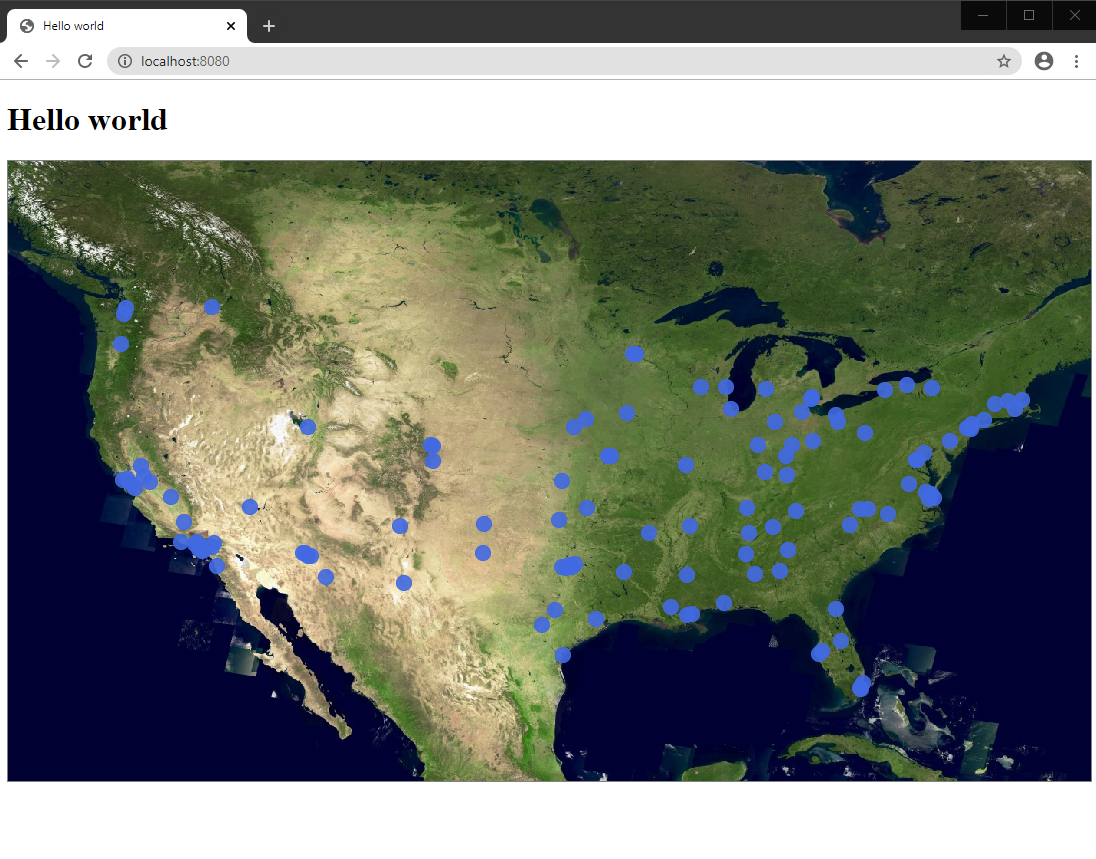
In this tutorial, we create a feature layer that displays vector data on a LuciadRIA map. We visualize cities of the United States of America, served by a Web Feature Service (WFS).
Starting point
We take the code written in Hello World as our starting point, and expand from there.
Step 1 - Create the store for data access
You must always access vector data through a Store that links the model with the data on the server. The store is responsible for:
|
A |
|
To learn more about LuciadRIA feature models, stores and the visualization of WFS features, see Introduction to feature (vector) models and Data Formats: OGC WFS. |
A store abstracts the underlying communication protocols and
storage mechanism: one of your stores can connect to a REST web service, another store connects to the local storage of the
browser, and a third connects to the non-persistent memory of the application. In our case, a WFS service serves the point
geometries representing cities of the USA. A WFS service is accessible through a WFSFeatureStore. It exposes a utility function createFromURL
that creates an instance of the WFSFeatureStore based on these arguments:
-
url: the URL pointing to the WFS service -
featureTypeName: the name of the WFS feature type to load -
options: an object literal that has optional settings for the store
Note that the options.codec parameter is optional. LuciadRIA reads the capabilities information of the WFS to decide which codec to use.
We connect to a WFS served by LuciadFusion.
By default, LuciadRIA uses a GeoJsonCodec, which suits our requirements for this example.
The following code snippet shows you how to create a store that retrieves data from a WFS service.
import {WFSFeatureStore} from "@luciad/ria/model/store/WFSFeatureStore.js";
// ...
// Create a WFS store
const url = "https://sampleservices.luciad.com/wfs";
const featureTypeName = "cities";
WFSFeatureStore.createFromURL(url, featureTypeName).then(
    (wfsSore: WFSFeatureStore) => {
      // We will create a model based on the store
    });
Note that WFSFeatureStore.createFromURL returns a promise for a WFSFeatureStore instance.
|
You can check which feature types and capabilities the WFS service offers by executing a |
Step 2 - Create a model for the store
We create the model by wrapping the store in a FeatureModel. Its main constructor argument is the Store we created in an earlier step.
This code snippet shows the creation of the FeatureModel that uses the WFS store:
import {FeatureModel} from "@luciad/ria/model/feature/FeatureModel.js";
// ...
        // Create a feature model
        const featureModel = new FeatureModel(wfsSore);
Step 3 - Create a layer for the model
We need a layer to visualize the model. For vector data in a FeatureModel, we use a FeatureLayer.
Its constructor needs these parameters:
-
model: the feature model -
options: JavaScript object containing layer-specific options. See the API reference documentation for more information.
This code snippet creates the layer:
import {FeatureLayer} from "@luciad/ria/view/feature/FeatureLayer.js";
import {LayerType} from "@luciad/ria/view/LayerType.js";
// ...
        // Create a feature layer
        const featureLayer = new FeatureLayer(featureModel, {
          label: "US Cities",
          layerType: LayerType.STATIC
        });
Step 4 - Add the layer to the map
Now we can add the layer to the map through this code snippet:
// Add a layer to the map
map.layerTree.addChild(featureLayer);
Output
Let’s put all steps of this tutorial together in a new file src/vectorData.ts. The file exposes a createCitiesLayer(map) function
that expects one argument, which is our LuciadRIA map object.
vectorData.ts file
import {FeatureLayer} from "@luciad/ria/view/feature/FeatureLayer.js";
import {FeatureModel} from "@luciad/ria/model/feature/FeatureModel.js";
import {LayerType} from "@luciad/ria/view/LayerType.js";
import {Map} from "@luciad/ria/view/Map.js";
import {WFSFeatureStore} from "@luciad/ria/model/store/WFSFeatureStore.js";

export function createCitiesLayer(map: Map) {
  const url = "https://sampleservices.luciad.com/wfs";
  const featureTypeName = "cities";
  // Create a WFS store
  return WFSFeatureStore.createFromURL(url, featureTypeName).then(
      (wfsSore: WFSFeatureStore) => {
        // Create a feature model
        const featureModel = new FeatureModel(wfsSore);

        // Create a feature layer
        const featureLayer = new FeatureLayer(featureModel, {
          label: "US Cities",
          layerType: LayerType.STATIC
        });

        // Add a layer to the map
        map.layerTree.addChild(featureLayer);
      });
}
Now we can invoke the createCitiesLayer(map) function from our main module (index.ts).
index.ts code after modification
import "./license-loader";
import {WMSTileSetModel}  from "@luciad/ria/model/tileset/WMSTileSetModel.js";
import {RasterTileSetLayer} from "@luciad/ria/view/tileset/RasterTileSetLayer.js";
import {createCitiesLayer} from "./vectorData.js";
import {WebGLMap} from "@luciad/ria/view/WebGLMap.js";

//Create a new map instance, and display it in the div with the "map" id
const map = new WebGLMap("map");

//Add some WMS data to the map
const server = "https://sampleservices.luciad.com/wms";
const dataSetName = "4ceea49c-3e7c-4e2d-973d-c608fb2fb07e";
WMSTileSetModel.createFromURL(server, [{layer: dataSetName}])
    .then(model => {
      //Once the data is available, create a layer for it
      const layer = new RasterTileSetLayer(model);
      //and add the layer to the map
      map.layerTree.addChild(layer);
    });

createCitiesLayer(map);
The application draws city features on the map.