|
LuciadCPillar 2026.0.08
|
|
LuciadCPillar 2026.0.08
|
Classes for modeling raster data. More...
Classes | |
| class | luciad::PixelDensity |
| A pixel density represents the number of pixel in raster data over a unit of area in a given coordinate reference. More... | |
Enumerations | |
| enum class | luciad::RasterSamplingMode { luciad::RasterSamplingMode::Area , luciad::RasterSamplingMode::Point } |
| Sampling mode of a raster. More... | |
Classes for modeling raster data.
|
strong |
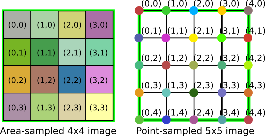
Sampling mode of a raster.
luciad/rasters/RasterSamplingMode.h
The following image clarifies the interpretation of the sampling mode. The green rectangle represents the bounds of the image. On the left side the colored rectangles represent pixels in an area-sampled basic image and on the right side the colored dots represent pixels in a point-sampled basic image.