Function create3DMesh
- create3DMesh(positions, indices, options?): Mesh
Parameters
positions: number[]
An array of positions containing (X,Y,Z) positions defined in a local cartesian reference. The unit of measure is assumed to be meters. You can control how the local mesh is placed in the world with Icon3DStyle. Its documentation also provides a more in depth explanation of how to place the (local) positions in the world. In short; the Y-axis points north, the X-axis points east and the Z-axis points up.
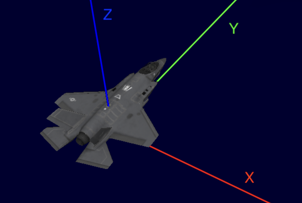
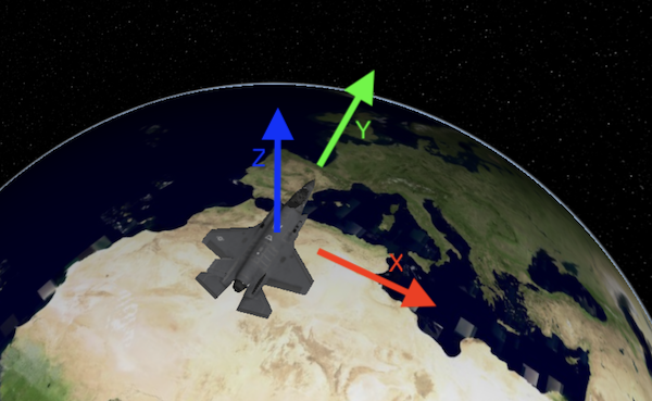
The positions in local cartesian reference Local positions placed in world indices: number[]
An array of indices connecting the various positions together as a set of triangles. Each triple of indices points to the 3 vertices of a triangle. The indices of the triangle must match the indices of the positions in the positions array.
Optionaloptions: MeshCreateOptionsAn object literal containing various options to create this 3D mesh.
Returns Mesh
A 3D mesh that can be painted by a FeaturePainter.
Creates a 3D mesh, with the given parameters.