About this release
The 2026.0 release of LuciadLightspeed brings support for the long-awaited S-101 format for Electronic Navigational Charts (ENC).
Support for ENC in S-101
An Electronic Chart Display and Information System (ECDIS) is a computer-based navigation system which is used to visualize digital nautical data, as an alternative to paper nautical charts. Nautical data includes all information which may be of assistance for the safe navigation of vessels at sea and harbors, such as sea depth information, positions of buoys, lights, or wrecks. The data to be rendered is either vector or raster data.
Data for vector-based ECDIS systems are called Electronic Navigational Charts (ENC). In early 2025, the new format for ENC, S-101, was officially adopted. This LuciadLightspeed release follows suit with support for the S-101 format, in addition to the existing support for S-57.
S-101 introduces several important changes that improve usability and interoperability, and future-proof ENC. Examples of such changes are GML encoding and the use of portrayal catalogs. S-101 also allows symbols and display rules to evolve independently from the data itself, and focuses on the interoperability between distinct maritime data sources, to bring them together on one map more easily.
This new capability is offered as part of the Maritime Standards product option.
Decoding and visualizing S-101 data
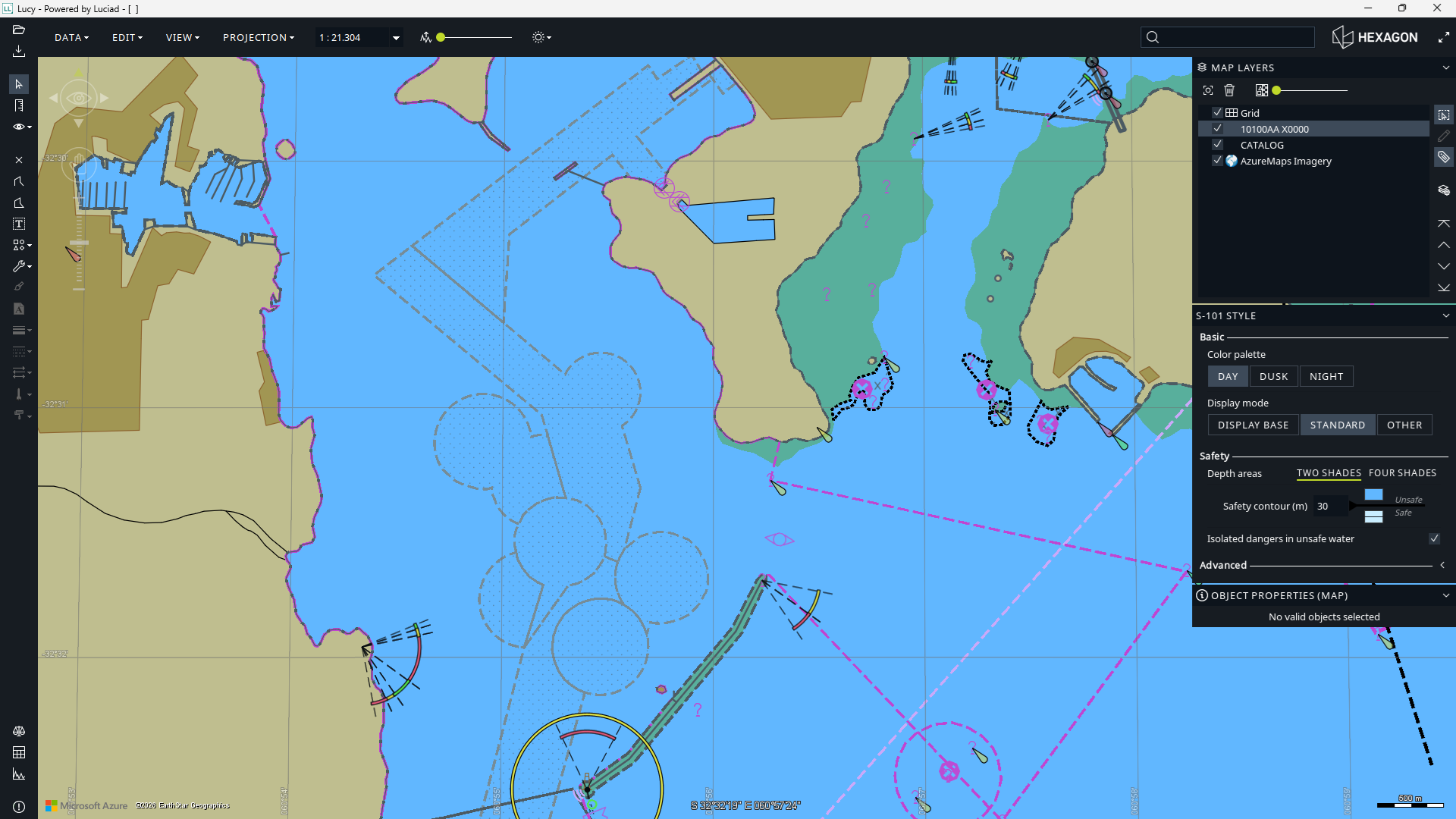
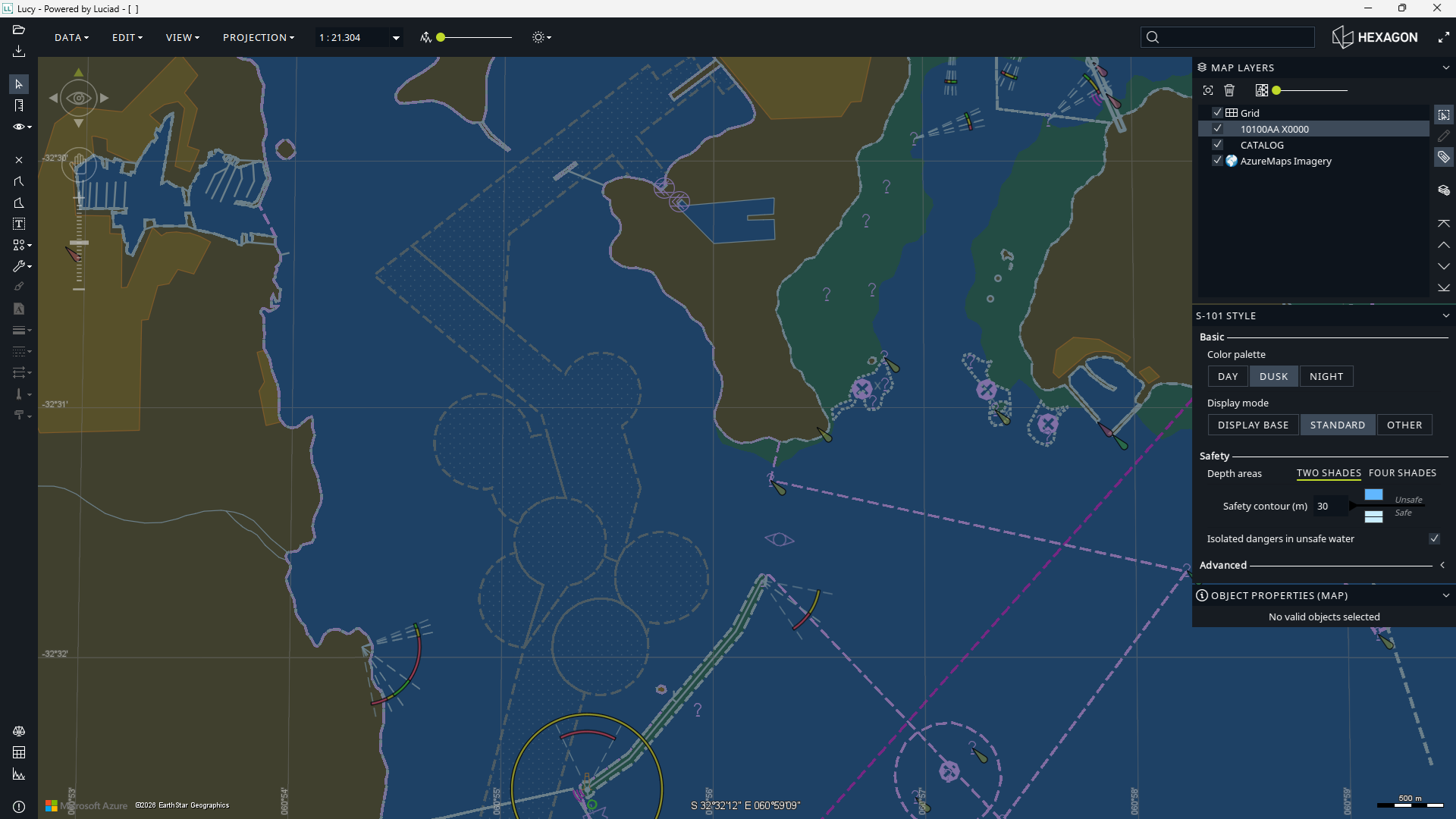
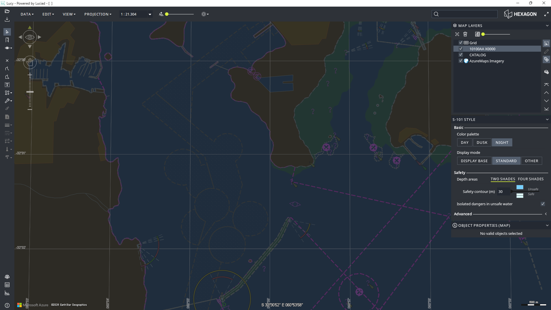
LuciadLightspeed now offers you the capability to decode S-101 data, in the form of either a data catalog or an individual data cell. The use of catalogs is recommended, because it allows the cells to be loaded lazily, based on the current extents and zoom level of the map.
The visualization of S-101 data is supported in both the Lightspeed and the GXY views. There is full support for display settings and portrayal capabilities defined in the S-101 standard, allowing you to visualize Electronic Navigational Charts with the appropriate symbology and styling rules. This enables you to leverage S-101 data in any LuciadLightspeed application.
The OGC WMS Client capabilities were expanded to support S-101 data. WMS client users are now able to make client-side customizations based on the display settings. This enhancement allows you to retrieve S-101 data from a WMS server and apply custom styling and display configurations directly on the client, giving you flexibility in how your S-101 data is presented.
Sample code/documentation to get you started
Both for the Lightspeed view and the GXY view, a new sample was added to illustrate bringing in and working with S-101 data.
These articles explain how to decode S-101 data, how to configure the display settings, and how to style S-101 data served as WMS:
APP-6E cyber units support
This release of LuciadLightspeed offers partial support for the APP-6E standard (Version 1). In future releases, we will complete this support.
For this release, the focus is on the cyberspace icons:
-
60: Cyberspace
-
61: Cyberspace - Space
-
62: Cyberspace - Air
-
63: Cyberspace - Land Unit
-
64: Cyberspace - Land Equipment
-
65: Cyberspace - Land Installation
-
66: Cyberspace - Dismounted Individual
-
67: Cyberspace - Sea Surface
-
68: Cyberspace - Sea Subsurface
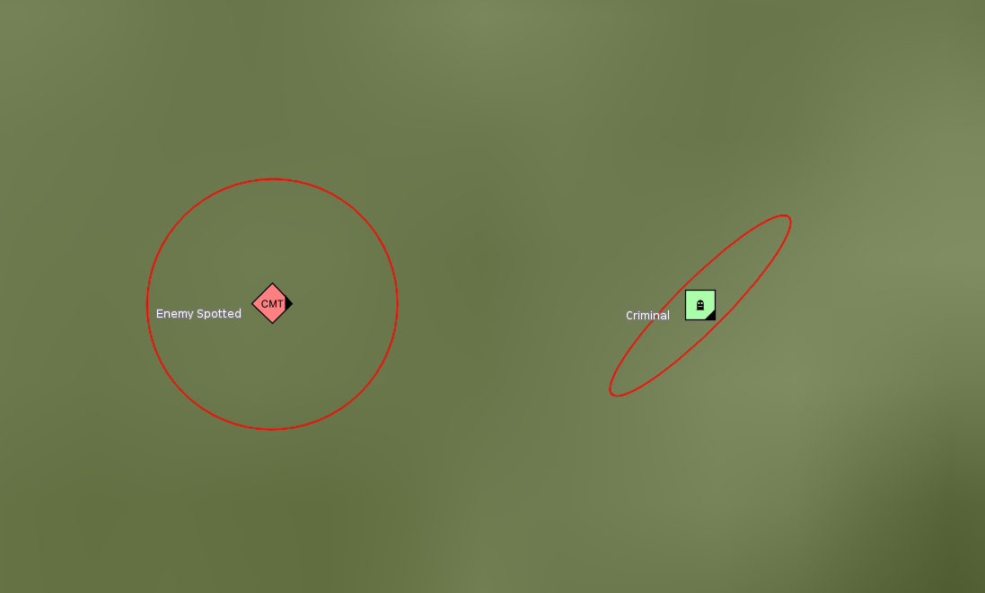
This support also includes the handling of areas of uncertainty, a new graphic modifier in APP-6E.
Sample code/documentation to get you started
The new support for APP-6E is seamlessly integrated into the existing military symbology capability. We refer to the article What are the supported standards? for an overview.
The new area of uncertainty indication is further explained in the article How to visualize the area of uncertainty indicator.
Other improvements
This LuciadLightspeed release also features a number of smaller improvements, for example:
- Compatible with Java 25
-
LuciadLightspeed now supports Java 25. The supported Java versions are documented with the Hardware and software requirements in the product documentation.
- Security updates
-
The 2026.0 release of LuciadLightspeed includes several security updates. The release notes provide full details on the dependencies that were added, updated, or removed. Please look for security updates under the upgrade considerations in the release notes.
- Deprecated formats
-
-
The ASDI format for streaming air traffic data has fallen out of use in recent years, in favor of more recent air traffic management systems. Therefore, the ASDI model decoder and related classes have been deprecated.
-
The JPIP imagery streaming format has been deprecated. JPIP isn’t widely adopted, and we recommend the use of LuciadFusion with WM(T)S or ECWP as an alternative to serve large amounts of imagery to clients.
-