Why do it?
On a LuciadRIA map with a non-geographic reference, you want to fit tightly around the data. That way, you don’t have excess whitespace around the data, and the entire map screen shows relevant data.
The default LuciadRIA fit leaves some padding, so there is no tight fit on data. It also preserves the scale ratio between the X and Y axes before and after the fit. After a fit, you could end up with excess space either at the top or the bottom, or on the left or the right of the map.
How to fit tightly around data?
If these conditions are true:
-
The map has a reference of
CoordinateType.CARTESIANwhere the unit of measure on one axis is independent of the unit of measure on the other axis -
You can stretch or compress the data
Set the allowWarpXYAxis parameter to true when you call the Map.mapNavigator.fit method.
|
Do not set this parameter to true when the map shows geographic data. |
In other words, the parameter is only useful when you are using a map to create a scatter plot or a vertical view, for example. The result of a tight fit is that the X and Y scales of the map aren’t the same.
Examples
-
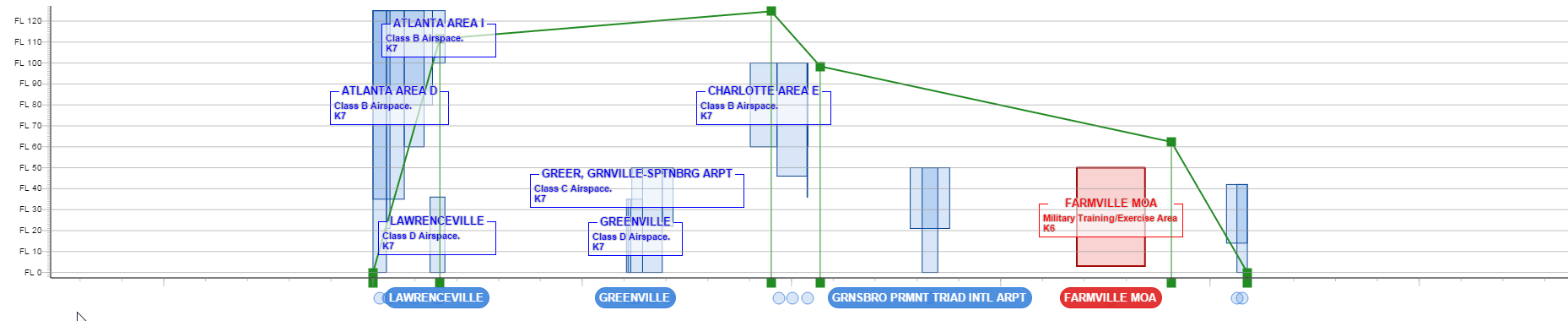
Fitting on the bounds of a flight trajectory when you set the warping parameter
true. Note that LuciadRIA stretches the data to fit the entire screen.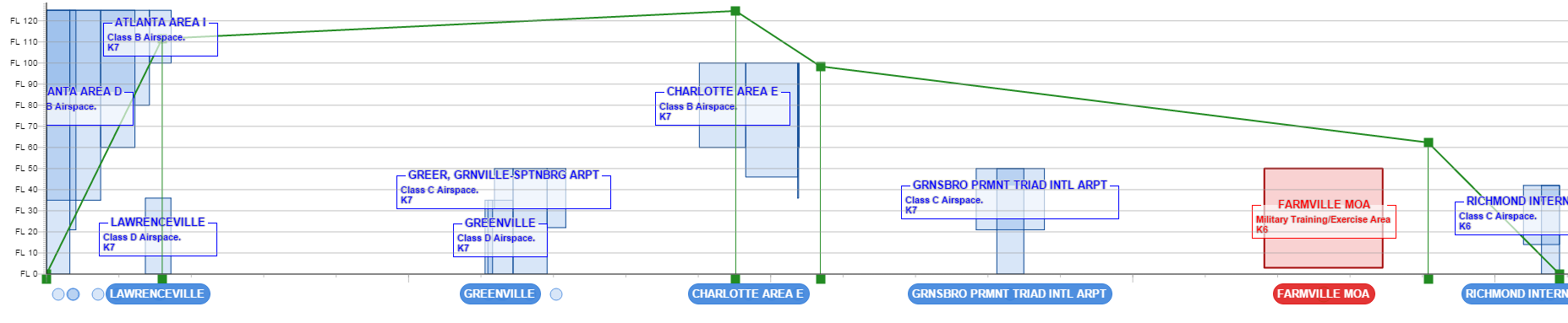
-
Fitting on the bounds of a flight trajectory when you set the warping parameter to
false. Note the excess white space on the left and on the right. In this case, the scale ratio between the X and Y axis is the same before and after the fit.