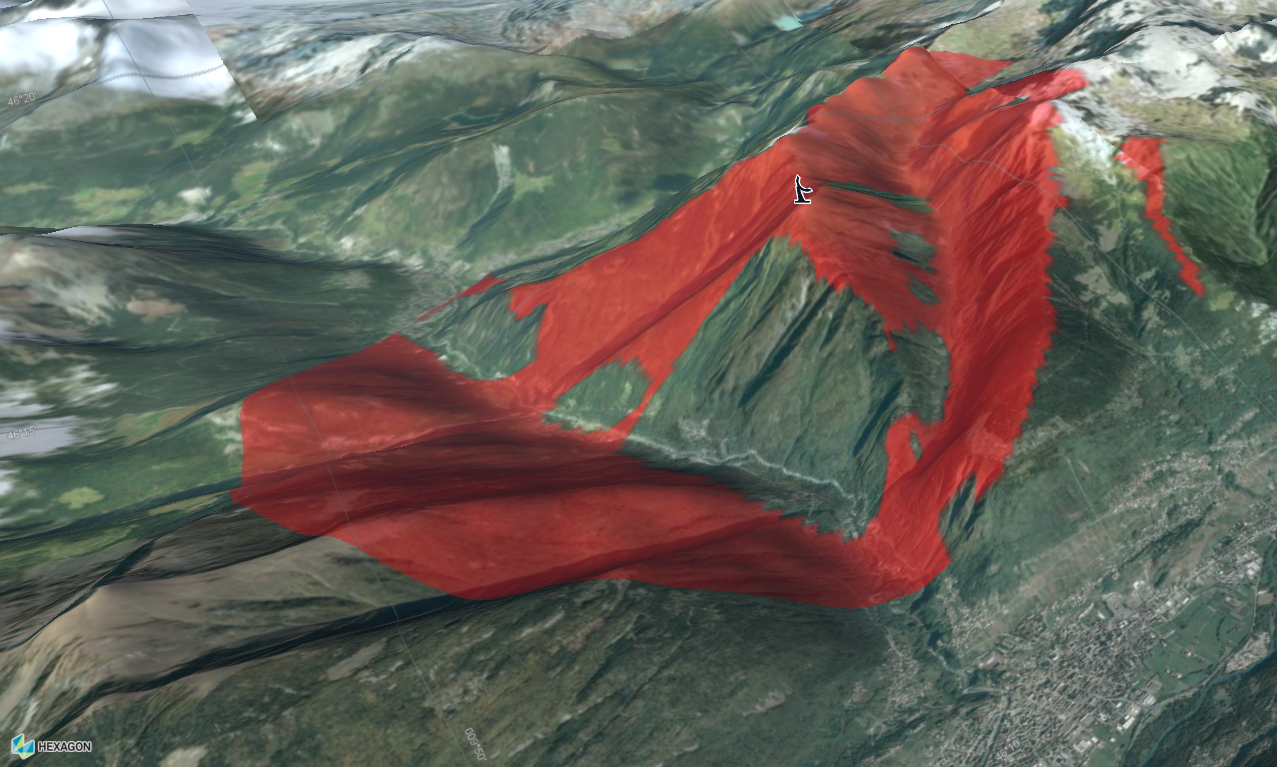
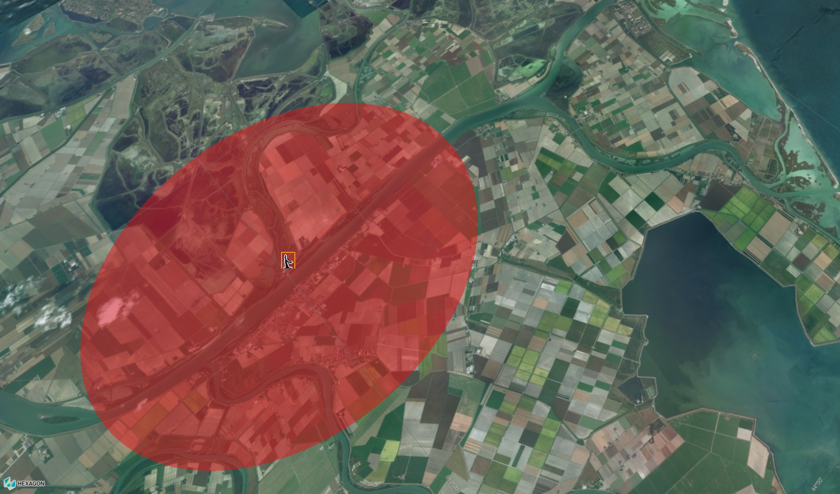
What can you do with a LOS coverage?
A line-of-sight coverage is a matrix of height values. These values indicate the minimum height an object must have to be visible to an observer. It can be used to show the visibility of objects in an area surrounding a central point of observation. The central point of observation may be a radar installation, for instance.
|
A line-of-sight coverage calculation computes lines-of-sight from point to environment, meaning the surrounding area. It results in the display of a circular or oval shape on the map. A plain line-of-sight computation determines the visibility from one point to another. The end result is a colored line on the map. You need to make elevation data available on the map for both calculations. |
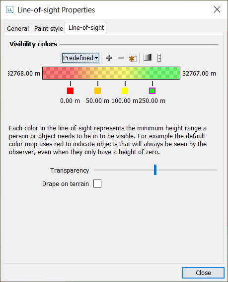
The various colors in the LOS coverage area indicate the height required for objects to be visible from the observation point.
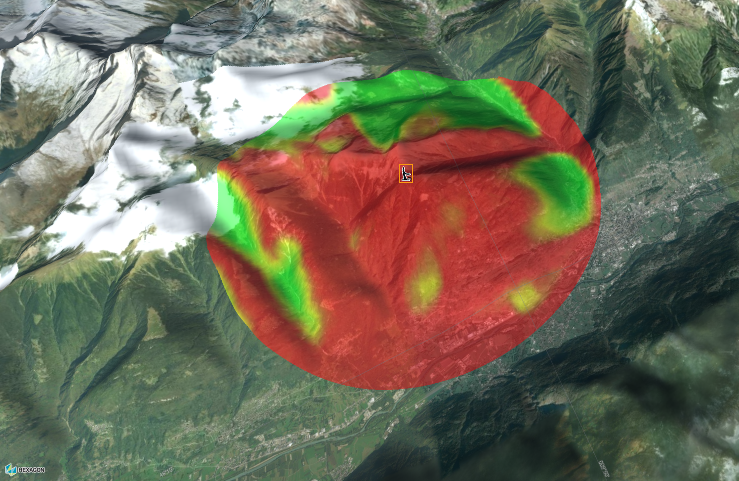
In a red area, for instance, objects at an altitude of 0 meters are already visible to the radar. At the opposite end of the color range, objects in a green area are only visible to the radar if they are located at an altitude of 250 meters or more. Within such a color configuration, the red areas in the LOS coverage typically become larger if you move the radar to a higher position on uneven terrain. As the radar moves higher up, its observation range increases, and objects at low altitudes become visible in larger areas. Similarly, a radar positioned on low-lying, level terrain will completely cover the surrounding low-altitude areas. Those areas will all turn red.
How is a LOS coverage calculated?
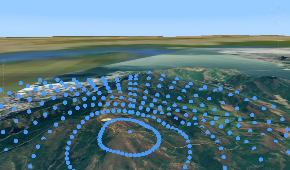
To construct such a LOS coverage, LuciadLightspeed retrieves the terrain height at various sample locations around the observation point. Based on those terrain height values, it calculates the line-of-sight height value for each sample point. The result of such a computation is a LOS coverage matrix.
It specifies the height that an object at a specific position must have to be visible to the observer.
It is possible to modify the parameters of the calculation. You can tweak properties such as the radius, vertical angles and radius step through code, or by manipulating the LOS coverage handles on a Lightspeed map.
How are the colors assigned?
To visualize the height values in the matrix as a typical LOS coverage on the map, they must be mapped to a color range.
|
The height values in a LOS coverage are calculated with respect to an altitude mode. For example, values calculated for the above-ellipsoid altitude mode will typically be greater than those calculated for the above-terrain altitude mode. It follows that the color mapping values will be too. |
Alternatively, you can visualize just those areas that fall within a certain height range, and leave the remaining parts fully transparent.