This scenario demonstrates how you can add a data source with panoramic image data, and serve it to clients in a Panoramics service. The Panoramics service is the optimal format for distributing and visualizing detailed panoramic imagery because the data is tiled and multi-leveled.
Please go through this quickstart guide first. For more details, see this guide.
Add georeference information
To prepare the panoramic image data for visualization by LuciadFusion Studio, and later on by visualization clients, you need to make sure that georeference information is available for the data. If LuciadFusion can’t detect georeference information, the data won’t be positioned in the correct location.
|
Adding georeference information
Georeference information is usually provided in a If your data doesn’t have any georeferencing information, you can still process and serve it. See how to process and visualize non-georeferenced panorama data. |
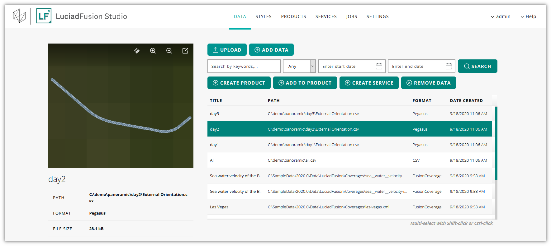
Adding the data
The section Adding your data in the LuciadFusion Studio User Guide describes the options you have for adding the panoramic data sources.
Once the panoramic data is recognized, you’ll find it in the DATA tab of LuciadFusion Studio. In the preview window, you can see an overview of all locations with panoramic images.
| You can plug in a decoder for your own custom panorama data. See the article on custom formats. |
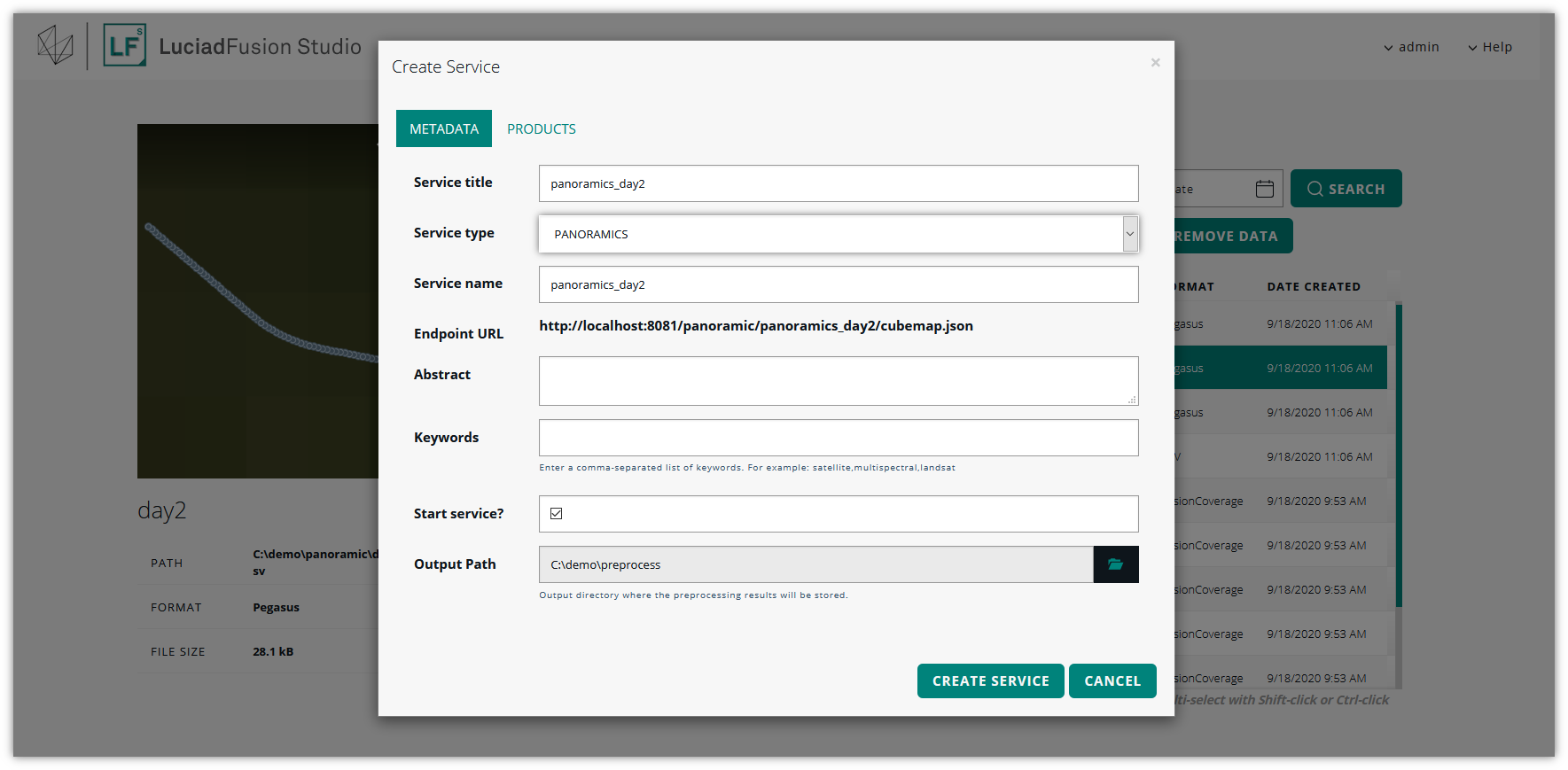
Setting up a PANORAMICS service
We want to publish our panoramic image data as a PANORAMICS service. LuciadFusion will transform the input data to a multi-leveled and tiled Luciad Panorama Format, unless the input data was already in that format. The Luciad Panorama Format is optimized for serving the panoramic imagery to clients, such as LuciadRIA.
To create the PANORAMICS service:
-
Select the data set on the DATA screen.
-
Click CREATE SERVICE.
-
Enter a service title and name in the Create service dialog, and select the PANORAMICS service type.
-
Leave the Start service? check box selected, and click CREATE SERVICE.
At this point, LuciadFusion Studio starts converting the panoramic image data. While it’s taking care of this pre-processing job, your new service will have the PENDING status.
The pre-processing may take a while if you loaded a large data set. To track the status of the pre-processing job, you can go to the JOBS screen. It shows the running pre-processing job in the lower half of the screen. You can click the job entry for more details.
The job runs on your LuciadFusion Studio machine and can be quite resource-intensive. You can pause and resume it if necessary.
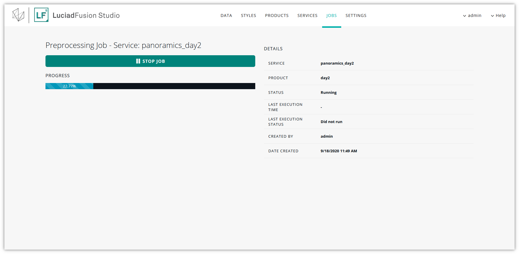
As soon as the pre-processing job is done, the PANORAMICS service status switches from PENDING to RUNNING. In the preview window, you again see an overview of all locations with panoramic images.
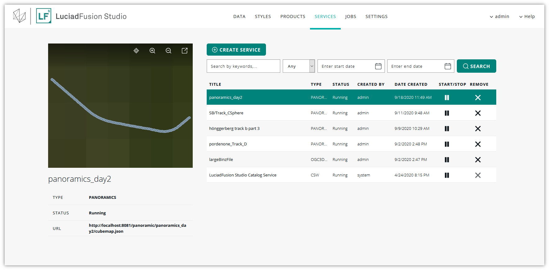
Connecting to the PANORAMICS service with LuciadRIA
You are now ready to use the data in client applications, such as LuciadRIA applications.
To connect to the PANORAMICS service from a client, you need the endpoint URL of the service.
To find out what the endpoint URL is, go to SERVICES and click the title of the PANORAMICS service in the list to open the details screen. Find the ENDPOINT URL entry.
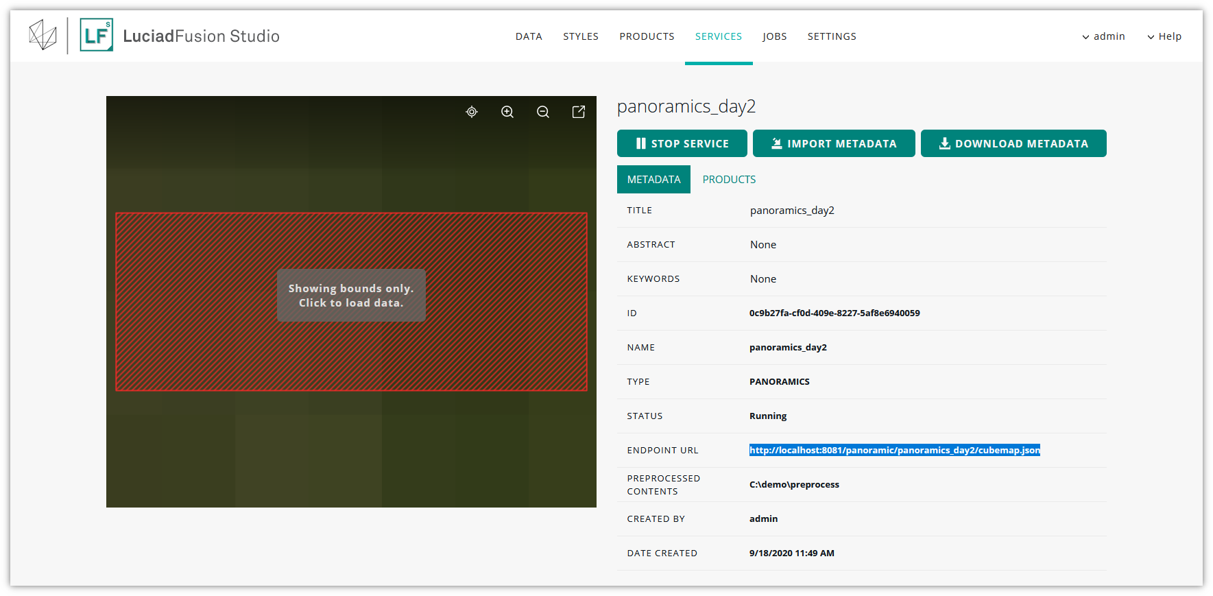
Use this endpoint URL when you set up your LuciadRIA model.
See the LuciadRIA documentation of FusionPanoramaModel for more information.