|
LuciadLightspeed and LuciadFusion provide API to model, load, process and serve panorama data to LuciadRIA. They don’t provide an immersive 360° view of panorama data on a map, though. LuciadRIA does offer panorama visualization that is fully integrated on a 3D map. You can use the Panorama Viewer sample to load panorama positions on a map and inspect the raw panoramic images. |
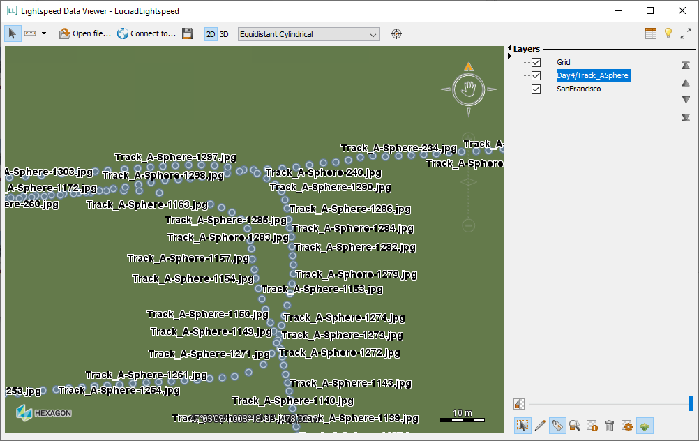
Because the ILcdPanorama objects implement the ILcdDataObject interface, you can easily visualize their locations on a Lightspeed map.
The majority of formats require the same two steps for visualization on a Lightspeed view.To visualize Pegasus data:
-
Decode the data into an
ILcdModelusing anILcdModelDecoder. -
Create an
ILspLayerfor theILcdModeland add it to theILspView.
//First create the model
ILcdModelDecoder decoder =
    new TLcdCompositeModelDecoder(TLcdServiceLoader.getInstance(ILcdModelDecoder.class));
ILcdModel model = decoder.decode(sourceName);

//Create a layer for the model with default styling
ILspLayer layer = TLspShapeLayerBuilder.newBuilder()
                                       .model(model)
                                       .build();

//Add the layer to the Lightspeed view (an ILspView)
view.addLayer(layer);
This results in a Panoramic image layer with default styling. See Visualizing Vector Data for more information about visualizing and styling vector data.