LIDAR is a remote sensing technology that measures distance by illuminating a target with a laser and analyzing the reflected light.
This technology uses high-resolution three-dimensional scans to create point clouds of objects and terrains at various scales.
LIDAR data typically contains many millions of point samples. Although the samples are not laid out in a regular grid, they are evenly spread out over the range of the scan.
The point positions can be georeferenced. LIDAR points often have many other attributes that provide information about the point, such as color, reflection intensity, infrared or classification.
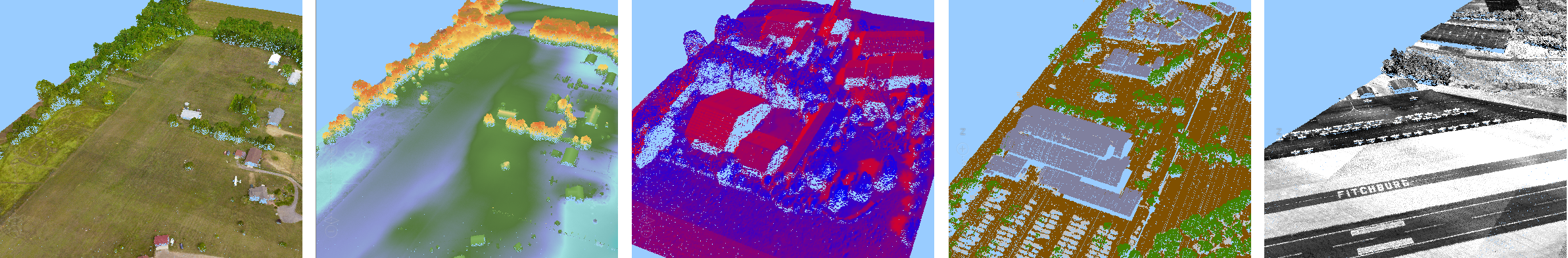
Figure 1. LIDAR data visualized with different styling based on point attributes. From left to right: color, height, infrared,
classification, intensity.